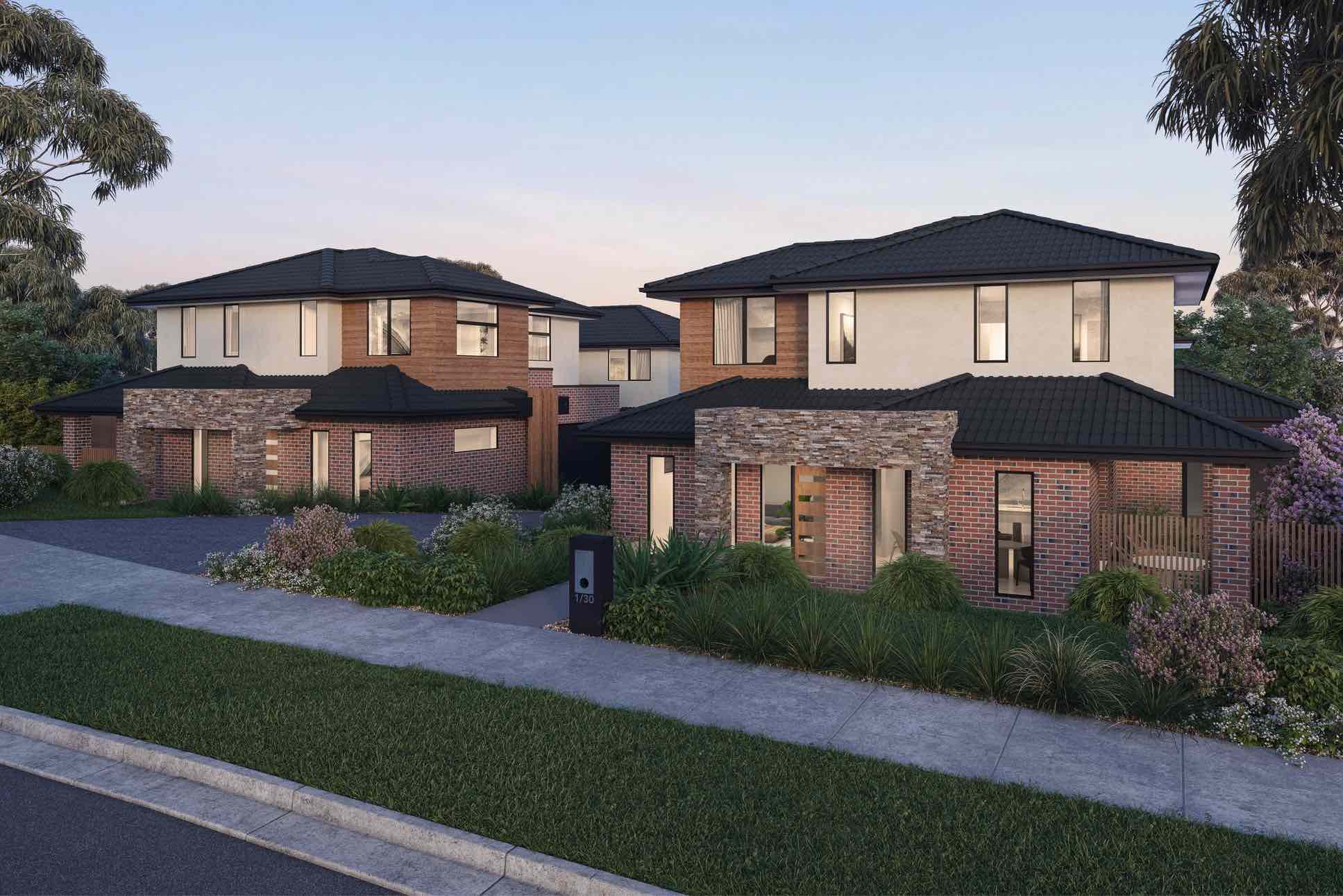

The Grove - Doncaster East
 30-32 Boronia Grove, Doncaster East VIC 3109
This information is estimated by the OpenLot research team. Let us know here to provide up-to-date information about this development.
| Total new homes | 8 |
| Area size | 0.20 hectares |
| Growth Region | Melbourne East |
| City council | Manningham City Council |
| Developer | N/A |
| Project marketer | Parkes Property |
| Distance to | Melbourne CBD - 17 km east Melbourne Airport - 31 km south-east |
Townhomes:
Popular Estates near The Grove - Doncaster East

Tullamore by Mirvac - Doncaster

Blackburn Quarter Townhomes - Blackburn

25-27 Whitehorse Road, Blackburn VIC 3130

Doncaster Gardens Estate - Doncaster East

320 Serpells Road, Doncaster East VIC 3109

Dryden Residence - Doncaster East

Monte 8 Estate - Doncaster East

Parc Townhomes - Doncaster

Anderson Creek Townhomes - Doncaster East
Updates for The Grove - Doncaster East
Location & Map for The Grove - Doncaster East
Vacancy Rate in Doncaster East VIC 3109
View full vacancy rate history in Doncaster East VIC 3109 via SQM Research.
Schools near The Grove - Doncaster East
Here are 6 schools near The Grove - Doncaster East:
Prep-6 Government Primary School
Prep-6 Government Primary School
Prep-6 Catholic Primary School
Prep-6 Catholic Primary School
7-12 Government Secondary School
Prep-6 Government Primary School
Land Release Applications for The Grove - Doncaster East
| Land release | Land report | Number of lots | Plan number | Land surveyor | Lodged date | Intended use | Settlement tracking | |||||||||||||||||||||||||||||||||||||||||||||||||||||||||||||||||||||||||||||||||||||||||||
|---|---|---|---|---|---|---|---|---|---|---|---|---|---|---|---|---|---|---|---|---|---|---|---|---|---|---|---|---|---|---|---|---|---|---|---|---|---|---|---|---|---|---|---|---|---|---|---|---|---|---|---|---|---|---|---|---|---|---|---|---|---|---|---|---|---|---|---|---|---|---|---|---|---|---|---|---|---|---|---|---|---|---|---|---|---|---|---|---|---|---|---|---|---|---|---|---|---|---|
| No updates found |
Reviews & Comments on The Grove - Doncaster East
Estate Brochure, Masterplan, Engineering Plan, Plan of Subdivision (POS), Design Guidelines
FAQs about The Grove - Doncaster East
View all estates marketed by Parkes Property
- Beverley Hills Primary School - 400m north-east
- Old Orchard Primary School - 932m south
- Ss Peter & Paul's School - 1.0km north
- St Philip's School - 1.3km south-east
- Blackburn High School - 1.3km south-west
- Whitehorse Primary School - 1.3km south-east
Popular Estates near The Grove - Doncaster East
Tullamore by Mirvac - Doncaster
Blackburn Quarter Townhomes - Blackburn
25-27 Whitehorse Road, Blackburn VIC 3130
Doncaster Gardens Estate - Doncaster East
320 Serpells Road, Doncaster East VIC 3109
Dryden Residence - Doncaster East
Monte 8 Estate - Doncaster East
Parc Townhomes - Doncaster
Anderson Creek Townhomes - Doncaster East
Latest New Home Articles for You

15/Apr/2024
Navigating the Intricacies of Nomination Blocks
In a recent episode of the Home Building Hub podcast, hosted by industry ...

10/Apr/2024
How Do Mortgages Work?
What is a mortgage broker? How does a mortgage broker get paid? Licensing...

10/Apr/2024
Victoria: Top 30 Most Searched Housing Developments (March 2024)
We're delighted to present the lineup of the top 30 most searched housing...

10/Apr/2024
Queensland: Top 30 Most Searched Housing Developments (March 2024)
In the radiant expanse of Australia's eastern coast lies Queensland, reno...

09/Apr/2024
South Australia: Top 30 Most Searched Housing Developments (March 2024)
South Australia, with its enchanting appeal and rich cultural heritage, e...

09/Apr/2024
New South Wales: Top 30 Most Searched Housing Developments (March 2024)
We have compiled the definitive list of the most sought-after housing dev...

09/Apr/2024
Western Australia: Top 30 Most Searched Housing Developments (March 2024)
If you've ever dreamed of calling Western Australia your home, now's the ...
![[Mar/2024] Top Most Searched Housing Developments in Australia](https://files.openlot.com.au/p/styles/500h/s3/article/Thumbnail%20-%20Top%2030%20Most%20Searched%20Housing%20Developments-5.jpg.webp?itok=yt0VccIK)
08/Apr/2024
[Mar/2024] Top Most Searched Housing Developments in Australia
In March 2024, OpenLot unveils a comprehensive showcase of the top-perfor...

02/Apr/2024
What is a house and land package? ...and are they exclusive?
House and land packages in new home construction, emphasising flexibility...