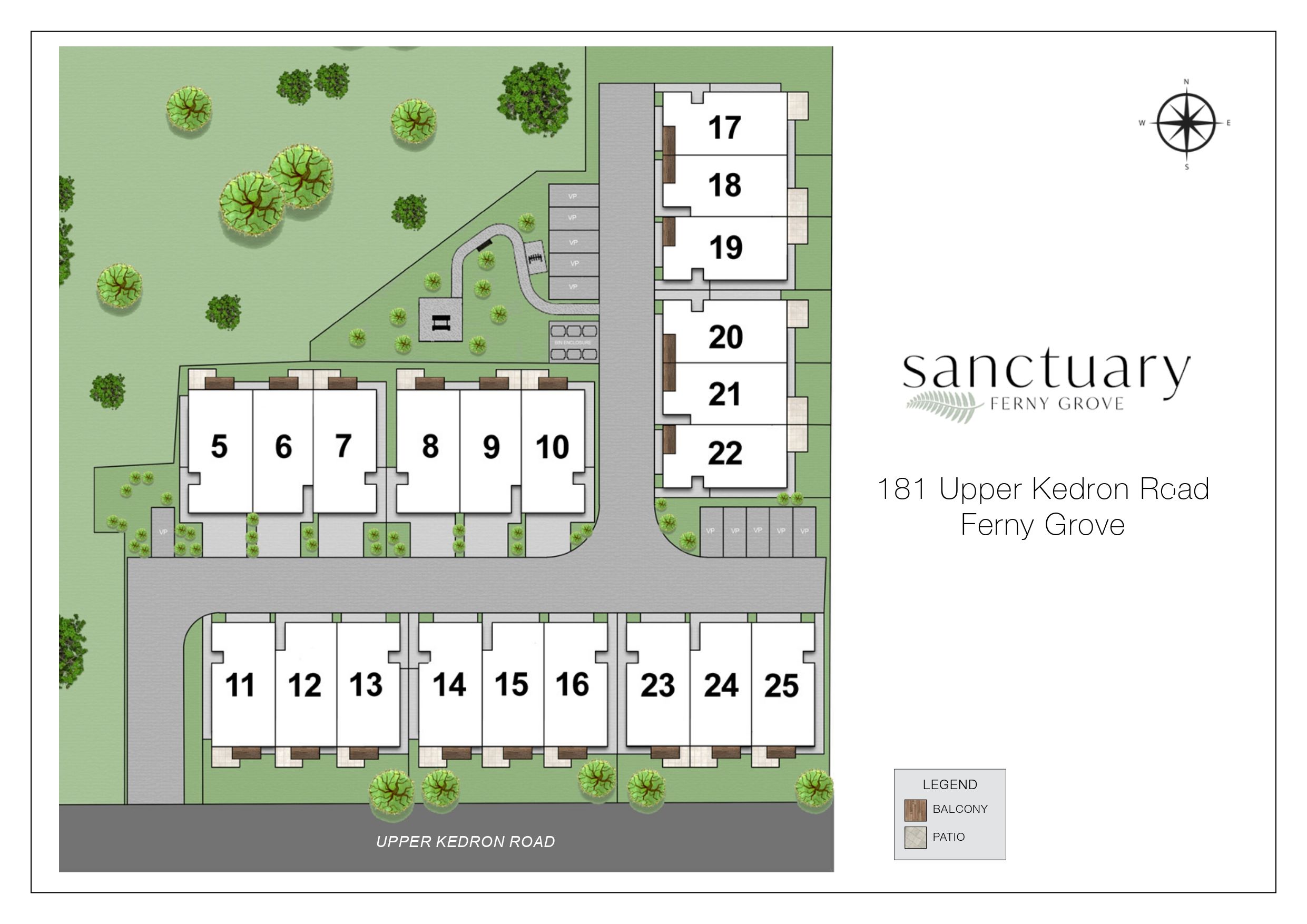
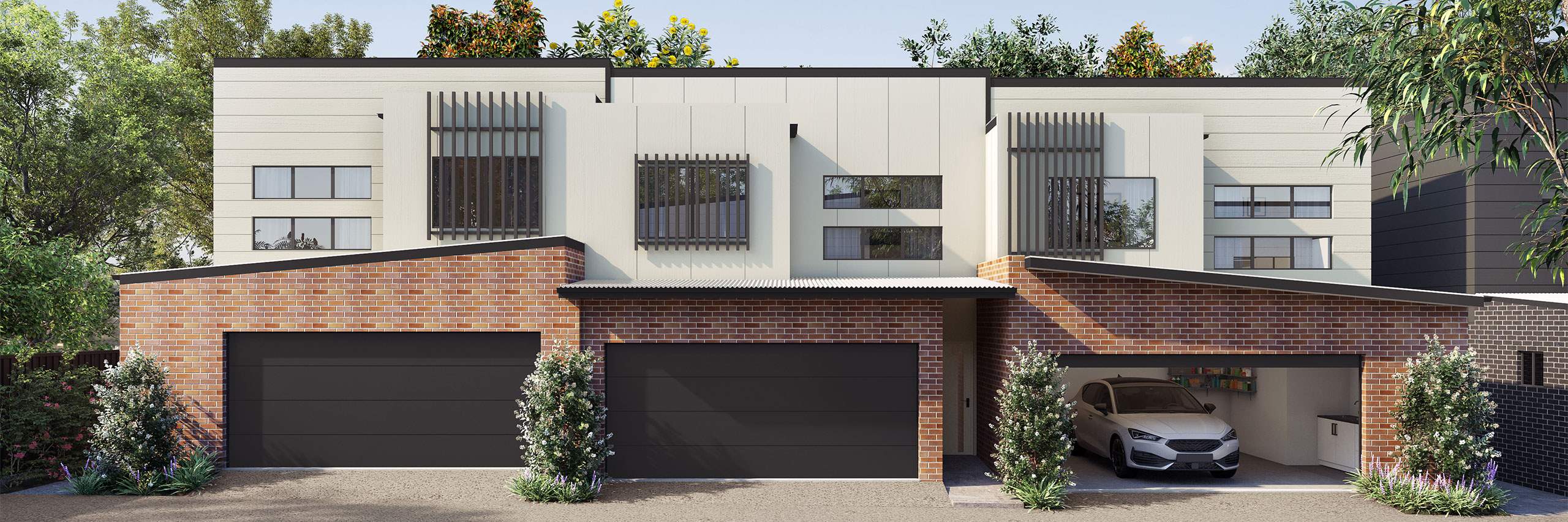
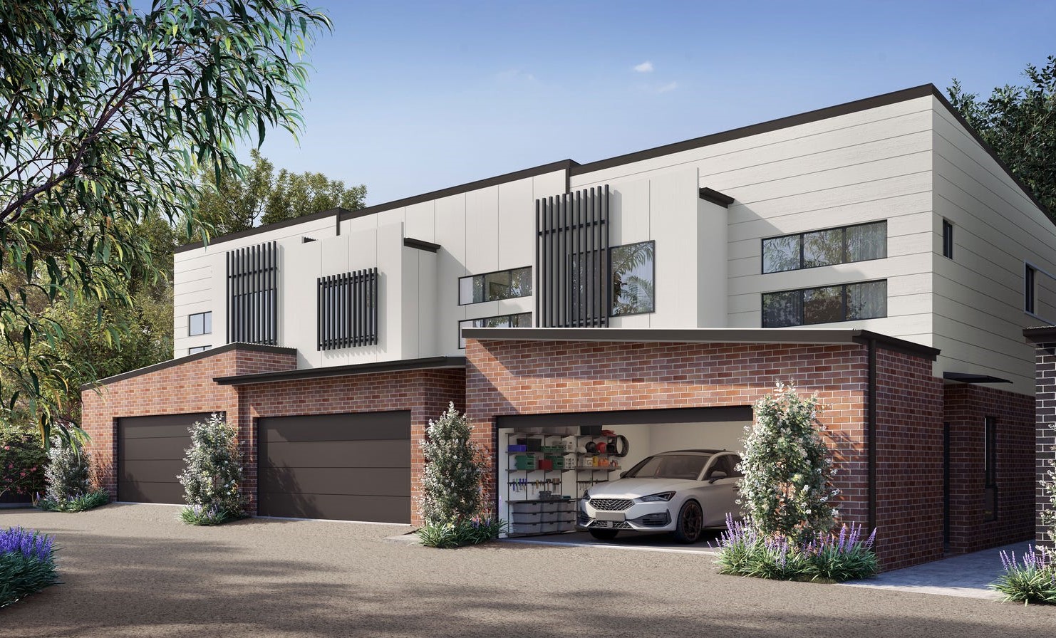


Sanctuary Townhomes - Ferny Grove
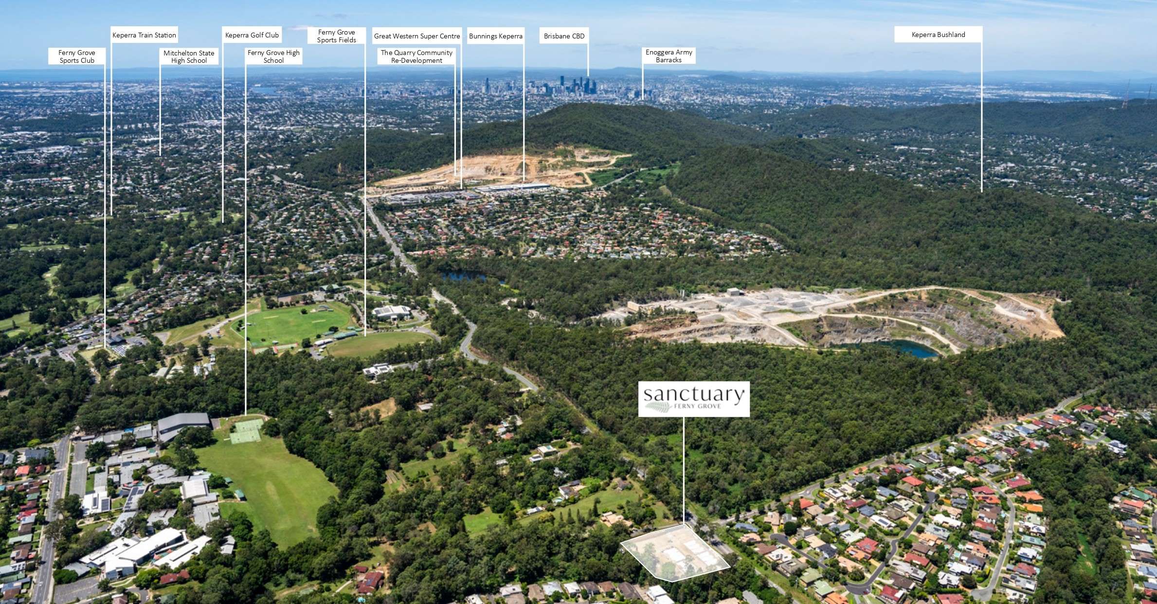
 181 Upper Kedron Road, Ferny Grove QLD 4055
This information is estimated by the OpenLot research team. Let us know here to provide up-to-date information about this development.
| Total new homes | 21 |
| Area size | 0.78 hectares |
| Growth Region | Greater Brisbane Growth Areas |
| City council | Brisbane City Council |
| Developer | AR Developments |
| Distance to | Brisbane CBD - 11 km north-west Brisbane Airport - 19 km west |
Townhomes:
Popular Estates near Sanctuary Townhomes - Ferny Grove

Ellendale Estate - Upper Kedron

Nature's Edge Estate - The Gap

Nuovo Estate - Arana Hills

Yallambi Estate - Bunya

West Grove Estate - Ferny Grove

The Quarry Estate - Keperra

Tallowwood Estate - The Gap

Henderson Terraces - Everton Hills

Cedar Creek Residences - Upper Kedron
Updates for Sanctuary Townhomes - Ferny Grove
Facebook updates:
Submit the Facebook page for Sanctuary Townhomes - Ferny Grove.
Related news:

Development.i provides access to past and current application details and basic property information for the Brisbane City Council Local Government area so it is easy to stay informed about what is happening in your area.

AR Developments - Builders for new apartments, developments | Show case the best development and off the plan real estate projects in Australia
Missing articles? Send us a link here.
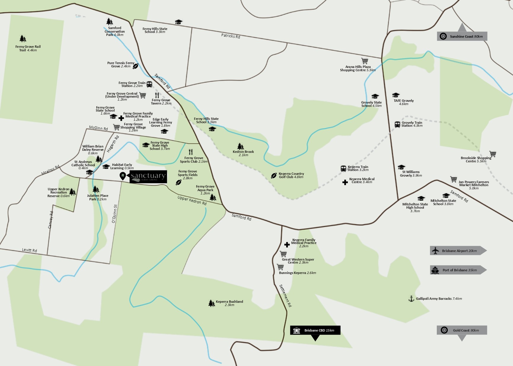
Location & Map for Sanctuary Townhomes - Ferny Grove
Vacancy Rate in Ferny Grove QLD 4055
View full vacancy rate history in Ferny Grove QLD 4055 via SQM Research.
Schools near Sanctuary Townhomes - Ferny Grove
Here are 6 schools near Sanctuary Townhomes - Ferny Grove:
Prep-6 Catholic Primary School
7-12 Government Secondary School
Prep-6 Government Primary School
Prep-6 Government Primary School
Prep-6 Government Primary School
Prep-6 Government Primary School
Reviews & Comments on Sanctuary Townhomes - Ferny Grove
Estate Brochure, Masterplan, Engineering Plan, Plan of Subdivision (POS), Design Guidelines
FAQs about Sanctuary Townhomes - Ferny Grove
View all estates from AR Developments
- St Andrew's Catholic School - 345m west
- Ferny Grove State High School - 603m north-east
- Ferny Grove State School - 777m north
- Ferny Hills State School - 1.6km north-east
- Patricks Road State School - 2.0km north
- Hilder Road State School - 3.1km south
Popular Estates near Sanctuary Townhomes - Ferny Grove
Ellendale Estate - Upper Kedron
Nature's Edge Estate - The Gap
Nuovo Estate - Arana Hills
Yallambi Estate - Bunya
West Grove Estate - Ferny Grove
The Quarry Estate - Keperra
Tallowwood Estate - The Gap
Henderson Terraces - Everton Hills
Cedar Creek Residences - Upper Kedron
Latest New Home Articles for You

17/May/2024
How to Approach Builders: The Do's and Don'ts for Homebuyers
In the latest episode of the Home Building Hub podcast, hosts Colin Bisch...

13/May/2024
Transformative Changes in Australia's Home Building Landscape with NCC 2022 Revisions
Australia's home building sector is undergoing a significant transformati...

10/May/2024
Insights into Conveyancing
In a recent episode, Colin Bischof and Darren Brennan discussed the intri...

08/May/2024
Market Update With OpenLot's Ryan Smits
In a recent episode of the Home Building Hub podcast, industry experts Co...
![[Apr/2024] Top Most Searched Housing Developments in Australia](https://files.openlot.com.au/p/styles/500h/s3/article/Thumbnail%20-%20Australia%20Top%20Most%20Searched%20Housing%20Developments.jpg.webp?itok=iKXIJbcX)
07/May/2024
[Apr/2024] Top Most Searched Housing Developments in Australia
In March 2024, OpenLot unveils a comprehensive showcase of the top-perfor...

06/May/2024
Essential Tips for Home Builders: Top 10 Considerations You Shouldn't Overlook
In the ever-evolving landscape of home construction, it's crucial to stay...

01/May/2024
New Homes vs. Secondhand: Why Building New Might Be Your Best Choice
In the latest episode of The Home Building Hub podcast, hosts Colin Bisch...

30/Apr/2024
The Power of Co Living Investing
In the latest episode of The Property Now Podcast, hosts Matt Ellul and B...

29/Apr/2024
Titled Land vs Non-titled Land - Which is better?
In the latest episode of the Home Building Hub podcast, hosts Colin Bisch...