


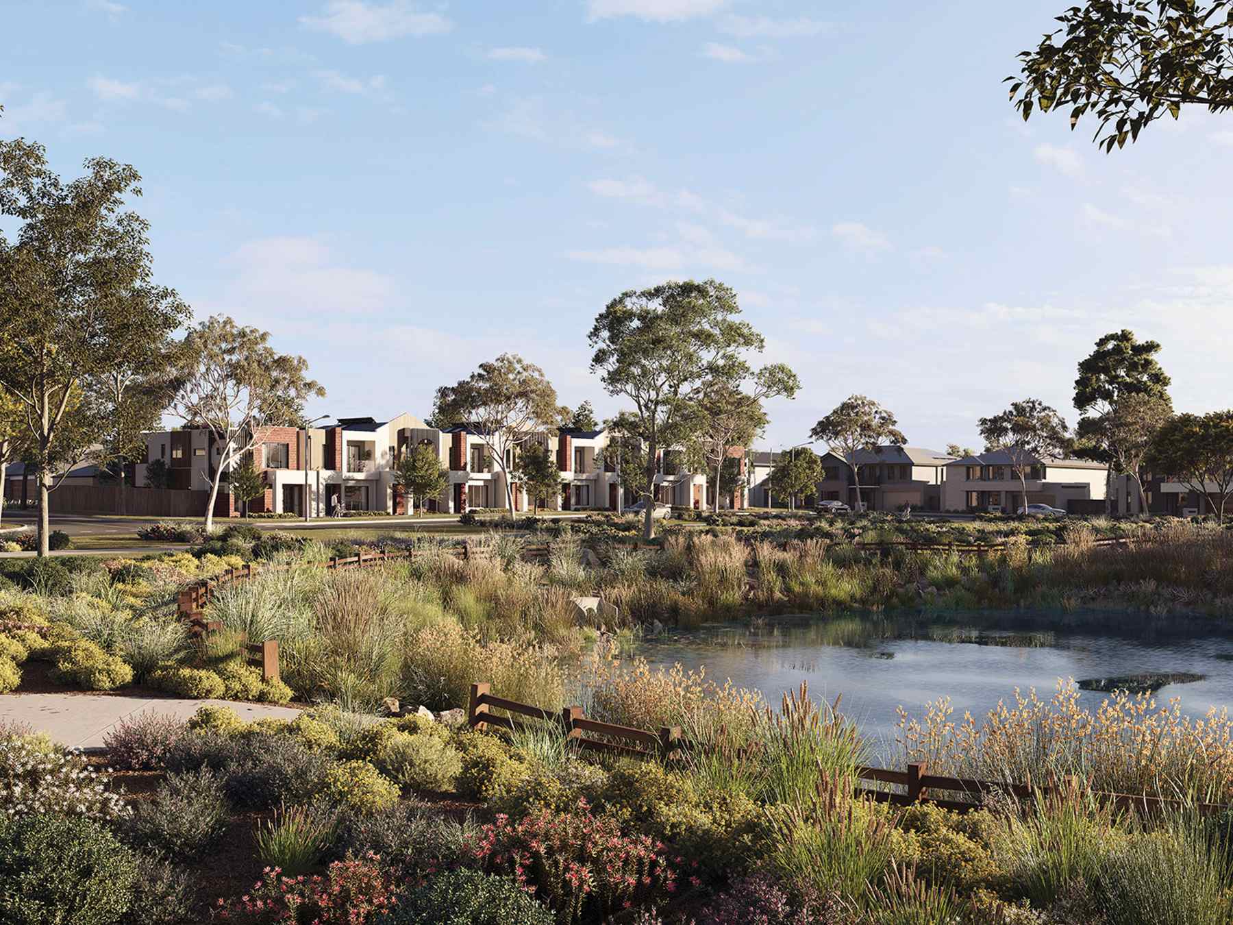
Kingsfield - Sunbury 10 AVAILABLE
[NEW RELEASE] Land Now Selling in Sunbury | Town Centre Under Construction!
- Stage 22A - NEW RELEASE - Q1 2027 titles with lots ranging from 375m2 to 612m2. A tranquil neighbourhood immersed in nature, Creekside Stage 22 offers a high proportion of sought-after medium-sized blocks and picturesque views over the Emu Creek Valley.
- Stage 21 - NEW RELEASE NEARLY SOLD OUT- Q3 2026 titles with lots ranging from 339m2 to 427m2.
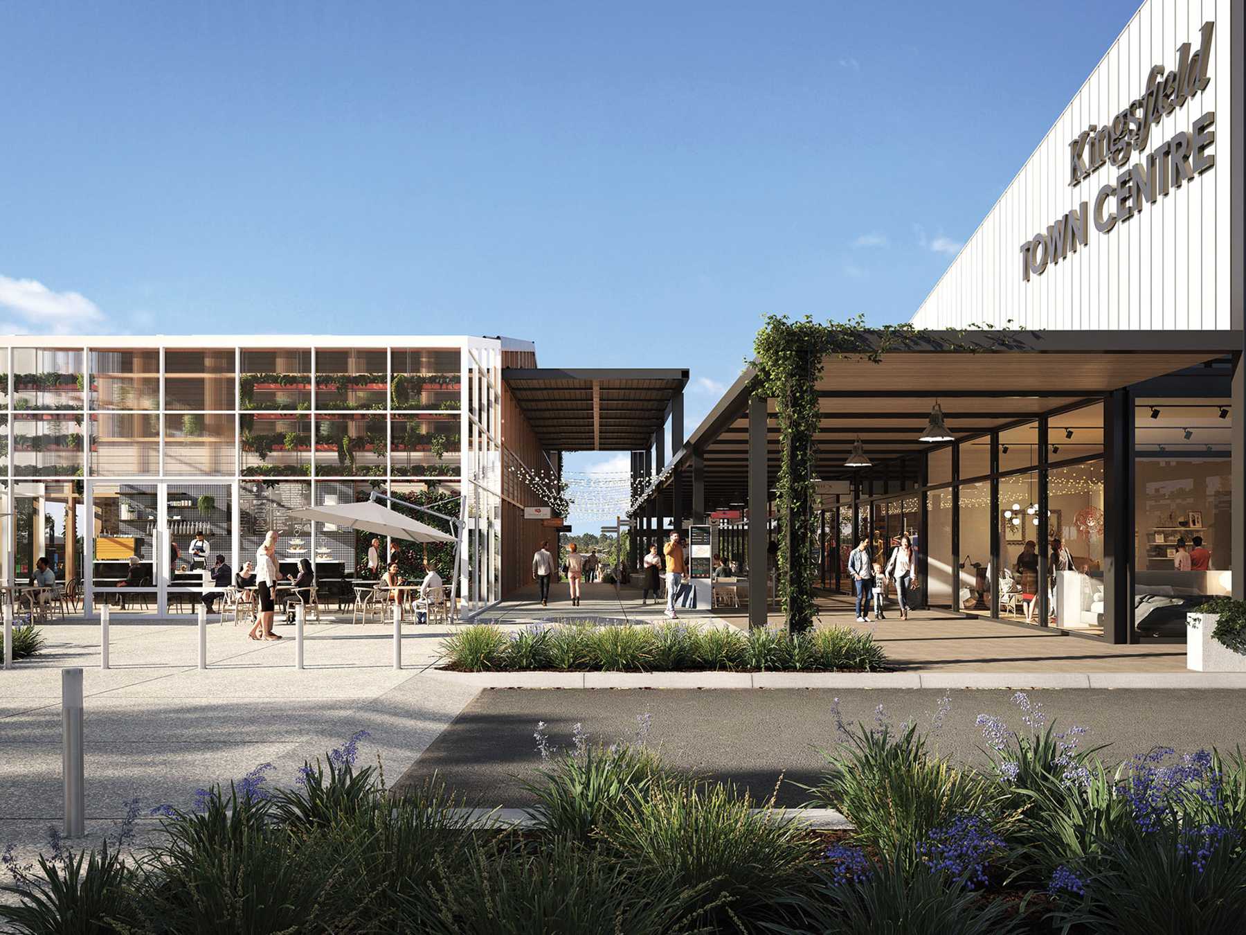
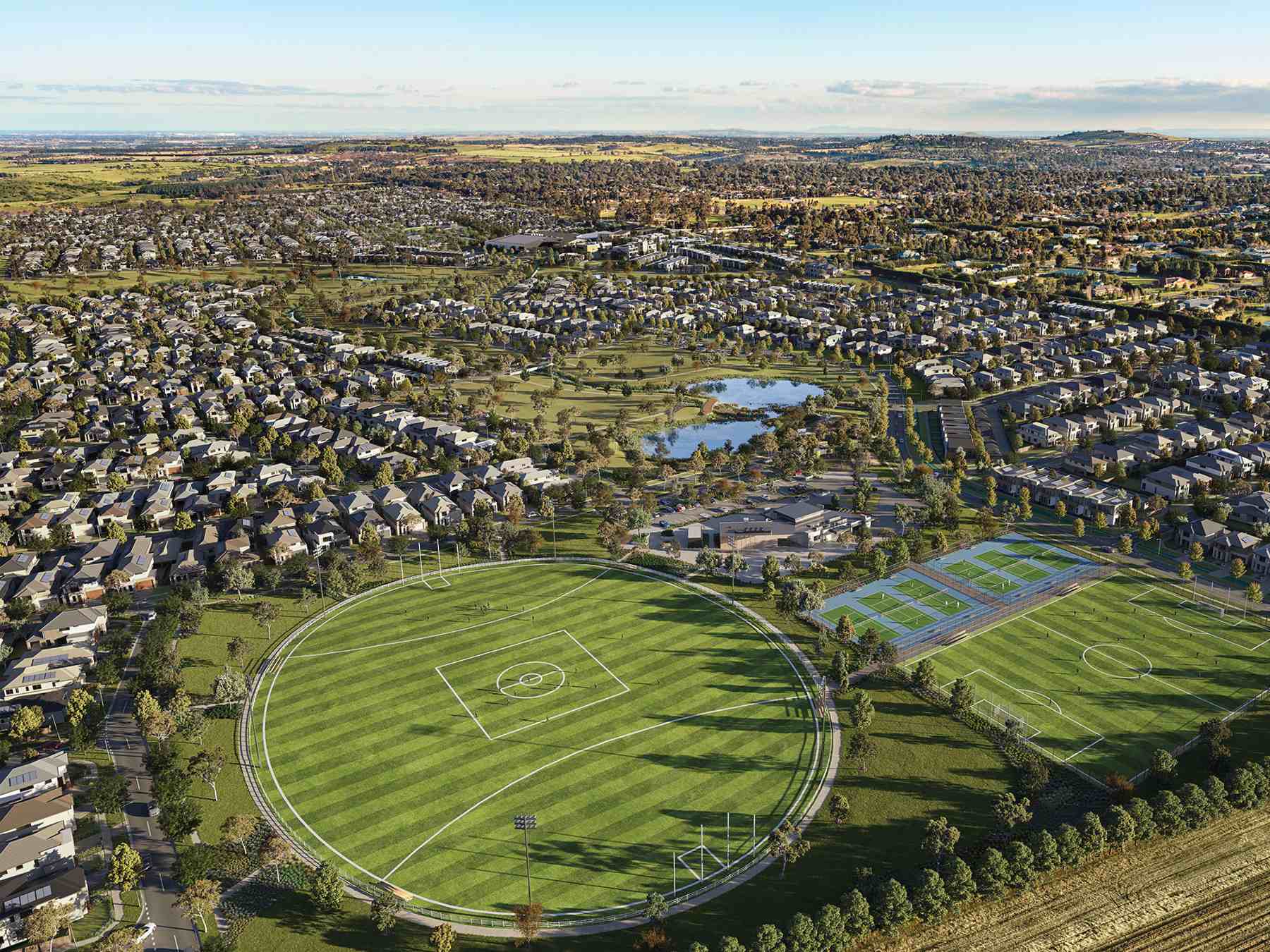
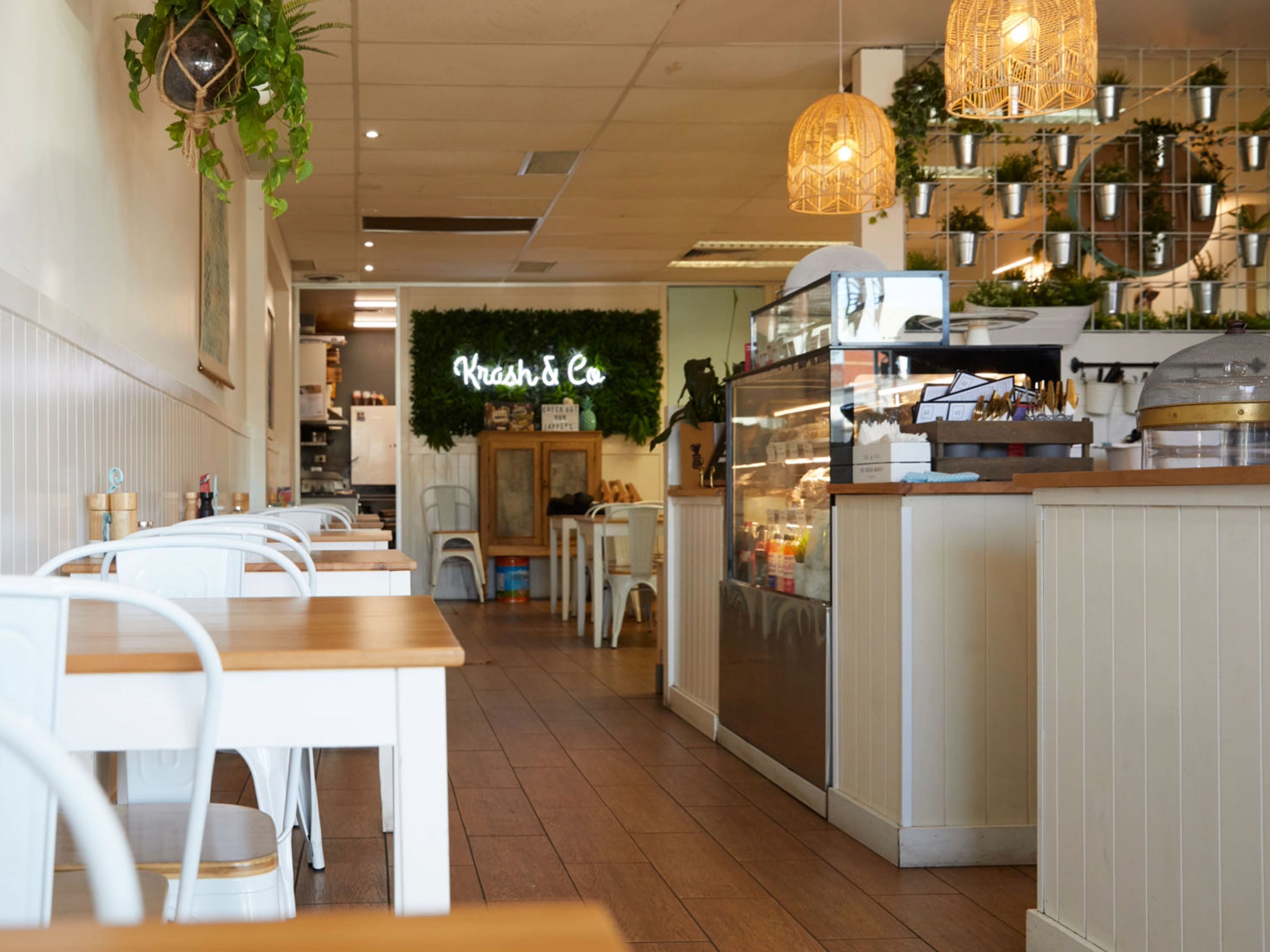
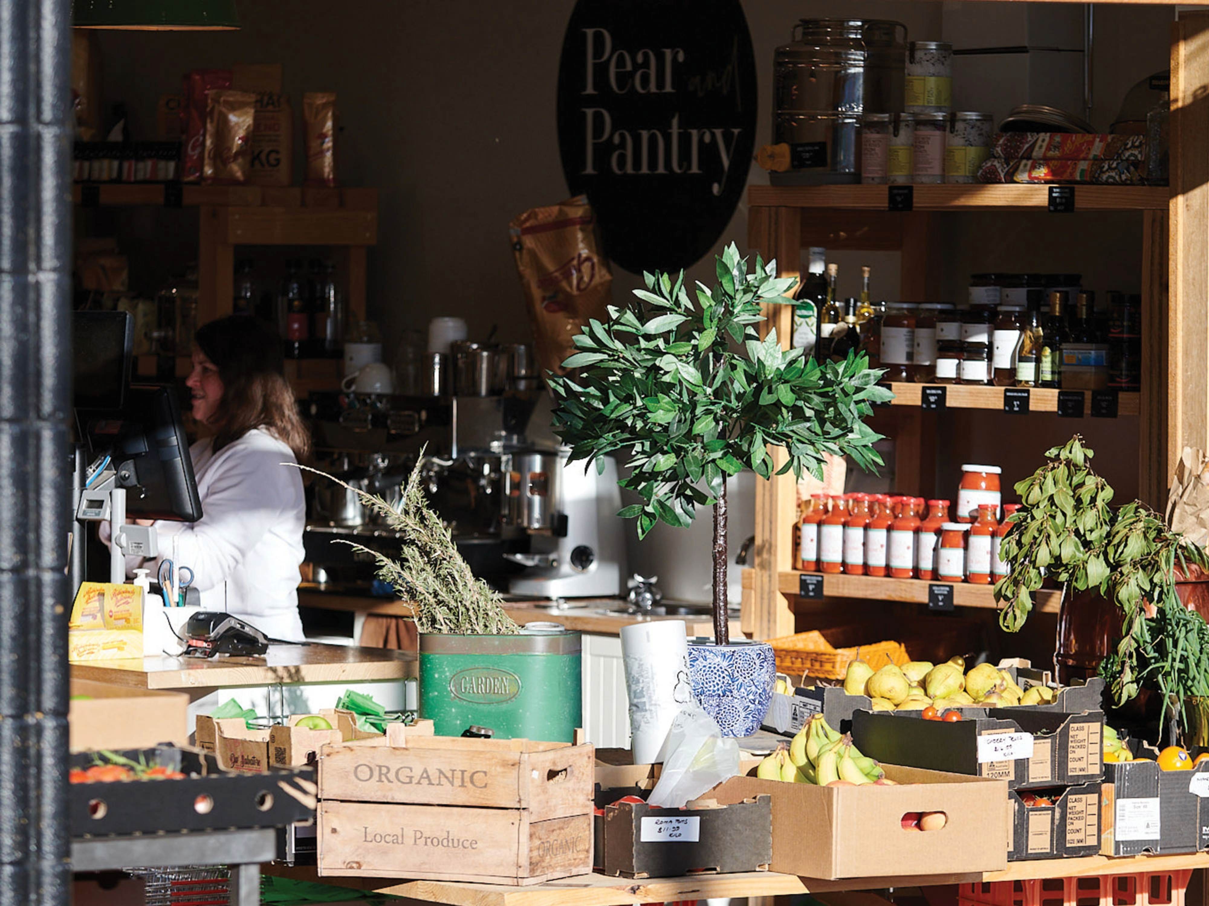
- Kingsfield Town Centre, East Sunbury Village, has commenced construction and is expected to open by Q4 2026. The precinct will feature a Woolworths, Anytime Fitness, Priceline, medical centre, swim school and more!
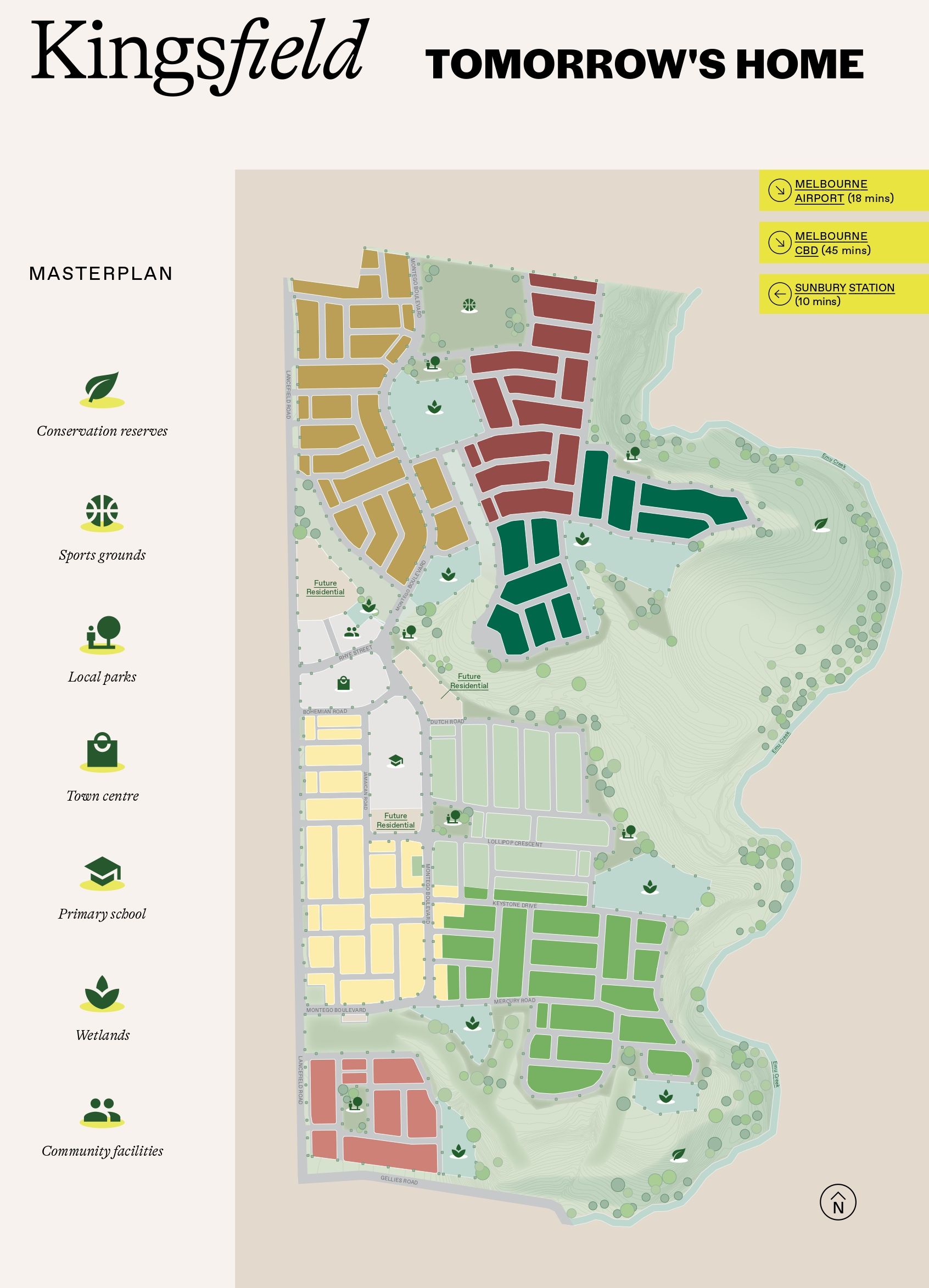
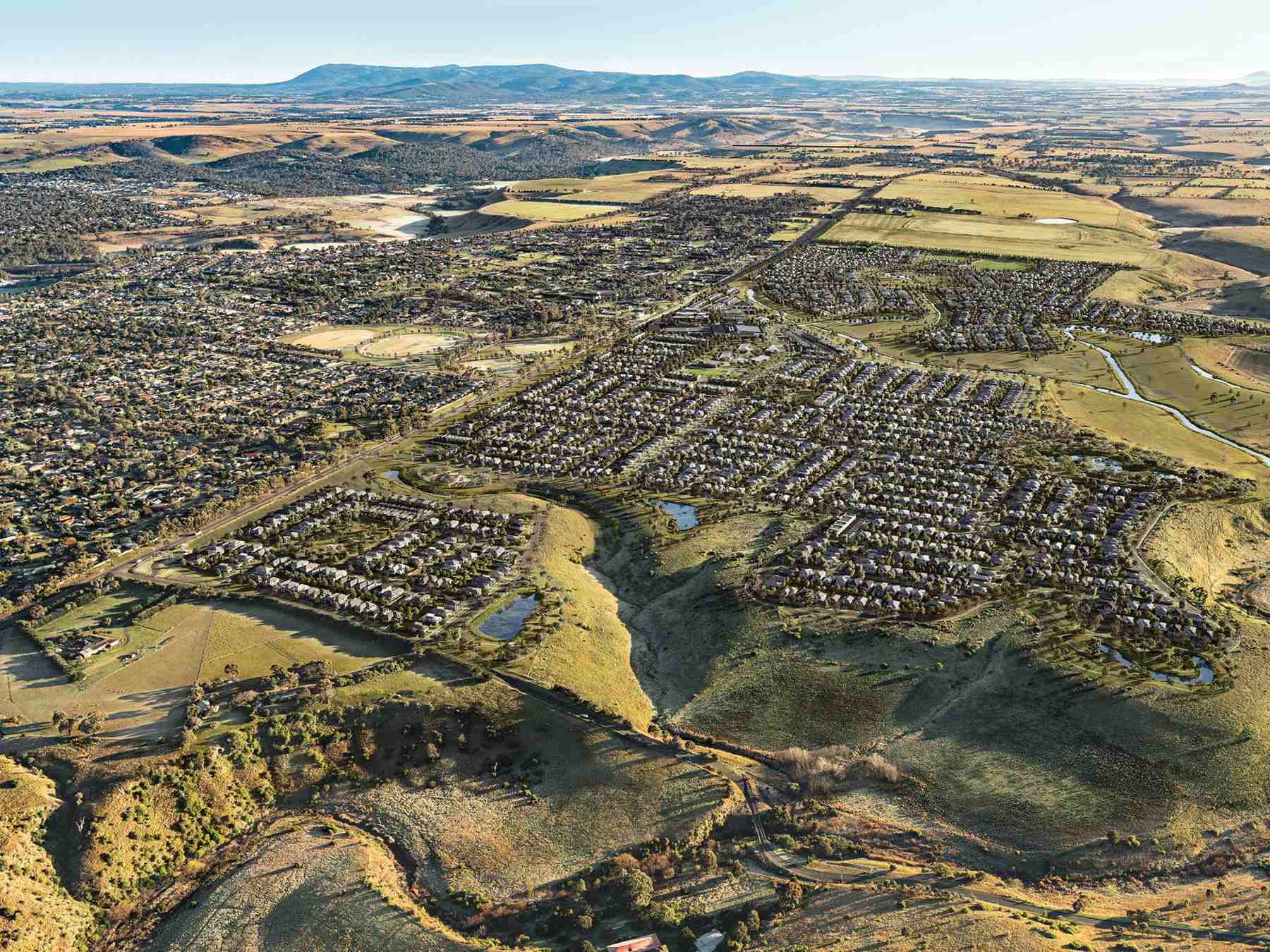
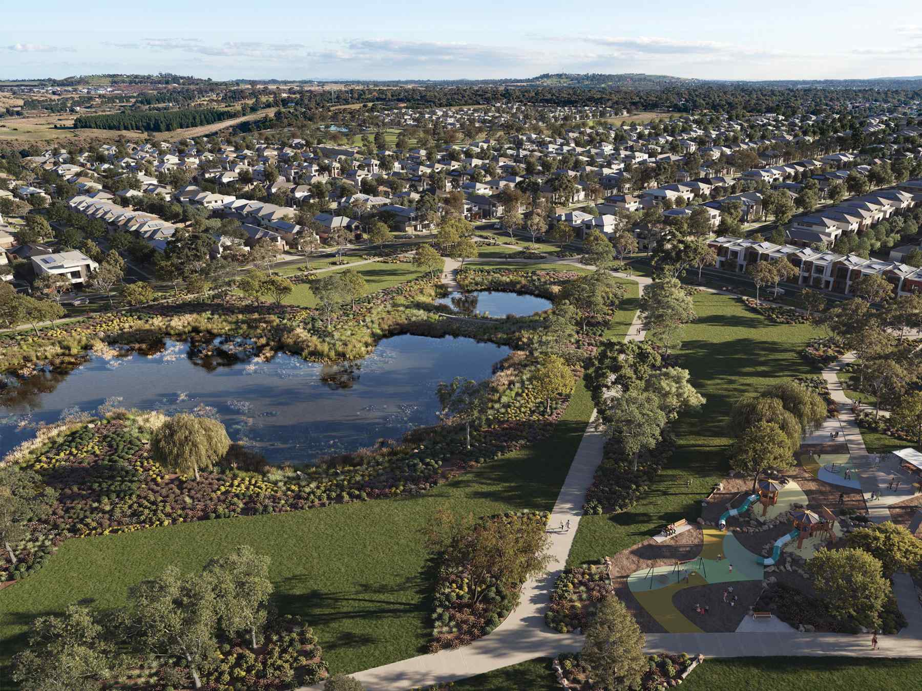
- A Masterplanned Community of approximately 2,200 allotments.
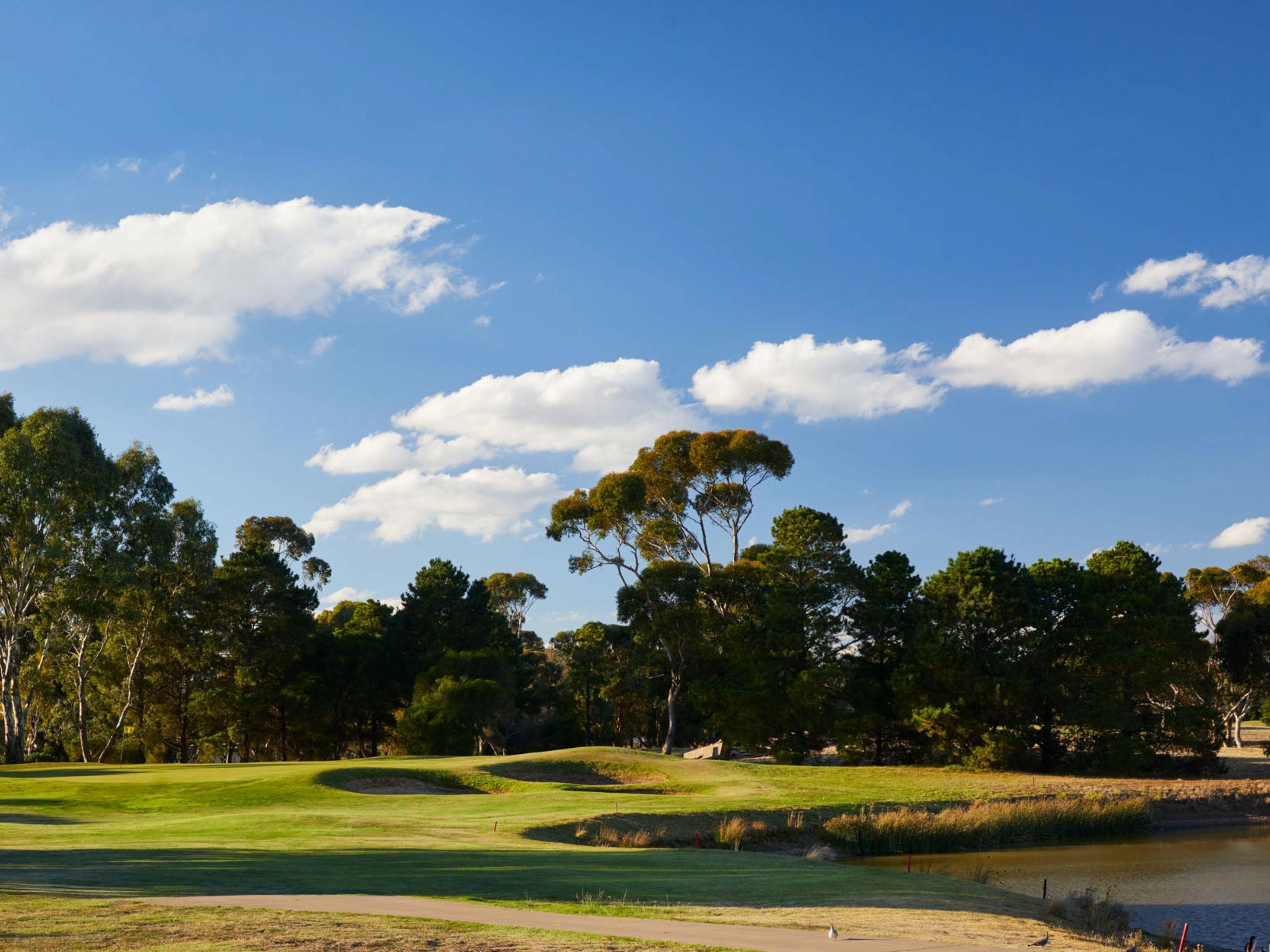
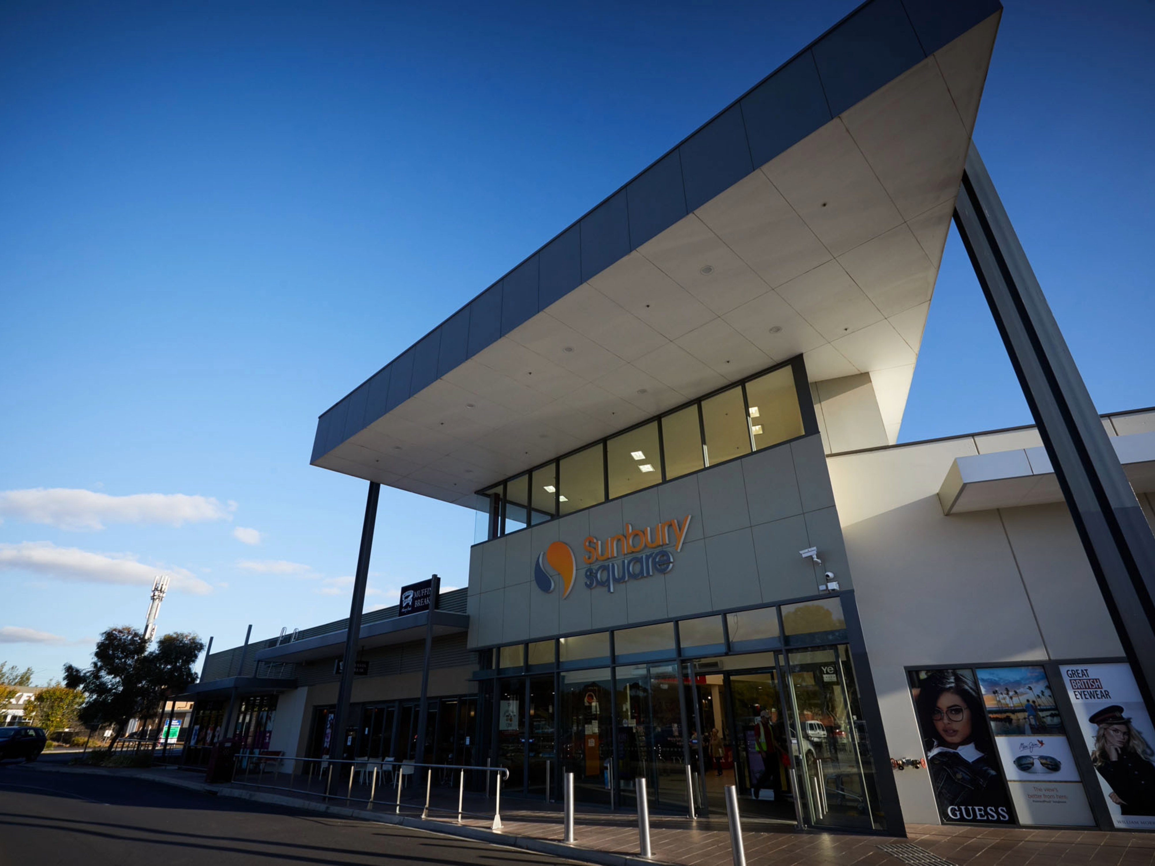
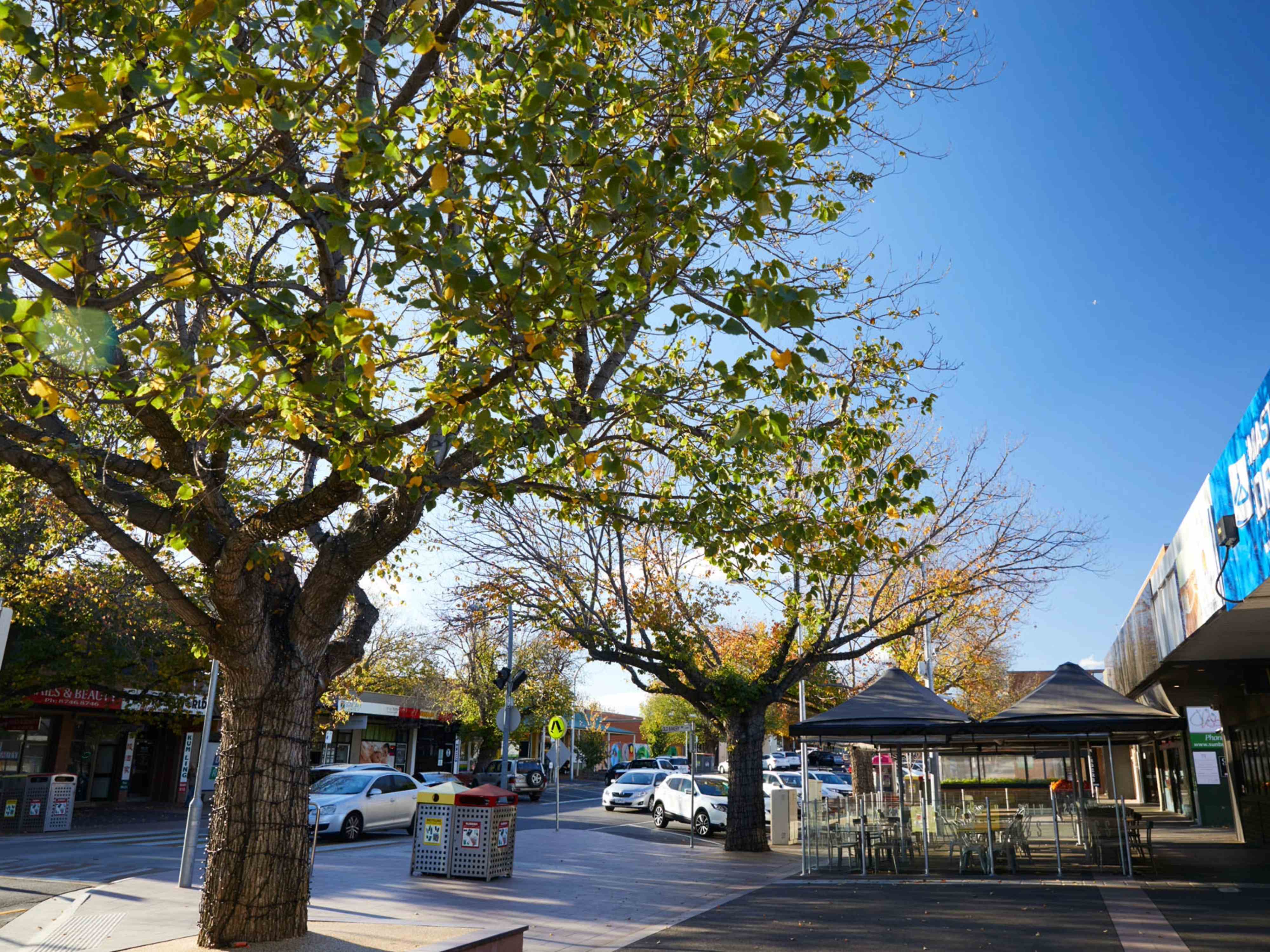
- Existing Sunbury Square shopping centre – 4.2kms; coupled with leisure options including wineries, golf courses, sporting clubs & more.
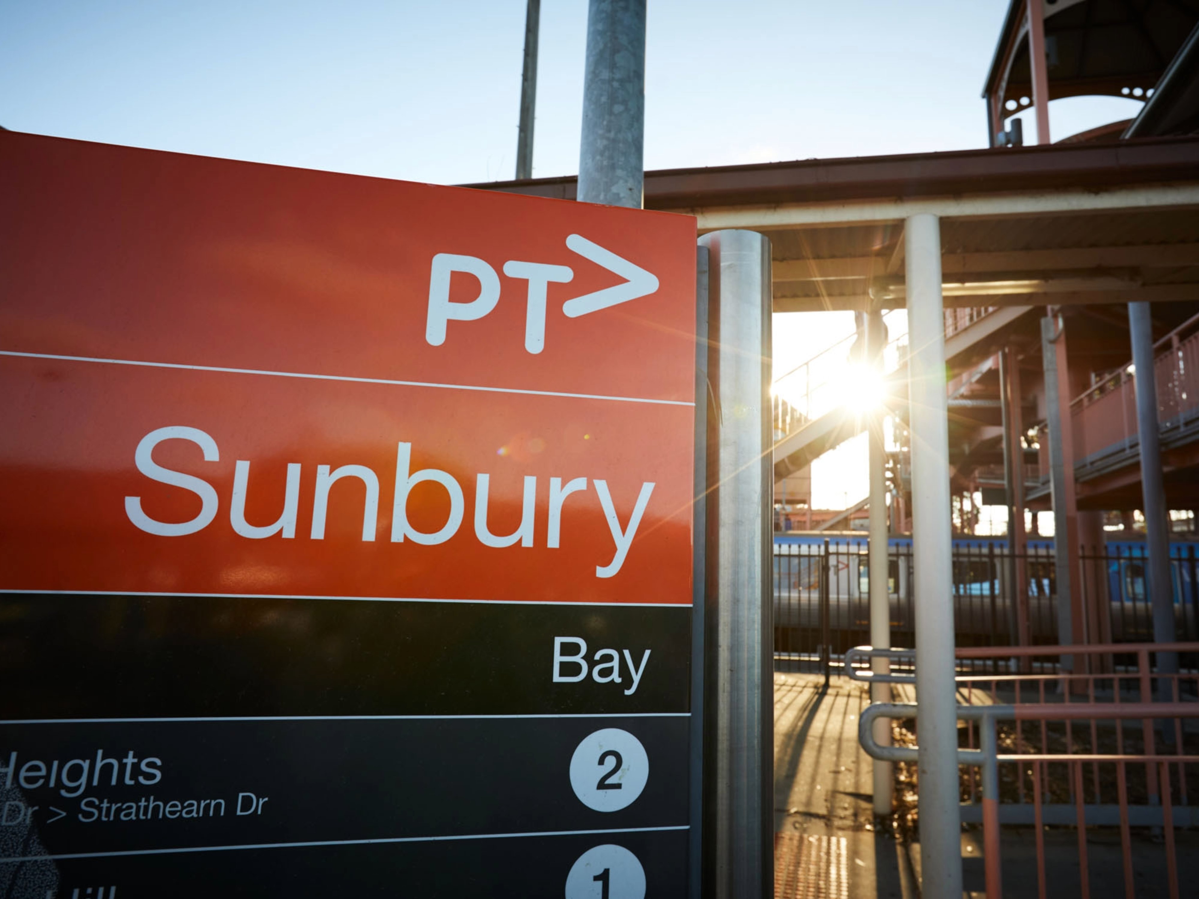
- Existing Sunbury Metro & V-Line Train Stations – 4.3kms. Existing Bus services along Sunningdale Ave & Rolling Meadows Dr to and from the stations and shops.
- Variety of state, independent and religious schools to choose from within 8 minutes and a proposed school within Kingsfield.
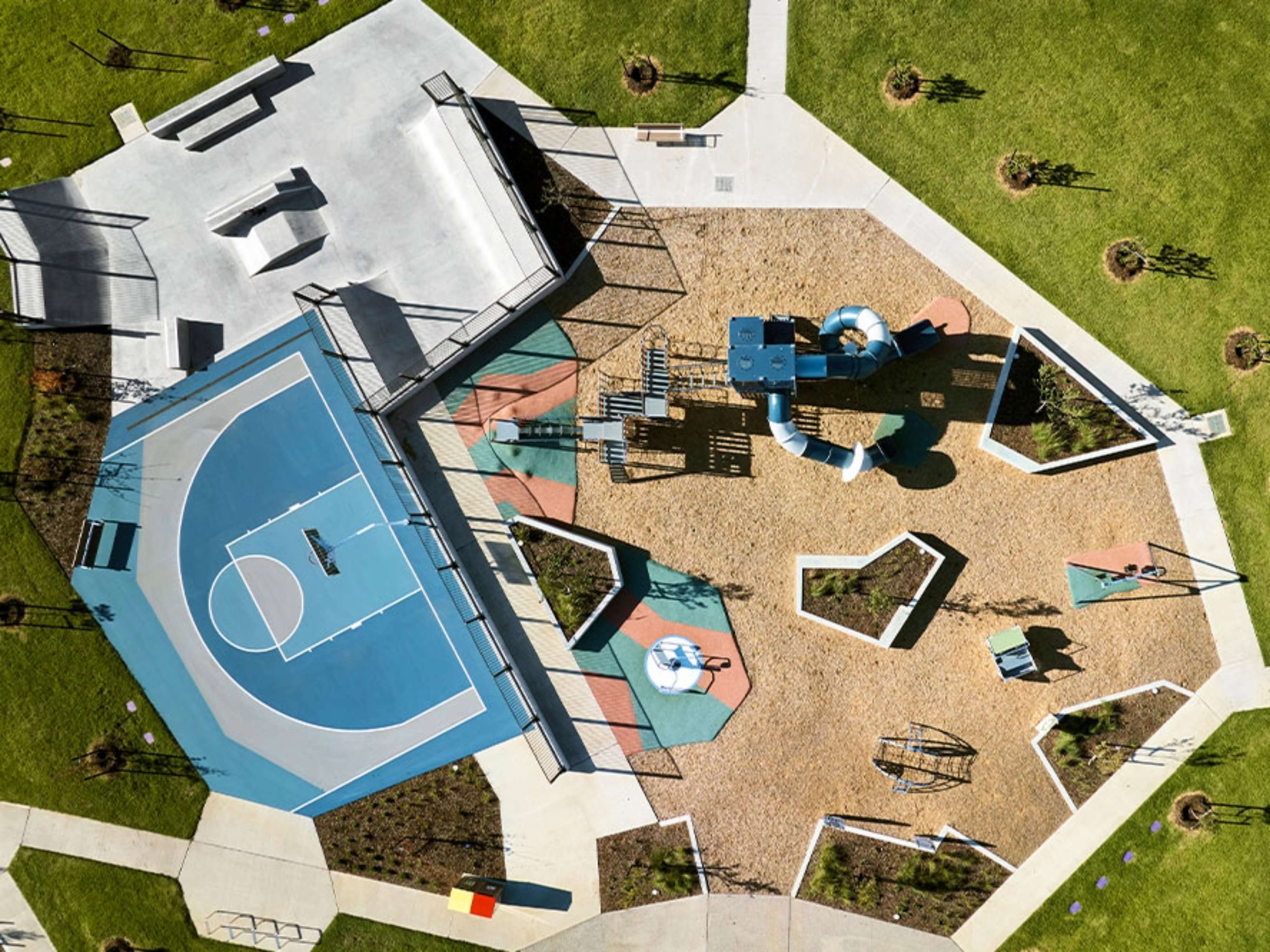
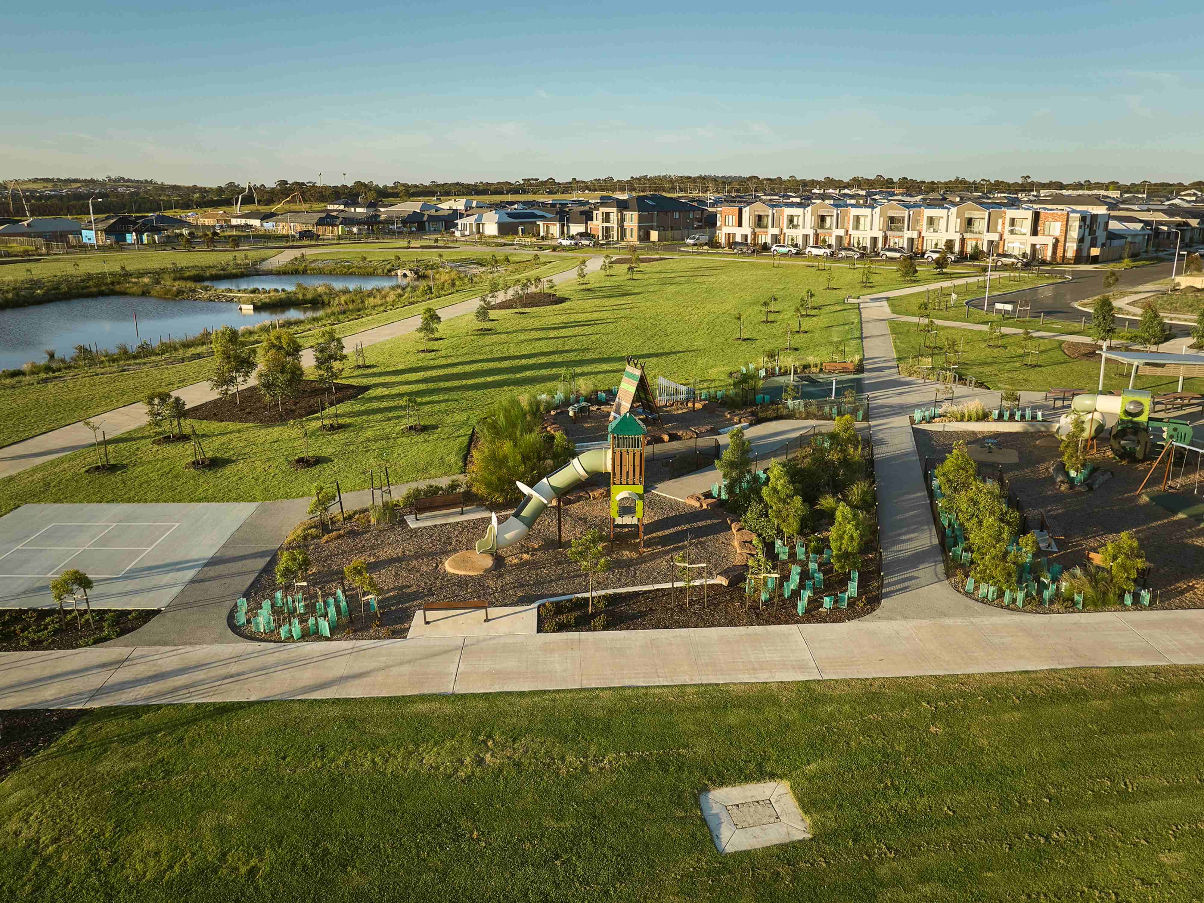
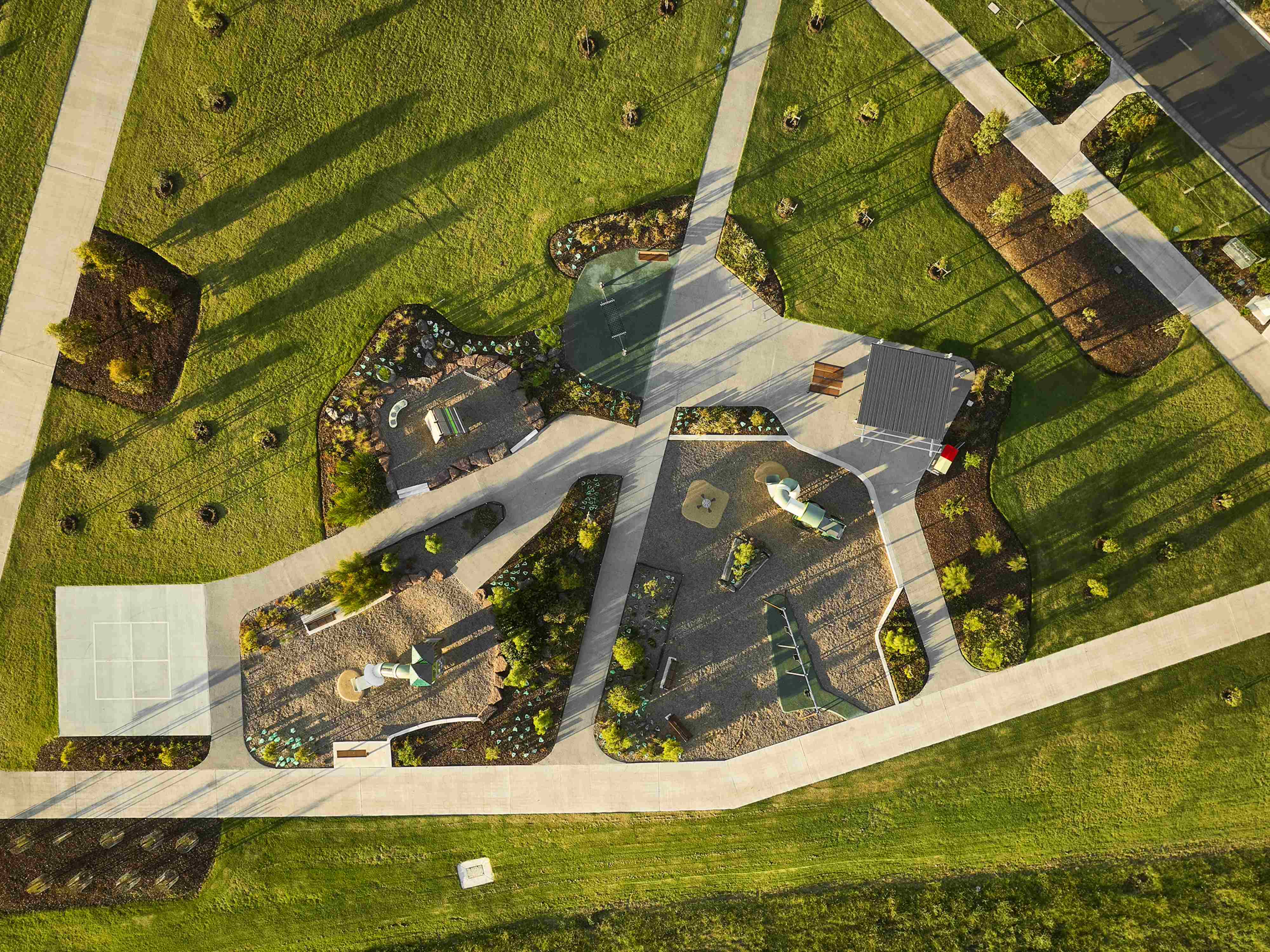
- 330 Acres of beautifully landscaped open space, wetlands and parks featuring picturesque views - NO Body Corporate.
- Stage 5 & Stage 9 neighbourhood parks now open!
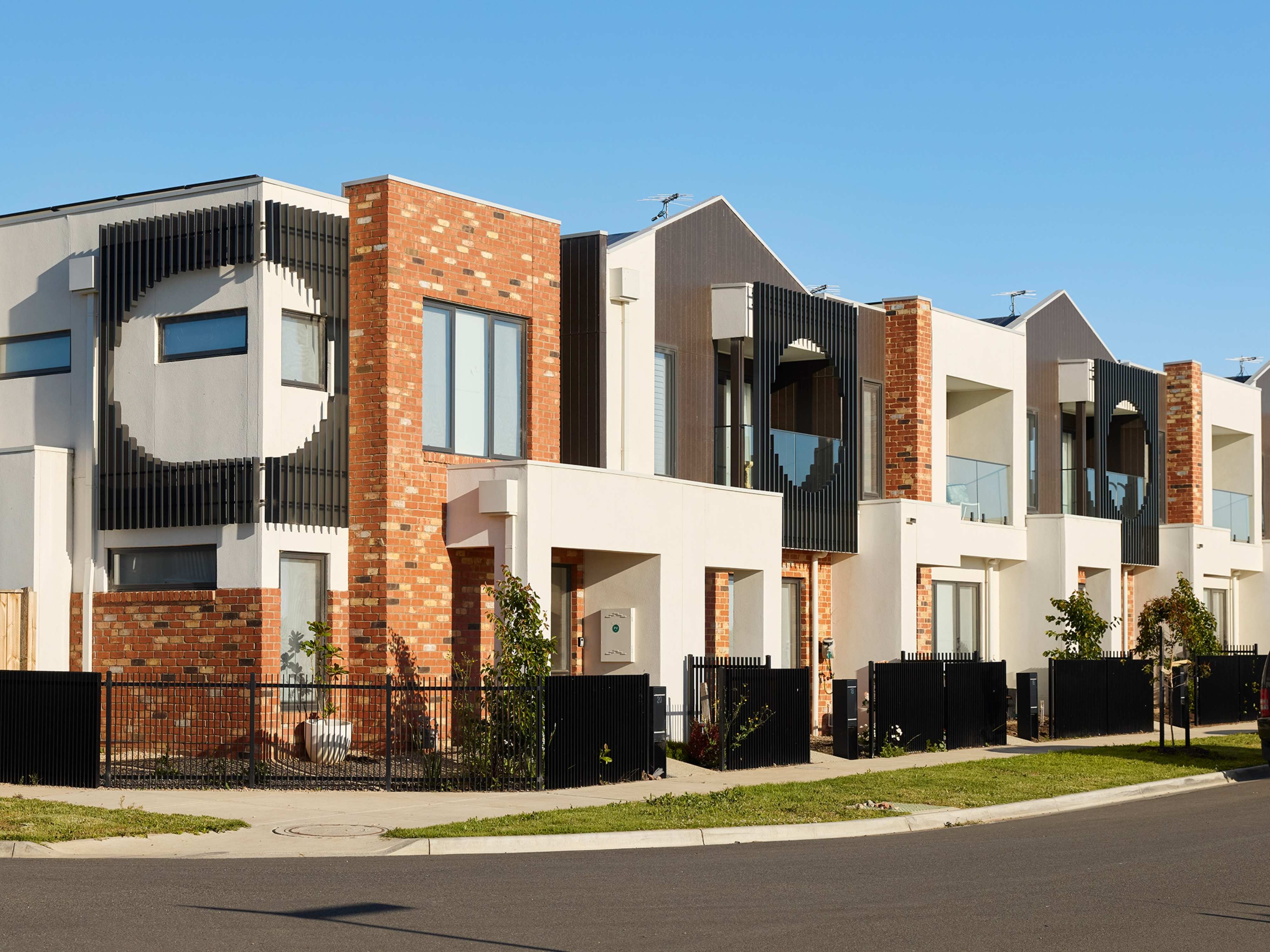
- Land construction progressing with titles achieved up to Stage 19 and a community being established!
This information is estimated by the OpenLot research team. Let us know here to provide up-to-date information about this development.
| Total new homes | 2,200 |
| Area size | 277.20 hectares |
| Growth Region | Melbourne North Growth Corridor |
| City council | Hume City Council |
| Developer | Moremac Property Group |
| Project marketer | Australian Land Corporation |
| Creative agency | Savi Communications |
| Distance to | Melbourne Airport - 13 km north-west Melbourne CBD - 32 km north-west |
Land for Sale, House and Land Packages:
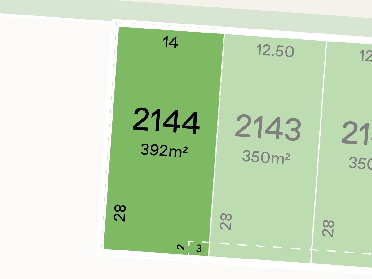
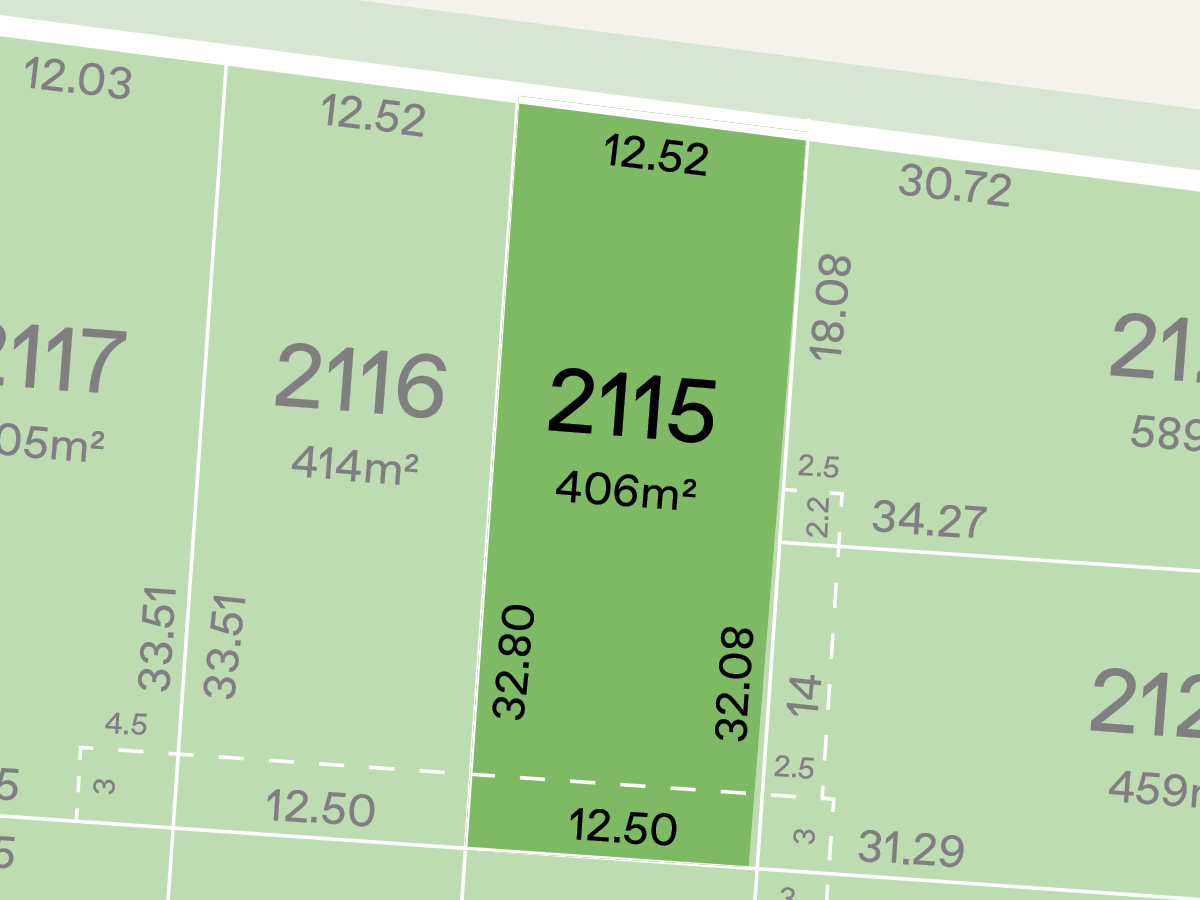
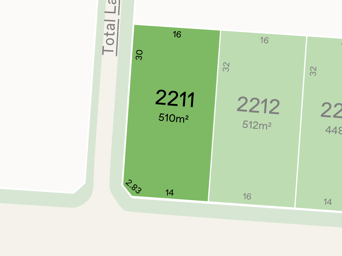
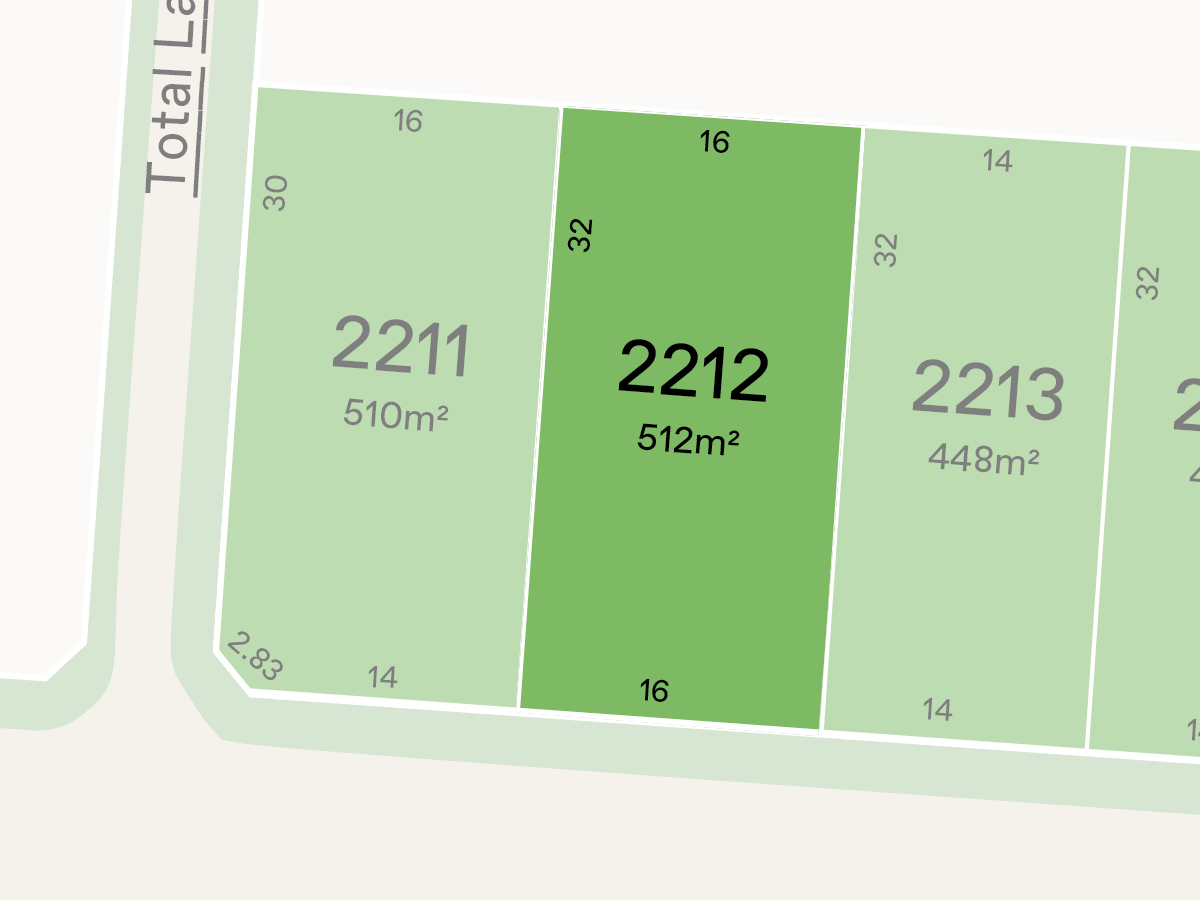
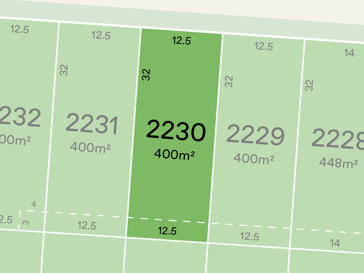
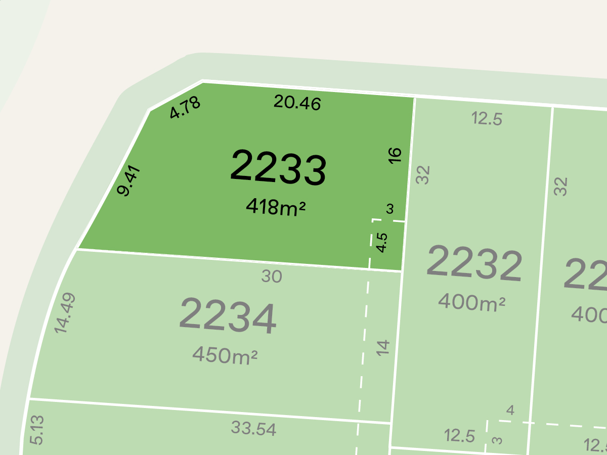
17 Land Lots in Kingsfield - Sunbury
House and Land Packages in Kingsfield - Sunbury

 4
4
 2
2
 2
2
Popular Estates near Kingsfield - Sunbury


Updates for Kingsfield - Sunbury
Facebook updates:
Related news:
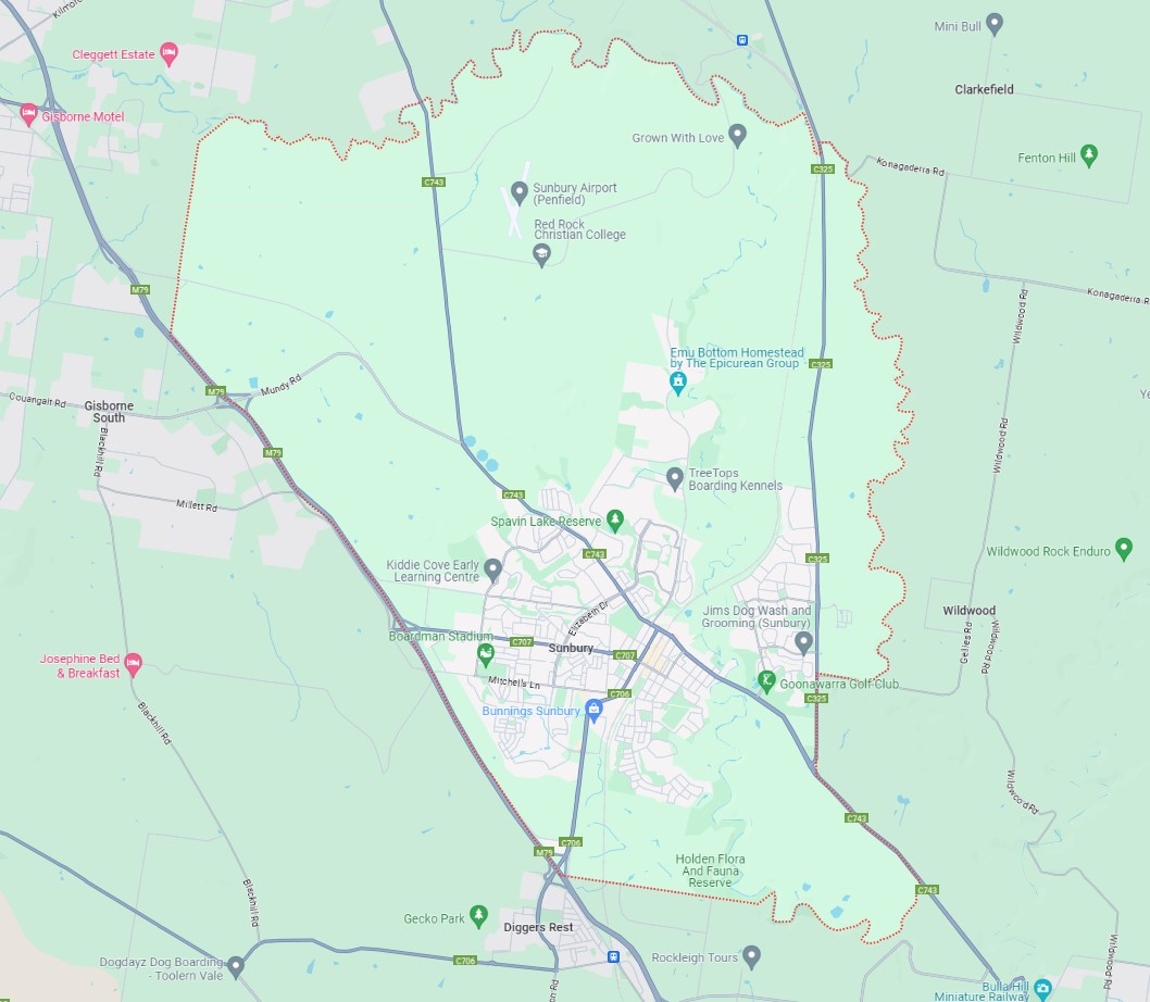
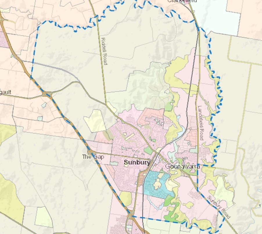
Sunbury is approximately 22.1 square kilometres within the City of Hume, a largely rural location to the north-west of Melbourne’s outer suburbs of the Urban Growth Boundary and logical expansion of the former Sunbury township. The suburb is located 38 kilometres north-west of Melbourne CBD.
Melbourne developer Moremac is poised to swoop on a major housing estate in Sunbury in the city's north-west in a deal insiders have put at more than $100 million.
Introducing the Mondina Parkside collection of 10 premium townhomes in the Kingsfield Sunbury estate, curated to meet the needs of growing families.

Missing articles? Send us a link here.
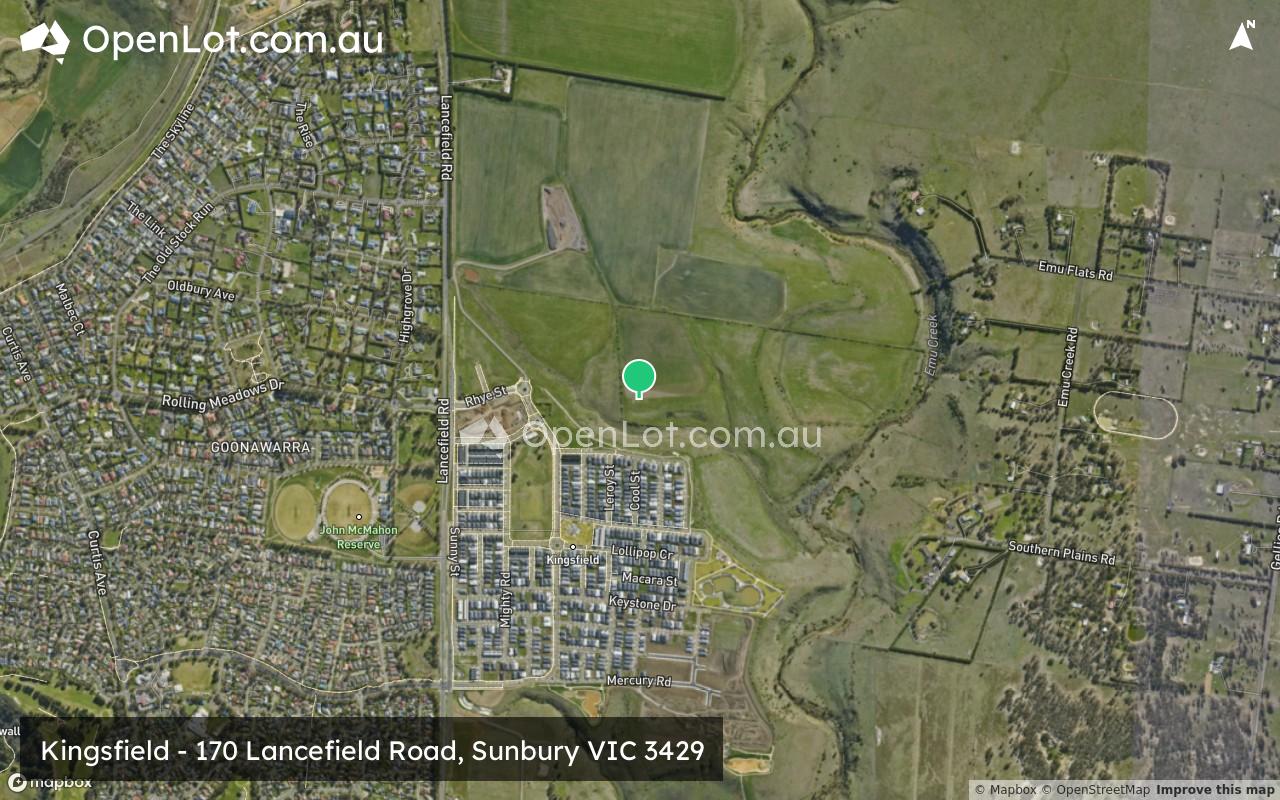
Location & Map for Kingsfield - Sunbury
Visit Display Homes near Kingsfield - Sunbury


Land Price Trend in Sunbury VIC 3429
- In Oct - Dec 24, the median price for vacant land in Sunbury VIC 3429 was $345,000. *
- From Oct - Dec 17 to Oct - Dec 24, the median price for vacant land in Sunbury VIC 3429 has increased 22.78%. *
- From 2008 to 2024, the median price for vacant land in Sunbury VIC 3429 has increased 143.36%. *
Vacancy Rate in Sunbury VIC 3429
View full vacancy rate history in Sunbury VIC 3429 via SQM Research.
Schools near Kingsfield - Sunbury
Here are 6 schools near Kingsfield - Sunbury:
Prep-6 Government Primary School
7-12 Catholic Secondary School
Prep-6 Catholic Primary School
7-12 Government Secondary School
Prep-6 Government Primary School
U Government Special School - School Head Campus
Suburb Planning Review in Sunbury VIC 3429
Sunbury is approximately 22.1 square kilometres within the City of Hume, a largely rural location to the north-west of Melbourne’s outer suburbs of the Urban Growth Boundary and logical expansion of the former Sunbury township. The suburb is located 38 kilometres north-west of Melbourne CBD.
Sunbury became recognised as part of Greater Melbourne following the Victorian Government's resolution in 2009 to expand the urban growth boundary in 2011. This decision incorporated the region into the Melbourne Urban Area, specifically as the north-western periphery of Greater Melbourne.
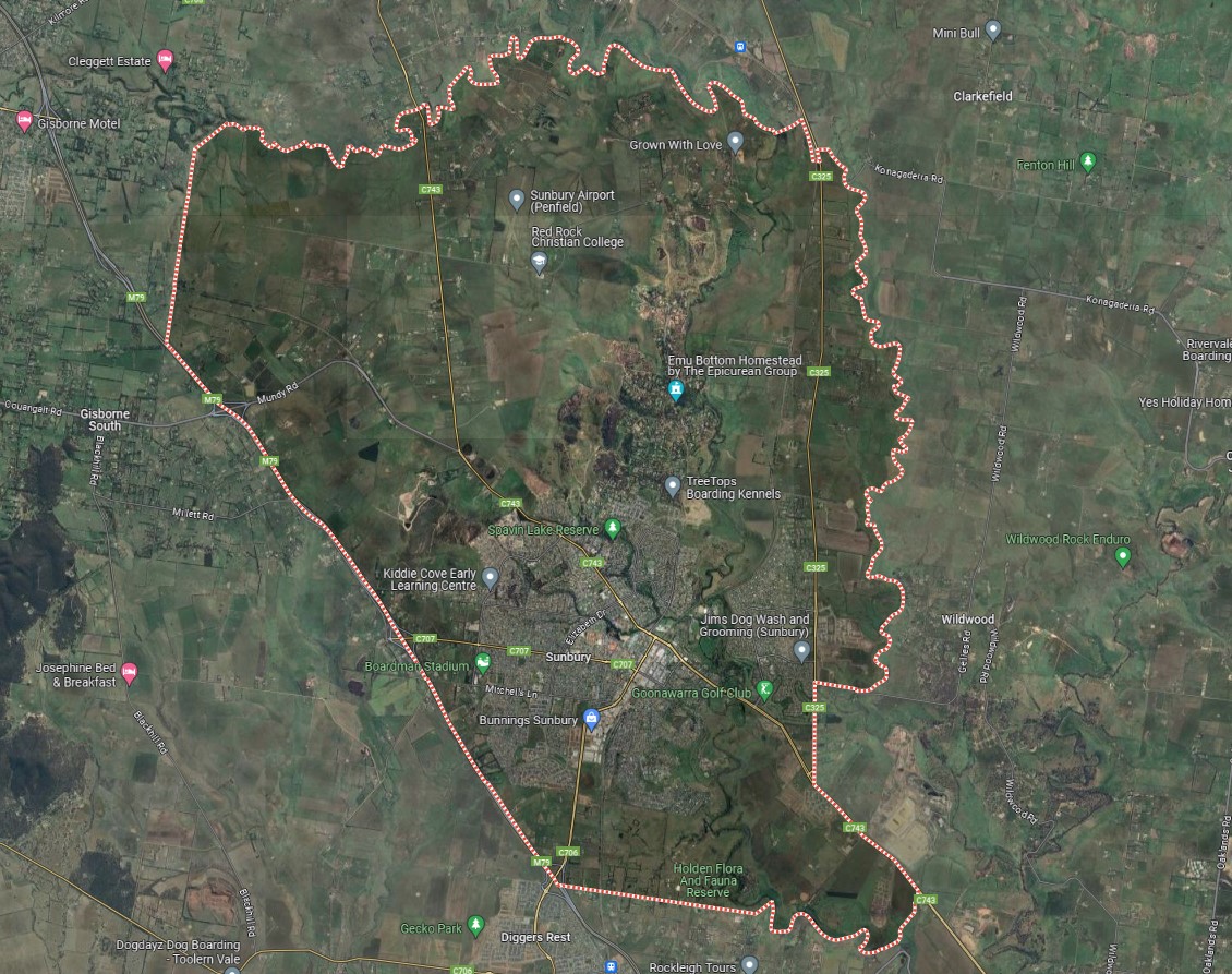
The suburb boundary is located along Jacksons Creek corridor to the North, with Emu Creek and Lancefield Road making up the eastern boundary. Watsons Road and Jacksons Creek provide the small southern boundary, with property boundaries and Calder Freeway providing the western boundary.
Riddell Road, Vineyard Road and Sunbury Road provide local road access (north to south), along with Gap Road and Mundy Road provide local road access (East to West) throughout Sunbury linking to the Calder Freeway interchange found to the eastern boundary of the township. An additional southbound off-ramp is found in three locations along the eastern boundary. The interchanges allow direct access for anyone travelling through the region.
The suburb of Sunbury is a large established suburb, providing a range of residential settlement patterns, small-large property sizes, townhouses and multiple dwellings. A large northern portion and small southern pocket of the suburb is still rural land, with hilly terrain and waterway corridor located throughout. Sunbury slowly redeveloping, with existing local retail centres, supermarkets, small airport, train station, services, schools and recreational areas supporting the growth.
Melbourne 2030 (2008 Update) - Victorian Government
In 2002 the Victorian Government's blueprint for managing long-term growth in the surrounding region. The 2008 release of updated population projections in "Victoria in Future 2008" prompts a revaluation of development strategies, ensuring Melbourne remains adaptable. Acknowledging an inevitable population surge, "Melbourne @ 5 million" emphasises readiness and focuses on job creation and service provision in key areas.
The update prioritises preserving liveability and enhancing quality of life. It targets growth towards Melbourne's north and west while exploring expansion possibilities. Moreover, it encourages collaboration with councils to identify suitable redevelopment sites, underscoring the importance of community support for Melbourne's evolution as a top-tier city.
Key Facts:
Melbourne 2030 (2002): Established the Urban Growth Boundary (UGB) to manage expansion
UGB Purpose: Directs growth to areas with infrastructure while protecting land and environment.
2010 UGB Review: Accommodated 600,000 new dwellings, primarily in north and west
Environmental Assessment: rigorous studies and Commonwealth approval to protect natural features.
Funding Infrastructure: Introduction of Growth Areas Infrastructure Contribution (GAIC) and improved Development Contribution Plans (DCP).
2012 Expansion: Added 6,000 hectares to UGB based on recommendations
Outer Melbourne Northern Suburbs Upgrade
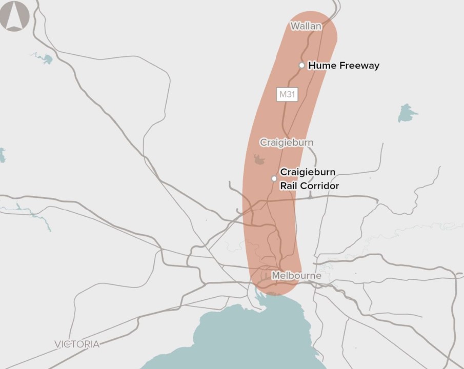
Infrastructure Australia in 2016 identified the need to improve urban transport networks between Melbourne's Outer Northern Suburbs and the CBD, marking it as crucial within a medium-term timeframe of 5-10 years. The proposal aims to address pressing transportation challenges due to rapid growth in the Northern Growth Corridor. With projections indicating significant population and employment increases by 2031, existing road and rail infrastructure faces strain, leading to anticipated congestion and delays along the Hume Freeway and the Seymour Line.
Recognising the urgency, the Victorian and Australian Governments are collaborating on a comprehensive strategy integrating road and rail network planning. Through various projects and proposed reforms outlined in Victoria’s infrastructure strategy 2021-2051, efforts are underway to alleviate congestion and enhance transportation services in the corridor. Emphasising the need to explore diverse options, including infrastructure upgrades and reforms, this proposal seeks to meet the transportation needs of Melbourne's outer northern suburbs' growing population and employment hub.
Growth Corridor Plans
The Precinct Structure Plans (PSPs) complement the broader land use framework outlined in the Growth Corridor Plans. PSPs are detailed planning documents that guide development within specific precincts, ensuring they align with the overarching goals of the Growth Corridor Plans. Developed through a consultative process involving stakeholders, PSPs provide a strategic blueprint for neighbourhood development.
In 2012, the Growth Areas Authority (GAA) in collaboration with local councils, PSPs defined the pattern for neighbourhood growth, ensuring cohesion and sustainability over time. They play a crucial role in creating attractive, convenient, and sustainable local communities within the broader growth framework.
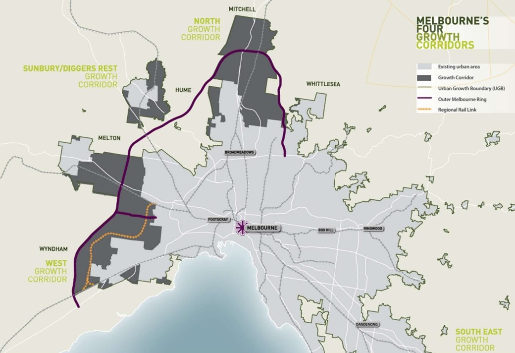
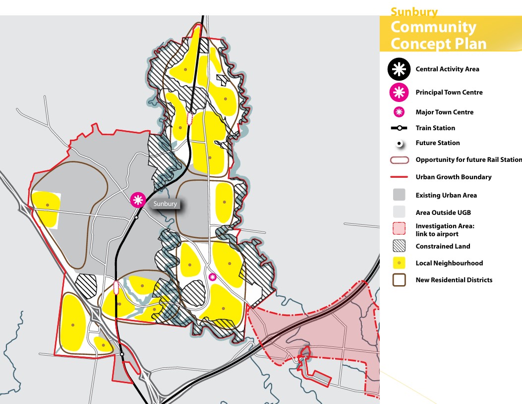
Northern Growth Corridor Plan (Sunbury Shown)
Melbourne's north will undergo significant transformation, driven by a diverse socio-economic landscape and a burgeoning economy, supported by key infrastructure like Melbourne Airport and major transport arteries. The Northern Growth Corridor Plan aims to accommodate 260,000 residents and generate 83,000 jobs, focusing on advanced manufacturing, logistics, and the knowledge economy. The plan prioritizes preserving natural features, improving public transport, and developing new town centres to sustainably support the area's growth, alongside initiatives to provide diverse housing options for evolving community needs.
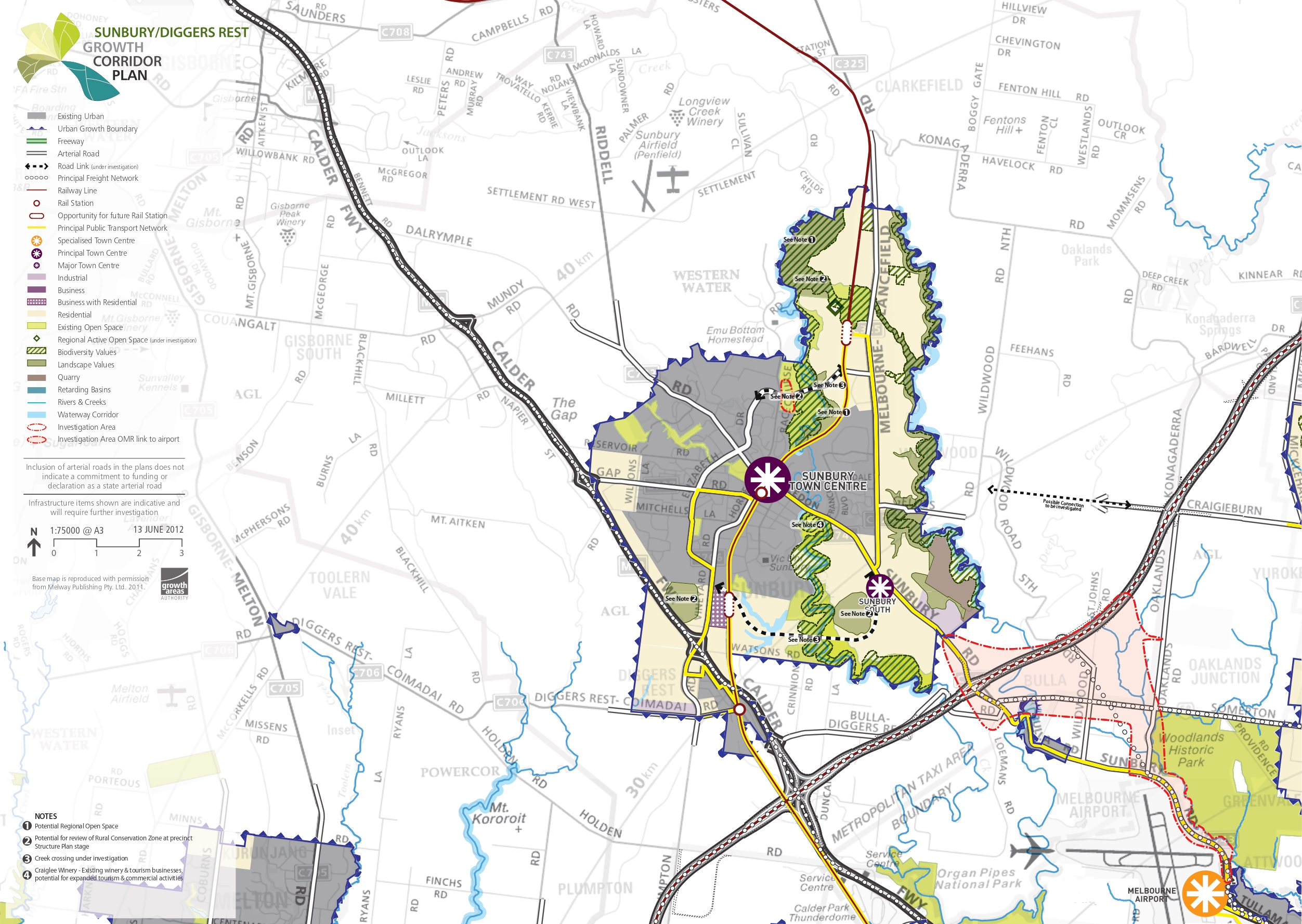
Sunbury/Diggers Rest Growth Corridor Plan
Sunbury and Diggers Rest are nestled amidst rolling hills, tree-lined creek valleys, and open spaces. The Growth Corridor Plan anticipates accommodating a population of over 71,000 people and 10,000 jobs in the area. The well-established Sunbury town centre caters to residents and enjoys its 'country town' ambience, while also benefiting from proximity to major employment hubs like Melbourne Airport and Broadmeadows. Accessibility to Melbourne's CBD is facilitated by the Calder and Tullamarine Freeways, with further enhancements expected on the electrified Sunbury rail line.
However, limited local employment opportunities lead to pressure on transportation networks during peak hours. Sunbury's layout, shaped by plateaus and creek lines, gives rise to distinct urban areas connected to the main centre via arterial roads, though congestion is common due to restricted east-west connections.
Future development in Sunbury and Diggers Rest must address several key issues:
Improving local transport links, including creek crossings and main approach roads
Enhancing the range of local jobs and services
Strengthening the Sunbury town centre and providing quality local access
Increasing Diggers Rest's population to support a wider range of amenities
Preserving and enhancing the semi-rural and natural environment
Establishing accessible open spaces, particularly along Jacksons and Emu creeks
Vision of Sunbury and Diggers Rest
“Sunbury and Diggers Rest will develop as a highly attractive and liveable regional city linked to but distinct from the metropolitan area. Its distinctive creek environs, hills and rural hinterland provide an attractive landscape setting for the township, which will be maintained and enhanced. The environmental and cultural heritage values of Jacksons and Emu Creeks will be protected and enhanced, and community access to these areas will be improved over time.
The Sunbury Town Centre will grow in importance as a regional hub and will be complemented by a series of smaller town centres that meet the local shopping and other needs of residents. Diggers Rest will grow to become a more self-contained neighbourhood, supported by a Local Town Centre, open space and community facilities. Transport access will improve over time, with the extension and electrification of rail services and extensions to the local bus networks, as well as road upgrades that improve connectivity within and to the town centre.
These upgrades will better link the community to employment areas beyond Sunbury, including Melbourne Airport, the Craigieburn employment corridor and opportunities proposed in the Melton corridor. Additional employment opportunities will be provided within the town over time, within the Sunbury Town Centre, local centres and new local industrial precincts”.
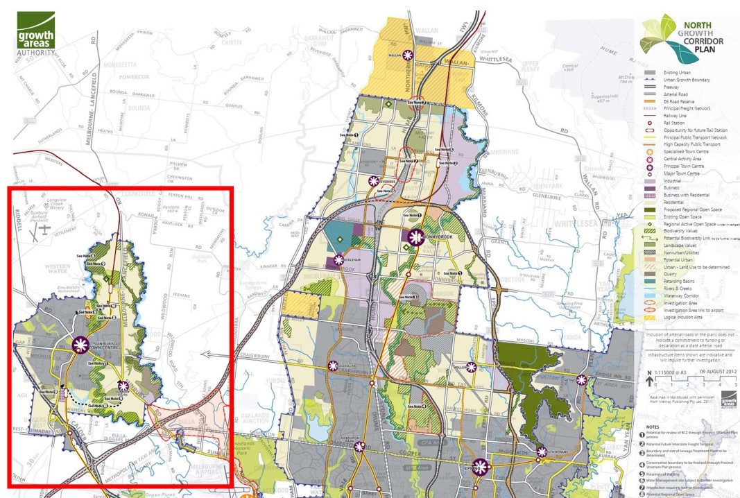
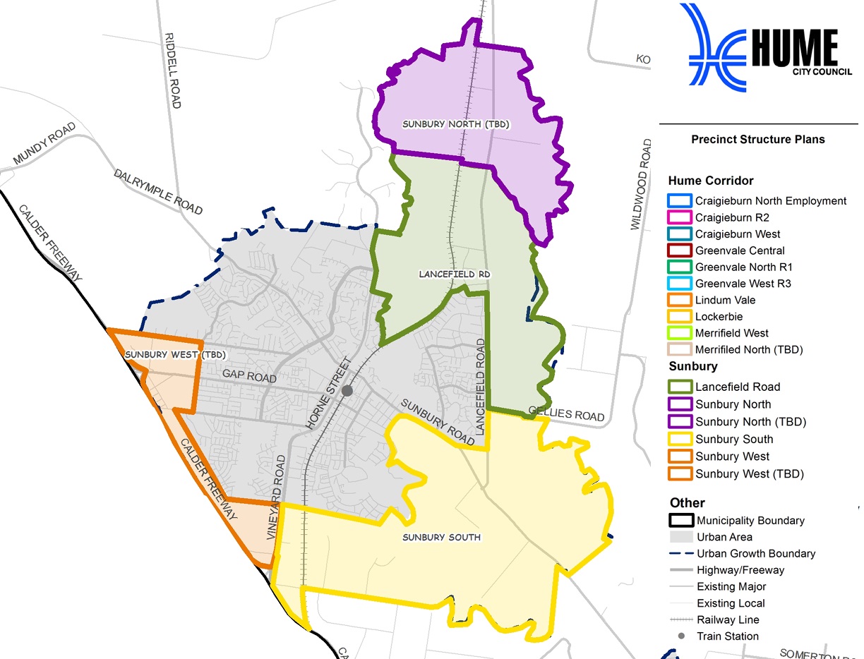
Precinct Structure Plans
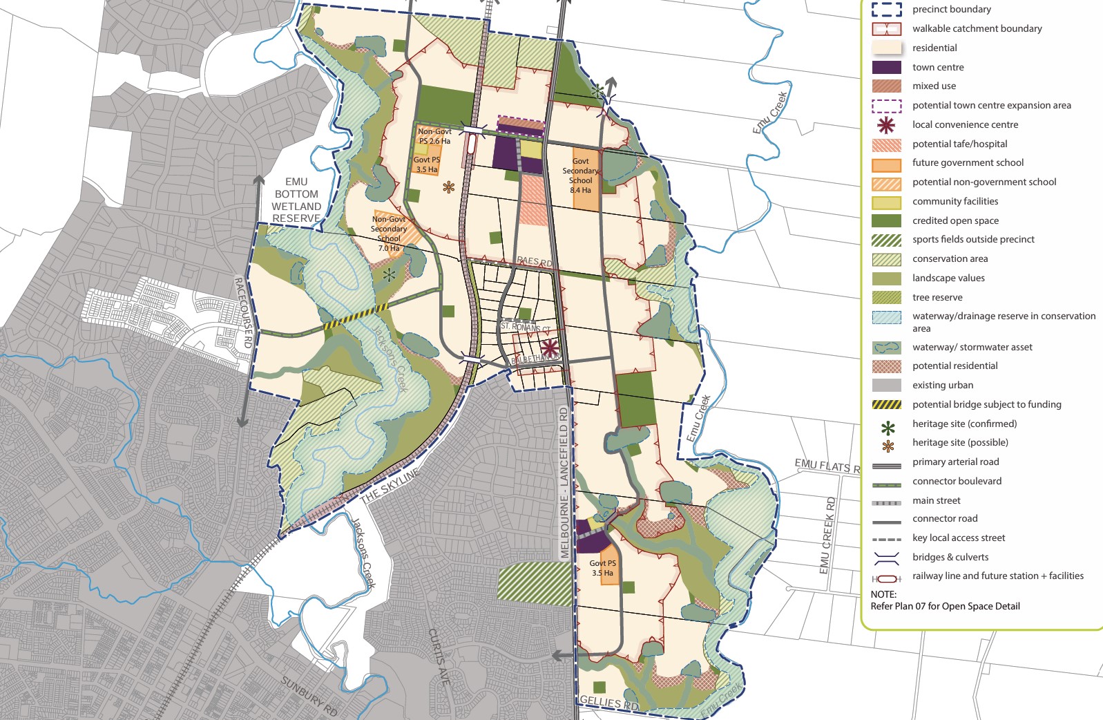
The Growth Areas Authority, in collaboration with the Hume City Council, government agencies, service authorities, and key stakeholders, has developed the Precinct Structure Plans (PSP) for Sunbury. These plans are crafted to steer the redevelopment of designated land, creating interconnected neighbourhoods supported by diverse local town centres, schools, and community facilities. Additionally, measures to safeguard natural assets and conservation areas are incorporated to preserve habitats within the planned suburb.
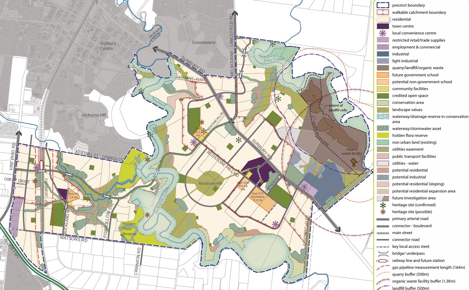
The Victorian Planning Authority (VPA) has approved the first two PSPs for various new communities within Sunbury, namely Sunbury South and Lancefield Road. The approval of Precinct Structure Plans (PSPs) for Sunbury South and Lancefield Road brings significant developments, including:
- Nearly 40% open space in new communities
- Plans for a regional park and conservation network
- Over two decades, 19,000 dwellings and 6,000 local jobs will be created
- Two future train stations and nine new schools are proposed
- Introduction of one new crossing over Jacksons Creek and three crossings over the railway corridor
PSP Relevant to Sunbury:
Sunbury South PSP (June 2018) - updated June 2022
Lancefi Future Precinct Structure Plans to be confirmed
Sunbury West (Future PSP)
Sunbury North (Future PSP)
Precinct Structure Plan:
Acts as a roadmap for creating a high-quality urban environment
Establishes a vision for land development, outlining future urban structure and development objectives
Identifies necessary projects to ensure timely access to services and transport infrastructure for residents, visitors, and workers
Specifies the form and conditions for future land use and development
Sets the framework for development controls in the Urban Growth Zone
Guides planning permits within the zone
Offers direction for developers, investors, and local communities regarding future development
Complies with the requirements of the EPBC Act 1999
Hume Regional Growth Plan
The Hume Regional Growth Plan was published in 2014 to offer a comprehensive approach to land use planning across the Council area. Accompanied by a background paper detailing considerations, the plan outlines strategies to foster growth and facilitate change over the next three decades. Building upon the Hume Strategy for Sustainable Communities 2010–2020, it aspires to realise a shared vision for the Hume Region. The plan outlines future development locations, preservation strategies for environmental and heritage assets, and regional infrastructure priorities to support growth.
Vision of The Hume Region
The Hume Region will be resilient, diverse and thriving. It will capitalise on the strengths and competitive advantages of the four sub-regions, to harness growth for the benefit of the region and to develop liveable and sustainable communities.
Hume Council Planning Scheme (2024)
The council is responsible for ensuring adequate housing, facilities, infrastructure, and services for new residents and businesses. The city of Hume is experiencing rapid growth and to address this, the Council has continuously updated its planning scheme. The population will grow by more than 50% from just under 245,000 in 2021 to nearly 395,000 by 2041. When all current growth area land is developed the population will be around 420,000. Revisions to the plan may occur based on feedback and changes in circumstances, or new planning information.
New development has occurred in the growth areas, supported by the zoning applied by the Hume Planning Scheme and the precinct structure plans. The new urban areas are supported by new schools, parks, sporting grounds, local centres and transport infrastructure.
Sunbury Suburb Summary
References
Hume Council – PSP Locations Map
Melbourne 2030: A Planning Update
Melbourne Urban Growth boundary
Growth Corridor Plan – Managing Melbourne’s Growth
The North Growth Corridor Plan
The Sunbury Growth Corridor Plan
Melbourne outer northern suburbs to CBD capacity upgrade
Hume-Regional-Growth-Plan-May-2014
Lacefield Road Precinct Structure Plan - VPA
Sunbury South Precinct Structure Plan - VPA
Reviews & Comments on Kingsfield - Sunbury
Estate Brochure, Masterplan, Engineering Plan, Plan of Subdivision (POS), Design Guidelines
FAQs about Kingsfield - Sunbury
View all estates from Moremac Property Group
View all estates marketed by Australian Land Corporation
- Goonawarra Primary School - 1.7km south-west
- Salesian College Sunbury - 2.5km west
- Our Lady of Mount Carmel School - 2.9km west
- Sunbury College - 3.4km west
- Kismet Park Primary School - 3.5km west
- Sunbury And Macedon Ranges Specialist School - 4.3km south-west
Popular Estates near Kingsfield - Sunbury
Latest New Home Articles for You

10/Feb/2026 | OpenLot.com.au
Victoria: Top 30 Most Searched Housing Developments (January 2026)
If you’ve been considering making a move in Victoria, January 2026 offere...

10/Feb/2026 | OpenLot.com.au
Queensland: Top 30 Most Searched Housing Developments (January 2026)
If you’ve been considering making a move in Queensland, January 2026 offe...

09/Feb/2026 | OpenLot.com.au
Western Australia: Top 30 Most Searched Housing Developments (January 2026)
If you’ve been considering making a move in Western Australia, January 20...

06/Feb/2026 | OpenLot.com.au
South Australia: Top 30 Most Searched Housing Developments (January 2026)
If you’ve been considering making a move in South Australia, January 2026...

05/Feb/2026 | OpenLot.com.au
New South Wales: Top 30 Most Searched Housing Developments (January 2026)
If you’ve been considering making a move in New South Wales, January 2026...

31/Jan/2026 | OpenLot.com.au
Five Estates. Five Futures. A New Way to Live.
Across New South Wales, a quiet but powerful transformation is underway. ...

27/Jan/2026 | OpenLot.com.au
Display Homes at Stockland Wildflower Estate: A Smart Community in Piara Waters
Welcome to Wildflower, a vibrant new neighbourhood nestled in the heart o...

16/Jan/2026 | OpenLot.com.au
South Australia Top 30 Most Searched Housing Developments (December 2025)

15/Jan/2026 | OpenLot.com.au
Queensland: Top 30 Most Searched Housing Developments (December 2025)
If you’ve been tracking housing demand across Queensland, December 2025 p...