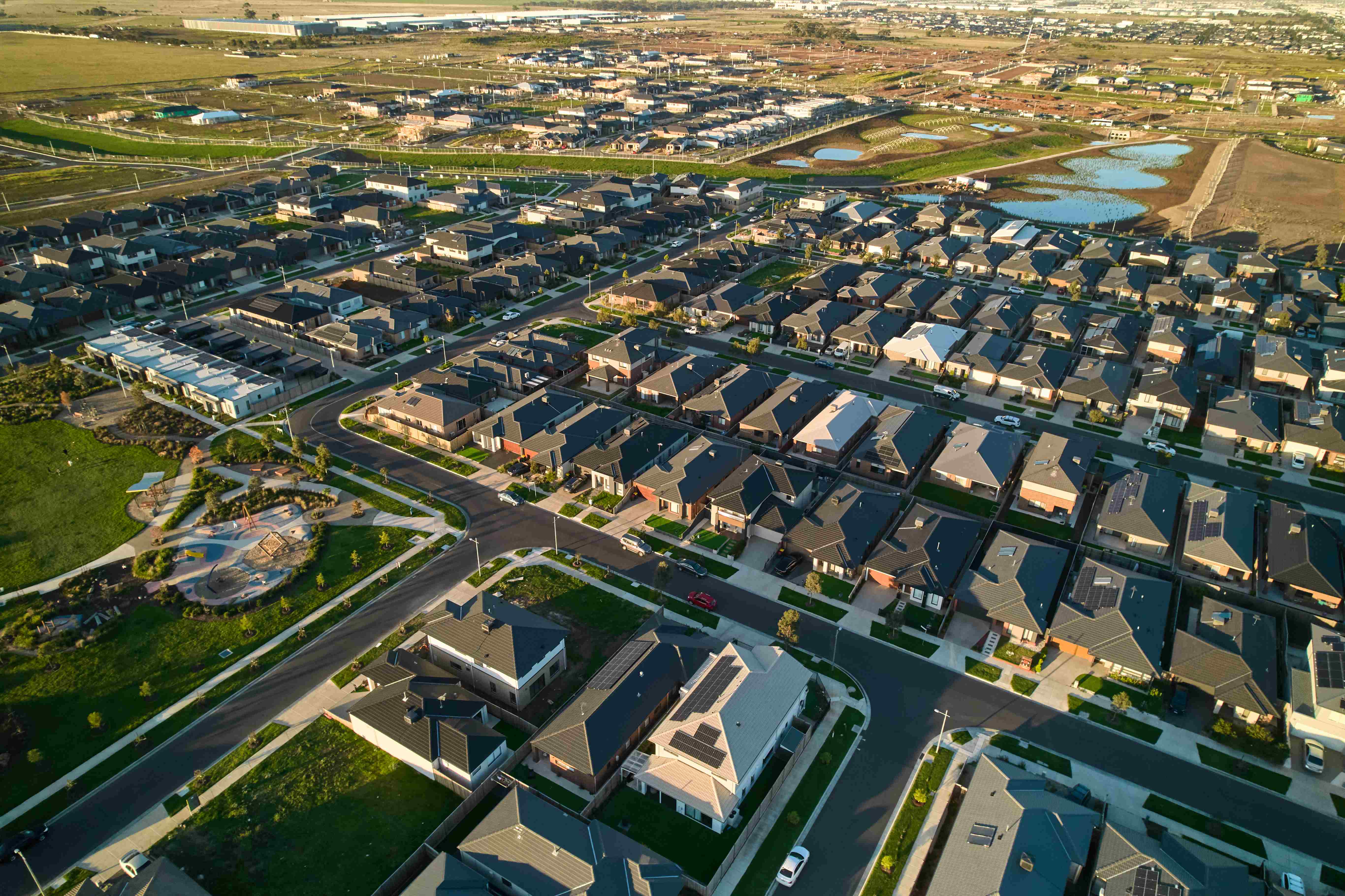
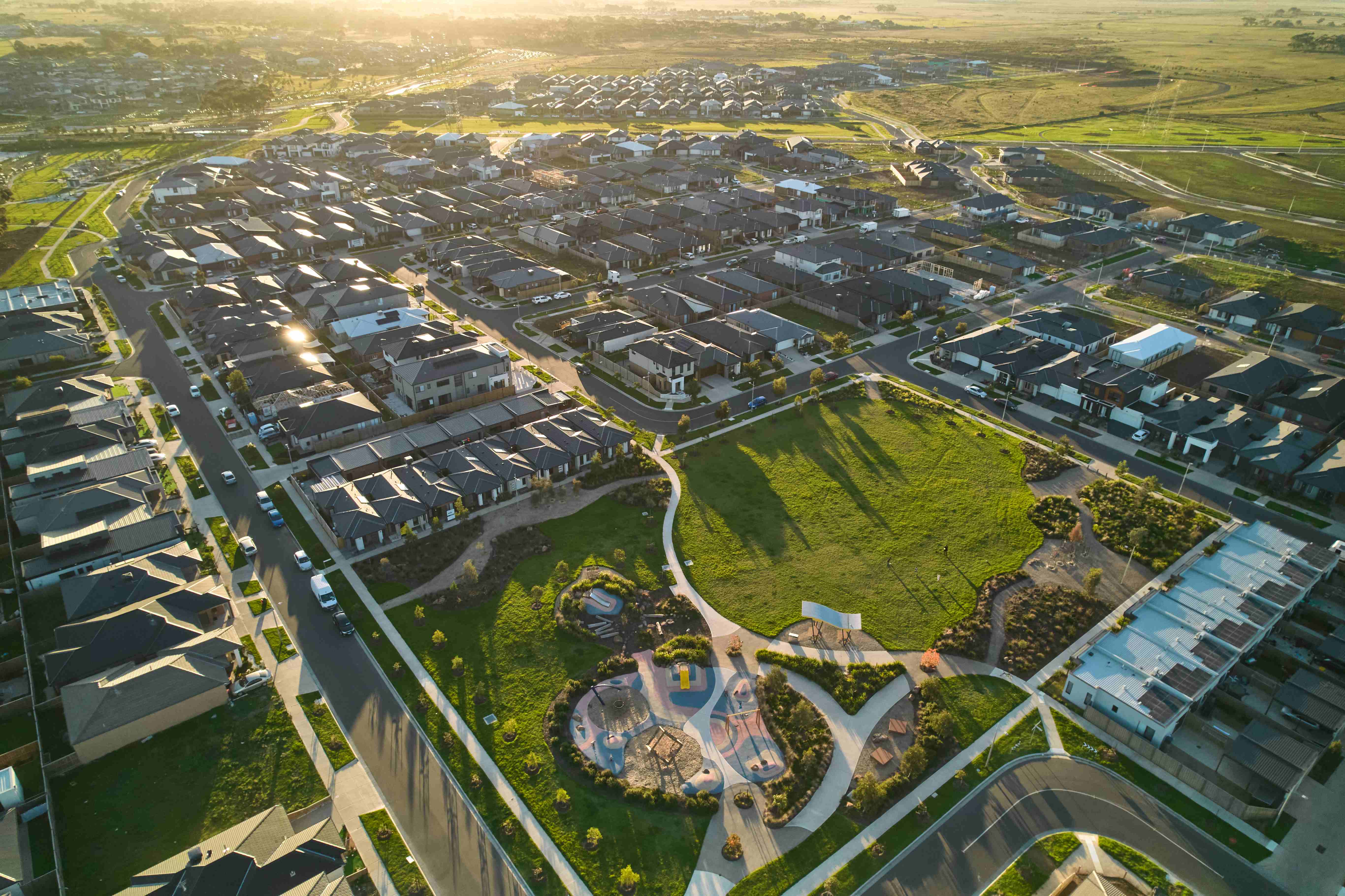
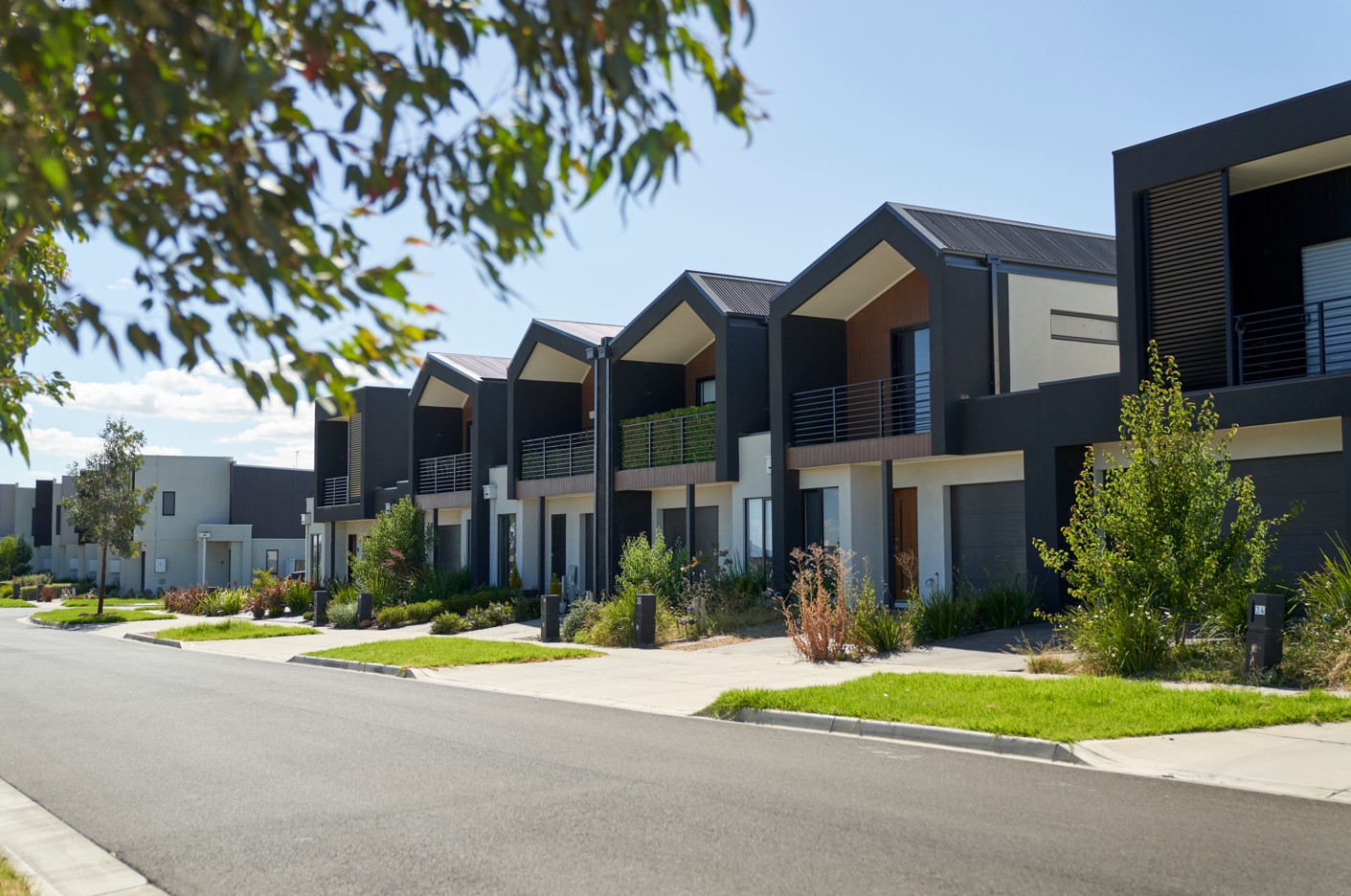

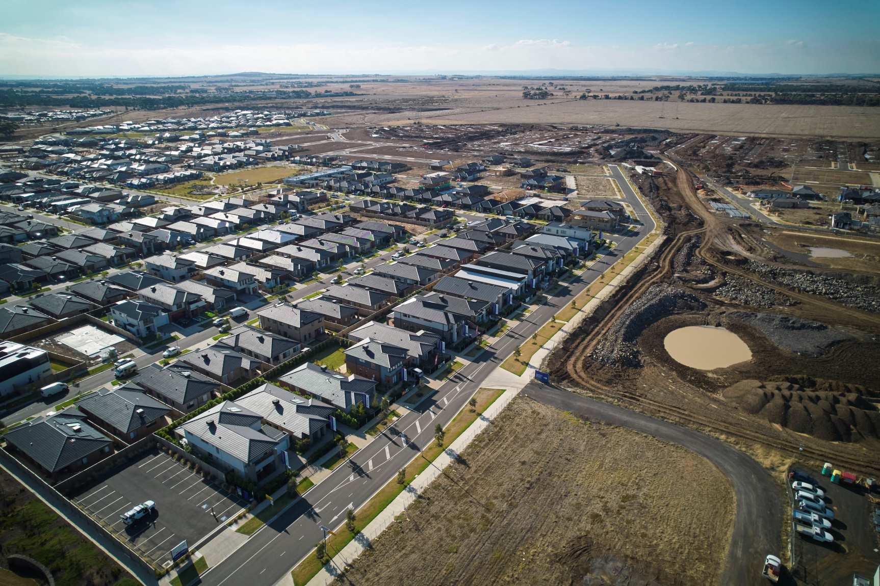
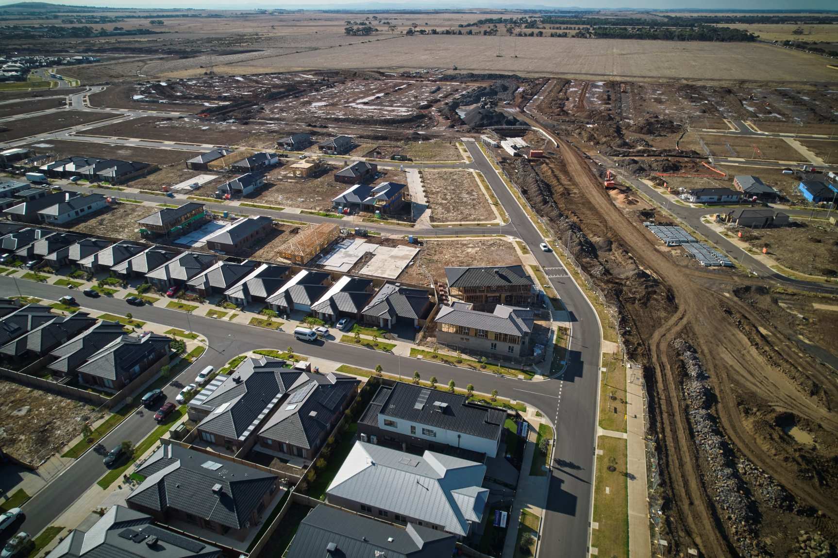
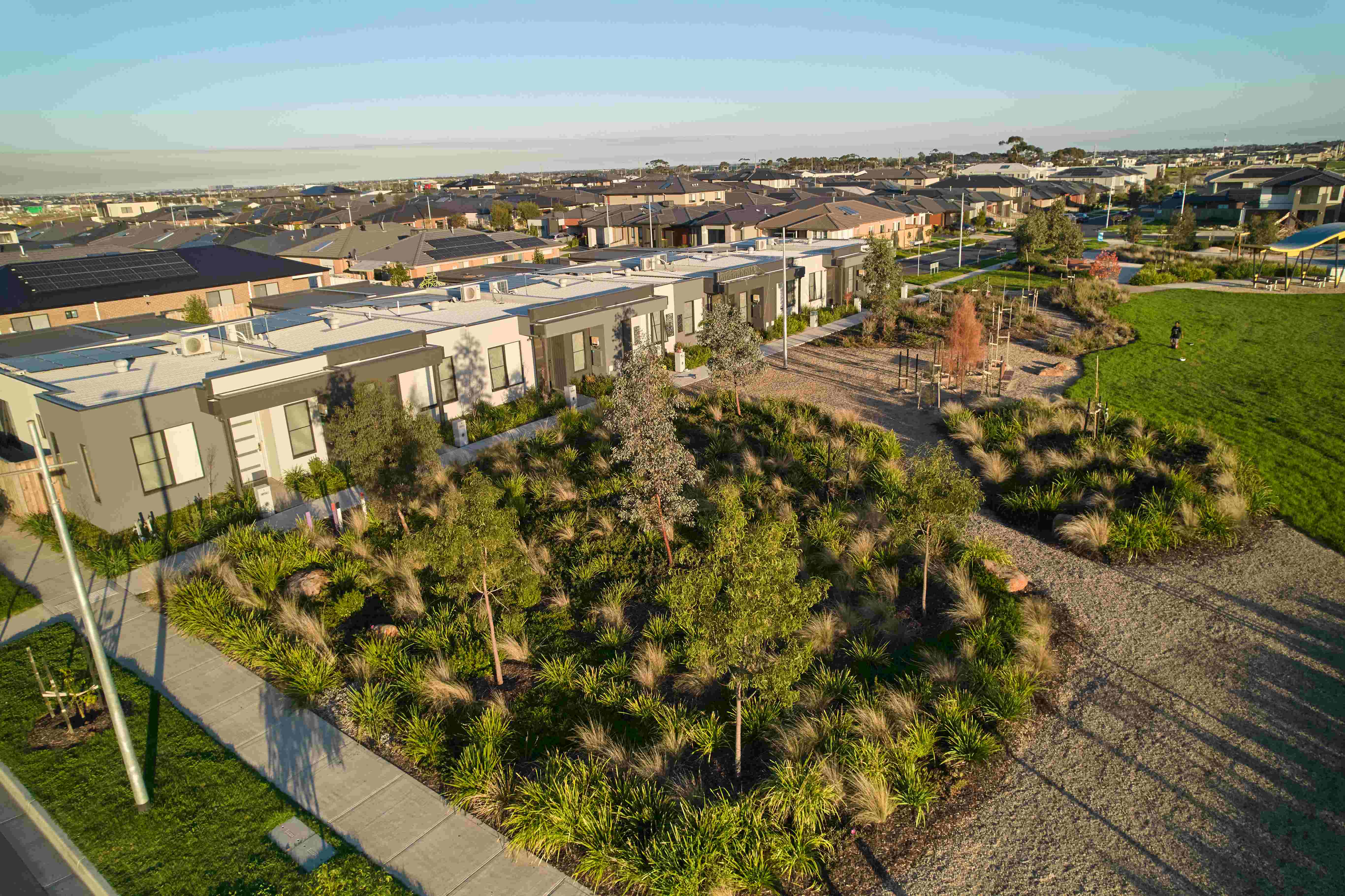
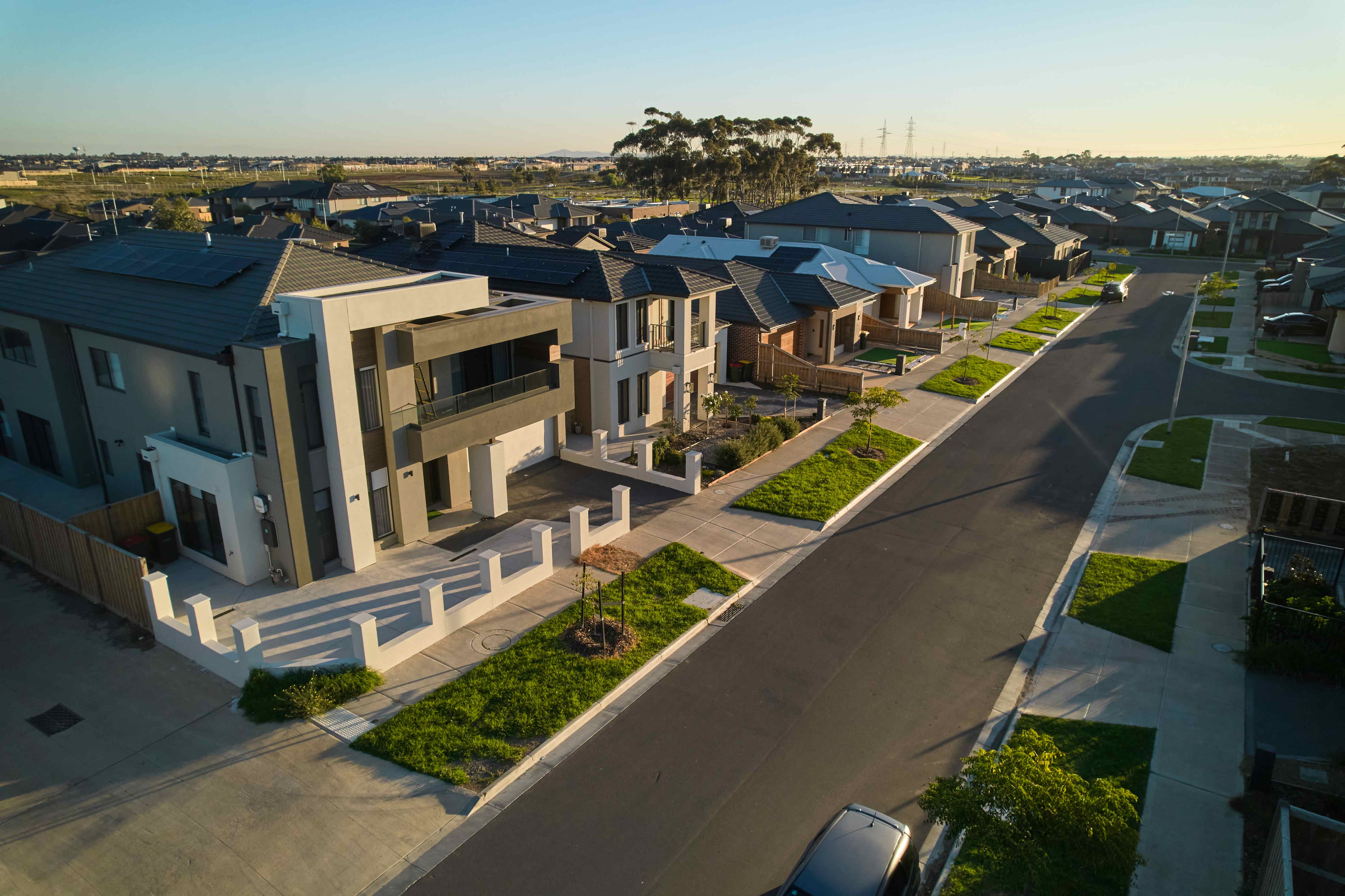
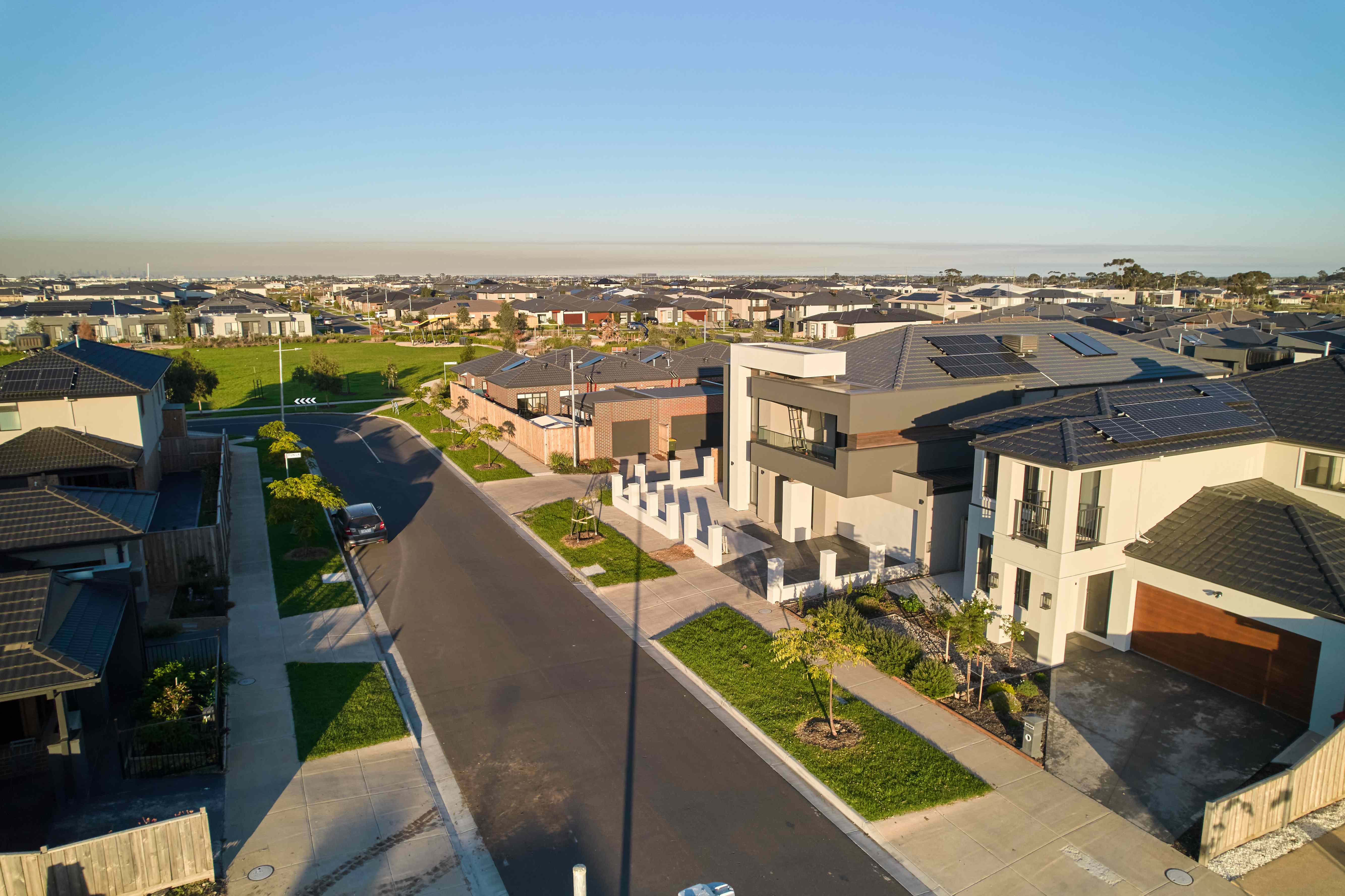

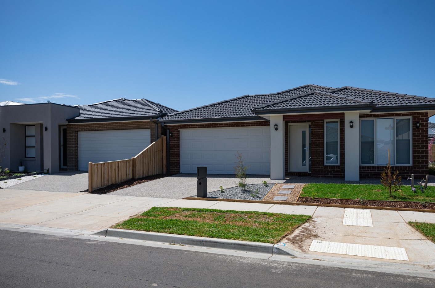
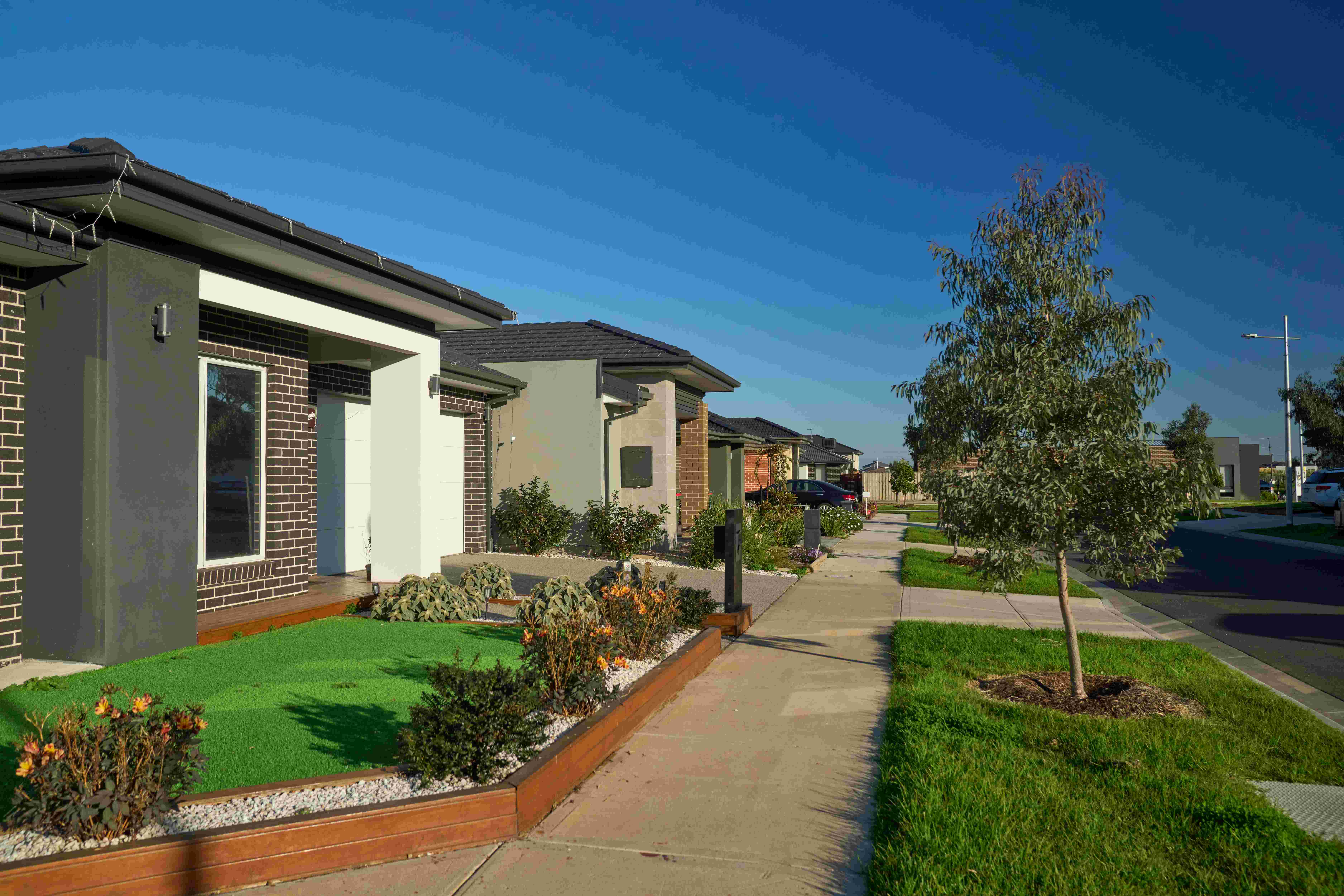
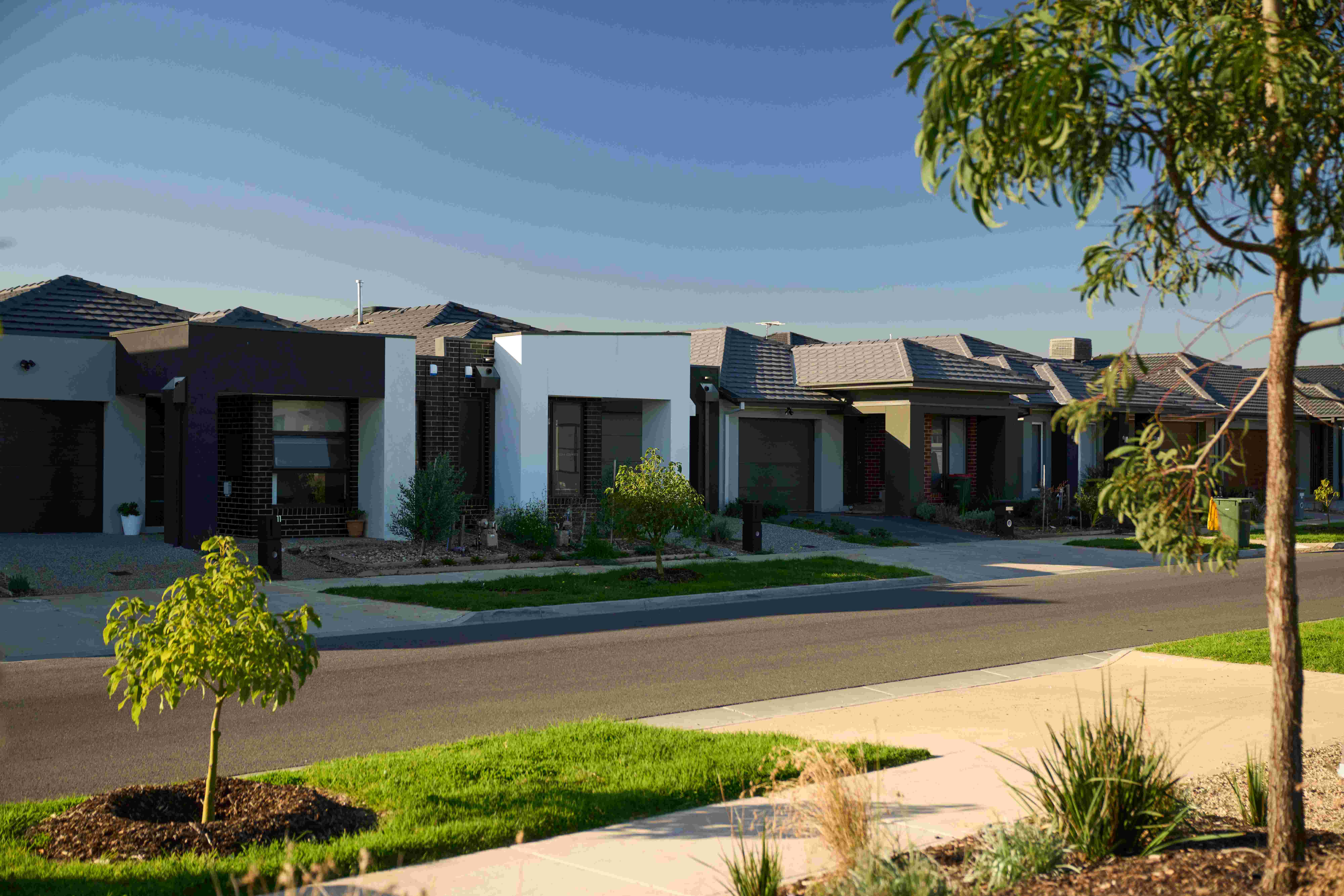
Marigold Estate - Tarneit 18 AVAILABLE
[LIMITED OFFER] Titled & Ready to Build On Land Available! Save Big on Land!
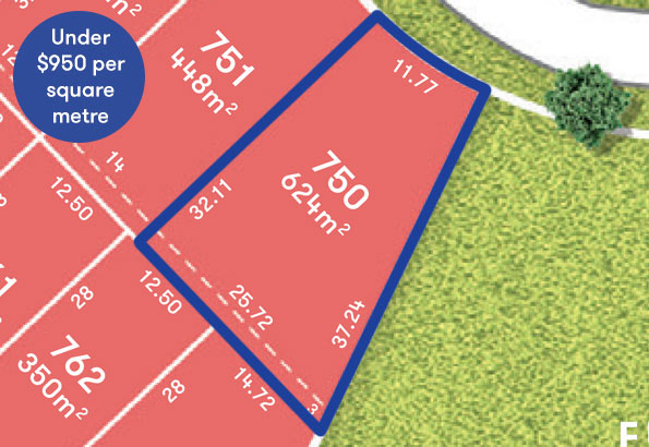
- Titled & Ready to Build Land Available
- Secure your lot with only a 5% deposit
- Family & Friend Referral on NOW!
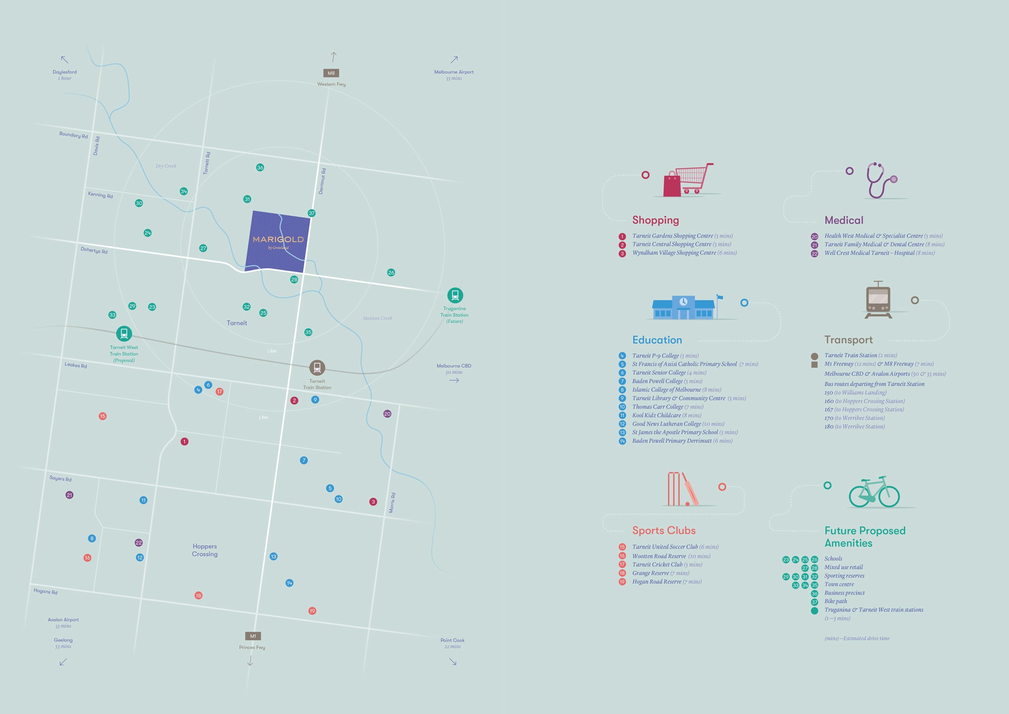
- 2 minutes to Tarneit Train Station
- Close to Tarneit Gardens Shopping Centre (5mins), Tarneit Central Shopping Centre (5mins) and Wyndham Village Shopping Centre (8mins)
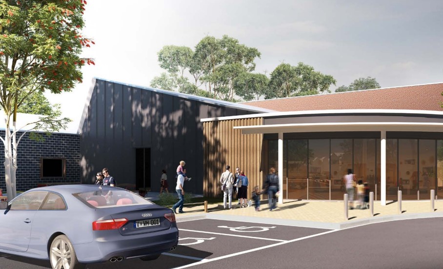
- 3 minutes from childcare, schools, community centre and medical centre (8mins)
- Just 25km from Melbourne’s CBD
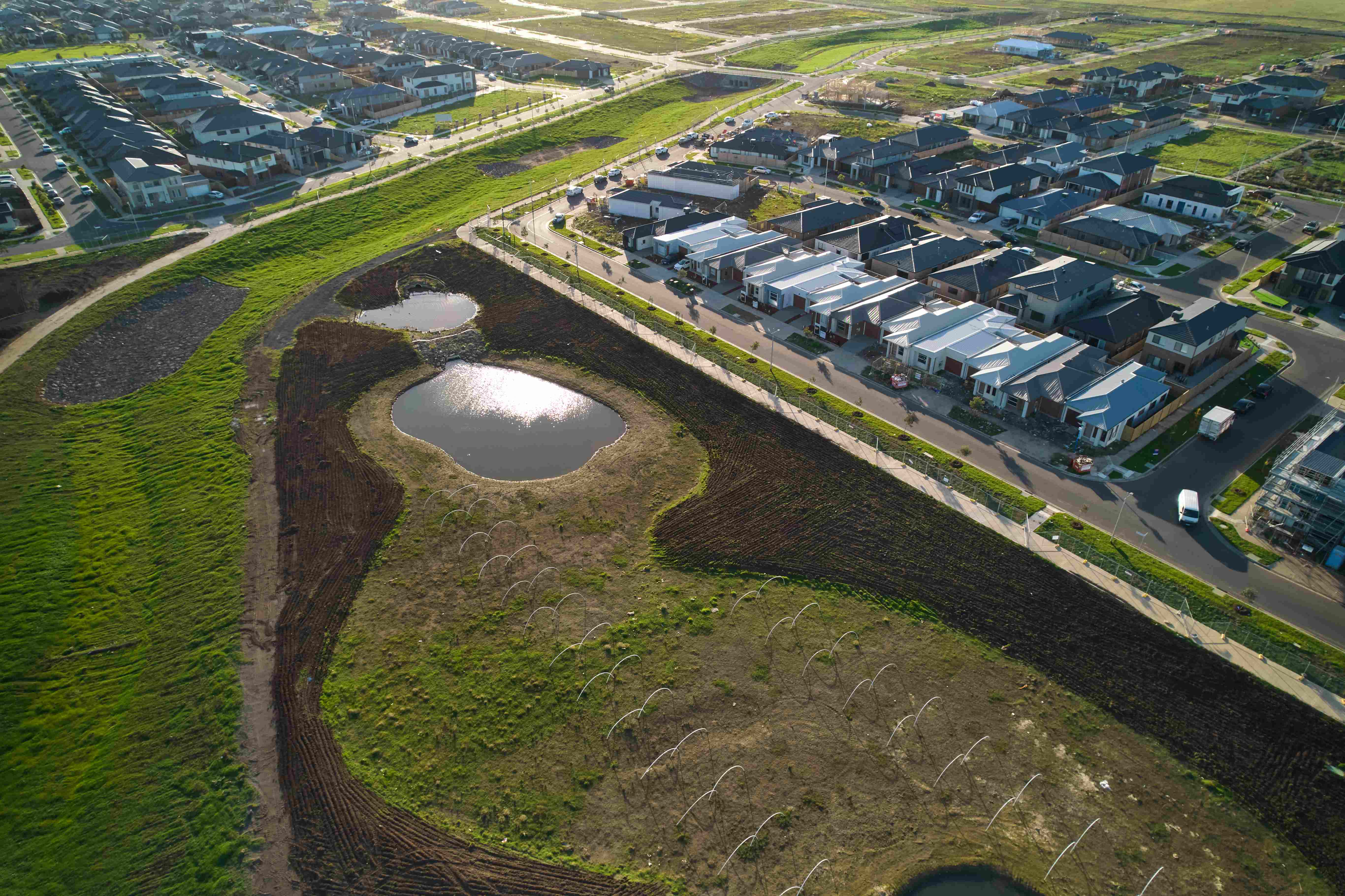
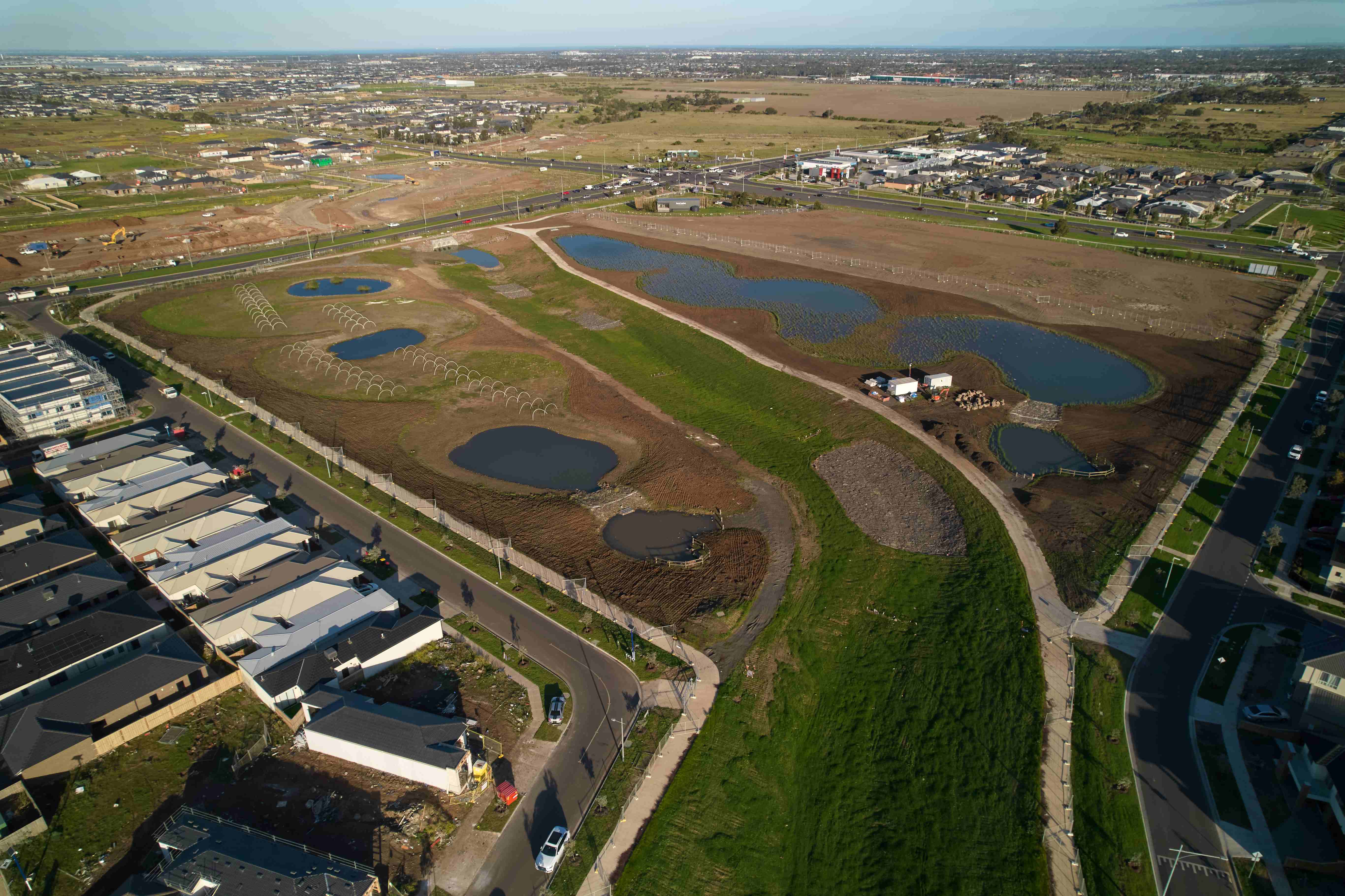
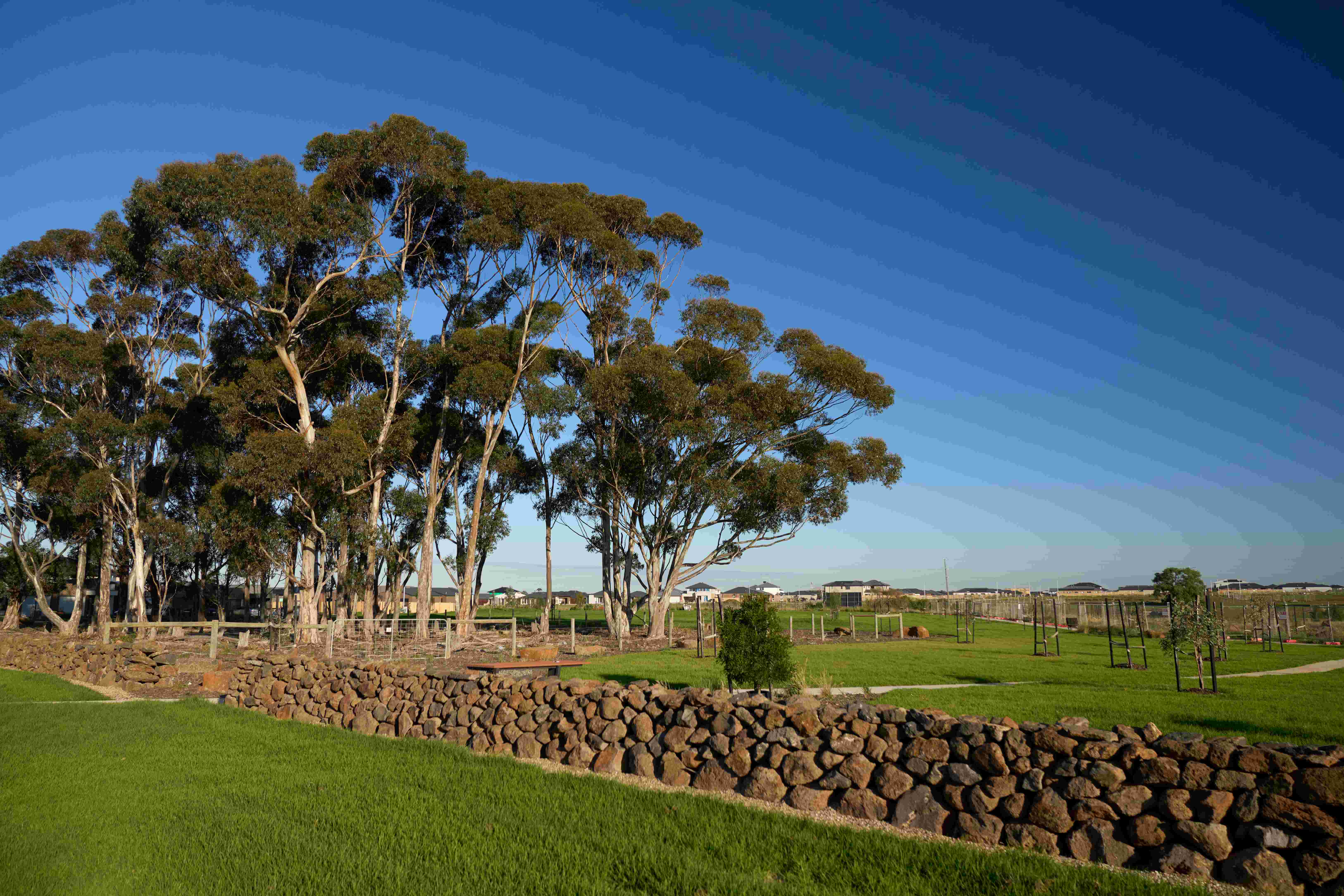
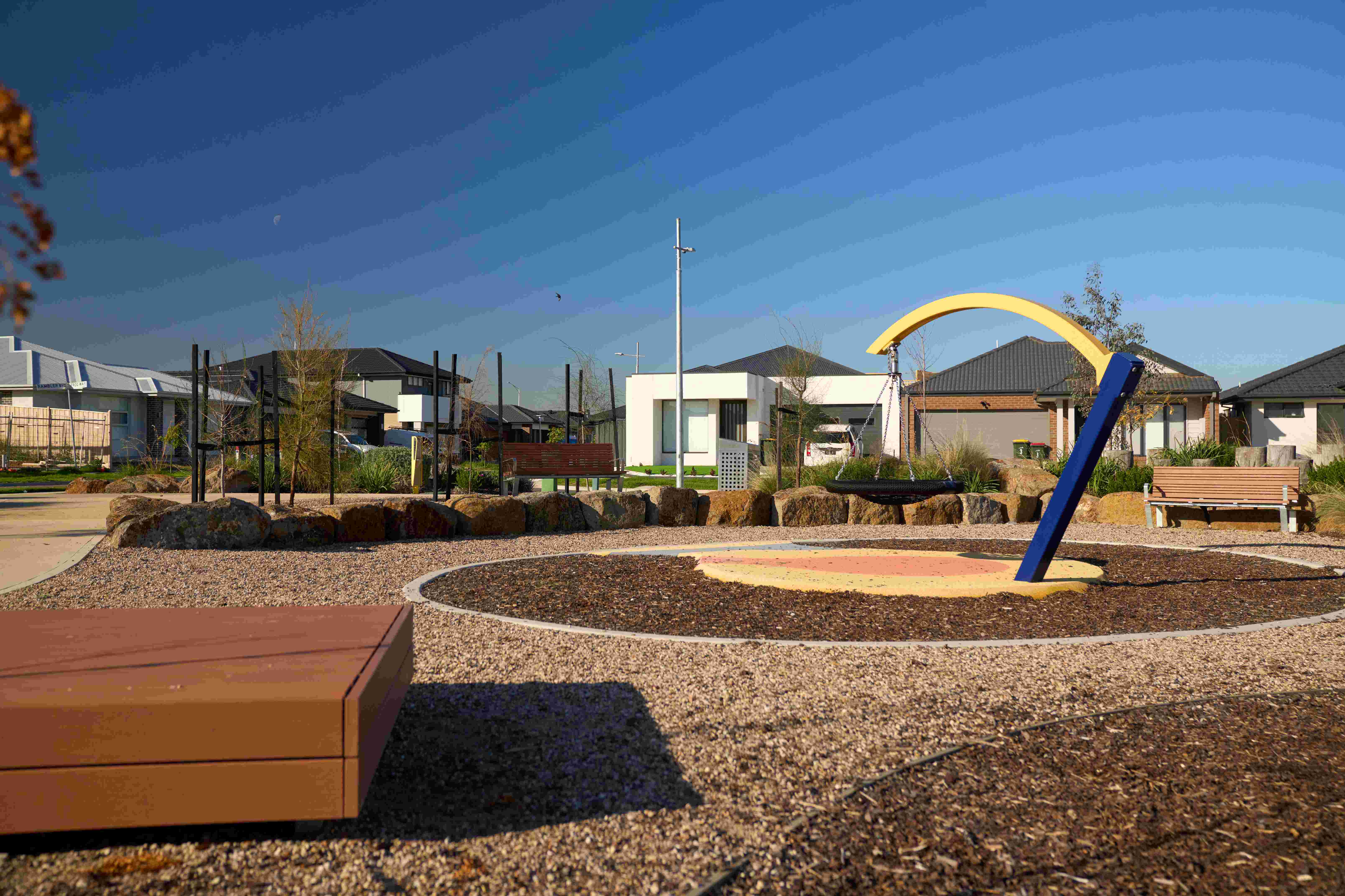
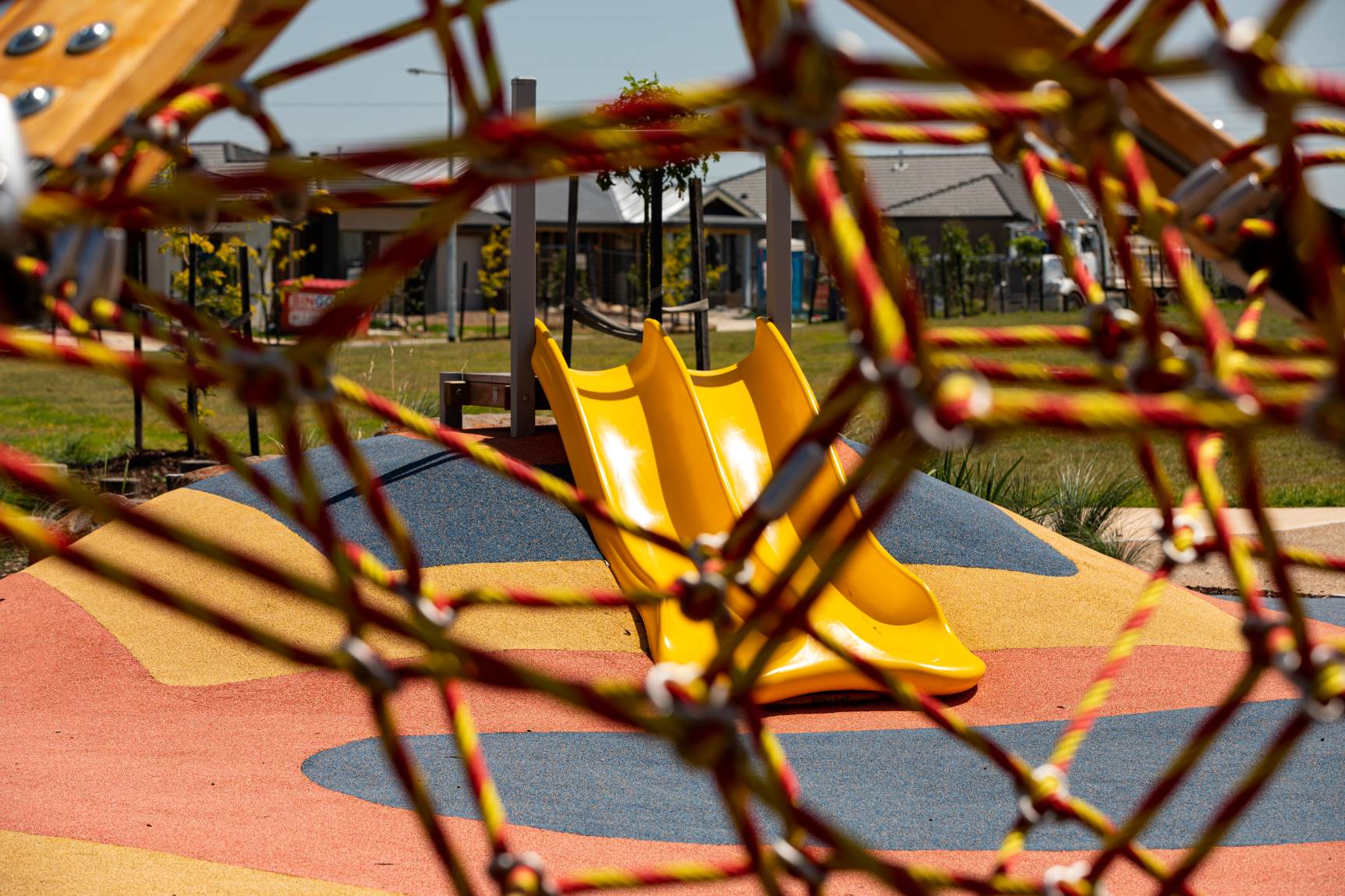
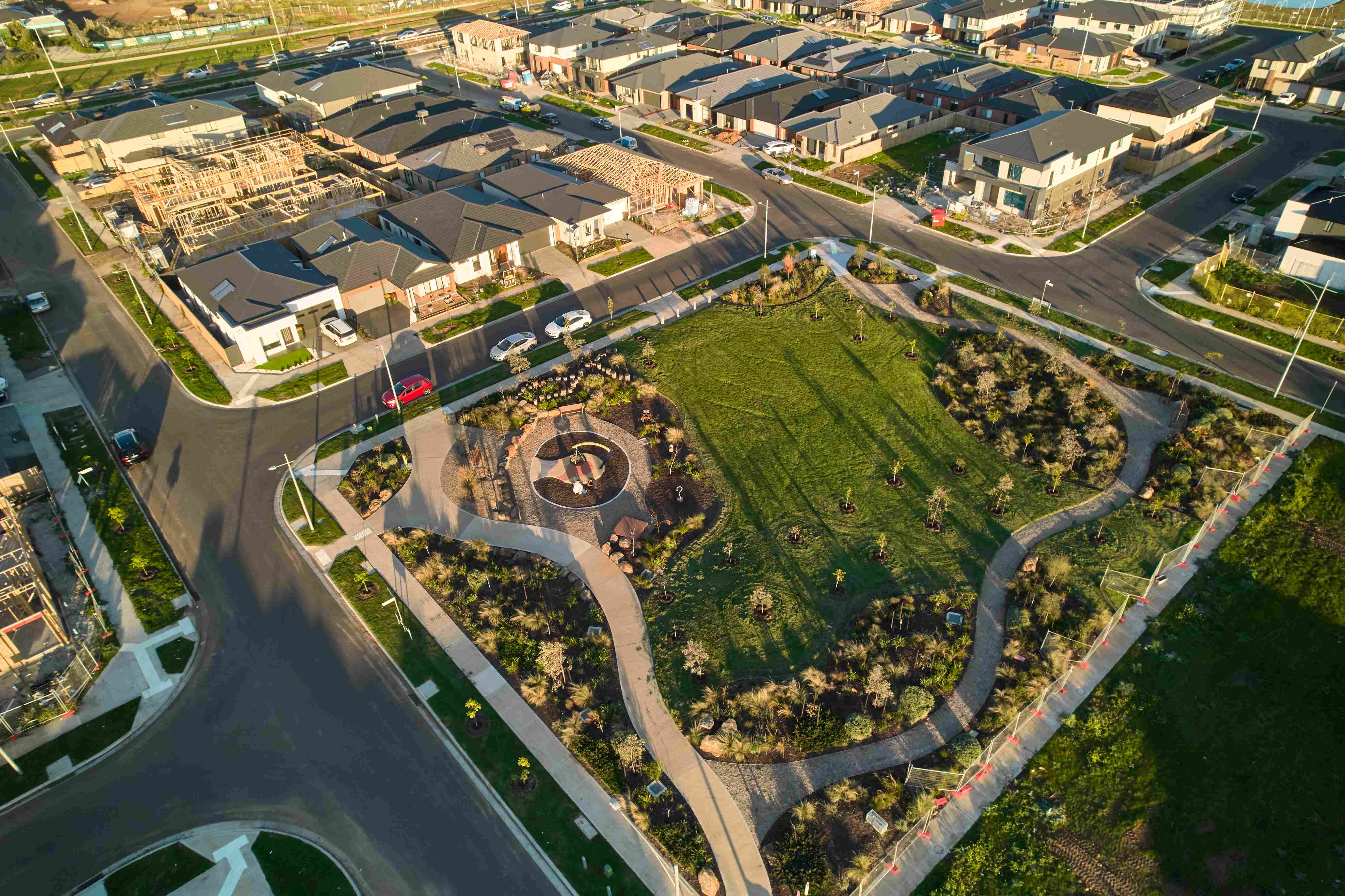
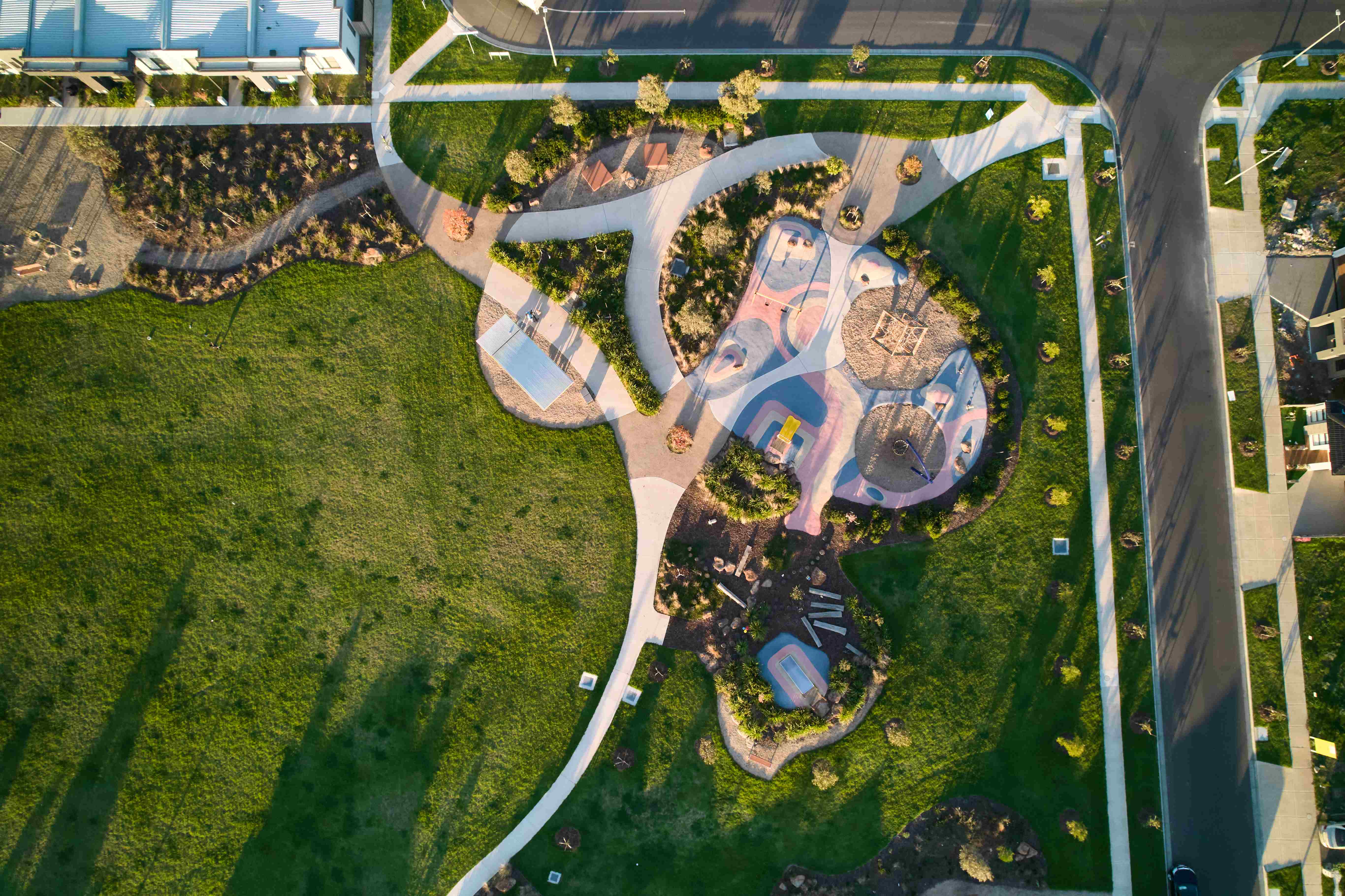
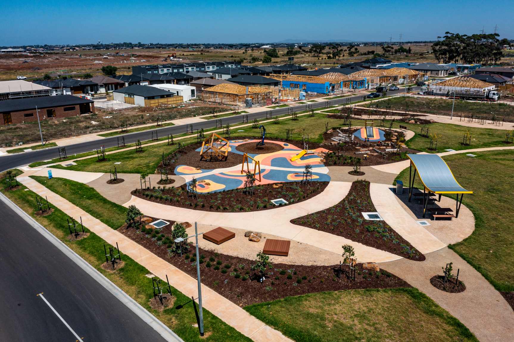
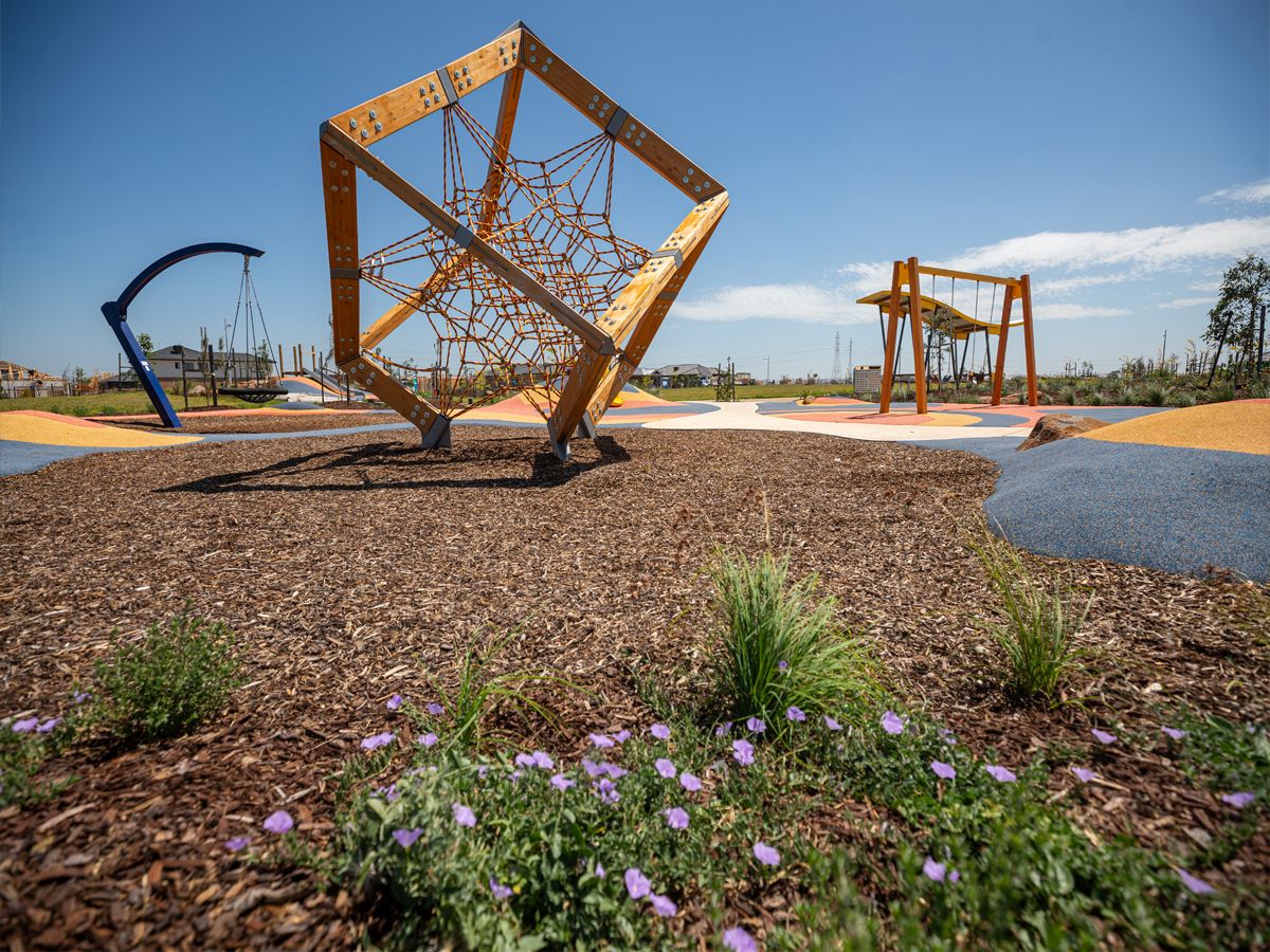
- Established community with completed parks and amenity
This information is estimated by the OpenLot research team. Let us know here to provide up-to-date information about this development.
| Total new homes | 920 |
| Area size | 60.00 hectares |
| Growth Region | Melbourne West Growth Corridor |
| City council | Wyndham City Council |
| Developer | Growland |
| Project marketer | Australian Land Corporation |
| Creative agency | Ivy Street |
| Distance to | Melbourne Airport - 21 km south-west Melbourne CBD - 24 km west |
Land for Sale, House and Land Packages, Townhomes:
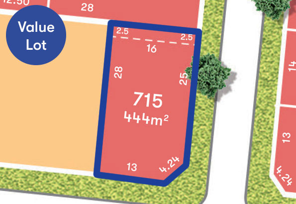
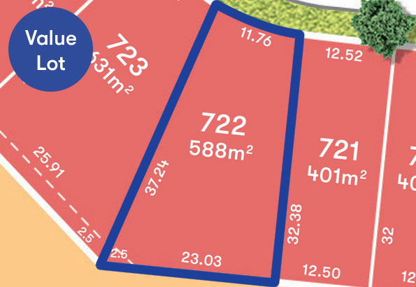
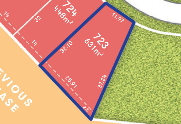
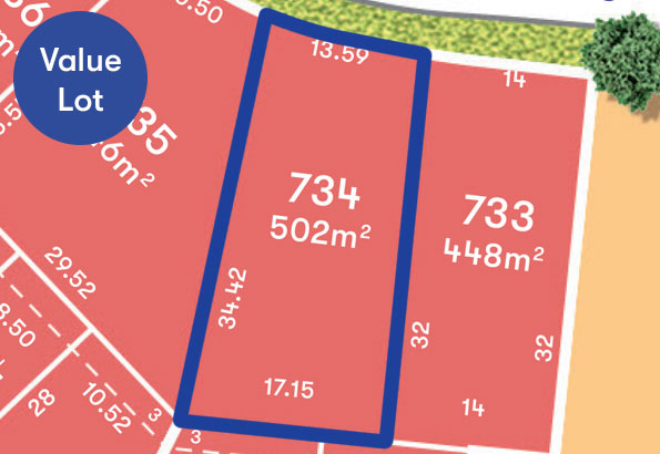
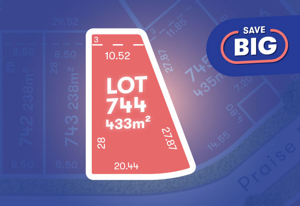
25 Land Lots in Marigold Estate - Tarneit
House and Land Packages in Marigold Estate - Tarneit
Popular Estates near Marigold Estate - Tarneit


 4
4
 2
2
 2
2


Updates for Marigold Estate - Tarneit
Facebook updates:
Related news:
Growland expanding its portfolio into Melbourne’s western growth corridor with a strategic $420 million land acquisition in Tarneit.
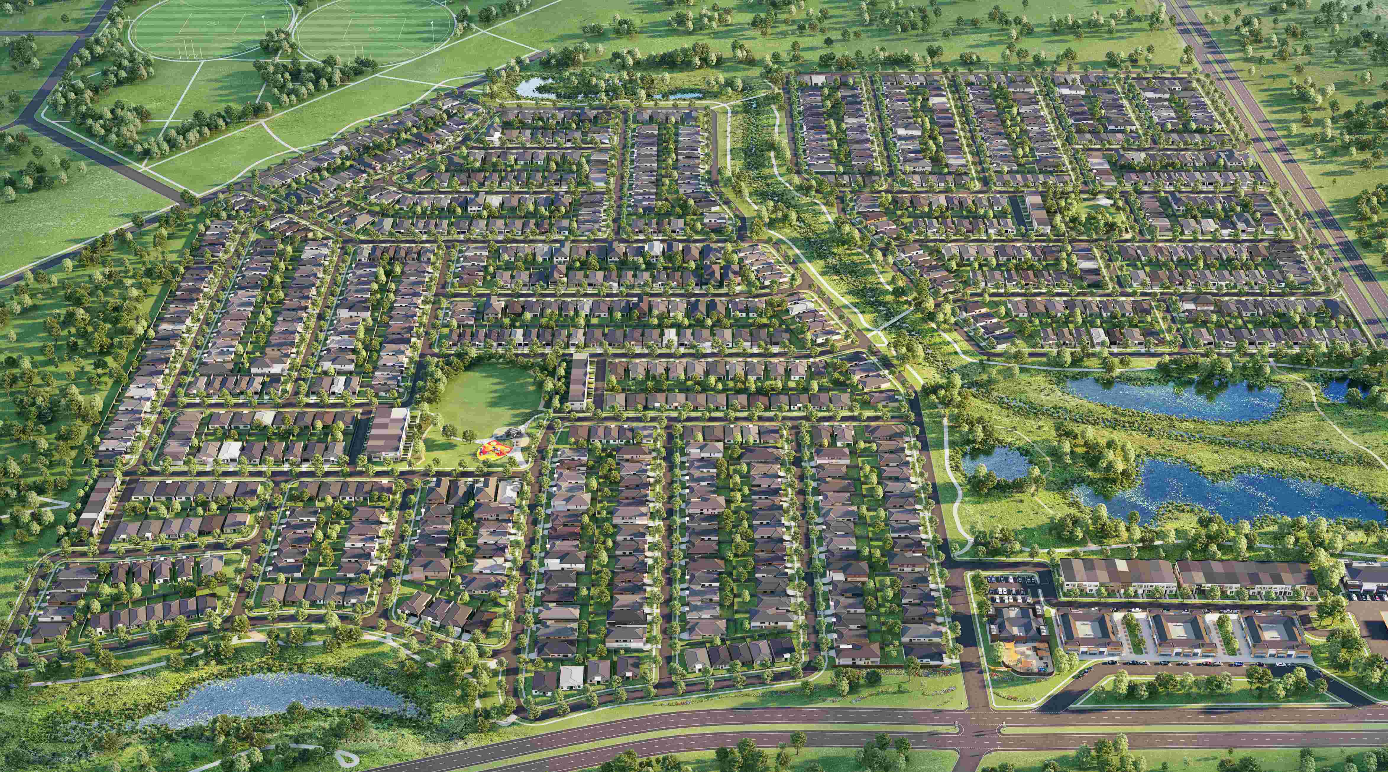
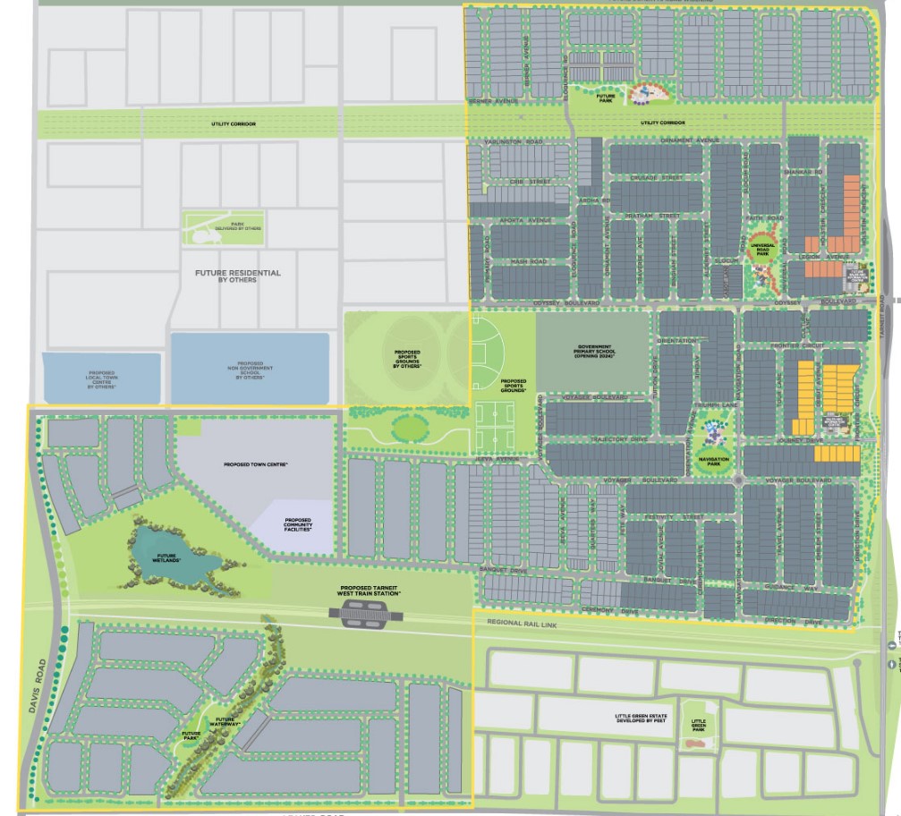
Masterplanned Community Marigold - Tarneit Marigold by Growland is a 920 lot master planned residential community located in Tarneit. Planning approvals have been secured and stages 1 and 2 are currently under construction. PROJECT ROLE

Missing articles? Send us a link here.
Location & Map for Marigold Estate - Tarneit
Visit Display Homes near Marigold Estate - Tarneit


Land Price Trend in Tarneit VIC 3029
- In Oct - Dec 24, the median price for vacant land in Tarneit VIC 3029 was $360,500. *
- From Oct - Dec 17 to Oct - Dec 24, the median price for vacant land in Tarneit VIC 3029 has increased 21.79%. *
- From 2008 to 2024, the median price for vacant land in Tarneit VIC 3029 has increased 147.84%. *
Vacancy Rate in Tarneit VIC 3029
View full vacancy rate history in Tarneit VIC 3029 via SQM Research.
Schools near Marigold Estate - Tarneit
Here are 6 schools near Marigold Estate - Tarneit:
Prep-6 Government Primary School
10-12 Government Secondary School
Prep-9 Government Combined School
Prep-6 Catholic Primary School
Prep-6 Government Primary School
Prep-6 Government Primary School
Suburb Planning Review in Tarneit VIC 3029
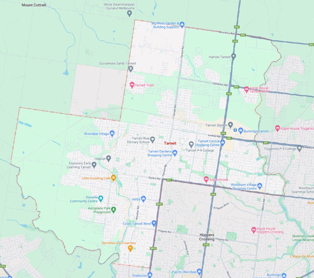
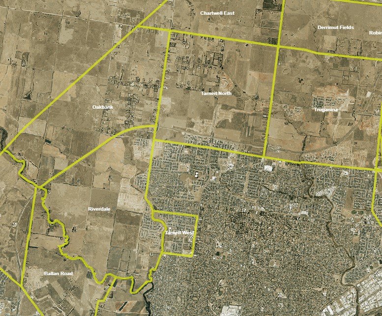
Tarneit is approximately 38.17 square kilometres located within the City of Wyndham forming part of the Victorian western growth corridor area, located 25 kilometres west of Melbourne.
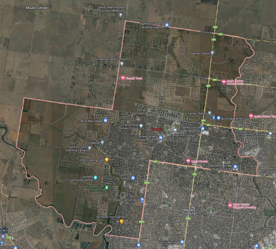
The suburb is bounded by Davis Road, Leakes Road, Shanahans Road and Werribee River to the west. Property boundaries and the Werribee River complete the southern boundary, while Boundary Road completes the north. Tarneit Road, Sayers Road and the Skeleton Waterholes Creek provide the eastern boundary.
Tarneit Road and Davis Road provide local road access in a north to south direction, with Leakes Road and Sayers Road providing local connections in an east to west direction. These roads provide for the local network found throughout Tarneit and to surrounding suburbs.
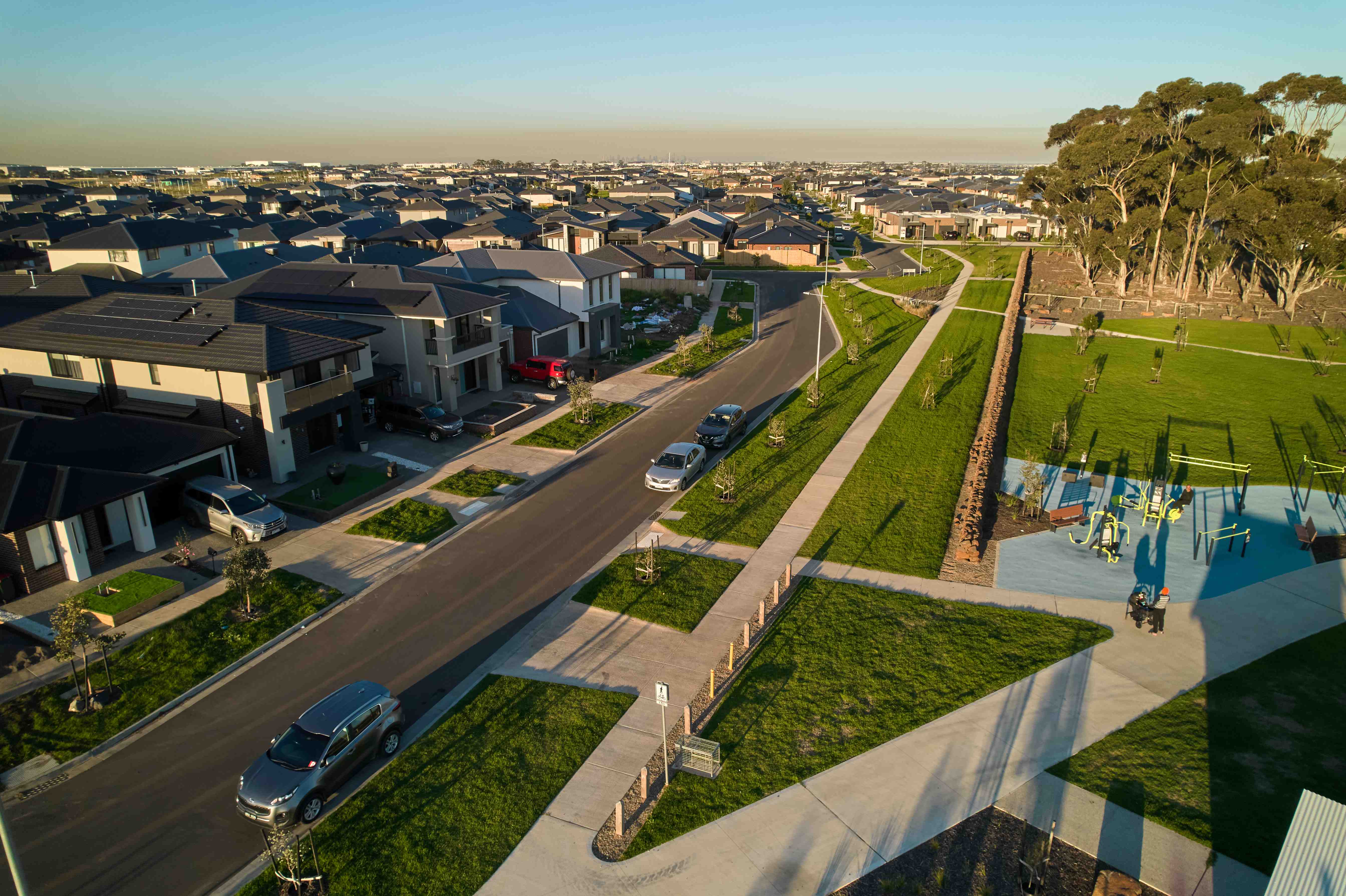
The suburb of Tarneit is primarily rural land holdings, with Davis Creek and Dry Creek traversing the suburb and the rail corridor separating the northern portion of the suburb. The suburb has a central business/shopping district, recreational areas, schools, dams and a train station. New urban development is occurring from the south east portion of the suburb, where the growth can be seen increasing to the north and west around the central commercial location.
Victorian Government of Tarneit
Victorian Government leads the suburban policy agenda for utilising Metropolitan Partnerships and Suburban Revitalisation Programs. Collaboration with local stakeholders and communities is integral to identifying their needs and aspirations and implementing projects to enhance community involvement, infrastructure, and services.
The approach begins with understanding localities and residents, leading to actionable initiatives. Partnerships with businesses, community leaders, service providers, local government, and other departments are formed to:
- Identify community needs for local improvement.
- Develop tailored solutions to address these needs.
- Facilitate the implementation of works and programs to translate solutions into tangible outcomes.
Investments are made in projects and programs aimed at rejuvenating suburban areas and fostering local job creation. Examples include:
- Enhancing bike and pedestrian connections to amenities.
- Implementing landscaping projects for aesthetic enhancement and climate mitigation.
- Establishing pop-up parks near commercial areas.
- Upgrading community facilities and hubs.
- Launching youth employment and skill development initiatives.
- Supporting community-driven events.
Suburban Revitalisation Programs
The Suburban Revitalisation Program, backed by the Office for Suburban Development, aims to boost economic and social prosperity in Melbourne's suburbs. It comprises various streams, including Suburban Revitalisation Boards, the Living Local Fund, the Neighbourhood Activity Centre Renewal Fund, and targeted revitalisation investments. Projects within each stream of the Suburban Revitalisation Program are collaboratively undertaken with input from local government, businesses, service providers, and the community.
Suburban Revitalisation Boards partners with the Office for Suburban Development to drive local economic and community renewal in selected activity centres across Melbourne. Following success in Broadmeadows and Frankston, six additional boards were established in 2021 for Boronia, Broadmeadows, Frankston, Lilydale, Melton, Noble Park, Reservoir, and Tarneit. Chaired by Members of Parliament, each board includes representatives from local government, community groups, service providers, businesses, and other leaders. The Victorian Government, through the Office for Suburban Development, continues to work with these boards to co-invest in projects aligning with community needs and aspirations.
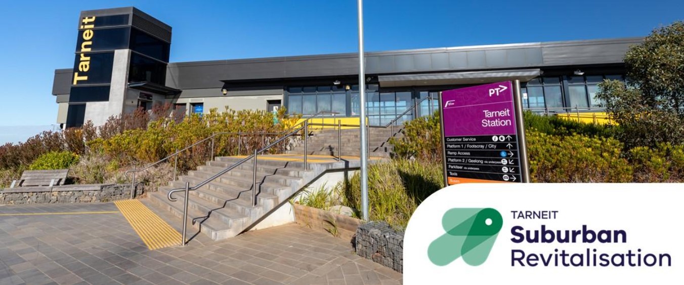
Tarneit Suburban Revitalisation Board
Tarneit occupies a strategic location in Melbourne's expanding urban landscape and is experiencing rapid growth, projected to surge by 164% to 131,166 residents by 2041. This growth underscores Tarneit's status as one of the fastest-growing suburbs in outer Melbourne.
The Tarneit activity centre holds a pivotal role in the community's development, classified as a 'Major Activity Centre' in Plan Melbourne. Its primary objective is to cater to the retail, service, and business needs of the Tarneit community, positioning it as a vital hub within the region's urban framework.
The Tarneit Suburban Revitalisation Board was established in 2021, the Board provides a local voice to the Victorian Government's Suburban Revitalisation program, working with communities to identify opportunities for locally-led projects to help Tarneit thrive.
Tarneit Revitalisation Report 2021–22
The report summarises key accomplishments and insights from the initial term of the Board's appointment and outlines future directions for Tarneit's ongoing revitalisation. Tarneit was designated as a revitalisation site in 2021 under the Victorian Government's Suburban Revitalisation Program in collaborating with Wyndham City Council and other local partners to invest $2.5 million in local capital and social renewal projects.
The report outlines various projects, including Melbourne Water Pipe Reserve, Shared-User Path Lighting Project, Penrose Community Garden Activation, Place-Based Employment Program, 'Chamber of Commerce' development aiming to form a Tarneit Business Association, Arts Placemaking and Social Connection Program, Tarneit Place Activation Program (Stages 1 and 2), Penrose Community Centre – Community Garden, Tarneit Gardens Shopping Centre Mural, Tarneit Parks Network Revitalisation Project, Cowies Hill Water Tower Lighting, Sunset Views Boulevard Enhancements, Tarneit dog off-leash area, Youth Empowerment Project – Youth Soccer Cup, Garden beds at Julia Gillard Library, Hawkers Market Feasibility Study, and Firefly Night Market Pilot, along with the Tarneit Community Activity Sessions Program.
Victorian Planning Authority Structure Plans
- Tarneit North Precinct Structure Plan (Amendment May 2022)
- Tarneit West Precinct Structure Plan (June 27, 2016)
- Riverdale Precinct Structure Plan (Amendment May 2022)
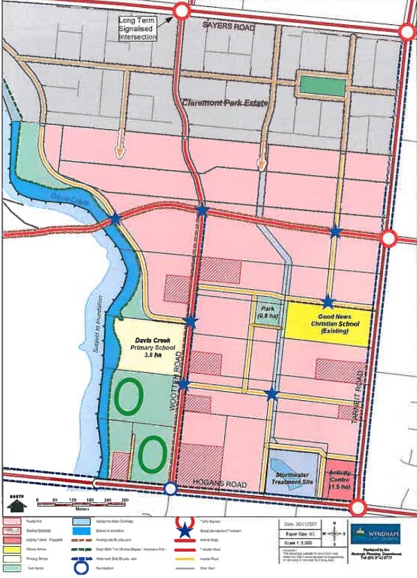
Tarneit West Precinct Structure Plan
The location of this structure plan is south of the shopping centre in Tarneit to allow the further redevelopment of the rural land into urban residential. Amendment C106 to the Wyndham Planning Scheme resulted in the approval of the Tarneit West Precinct Structure Plan by the Minister for Planning, gazetted on July 31, 2008.
An amendment to the Development Plan document was made in July 2017 to capture 118 hectares of land bounded by Davis Creek, Hogans and Tarneit Roads, with the northern boundary being Claremont Park Estate. This part of Tarneit has had significant development, with urban development now pushed past Davis Creek into the Riverdale Precinct Structure Plan.
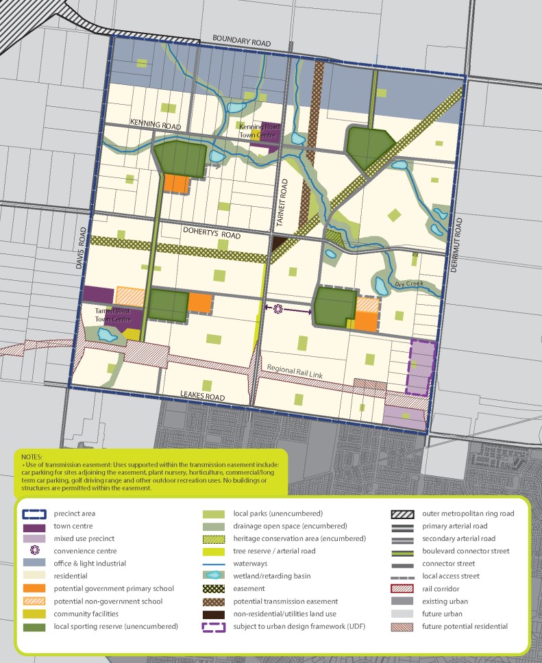
Tarneit North Precinct Structure Plan
The location of this structure plan is north of the rail station in Tarneit to allow the further redevelopment of the rural land into urban residential. Amendment VC213, effective from July 14, 2022, updated the Victoria Planning Provisions and planning schemes to align with Melbourne Strategic Assessment requirements for biodiversity outcomes in growth corridors. This led to modifications in the Tarneit North PSP and Amendment C177 to the Wyndham Planning Scheme in 2022.
Vision of Tarneit North
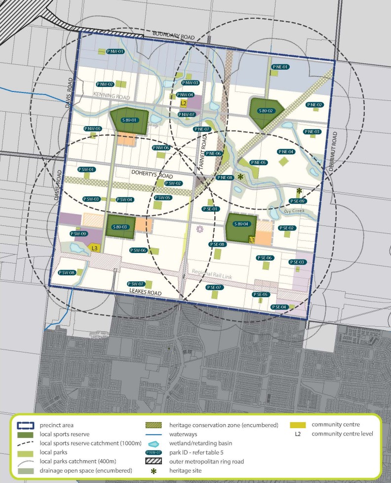
The Tarneit North area has been shaped by its historic settlement patterns and former agricultural uses. This is evident in the dry stone walls, bluestone buildings, and cultural artefacts along Dry Creek, which traverses the precinct’s gently undulating landscape. The Precinct Structure plan will retain and enhance these attractive elements to inform the structure and character for this new community. Natural and heritage features will be incorporated into open space, parks and streets to create vibrant neighbourhoods that are well connected to town centres, housing, schools and community services. Water will be a key connecting feature of the future urban environment in Tarneit North.
Dry Creek and its tributaries will be strengthened through the delivery of linear open space and parks for the local community to enjoy for walking and cycling.A water feature treatment will provide an attractive link from the Tarneit West local town centre to the waterways and community hub to the north. Furthermore, water assets located throughout the precinct will provide additional opportunities for passive recreation and attractive natural features. The two local town centres, Tarneit West and Kenning Road, will provide for a range of community, commercial, retail and residential uses.
The centres will be well connected to the public transport network given their proximity to the proposed Tarneit station to the east and the potential future train station in the south of this precinct. A strong heart for the centres will be created through a central town square integrated with schools and community centres. The Tarneit North community will be able to access a range of employment and services in the immediate surrounds and wider western corridor. The oce and light industrial areas along Boundary Road will provide for signicant local and regional employment opportunities. Access to wider employment will be improved through additional major infrastructure in this area, including the Regional Rail Link and road improvements.
Riverdale Precinct Structure Plan
The location of this structure plan is west of the Tarneit commercial area, further than Davis Creek allowing for further redevelopment of the rural land into urban residential. Amendment VC213, effective from July 14, 2022, updated the Victoria Planning Provisions and planning schemes to align with Melbourne Strategic Assessment requirements for biodiversity outcomes in growth corridors.
Vision of Riverdale
The Riverdale precinct is characterised by open views, strong linear stands of trees, and waterways winding toward the Werribee River, which dominates the southern precinct boundary. The rich character of the landscape is the foundation of the new urban structure. The river and environs will become a corridor of open space that protects important environmental values and provides recreational and regional connectivity. New neighbourhoods and town centres will be formed on the edge of the creeks and tributaries that run southward and connect to the river.
Providing connections between waterways, retained windrows and varying streetscapes of boulevards, avenues, and meandering waterside drives integrate east-west and form an expansive network of paths. Significant biodiversity values will be protected and enhanced within the Growling Grass Frog Conservation Area which extends along the Werribee River and Davis Creek, which may also be accessible to the community to allow appreciation of these values.
The substantial public investment in the Regional Rail Link is a catalyst for change and driving force behind growth across the corridor. The PSP capitalises on this investment through the creation of a transit-ready major town centre that intensifies uses around the potential future Riverdale station station. The centre, will be the central hub of activity and gateway to the precinct, providing inter-metropolitan connections the Priority Public Transport Network and eventually the railway, as well as retail, entertainment, recreation, business opportunities and a variety of local jobs. Two local town centres will complement the services of the major hub with additional retail and employment opportunities, each centred on a main street and public space. The town centres, public transport infrastructure, and the expansive integrated network of open space will lead to a greater variety of housing choices and price points across a highly diverse precinct.
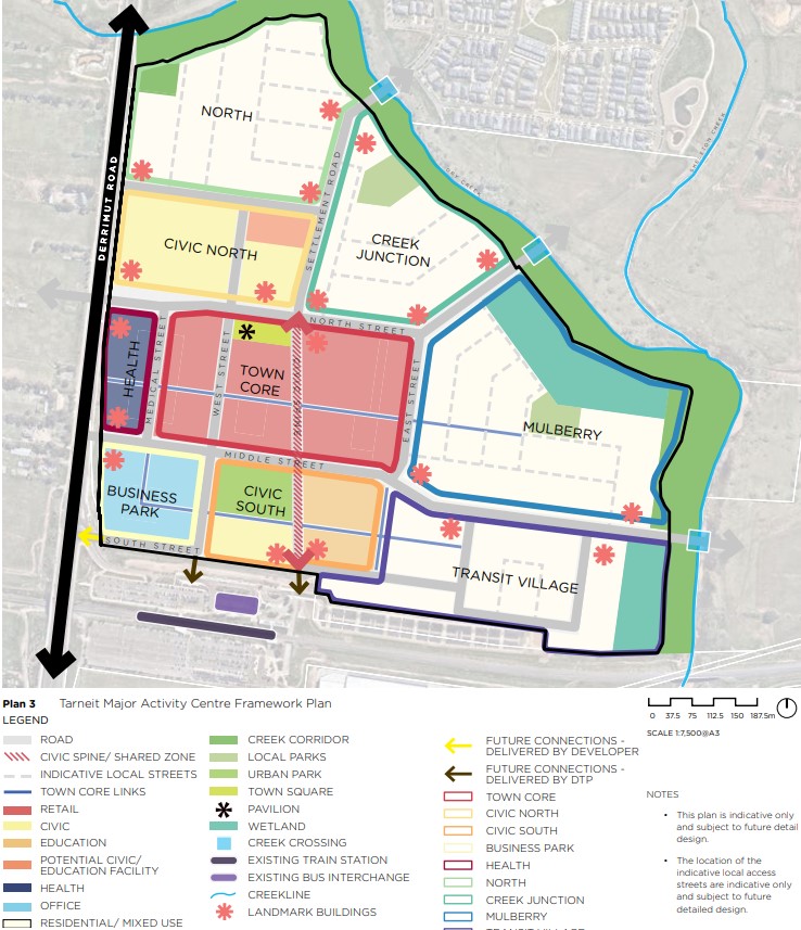
An Urban Design Framework (UDF) has been developed for a Major Town Centre to shape the design, development, and growth of the Tarneit urban core. With Tarneit experiencing rapid change and growth, the UDF aims to ensure the town center meets the needs of its expanding population, accommodating 8,000 jobs and housing for over 10,000 people. The vision is for Tarneit to become a hub of economic prosperity, featuring green corridors and facilities for art, health, and education, while celebrating Indigenous and cultural heritage. The UDF will serve as a guide for staged development and investment attraction over the next 30 years, offering opportunities for recreation, retail, and housing.
The UDF in November 2022, outlined a long-term vision for the northern part of the Tarneit Major Town Centre, integrating diagrams, objectives, requirements, guidelines, and actions. It serves as a bridge between the Truganina Precinct Structure Plan (PSP) and planning permits, making decisions on key public assets, spaces, services, and the form of development. The UDF also guides decisions on transport infrastructure and open space design. Planning permits for the town centre must adhere to the UDF.
Tarneit North Community Precinct Master Plan Implementation
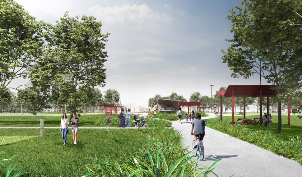
The Bembit Bag-rook Community Centre represents the initial phase of Wyndham City's $21 million Tarneit North Community Precinct Masterplan. Completed in 2022, it offers a range of community, health, and educational services for people of all ages, backgrounds, and abilities, including kindergarten and maternal child health services.
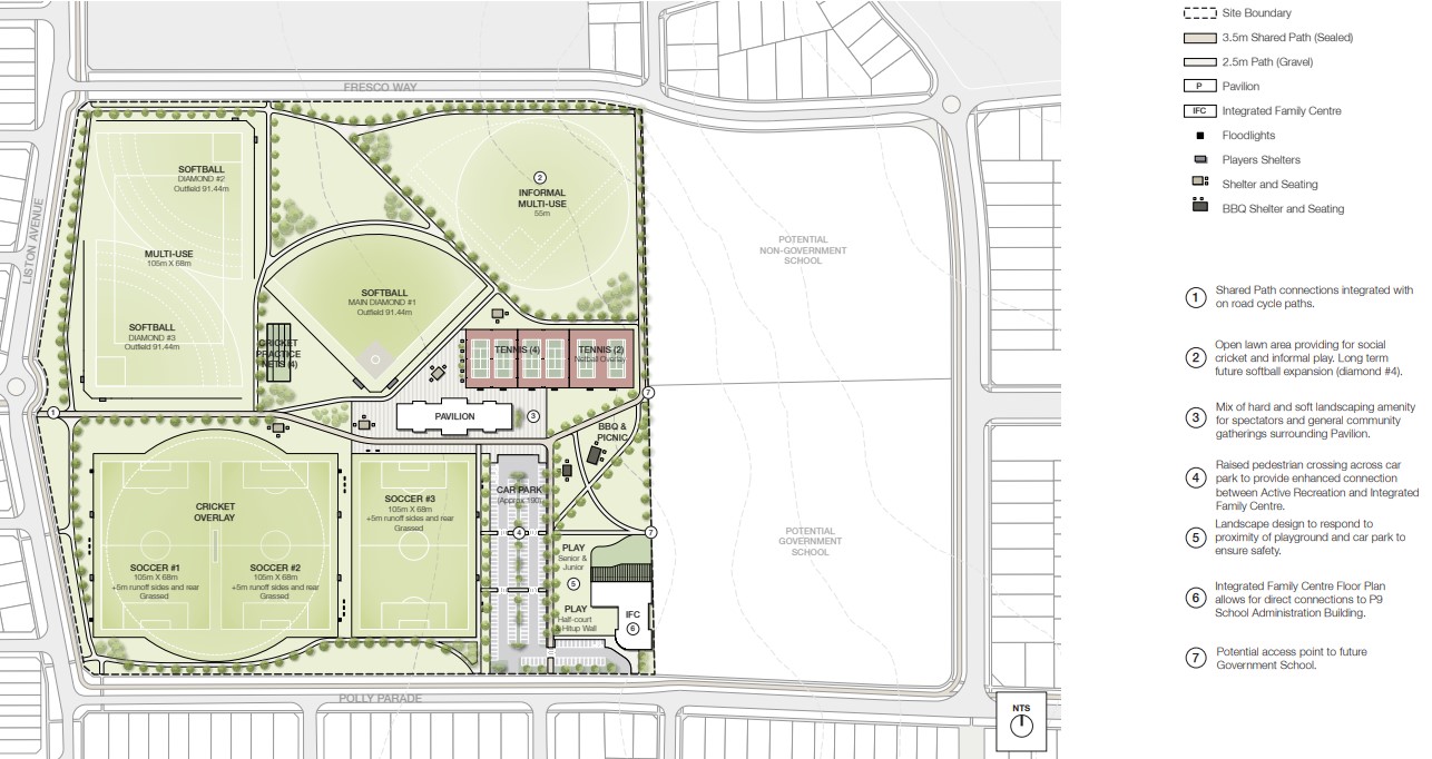
The Sport and Recreation component of the new community precinct at Polly Parade Reserve includes:
- Stage 1: Soccer fields, tennis courts, cricket practice nets, BBQ/picnic area, children's play space, walking paths, landscaping.
- Stage 2: Planned construction of a sports pavilion.
- Stage 3: Planned development of softball fields/multi-purpose sports fields.
Construction of Stage 1 is expected to start in April 2024.
Newhaven Master Planned Community
The updated Newhaven Masterplan has expanded to include an additional 53 hectares along Leakes Road. It encompasses four parks and playgrounds, with two already open, Wimba Primary School, future wetlands and waterway, proposed 10-hectare sports grounds, a town centre, and the proposed Tarneit West Train Station (planned to open in 2026).
Tarneit Growth Summary
References
Victoria Planning Authority – Planning Scheme
Victoria Planning Authority – Tarneit North Precinct Structure Plan
Victoria Planning Authority – Tarneit West Precinct Structure Plan
Victoria Planning Authority – Riverdale Precinct Structure Plan
Help grow the future of Tarneit Major Town Centre | The Loop (wyndham.vic.gov.au)
Reviews & Comments on Marigold Estate - Tarneit
Estate Brochure, Masterplan, Engineering Plan, Plan of Subdivision (POS), Design Guidelines
FAQs about Marigold Estate - Tarneit
View all estates from Growland
View all estates marketed by Australian Land Corporation
- Nearnung Primary School - 1.4km south-west
- Tarneit Senior College - 2.2km south-west
- Tarneit P-9 College - 2.5km south
- St John the Apostle Catholic Primary School - 2.9km south-west
- Tarneit Rise Primary School - 3.1km south-west
- Garrang Wilam Primary School - 3.4km south-east
Popular Estates near Marigold Estate - Tarneit
Latest New Home Articles for You

16/Mar/2026 | OpenLot.com.au
New South Wales: Top 30 Most Searched Housing Developments (February 2026)
If you’ve been considering a move in New South Wales, February 2026 provi...

09/Mar/2026 | OpenLot.com.au
Victoria: Top 30 Most Searched Housing Developments (February 2026)
If you’ve been exploring housing opportunities in Victoria, February 2026...

20/Feb/2026 | OpenLot.com.au
Display Homes at Drouin Fields Estate: A Thriving Community in Drouin
Welcome to Drouin Fields, a place where beauty, space, and modern luxury ...

19/Feb/2026 | OpenLot.com.au
Display Homes at Manor Lakes Esate: A Thriving Waterside Community in Manor Lakes
A place where you can settle in, rather than just settle down. Named for ...

13/Feb/2026 | OpenLot.com.au
🏠 Victoria: Top 30 Most Searched Townhouse Developments – January 2026

11/Feb/2026 | OpenLot.com.au
🏡 Top 30 Most Searched Estates by State - January 2026

10/Feb/2026 | OpenLot.com.au
Victoria: Top 30 Most Searched Housing Developments (January 2026)
If you’ve been considering making a move in Victoria, January 2026 offere...

10/Feb/2026 | OpenLot.com.au
Queensland: Top 30 Most Searched Housing Developments (January 2026)
If you’ve been considering making a move in Queensland, January 2026 offe...

09/Feb/2026 | OpenLot.com.au
Western Australia: Top 30 Most Searched Housing Developments (January 2026)
If you’ve been considering making a move in Western Australia, January 20...