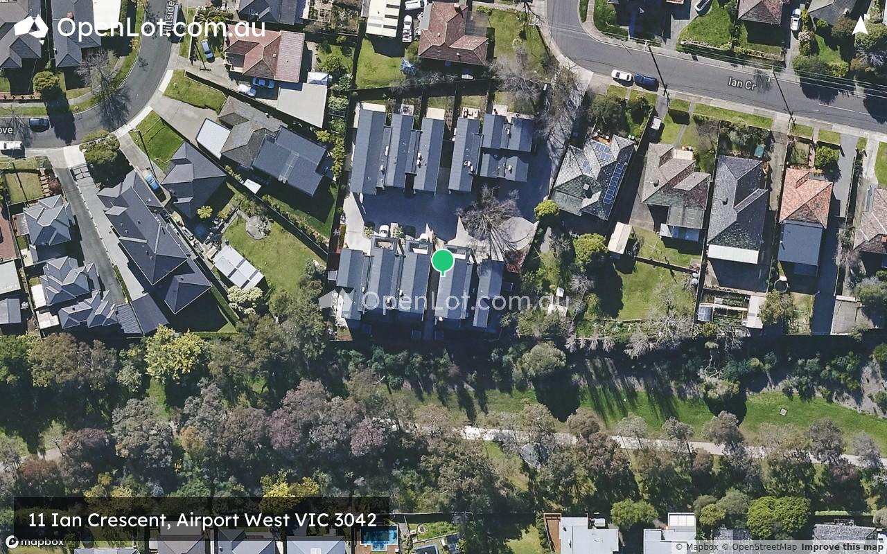
11 Ian Crescent, Airport West VIC 3042 IN PLANNING
This information is estimated by the OpenLot research team. Let us know here to provide up-to-date information about this development.
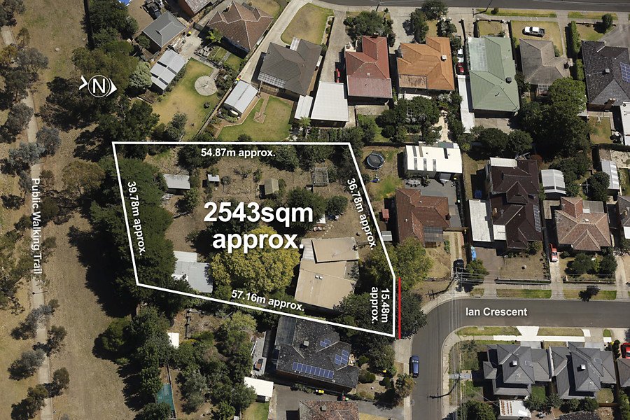
| Total new homes | 10 |
| Area size | 0.25 hectares |
| Growth Region | Melbourne North Growth Corridor |
| City council | Moonee Valley City Council |
| Developer | N/A |
| Distance to | Melbourne Airport - 7 km south-east Melbourne CBD - 12 km north-west |
Land for Sale, House and Land Packages:
Popular Estates near 11 Ian Crescent, Airport West


Updates for 11 Ian Crescent, Airport West
Facebook updates:
Related news:
A 1960s home occupying one of the area's biggest blocks (approx 2543sqm) sets the scene for one of the year's most exciting and potentially rewarding development opportunities (STCA). Immediately comfortable in the short term, the home's tidy interior comprises four bedrooms and centr...

Missing articles? Send us a link here.
Location & Map for 11 Ian Crescent, Airport West
Visit Display Homes near 11 Ian Crescent, Airport West

Vacancy Rate in Airport West VIC 3042
View full vacancy rate history in Airport West VIC 3042 via SQM Research.
Schools near 11 Ian Crescent, Airport West
Here are 6 schools near 11 Ian Crescent, Airport West:
Prep-6 Catholic Primary School
Prep-6 Government Primary School
Prep-12 Independent Combined School - School Head Campus
Prep-6 Government Primary School
7-12 Government Secondary School - School Head Campus
U Government Special School
Reviews & Comments on 11 Ian Crescent, Airport West
Estate Brochure, Masterplan, Engineering Plan, Plan of Subdivision (POS), Design Guidelines
FAQs about 11 Ian Crescent, Airport West
- St Christopher's School - 384m north-east
- Niddrie Primary School - 392m south
- Penleigh & Essendon Grammar School - 796m south-west
- Keilor Heights Primary School - 1.5km south-west
- Essendon Keilor College - 2.0km south-west
- Niddrie Autistic School - 2.1km south-east
Popular Estates near 11 Ian Crescent, Airport West
Latest New Home Articles for You

27/Jan/2026 | OpenLot.com.au
Display Homes at Stockland Wildflower Estate: A Smart Community in Piara Waters
Welcome to Wildflower, a vibrant new neighbourhood nestled in the heart o...

16/Jan/2026 | OpenLot.com.au
South Australia Top 30 Most Searched Housing Developments (December 2025)

15/Jan/2026 | OpenLot.com.au
Queensland: Top 30 Most Searched Housing Developments (December 2025)
If you’ve been tracking housing demand across Queensland, December 2025 p...

14/Jan/2026 | OpenLot.com.au
Victoria: Top 30 Most Searched Housing Developments (December 2025)
If you’ve been exploring housing opportunities in Victoria, December 2025...

14/Jan/2026 | OpenLot.com.au
Display Homes at Apsley Estate: A Masterplanned Community in Mandogalup
Apsley is a bold, 1,800-lot masterplanned community just 25 minutes south...

13/Jan/2026 | OpenLot.com.au
Western Australia: Top 30 Most Searched Housing Developments (December 2025)
If you’ve been keeping an eye on housing demand across Western Australia,...

12/Jan/2026 | OpenLot.com.au
New South Wales: Top 30 Most Searched Housing Developments (December 2025)
If you’ve been considering making a move in New South Wales, December 202...

07/Jan/2026 | OpenLot.com.au
🏡 Top 30 Most Searched Estates by State - December

06/Jan/2026 | OpenLot.com.au
Display Homes Near Me (WA): Your Complete Guide to Display Villages Across Western Australia
Finding the right display home in Western Australia has never been easier...