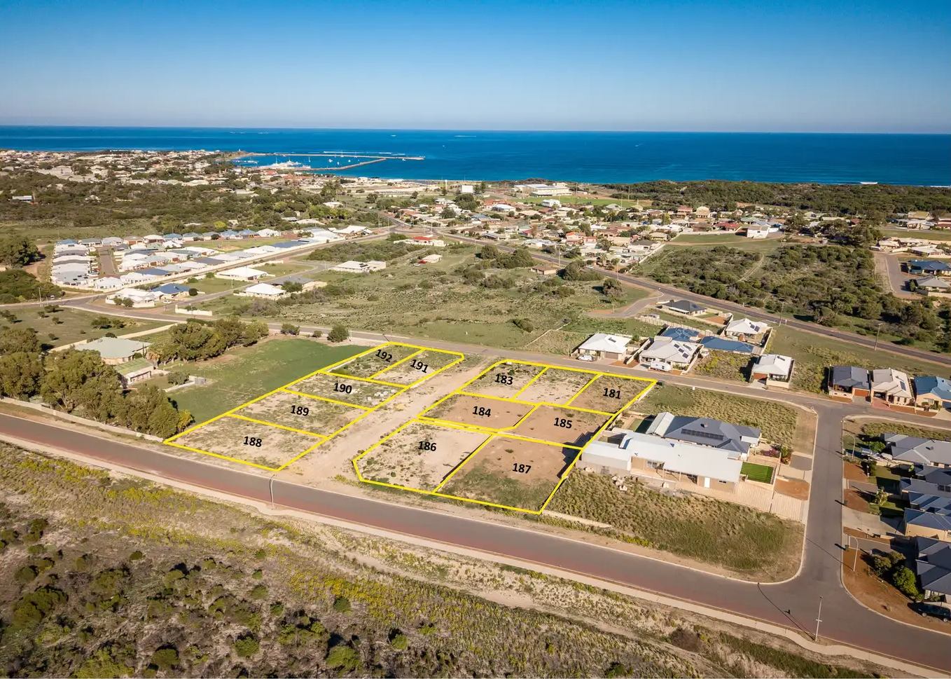
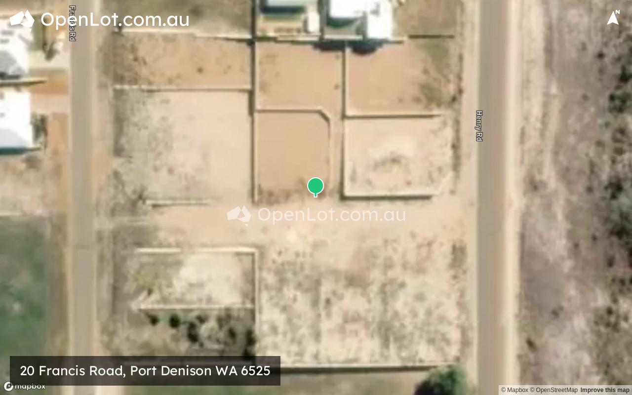
20 Francis Road, Port Denison WA 6525 SOLD OUT
This information is estimated by the OpenLot research team. Let us know here to provide up-to-date information about this development.
| Total new homes | 11 |
| Area size | 1.02 hectares |
| City council | Shire of Irwin |
| Developer | N/A |
| Project marketer | Ray White Dongara |
Land for Sale, House and Land Packages:
Popular Estates near 20 Francis Road, Port Denison


Updates for 20 Francis Road, Port Denison
Location & Map for 20 Francis Road, Port Denison
Vacancy Rate in Port Denison WA 6525
View full vacancy rate history in Port Denison WA 6525 via SQM Research.
Schools near 20 Francis Road, Port Denison
Here are 6 schools near 20 Francis Road, Port Denison:
K-12 Government Combined School
K-6 Government Primary School
K-6 Government Primary School
K-6 Government Primary School
K-6 Government Primary School
7-12 Government Secondary School
Reviews & Comments on 20 Francis Road, Port Denison
Estate Brochure, Masterplan, Engineering Plan, Plan of Subdivision (POS), Design Guidelines
FAQs about 20 Francis Road, Port Denison
View all estates marketed by Ray White Dongara
- Dongara District High School - 1.5km north
- Walkaway Primary School - 38.2km north
- Mingenew Primary School - 49.8km east
- Wandina Primary School - 57.4km north-west
- Mount Tarcoola Primary School - 59.2km north-west
- Champion Bay Senior High School - 59.7km north-west
Popular Estates near 20 Francis Road, Port Denison
Latest New Home Articles for You

09/Mar/2026 | OpenLot.com.au
Victoria: Top 30 Most Searched Housing Developments (February 2026)
If you’ve been exploring housing opportunities in Victoria, February 2026...

20/Feb/2026 | OpenLot.com.au
Display Homes at Drouin Fields Estate: A Thriving Community in Drouin
Welcome to Drouin Fields, a place where beauty, space, and modern luxury ...

19/Feb/2026 | OpenLot.com.au
Display Homes at Manor Lakes Esate: A Thriving Waterside Community in Manor Lakes
A place where you can settle in, rather than just settle down. Named for ...

13/Feb/2026 | OpenLot.com.au
🏠 Victoria: Top 30 Most Searched Townhouse Developments – January 2026

11/Feb/2026 | OpenLot.com.au
🏡 Top 30 Most Searched Estates by State - January 2026

10/Feb/2026 | OpenLot.com.au
Victoria: Top 30 Most Searched Housing Developments (January 2026)
If you’ve been considering making a move in Victoria, January 2026 offere...

10/Feb/2026 | OpenLot.com.au
Queensland: Top 30 Most Searched Housing Developments (January 2026)
If you’ve been considering making a move in Queensland, January 2026 offe...

09/Feb/2026 | OpenLot.com.au
Western Australia: Top 30 Most Searched Housing Developments (January 2026)
If you’ve been considering making a move in Western Australia, January 20...

06/Feb/2026 | OpenLot.com.au
South Australia: Top 30 Most Searched Housing Developments (January 2026)
If you’ve been considering making a move in South Australia, January 2026...