268 Padstow Road, Eight Mile Plains QLD 4113 IN PLANNING
This information is estimated by the OpenLot research team. Let us know here to provide up-to-date information about this development.
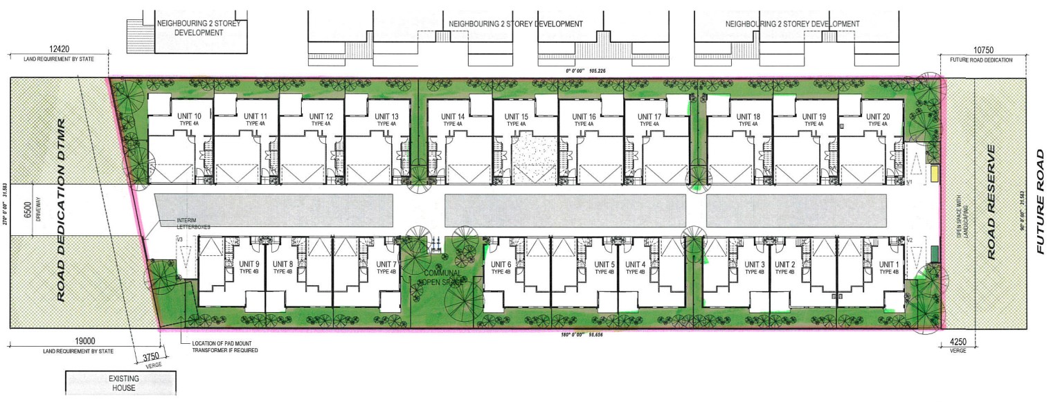
| Total new homes | 20 |
| Area size | 0.41 hectares |
| Growth Region | Greater Brisbane Growth Areas |
| City council | Brisbane City Council |
| Developer | N/A |
| Distance to | Brisbane CBD - 13 km south-east Brisbane Airport - 20 km south |
Townhomes:
Popular Estates near 268 Padstow Road, Eight Mile Plains


 5
5
 3
3
 2
2


Updates for 268 Padstow Road, Eight Mile Plains
Facebook updates:
Submit the Facebook page for 268 Padstow Road, Eight Mile Plains.
Related news:
A development application has been lodged for Multiple Dwellings and Subdivision, located at 268 Padstow Road, Eight Mile Plains. Designed by Idearchitectur

DUE TO A CHANGE IN CIRCUMSTANCES, AMBEMA GROUP HAVE GIVEN CLEAR INSTRUCTIONS TO ENSURE THIS SITE IS SOLD! WE ARE EXCITED TO OFFER 268 PADSTOW ROAD, EIGHT MILE PLAINS!This outstanding site is located prominently on Padstow Road, Eight Mile Plains… Listed by Ray White Mt Gravatt
Missing articles? Send us a link here.
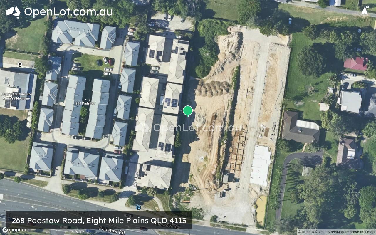
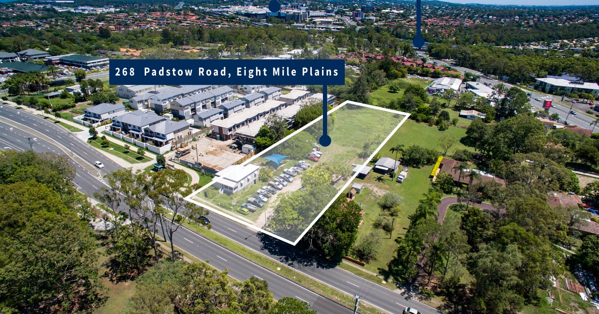
Location & Map for 268 Padstow Road, Eight Mile Plains
Visit Display Homes near 268 Padstow Road, Eight Mile Plains


Vacancy Rate in Eight Mile Plains QLD 4113
View full vacancy rate history in Eight Mile Plains QLD 4113 via SQM Research.
Schools near 268 Padstow Road, Eight Mile Plains
Here are 6 schools near 268 Padstow Road, Eight Mile Plains:
Prep-6 Government Primary School
7-12 Government Secondary School
Prep-6 Government Primary School
Prep-6 Government Primary School
7-12 Government Secondary School
7-12 Government Secondary School
Reviews & Comments on 268 Padstow Road, Eight Mile Plains
Estate Brochure, Masterplan, Engineering Plan, Plan of Subdivision (POS), Design Guidelines
FAQs about 268 Padstow Road, Eight Mile Plains
- Warrigal Road State School - 1.4km south
- MacGregor State High School - 1.6km north-west
- MacGregor State School - 2.3km west
- Upper Mount Gravatt State School - 2.3km north-west
- Runcorn State High School - 2.3km south-west
- Rochedale State High School - 2.5km south-east
Popular Estates near 268 Padstow Road, Eight Mile Plains
Latest New Home Articles for You

09/Mar/2026 | OpenLot.com.au
Victoria: Top 30 Most Searched Housing Developments (February 2026)
If you’ve been exploring housing opportunities in Victoria, February 2026...

20/Feb/2026 | OpenLot.com.au
Display Homes at Drouin Fields Estate: A Thriving Community in Drouin
Welcome to Drouin Fields, a place where beauty, space, and modern luxury ...

19/Feb/2026 | OpenLot.com.au
Display Homes at Manor Lakes Esate: A Thriving Waterside Community in Manor Lakes
A place where you can settle in, rather than just settle down. Named for ...

13/Feb/2026 | OpenLot.com.au
🏠 Victoria: Top 30 Most Searched Townhouse Developments – January 2026

11/Feb/2026 | OpenLot.com.au
🏡 Top 30 Most Searched Estates by State - January 2026

10/Feb/2026 | OpenLot.com.au
Victoria: Top 30 Most Searched Housing Developments (January 2026)
If you’ve been considering making a move in Victoria, January 2026 offere...

10/Feb/2026 | OpenLot.com.au
Queensland: Top 30 Most Searched Housing Developments (January 2026)
If you’ve been considering making a move in Queensland, January 2026 offe...

09/Feb/2026 | OpenLot.com.au
Western Australia: Top 30 Most Searched Housing Developments (January 2026)
If you’ve been considering making a move in Western Australia, January 20...

06/Feb/2026 | OpenLot.com.au
South Australia: Top 30 Most Searched Housing Developments (January 2026)
If you’ve been considering making a move in South Australia, January 2026...