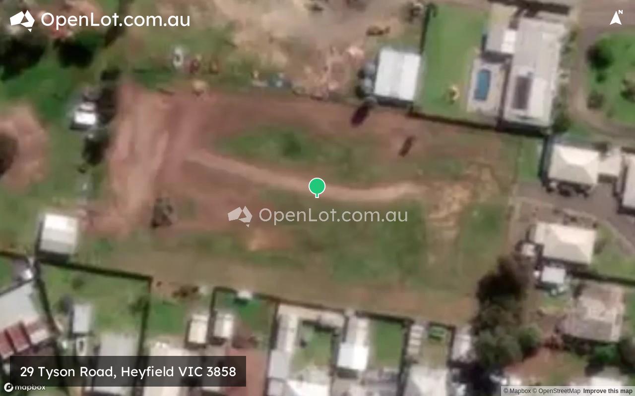
29 Tyson Road, Heyfield VIC 3858
This information is estimated by the OpenLot research team. Let us know here to provide up-to-date information about this development.
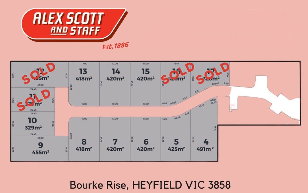
| Total new homes | 14 |
| Area size | 0.67 hectares |
| Growth Region | Gippsland Regional Growth Areas |
| City council | Wellington Shire Council |
| Developer | N/A |
| Project marketer | Alex Scott & Staff Real Estate |
Land for Sale, House and Land Packages:
Popular Estates near 29 Tyson Road, Heyfield


Updates for 29 Tyson Road, Heyfield
Location & Map for 29 Tyson Road, Heyfield
Vacancy Rate in Heyfield VIC 3858
View full vacancy rate history in Heyfield VIC 3858 via SQM Research.
Schools near 29 Tyson Road, Heyfield
Here are 6 schools near 29 Tyson Road, Heyfield:
Prep-6 Catholic Primary School
Prep-6 Government Primary School
Prep-6 Government Primary School
Prep-6 Government Primary School
Prep-6 Catholic Primary School
Prep-6 Government Primary School
Reviews & Comments on 29 Tyson Road, Heyfield
Estate Brochure, Masterplan, Engineering Plan, Plan of Subdivision (POS), Design Guidelines
FAQs about 29 Tyson Road, Heyfield
View all estates marketed by Alex Scott & Staff Real Estate
- St Michael's School - 629m south
- Heyfield Primary School - 728m south
- Cowwarr Primary School - 8.6km south-west
- Nambrok Denison Primary School - 11.8km south-east
- St Mary's School - 16.6km east
- Toongabbie Primary School - 16.6km south-west
Popular Estates near 29 Tyson Road, Heyfield
Latest New Home Articles for You

09/Mar/2026 | OpenLot.com.au
Victoria: Top 30 Most Searched Housing Developments (February 2026)
If you’ve been exploring housing opportunities in Victoria, February 2026...

20/Feb/2026 | OpenLot.com.au
Display Homes at Drouin Fields Estate: A Thriving Community in Drouin
Welcome to Drouin Fields, a place where beauty, space, and modern luxury ...

19/Feb/2026 | OpenLot.com.au
Display Homes at Manor Lakes Esate: A Thriving Waterside Community in Manor Lakes
A place where you can settle in, rather than just settle down. Named for ...

13/Feb/2026 | OpenLot.com.au
🏠 Victoria: Top 30 Most Searched Townhouse Developments – January 2026

11/Feb/2026 | OpenLot.com.au
🏡 Top 30 Most Searched Estates by State - January 2026

10/Feb/2026 | OpenLot.com.au
Victoria: Top 30 Most Searched Housing Developments (January 2026)
If you’ve been considering making a move in Victoria, January 2026 offere...

10/Feb/2026 | OpenLot.com.au
Queensland: Top 30 Most Searched Housing Developments (January 2026)
If you’ve been considering making a move in Queensland, January 2026 offe...

09/Feb/2026 | OpenLot.com.au
Western Australia: Top 30 Most Searched Housing Developments (January 2026)
If you’ve been considering making a move in Western Australia, January 20...

06/Feb/2026 | OpenLot.com.au
South Australia: Top 30 Most Searched Housing Developments (January 2026)
If you’ve been considering making a move in South Australia, January 2026...