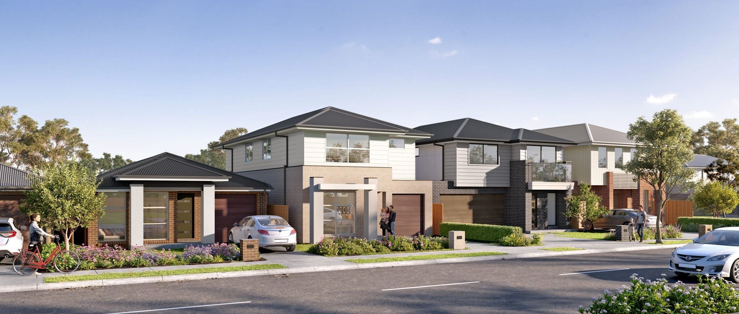

Eucalypt Grove Estate - Austral
 5-15 Thirteenth Avenue, Austral NSW 2179
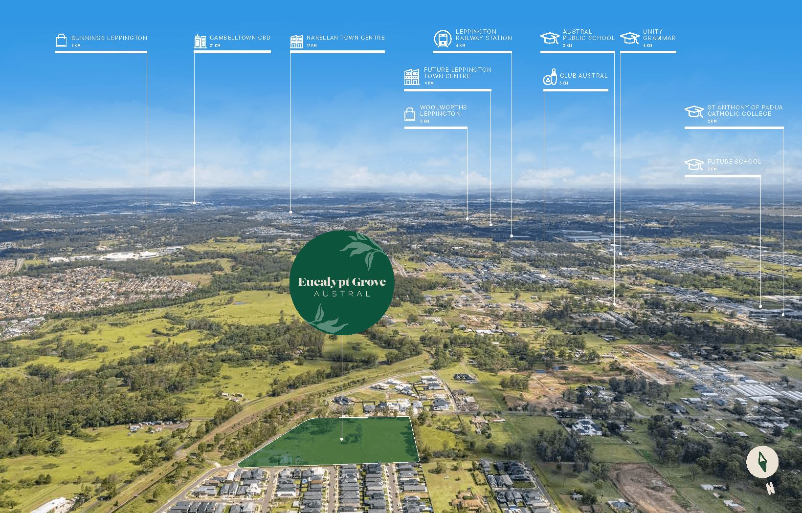
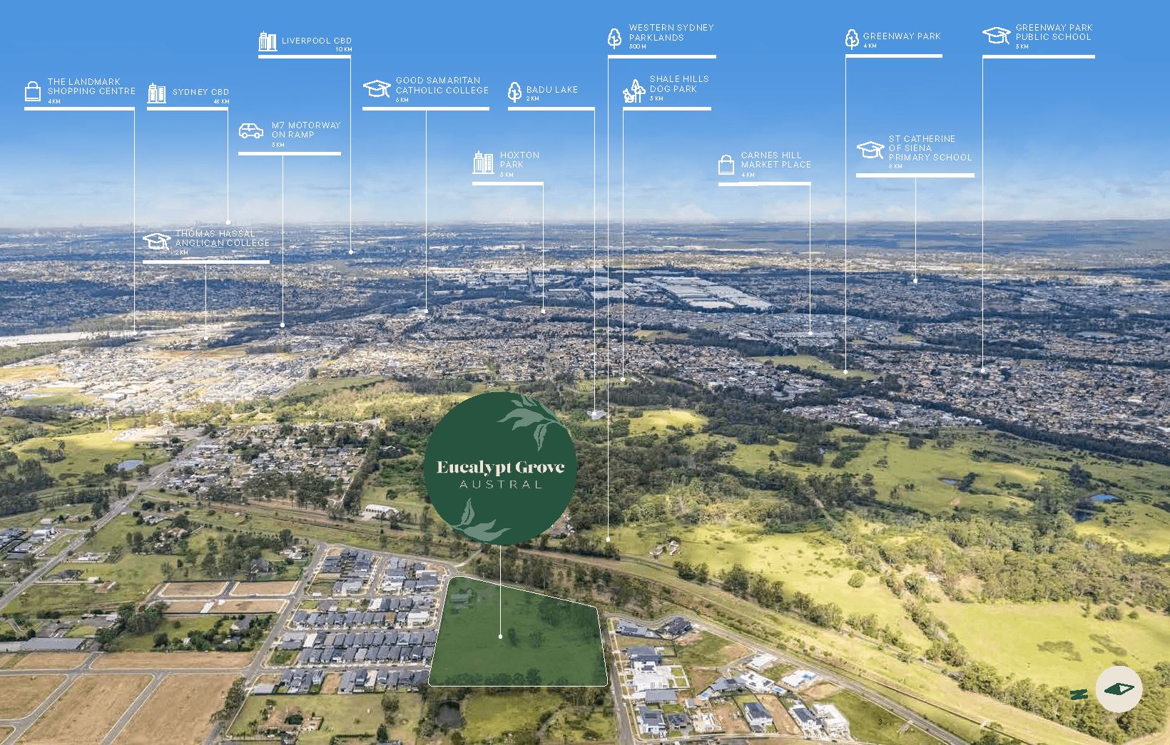
- Only 9 kilometres west of Liverpool and close to Campbelltown, Austral is a well-connected suburb that prides itself on its community spirit, sense of open space and ever-increasing amenities.
- A place where people and families can enjoy wholesome and well-balanced lifestyles, Austral is perfectly located for shopping and recreation (with the future Town Centre only 1km away), jobs, and schools. Austral is also within easy reach of several sporting fields and the Kemps Creek nature reserve, with extensive walking trails.
- Set for growth, significant rezoning is anticipated to increase housing supply in the region, while the future Western Sydney Airport at Badgerys Creek will be nearby. Major infrastructure is only a stone’s throw from Austral including Leppington train station and the M5 and M7 motorways, for fast access to Sydney CBD and other Western Sydney hubs.
- This is your chance to be part of the growth in Southwest Sydney, benefitting from future major infrastructure investment, new homes and more jobs.
This information is estimated by the OpenLot research team. Let us know here to provide up-to-date information about this development.
| Total new homes | 76 |
| Area size | N/A |
| Growth Region | Sydney South West Growth Areas |
| City council | Liverpool City Council |
| Developer | Rawson Homes |
| Distance to | Sydney Airport - 33 km west Sydney CBD - 34 km west |
Land for Sale, House and Land Packages:
Popular Estates near Eucalypt Grove Estate - Austral


 5
5  3
3  1
1


Updates for Eucalypt Grove Estate - Austral
Location & Map for Eucalypt Grove Estate - Austral
Vacancy Rate in Austral NSW 2179
View full vacancy rate history in Austral NSW 2179 via SQM Research.
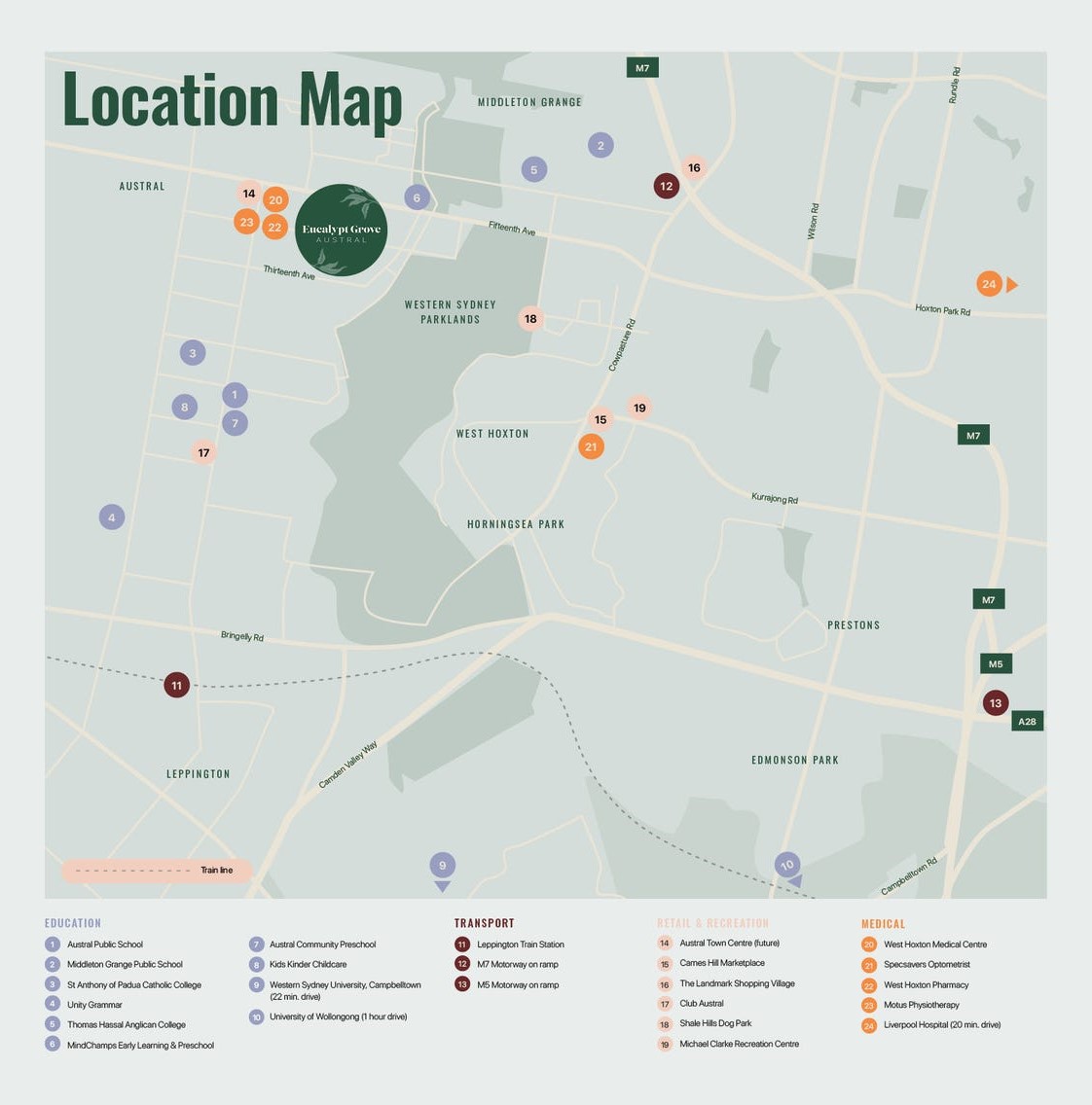
Schools near Eucalypt Grove Estate - Austral
Here are 6 schools near Eucalypt Grove Estate - Austral:
K-8 Catholic Combined School
7-12 Catholic Secondary School
K-2 Independent Primary School
K-6 Government Primary School
K-12 Independent Combined School
K-6 Government Primary School
Suburb Planning Review in Austral NSW 2179
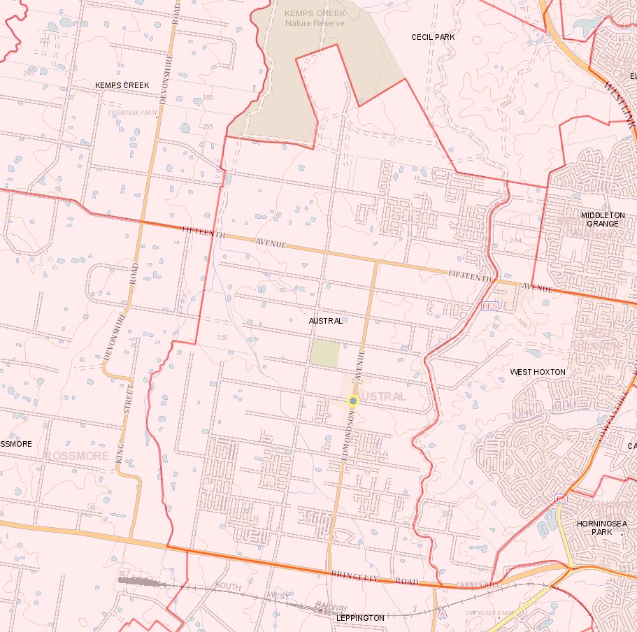
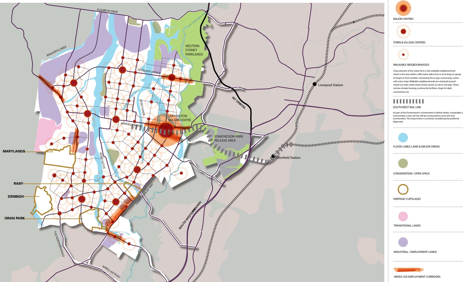
Austral is approximately 14.33 square kilometres located within the Liverpool Council and Camden Council forming part of the Greater Western Sydney region in New South Wales, located 42 kilometres south-west of Sydney. The suburb is primarily large agricultural land holdings and rural residential properties, with sporadic residential development increasing the density across the suburb. The suburb has a small business district in a central location, providing a strip of urban conveniences, retail and services that provide for the area. The Leppington train station is found to the south, outside the suburb boundary.
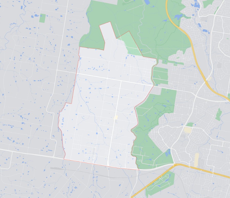
The suburb boundary is located along Kemps Creek and property boundaries are to the west, with the suburb boundary found along a drainage channel to the east. The suburb boundary is located along Bringelly Road to the south, with the TransGrid – Kemps Creek Electrical Substation and property boundaries providing the suburb boundary to the north.
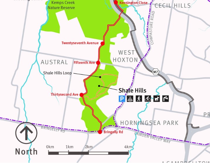
A unique vegetated preservation area located to the north and east, known as the Western Sydney Parklands covers 5,280 hectares and features a great assortment of picnic areas, walking and cycling tracks, and other entertainment facilities.
Fifteenth Avenue and Edmondson Avenue are the two major roads that provide access to the surrounding suburbs and the local roads network sound within the suburb. Kemps Creek continues from the adjoining suburb of Kemps Creek and splinters into other smaller creek corridors that traverse the suburb.
South West Priority Growth Area
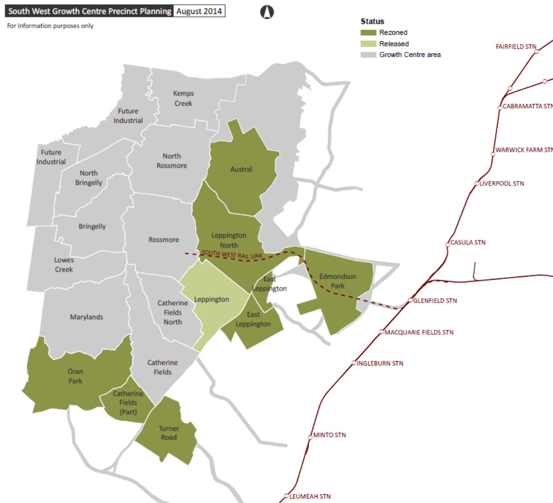
The Austral Precinct is within an urban release area in Sydney’s South West Growth Centre and the Liverpool Local Government Area prepared the Liverpool Contributions Plan in 2014. The plan was to authorise the imposition of development contributions on development expected to occur in the Austral Precinct that would assist in the funding of new and augmented infrastructure needs. The Plan was adopted by Council on 26 May 2015 and came into effect on 3 June 2015.
The Liverpool Contributions Plan allocated a portion of Austral in the rezoning to a new precinct called Leppington North and a Leppington Major Centre. As a result, the suburb of Austral is now a reduced size and shape, with the new southern boundary along the Kemps Creek corridor and Ninth Avenue.
The NSW State Government Department of Planning and Environment is preparing an update of the SGWA Structure Plan as a lot has occurred since it was published (below). Work has commenced with the relevant councils (Camden, Campbelltown and Liverpool Councils) as well as other state agencies and industry groups, to ensure the Structure Plan reflects current planning for the area.
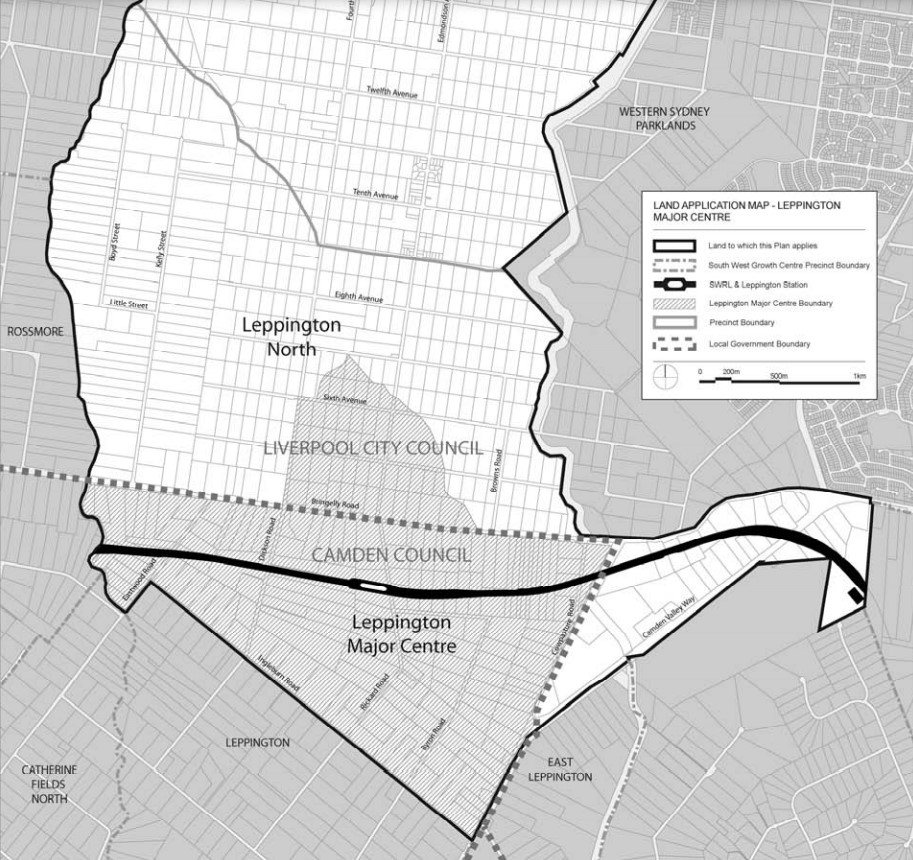
Austral forms part of the South West Growth Area and a Development Control Plan (DCP) was prepared to embed density controls in precinct plans to ensure that infrastructure planning aligns with growth. This Plan is known as the Liverpool Growth Centre Precincts Development Control Plan (DCP), particularly Schedule 1 – Austral and Leppington North Precincts and Schedule 2 - Leppington Major Centre Precinct was adopted and came into force on 3 April 2013 and was recently amended on 18 June 2021 (Austral ILP Amendment).
The DCP was prepared to provide additional guidance to developers, simplify the planning and ensure the orderly, efficient and environmentally sensitive development within the Precinct. The Liverpool Growth Centre Precinct is to be envisaged by the South West Sector Structure Plan and refined by both the Indicative Layout Plan for Austral and Leppington North Precincts and Leppington Major Centre.
Austral & Leppington North
- new Major Centre
- the new Leppington station
- three neighbourhood centres
- 220 hectares of employment land
- 135 hectares of open space and recreation areas
- upgrades to major roads
- new primary and high schools
- protection of significant vegetation, and major creek corridors
- improved connections to encourage walking and cycling.
The newly revitalised community at Austral & Leppington North will benefit from up to 17,350 new homes and the delivery of local amenities close to transport options, including:
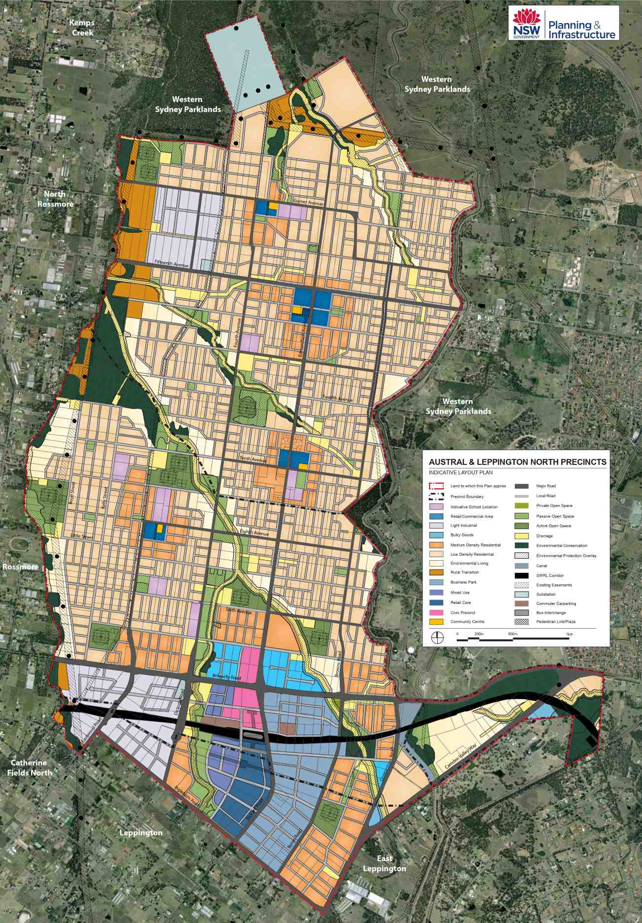
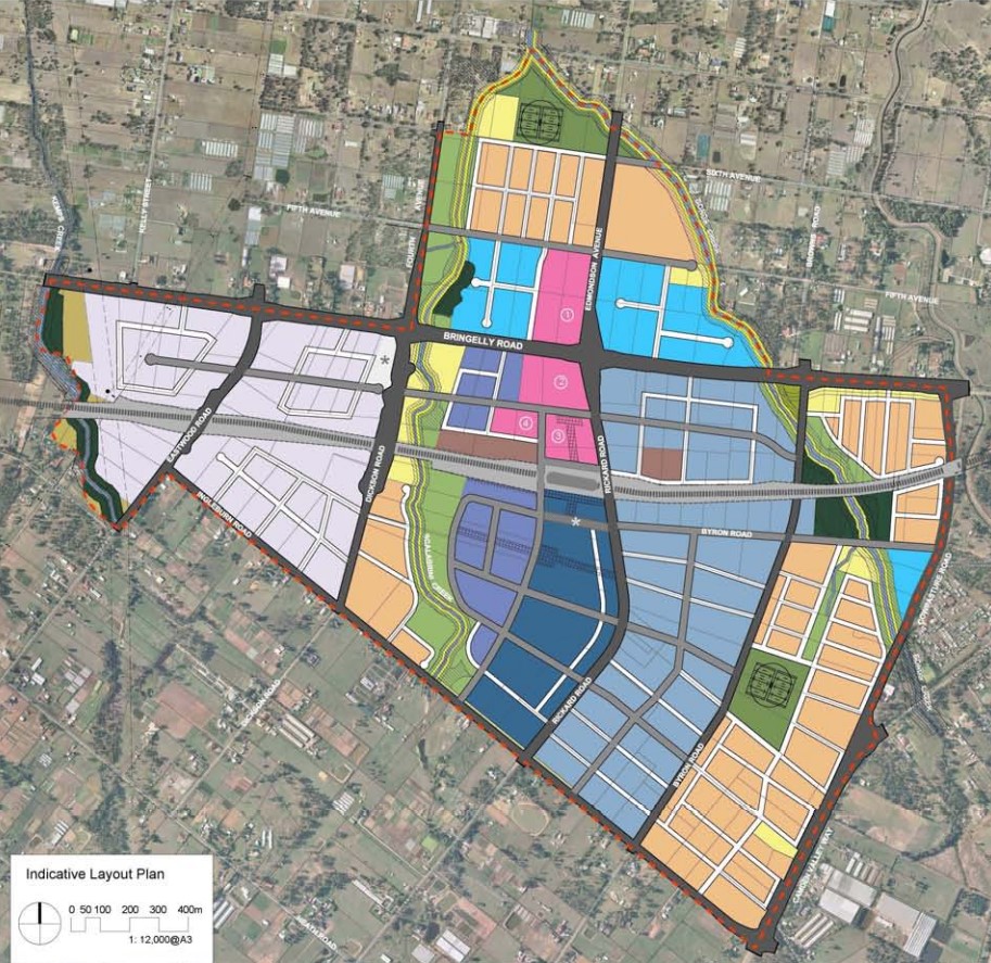
Precinct Zoning
The existing zoning will be amended to provide for future infrastructures to facilitate future development within the Austral and Leppington North Precinct and Leppington Major Centre Precinct. A major centre is to be established above the Leppington Train station and localised town/village centres provided at major intersections. The structure plan provides for the community including supermarkets, community facilities, retail and services to meet the local shopping needs of future residents.
A new road network has been designed to help provide safe streets for residents, cycling and walking paths, and provide direct access to the village centre. The new roads will enable bus services to connect people to surrounding suburbs and areas for schools, employment, retail, open spaces and services. Pedestrian and cyclist facilities will be constructed along open space and creek corridors that will access the new residential areas.
Green spaces will be integrated with new homes with landscaping and tree planting along streets and in public domain areas and protected vegetation.
Suburb Summary
References
- Leppington North and Austral – NSW State Government
- South West Grown Area Structure Plan
- NSW State Government Planning Portal
- Western Sydney Parkland
- Leppington - Precinct Rezoning Plan
- The Hills Shire Council Growth Centres Precinct - Development Control Plan
- NSW Planning (ePlanning Spatial Viewer)- Rezoned Area
- Google Streetview and Aerial
Reviews & Comments on Eucalypt Grove Estate - Austral
Estate Brochure, Masterplan, Engineering Plan, Plan of Subdivision (POS), Design Guidelines
FAQs about Eucalypt Grove Estate - Austral
View all estates from Rawson Homes
- St Anthony of Padua Catholic College - 1.4km south-west
- Clancy Catholic College - 1.4km south-east
- Arrahman College - 1.4km north
- Austral Public School - 1.5km south-west
- Thomas Hassall Anglican College - 1.6km north-east
- Greenway Park Public School - 1.9km south-east
Popular Estates near Eucalypt Grove Estate - Austral
Latest New Home Articles for You

26/Jul/2024
Your next Investment Property Can Now Return 10%+
Find out How A ‘Multi-Liv’ Property Returns on Average $7,350 per mont...

26/Jul/2024
Deciphering the Tactics Behind Builder Promotions for Informed Decision-Making
In the labyrinthine world of home building, the allure of promotions can ...

18/Jul/2024
Display Homes at Ferntree Ridge: Embrace Country Living in Drouin
Ferntree Ridge by LandGipps, offers a unique opportunity to experience th...

15/Jul/2024
How to Finance Your House and Land Package
Financing a house and land package involves understanding various options...

09/Jul/2024
Display Homes at Kinley Lilydale: A New Era of Living
Intrapac Property's latest development, Kinley, is set to transform Lilyd...

09/Jul/2024
Victoria: Top 30 Most Searched Housing Developments (June 2024)
We're excited to unveil the lineup of the top 30 most searched housing de...

09/Jul/2024
Western Australia: Top 30 Most Searched Housing Developments (June 2024)
If you've ever dreamt of making Western Australia your home, now is the p...

09/Jul/2024
South Australia: Top 30 Most Searched Housing Developments (June 2024)
South Australia, with its captivating allure and rich cultural heritage, ...

09/Jul/2024
Queensland: Top 30 Most Searched Housing Developments (June 2024)
On Australia's sun-kissed eastern coast lies Queensland, often referred t...