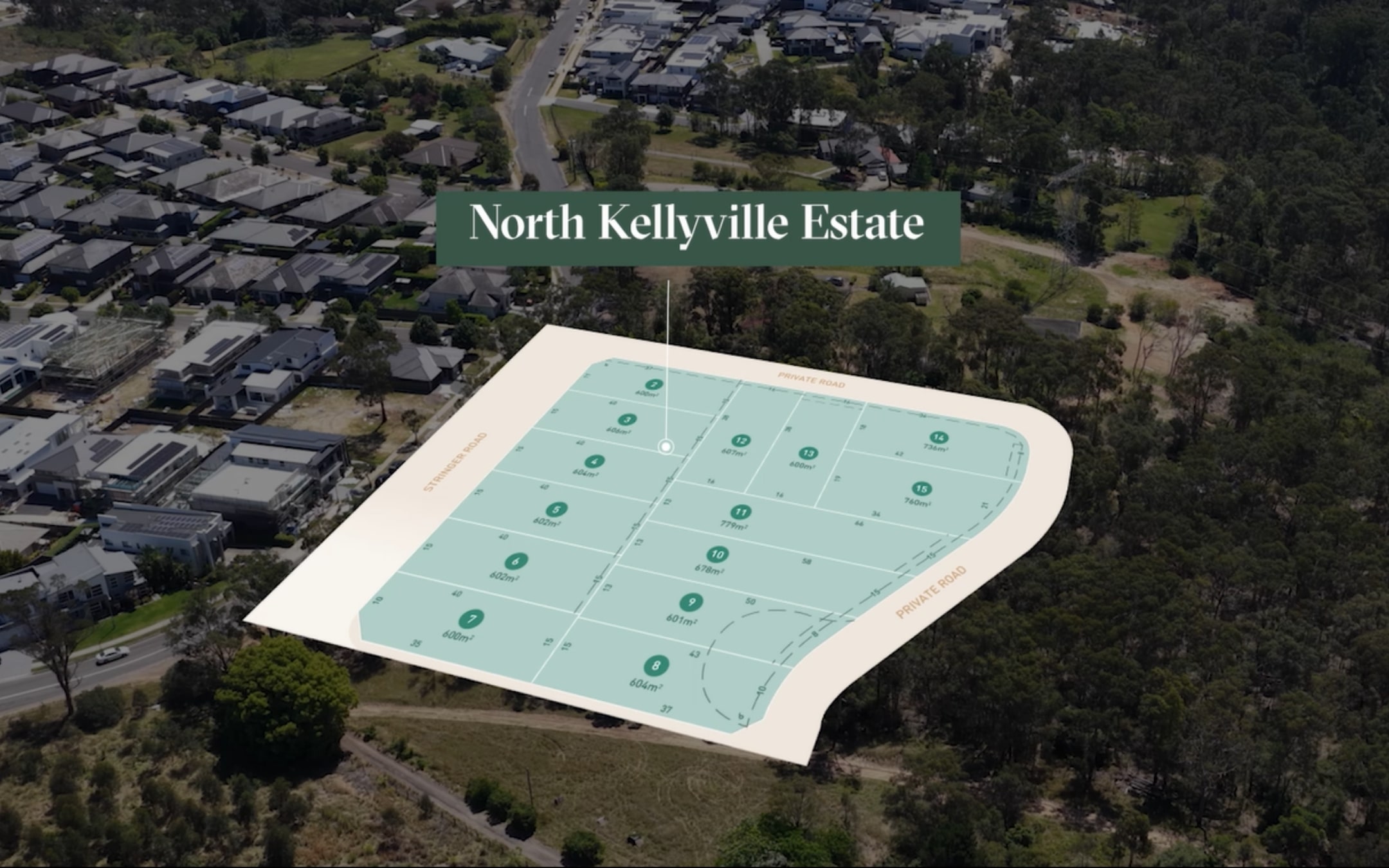
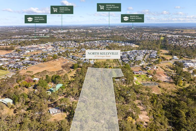
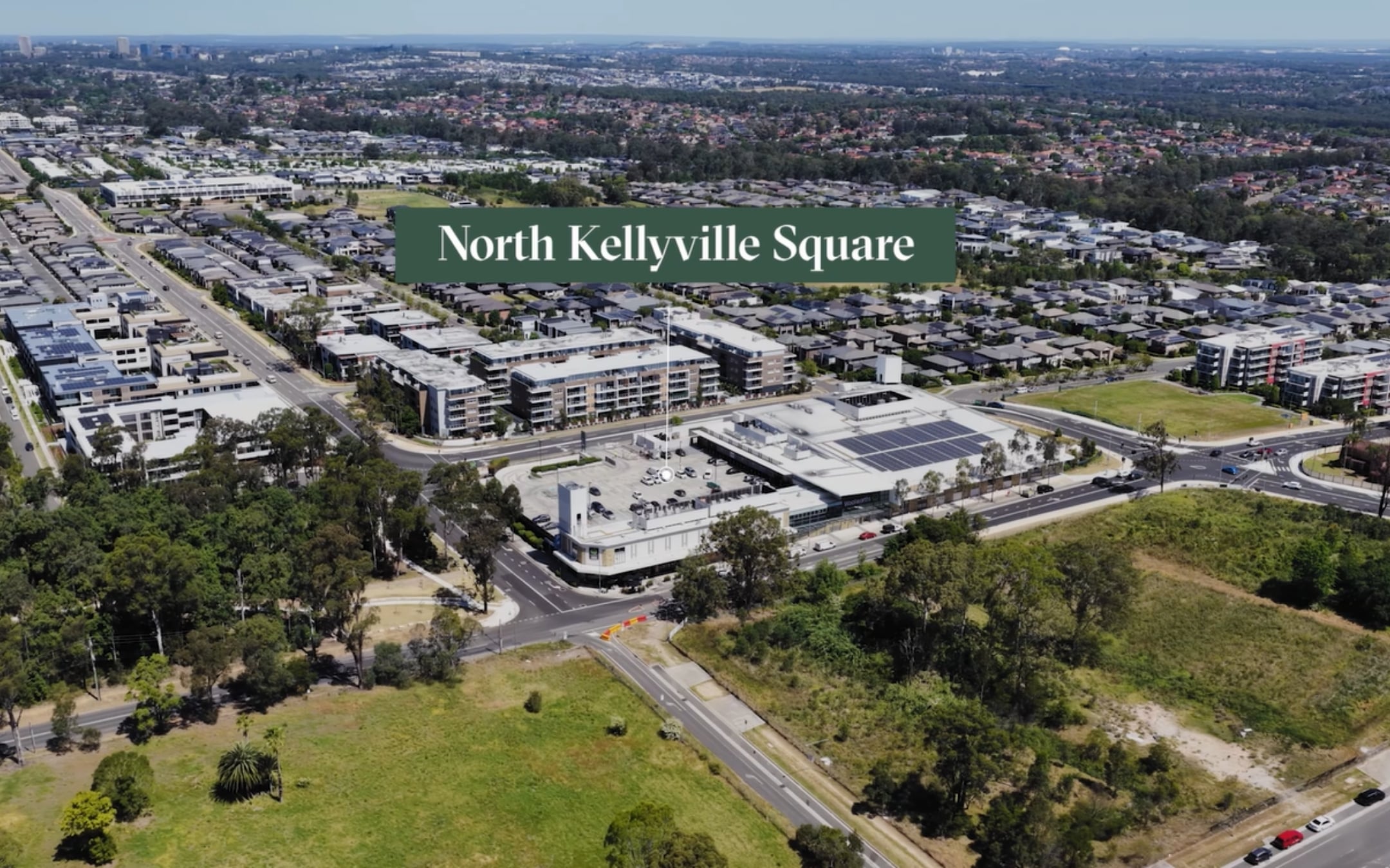
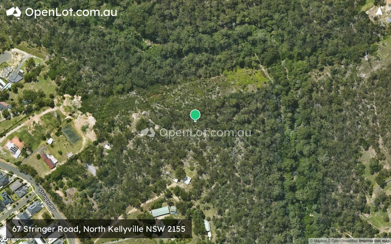
67 Stringer Road, North Kellyville NSW 2155 IN PLANNING
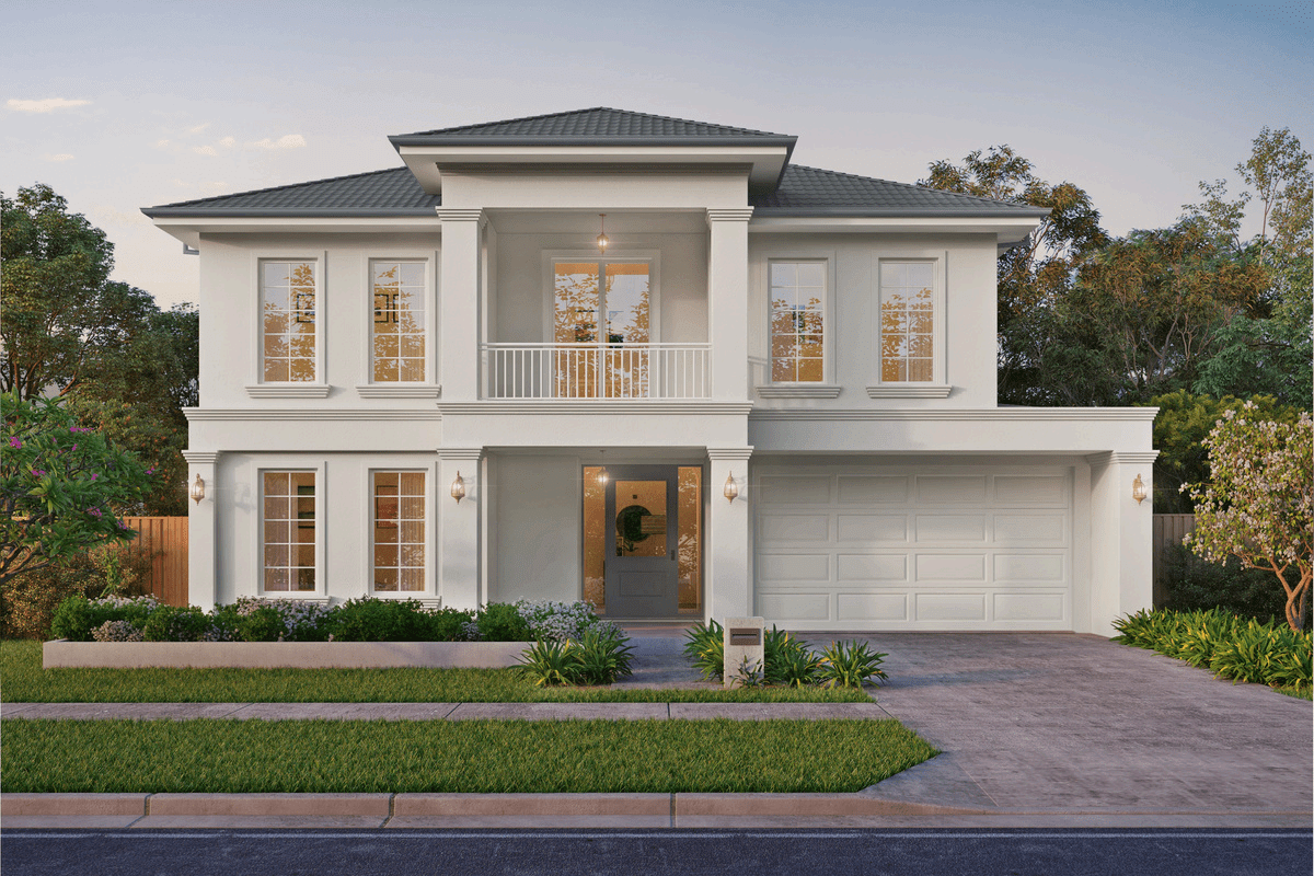
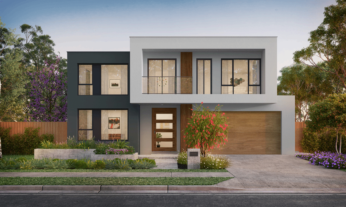
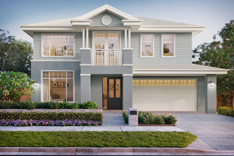
[LIMITED OFFER] Grand designs in a thriving suburban gem.
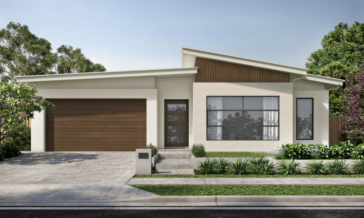
- Sigle-storey homes available from $2,334,000
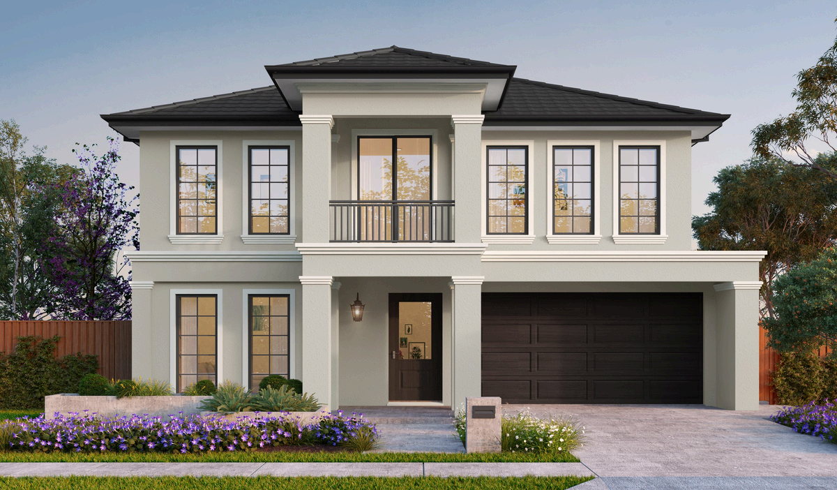
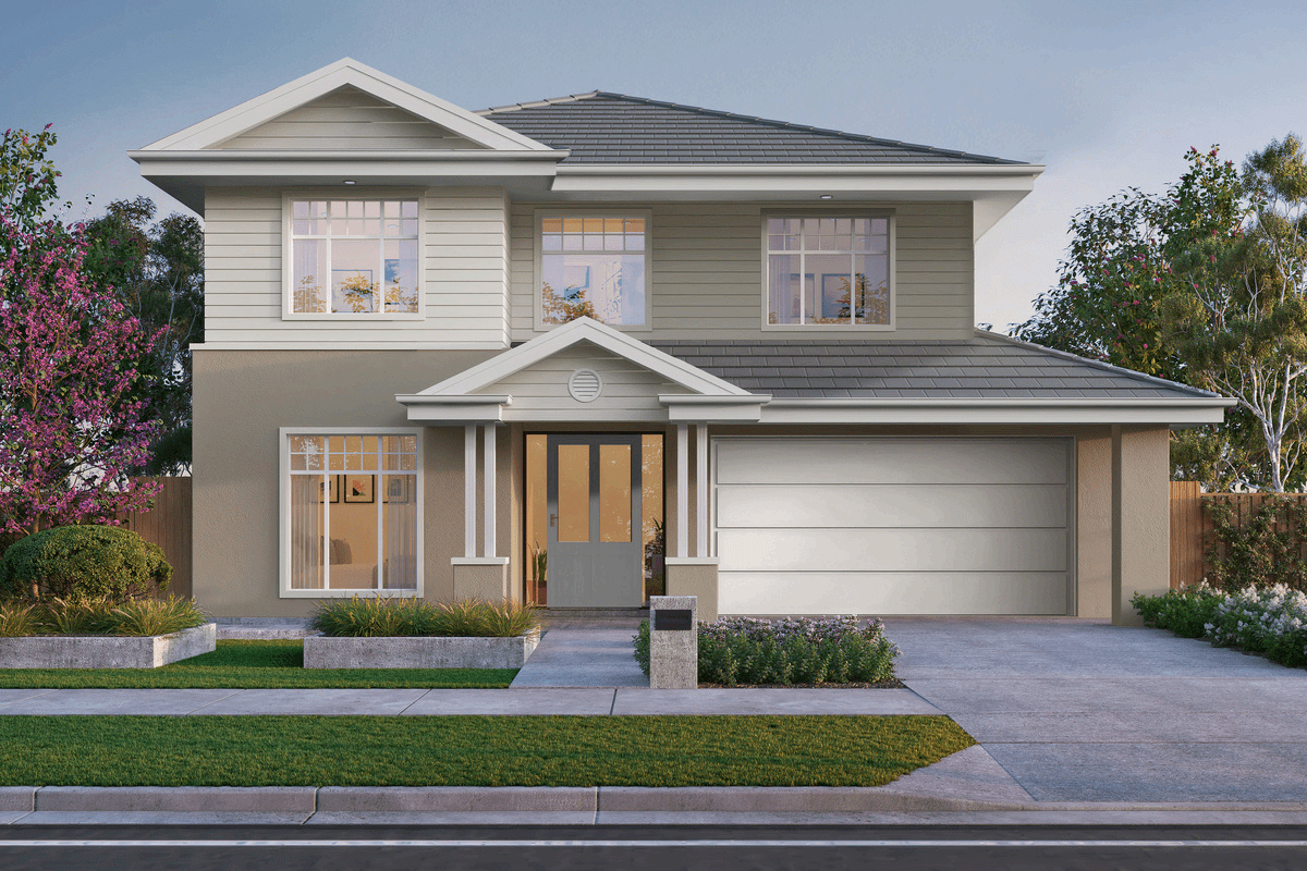
- Double-storey homes available from $2,537,000
- Customisable floorplans
- Available only as home & land packages
- Architecturally designed for generous 600m²+ blocks of land
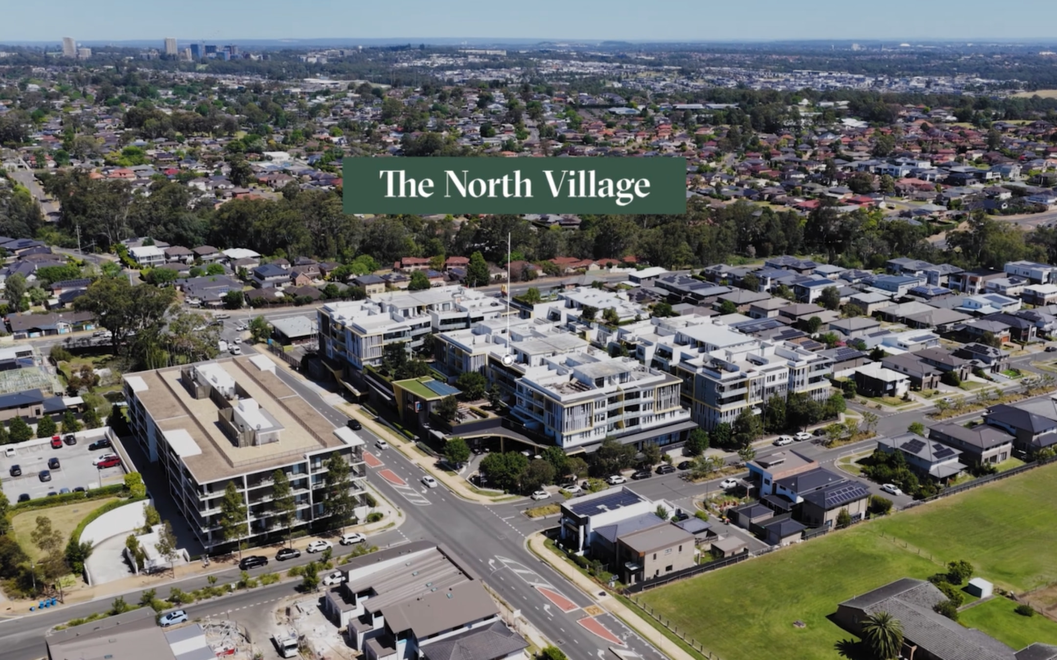
- Located minutes from North Kellyville Square & The North Village
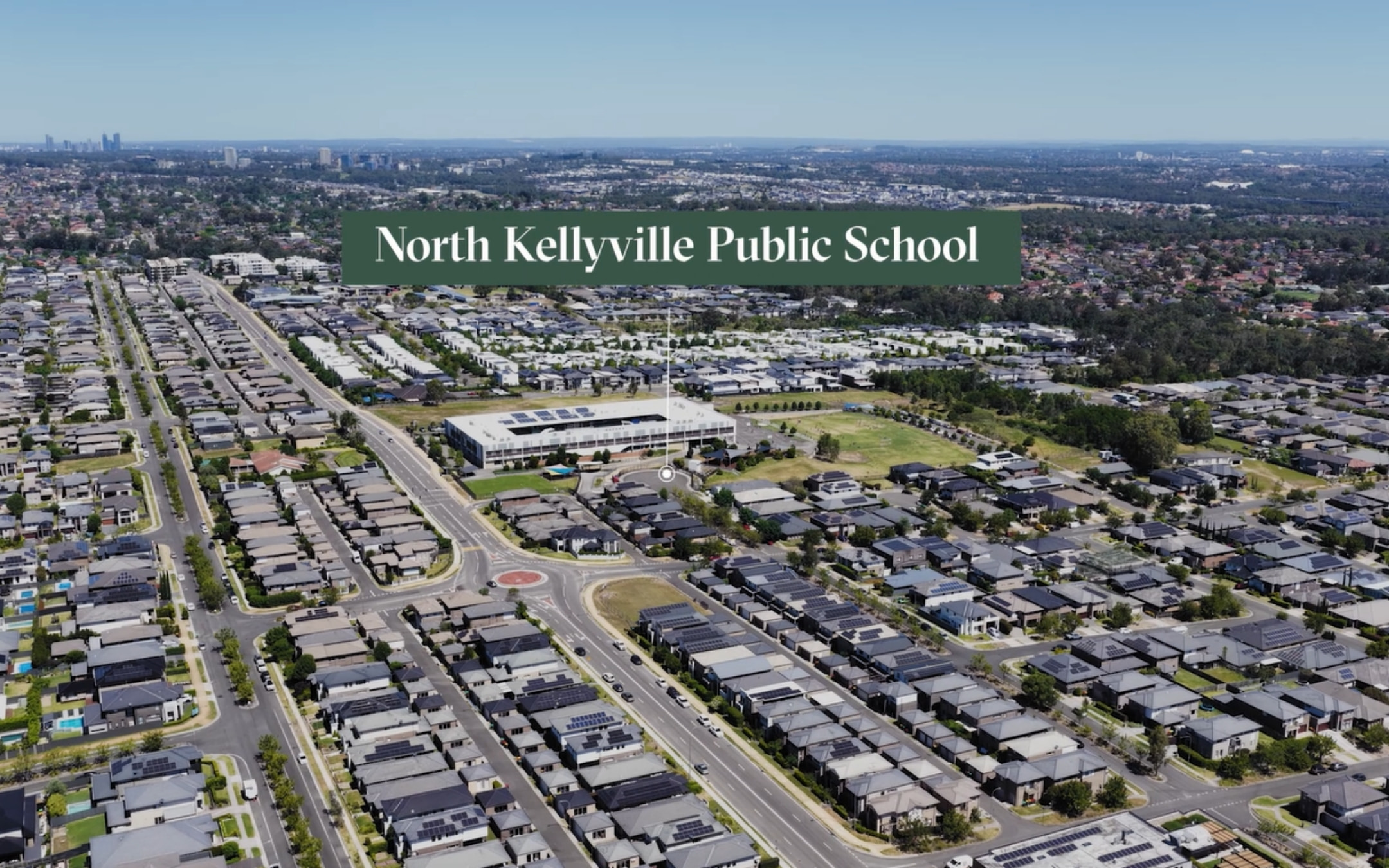
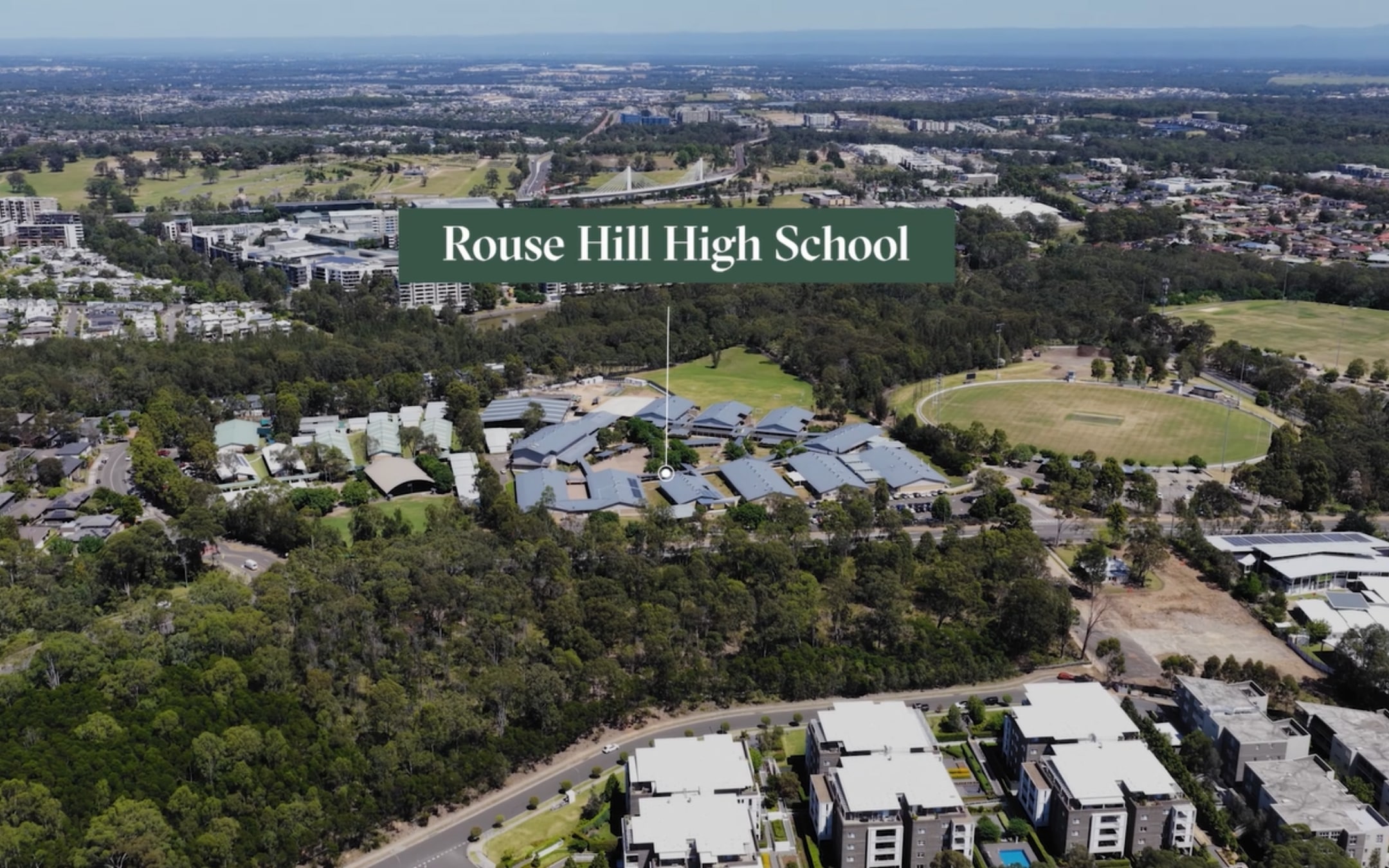
- Close to North Kellyville Public School & Rouse Hill High School
This information is estimated by the OpenLot research team. Let us know here to provide up-to-date information about this development.
| Total new homes | N/A |
| Area size | 2.58 hectares |
| Growth Region | Sydney North West Growth Areas |
| City council | The Hills Shire Council |
| Developer | Landen |
| Distance to | Sydney CBD - 32 km north-west Sydney Airport - 38 km north-west |
House and Land Packages:
Popular Estates near 67 Stringer Road, North Kellyville


 4
4
 2
2
 1
1


Updates for 67 Stringer Road, North Kellyville
Location & Map for 67 Stringer Road, North Kellyville
Visit Display Homes near 67 Stringer Road, North Kellyville


Vacancy Rate in North Kellyville NSW 2155
View full vacancy rate history in North Kellyville NSW 2155 via SQM Research.
Schools near 67 Stringer Road, North Kellyville
Here are 6 schools near 67 Stringer Road, North Kellyville:
K-6 Government Primary School
K-6 Catholic Primary School
7-12 Government Secondary School
K-6 Government Primary School
K-6 Government Primary School
K-6 Government Primary School
Reviews & Comments on 67 Stringer Road, North Kellyville
Estate Brochure, Masterplan, Engineering Plan, Plan of Subdivision (POS), Design Guidelines
FAQs about 67 Stringer Road, North Kellyville
View all estates from Landen
- Annangrove Public School - 726m east
- Our Lady of the Angels Primary School - 2.0km south-west
- Rouse Hill High School - 2.2km south-west
- Ironbark Ridge Public School - 2.3km south-west
- Rouse Hill Public School - 2.6km south-west
- North Kellyville Public School - 2.6km south
Popular Estates near 67 Stringer Road, North Kellyville
Latest New Home Articles for You

09/Mar/2026 | OpenLot.com.au
Victoria: Top 30 Most Searched Housing Developments (February 2026)
If you’ve been exploring housing opportunities in Victoria, February 2026...

20/Feb/2026 | OpenLot.com.au
Display Homes at Drouin Fields Estate: A Thriving Community in Drouin
Welcome to Drouin Fields, a place where beauty, space, and modern luxury ...

19/Feb/2026 | OpenLot.com.au
Display Homes at Manor Lakes Esate: A Thriving Waterside Community in Manor Lakes
A place where you can settle in, rather than just settle down. Named for ...

13/Feb/2026 | OpenLot.com.au
🏠 Victoria: Top 30 Most Searched Townhouse Developments – January 2026

11/Feb/2026 | OpenLot.com.au
🏡 Top 30 Most Searched Estates by State - January 2026

10/Feb/2026 | OpenLot.com.au
Victoria: Top 30 Most Searched Housing Developments (January 2026)
If you’ve been considering making a move in Victoria, January 2026 offere...

10/Feb/2026 | OpenLot.com.au
Queensland: Top 30 Most Searched Housing Developments (January 2026)
If you’ve been considering making a move in Queensland, January 2026 offe...

09/Feb/2026 | OpenLot.com.au
Western Australia: Top 30 Most Searched Housing Developments (January 2026)
If you’ve been considering making a move in Western Australia, January 20...

06/Feb/2026 | OpenLot.com.au
South Australia: Top 30 Most Searched Housing Developments (January 2026)
If you’ve been considering making a move in South Australia, January 2026...