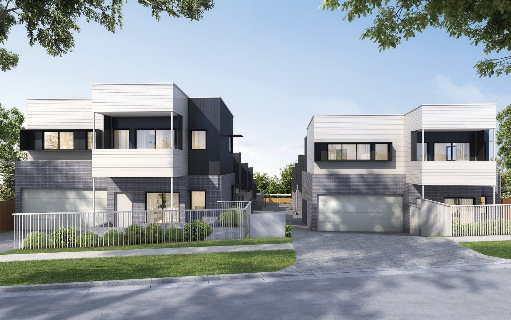
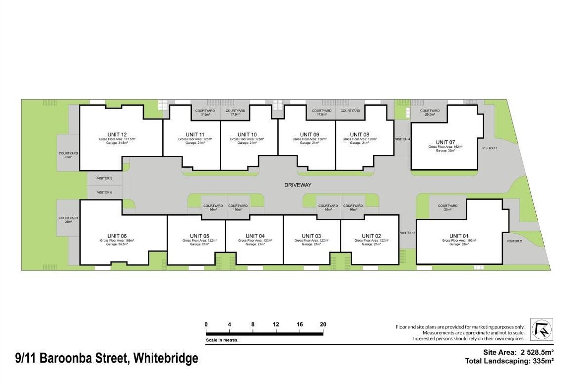
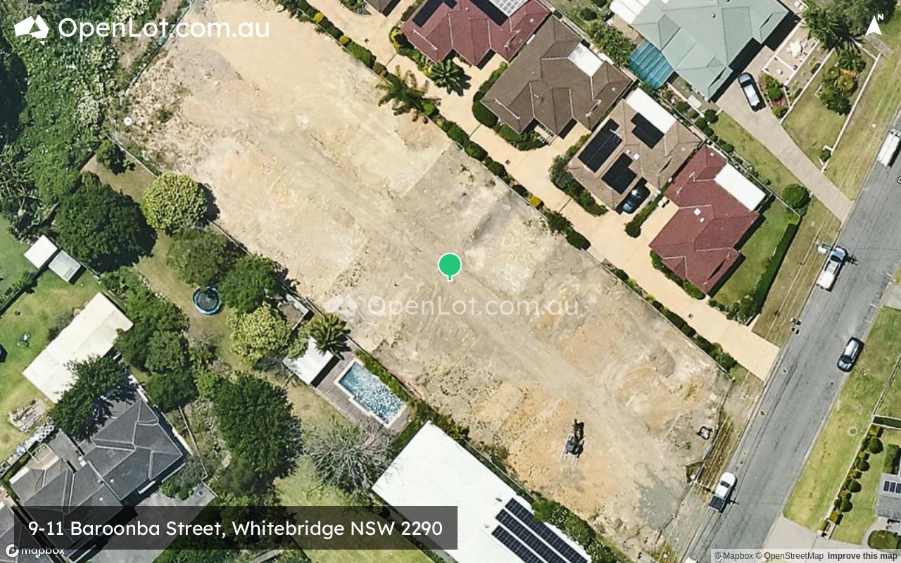
9-11 Baroonba Street, Whitebridge NSW 2290
This information is estimated by the OpenLot research team. Let us know here to provide up-to-date information about this development.
| Total new homes | 12 |
| Area size | 0.25 hectares |
| Growth Region | Greater Newcastle Growth Areas (The Hunter Region) |
| City council | Lake Macquarie City Council |
| Developer | N/A |
| Project marketer | Shiels+Co Property |
| Distance to | Newcastle CBD - 8 km south-west |
Townhomes:
Popular Estates near 9-11 Baroonba Street, Whitebridge


 3
3
 2.5
2.5
 2
2


Updates for 9-11 Baroonba Street, Whitebridge
Facebook updates:
Submit the Facebook page for 9-11 Baroonba Street, Whitebridge.
Related news:
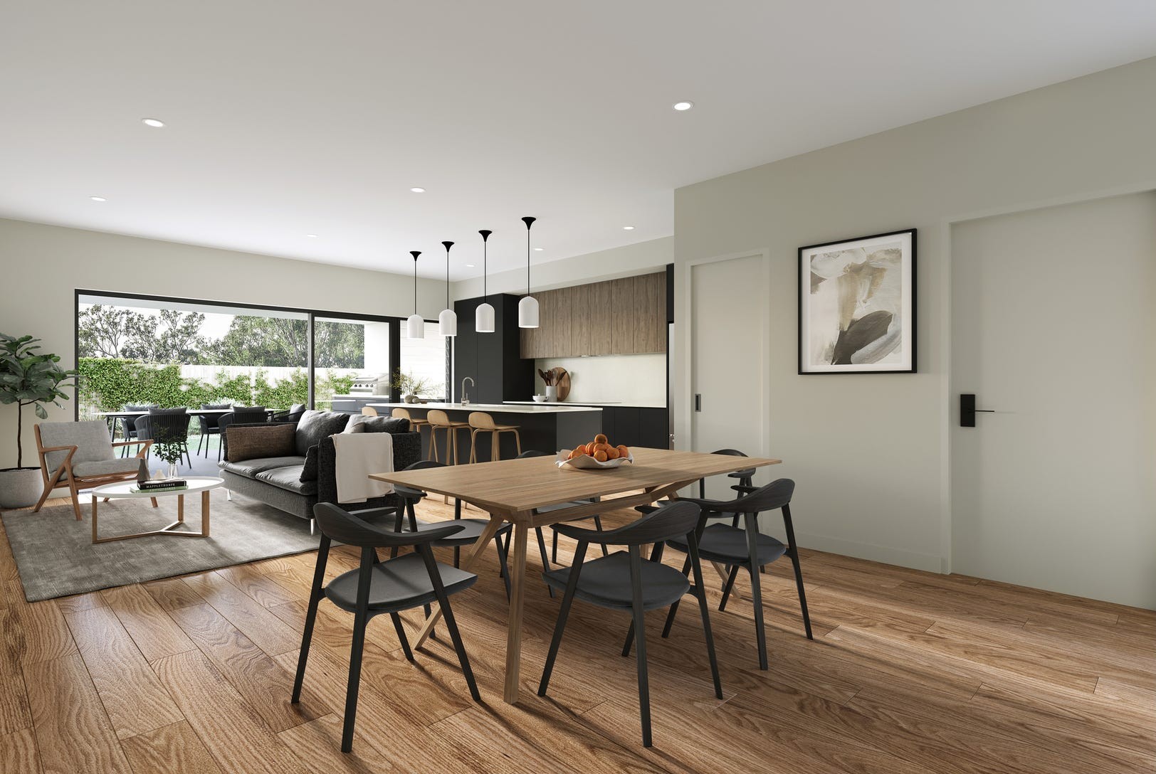
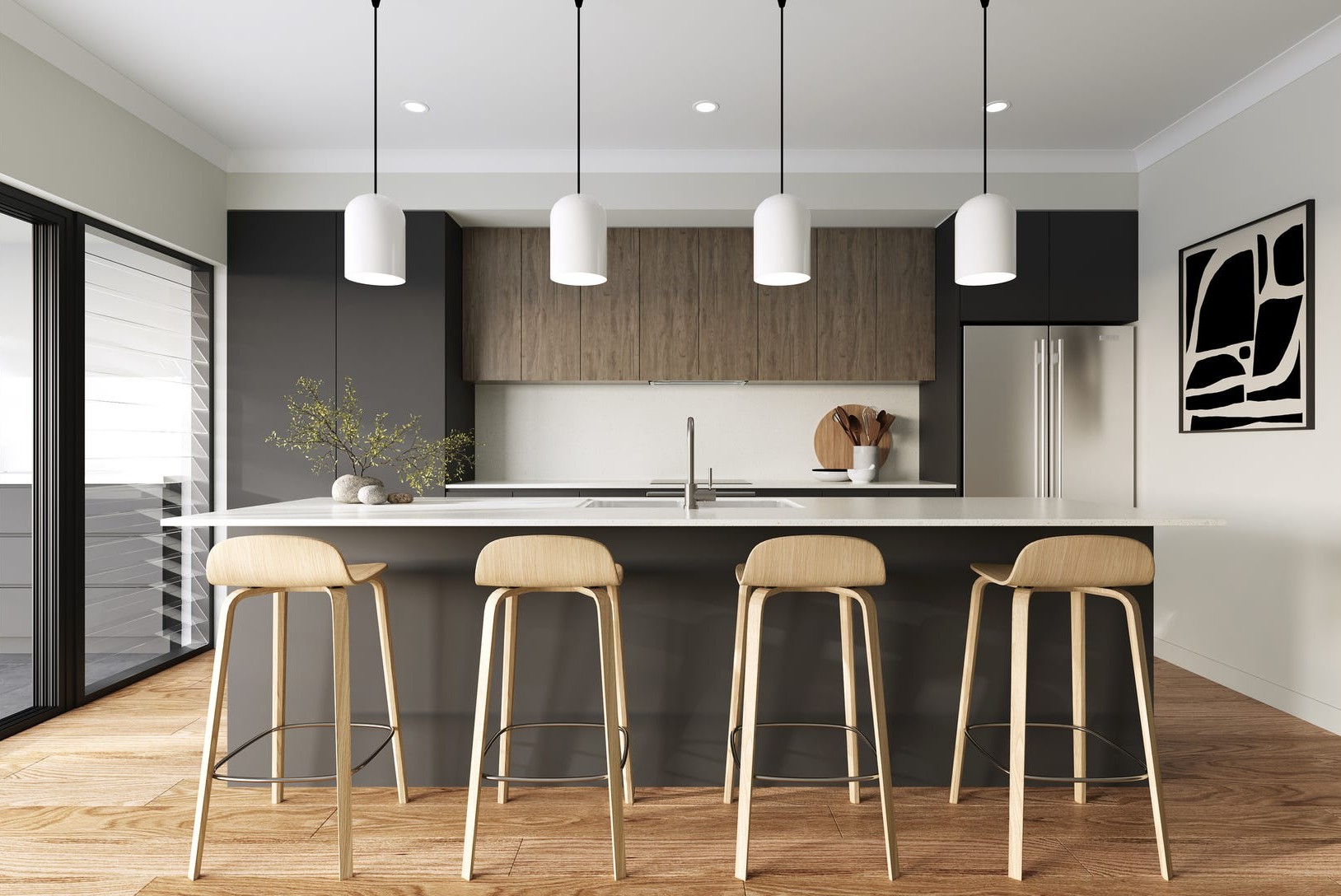
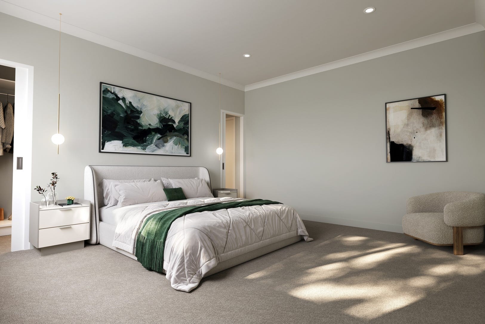
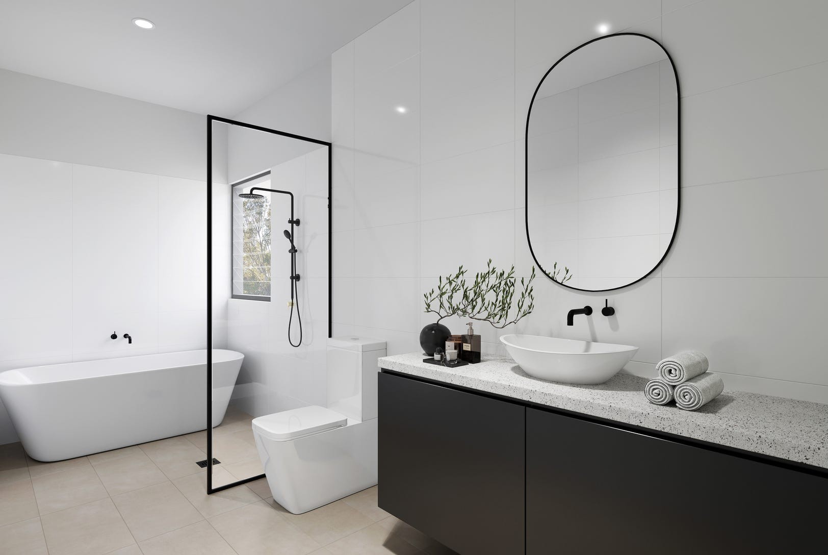
Set for completion in late-2025, this exclusive four-bedroom townhouse offers architecturally designed, that epitomise modern living. The residence boasts an open-plan layout tailored for functionality and comfort, featuring high-end fixtures and finishes that have been meticulously selected to elevate your living experience. From spacious living areas to thoughtfully crafted interiors, this home is designed to cater to your lifestyle needs. Offering multiple living spaces, the home here seamlessly integrates indoor and outdoor living with private courtyards creating a perfect sanctuary for relaxation and entertaining. The master suites are a true retreat with walk-in robes and luxurious ensuites. Off-street parking adds convenience to your daily life, making this home not just a place to live, but a place to thrive. Secure your off-the-plan purchase today and be part of this vibrant new community in Whitebridge. Property Highlights: - Set in a modern, intimate complex of 12 townhouses. - Hybrid timber flooring is used throughout the main living and kitchen areas, and plush carpets are transitioned to the bedrooms. - Roller blinds installed throughout. - Generously sized, modern kitchens with Caesarstone benchtops and ample pantry space; some units include a butler's pantry. - Equipped with SMEG or Fisher & Paykel stainless steel electric cooktops, ovens, and dishwashers. - Spacious bathrooms with floor-to-ceiling tiles, free-standing baths, showers, and toilets. - Master bedrooms feature walk-in robes (WIR) and private ensuites with showers and w/c. - Separate powder rooms. - Generously sized laundry rooms with ample storage space. - Split system reverse cycle air conditioning. - Attached garages (single and double options) with internal access. - Fully fenced courtyard - Ample storage solutions throughout. - Centrally located, just moments from Whitebridge Shopping Village, where cafés and everyday essentials are conveniently available. - A short walk to the Fernleigh Track. - Located just 3.1 km from the vibrant Charlestown Square, offering extensive shopping and dining options. - Zoned for the highly sought-after Charlestown East Public School and Whitebridge High School.


Missing articles? Send us a link here.
Location & Map for 9-11 Baroonba Street, Whitebridge
Vacancy Rate in Whitebridge NSW 2290
View full vacancy rate history in Whitebridge NSW 2290 via SQM Research.
Schools near 9-11 Baroonba Street, Whitebridge
Here are 6 schools near 9-11 Baroonba Street, Whitebridge:
7-12 Government Secondary School
K-6 Government Primary School
K-6 Government Primary School
K-6 Government Primary School
K-6 Catholic Primary School
Reviews & Comments on 9-11 Baroonba Street, Whitebridge
Estate Brochure, Masterplan, Engineering Plan, Plan of Subdivision (POS), Design Guidelines
FAQs about 9-11 Baroonba Street, Whitebridge
View all estates marketed by Shiels+Co Property
- Whitebridge High School - 613m north
- Charlestown East Public School - 1.0km north-west
- Dudley Public School - 1.4km south
- Kahibah Public School - 1.4km north
- St Joseph's Primary School - 1.5km north-west
Popular Estates near 9-11 Baroonba Street, Whitebridge
Latest New Home Articles for You

09/Mar/2026 | OpenLot.com.au
Victoria: Top 30 Most Searched Housing Developments (February 2026)
If you’ve been exploring housing opportunities in Victoria, February 2026...

20/Feb/2026 | OpenLot.com.au
Display Homes at Drouin Fields Estate: A Thriving Community in Drouin
Welcome to Drouin Fields, a place where beauty, space, and modern luxury ...

19/Feb/2026 | OpenLot.com.au
Display Homes at Manor Lakes Esate: A Thriving Waterside Community in Manor Lakes
A place where you can settle in, rather than just settle down. Named for ...

13/Feb/2026 | OpenLot.com.au
🏠 Victoria: Top 30 Most Searched Townhouse Developments – January 2026

11/Feb/2026 | OpenLot.com.au
🏡 Top 30 Most Searched Estates by State - January 2026

10/Feb/2026 | OpenLot.com.au
Victoria: Top 30 Most Searched Housing Developments (January 2026)
If you’ve been considering making a move in Victoria, January 2026 offere...

10/Feb/2026 | OpenLot.com.au
Queensland: Top 30 Most Searched Housing Developments (January 2026)
If you’ve been considering making a move in Queensland, January 2026 offe...

09/Feb/2026 | OpenLot.com.au
Western Australia: Top 30 Most Searched Housing Developments (January 2026)
If you’ve been considering making a move in Western Australia, January 20...

06/Feb/2026 | OpenLot.com.au
South Australia: Top 30 Most Searched Housing Developments (January 2026)
If you’ve been considering making a move in South Australia, January 2026...