

 3
3
 2
2
 2
2


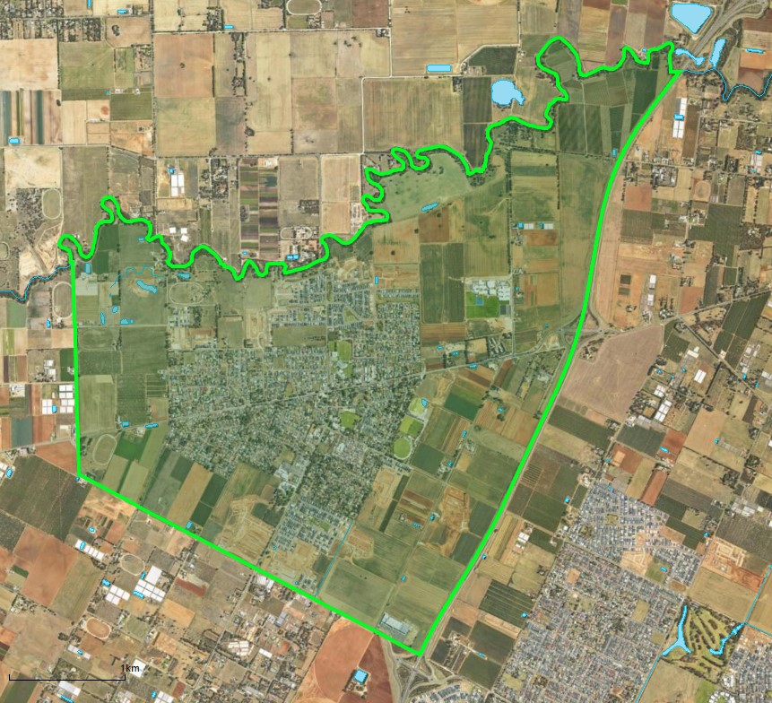
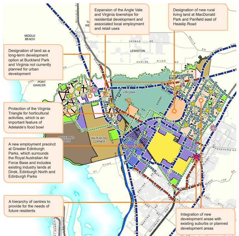
Angle Vale is approximately 14.1 square kilometres within the Playford City Council, located on the Adelaide Plains and forms part of the Greater Adelaide region in South Australia. Located 31 kilometres north of Adelaide CBD, the semi-rural township contains a central urbanised area, residential areas, parks, schools, shops and a local centre. The urbanised area is surrounded by rural land holdings and the agriculture industry.
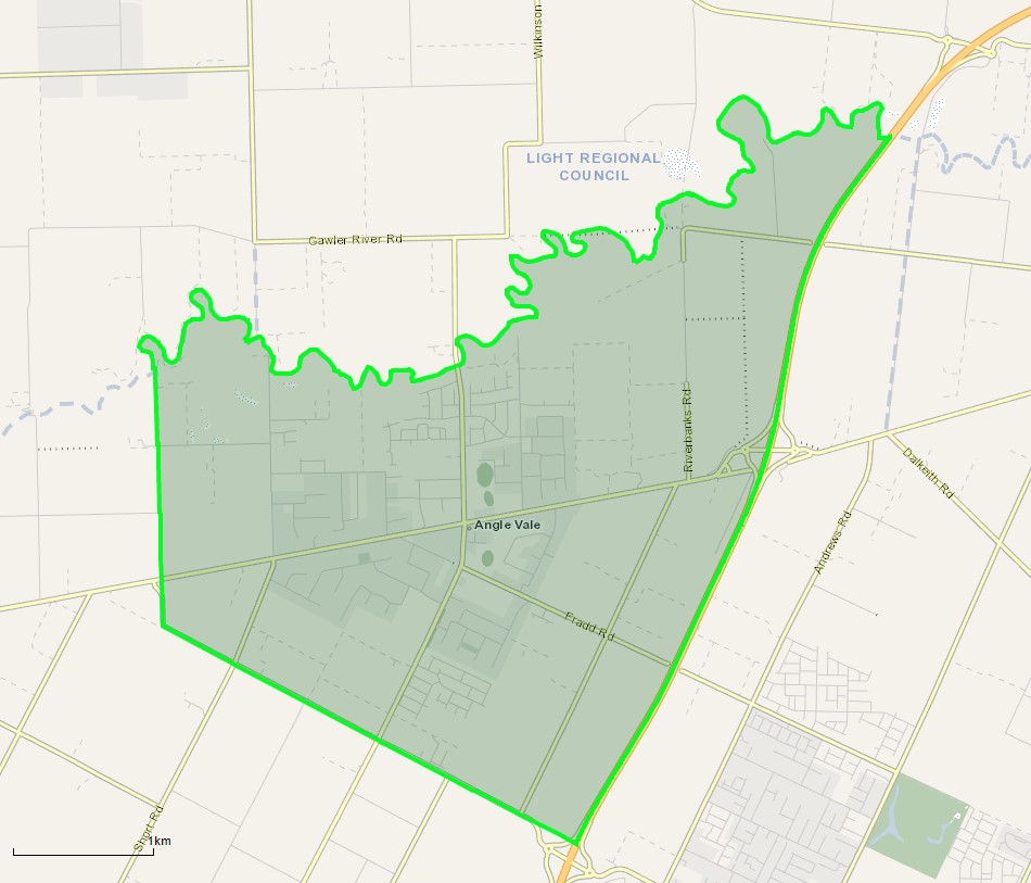
The suburb boundary is located along the Northern Expressway and Curtis Road to the south. The Gawler River is the entire northern boundary, McGee Road to the west and the Northern Expressway to the east.
A local road network is found throughout Angle Vale, providing access to the surrounding suburbs and the local network of roads. Heaslip Road provides north and south connections, while Angle Vale Road provides west and east connections through the centre of the suburb, linking to the major arterial road in proximity.
The urban area found in the centre of the suburb is zoned Master Planned Township zoning, with Rural Horticulture and Employment zones found to the east and west of the township.
The Master Planned Township zoning has been increased in size and renamed the Suburban Neighbourhood zoning under the Playford Urban Growth Areas Development Plan (amendment) declared by the Minister for Planning in January 2014.
The amendment provides limited areas for commercial, light industry and primary production zoning in Angle Vale, with most land dedicated to infill residential development. This is supported under the 30-Year Plan for Greater Adelaide prepared by the Department of Planning, Transport and Infrastructure for the South Australian State Government.
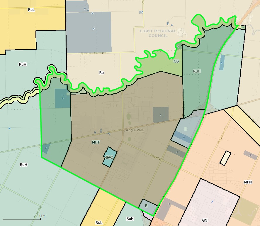
Development for urban purposes cannot proceed for land bounded by Heaslip Road, Chivell Road and the Harris Road alignment until a levee is installed to protect potential flooding from the Gawler River. Furthermore, noise attenuation walls are recommended to be provided adjacent to the Expressway before residential are developed to protect the amenity.
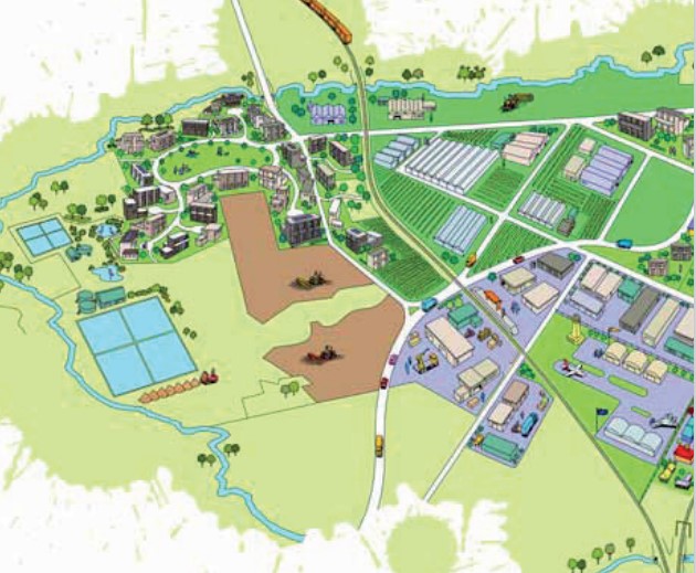
Angle Vale will be transformed into a low and medium density residential walkable neighbourhood that builds on the established neighbourhood activity centres. The growth areas will provide active public spaces and providing equitable access to public open spaces, shops, education facilities (new and existing) and provide a range of community services.
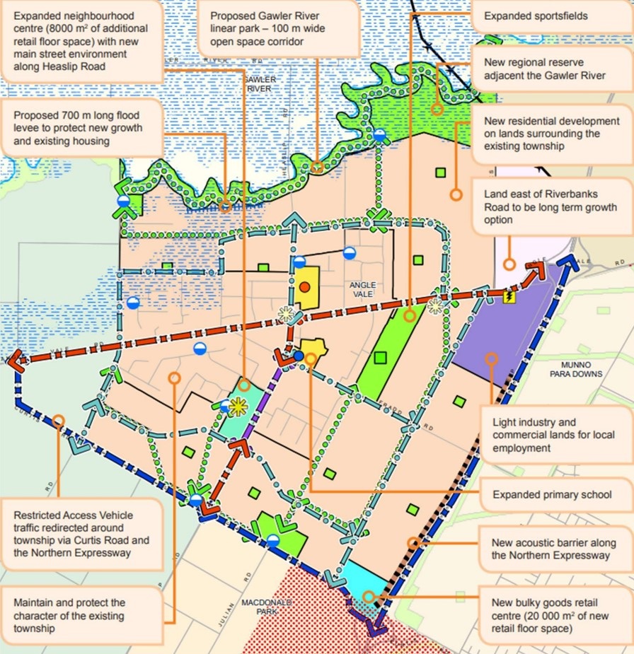
Further objectives include:
- Provision of medium density residential development adjacent to activity centres, public transport stops and public open space.
- Local and neighbourhood activity centres that provide a range of shopping, community, business and recreational facilities for the surrounding neighbourhood.
- The orderly expansion or intensification of urban areas to support the effective and economic provision of public infrastructure and community services.
- Sustainable development outcomes through innovation in stormwater management, waste minimisation, water conservation, energy efficiency and urban biodiversity.
Playford Urban Growth Area of Angle Vale
Angle Vale forms the outer northern area of Playford City Council Growth Area and is part of the region plan for the Greater Adelaide Region. The plan for the next 30 years is the revitalisation of existing neighbourhoods, concentrated new development around transit corridors, and proposed new mixed-use precincts to bring jobs, services and public transport closer to where people live. Changes are illustrated below in the growth structure plan.
Greater Adelaide Region Growth Area
The population growth in the Greater Adelaide Region area will be 1.97 million people by 2045, which is expected to require a housing growth of 248,000 dwellings. The planning priorities and actions for improving the liveability of residents, a competitive and sustainable region are set down in the 30-Year Plan For Greater Adelaide, 2017 update.
The growth areas will create the opportunity to reduce urban sprawl to the north and south of the elongated metropolitan footprint and the use of urban renewal projects is encouraged to find new spaces and places to live. The City Shape 2043 provides a basis for ongoing discussion with the community about the changing shape of Playford as it grows.
Playford Vision
“Playford is the City of Opportunity, supporting the community’s hopes and aspirations to be vibrant, thriving and sustainable. It provides an enviable lifestyle that is connected, healthy, happy, ambitious and proud, where each individual can take advantage of the many opportunities offered, making the City prosperous, liveable and happy.”
Angle Vale Suburb Summary
References
- Angle Vale – SA State Government
- Playford Community Vision 2043
- Angle Vale – Development Control Plan - Amendment
- Playford Growth Area Structure Plan December 2013
- Google Streetview and Aerial