
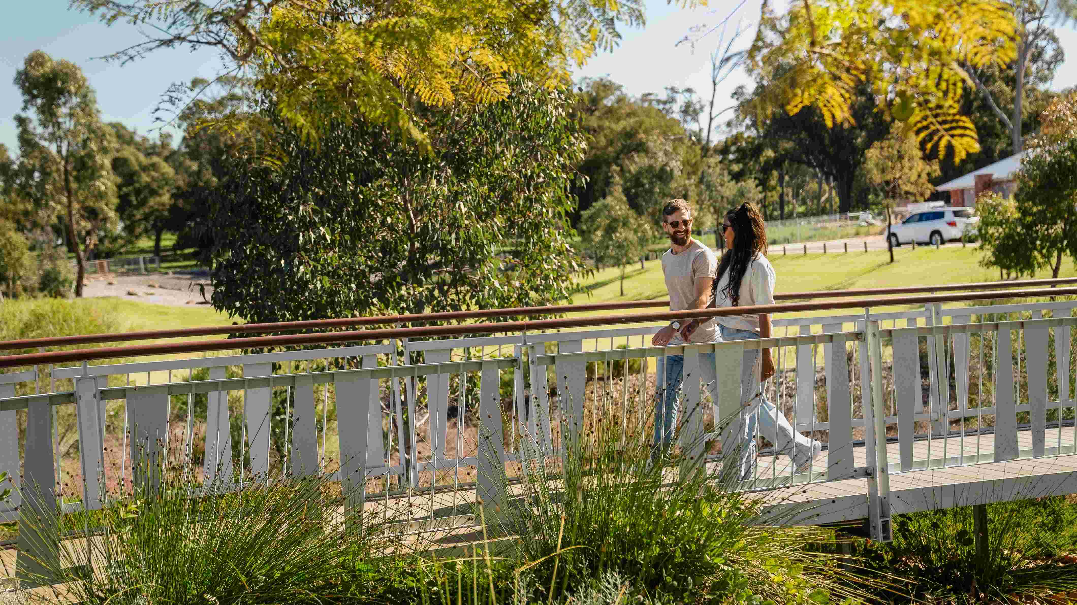
Baldivis Grove Estate - Baldivis SOLD OUT
Vacant land
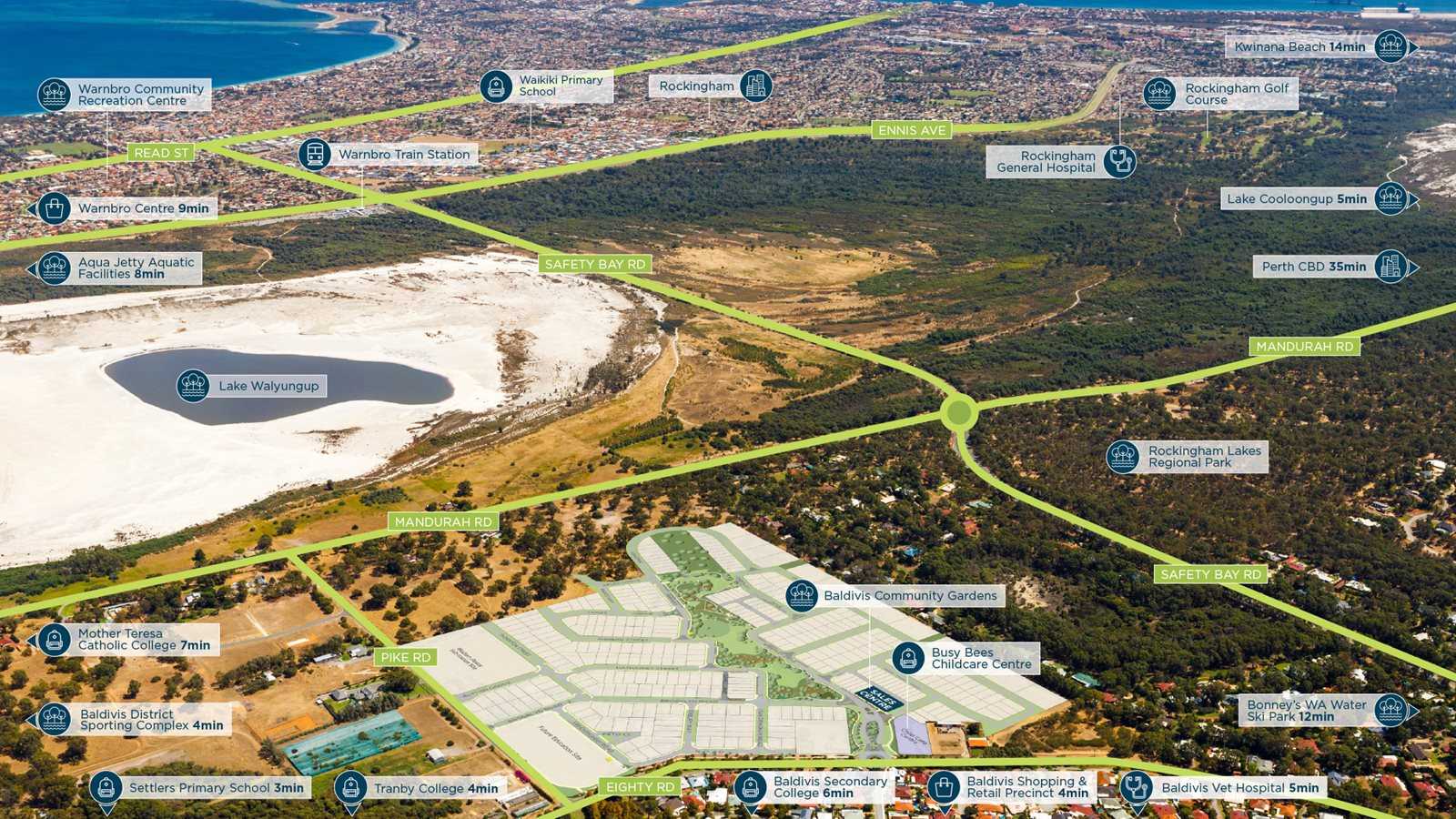
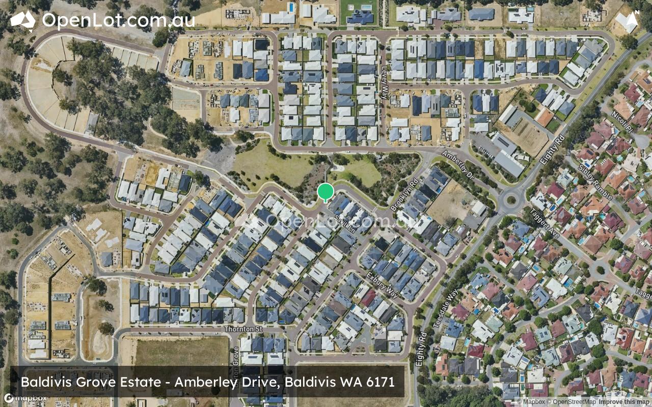
Amberley Drive, Baldivis WA 6171
- Currently Sold Out! Register your interest for future releases.
- Minutes to the Baldivis Town Centre
- Busy Bees Childcare already established within the community
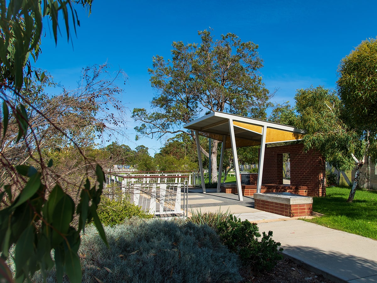
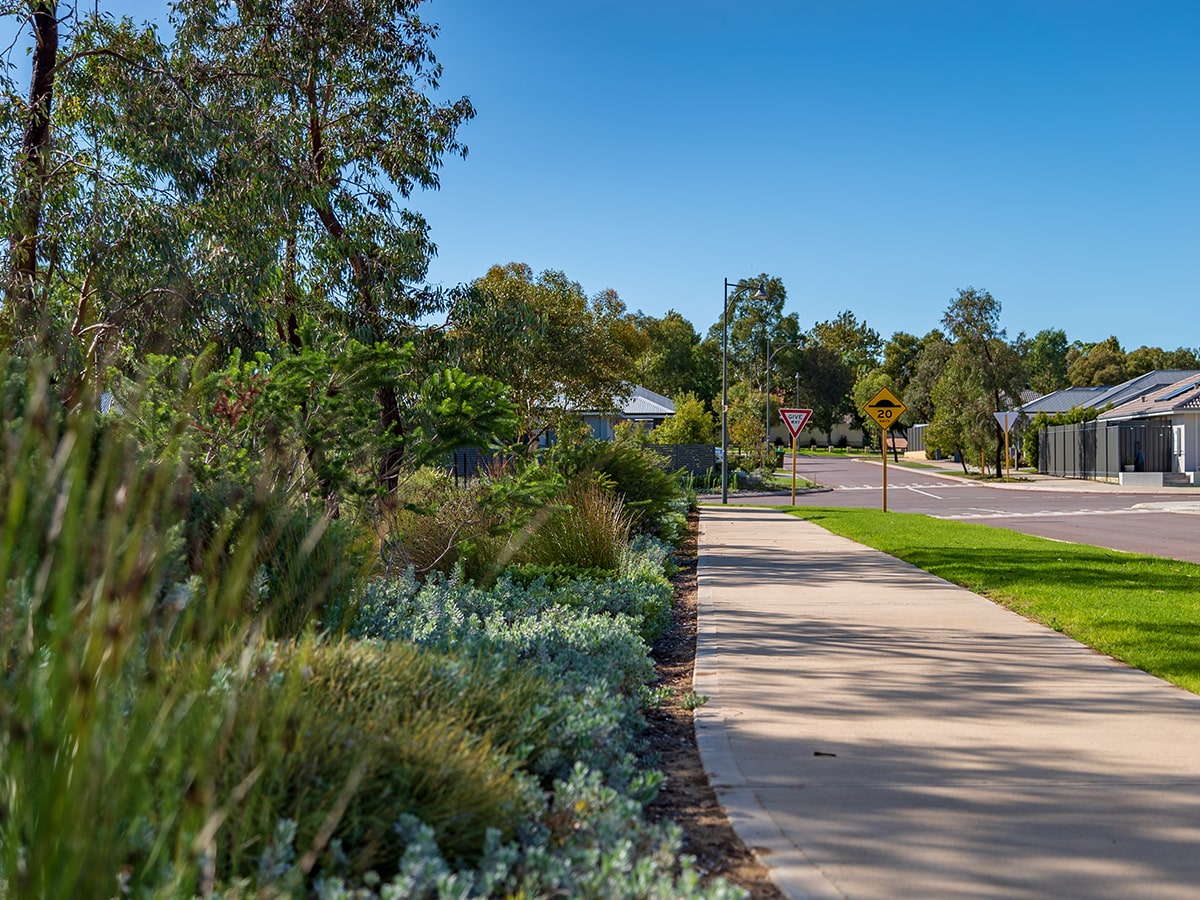
- Huge central landscaped parklands
The information provided in relation to this development has been obtained from publicly available sources and has not been verified or in any way endorsed by the developer. OpenLot.com.au has not been authorised by the developer to market this land estate on behalf of the developer or the vendors or any other third party.
If you're the developer or authorised agent, contact us now to activate your project.
This information is estimated by the OpenLot research team. Let us know here to provide up-to-date information about this development.
| Total new homes | N/A |
| Area size | N/A |
| Growth Region | Perth South West Growth Areas |
| City council | Rockingham City Council |
| Developer | N/A |
Land for Sale:
Land Lots in Baldivis Grove Estate - Baldivis
Popular Estates near Baldivis Grove Estate - Baldivis


Updates for Baldivis Grove Estate - Baldivis
Location & Map for Baldivis Grove Estate - Baldivis
Vacancy Rate in Baldivis WA 6171
View full vacancy rate history in Baldivis WA 6171 via SQM Research.
Schools near Baldivis Grove Estate - Baldivis
Here are 6 schools near Baldivis Grove Estate - Baldivis:
PP-12 Independent Combined School
K-6 Government Primary School
K-6 Government Primary School
K-6 Government Primary School
7-12 Government Secondary School
PP-6 Independent Primary School
Suburb Planning Review in Baldivis WA 6171
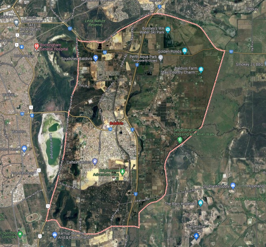
Baldivis is a local town of approximately 37.9 square kilometres in area, forming part of the southern coastal region of Perth that is located 87.3 kilometres in size. The township is located east of the Waikiki and Warnbro coastal townships divided by both Cooloongup and Walyungup Lakes. The centre of the suburb contains an urbanised area, local centres (commercial and retail), large residential areas, parks and schools.
The urbanised area forms part of the City of Rockingham local government area. For the most part, the suburb is half covered in rural residential and farming land with the Kwinana Freeway separating the increased density of residential housing.
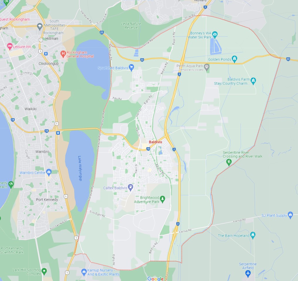
The suburb boundary is located along Stakehill Road to the south, Millar Road Way to the north and Mandurah Road to the west. The Serpentine River and a thin irrigation channel make up the entire eastern boundary.
A local road network is found throughout Baldivis, providing access to the surrounding suburbs and the local network of roads. Safety Bay Road and Mundijong Road provide connections to the coastline to the west. Mundijong Road and Karnup Road provide connections to the east to the north of the suburb. The Kwinana Freeway runs through the centre of the suburb, providing a north and south connection, providing the main major arterial road to Perth.
Baldivis township was named in the 1920s and was named after three transport ships that brought foreigners to settle in the area (BALranald, DIogenes and the JerVIS Bay). The land development in the area was supported in the 1990s, when the western portion of Baldivis was zoned for urban development for residential use.
In recent years, Baldivis, a once semi-rural suburb, has experienced rapid expansion, transforming it into one of the most sought-after residential areas south of the river. Situated within the City of Rockingham, the majority of Baldivis' population resides in its northern region, and this growth is expected to persist.
The town centre of Baldivis has evolved with the suburb's swift development. Now a bustling hub, this area features amenities such as the Stockland Baldivis shopping centre, medical facilities, a dental clinic, fitness centre, coffee shops, and the local pub known as The Chase. Additionally, noteworthy attractions include the Baldivis Nature Reserve, Baldivis Recreation Centre, and Bonney's WA Water Ski Park. Residents in the area have access to several local schools, including Baldivis Primary School, Settlers Primary School, and Tranby College.
Baldivis is a rapidly growing suburb located in the southern coastal region of Perth, Western Australia. The Rockingham City Council has been reviewing the planning documents that shape the growth and development that includes the Baldivis area. It is designated as a "growth area" by the Western Australian Planning Commission due to its significant potential for future development and expansion.
Perth and Peel Growth Areas
Growth Areas Perth and Peel (GAPP) represents an alliance of eleven suburban councils in the Perth and Peel regions. These councils have consistently championed the need for increased availability of public open spaces and the development of local sports facilities. They include the City of Rockingham.
GAPP's primary objective is to secure up to $350 million in federal funding for a dedicated account, a fund that would also attract supplementary investments from the State Government, Local Government, and development contribution programs.
With a maximum allocation of $30 million for any single project, these funds would be adequate to develop as many as 12 major sports precincts spanning the 11 suburban local government areas within the next four to eight years. Once these facilities are established, they will be operated and maintained by the respective Local Governments.
What Are the Advantages
- Increased Opportunities for Sports and Healthy Lifestyles:
- Enhanced access to sports facilities promotes physical activity and healthier living.
- Reduction in Obesity Rates:
- The availability of these sports precincts can contribute to lowering obesity rates through increased physical activity.
- Mitigation of Other Lifestyle Issues and Risks:
- These developments can help address various lifestyle-related issues and risks, fostering healthier and safer communities.
- Job Creation:
- The project would stimulate job opportunities, benefiting the local economy.
- Enhanced Livability and Appeal of Perth's Suburban Areas:
- The presence of modern sports facilities enhances the overall quality of life and attractiveness of Perth's suburban regions.
Projects in Baldivis
Under this initiative, the Baldivis District Sporting Complex will be built as there are no facilities at the district level within the City of Rockingham. The existing local facilities fall short in terms of providing adequate public open space for the expanding population.
The City of Rockingham is experiencing the swiftest population growth in the southern metropolitan region, ranging from four to five per cent. Over the next decade, an additional 40,000 residents will join the community, bringing the total population to 179,000. Given the projected continued growth in the area, it is imperative to ensure that the necessary infrastructure is in place to provide sports and recreational facilities for the local community.
Baldivis boasts a higher proportion of young families and children compared to the broader metropolitan area. Meeting the demand for sustainable sporting and recreational opportunities is crucial for the physical health and social development of residents in Baldivis and the surrounding areas of Rockingham.
The proposed facility will cover nearly 20 hectares and will be developed in three phases. It is designed to accommodate the growth of at least 20 new sporting clubs, offering a mix of indoor and outdoor facilities to serve the communities of Baldivis (both north and south), Warnbro, Port Kennedy, Golden Bay, and Singleton. Additionally, as the facility will cater to district-level sports, it will create opportunities for the broader Rockingham population and attract participants from across the metropolitan and Peel regions. The BSC site started in March 2020 and stage one was completed in 2022.

Rockingham: Shaping the City's Future
The development of a new Local Planning Strategy (LPS) is currently underway to steer the growth and development of the city over the next two decades and beyond. It also serves the purpose of safeguarding the aspects that the community holds in high regard. An LPS is a vital planning document that provides insight into future land use and the broader direction of the city.
It offers clarity not only to the community but also to the city and government decision-makers, guiding them to make decisions that align with the city's chosen path. Community participation is considered essential in influencing the city's future direction.
The commitment is to provide residents with ample opportunities to engage in the consultation process. The LPS will serve as the guiding framework for future planning and development endeavours, in harmony with Rockingham's collective vision of becoming one of the nation's safest, most liveable, and sustainable cities.
Rockingham Strategic Centre Planning Framework
This comprehensive review has spanned several years and carefully examined the challenges and opportunities associated with new development, redevelopment, and infill development within the Strategic Centre. It also focuses on enhancements to the existing planning framework.
The publicly advertised draft local planning framework, available for review from May 3, 2023, to July 3, 2023, consists of two key components:
- The Rockingham Strategic Centre Precinct Structure Plan (RSCPSP): This plan is designed to coordinate future subdivision, zoning, and development within the Rockingham Strategic Centre (RSC).
- Amendment No. 191 to Town Planning Scheme No. 2: This amendment aims to facilitate the implementation of the RSCPSP and outline the associated land use and development requirements.
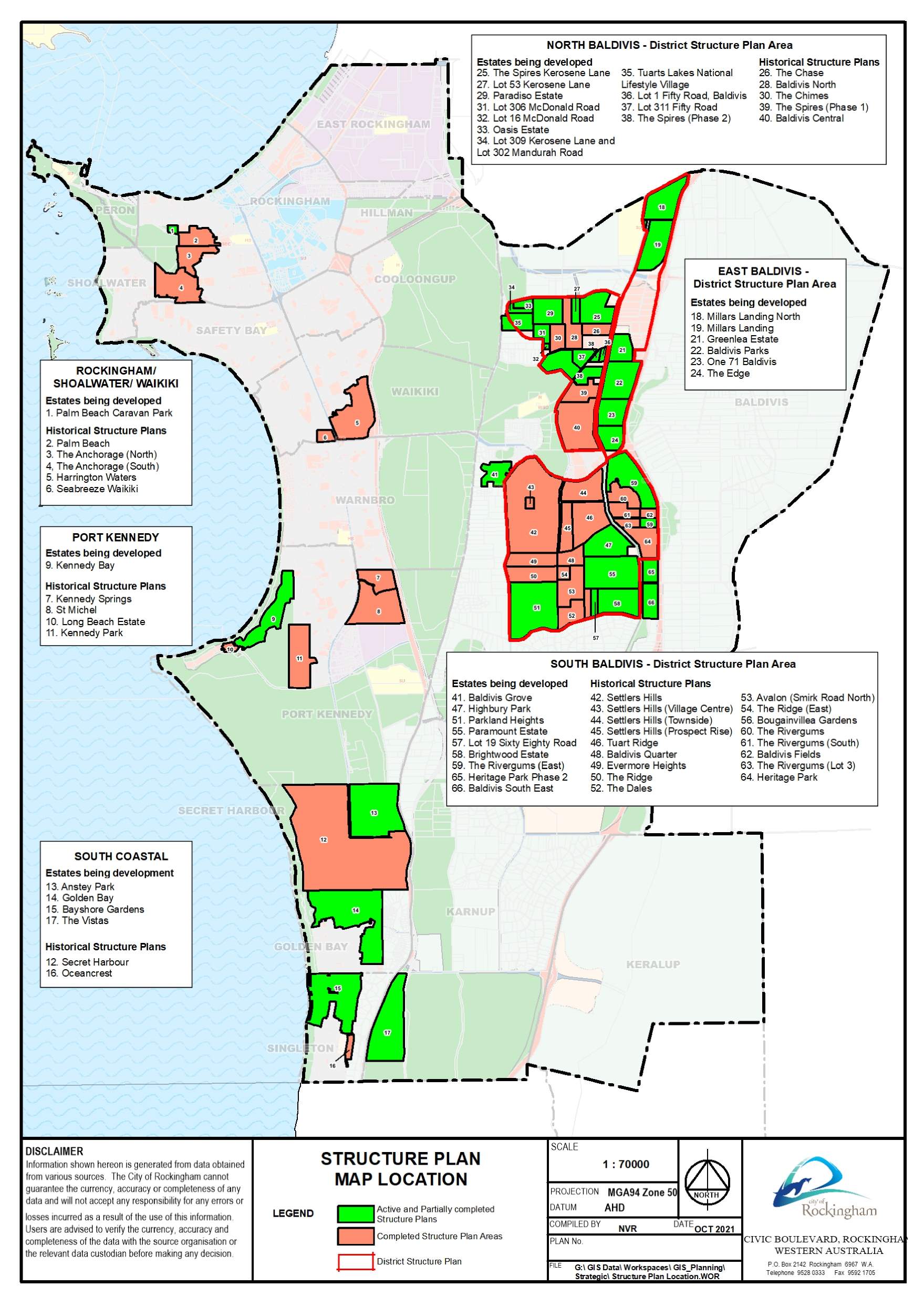
Structure Plans
The Council has embraced District Structure Plans for extensive regions earmarked for forthcoming urban expansion, involving various landowners. These plans serve the crucial role of ensuring that development unfolds in a coordinated manner across these properties by designating essential infrastructure elements, including major road networks, commercial centres, and regional open spaces.
In relation to Baldivis, the following are of interest:
- North Baldivis District Structure Plan
- South Baldivis District Structure Plan
- East Baldivis District Structure Plan.
The Perth and Peel @ 3.5million
The frameworks aim to accommodate 3.5 million people by 2050 by creating vibrant communities within a compact and connected city; making best use of existing and proposed infrastructure; and protecting important environmental assets.
The framework encourages significantly greater infill development with almost half of the required 800,000 new homes – 380,000 at a minimum - to be built through infill development. The majority of these – around 214,000 – will be built in existing suburbs within the Central sub-region and particularly through alignment with the new METRONET rail project.
The South Metropolitan Peel sub-region report, produced by the Western Australian Planning Commission, indicates that a significant portion of future development will take place on land already designated for urban use. This encompasses ongoing development between Kwinana-Rockingham and Mandurah-Pinjarra, as well as within emerging urban zones throughout the sub-region, including Byford and Mundijong.
In alignment with the planning principle established in the 1999 Coastal and Lakelands Planning Strategy, urban development will not extend south of a demarcation line stretching from Dawesville to Pinjarra. Furthermore, the framework designates specific limited areas in Jandakot/Treeby, Langford, Cardup, Mangles Bay, the Pinjarra-Ravenswood sector, and east of Kwinana for further planning investigation.
A significant focus of future urban development will be situated in the Baldivis-Karnup area.


Baldivis Suburb Summary
References
The Rockingham Strategic Community Plan 2023-2033
City of Rockingham planning information
North Baldivis District Structure Plan
North Baldivis District Structure Plan Report
South Baldivis District Structure Plan
Baldivis – Perth and Peel @ 3.5 million - WA Planning Submission
Google Streetview and Aerial
Reviews & Comments on Baldivis Grove Estate - Baldivis
Estate Brochure, Masterplan, Engineering Plan, Plan of Subdivision (POS), Design Guidelines
FAQs about Baldivis Grove Estate - Baldivis
- Tranby College - 973m south-east
- Settlers Primary School - 1.3km south
- Makybe Rise Primary School - 2.3km south-east
- Tuart Rise Primary School - 2.9km south-east
- Baldivis Secondary College - 3.0km east
- Rockingham John Calvin School - 3.0km north
Popular Estates near Baldivis Grove Estate - Baldivis
Latest New Home Articles for You

09/Mar/2026 | OpenLot.com.au
Victoria: Top 30 Most Searched Housing Developments (February 2026)
If you’ve been exploring housing opportunities in Victoria, February 2026...

20/Feb/2026 | OpenLot.com.au
Display Homes at Drouin Fields Estate: A Thriving Community in Drouin
Welcome to Drouin Fields, a place where beauty, space, and modern luxury ...

19/Feb/2026 | OpenLot.com.au
Display Homes at Manor Lakes Esate: A Thriving Waterside Community in Manor Lakes
A place where you can settle in, rather than just settle down. Named for ...

13/Feb/2026 | OpenLot.com.au
🏠 Victoria: Top 30 Most Searched Townhouse Developments – January 2026

11/Feb/2026 | OpenLot.com.au
🏡 Top 30 Most Searched Estates by State - January 2026

10/Feb/2026 | OpenLot.com.au
Victoria: Top 30 Most Searched Housing Developments (January 2026)
If you’ve been considering making a move in Victoria, January 2026 offere...

10/Feb/2026 | OpenLot.com.au
Queensland: Top 30 Most Searched Housing Developments (January 2026)
If you’ve been considering making a move in Queensland, January 2026 offe...

09/Feb/2026 | OpenLot.com.au
Western Australia: Top 30 Most Searched Housing Developments (January 2026)
If you’ve been considering making a move in Western Australia, January 20...

06/Feb/2026 | OpenLot.com.au
South Australia: Top 30 Most Searched Housing Developments (January 2026)
If you’ve been considering making a move in South Australia, January 2026...