


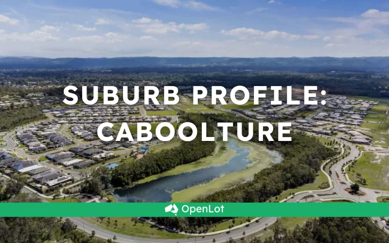
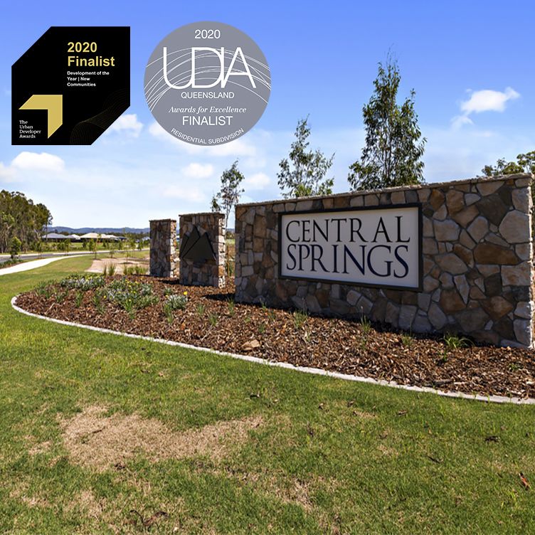
Central Springs Estate - Caboolture
[NEW RELEASE] NEW STAGE JUST LISTED!!
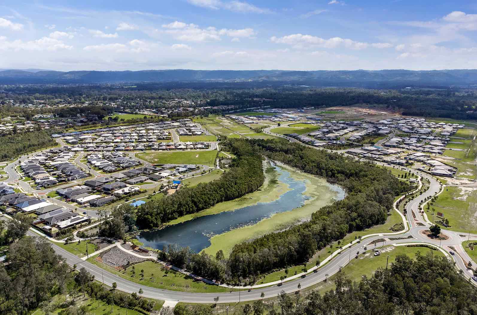
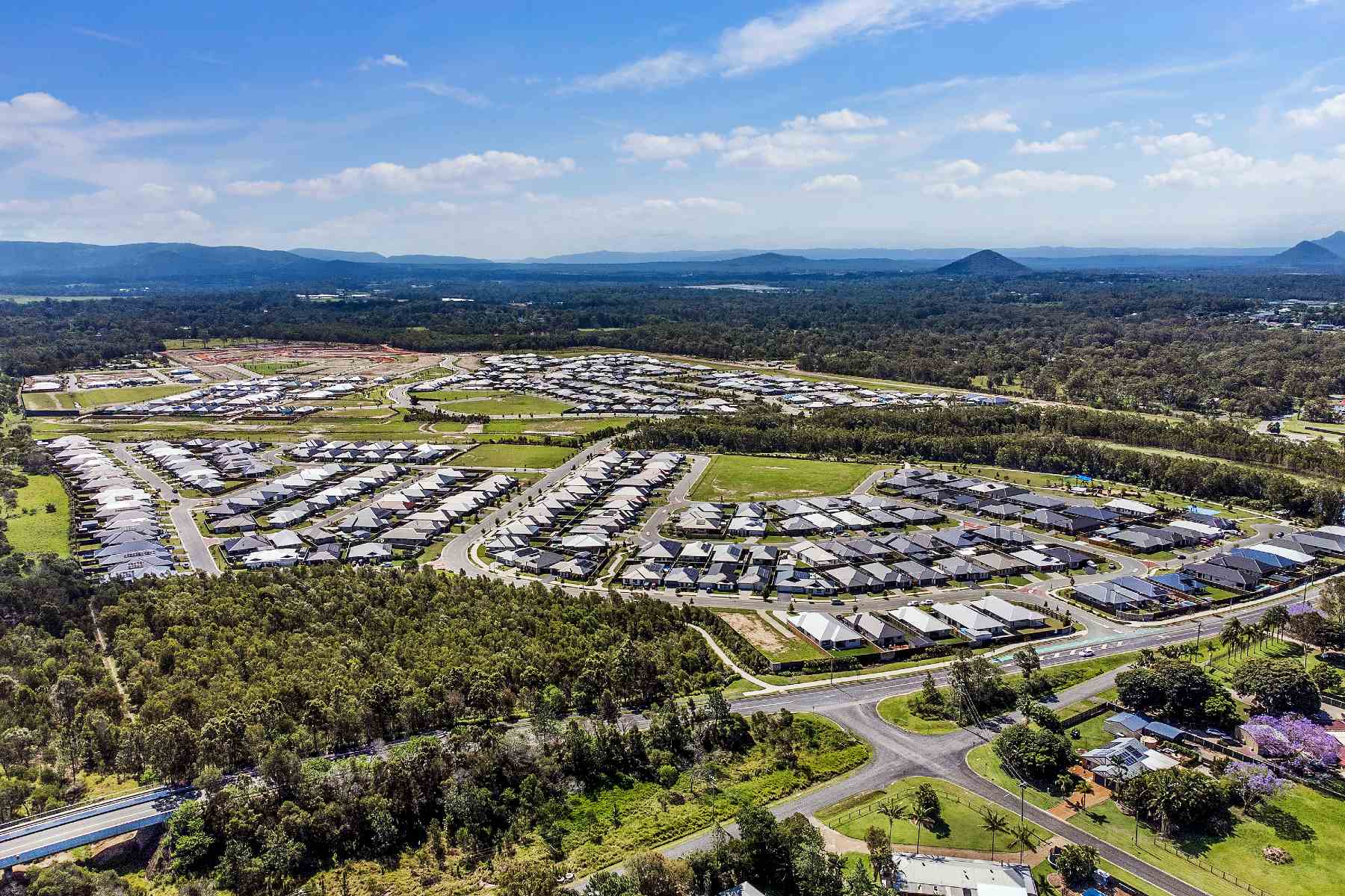
- Largest master planned community in the region
- Private, peaceful park front land release now selling
- Large 600sqm lots available with room for a shed
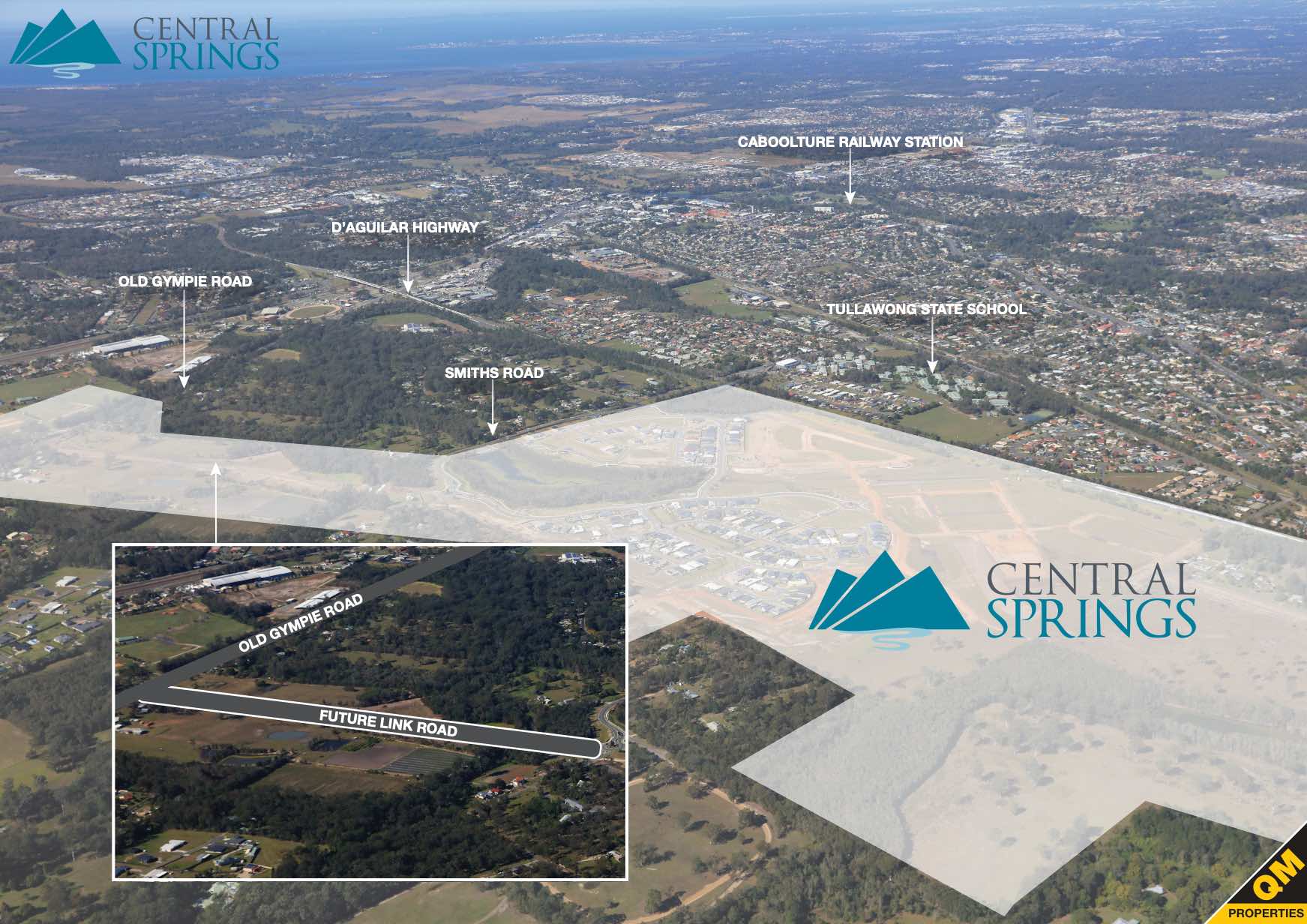
- The Central Lakes Shopping Village and major transport hubs are only minutes away
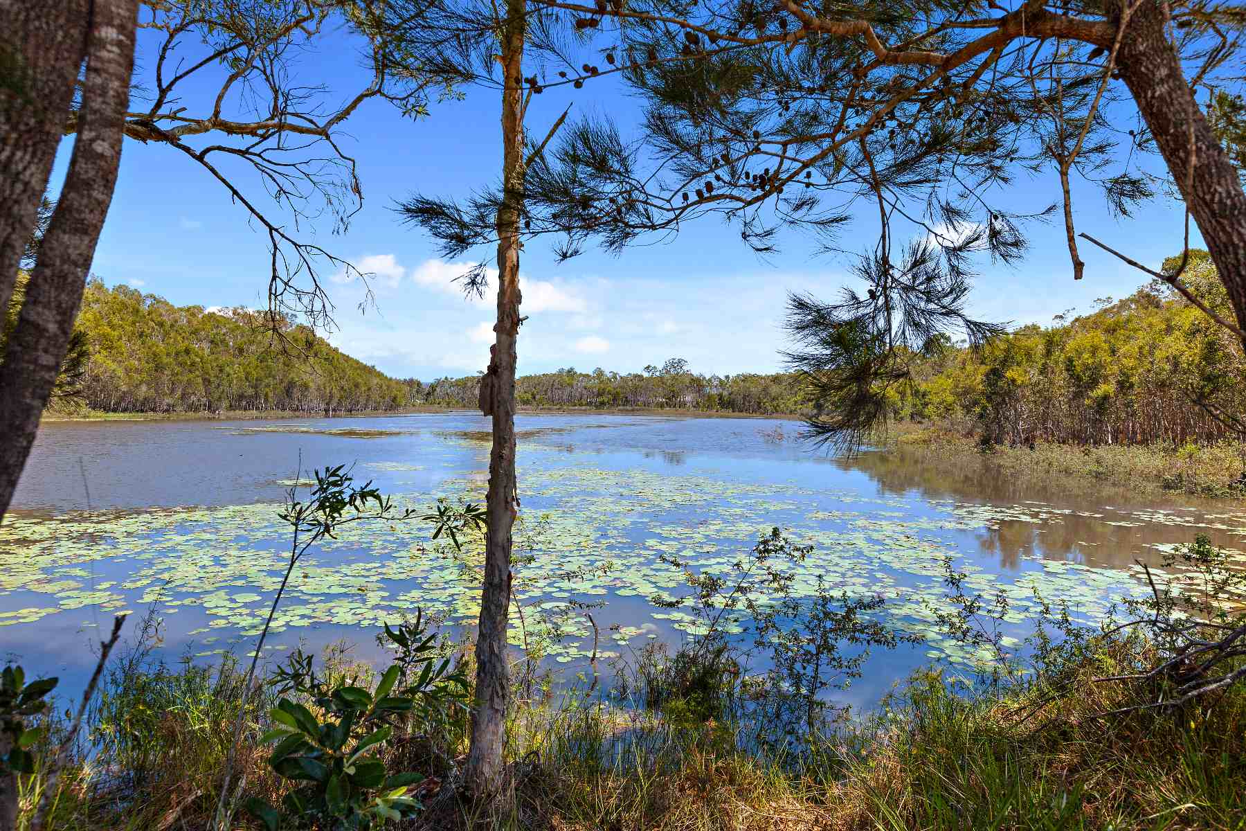
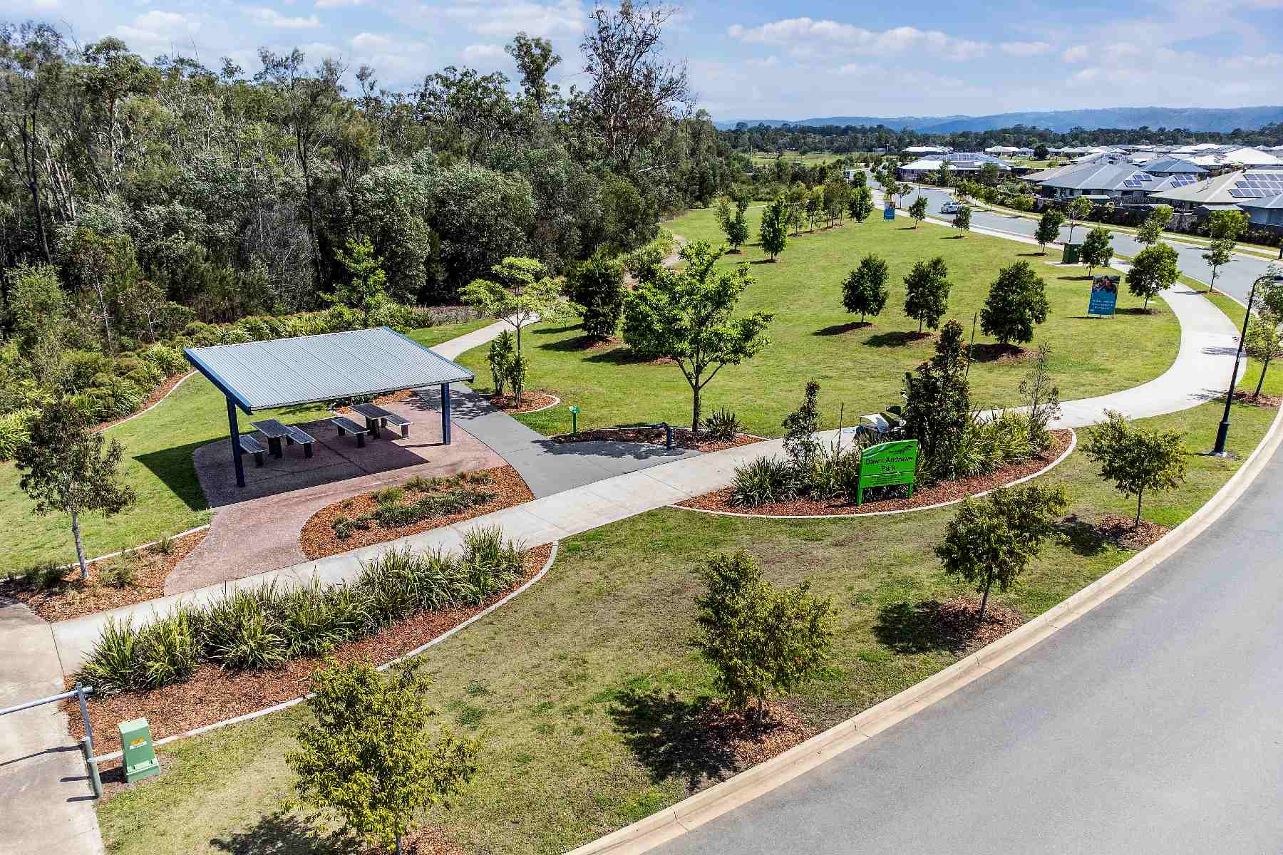
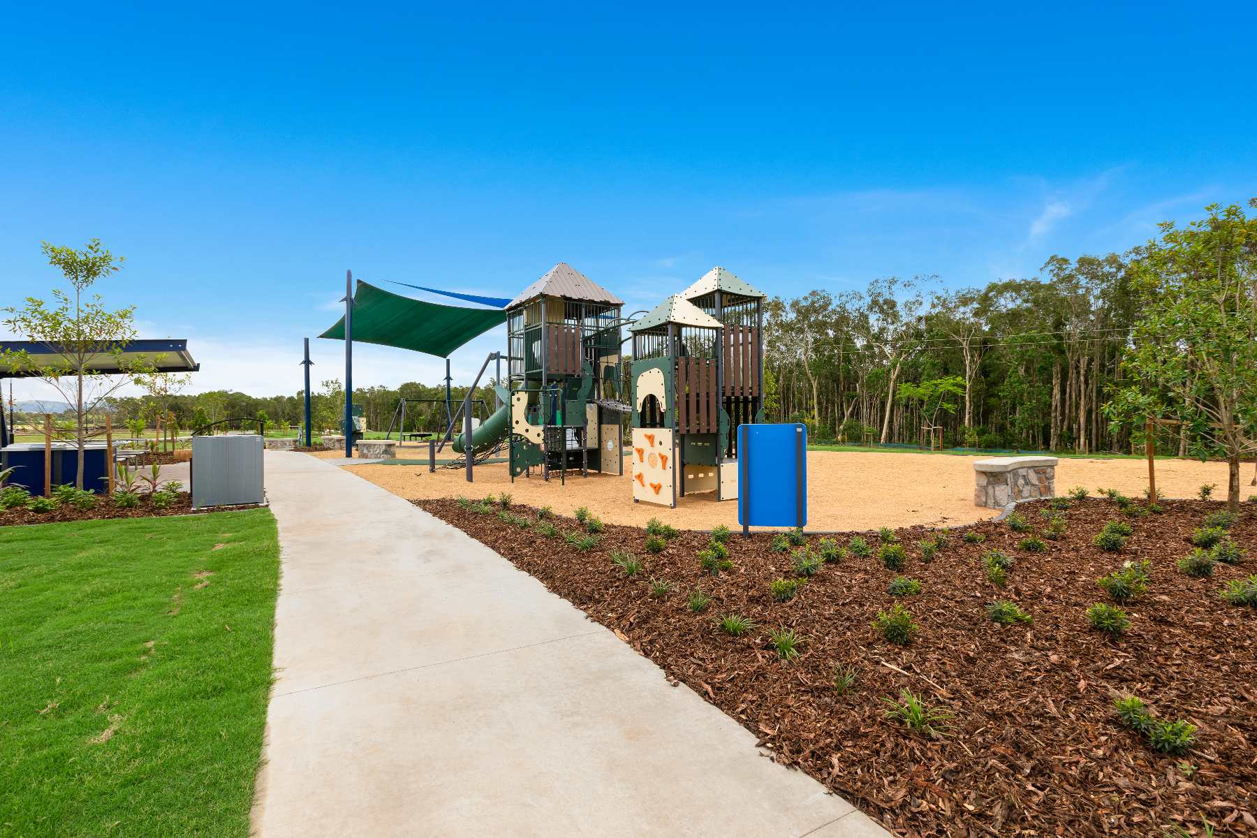
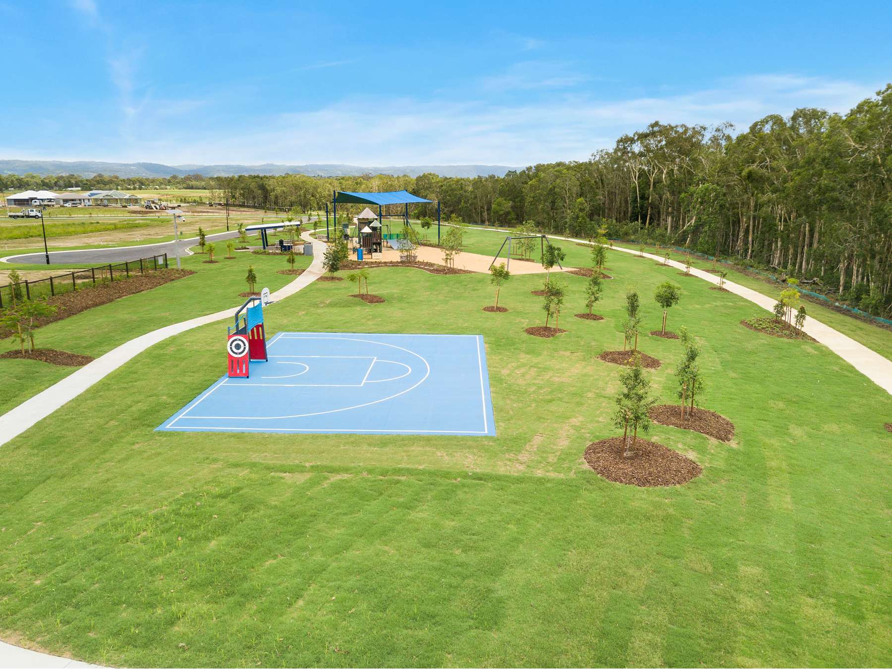
- Plenty of green open spaces, recreational areas and a central four hectare lake
- Large family park with playground equipment, two 30 metre flying foxes, climbing platforms, slides, swings, basketball courts, picnic tables and barbecues
This information is estimated by the OpenLot research team. Let us know here to provide up-to-date information about this development.
| Total new homes | 900 |
| Area size | N/A |
| Growth Region | Greater Brisbane Growth Areas |
| City council | Moreton Bay Regional Council |
| Developer | QM Properties |
| Distance to | Brisbane Airport - 42 km north-west Brisbane CBD - 46 km north |
Land for Sale, House and Land Packages:
Popular Estates near Central Springs Estate - Caboolture


Updates for Central Springs Estate - Caboolture
Facebook updates:
Related news:
Caboolture is approximately 68.7 square kilometres within the City of Moreton Bay, forming the northernmost urban area of the greater Brisbane metropolitan region within South East Queensland, located 44 kilometres north of Brisbane and south of the Beerburrum East State Forest.
Central Springs is a master planned community situated between the Sunshine Coast and Brisbane CBD. Enjoy a more relaxed lifestyle at Central Springs!
Missing articles? Send us a link here.
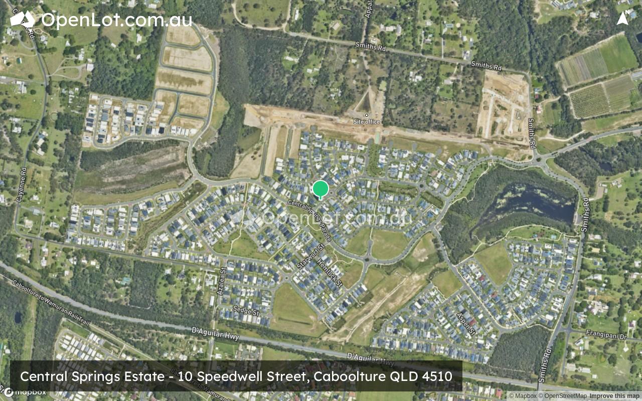
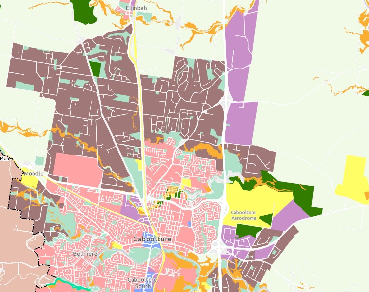
Location & Map for Central Springs Estate - Caboolture
Visit Display Homes near Central Springs Estate - Caboolture


Vacancy Rate in Caboolture QLD 4510
View full vacancy rate history in Caboolture QLD 4510 via SQM Research.
Schools near Central Springs Estate - Caboolture
Here are 6 schools near Central Springs Estate - Caboolture:
7-12 Government Secondary School
Prep-6 Government Primary School
Prep-6 Independent Primary School
Prep-6 Independent Primary School
7-12 Independent Secondary School - School Head Campus
Prep-12 Independent Combined School - School Head Campus
Suburb Planning Review in Caboolture QLD 4510
Caboolture is approximately 68.7 square kilometres within the City of Moreton Bay, forming the northernmost urban area of the greater Brisbane metropolitan region within South East Queensland, located 44 kilometres north of Brisbane and south of the Beerburrum East State Forest.
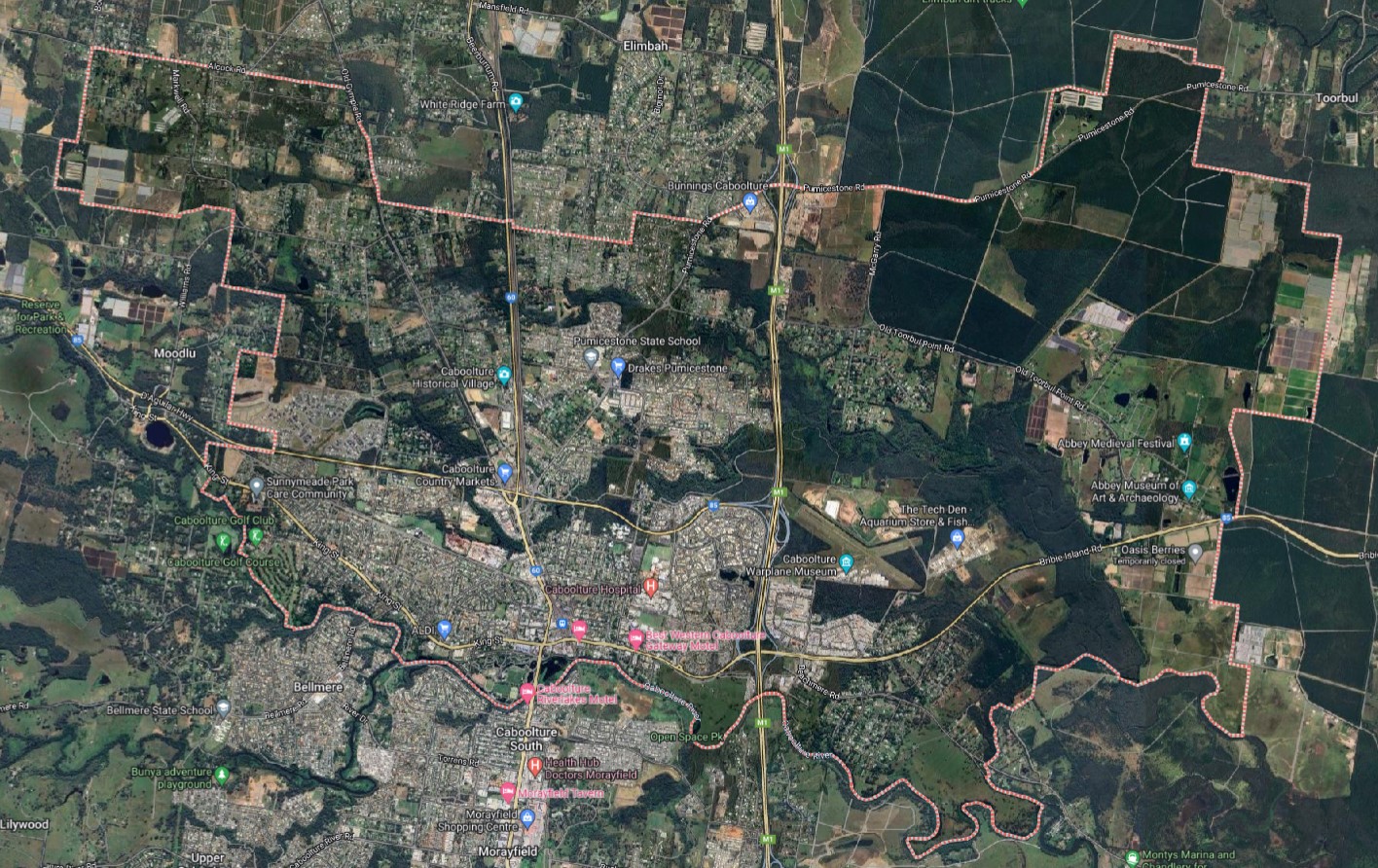
The suburb boundary is located along Boden Road and property boundaries to the west and the Caboolture River along the entire southern boundary. Hume Road, Saint Road, McGrath Road, and property boundaries make up the eastern boundary. Alcock Road, Field Road, Old Gympie Road, Kilby Road, Emu Road, Pumicestone Road, Simpson Road, Steffenn Road and property boundaries make up the northern boundary.
Beerburrums Road, Morayfield Saint Road, Old Gympie Road and Pumicestone Road provide local road access (north to south) and connect the local road network found throughout Caboolture. The Bruce Highway (M1) traverses through Caboolture centre, segregating east-west connections through the area and provides three interchanges in the Caboolture area.
The northern and southern M1 interchanges allow connections in an eastern direction but also provide direct access for anyone travelling through the region via the M1. Bribie Island Road and Pumicestone Road provide access to the bayside settlements past east Caboolture and Bribie Island. The D’Aguilar highway and King Street are to the west of the two southern interchanges providing local access and the next townships to the west.
The suburb of Caboolture provides a mix of land uses, with the eastern portion undeveloped and made up of forest, rural living properties and a vegetated waterway corridor of King John Creek. Caboolture has a large business district, dense urban development to the southern portion a major train station, recreational areas, natural watercourses, and proximity to national parks. New urban development is occurring in the north and west portions of the suburb along major transport corridors. A new city is planned to the south-west of the Caboolture CBD, which has been labelled Caboolture West and Caboolture North has been expressed as a Potential Future Growth Area.

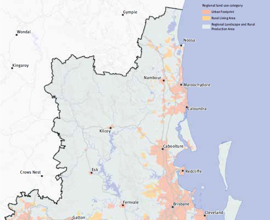
SEQ Regional Plan 2009–2031
The South East Queensland Regional Plan 2017, also known as ShapingSEQ is a regional plan for South East Queensland (SEQ), Australia and includes Central Coast Regional Council (urban extent only).
It is a long-term strategic plan that guides land use and development in the region. Developed by the Queensland Government, ShapingSEQ is intended to support sustainable growth and development while protecting the region's natural and cultural heritage. The plan includes policies and guidelines on land use, infrastructure, transport, environment, and economic development.
The plan identifies priority growth areas and development corridors, and sets targets for population growth and housing supply in the region. It also includes strategies for managing urban sprawl, protecting natural resources and biodiversity, and addressing climate change impacts.
The plan also lays out the vision for the region in 2041 which includes a liveable, sustainable, and prosperous region, with a focus on protecting the environment and encouraging sustainable development, as well as improving connectivity and accessibility throughout the region. ShapingSEQ provides a regional framework for growth management and sets the planning direction for sustainable growth, global economic competitiveness, and high-quality living by:
- identifying a long-term sustainable pattern of development which focuses more on growth in existing urban areas
- harnessing regional economic strengths and clusters to compete globally
- ensuring land use and infrastructure planning are integrated
- valuing and protecting the natural environment, productive land, resources, landscapes, and cultural heritage
- promoting more choice of housing and lifestyle options
- locating people and jobs closer together, and moving people and goods more efficiently and reliably
- promoting vibrant, fair, healthy, and affordable living and housing to meet all the community's needs
- valuing design and embracing the climate to create high-quality living environments
- maximising the use of existing infrastructure and planning for smarter solutions for new infrastructure
- supporting strong rural communities and economic diversification.

Regional Growth Management Strategy 2042
The Growth Management Strategy 2042 provides a roadmap for sustainable growth in the region over the next 20 years, aligned with the 'Our Well-Planned Places' goal of the Corporate Plan 2022-2027. It outlines strategic priorities, policies, and actions for short, medium, and long-term outcomes, with a focus on monitoring progress. As one of six central council strategies, it ensures an integrated approach to planning, responding to the South East Queensland Regional Plan 2017. It builds on past achievements, addresses gaps, and responds to housing challenges while preserving local character. Neighbourhood planning and employment opportunities are emphasized, with collaboration being key to its success.

South East Queensland City Deal – Implementation Plan
The Australian Government, Queensland Government, and Council of Mayors (SEQ) are already delivering for local communities throughout South East Queensland. They are focused on commitments that meet four strategic outcomes: accelerating future jobs across SEQ; a faster, more connected SEQ region; a more liveable SEQ; and creating thriving communities for SEQ.
The SEQ City Deal agreement was signed on 21 March 2022 by the Australian Government, Queensland Government and Council of Mayors (SEQ). The accompanying Deal document sets out the vision, objectives, and commitments.
The SEQ City Deal Implementation Plan was released in July 2023 and provides details about how the Deal will be delivered, commitment milestones and funding arrangements. The document identifies the Moreton Bay Region council area as M (Growth Area Compact).
Caboolture West - Growth Area Compact
The new Caboolture West deal includes the commencement of the Caboolture West Interim Structure Plan on March 14, 2023. This plan establishes a regulatory framework for assessing and approving 13,000 new homes, covering roughly half of Caboolture West. The Australian Government, Queensland Government, and Moreton Bay Regional Council are collaborating to establish a Growth Area Compact for Caboolture West.
The Growth Area Compact aims to coordinate infrastructure development to support affordable housing options in the area. The Australian Government has committed a $100 million loan (in principle) for trunk communications infrastructure, while the Queensland Government and Moreton Bay Regional Council will invest in trunk infrastructure and overall area development. Key milestones include infrastructure planning, project selection, and construction, with future milestones subject to negotiation. Responsibility lies with the Queensland Government, with financial commitments totalling $210 million, including the loan. Engagement with the private sector for potential partnerships and funding support will also be pursued.

Moreton Bay Regional Council Planning Scheme
The council is responsible for ensuring adequate housing, facilities, infrastructure, and services for new residents and businesses. It sets the policy direction for regional growth through the Moreton Bay Regional Council Planning Scheme 2021, which came into effect on 12 December 2021.
This scheme serves as a local planning framework, incorporating state and regional policies while responding to local needs. The council regularly reviews and enhances the planning scheme to address emerging issues. Importantly, the scheme dictates permissible development, land use regulations, approval processes, expected outcomes, and criteria for assessment by the council.
Caboolture Suburb Summary
References
Moreton Bay Planning Scheme
South East Queensland City Deal – Implementation Plan
Regional Growth Management Strategy 2042
Reshaping our region’s planning
Reviews & Comments on Central Springs Estate - Caboolture
Estate Brochure, Masterplan, Engineering Plan, Plan of Subdivision (POS), Design Guidelines
FAQs about Central Springs Estate - Caboolture
View all estates from QM Properties
- Tullawong State High School - 1.0km south
- Tullawong State School - 1.1km south-east
- St Paul's Lutheran Primary School - 1.4km south-east
- Caboolture Montessori School - 1.4km north-east
- Alta-1 College - 1.9km south-east
- Australian Christian College - Moreton - 2.8km east
Popular Estates near Central Springs Estate - Caboolture
Latest New Home Articles for You

09/Mar/2026 | OpenLot.com.au
Victoria: Top 30 Most Searched Housing Developments (February 2026)
If you’ve been exploring housing opportunities in Victoria, February 2026...

20/Feb/2026 | OpenLot.com.au
Display Homes at Drouin Fields Estate: A Thriving Community in Drouin
Welcome to Drouin Fields, a place where beauty, space, and modern luxury ...

19/Feb/2026 | OpenLot.com.au
Display Homes at Manor Lakes Esate: A Thriving Waterside Community in Manor Lakes
A place where you can settle in, rather than just settle down. Named for ...

13/Feb/2026 | OpenLot.com.au
🏠 Victoria: Top 30 Most Searched Townhouse Developments – January 2026

11/Feb/2026 | OpenLot.com.au
🏡 Top 30 Most Searched Estates by State - January 2026

10/Feb/2026 | OpenLot.com.au
Victoria: Top 30 Most Searched Housing Developments (January 2026)
If you’ve been considering making a move in Victoria, January 2026 offere...

10/Feb/2026 | OpenLot.com.au
Queensland: Top 30 Most Searched Housing Developments (January 2026)
If you’ve been considering making a move in Queensland, January 2026 offe...

09/Feb/2026 | OpenLot.com.au
Western Australia: Top 30 Most Searched Housing Developments (January 2026)
If you’ve been considering making a move in Western Australia, January 20...

06/Feb/2026 | OpenLot.com.au
South Australia: Top 30 Most Searched Housing Developments (January 2026)
If you’ve been considering making a move in South Australia, January 2026...