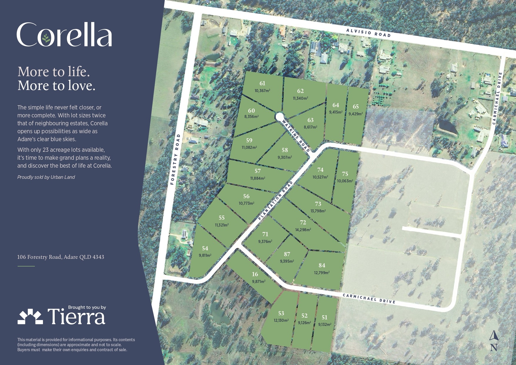
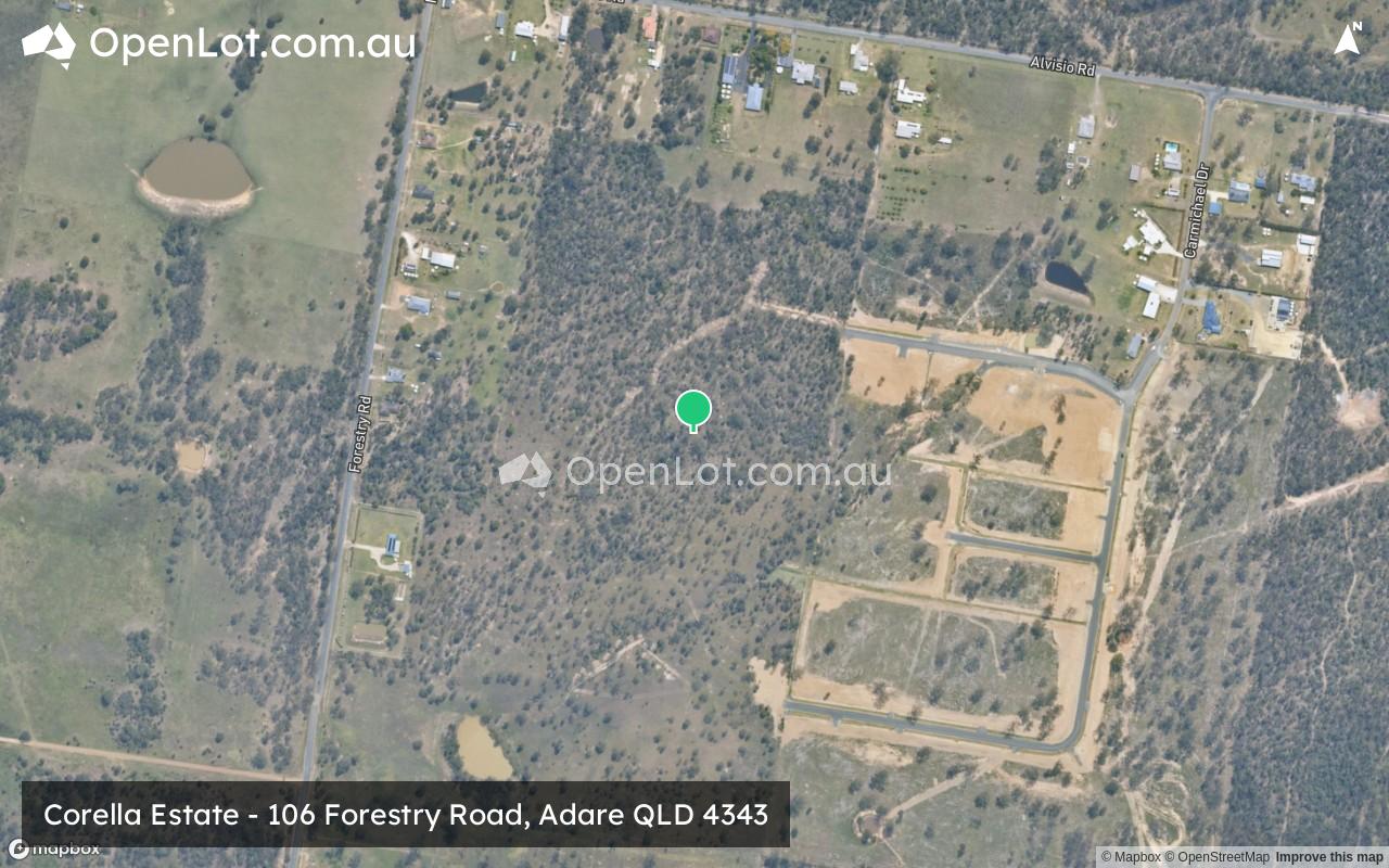
Corella Estate - Adare
This information is estimated by the OpenLot research team. Let us know here to provide up-to-date information about this development.
| Total new homes | 23 |
| Area size | 26.71 hectares |
| City council | Lockyer Valley Regional Council |
| Developer | Tierra Group |
| Project marketer | The Urban Land Queensland |
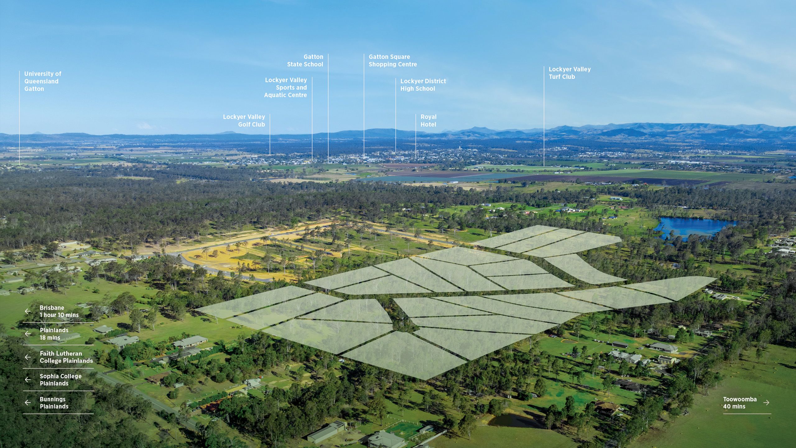
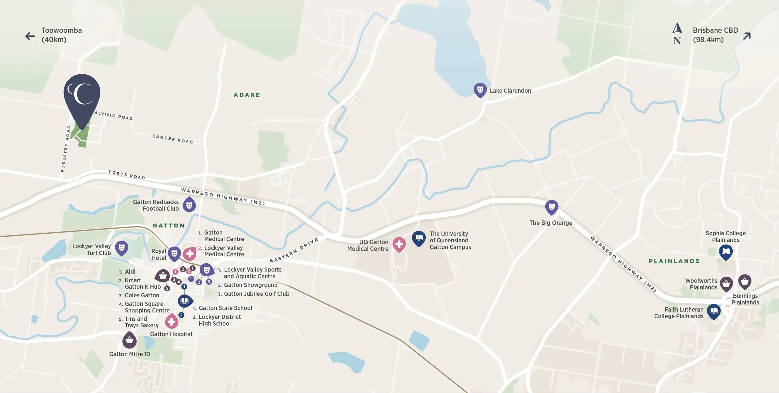
| Distance to | Brisbane CBD - 76 km west |
Land for Sale:
Popular Estates near Corella Estate - Adare


 4
4
 2
2
 2
2


Updates for Corella Estate - Adare
Facebook updates:
Related news:

Missing articles? Send us a link here.
Location & Map for Corella Estate - Adare
Schools near Corella Estate - Adare
Here are 6 schools near Corella Estate - Adare:
Prep-6 Catholic Primary School
Prep-6 Independent Primary School
Prep-6 Government Primary School
7-12 Government Secondary School
Prep-6 Government Primary School
Prep-6 Government Primary School
Reviews & Comments on Corella Estate - Adare
Estate Brochure, Masterplan, Engineering Plan, Plan of Subdivision (POS), Design Guidelines
FAQs about Corella Estate - Adare
View all estates from Tierra Group
View all estates marketed by The Urban Land Queensland
- Our Lady of Good Counsel School - 4.2km south-east
- Peace Lutheran Primary School - 4.2km south-east
- Gatton State School - 4.7km south-east
- Lockyer District State High School - 5.3km south-east
- Grantham State School - 7.4km south-west
- Tent Hill Lower State School - 7.7km south
Popular Estates near Corella Estate - Adare
Latest New Home Articles for You

20/Feb/2026 | OpenLot.com.au
Display Homes at Drouin Fields Estate: A Thriving Community in Drouin
Welcome to Drouin Fields, a place where beauty, space, and modern luxury ...

19/Feb/2026 | OpenLot.com.au
Display Homes at Manor Lakes Esate: A Thriving Waterside Community in Manor Lakes
A place where you can settle in, rather than just settle down. Named for ...

13/Feb/2026 | OpenLot.com.au
🏠 Victoria: Top 30 Most Searched Townhouse Developments – January 2026

11/Feb/2026 | OpenLot.com.au
🏡 Top 30 Most Searched Estates by State - January 2026

10/Feb/2026 | OpenLot.com.au
Victoria: Top 30 Most Searched Housing Developments (January 2026)
If you’ve been considering making a move in Victoria, January 2026 offere...

10/Feb/2026 | OpenLot.com.au
Queensland: Top 30 Most Searched Housing Developments (January 2026)
If you’ve been considering making a move in Queensland, January 2026 offe...

09/Feb/2026 | OpenLot.com.au
Western Australia: Top 30 Most Searched Housing Developments (January 2026)
If you’ve been considering making a move in Western Australia, January 20...

06/Feb/2026 | OpenLot.com.au
South Australia: Top 30 Most Searched Housing Developments (January 2026)
If you’ve been considering making a move in South Australia, January 2026...

05/Feb/2026 | OpenLot.com.au
New South Wales: Top 30 Most Searched Housing Developments (January 2026)
If you’ve been considering making a move in New South Wales, January 2026...