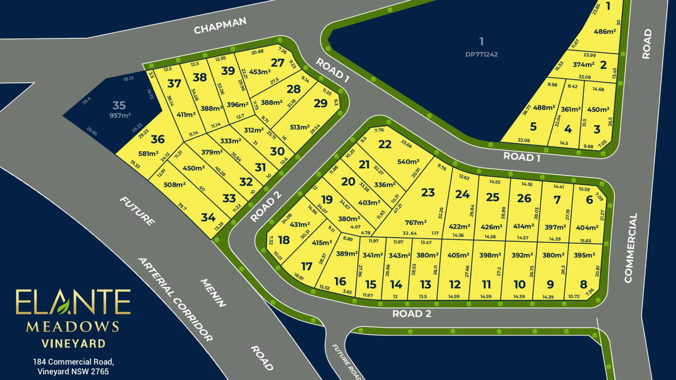
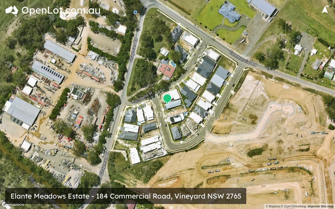
Elante Meadows Estate - Vineyard SOLD OUT
This information is estimated by the OpenLot research team. Let us know here to provide up-to-date information about this development.
| Total new homes | 39 |
| Area size | 2.44 hectares |
| Growth Region | Sydney North West Growth Areas |
| City council | Hawkesbury City Council |
| Developer | Elante Homes |
| Distance to | Sydney CBD - 39 km north-west Sydney Airport - 45 km north-west |
House and Land Packages:
Popular Estates near Elante Meadows Estate - Vineyard


 4
4
 2
2
 1
1


Updates for Elante Meadows Estate - Vineyard
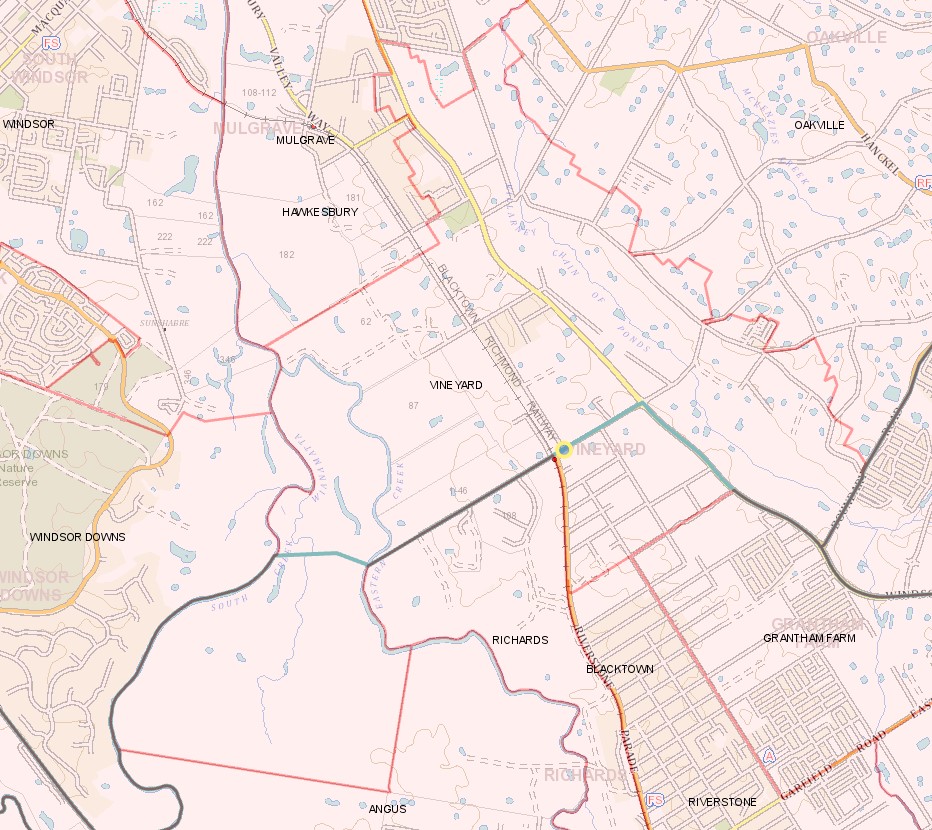
Location & Map for Elante Meadows Estate - Vineyard
Visit Display Homes near Elante Meadows Estate - Vineyard


Vacancy Rate in Vineyard NSW 2765
View full vacancy rate history in Vineyard NSW 2765 via SQM Research.
Schools near Elante Meadows Estate - Vineyard
Here are 6 schools near Elante Meadows Estate - Vineyard:
K-6 Government Primary School
K-6 Government Primary School
K-12 Independent Combined School
K-6 Catholic Primary School
7-12 Government Secondary School
U Government Special School
Suburb Planning Review in Vineyard NSW 2765
Vineyard is approximately 1,380ha within the City of Blacktown and partial the City of Hawkesbury , forming part of the Greater Western Sydney region in New South Wales, located 50 kilometres north west of Sydney. The southern portion of the suburb is primarily rural land holdings, with vegetated rural residential properties found in the northeast, increased density in the north and an industrial area located in the northwest of the suburb. The suburb does not have a business district, though contributes to the adjacent urban centre of Mulgave.
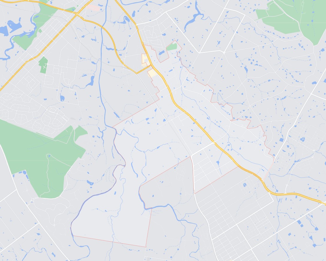
The suburb boundary is located along South Creek to the west and Eastern Creek to the east. The suburb boundaries to the north and south are along existing property boundaries. Windsor Road runs through the top of the suburb, parallel to the Blacktown Richmond Railway line that segregates the suburb. Eastern Creek runs through in the middle of Vineyard and Killarney Chain of Ponds to the north. Windsor Road provides access to the surrounding suburbs and local government areas, with a local network of roads providing access to the rural area.
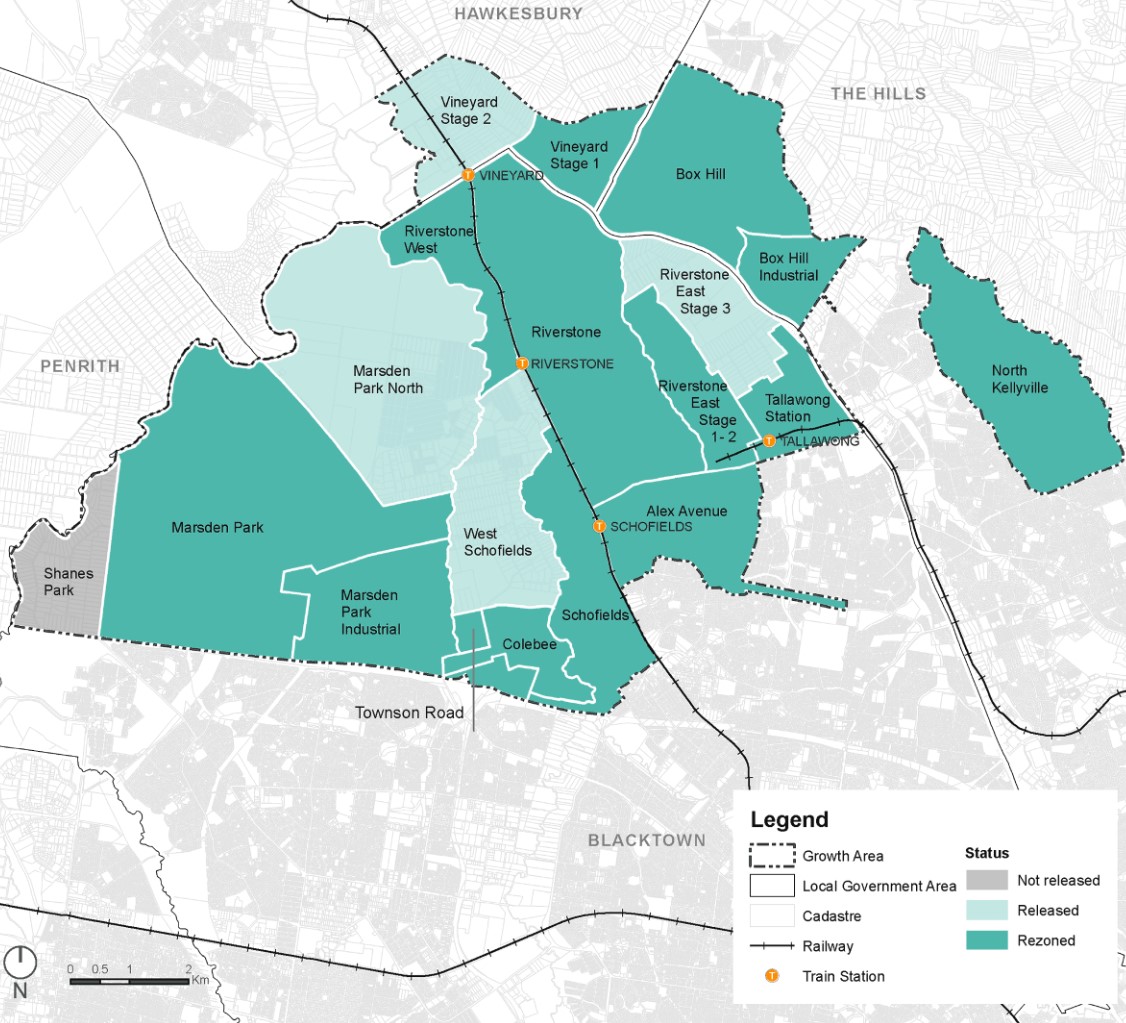
North West Priority Growth Area
Sydney’s North West will form part of the new approach to planning in NSW, following a review by the Department of Planning Industry and Environment in partnership with the Greater Sydney Commission and Government Architect. The decision was made to deliver 51 growth precincts, with the state government able to target areas and local councils empowered to get the correct planning for their community. The precinct planning will occur in four different pathways, being:
- State-led strategic planning
- Collaborative planning between the State and councils
- State-led rezoning
- Council-led rezoning
Vineyard forms part of the North West Growth Area and will proceed under the Strategic Planning method, with early work by the Department, councils, State agencies and communities in the development of places and the planning frameworks that support them.
The Hawkesbury City Council prepared a Growth Centres Precinct Development Control Plan (DCP) that was adopted by the Secretary (or delegate) of the Department of Planning and Environment on 8 January 2018 and came into force on 18 January 2018.
The DCP was prepared to provide additional guidance to developers on how development is to occur in the Precinct and considerations undertake development in the Vineyard Precinct. The Council’s statutory development assessment will refer to the DCP and in conjunction with the Growth Centres SEPP.
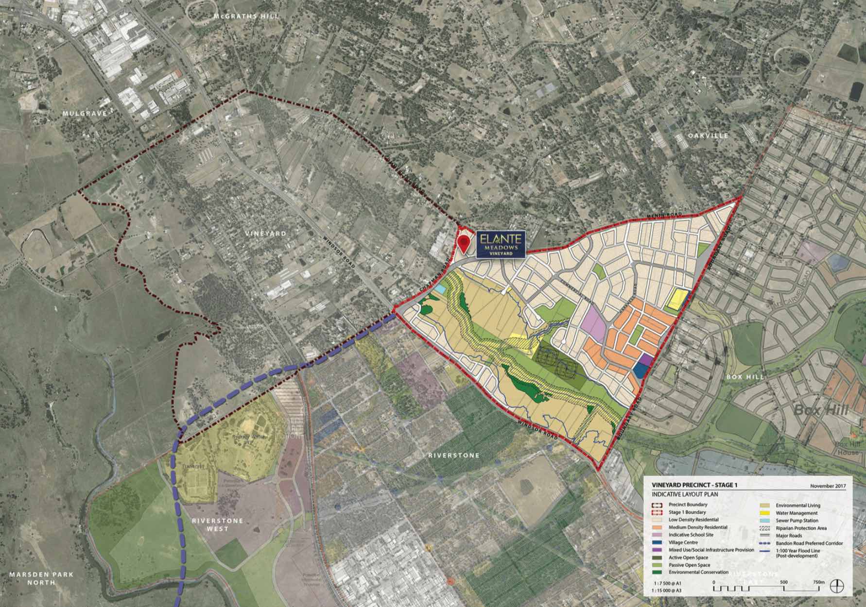
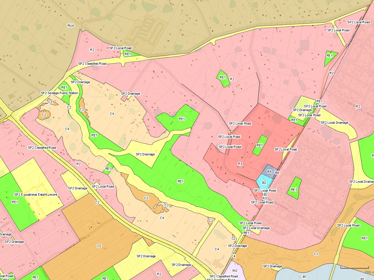
.jpg)
 Indicative Layout Plan.jpg)
The eastern portion of Vineyard and a portion of Oakville to the north-east created the new Precinct., which set out the new road, open space and drain network for the area. The Precinct was provided with new density levels for residential areas, preferred new school location and retail, as well as environmental heritage values.
The New South Wales State Government aimed to provide a new precinct that was an attractive and well-connected community, in proximity to public transport, community facilities, open space and retail.
It is noted that the Precincts of Roverstone and Roverstone West will use parts of the former Vineyard suburb for redevelopment growth.

Vision of Vineyard
“Planning for the Vineyard Precinct responds to the need for new and diverse housing in Sydney that is well connected to major centres and employment, protects natural assets and encourages sustainable living. Consideration of the surrounding context, history and natural environment has informed the precinct planning process”.
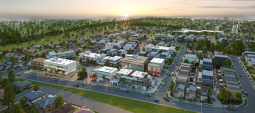
“The Precinct will consist of a mix of housing types that will allow for greater choice for different household types. It predominantly provides for low density housing, with some medium density around the village centre and open spaces”.
“Places of significant heritage value, particularly the Pitt Town Common House, have been integrated into the planning of the Precinct to ensure protection through a sensitive design approach. The village centre will support retail, commercial and community services to promote community interaction”.
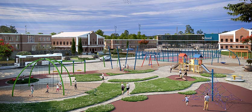
“Regional public transport accessibility has been provided through road connections to the nearby Vineyard railway station and a regional bus network along the major roads. A safe and permeable street network will promote accessibility, connectivity and social interaction. The provision of cycle ways and pedestrian connections, as well as public transport connections to surrounding centres, will promote a community that is less dependent on private vehicle use”.
.jpg)
Precinct Zoning of Vineyard
The existing zoning will be amended to provide for future infrastructures to facilitate future development within the Hawkesbury City Council Growth Centres Precinct. A new village centre including a supermarket and some community facilities is planned to meet the local shopping needs of future residents.
A new road network has been designed to help provide safe streets for residents, cycling and walking paths, and provide direct access to the village centre. The new roads will enable bus services to connect people to surrounding suburbs and areas for schools, employment, retail, open spaces and services.
Pedestrian and cyclist facilities will be constructed along open space and Killarney Chain of Ponds that will access the new residential areas.

The rezoning of part of the Vineyard precinct will create a new community with shops, cafes and substantial green open space in Sydney's North West. Green spaces will be integrated with new homes with landscaping and tree planting along streets and in public domain areas, and with protected remnant stands of vegetation, for local residents to enjoy.
Vineyard Suburb Summary
Reviews & Comments on Elante Meadows Estate - Vineyard
Estate Brochure, Masterplan, Engineering Plan, Plan of Subdivision (POS), Design Guidelines
FAQs about Elante Meadows Estate - Vineyard
View all estates from Elante Homes
- Vineyard Public School - 816m south-west
- Oakville Public School - 2.5km north
- Arndell Anglican College - 2.8km north-west
- St John's Primary School - 3.7km south
- Windsor High School - 3.9km north-west
- Casuarina School - 3.9km south
Popular Estates near Elante Meadows Estate - Vineyard
Latest New Home Articles for You

09/Mar/2026 | OpenLot.com.au
Victoria: Top 30 Most Searched Housing Developments (February 2026)
If you’ve been exploring housing opportunities in Victoria, February 2026...

20/Feb/2026 | OpenLot.com.au
Display Homes at Drouin Fields Estate: A Thriving Community in Drouin
Welcome to Drouin Fields, a place where beauty, space, and modern luxury ...

19/Feb/2026 | OpenLot.com.au
Display Homes at Manor Lakes Esate: A Thriving Waterside Community in Manor Lakes
A place where you can settle in, rather than just settle down. Named for ...

13/Feb/2026 | OpenLot.com.au
🏠 Victoria: Top 30 Most Searched Townhouse Developments – January 2026

11/Feb/2026 | OpenLot.com.au
🏡 Top 30 Most Searched Estates by State - January 2026

10/Feb/2026 | OpenLot.com.au
Victoria: Top 30 Most Searched Housing Developments (January 2026)
If you’ve been considering making a move in Victoria, January 2026 offere...

10/Feb/2026 | OpenLot.com.au
Queensland: Top 30 Most Searched Housing Developments (January 2026)
If you’ve been considering making a move in Queensland, January 2026 offe...

09/Feb/2026 | OpenLot.com.au
Western Australia: Top 30 Most Searched Housing Developments (January 2026)
If you’ve been considering making a move in Western Australia, January 20...

06/Feb/2026 | OpenLot.com.au
South Australia: Top 30 Most Searched Housing Developments (January 2026)
If you’ve been considering making a move in South Australia, January 2026...