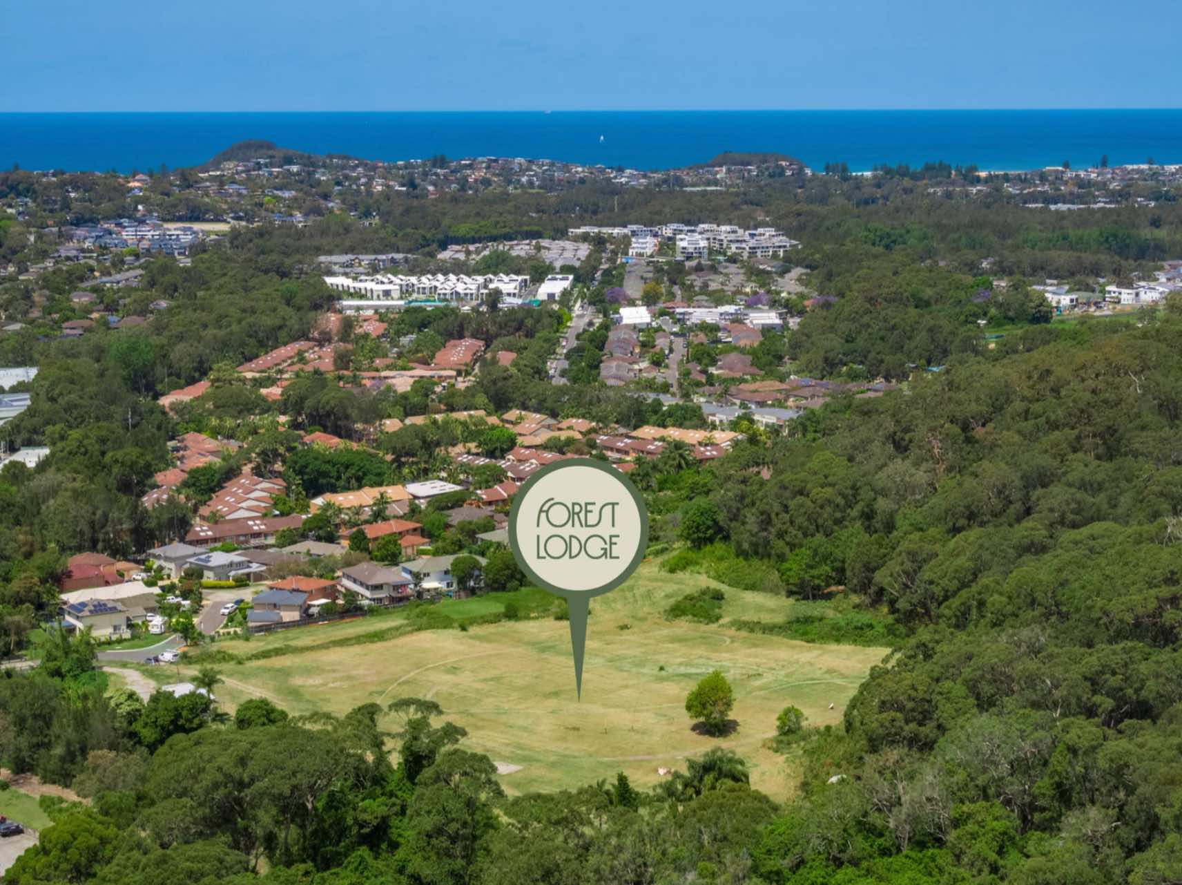
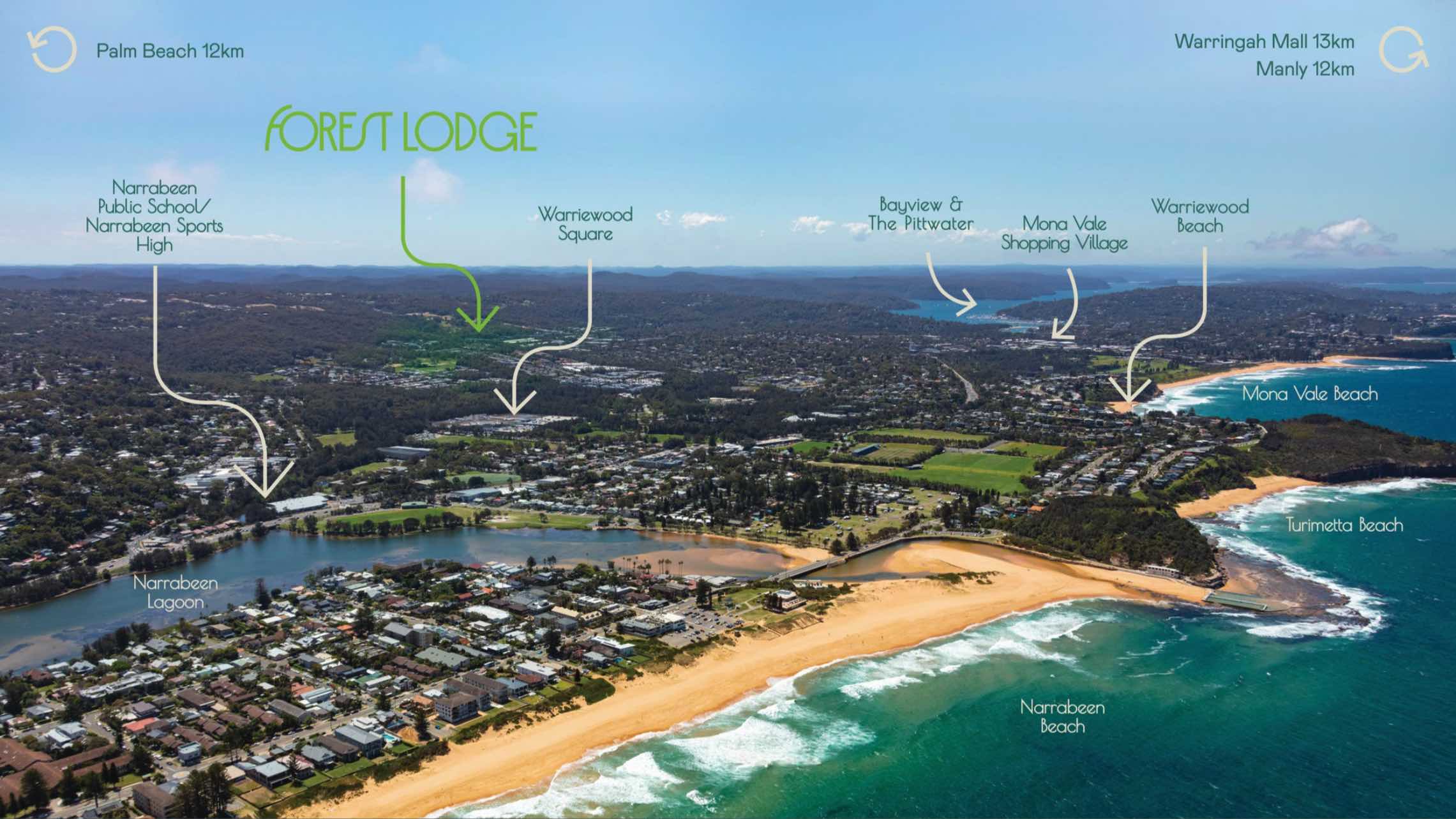
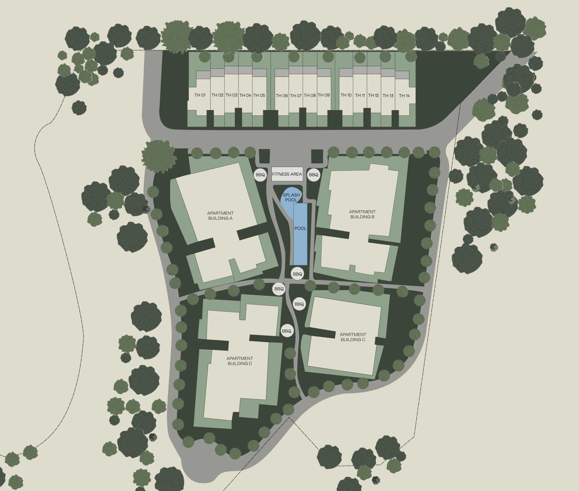
Forest Lodge Estate - Warriewood
This information is estimated by the OpenLot research team. Let us know here to provide up-to-date information about this development.
| Total new homes | 80 |
| Area size | 5.66 hectares |
| City council | Northern Beaches Council |
| Developer | N/A |
| Distance to | Sydney CBD - 23 km north-east Sydney Airport - 31 km north |
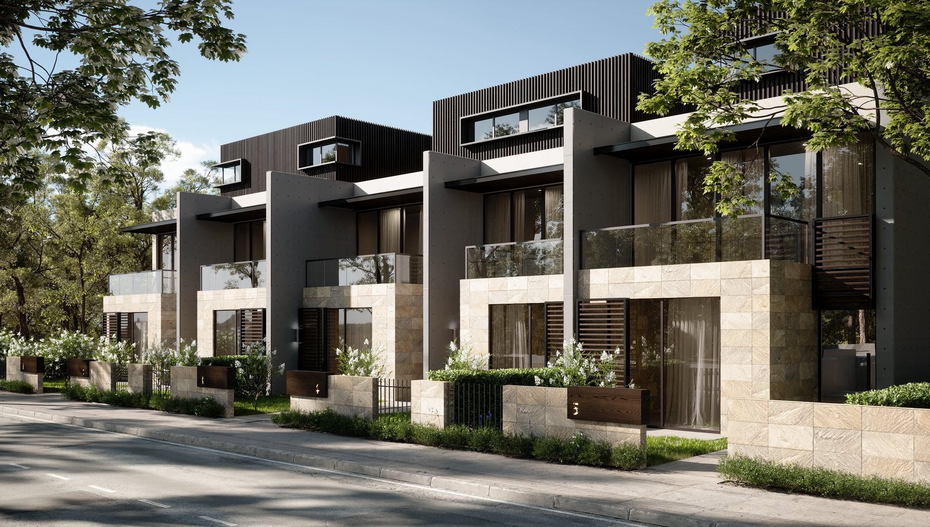
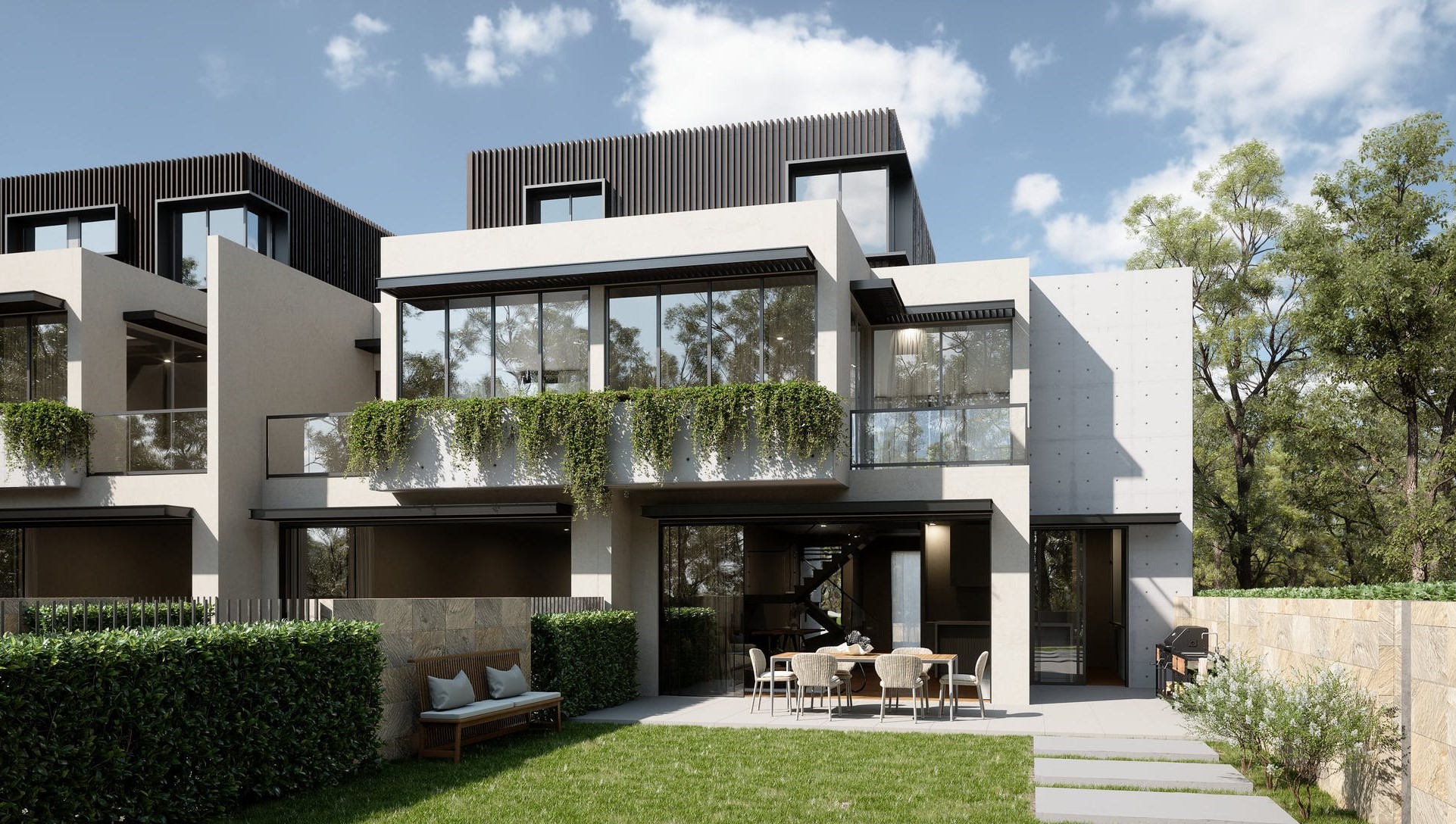
Townhomes:
Popular Estates near Forest Lodge Estate - Warriewood


Updates for Forest Lodge Estate - Warriewood
Facebook updates:
Submit the Facebook page for Forest Lodge Estate - Warriewood.
Related news:
Missing articles? Send us a link here.
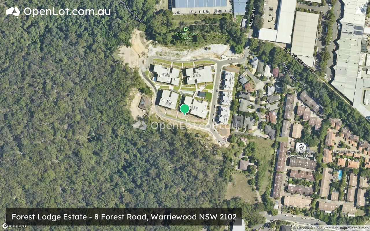
Location & Map for Forest Lodge Estate - Warriewood
Vacancy Rate in Warriewood NSW 2102
View full vacancy rate history in Warriewood NSW 2102 via SQM Research.
Schools near Forest Lodge Estate - Warriewood
Here are 6 schools near Forest Lodge Estate - Warriewood:
7-12 Catholic Secondary School
K-6 Government Primary School
K-6 Catholic Primary School
7-12 Government Secondary School
K-12 Independent Combined School
K-6 Government Primary School
Reviews & Comments on Forest Lodge Estate - Warriewood
Estate Brochure, Masterplan, Engineering Plan, Plan of Subdivision (POS), Design Guidelines
FAQs about Forest Lodge Estate - Warriewood
- Mater Maria Catholic College - 355m south-east
- Mona Vale Public School - 1.6km east
- Sacred Heart Catholic Primary School - 1.7km east
- Pittwater High School - 2.2km north-east
- Galstaun College - 2.2km west
- Narrabeen North Public School - 2.4km south-east
Popular Estates near Forest Lodge Estate - Warriewood
Latest New Home Articles for You

09/Mar/2026 | OpenLot.com.au
Victoria: Top 30 Most Searched Housing Developments (February 2026)
If you’ve been exploring housing opportunities in Victoria, February 2026...

20/Feb/2026 | OpenLot.com.au
Display Homes at Drouin Fields Estate: A Thriving Community in Drouin
Welcome to Drouin Fields, a place where beauty, space, and modern luxury ...

19/Feb/2026 | OpenLot.com.au
Display Homes at Manor Lakes Esate: A Thriving Waterside Community in Manor Lakes
A place where you can settle in, rather than just settle down. Named for ...

13/Feb/2026 | OpenLot.com.au
🏠 Victoria: Top 30 Most Searched Townhouse Developments – January 2026

11/Feb/2026 | OpenLot.com.au
🏡 Top 30 Most Searched Estates by State - January 2026

10/Feb/2026 | OpenLot.com.au
Victoria: Top 30 Most Searched Housing Developments (January 2026)
If you’ve been considering making a move in Victoria, January 2026 offere...

10/Feb/2026 | OpenLot.com.au
Queensland: Top 30 Most Searched Housing Developments (January 2026)
If you’ve been considering making a move in Queensland, January 2026 offe...

09/Feb/2026 | OpenLot.com.au
Western Australia: Top 30 Most Searched Housing Developments (January 2026)
If you’ve been considering making a move in Western Australia, January 20...

06/Feb/2026 | OpenLot.com.au
South Australia: Top 30 Most Searched Housing Developments (January 2026)
If you’ve been considering making a move in South Australia, January 2026...