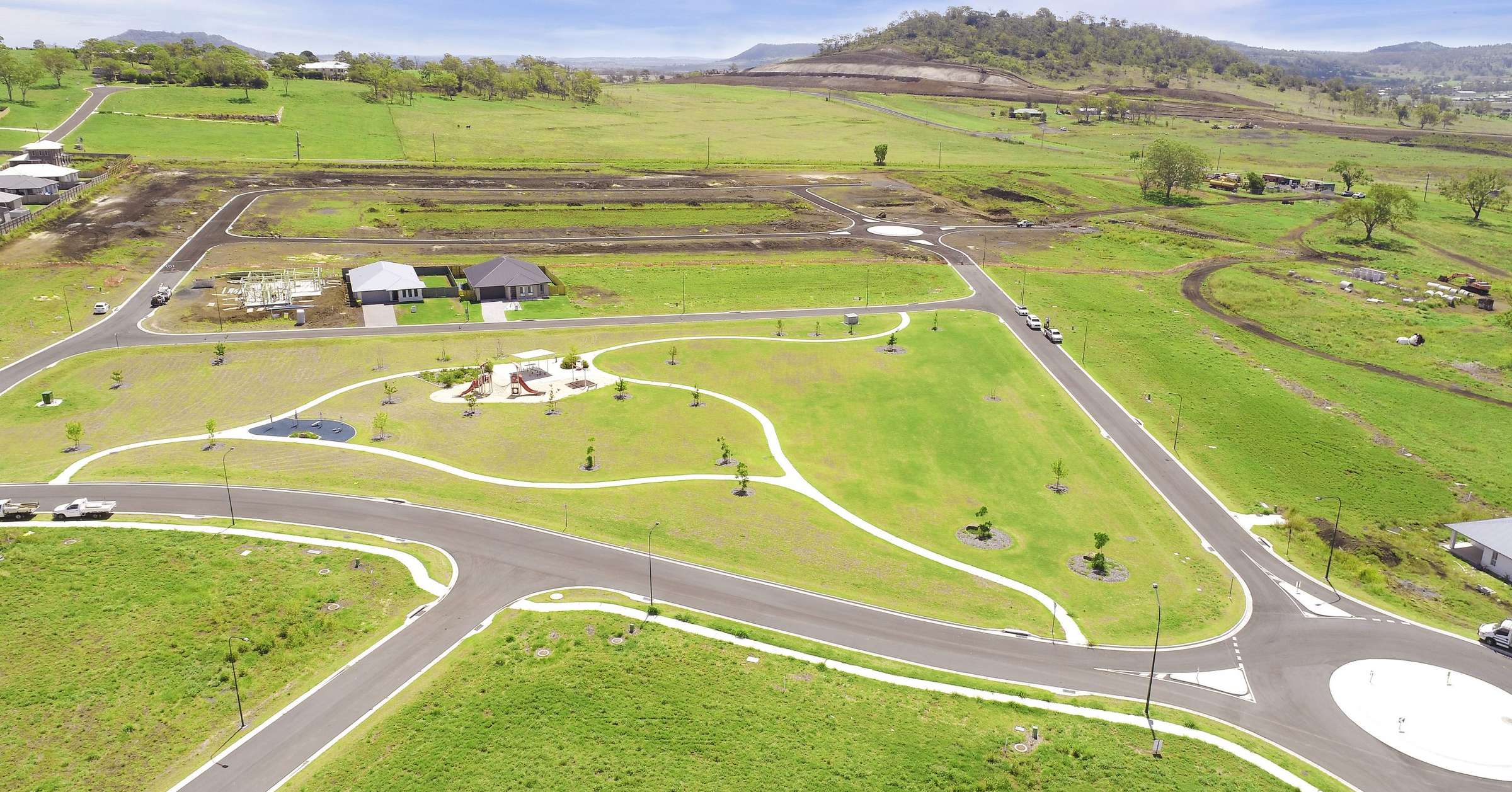
Kooringa Valley Estate - Cotswold Hills SOLD OUT
This information is estimated by the OpenLot research team. Let us know here to provide up-to-date information about this development.
| Total new homes | 700 |
| Area size | N/A |
| Growth Region | Toowoomba Growth Areas |
| City council | Toowoomba Regional Council |
| Developer | Richard Adams Homes |
| Project marketer | Ray White Highfields | Toowoomba Range |
| Distance to | Toowoomba CBD - 8 km north-east |
Land for Sale, House and Land Packages:
Popular Estates near Kooringa Valley Estate - Cotswold Hills


Updates for Kooringa Valley Estate - Cotswold Hills
Facebook updates:
Submit the Facebook page for Kooringa Valley Estate - Cotswold Hills.
Related news:
Kooringa Valley Estate House and Land packages available from Richard Adams Homes Click on the link to view current packages – SORRY NO PACKAGES AVAILABLE Stage…
H&L: Build your dream home with Toowoomba's leading home builder. Residential houses, custom plans, house and land packages and more! Having over 30 years of experience building homes for Toowoomba families just like you, we’re confident we can build just what you’re looking for. From a si

Missing articles? Send us a link here.
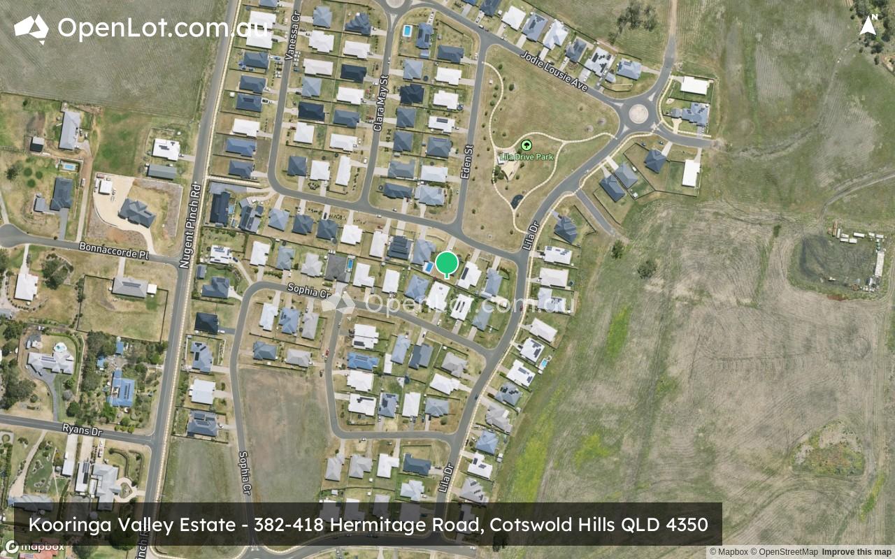
Location & Map for Kooringa Valley Estate - Cotswold Hills
Visit Display Homes near Kooringa Valley Estate - Cotswold Hills

Vacancy Rate in Cotswold Hills QLD 4350
View full vacancy rate history in Cotswold Hills QLD 4350 via SQM Research.
Schools near Kooringa Valley Estate - Cotswold Hills
Here are 6 schools near Kooringa Valley Estate - Cotswold Hills:
Prep-6 Government Primary School
Prep-6 Government Primary School
7-12 Government Secondary School
Prep-6 Government Primary School
Prep-6 Government Primary School
Prep-6 Catholic Primary School
Reviews & Comments on Kooringa Valley Estate - Cotswold Hills
Estate Brochure, Masterplan, Engineering Plan, Plan of Subdivision (POS), Design Guidelines
FAQs about Kooringa Valley Estate - Cotswold Hills
View all estates from Richard Adams Homes
View all estates marketed by Ray White Highfields | Toowoomba Range
- Fairview Heights State School - 2.2km south-east
- Gowrie State School - 3.1km north
- Wilsonton State High School - 3.1km south-east
- Wilsonton State School - 3.4km south-east
- Rockville State School - 3.6km south-east
- Sacred Heart Primary School - 3.7km south-east
Popular Estates near Kooringa Valley Estate - Cotswold Hills
Latest New Home Articles for You

09/Mar/2026 | OpenLot.com.au
Victoria: Top 30 Most Searched Housing Developments (February 2026)
If you’ve been exploring housing opportunities in Victoria, February 2026...

20/Feb/2026 | OpenLot.com.au
Display Homes at Drouin Fields Estate: A Thriving Community in Drouin
Welcome to Drouin Fields, a place where beauty, space, and modern luxury ...

19/Feb/2026 | OpenLot.com.au
Display Homes at Manor Lakes Esate: A Thriving Waterside Community in Manor Lakes
A place where you can settle in, rather than just settle down. Named for ...

13/Feb/2026 | OpenLot.com.au
🏠 Victoria: Top 30 Most Searched Townhouse Developments – January 2026

11/Feb/2026 | OpenLot.com.au
🏡 Top 30 Most Searched Estates by State - January 2026

10/Feb/2026 | OpenLot.com.au
Victoria: Top 30 Most Searched Housing Developments (January 2026)
If you’ve been considering making a move in Victoria, January 2026 offere...

10/Feb/2026 | OpenLot.com.au
Queensland: Top 30 Most Searched Housing Developments (January 2026)
If you’ve been considering making a move in Queensland, January 2026 offe...

09/Feb/2026 | OpenLot.com.au
Western Australia: Top 30 Most Searched Housing Developments (January 2026)
If you’ve been considering making a move in Western Australia, January 20...

06/Feb/2026 | OpenLot.com.au
South Australia: Top 30 Most Searched Housing Developments (January 2026)
If you’ve been considering making a move in South Australia, January 2026...