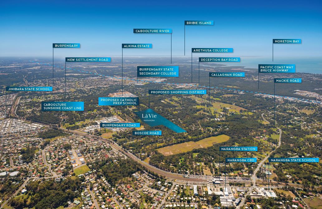


La Vie Estate - Narangba
[LIMITED OFFER] This Development is due to start construction mid 2023
This information is estimated by the OpenLot research team. Let us know here to provide up-to-date information about this development.
| Total new homes | 169 |
| Area size | 13.80 hectares |
| Growth Region | Greater Brisbane Growth Areas |
| City council | Moreton Bay Regional Council |
| Developer | Trask Land |
| Other names | Aria Estate |
| Distance to | Brisbane Airport - 27 km north-west Brisbane CBD - 31 km north |
Land for Sale, House and Land Packages:
Popular Estates near La Vie Estate - Narangba


Updates for La Vie Estate - Narangba
Facebook updates:
Related news:
The Narangba site is about 34 kilometres north of Brisbane's CBD. Trask Land is paying $8.7 million for a 10.8 hectare residential development site in north Brisbane’s fast growing Moreton Bay region. The Narangba holding,

DEVELOPMENT SITE IN HIGH GROWTH CORRIDOR JLL Metro Sales & Investments Queensland has the exclusive pleasure to offer for sale 191 &nda

Track the progress of development applications from lodgement through to decision.
Missing articles? Send us a link here.
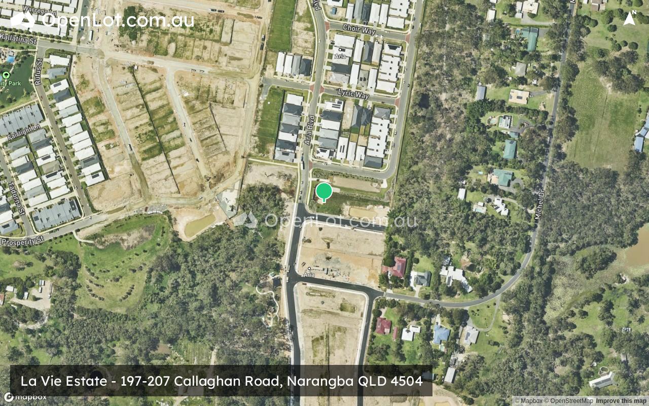
Location & Map for La Vie Estate - Narangba
Visit Display Homes near La Vie Estate - Narangba


Vacancy Rate in Narangba QLD 4504
View full vacancy rate history in Narangba QLD 4504 via SQM Research.
Schools near La Vie Estate - Narangba
Here are 6 schools near La Vie Estate - Narangba:
Prep-6 Government Primary School
Prep-6 Government Primary School
7-12 Independent Special School - School Head Campus
7-12 Government Secondary School
7-9 Independent Secondary School
7-12 Government Secondary School
Reviews & Comments on La Vie Estate - Narangba
Estate Brochure, Masterplan, Engineering Plan, Plan of Subdivision (POS), Design Guidelines
FAQs about La Vie Estate - Narangba
View all estates from Trask Land
- Narangba State School - 1.5km south
- Jinibara State School - 1.9km north-west
- Arethusa College - 2.7km north-east
- Burpengary State Secondary College - 2.7km north-east
- The Younity School - 2.7km north
- Narangba Valley State High School - 3.0km north-west
Popular Estates near La Vie Estate - Narangba
Latest New Home Articles for You

09/Mar/2026 | OpenLot.com.au
Victoria: Top 30 Most Searched Housing Developments (February 2026)
If you’ve been exploring housing opportunities in Victoria, February 2026...

20/Feb/2026 | OpenLot.com.au
Display Homes at Drouin Fields Estate: A Thriving Community in Drouin
Welcome to Drouin Fields, a place where beauty, space, and modern luxury ...

19/Feb/2026 | OpenLot.com.au
Display Homes at Manor Lakes Esate: A Thriving Waterside Community in Manor Lakes
A place where you can settle in, rather than just settle down. Named for ...

13/Feb/2026 | OpenLot.com.au
🏠 Victoria: Top 30 Most Searched Townhouse Developments – January 2026

11/Feb/2026 | OpenLot.com.au
🏡 Top 30 Most Searched Estates by State - January 2026

10/Feb/2026 | OpenLot.com.au
Victoria: Top 30 Most Searched Housing Developments (January 2026)
If you’ve been considering making a move in Victoria, January 2026 offere...

10/Feb/2026 | OpenLot.com.au
Queensland: Top 30 Most Searched Housing Developments (January 2026)
If you’ve been considering making a move in Queensland, January 2026 offe...

09/Feb/2026 | OpenLot.com.au
Western Australia: Top 30 Most Searched Housing Developments (January 2026)
If you’ve been considering making a move in Western Australia, January 20...

06/Feb/2026 | OpenLot.com.au
South Australia: Top 30 Most Searched Housing Developments (January 2026)
If you’ve been considering making a move in South Australia, January 2026...