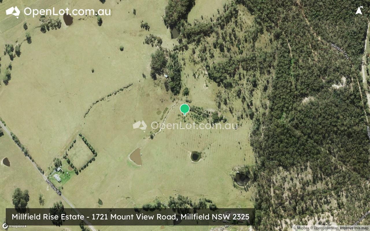
Millfield Rise Estate - Millfield
This information is estimated by the OpenLot research team. Let us know here to provide up-to-date information about this development.
| Total new homes | 250 |
| Area size | 44.11 hectares |
| Growth Region | Greater Newcastle Growth Areas (The Hunter Region) |
| City council | Cessnock City Council |
| Developer | Johnson Property Group |
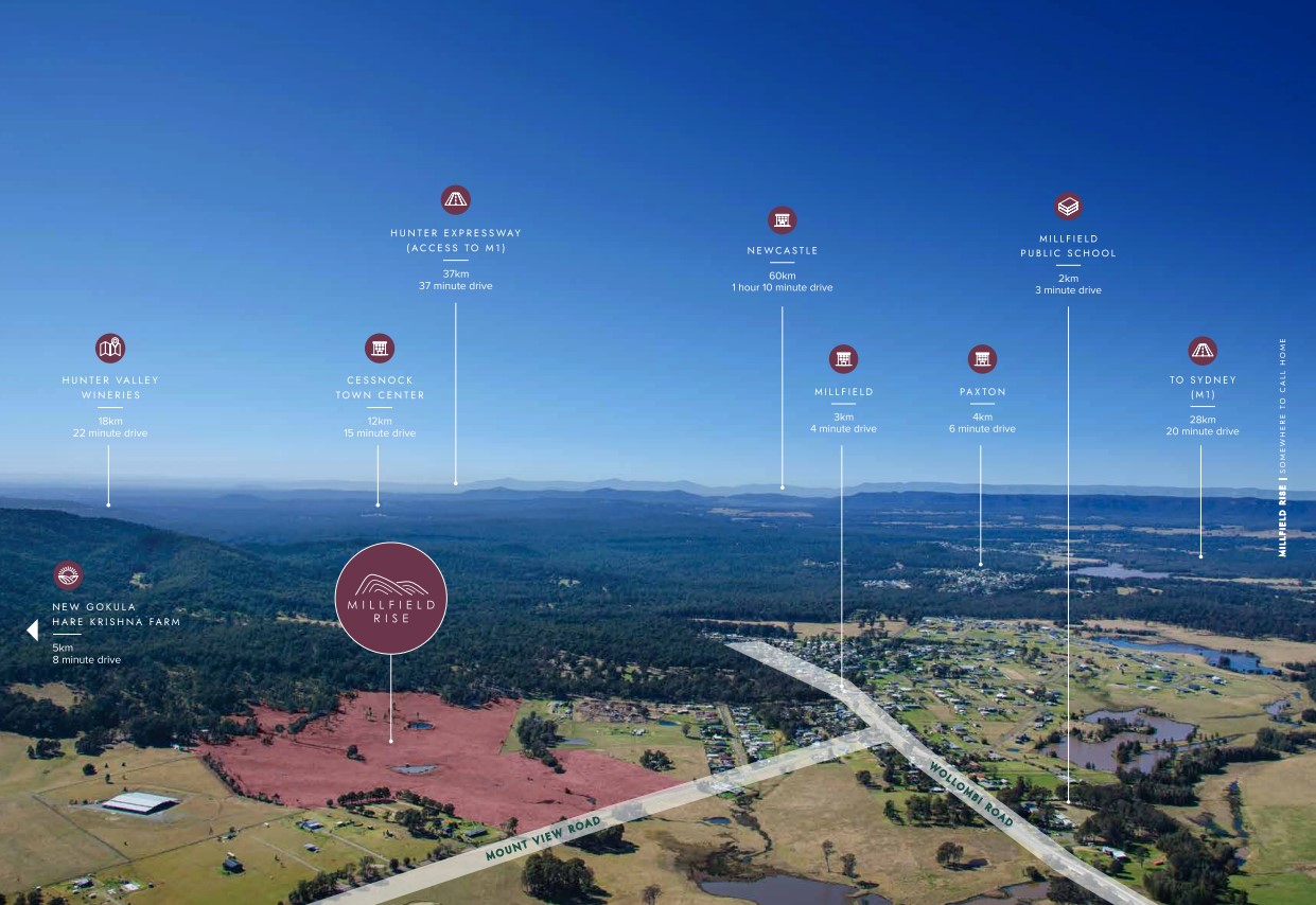
| Distance to | Newcastle CBD - 49 km west |
Land for Sale, House and Land Packages:
Popular Estates near Millfield Rise Estate - Millfield


 3
3
 2
2
 2
2


Updates for Millfield Rise Estate - Millfield
Facebook updates:
Submit the Facebook page for Millfield Rise Estate - Millfield.
Related news:
MILLFIED RISEWe are excited to announce we have a new project located in the Hunter Valley, Millfield Rise! Lots will be between 750-1,000sqm. We hope to be bringing these to the market soon so if you are interested in knowing more please complete the form below

Missing articles? Send us a link here.
Location & Map for Millfield Rise Estate - Millfield
Vacancy Rate in Millfield NSW 2325
View full vacancy rate history in Millfield NSW 2325 via SQM Research.
Schools near Millfield Rise Estate - Millfield
Here are 6 schools near Millfield Rise Estate - Millfield:
K-6 Government Primary School
K-6 Government Primary School
K-6 Government Primary School
K-6 Government Primary School
K-6 Government Primary School
7-12 Government Secondary School
Reviews & Comments on Millfield Rise Estate - Millfield
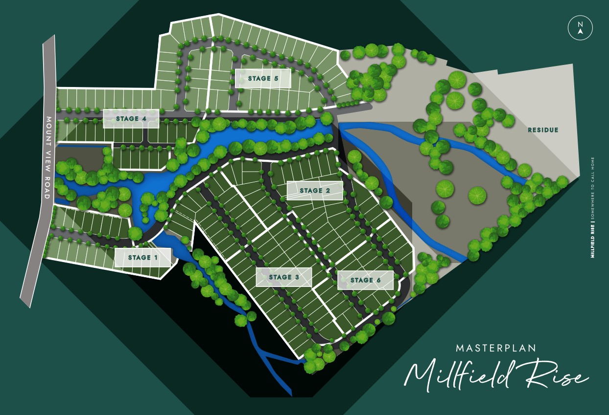
Estate Brochure, Masterplan, Engineering Plan, Plan of Subdivision (POS), Design Guidelines
FAQs about Millfield Rise Estate - Millfield
View all estates from Johnson Property Group
- Millfield Public School - 1.0km south-west
- Paxton Public School - 3.5km south-east
- Bellbird Public School - 6.2km north-east
- Ellalong Public School - 6.4km south-east
- Congewai Public School - 8.8km south
- Mount View High School - 9.3km north-east
Popular Estates near Millfield Rise Estate - Millfield
Latest New Home Articles for You

09/Mar/2026 | OpenLot.com.au
Victoria: Top 30 Most Searched Housing Developments (February 2026)
If you’ve been exploring housing opportunities in Victoria, February 2026...

20/Feb/2026 | OpenLot.com.au
Display Homes at Drouin Fields Estate: A Thriving Community in Drouin
Welcome to Drouin Fields, a place where beauty, space, and modern luxury ...

19/Feb/2026 | OpenLot.com.au
Display Homes at Manor Lakes Esate: A Thriving Waterside Community in Manor Lakes
A place where you can settle in, rather than just settle down. Named for ...

13/Feb/2026 | OpenLot.com.au
🏠 Victoria: Top 30 Most Searched Townhouse Developments – January 2026

11/Feb/2026 | OpenLot.com.au
🏡 Top 30 Most Searched Estates by State - January 2026

10/Feb/2026 | OpenLot.com.au
Victoria: Top 30 Most Searched Housing Developments (January 2026)
If you’ve been considering making a move in Victoria, January 2026 offere...

10/Feb/2026 | OpenLot.com.au
Queensland: Top 30 Most Searched Housing Developments (January 2026)
If you’ve been considering making a move in Queensland, January 2026 offe...

09/Feb/2026 | OpenLot.com.au
Western Australia: Top 30 Most Searched Housing Developments (January 2026)
If you’ve been considering making a move in Western Australia, January 20...

06/Feb/2026 | OpenLot.com.au
South Australia: Top 30 Most Searched Housing Developments (January 2026)
If you’ve been considering making a move in South Australia, January 2026...