
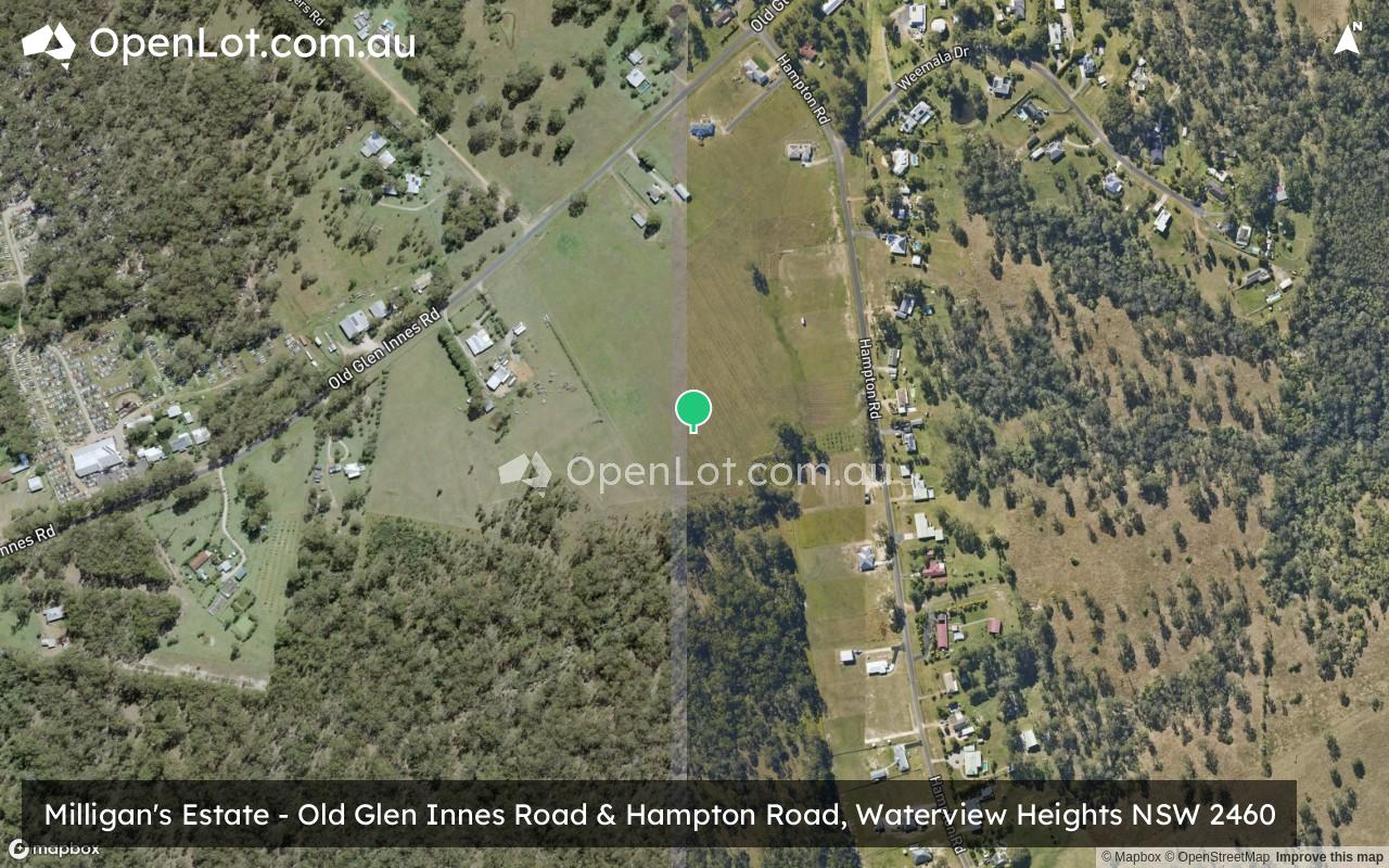
Milligan's Estate - Waterview Heights
This information is estimated by the OpenLot research team. Let us know here to provide up-to-date information about this development.
| Total new homes | N/A |
| Area size | N/A |
| City council | Clarence Valley Council |
| Developer | N/A |
| Project marketer | Ray Donovan Stock & Station Agents |
Land for Sale, House and Land Packages:
Popular Estates near Milligan's Estate - Waterview Heights


Updates for Milligan's Estate - Waterview Heights
Facebook updates:
Submit the Facebook page for Milligan's Estate - Waterview Heights.
Related news:
Lots 21-31 Hampton Road, Waterview Heights, NSW 2460. View property details and sold price of Lots 21-31 Hampton Road & other properties in Waterview Heights, NSW 2460.
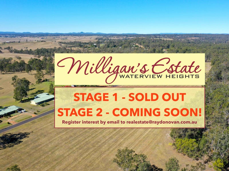
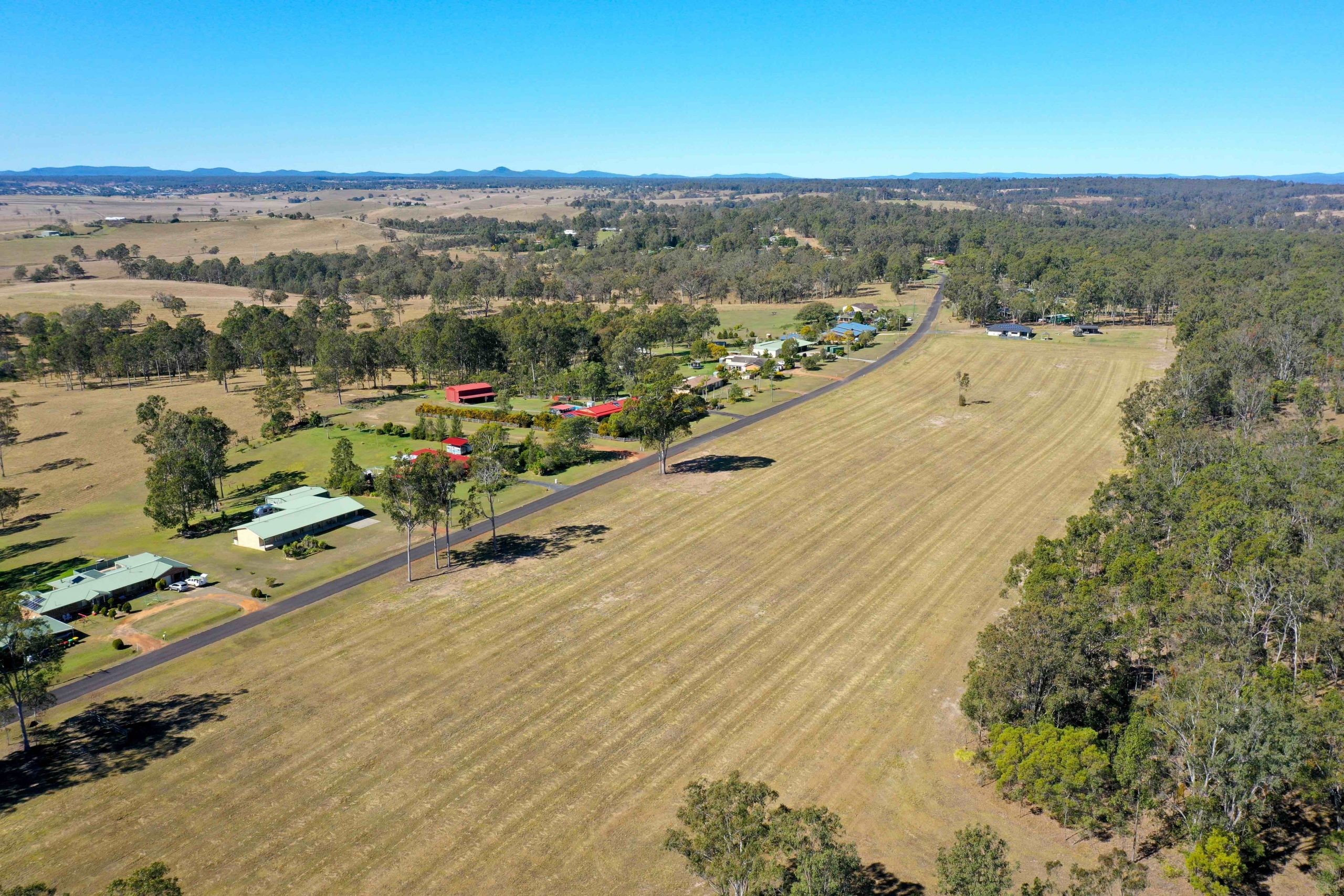
Build the house and shed package of your design on this exciting new subdivision fronting Hampton Road at Waterview Heights.Milligan’s Estate, named after the original owner of the farmland, offers...Read More→
Missing articles? Send us a link here.
Location & Map for Milligan's Estate - Waterview Heights
Vacancy Rate in Waterview Heights NSW 2460
View full vacancy rate history in Waterview Heights NSW 2460 via SQM Research.
Schools near Milligan's Estate - Waterview Heights
Here are 6 schools near Milligan's Estate - Waterview Heights:
7-12 Government Secondary School
K-6 Government Primary School
K-6 Government Primary School
7-12 Government Secondary School
K-6 Catholic Primary School
K-6 Government Primary School
Reviews & Comments on Milligan's Estate - Waterview Heights
Estate Brochure, Masterplan, Engineering Plan, Plan of Subdivision (POS), Design Guidelines
FAQs about Milligan's Estate - Waterview Heights
View all estates marketed by Ray Donovan Stock & Station Agents
- Grafton High School - 6.6km east
- Grafton Public School - 6.6km east
- Westlawn Public School - 6.6km east
- South Grafton High School - 6.7km south-east
- St Mary's Primary School - 6.9km east
- South Grafton Public School - 7.2km east
Popular Estates near Milligan's Estate - Waterview Heights
Latest New Home Articles for You

09/Mar/2026 | OpenLot.com.au
Victoria: Top 30 Most Searched Housing Developments (February 2026)
If you’ve been exploring housing opportunities in Victoria, February 2026...

20/Feb/2026 | OpenLot.com.au
Display Homes at Drouin Fields Estate: A Thriving Community in Drouin
Welcome to Drouin Fields, a place where beauty, space, and modern luxury ...

19/Feb/2026 | OpenLot.com.au
Display Homes at Manor Lakes Esate: A Thriving Waterside Community in Manor Lakes
A place where you can settle in, rather than just settle down. Named for ...

13/Feb/2026 | OpenLot.com.au
🏠 Victoria: Top 30 Most Searched Townhouse Developments – January 2026

11/Feb/2026 | OpenLot.com.au
🏡 Top 30 Most Searched Estates by State - January 2026

10/Feb/2026 | OpenLot.com.au
Victoria: Top 30 Most Searched Housing Developments (January 2026)
If you’ve been considering making a move in Victoria, January 2026 offere...

10/Feb/2026 | OpenLot.com.au
Queensland: Top 30 Most Searched Housing Developments (January 2026)
If you’ve been considering making a move in Queensland, January 2026 offe...

09/Feb/2026 | OpenLot.com.au
Western Australia: Top 30 Most Searched Housing Developments (January 2026)
If you’ve been considering making a move in Western Australia, January 20...

06/Feb/2026 | OpenLot.com.au
South Australia: Top 30 Most Searched Housing Developments (January 2026)
If you’ve been considering making a move in South Australia, January 2026...