Moorara Drive, Port Victoria SA 5573 IN PLANNING
This information is estimated by the OpenLot research team. Let us know here to provide up-to-date information about this development.
| Total new homes | N/A |
| Area size | 15.30 hectares |
| City council | Yorke Peninsula Council |
| Developer | N/A |
Land for Sale, House and Land Packages:
Popular Estates near Moorara Drive, Port Victoria


Updates for Moorara Drive, Port Victoria
Facebook updates:

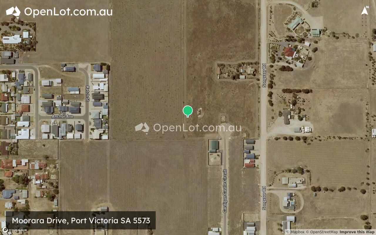
Location & Map for Moorara Drive, Port Victoria
Vacancy Rate in Port Victoria SA 5573
View full vacancy rate history in Port Victoria SA 5573 via SQM Research.
Schools near Moorara Drive, Port Victoria
Here are 6 schools near Moorara Drive, Port Victoria:
R-12 Government Combined School - School Head Campus
R-12 Independent Combined School
R-6 Government Primary School
R-12 Government Combined School
R-12 Government Combined School
U, R-12 Government Combined School
Reviews & Comments on Moorara Drive, Port Victoria
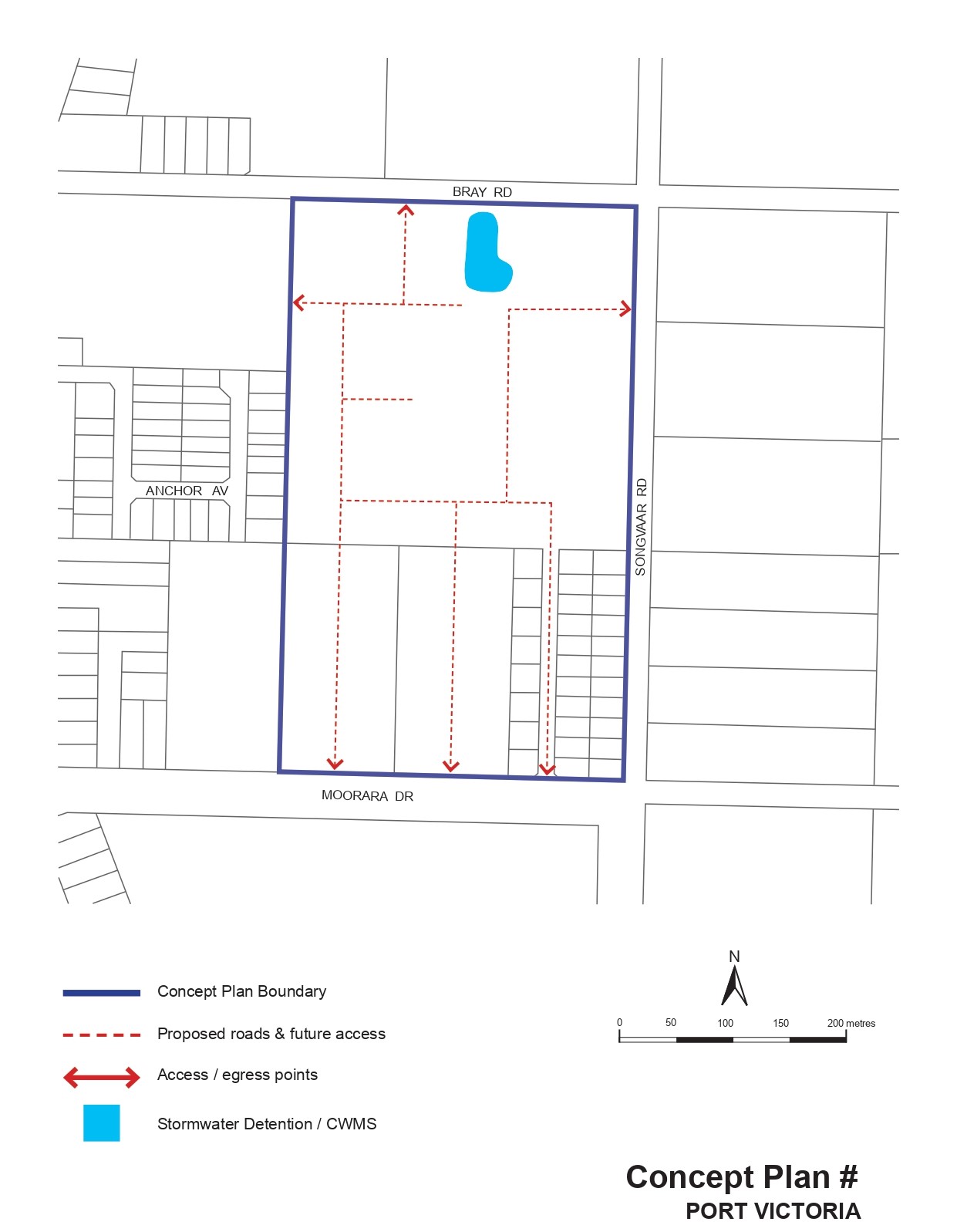
Estate Brochure, Masterplan, Engineering Plan, Plan of Subdivision (POS), Design Guidelines
FAQs about Moorara Drive, Port Victoria
- Central Yorke School - 21.7km north-east
- Maitland Lutheran School - 22.0km north-east
- Curramulka Primary School - 30.8km south-east
- Minlaton District School - 32.1km south
- Ardrossan Area School - 39.9km east
- Moonta Area School - 47.6km north
Popular Estates near Moorara Drive, Port Victoria
Latest New Home Articles for You

27/Jan/2026 | OpenLot.com.au
Display Homes at Stockland Wildflower Estate: A Smart Community in Piara Waters
Welcome to Wildflower, a vibrant new neighbourhood nestled in the heart o...

16/Jan/2026 | OpenLot.com.au
South Australia Top 30 Most Searched Housing Developments (December 2025)

15/Jan/2026 | OpenLot.com.au
Queensland: Top 30 Most Searched Housing Developments (December 2025)
If you’ve been tracking housing demand across Queensland, December 2025 p...

14/Jan/2026 | OpenLot.com.au
Victoria: Top 30 Most Searched Housing Developments (December 2025)
If you’ve been exploring housing opportunities in Victoria, December 2025...

14/Jan/2026 | OpenLot.com.au
Display Homes at Apsley Estate: A Masterplanned Community in Mandogalup
Apsley is a bold, 1,800-lot masterplanned community just 25 minutes south...

13/Jan/2026 | OpenLot.com.au
Western Australia: Top 30 Most Searched Housing Developments (December 2025)
If you’ve been keeping an eye on housing demand across Western Australia,...

12/Jan/2026 | OpenLot.com.au
New South Wales: Top 30 Most Searched Housing Developments (December 2025)
If you’ve been considering making a move in New South Wales, December 202...

07/Jan/2026 | OpenLot.com.au
🏡 Top 30 Most Searched Estates by State - December

06/Jan/2026 | OpenLot.com.au
Display Homes Near Me (WA): Your Complete Guide to Display Villages Across Western Australia
Finding the right display home in Western Australia has never been easier...