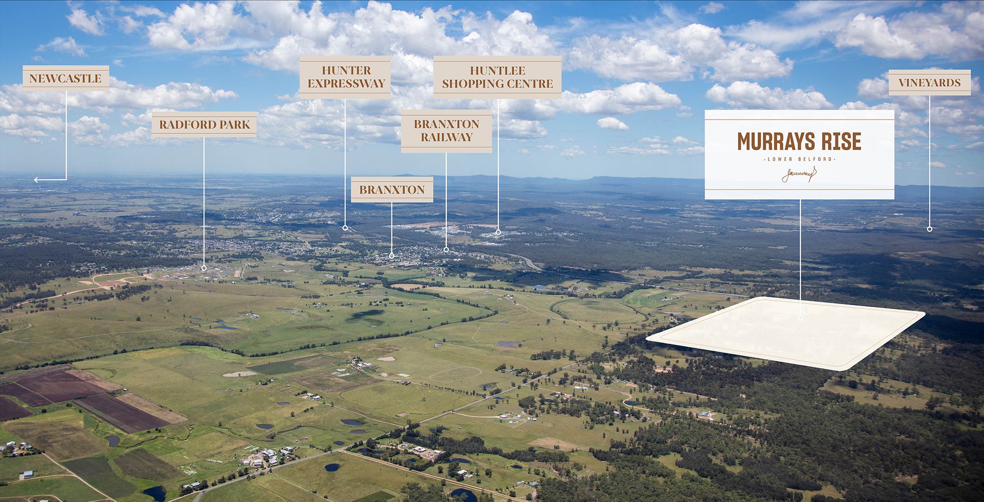
Murray's Rise Estate - Lower Belford
This information is estimated by the OpenLot research team. Let us know here to provide up-to-date information about this development.
| Total new homes | 118 |
| Area size | 136.26 hectares |
| City council | Singleton Council |
| Developer | N/A |
| Project marketer | Urban Land Housing |
Land for Sale, House and Land Packages:
Popular Estates near Murray's Rise Estate - Lower Belford


Updates for Murray's Rise Estate - Lower Belford
Facebook updates:
Related news:
Hundreds of new residents could soon call Branxton home with a Sydney-based developer ready to launch a $30 million rural residential land release north of the tiny town.

SINGLETON appears on the cusp of addressing its drastic lack of housing land.


Missing articles? Send us a link here.
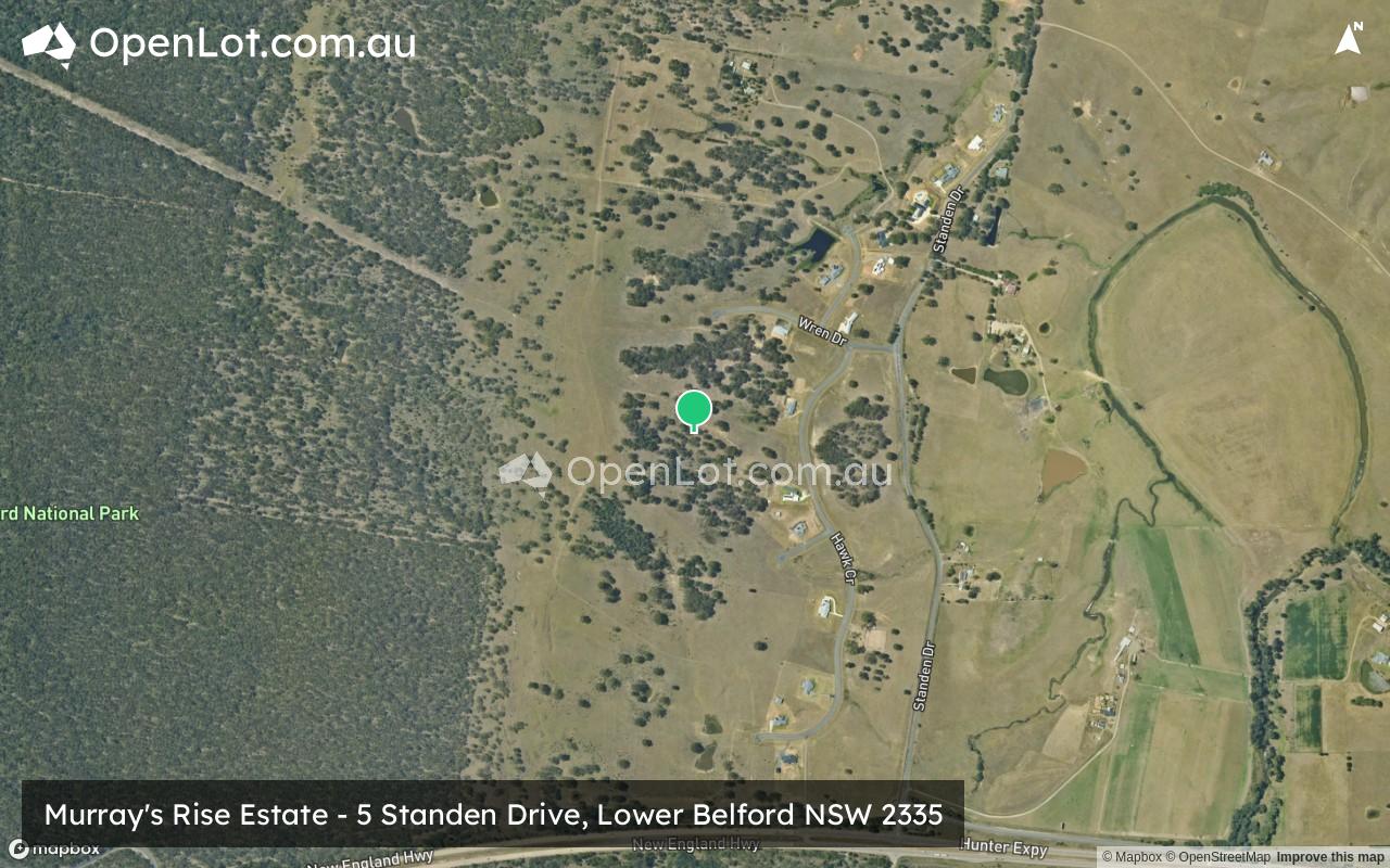
Location & Map for Murray's Rise Estate - Lower Belford
Visit Display Homes near Murray's Rise Estate - Lower Belford

Vacancy Rate in Lower Belford NSW 2335
View full vacancy rate history in Lower Belford NSW 2335 via SQM Research.
Schools near Murray's Rise Estate - Lower Belford
Here are 6 schools near Murray's Rise Estate - Lower Belford:
K-6 Catholic Primary School - School Head Campus
K-6 Government Primary School
K-6 Government Primary School
K-6 Government Primary School
K-6 Government Primary School
7-12 Catholic Secondary School
Reviews & Comments on Murray's Rise Estate - Lower Belford
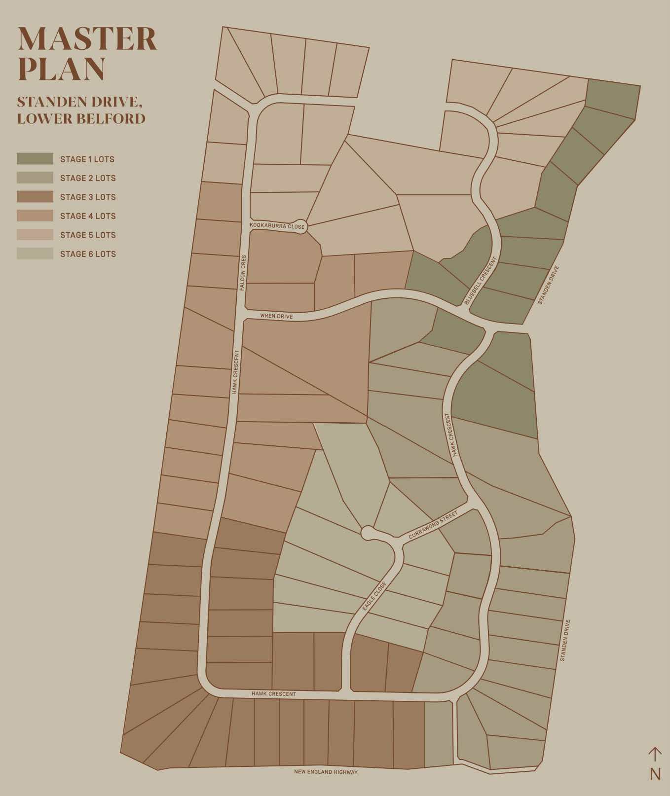
Estate Brochure, Masterplan, Engineering Plan, Plan of Subdivision (POS), Design Guidelines
FAQs about Murray's Rise Estate - Lower Belford
View all estates marketed by Urban Land Housing
- Rosary Park Catholic School - 3.1km south-east
- Branxton Public School - 3.5km east
- Kirkton Public School - 4.9km north-west
- Greta Public School - 7.6km south-east
- Lochinvar Public School - 14.0km south-east
- St Joseph's College - 14.4km south-east
Popular Estates near Murray's Rise Estate - Lower Belford
Latest New Home Articles for You

09/Mar/2026 | OpenLot.com.au
Victoria: Top 30 Most Searched Housing Developments (February 2026)
If you’ve been exploring housing opportunities in Victoria, February 2026...

20/Feb/2026 | OpenLot.com.au
Display Homes at Drouin Fields Estate: A Thriving Community in Drouin
Welcome to Drouin Fields, a place where beauty, space, and modern luxury ...

19/Feb/2026 | OpenLot.com.au
Display Homes at Manor Lakes Esate: A Thriving Waterside Community in Manor Lakes
A place where you can settle in, rather than just settle down. Named for ...

13/Feb/2026 | OpenLot.com.au
🏠 Victoria: Top 30 Most Searched Townhouse Developments – January 2026

11/Feb/2026 | OpenLot.com.au
🏡 Top 30 Most Searched Estates by State - January 2026

10/Feb/2026 | OpenLot.com.au
Victoria: Top 30 Most Searched Housing Developments (January 2026)
If you’ve been considering making a move in Victoria, January 2026 offere...

10/Feb/2026 | OpenLot.com.au
Queensland: Top 30 Most Searched Housing Developments (January 2026)
If you’ve been considering making a move in Queensland, January 2026 offe...

09/Feb/2026 | OpenLot.com.au
Western Australia: Top 30 Most Searched Housing Developments (January 2026)
If you’ve been considering making a move in Western Australia, January 20...

06/Feb/2026 | OpenLot.com.au
South Australia: Top 30 Most Searched Housing Developments (January 2026)
If you’ve been considering making a move in South Australia, January 2026...