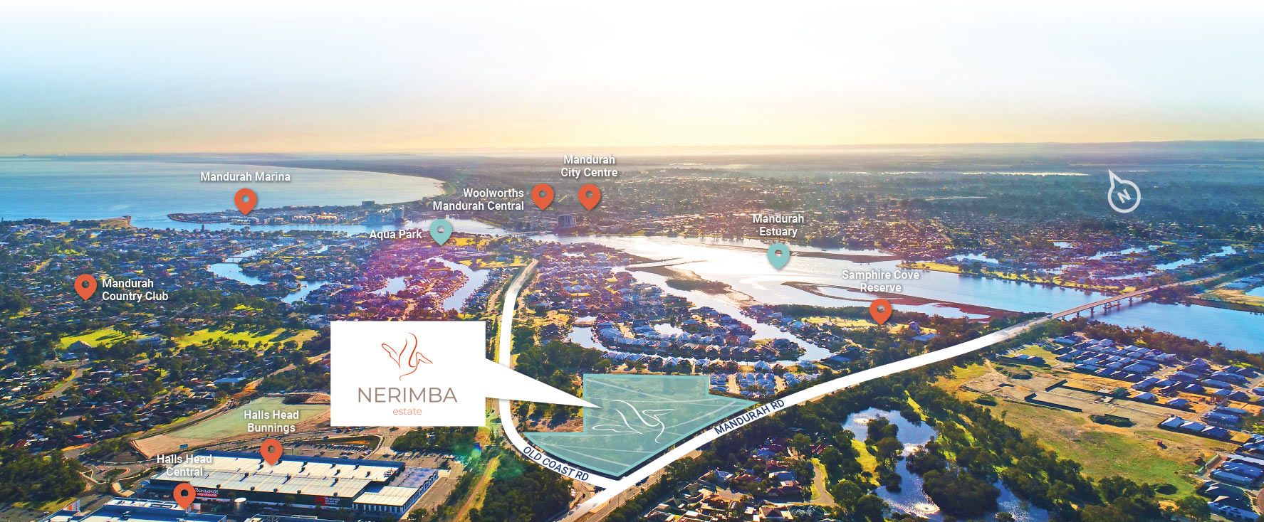
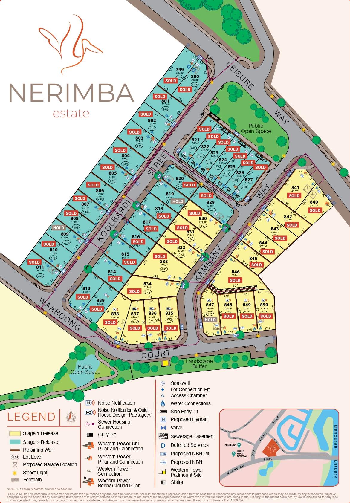
Nerimba Estate - Halls Head
This information is estimated by the OpenLot research team. Let us know here to provide up-to-date information about this development.
| Total new homes | 50 |
| Area size | N/A |
| Growth Region | Mandurah (Peel Region) |
| City council | City of Mandurah |
| Developer | N/A |
| Project marketer | Harcourts Mandurah |
Land for Sale, House and Land Packages:
Popular Estates near Nerimba Estate - Halls Head


Updates for Nerimba Estate - Halls Head
Facebook updates:
Related news:

Missing articles? Send us a link here.
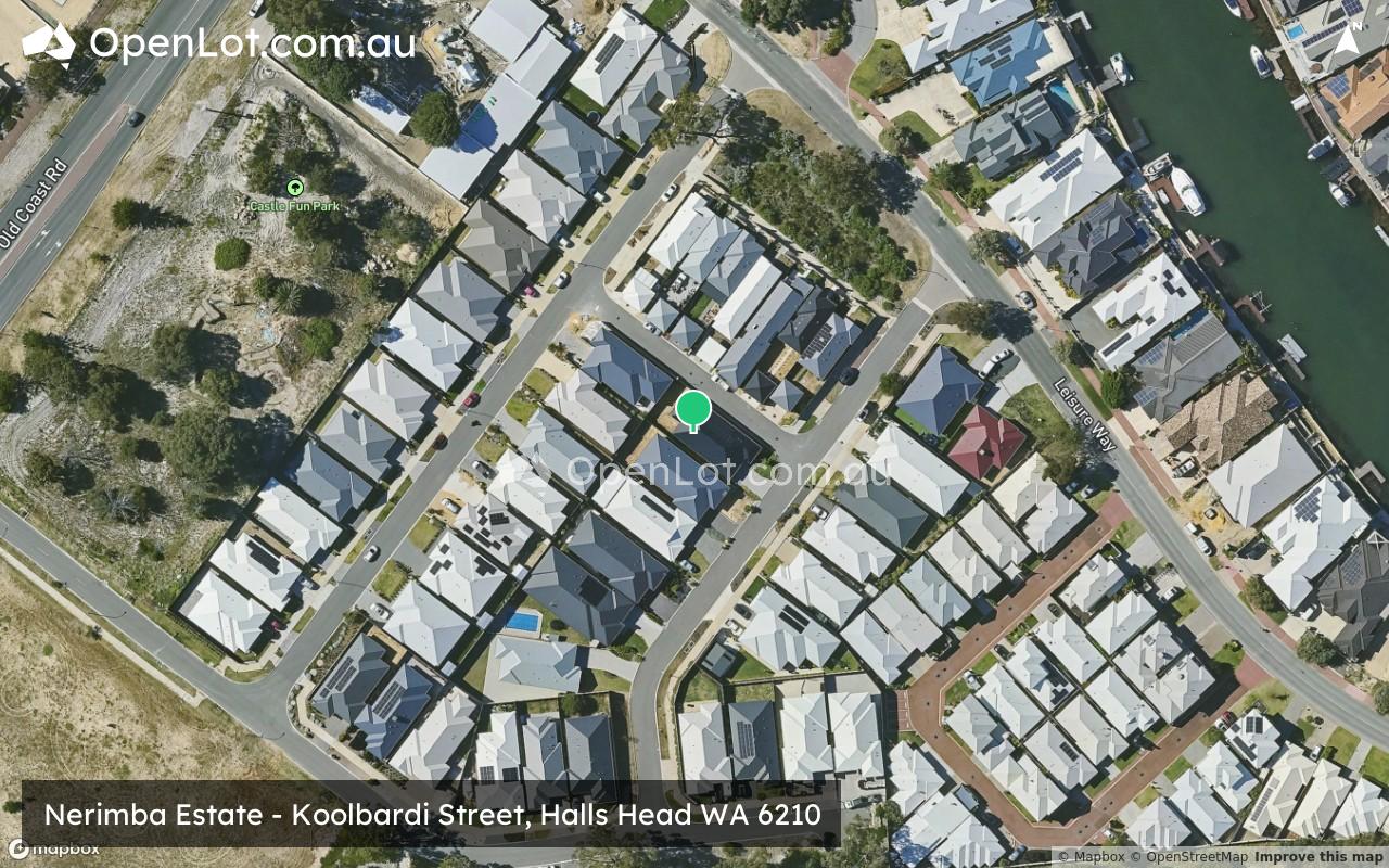
Location & Map for Nerimba Estate - Halls Head
Visit Display Homes near Nerimba Estate - Halls Head


Vacancy Rate in Halls Head WA 6210
View full vacancy rate history in Halls Head WA 6210 via SQM Research.
Schools near Nerimba Estate - Halls Head
Here are 6 schools near Nerimba Estate - Halls Head:
K-6 Government Primary School
K-6 Government Primary School
7-12 Government Secondary School
7-10 Government Special School
K-6 Government Primary School
K-6 Government Primary School
Reviews & Comments on Nerimba Estate - Halls Head
Estate Brochure, Masterplan, Engineering Plan, Plan of Subdivision (POS), Design Guidelines
FAQs about Nerimba Estate - Halls Head
View all estates marketed by Harcourts Mandurah
- Glencoe Primary School - 657m north-west
- Halls Head Primary School - 1.2km west
- Halls Head College - 1.7km south-west
- Halls Head College Education Support Centre - 1.7km south-west
- Dudley Park Primary School - 2.6km east
- Mandurah Primary School - 2.6km north-east
Popular Estates near Nerimba Estate - Halls Head
Latest New Home Articles for You

27/Jan/2026 | OpenLot.com.au
Display Homes at Stockland Wildflower Estate: A Smart Community in Piara Waters
Welcome to Wildflower, a vibrant new neighbourhood nestled in the heart o...

16/Jan/2026 | OpenLot.com.au
South Australia Top 30 Most Searched Housing Developments (December 2025)

15/Jan/2026 | OpenLot.com.au
Queensland: Top 30 Most Searched Housing Developments (December 2025)
If you’ve been tracking housing demand across Queensland, December 2025 p...

14/Jan/2026 | OpenLot.com.au
Victoria: Top 30 Most Searched Housing Developments (December 2025)
If you’ve been exploring housing opportunities in Victoria, December 2025...

14/Jan/2026 | OpenLot.com.au
Display Homes at Apsley Estate: A Masterplanned Community in Mandogalup
Apsley is a bold, 1,800-lot masterplanned community just 25 minutes south...

13/Jan/2026 | OpenLot.com.au
Western Australia: Top 30 Most Searched Housing Developments (December 2025)
If you’ve been keeping an eye on housing demand across Western Australia,...

12/Jan/2026 | OpenLot.com.au
New South Wales: Top 30 Most Searched Housing Developments (December 2025)
If you’ve been considering making a move in New South Wales, December 202...

07/Jan/2026 | OpenLot.com.au
🏡 Top 30 Most Searched Estates by State - December

06/Jan/2026 | OpenLot.com.au
Display Homes Near Me (WA): Your Complete Guide to Display Villages Across Western Australia
Finding the right display home in Western Australia has never been easier...