


Newenham Adelaide Hills Estate - Mount Barker 11 AVAILABLE
[NEW RELEASE] Welcome to Newenham - Designed for Wellbeing
- A special place where nature leads, community thrives, and life flows with gentle purpose. Born from vision, shaped by thoughtful design, and nurtured by a warm community, Newenham is the very essence of authentic Adelaide Hills living.
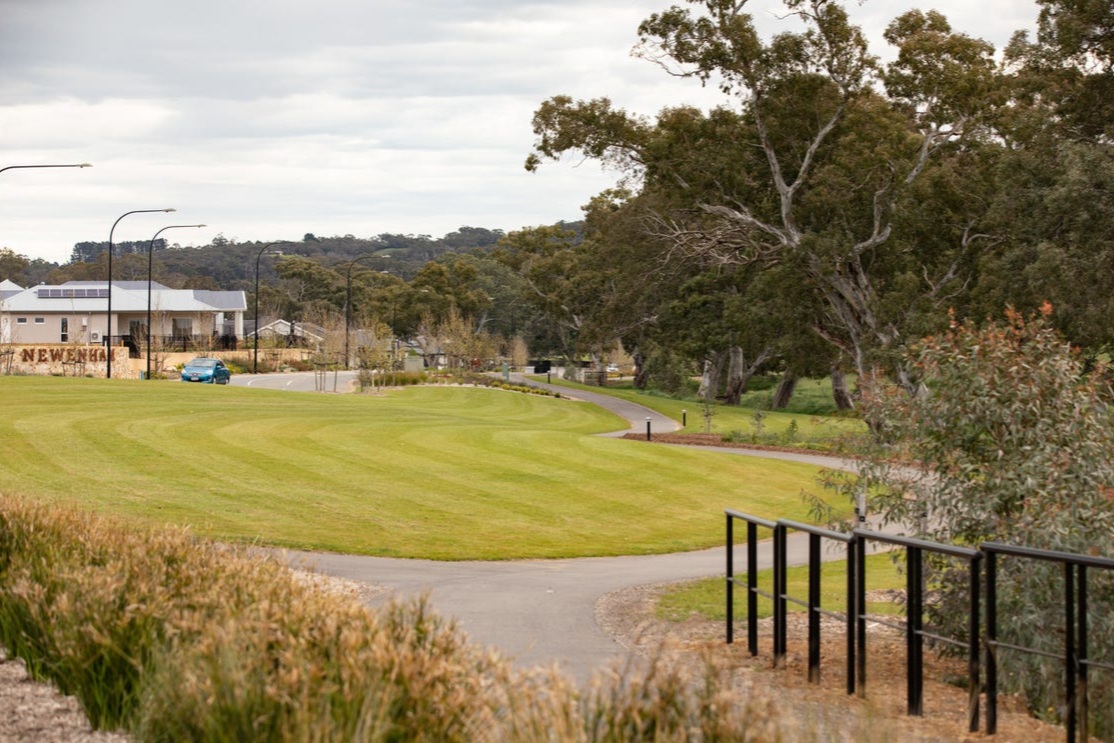
- Connected - Life in flow with nature - Nestled along the tranquil flow of Western Flat Creek, Newenham offers a lifestyle that feels both connected to nature and effortlessly inspiring. Here, thoughtful planning meets natural beauty, and everyday life flows with meaning, ease, and belonging.
- The Newenham masterplan has been thoughtfully designed for wellbeing and connection.
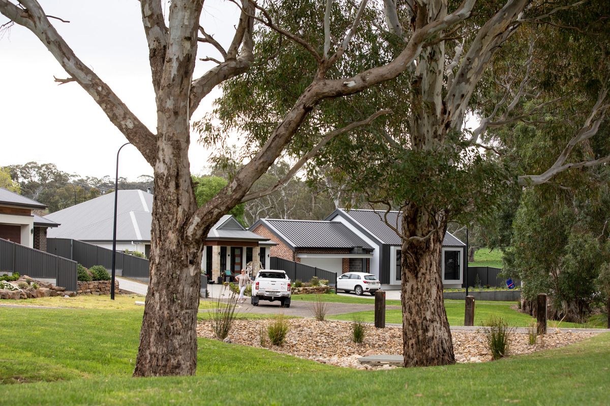
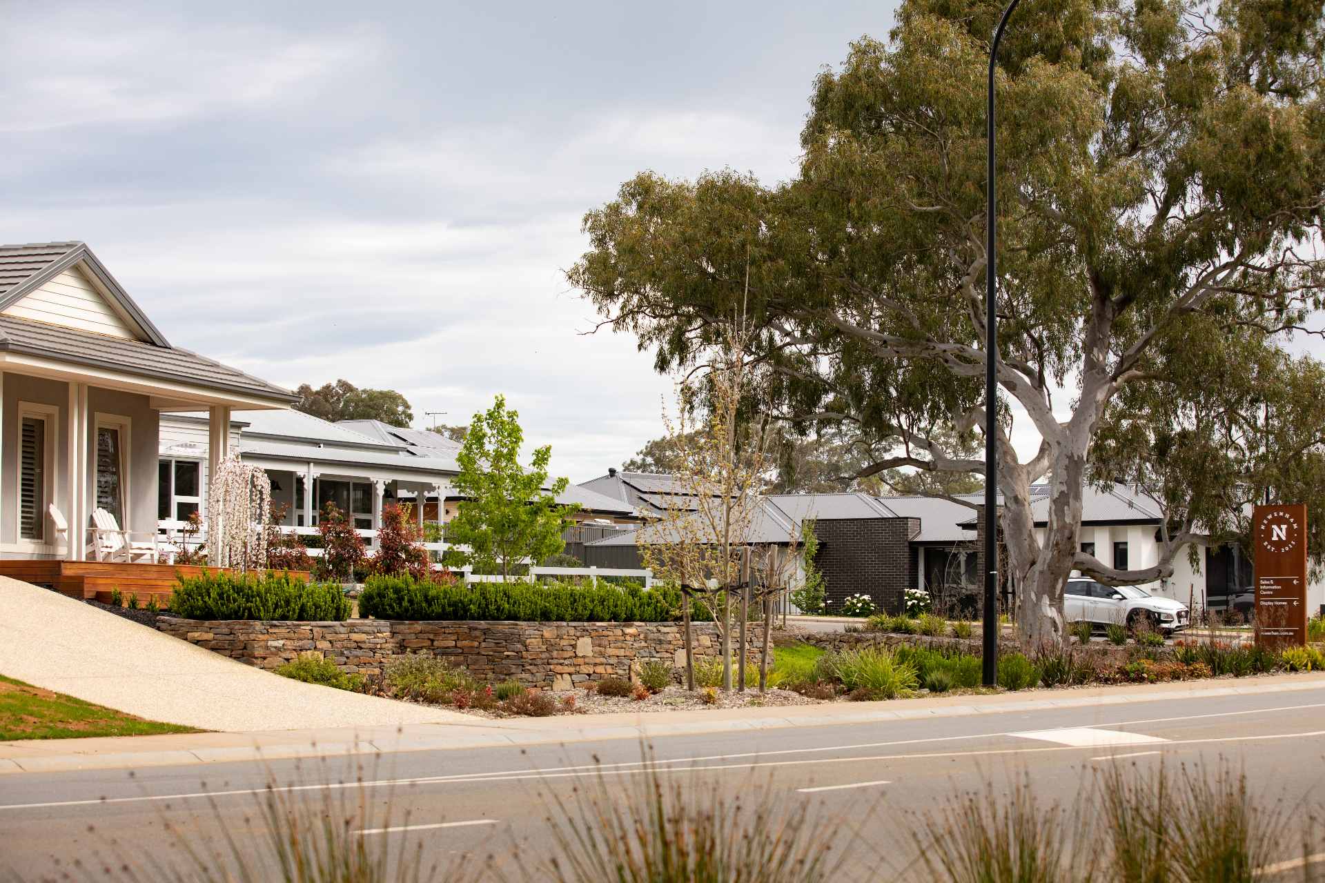
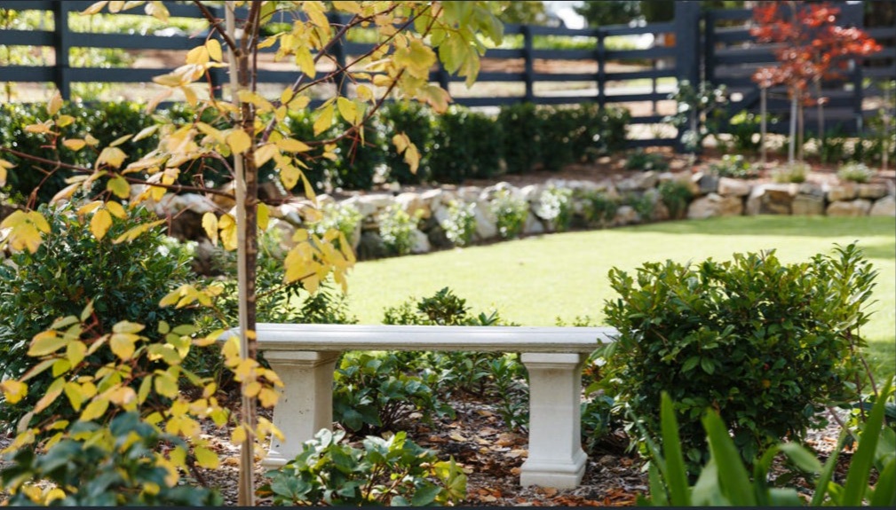
- Generous open spaces, wide footpaths for safety and walkability, and carefully framed view corridors create a neighbourhood that feels both spacious and intimate – a crafted place with a genuine connection to nature and community.
- Newenham offers premium large blocks in a variety of sizes, frontages and orientations, with deep verges and natural landscaping.
- The only project on the western side of Flaxley Road with the town centre of Mount Barker just 2km away, making it the best located and most accessible project in all of Mount Barker.
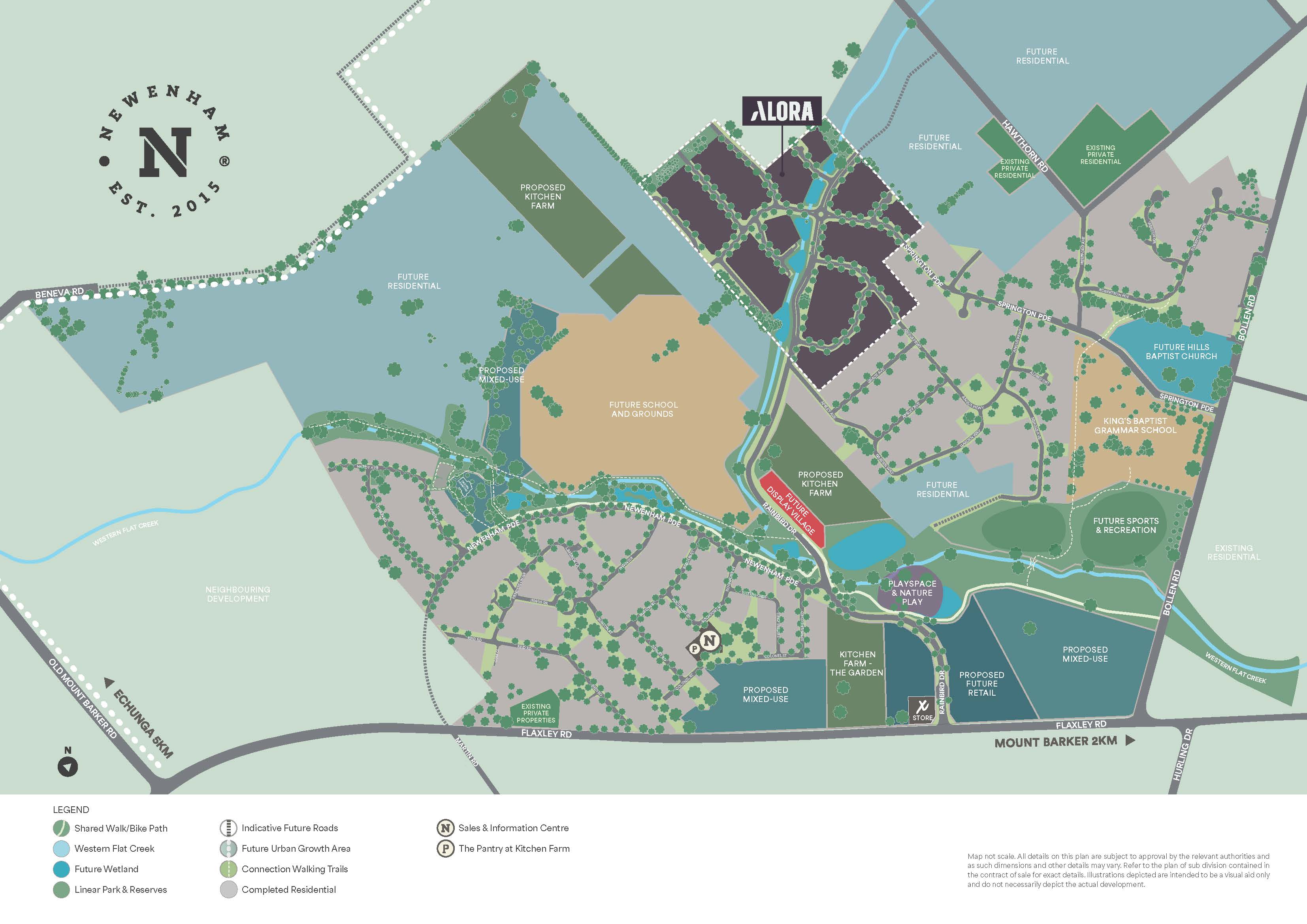
- The Western Flat Creek flows through the heart of Newenham, enhanced with native vegetation, wetlands and a viewing platform.
- Reserve and verge planting to enrich the environment and offer bio-diversity, landscaping abundance and colour to the streetscapes.
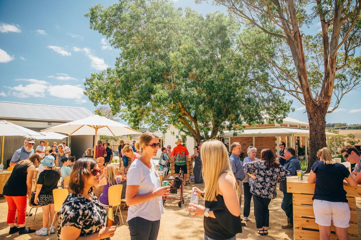
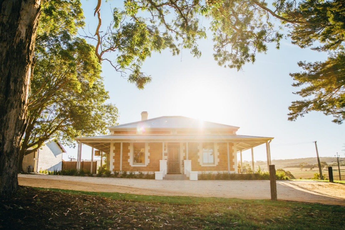
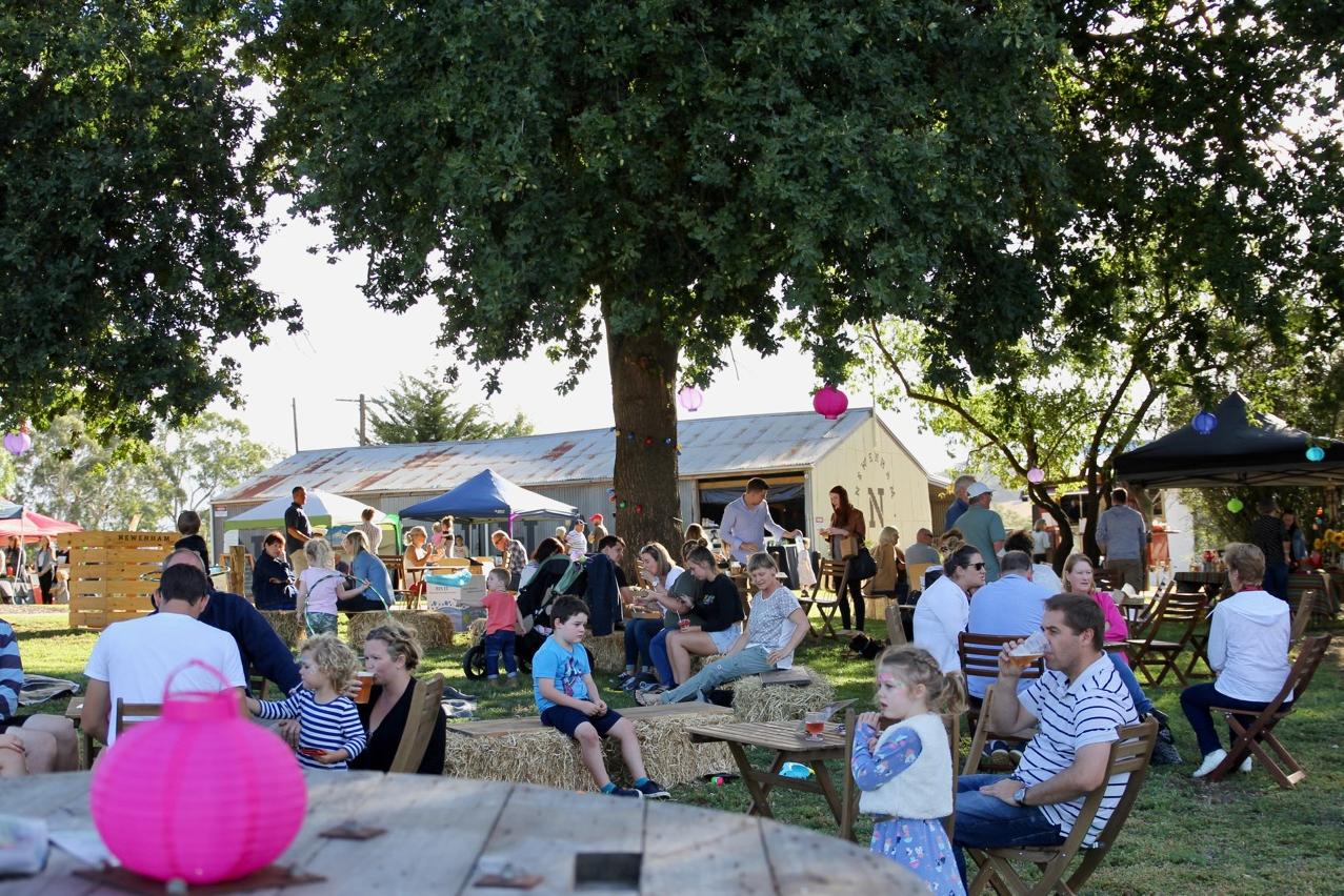
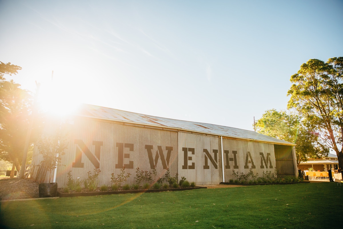
- Kitchen Farm is where people come together - to share great food, connect with neighbours and feel part of the Newenham community. Whether it’s a quiet chat over coffee, a long lunch in the sunshine or a local event in the restored barn. It reflects the spirit of Newenham - welcoming, grounded and deeply connected.
- Kings Baptist Grammar School opened in 2023, adjacent to the future sports and recreation grounds.
- Future retail village with main street shopping and supermarket.
- Up to 8 hectares of land dedicated for a thriving and productive nursery and farm.
- Nature on your doorstep with 98% of trees being retained and hundreds more being planted.
- An evolving playspace combining key pieces of equipment and nature play, to encourage kids to explore and connect, with the natural environment.
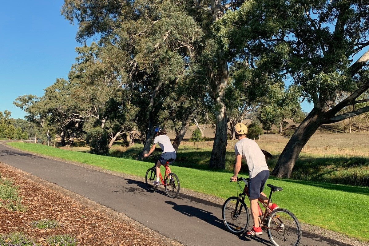
- The Newenham linear park follows the contours of the Western Flat Creek and features a bike and walk path to easily connect residents to the heart of Mount Barker and the bus interchange.
- Complimentary design service to assist you with the process of building your dream home within the simple and thoughtful Design Guidelines at Newenham.
This information is estimated by the OpenLot research team. Let us know here to provide up-to-date information about this development.
| Total new homes | 750 |
| Area size | 150.00 hectares |
| Growth Region | Adelaide Hills Growth Areas |
| City council | Mount Barker District Council |
| Developer | Burke Urban |
| Distance to | Adelaide CBD - 28 km south-east Adelaide Airport - 32 km south-east |
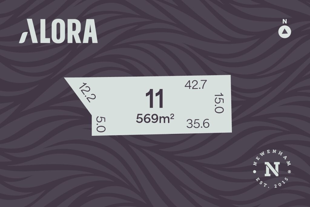
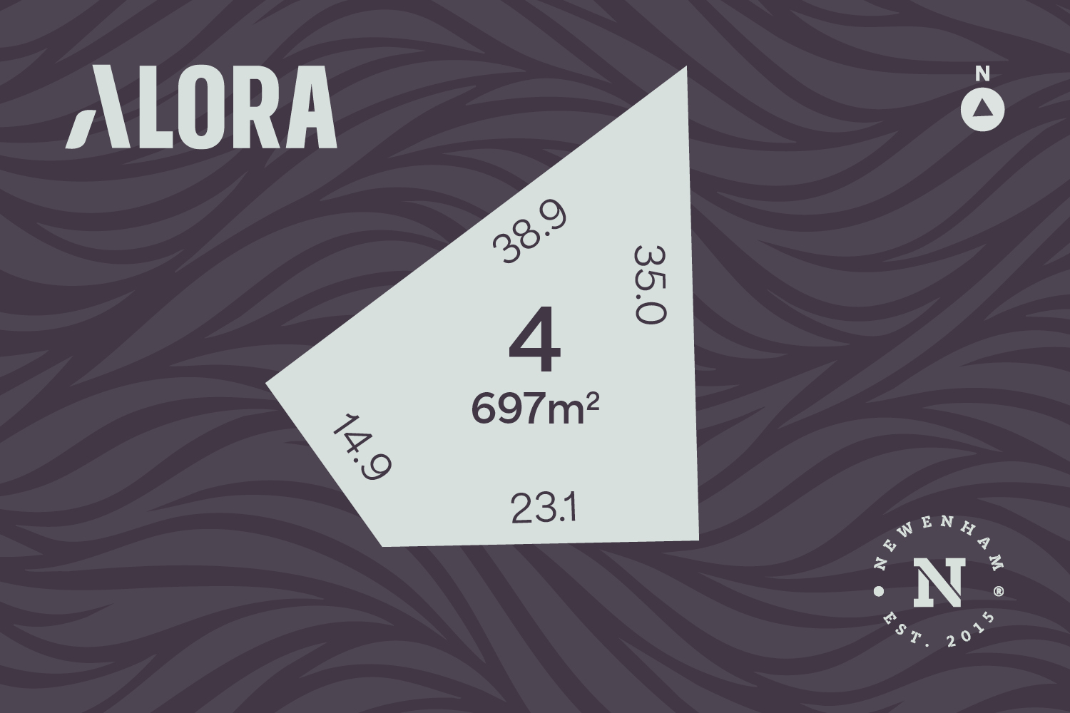
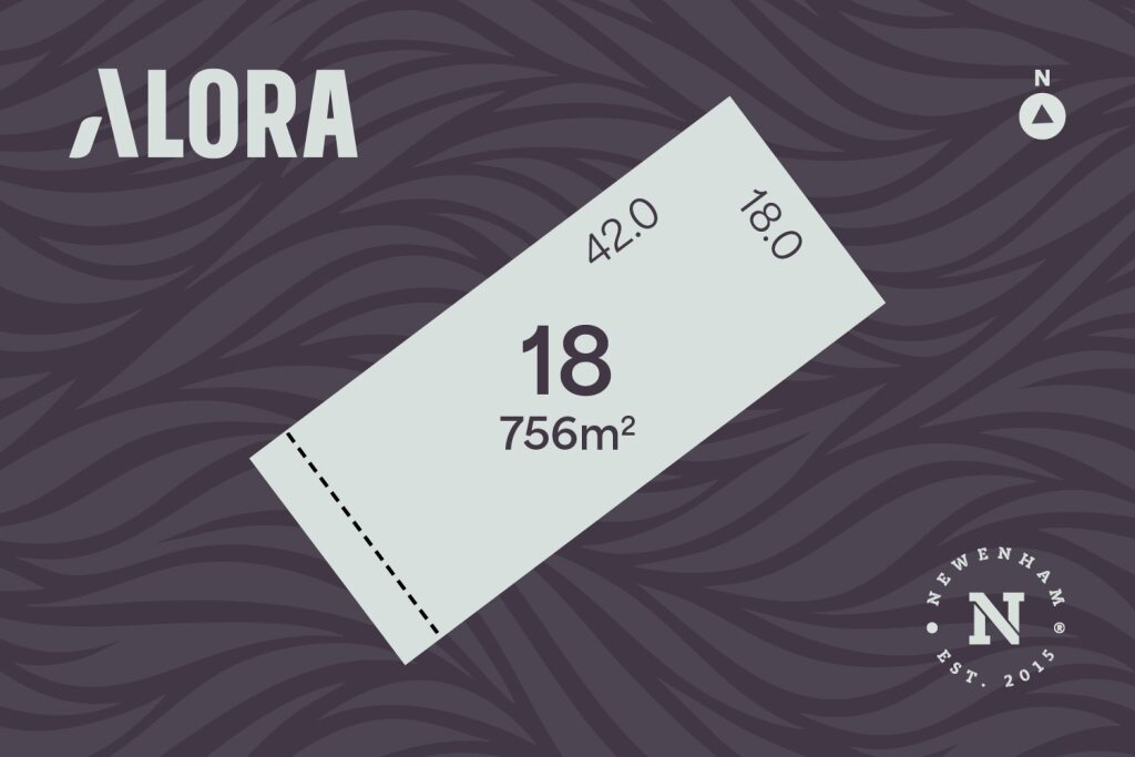
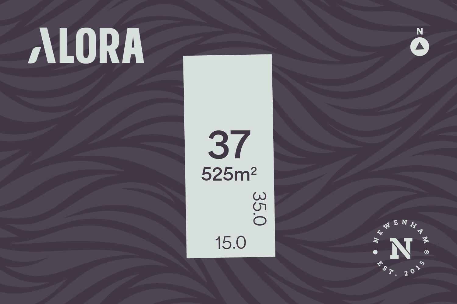
Land for Sale:
7 Land Lots in Newenham Adelaide Hills Estate - Mount Barker
Welcome to Newenham Adelaide Hills, a beautiful residential neighbourhood, designed to enrich the health, happiness and wellbeing of everyone who chooses to call it home.
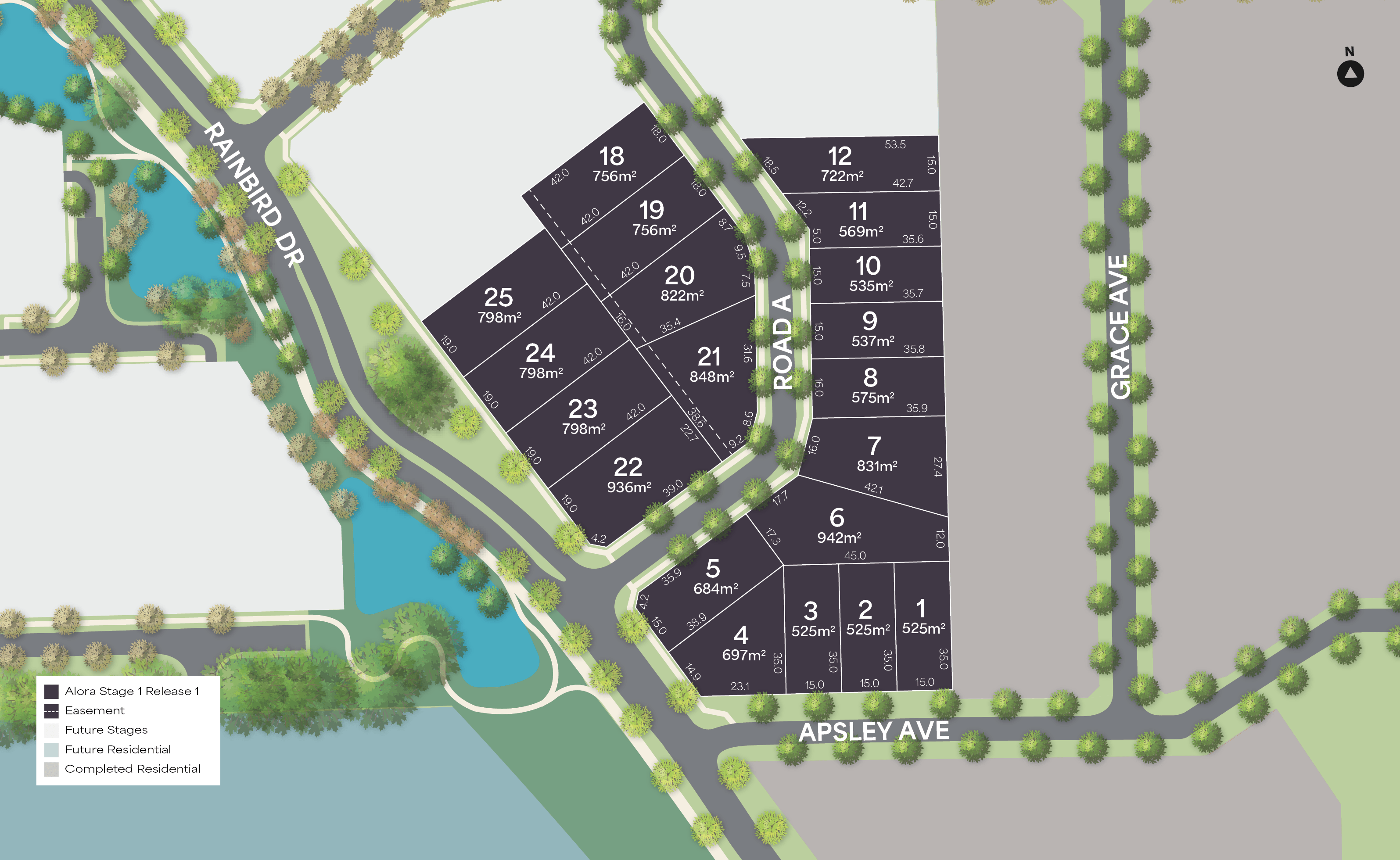
Alora is Newenham’s newest neighbourhood, proudly delivered by Newland Developments to continue the community’s vision of wellbeing, connection and natural beauty.
Set within natural surrounds, this vibrant community offers spacious lots ranging from 425m2 to 1000m2.
Here, leafy streets and generously spaced lots create a welcoming sense of openness and character. Wherever possible, the land’s natural contours are followed, preserving the beauty of the landscape and enhancing the feeling of harmony with nature.
A sweeping boulevard guides you through tree-lined streets, deep-planted verges, and a picturesque series of wetlands that form a central landscape feature. Every detail reflects Newenham’s open-space philosophy, bringing nature, community, and lifestyle together in a way that feels effortless and enduring.
Lot 4 Rainbird Drive, is well positioned at the heart of Newenham and the entrance to Alora, With nature right at your doorstep, you'll be facing the nearby wetland and reserves and will enjoy connected pathways through the Western Flat Creek and then, leading you into the vibrant heart of Mount Barker. Or you can take a leisurely walk to The Pantry at Kitchen Farm, where you can relax, unwind and indulge in delicious treats in a rustic atmosphere.
The only way to truly appreciate how spectacular this block is, and to experience the unique charm of Newenham and its community, is to come and see it for yourself.
To find out more about this block or other land for sale at Newenham, visit www.newenham.com.au or call our sales team on 0429 107 497.
Come and see for yourself why so many people have chosen to call Newenham home.
RLA345447


4 House and Land Packages in Newenham Adelaide Hills Estate - Mount Barker

 4
4
 2
2
 2
2
Popular Estates near Newenham Adelaide Hills Estate - Mount Barker


Updates for Newenham Adelaide Hills Estate - Mount Barker
Facebook updates:
Related news:
If you’ve been considering making a move in South Australia, January 2026 offered a clear snapshot of where buyer interest was strongest. OpenLot has compiled a definitive list of the Top 30 Most Searched Housing Developments in SA, ranked by the number of project page views generated from organic searches on OpenLot.com.au between 1 January 2026 and 31 January 2026.
South Australia’s property market is gaining momentum, with growth areas in Adelaide and the surrounding hills attracting significant buyer interest. According to data from OpenLot.com.au for January 2025, the following estates have emerged as the top five most popular among homebuyers and investors.
At Burke Urban we are a hands-on family business that has never lost sight of what we do – create places where people thrive and lifestyles are enhanced.

Missing articles? Send us a link here.
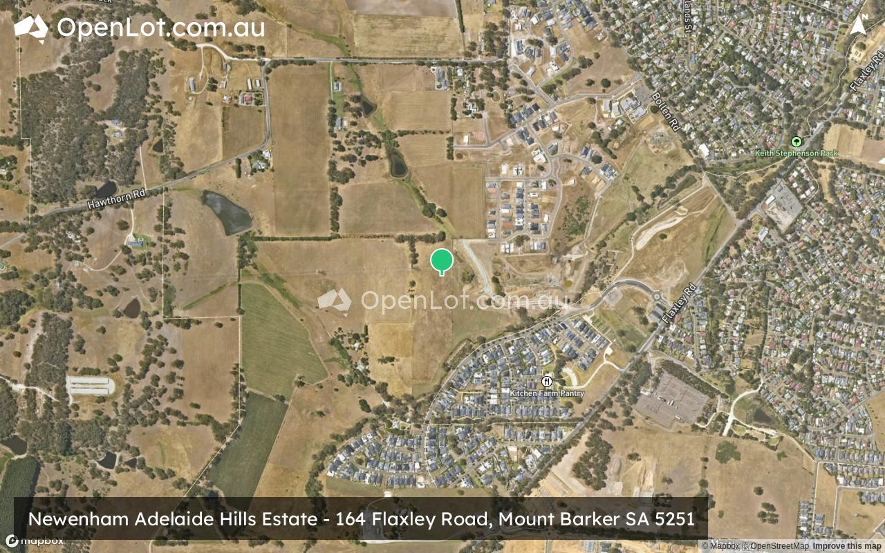
Location & Map for Newenham Adelaide Hills Estate - Mount Barker
Visit Display Homes near Newenham Adelaide Hills Estate - Mount Barker


Vacancy Rate in Mount Barker SA 5251
View full vacancy rate history in Mount Barker SA 5251 via SQM Research.
Schools near Newenham Adelaide Hills Estate - Mount Barker
Here are 6 schools near Newenham Adelaide Hills Estate - Mount Barker:
U, 7-12 Government Secondary School
U, R-6 Government Primary School
U, R-6 Government Primary School
R-6 Independent Primary School
7-12 Independent Secondary School
R-12 Catholic Combined School
Suburb Planning Review in Mount Barker SA 5251
Mount Barker is a local town approximately 37.9 square kilometres in area, forming part of the Mount Lofty Ranges in the Greater Adelaide region of South Australia. Located 33 kilometres south east of Adelaide CBD, the semi-rural township contains a northern urbanised area, large local centre (commercial and retail), large industrial area, residential areas, wetlands, parks and schools. The urbanised area is surrounded by rural land holdings and the agriculture industry.

The suburb boundary is located along the Native Avenue, Pinchbeck Firetrack, Fidler Lane, Potts Road, Yunkunga Road and Merritt Road to the south. The South Eastern Freeway is the entire northern boundary, Springs Road, Harper Road and property boundaries to the to the east. Flaxley Road, Haines Firtrack, Liebelt Summer Track and properties boundaries provide the suburb boundary to the west.
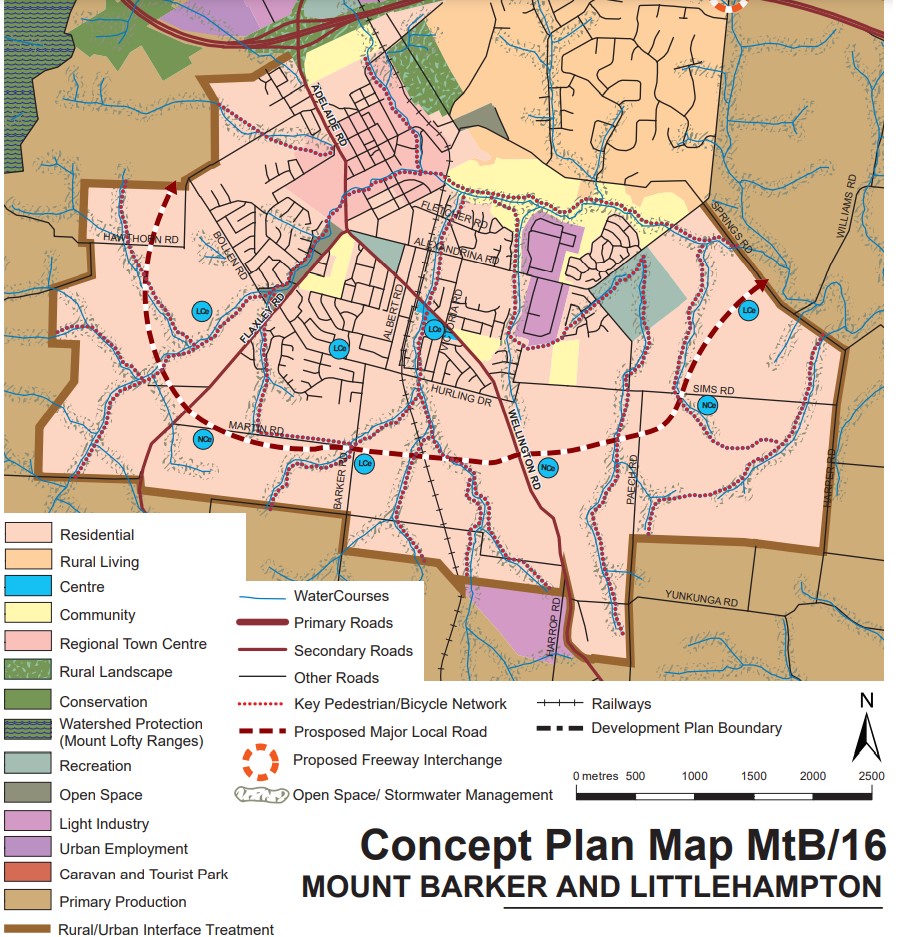
A local road network is found throughout Mount Barker, providing access to the surrounding suburbs and the local network of roads. Springs Road and Old Mount Barkers Road provides west and east connections through the centre of the suburb, whilst Wellington Road, Flaxley Road and Bald Hills Road provides north and south connections linking to the major arterial road in proximity.

The northern urban area contains a mix of zoning that facilitates the community needs and services. The neighbourhood zone exists to the south of the business, retail and commercial zoning and provides exiting residential areas of the suburb.
The Master Planned Neighbourhood zoning was rezone under the Mount Barker Urban Growth Areas Development Plan (amendment) declared by the Minister for Planning in December 2010. The growth areas were reflected in the Development Plan prepared by Mount Barker District Council and the 30-Year Plan for Greater Adelaide prepared by the Department of Planning, Transport and Infrastructure for the South Australian State Government.
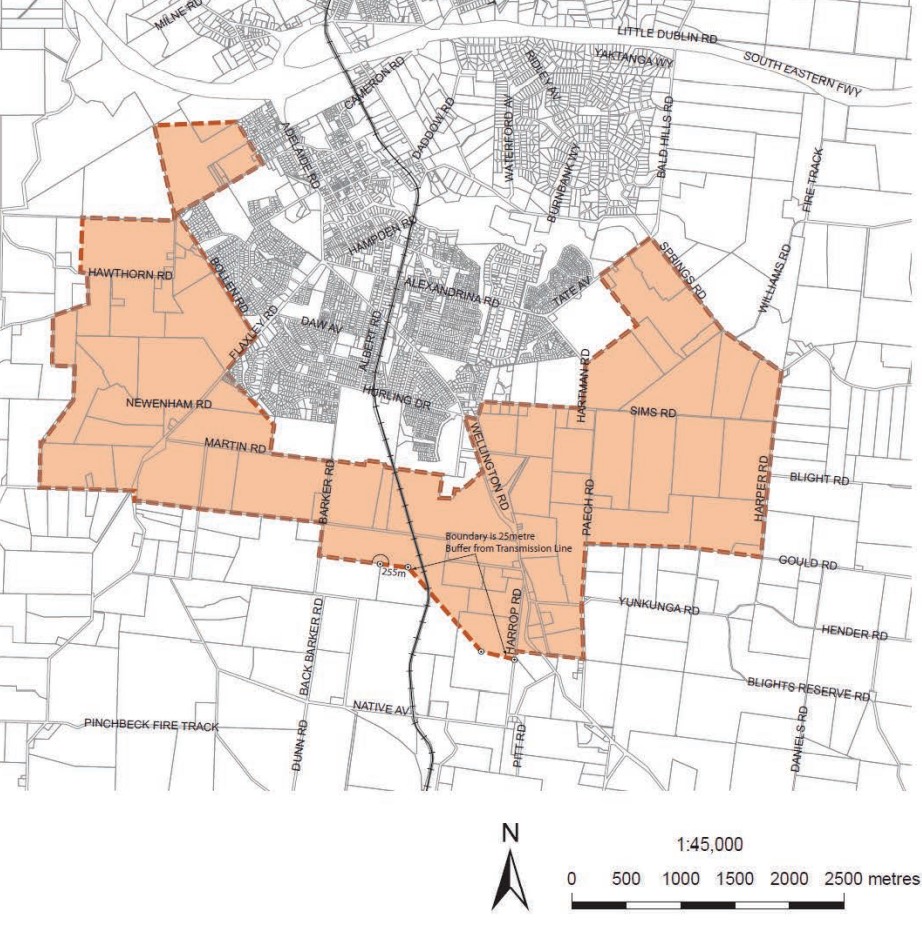
The rezone of Rural land to Residential under the Master Planned Neighbourhood zone affects approximately 1,200 hectares to accommodate a range of housing forms as well as a range of complementary services and activities to meet the needs of future residents. The rezone also included 42 hectares of land within the existing Light Industry Zone.
Mount Barker Submission for Managed Urban Growth
The plan for the next 30 years is the revitalisation of existing neighbourhoods, concentrated new development around transit corridors, and proposed new mixed-use precincts to bring jobs, services and public transport closer to where people live. The Mount Barker Council considered the growth area and provided the following position:
“Over the last ten years the District Council of Mount Barker has been the fastest growing non- coastal Council within Australia, averaging 3 per cent growth per annum. Through this experience Council has learnt invaluable lessons regarding managing and staging rapid growth and wishes to utilise this knowledge in the negotiation and provision of further growth. In the absence of strategies for community building, nor detail or commitment on how the infrastructure, health, education or social needs will be delivered or resourced; the rapid growth proposed in the draft 30 Year Plan threatens each pillar of sustainability and the values shared by the community. Council does not oppose population growth but will only support managed growth which is financially, socially and ecologically sustainable, and clearly resolves the critical issues outlined in Chapter 5 of this Submission”.
Mount Barker Strategic Vision
“The Mount Barker district will be recognised as being highly liveable, prosperous and safe, built from a foundation of community spirit and energy, quality of lifestyle and unique heritage, environment and landscape.” – Mount Barker 2035 District Strategic Plan.
Greater Adelaide Region Growth Area
The population growth in the Greater Adelaide Region area will be 1.97 million people by 2045, which is expected to require a housing growth of 248,000 dwellings. The planning priorities and actions for improving the liveability of residents, a competitive and sustainable region are set down in the 30-Year Plan for Greater Adelaide, 2017 update.
The growth areas will create the opportunity to reduce urban sprawl to the north and south of the elongated metropolitan footprint and the use of urban renewal projects is encouraged to find new spaces and places to live. The City Shape 2043 provides a basis for ongoing discussion with the community about the changing shape of Mount Barker as it grows.

Mount Barker Suburb Summary
Reviews & Comments on Newenham Adelaide Hills Estate - Mount Barker
Estate Brochure, Masterplan, Engineering Plan, Plan of Subdivision (POS), Design Guidelines
FAQs about Newenham Adelaide Hills Estate - Mount Barker
View all estates from Burke Urban
- Mount Barker High School - 1.7km north-east
- Mount Barker South Primary School - 1.8km east
- Mount Barker Primary School - 1.9km north-east
- St Mark's Lutheran School - 2.2km north-east
- Cornerstone College - 2.7km north-east
- St Francis de Sales College - 3.0km north-east
Popular Estates near Newenham Adelaide Hills Estate - Mount Barker
Latest New Home Articles for You

09/Mar/2026 | OpenLot.com.au
Victoria: Top 30 Most Searched Housing Developments (February 2026)
If you’ve been exploring housing opportunities in Victoria, February 2026...

20/Feb/2026 | OpenLot.com.au
Display Homes at Drouin Fields Estate: A Thriving Community in Drouin
Welcome to Drouin Fields, a place where beauty, space, and modern luxury ...

19/Feb/2026 | OpenLot.com.au
Display Homes at Manor Lakes Esate: A Thriving Waterside Community in Manor Lakes
A place where you can settle in, rather than just settle down. Named for ...

13/Feb/2026 | OpenLot.com.au
🏠 Victoria: Top 30 Most Searched Townhouse Developments – January 2026

11/Feb/2026 | OpenLot.com.au
🏡 Top 30 Most Searched Estates by State - January 2026

10/Feb/2026 | OpenLot.com.au
Victoria: Top 30 Most Searched Housing Developments (January 2026)
If you’ve been considering making a move in Victoria, January 2026 offere...

10/Feb/2026 | OpenLot.com.au
Queensland: Top 30 Most Searched Housing Developments (January 2026)
If you’ve been considering making a move in Queensland, January 2026 offe...

09/Feb/2026 | OpenLot.com.au
Western Australia: Top 30 Most Searched Housing Developments (January 2026)
If you’ve been considering making a move in Western Australia, January 20...

06/Feb/2026 | OpenLot.com.au
South Australia: Top 30 Most Searched Housing Developments (January 2026)
If you’ve been considering making a move in South Australia, January 2026...