
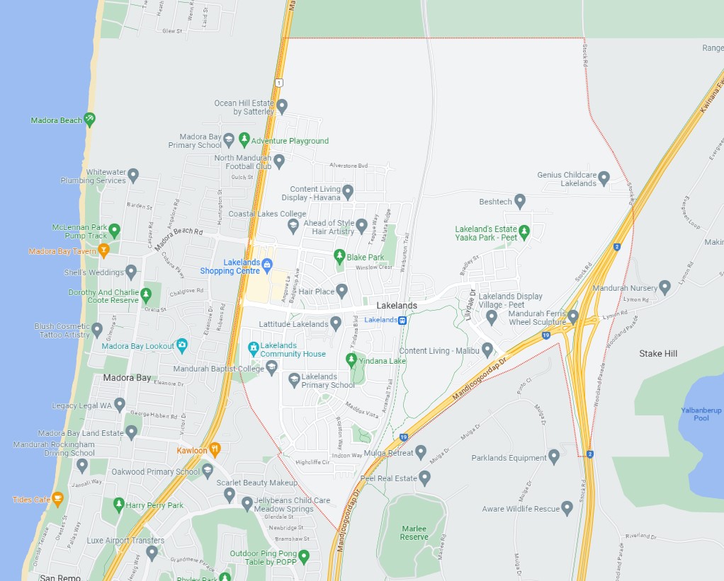
Lakelands is a town of approximately 7.1 square kilometres in area, forming part of the southern coastal region of Perth that is located 60 kilometres south of the Perth CBD. The township is located east of the Madora Bay coastal suburb and is separated by the Mandurah Road corridor that runs parallel to the coastline.
Lakelands, WA - Suburb Location
The suburb boundary is located along a disused rail corridor and Mandjoogoordap Drive to the south, property boundaries to the north and Mandurah Road to the west. Stock Road, Woodland Parade and Kwinana Freeway make up the entire eastern boundary.
The railway corridor runs through the middle of the suburb (north to south) separating both sides, with Lake Valley Drive providing local road access across and connecting both networks found throughout Lakelands.
Badgerup Avenue and Yindana Boulavard providing access to the surrounding suburbs and the local network of roads. Banksiadale Gate provides the sole connection to the coastline to the west. Mundijong Road, Mandjoogoordap Drive and Kwinana Freeway provide a north and south connection, providing the main major arterial roads to Perth.
Lakelands, SA – Google Maps
Lakelands began as several large vacant greenfield site, designated as part of master planning catering for the redevelopment of both the east and west, also a district town centre
The suburb structure plans were developed in 2016 for the West portion, followed by the East 2019 and in 2021 a structure plan for North-East of Lakelands was prepared. The suburb forms part of the City of Mandurah local government area, containing an urbanised area, local centres (commercial and retail), large residential areas, parks and schools in the southern portion of the suburb.
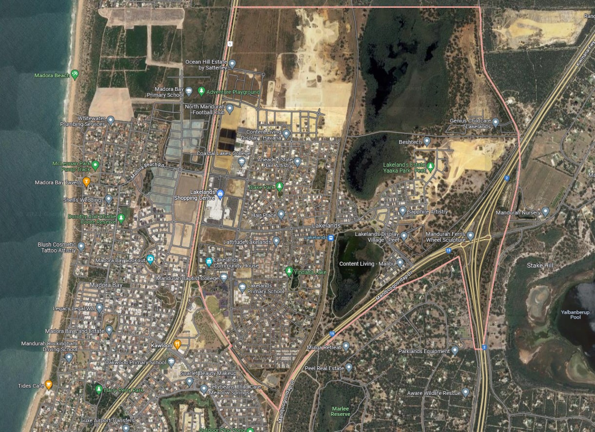
The urbanised area forms part of the City of Mandurah local government area. The suburb had 3 large lakes that are centrally located in a line from the north to the south of the suburb. A pocket of rural farming land in the northwest corner and eastern portion of the suburb, though is under redevelopment for residential housing.
Projects in Lakelands
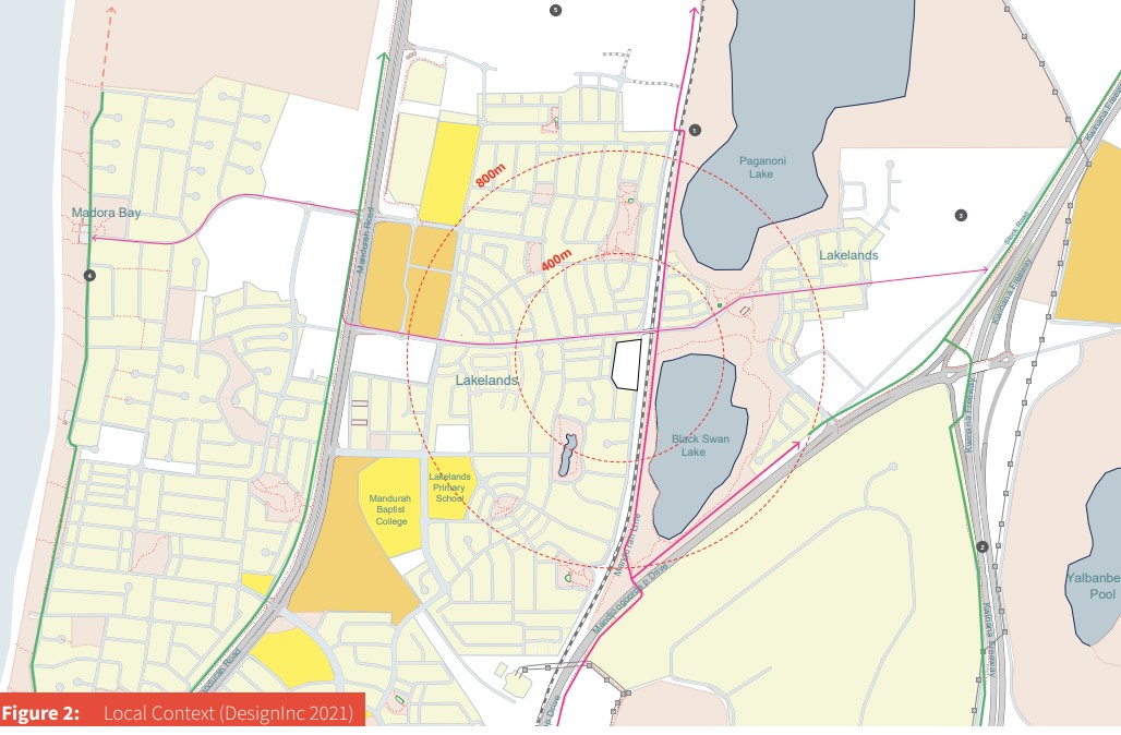
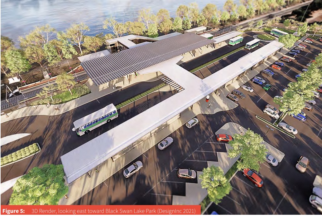
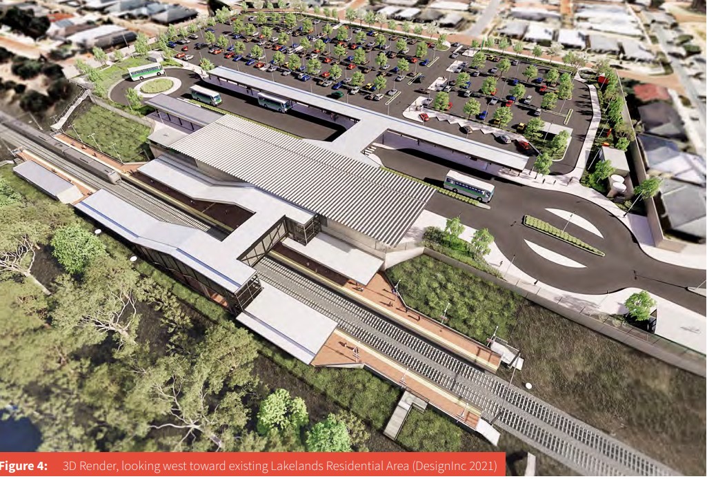
Lakelands Train Station / Bus Interchange
ADCO Constructions, selected as the preferred contractor in December 2020, was awarded the contract for Lakelands Station in January 2021. The $72 million project spearheaded by ADCO's project team with lead Architect Design Inc, ingeniously tackles challenges by situating two below-grade platforms within the rail reserve cutting, connected by an elevated concourse equipped with stairwells and elevators. Comprising two volumes linked by a spacious circulation area, the main station complex, positioned at grade, includes core amenities and service areas. The design navigates site-specific challenges, like topographical variations and construction within an operational rail corridor, utilising prefabricated elements in a narrow footprint to minimise disruptions to Mandurah line services and address level differences.
Beyond meeting Public Transport Authority specifications, the proposed station aligns with the METRONET Station Precinct Design Guide and State Planning Policy 7.0 – Design of the Built Environment. In addition to the train facilities, an off-street bus interchange is strategically located west of the main station buildings. This comprehensive interchange, featuring eight bus bays, layover space, and a canopy connecting to the station buildings, is designed to offer weather protection and shade. In harmony with Transperth operational requirements, the bus interchange plays a pivotal role in the station's overall functionality, enabling seamless connections between local bus services and the train station for efficient intermodal transfers.
Train Station Location
Train Station Location 2
Train Station Location 1
Mandurah: Local Planning Strategy
Mandurah's Local Planning Strategy is a foundational framework that shapes planning within the local government area, providing the basis for the development of a Local Planning Scheme. Governed by the 2015 Planning and Development (Local Planning Schemes) Regulations, the strategy outlines long-term planning directions, incorporates relevant State and Regional planning policies, and justifies land zoning or classification under the local planning scheme.
This strategy, expressly mentioned in Local Planning Scheme No. 12, encompasses the following:
- Establishing the long-term planning objectives for a local government.
- Incorporating relevant State and Regional planning policies into its framework.
- Providing the rationale for the zoning or classification of land under the local planning scheme.
Once endorsed by the Western Australian Planning Commission, the Local Planning Strategy comes into operation. Its functions include ensuring efficient land use, simplifying the planning framework, providing a spatial plan based on endorsed strategic plans, promoting design-focused outcomes, clarifying Mandurah's regional role, and assisting the Council in making informed planning decisions.
Mandurah: Strategic Community Plan 2020 - 2040
The Council's Strategic Community Plan (2020-2040) serves as a foundational framework, ensuring that the City's activities and services align with community expectations and aspirations. This plan addresses key challenges facing Mandurah in the future, such as climate change, environmental pressures, education, economic outcomes, community infrastructure, and the preservation of Mandurah's unique social fabric.
To operationalise this community vision, the Local Planning Strategy and Local Planning Scheme provide a mechanism, identifying strategies and initiatives from the Community Strategic Plan within each section. The overarching aim is to establish a land use planning framework that realizes the Place Aspiration, Place Vision, and achieves the objectives outlined in the Key Focus Areas of the Council's Strategic Community Plan (2020-2040).
Place Vision - “We are built in nature - a meeting place surrounded by unique waterways, where the wellbeing of our people and our environment are nurtured; where business in the community can thrive and entrepreneurship is celebrated. We will be the place where a thriving regional city and the heart of a village meet. This is our Mandjoogoordap.”
Structure Plans of Lakelands
The Council has embraced District Structure Plans for extensive regions earmarked for forthcoming urban expansion, involving various landowners. These plans serve the crucial role of ensuring that development unfolds in a coordinated manner across these properties by designating essential infrastructure elements, including major road networks, commercial centres, and regional open spaces.
In relation to Lakelands, the following are of interest:
- Lakelands East Structure Plan
- Lakelands West Structure Plan
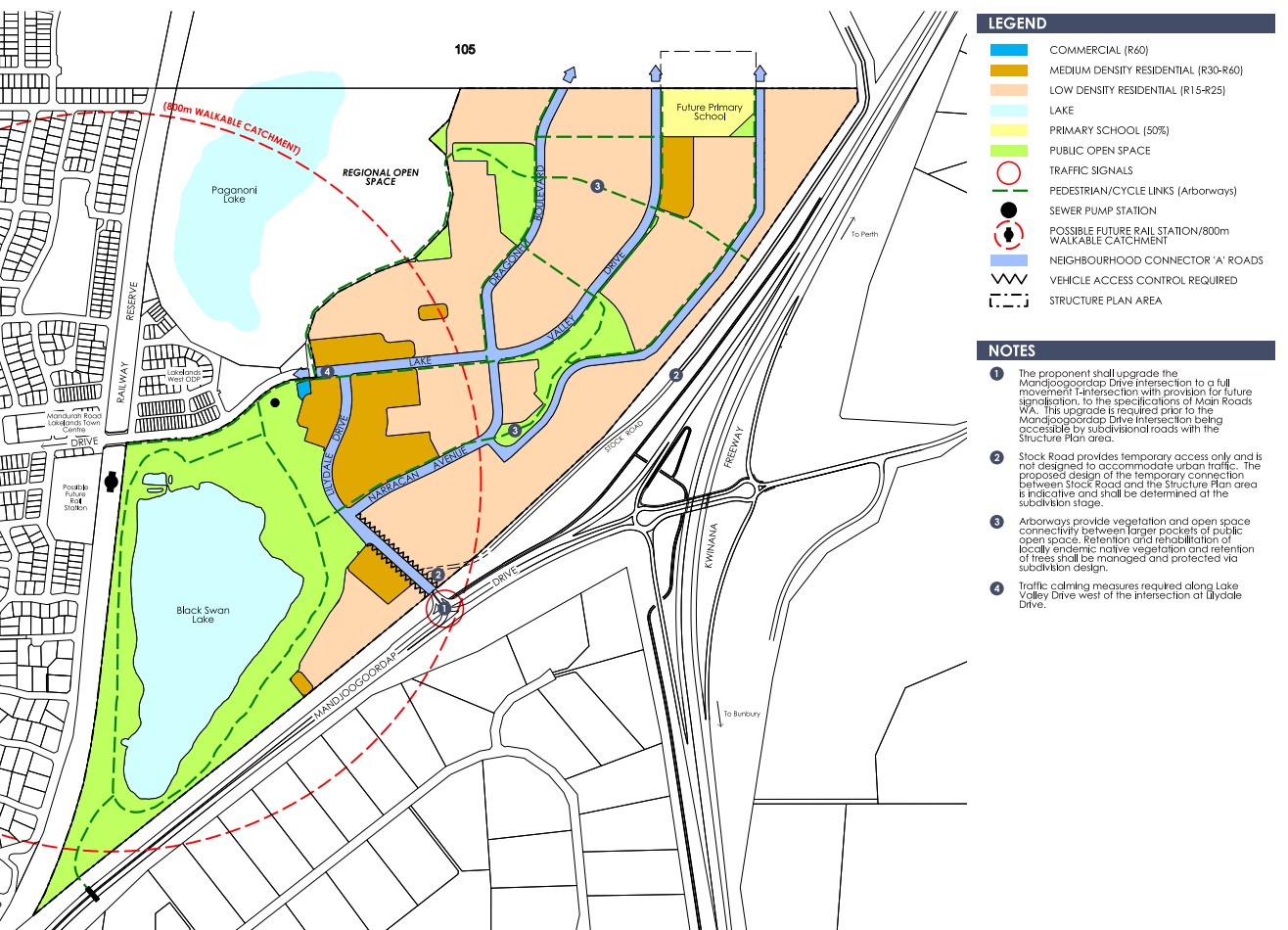
- Lakelands North East Structure Plan
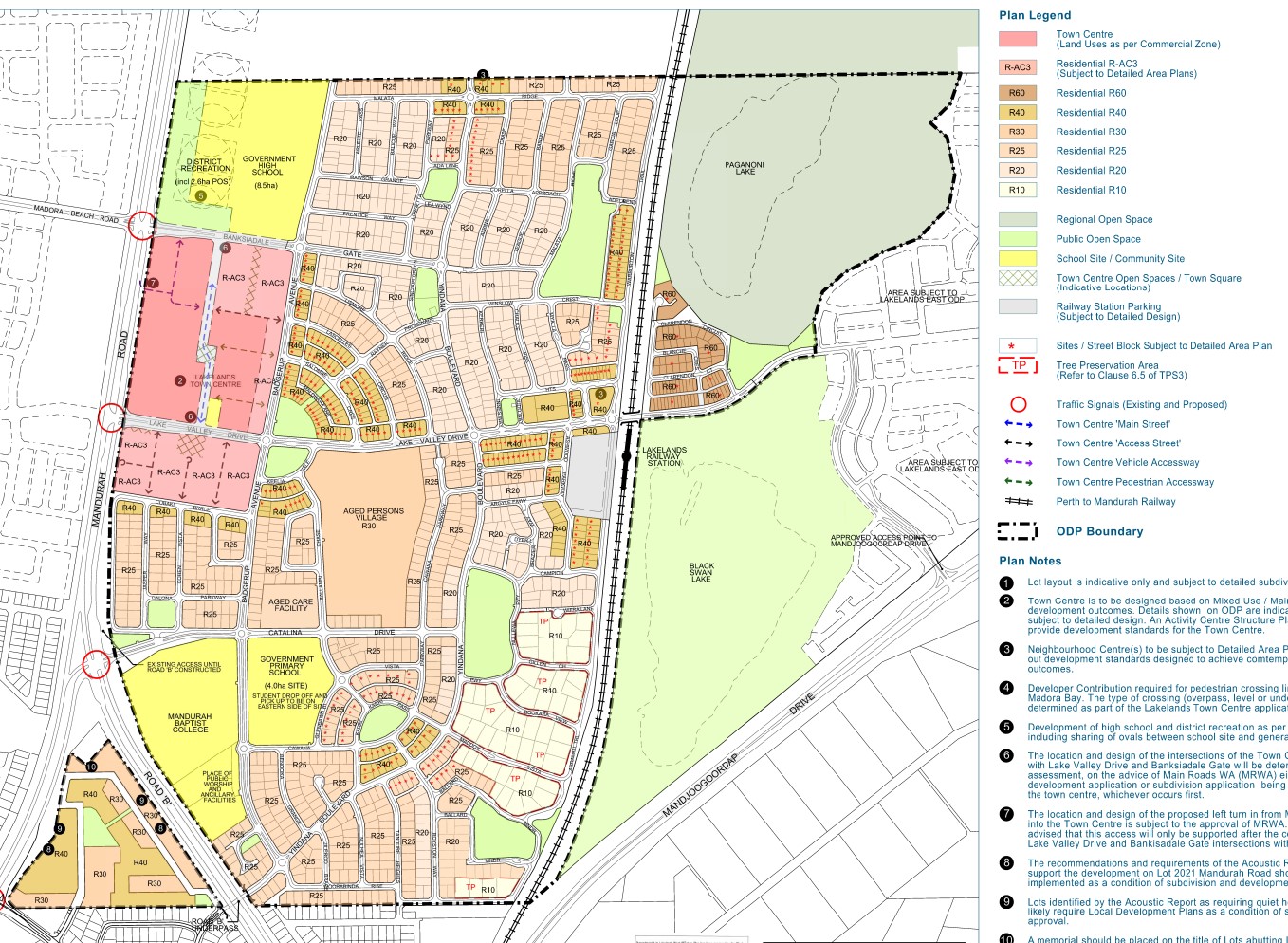
- Lakelands Town Centre Structure Plan
Lakelands East Structure Plan
Lakelands West Structure Plan
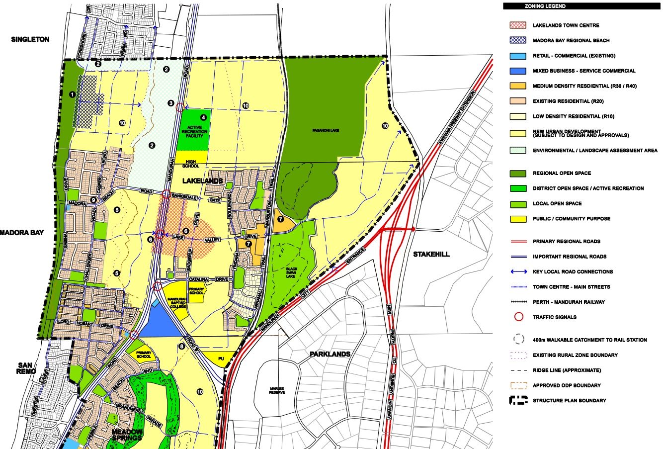
Lakelands North-East Structure Plan
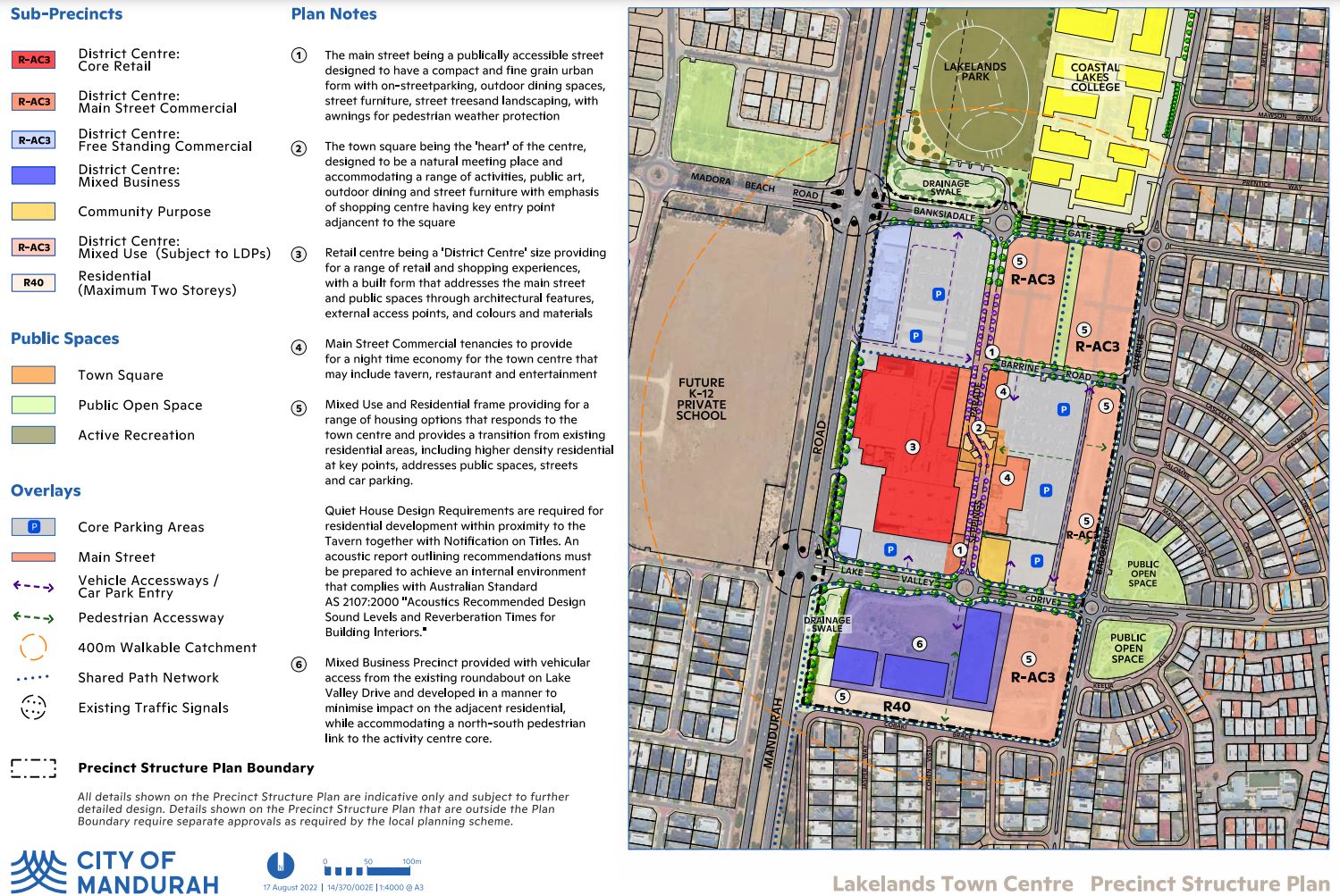
Lakelands Town Centre - Precinct Structure Plan
District Structure Plans
City of Mandurah utilises non-statutory District Structure Plans for long-term development beyond Town Planning Scheme No 3. Key plans include:
- Mandurah North Structure Plan (2006): Approved in June 2006, emphasising a vibrant town centre at Lakelands, a regional beach facilities node at Madora Bay North, and key road linkages.
These plans serve as frameworks for development and subdivision evaluations in Mandurah.
Mandurah North District Structure Plan
City of Mandurah Planning Scheme (Lakelands Area)
The City of Mandurah's Local Planning Scheme No. 12, updated on 3 October 2023, encompasses most of the Mandurah structure planning areas. The land use permissibility within the Structure Plan areas is to be in accordance with the corresponding zone or reserve under the City of Mandurah Town Planning Scheme No. 12. Below are the 4 maps that provided the current zoning.
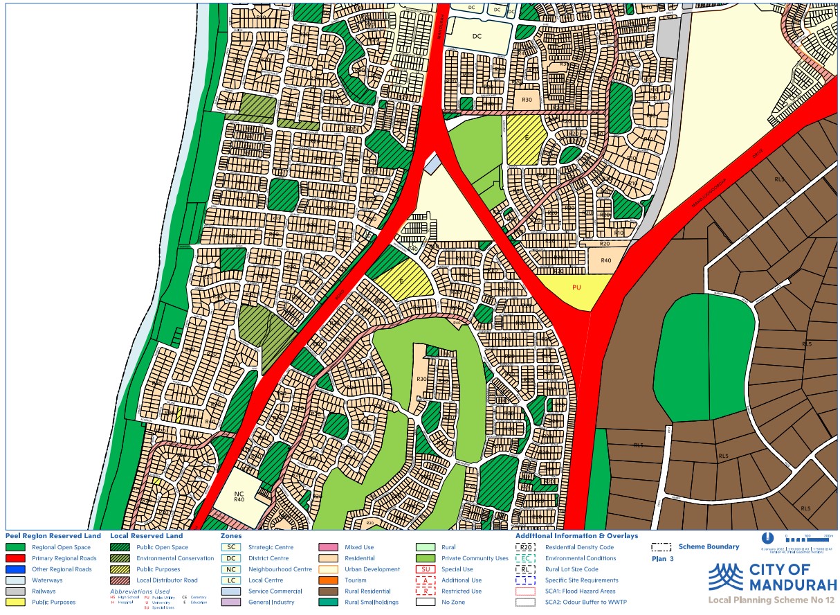
Lakelands - Planning Scheme Zoning - Plan 3
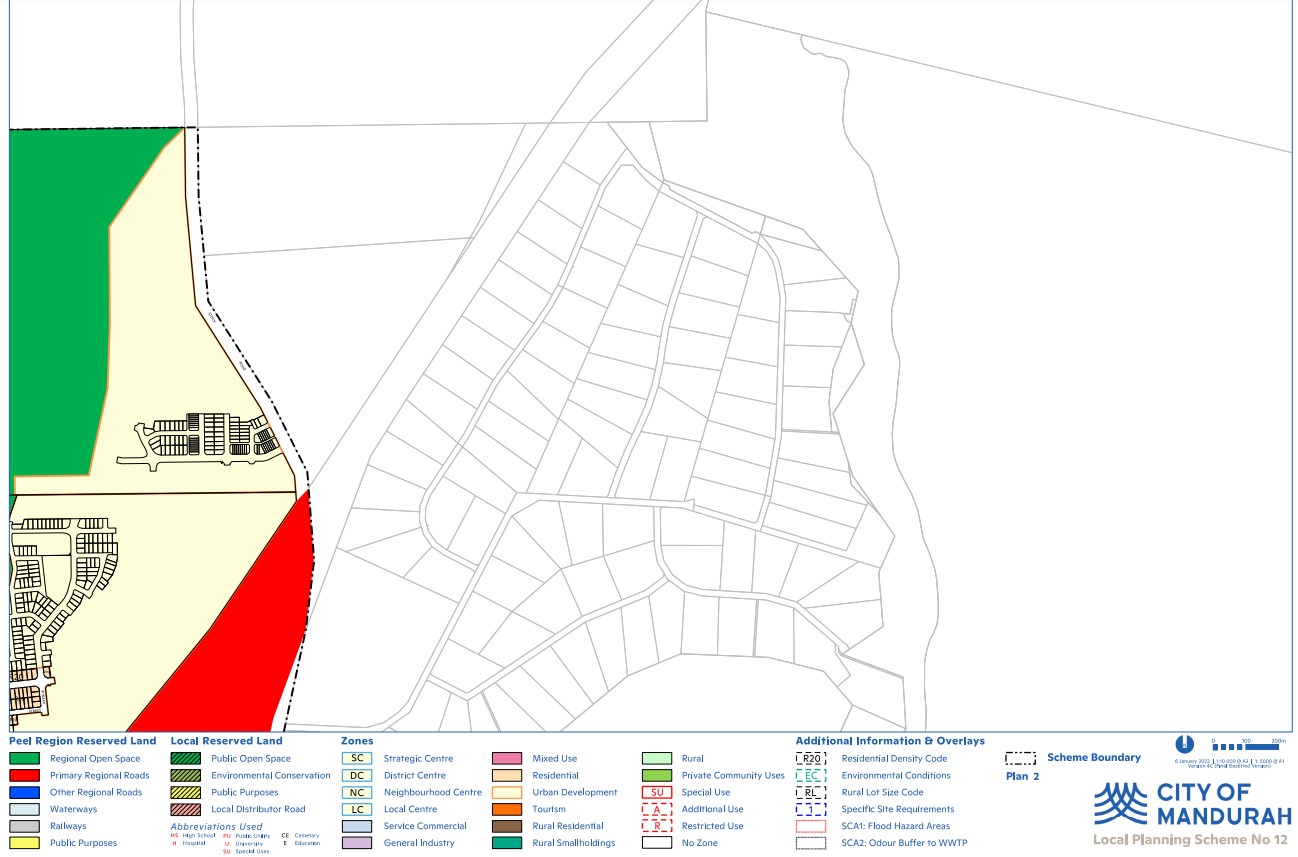
Lakelands - Planning Scheme Zoning - Plan 2
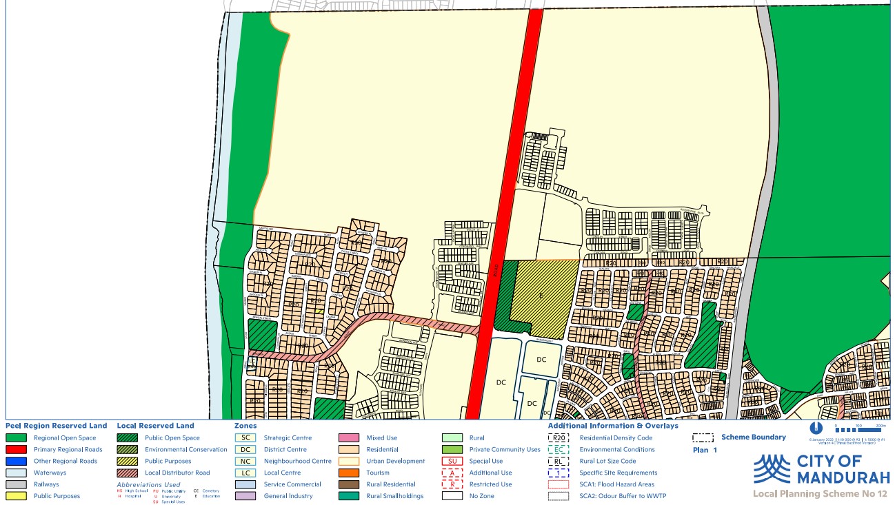
Lakelands - Planning Scheme Zoning - Plan 1
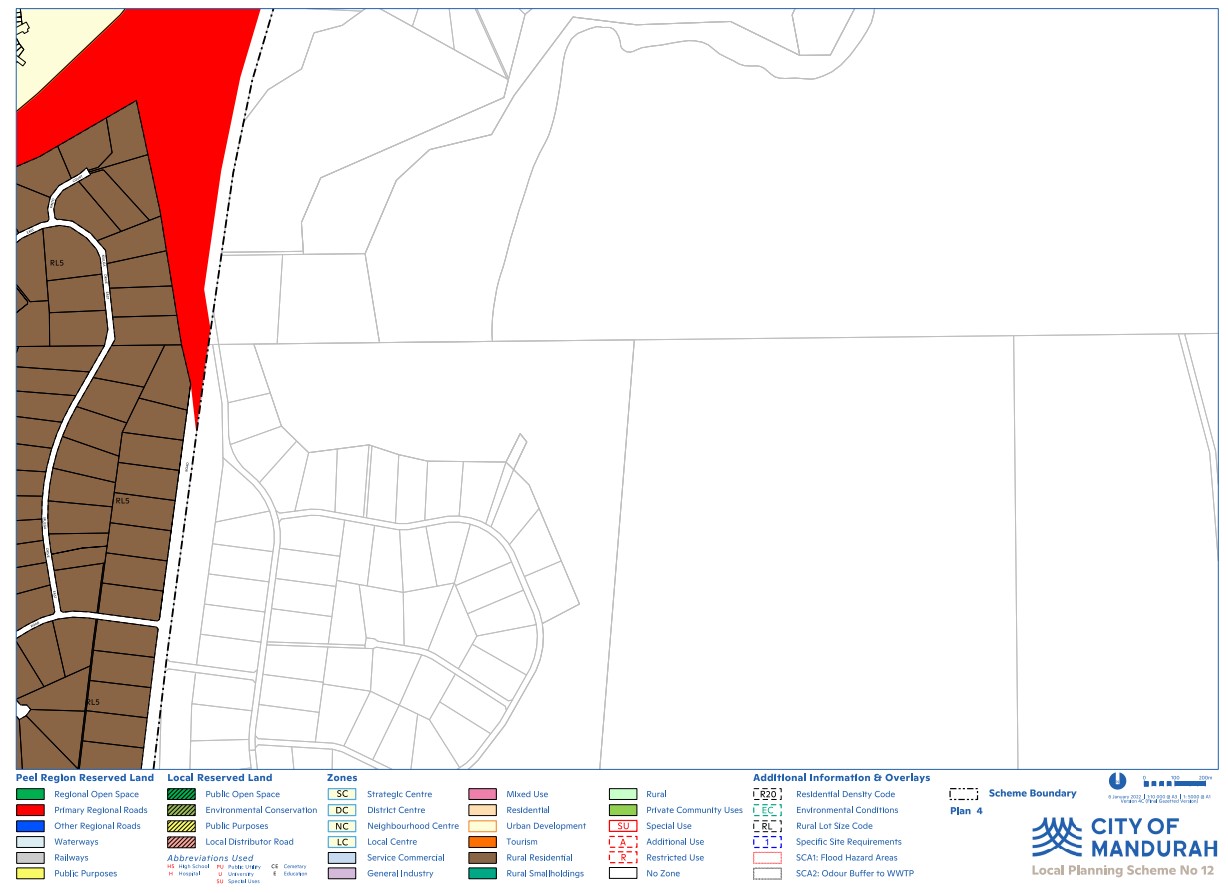
Lakelands - Planning Scheme Zoning - Plan 4
Directions 2031 and Beyond
The WAPC’s strategic planning framework document for Metropolitan Perth and Peel, is a high level strategic plan that establishes a vision for the future growth of the Perth and Peel region. It provides a framework to guide the detailed planning and delivery of housing, infrastructure and services necessary to accommodate that growth.
Perth and Peel Growth Areas
Growth Areas Perth and Peel (GAPP) represents an alliance of eleven suburban councils in the Perth and Peel regions. These councils have consistently championed the need for increased availability of public open spaces and the development of local sports facilities. They include the City of Cockburn.
GAPP's primary objective is to secure up to $350 million in federal funding for a dedicated account, a fund that would also attract supplementary investments from the State Government, Local Government, and development contribution programs.
With a maximum allocation of $30 million for any single project, these funds would be adequate to develop as many as 12 major sports precincts spanning the 11 suburban local government areas within the next four to eight years. Once these facilities are established, they will be operated and maintained by the respective Local Governments.
What Are the Advantages
- Increased Opportunities for Sports and Healthy Lifestyles:
- Enhanced access to sports facilities promotes physical activity and healthier living. - Reduction in Obesity Rates:
- The availability of these sports precincts can contribute to lowering obesity rates through increased physical activity. - Mitigation of Other Lifestyle Issues and Risks:
- These developments can help address various lifestyle-related issues and risks, fostering healthier and safer communities. - Job Creation:
- The project would stimulate job opportunities, benefiting the local economy. - Enhanced Livability and Appeal of Perth's Suburban Areas:
- The presence of modern sports facilities enhances the overall quality of life and attractiveness of Perth's suburban regions.
GAPP Framework
The frameworks aim to accommodate 3.5 million people by 2050 by creating vibrant communities within a compact and connected city; making best use of existing and proposed infrastructure; and protecting important environmental assets.
The framework encourages significantly greater infill development with almost half of the required 800,000 new homes – 380,000 at a minimum - to be built through infill development. The majority of these – around 214,000 – will be built in existing suburbs within the Central sub-region and particularly through alignment with the new METRONET rail project.
The South Metropolitan Peel sub-region report, produced by the Western Australian Planning Commission, indicates that a significant portion of future development will take place on land already designated for urban use. This encompasses ongoing development between Kwinana-Rockingham and Mandurah-Pinjarra, as well as within emerging urban zones throughout the sub-region, including Byford and Mundijong.
In alignment with the planning principle established in the 1999 Coastal and Lakelands Planning Strategy, urban development will not extend south of a demarcation line stretching from Dawesville to Pinjarra. Furthermore, the framework designates specific limited areas in Jandakot/Treeby, Langford, Cardup, Mangles Bay, the Pinjarra-Ravenswood sector, and east of Kwinana for further planning investigation.
A significant focus of future urban development will be situated in Lakeland area.
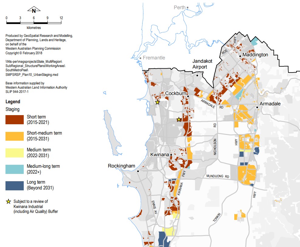
Perth and Peel - Urban Staging
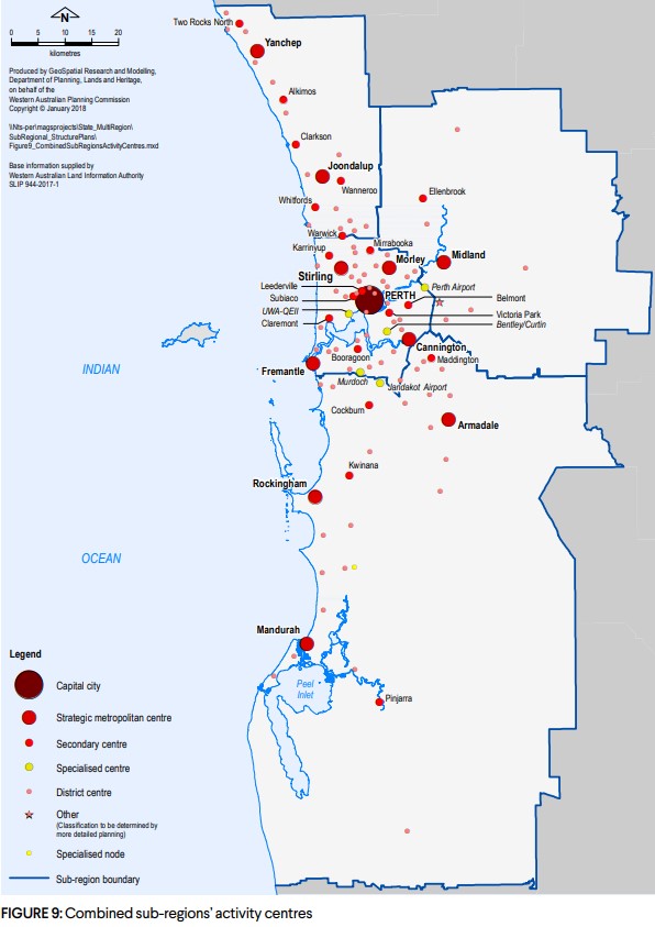
Sub-Regions activitiy centres
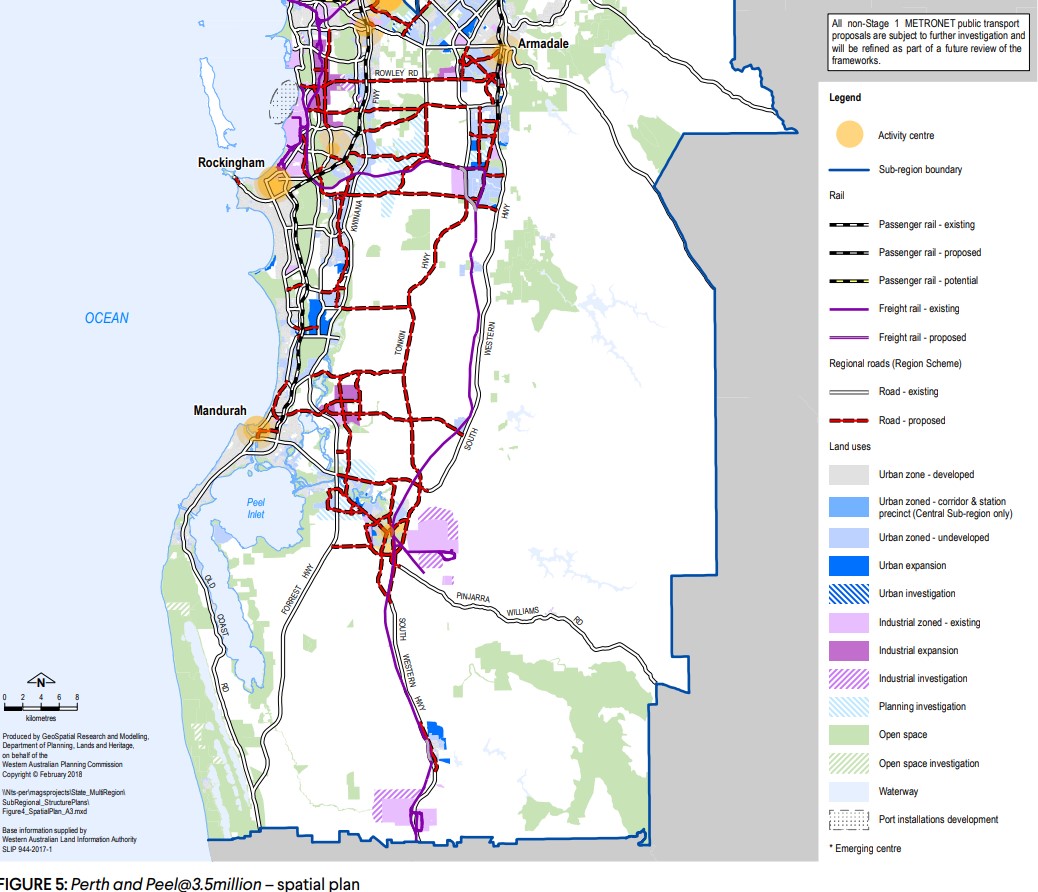
Perth and Peel - Spatial Plan
Featured Developments in Lakelands
 Land for Sale Welcome to Ocean Hill, Lakelands
Ocean Hill Estate - Lakelands


Lakelands Suburb Summary
References
City of Mandurah Planning Scheme (Lakelands Area)
Mandurah: Local Planning Strategy
Mandurah: Strategic Community Plan 2020 - 2040
Mandurah North District Structure Plan (2006)
Lakelands North-East Structure Plan
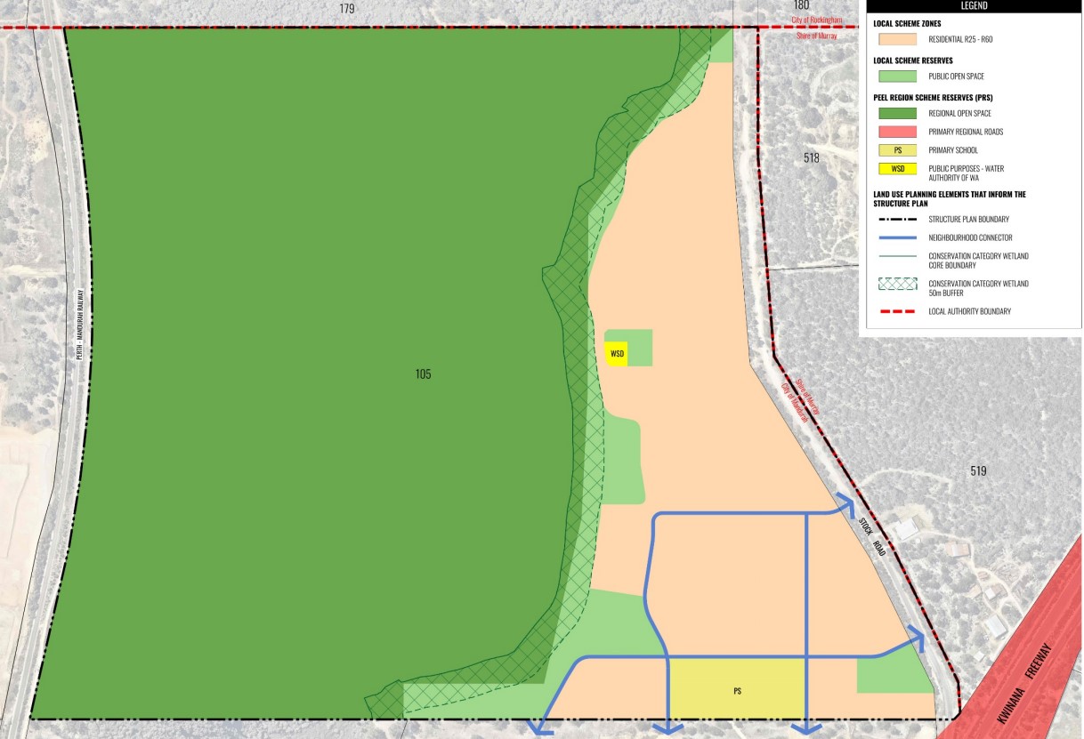
North Lakelands (Ocean Hill) Structure Plan
Lakelands – Perth and Peel @ 3.5 million - WA Planning Submission


