Wellard is a local town of approximately 16.3 square kilometres in area, forming part of the southern coastal region of Perth and located 37 kilometres south of the Perth CBD. The township is located east of the Rockingham coastal township and north of the Cooloongup and Walyungup Lakes. The centre of the suburb contains a large circular wetland area, surrounded by an urbanised area, local centres (commercial and retail), large residential areas, parks and schools.
The urbanised area forms part of the City of Kwinana local government area. For the most part, the suburb is half covered in rural residential land with the Kwinana Freeway separating the increased density of residential housing.
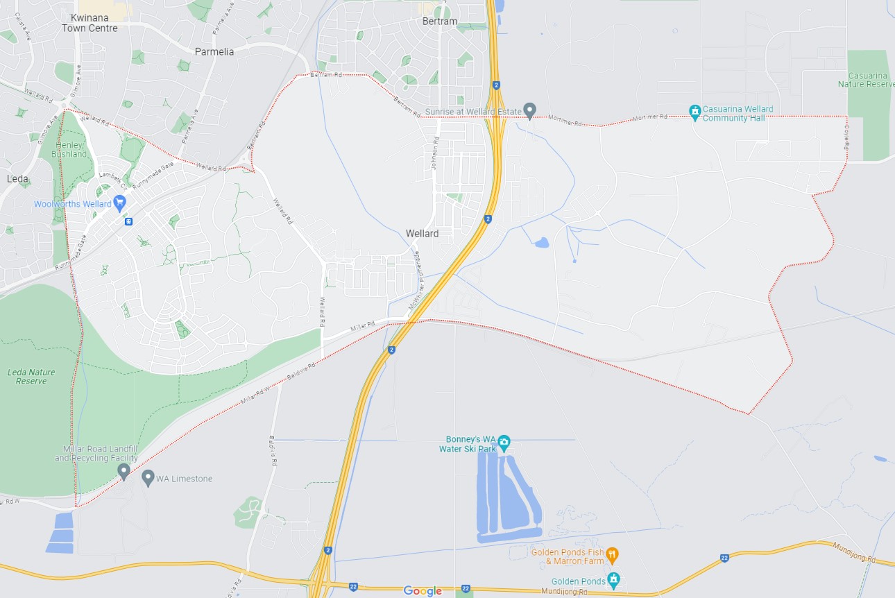
Wellard, WA - Suburb Location
The suburb boundary is located along Baldivis Road, Duckpond Road and Millar Road to the south, Mortimer Road, Wellard Road and Bertram Road to the north and Bankia Road to the west. The Henley Bushland Park, Runnymede Bushland Park and Leda Nature Reserve make up the entire eastern boundary.
A local road network is found throughout Wellard, providing access to the surrounding suburbs and the local network of roads. Runnymede Gate provides a connection to the coastline to the west. Mortimer Road and Millar Road provide access to the suburb’s east area under the Kwinana Freeway. Cavendish Boulavard, Framingham Cresent, Millar Rood, Leda Parade and Irsburg Parade provide east west connections throughout the suburb. The Kwinana Freeway runs through the centre of the suburb, providing a north and south connection, providing the main major arterial road to Perth
.
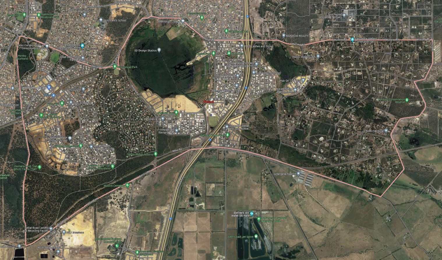
Wellard, SA – Google Maps
Wellard township was known as 13-Mile Camp (part of the Peel Estate) and was named in the 1920s after John Wellard, an early settler who owned a farm about 7.5 kilometres. The land development in the area was supported in the western portion of Wellard and was accordingly zoned for residential development for urbanised use.
In recent years, Wellard, a once semi-rural suburb, has experienced rapid expansion, transforming it into one of the most sought-after residential areas south of Perth. Situated within the City of Kwinana, the majority of Wellard's population resides in its north-west area, and this growth is expected to persist. Signs of further expansion are visible in the east of the Kwinana Freeway as large subdivisions redevelop large farms and rural land holdings.
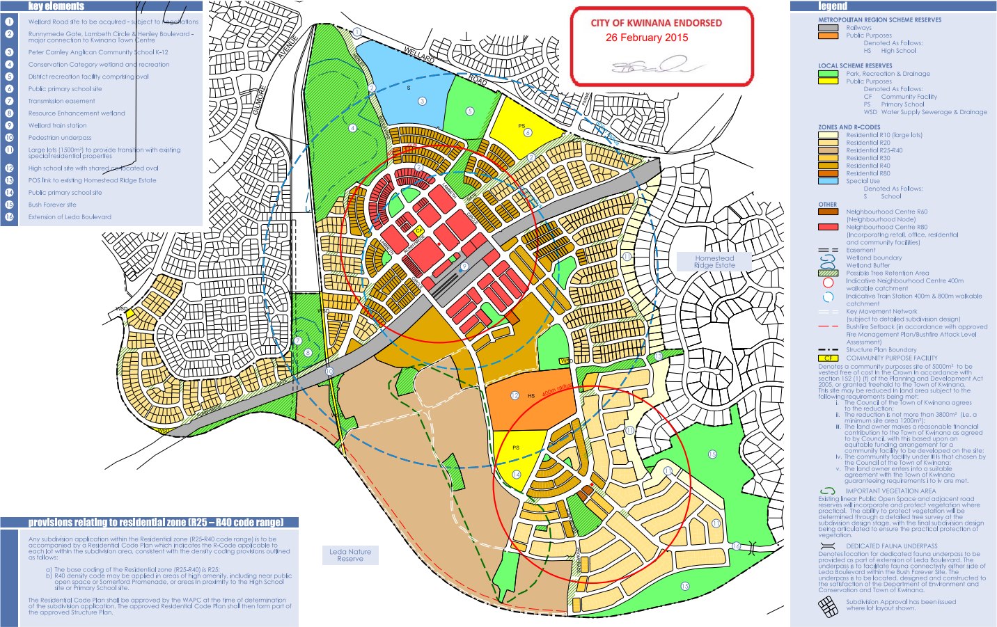
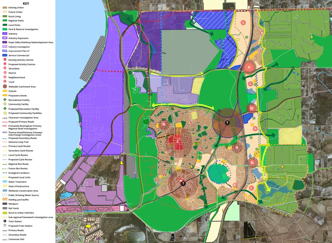
Wellard Village Structure Plan - Approved 2015
The village/town centre of Wellard has evolved with the Kwinana Council identifying the far west area of the suburb for a Village Centre. The vision for the Wellard Village Centre is to:
“Create a Village Centre that supports a variety of economic opportunities through the provision of proper land uses and a solid resident base, accommodated within a robust, contemporary architectural form”.
The Wellard Village Centre is identified as ‘Neighbourhood Centre R80’ (incorporating retail, office, residential and community facilities) on the approved Wellard Village Structure Plan (Structure Plan) on 26 February 2015. Development Area 2: Wellard Village of the Scheme states that uses to be supported within the ‘Neighbourhood Centre (R80)’ Wellard Village Centre Design Guidelines and Local Development Plan provide further detail for developers seeking to contribute to this area.
Situated near the Wellard Train Station, this area features amenities such as the Wellard Square shopping centre, medical facilities, a dental clinic, a cafe, a Woolworths supermarket and food and drink outlets. This area is also provided with Pimlico Gardens to provide a social community area. Additionally, noteworthy attractions include the Wellard Community Centre, vegetated reserves, recreation areas and Bonney's WA Water Ski Park throughout the town or in proximity. Residents in the area have access to several local schools, including Peter Carnley Anglican Community School, The King's College (formerly El Shaddai CS), Wellard Primary School, Wellard Village Primary School.
Wellard is a rapidly growing suburb located in the southern coastal region of Perth, Western Australia. The Kwinana City Council has been reviewing the planning documents that shape the growth and development that includes the Wellard area. It is designated as a "growth area" by the Western Australian Planning Commission due to its significant potential for future development and expansion.
Draft Local Planning Strategy
The City of Kwinana has drafted a Local Planning Strategy (LPS) to steer the city's growth and development over the next 10-15 years, during which the residential population will surge, and industrial areas will expand. The community is invited to contribute to this strategy, shaping the city's future land use vision.
The Local Planning Strategy serves several key purposes, including:
- Identifying land use planning issues and opportunities in Kwinana.
- Outlining strategic land use development directions and actions until 2036, in line with the City's Strategic Community Plan (2021-2031).
- Aligning strategic planning in Kwinana with State and regional planning.
- Coordinating existing plans and strategies within the City.
- Providing a framework for a new local planning scheme, zoning, land reservation, and development provisions.
- Guiding assessment and decision-making on scheme amendments, subdivisions, and development.
- Identifying the need for further studies on long-term planning and development.
- Outlining the Strategy's implementation, including local planning mechanisms, policies, and guidelines.
The draft LPS was developed by the City, considering technical studies related to social, environmental, and economic aspects such as housing diversity, community facilities, economic growth, land distribution, environmental protection, rural preservation, and heritage.
Community engagement was integral in shaping the draft LPS, capturing the community's views on Kwinana's future growth and development.
The Local Planning Strategy will evolve to align with the community's aspirations and long-term vision as defined in the Strategic Community Plans. Its themes align with the current objectives in the City's Strategic Community Plan.
Draft Local Planning Strategy Map
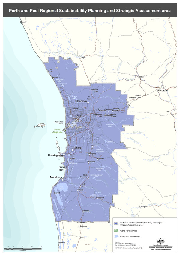
Perth and Peel Growth Areas
Growth Areas Perth and Peel (GAPP) represents an alliance of eleven suburban councils in the Perth and Peel regions. These councils have consistently championed the need for increased availability of public open spaces and the development of local sports facilities. They include the City of Kwinana.
GAPP's primary objective is to secure up to $350 million in federal funding for a dedicated account, a fund that would also attract supplementary investments from the State Government, Local Government, and development contribution programs.
With a maximum allocation of $30 million for any single project, these funds would be adequate to develop as many as 12 major sports precincts spanning the 11 suburban local government areas within the next four to eight years. Once these facilities are established, they will be operated and maintained by the respective Local Governments.
What Are the Advantages
- Increased Opportunities for Sports and Healthy Lifestyles:
- Enhanced access to sports facilities promotes physical activity and healthier living. - Reduction in Obesity Rates:
- The availability of these sports precincts can contribute to lowering obesity rates through increased physical activity. - Mitigation of Other Lifestyle Issues and Risks:
- These developments can help address various lifestyle-related issues and risks, fostering healthier and safer communities. - Job Creation:
- The project would stimulate job opportunities, benefiting the local economy. - Enhanced Livability and Appeal of Perth's Suburban Areas:
- The presence of modern sports facilities enhances the overall quality of life and attractiveness of Perth's suburban regions.
Perth Peel Region Map
Structure Plans(Wellard )
The Council has embraced District Structure Plans for extensive regions earmarked for forthcoming urban expansion, involving various landowners. These plans serve the crucial role of ensuring that development unfolds in a coordinated manner across these properties by designating essential infrastructure elements, including major road networks, commercial centres, and regional open spaces.
In relation to Wellard, the following are of interest:
- Wellard - East - Sunrise Estate
- Wellard - East - Woolcoot
- Wellard - Lot 502 Tamblyn Place
- Wellard - Lot 661 Bertram Road
- Wellard - Lots 670 and 1338 Bertram Road and Reserve 50
- Wellard - Mortimer – Draft
- Wellard - Oakebella Estate
- Wellard - Providence Estate
- Wellard - South - Sunrise Estate
- Wellard - Tamblyn – Draft
- Wellard - Wellard Glen Estate
- Wellard - Wellard Village
- Wellard West - Emerald Park Estate
The Perth and Peel @ 3.5million
The frameworks aim to accommodate 3.5 million people by 2050 by creating vibrant communities within a compact and connected city; making best use of existing and proposed infrastructure; and protecting important environmental assets.
The framework encourages significantly greater infill development with almost half of the required 800,000 new homes – 380,000 at a minimum - to be built through infill development. The majority of these – around 214,000 – will be built in existing suburbs within the Central sub-region and particularly through alignment with the new METRONET rail project.
The South Metropolitan Peel sub-region report, produced by the Western Australian Planning Commission, indicates that a significant portion of future development will take place on land already designated for urban use. This encompasses ongoing development between Kwinana-Rockingham and Mandurah-Pinjarra, as well as within emerging urban zones throughout the sub-region, including Byford and Mundijong.
In alignment with the planning principle established in the 1999 Coastal and Lakelands Planning Strategy, urban development will not extend south of a demarcation line stretching from Dawesville to Pinjarra. Furthermore, the framework designates specific limited areas in Jandakot/Treeby, Langford, Cardup, Mangles Bay, the Pinjarra-Ravenswood sector, and east of Kwinana for further planning investigation.
A significant focus of future urban development will be situated in the Wellard-Karnup area.
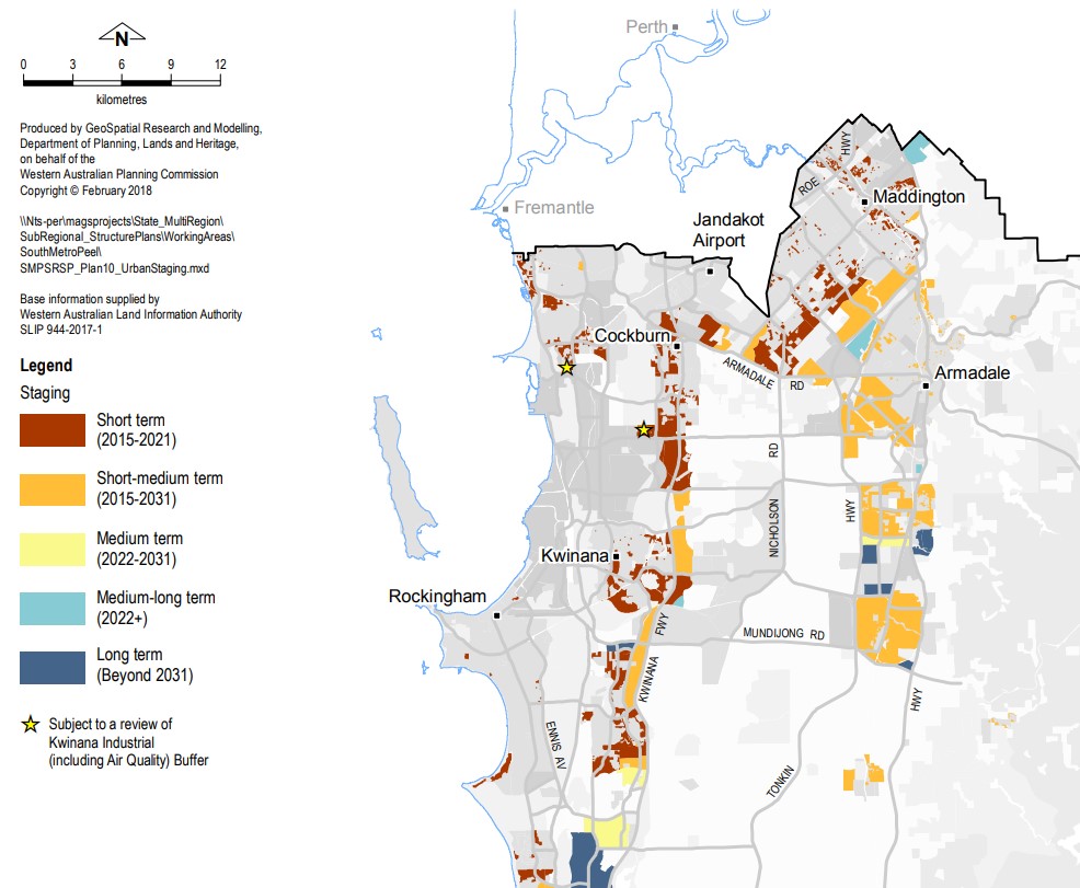
Perth and Peel - Urban Staging
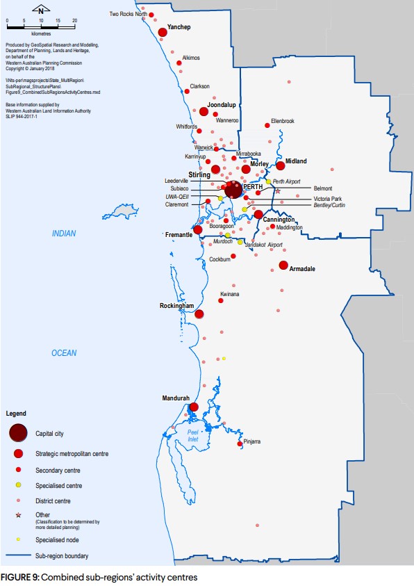
Sub-Regions activitiy centres
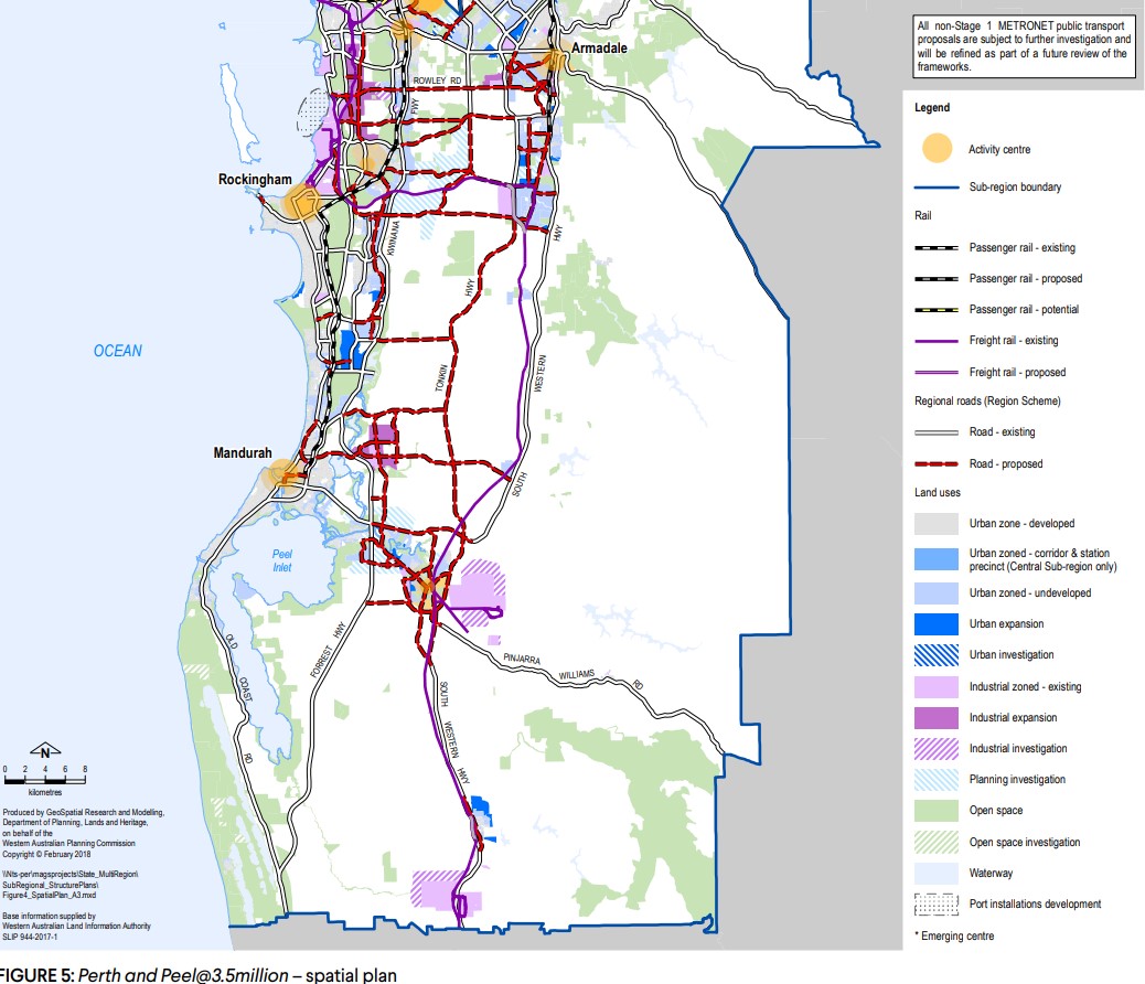
Perth and Peel - Spatial Plan
Featured Developments in Wellard
 Land for Sale Welcome to Oakebella, Wellard
Oakebella Estate - Wellard
-
Land for Sale Stage 22 Land Release Now Selling – Enquire Now
Providence Estate - Wellard


Wellard Suburb Summary
References
The Kwinana Strategic Community Plan 2021-2031
City of Kwinana planning information
Wellard - East - Sunrise Estate
Wellard - Lot 502 Tamblyn Place
Wellard - Lot 661 Bertram Road
Wellard - Lots 670 and 1338 Bertram Road and Reserve 50
Wellard West - Emerald Park Estate
Wellard – Perth and Peel @ 3.5 million - WA Planning Submission


