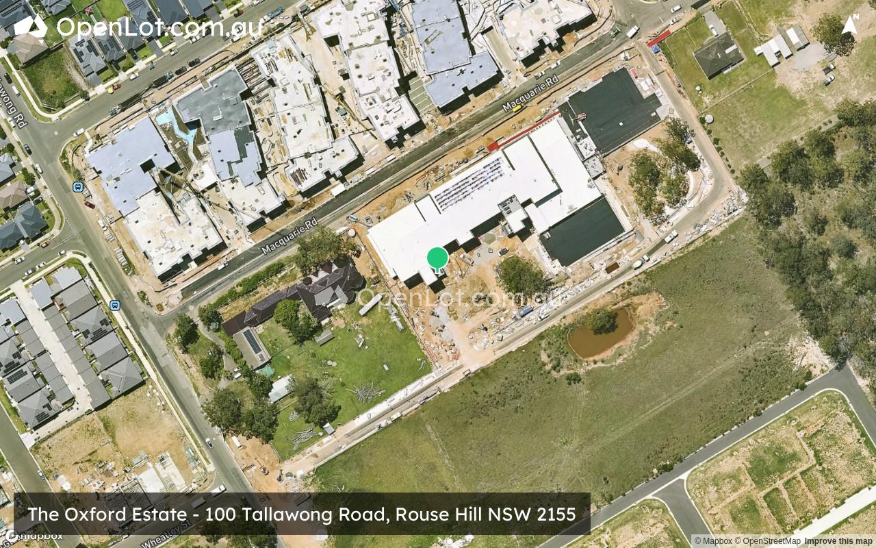
The Oxford Estate - Rouse Hill COMING SOON
Coming Soon. Stay Tuned.
This information is estimated by the OpenLot research team. Let us know here to provide up-to-date information about this development.
| Total new homes | 50 |
| Area size | 2.00 hectares |
| Growth Region | Sydney North West Growth Areas |
| City council | Blacktown City Council |
| Developer | N/A |
| Distance to | Sydney CBD - 33 km north-west Sydney Airport - 39 km north-west |
Land for Sale, House and Land Packages:
Popular Estates near The Oxford Estate - Rouse Hill


 4
4
 2
2
 1
1


Updates for The Oxford Estate - Rouse Hill
Facebook updates:
Submit the Facebook page for The Oxford Estate - Rouse Hill.
Related news:
Missing articles? Send us a link here.
Location & Map for The Oxford Estate - Rouse Hill
Visit Display Homes near The Oxford Estate - Rouse Hill


Vacancy Rate in Rouse Hill NSW 2155
View full vacancy rate history in Rouse Hill NSW 2155 via SQM Research.
Schools near The Oxford Estate - Rouse Hill
Here are 6 schools near The Oxford Estate - Rouse Hill:
K-12 Independent Combined School
U Government Special School
7-12 Government Secondary School
K-6 Government Primary School
K-6 Government Primary School
7-12 Catholic Secondary School - School Head Campus
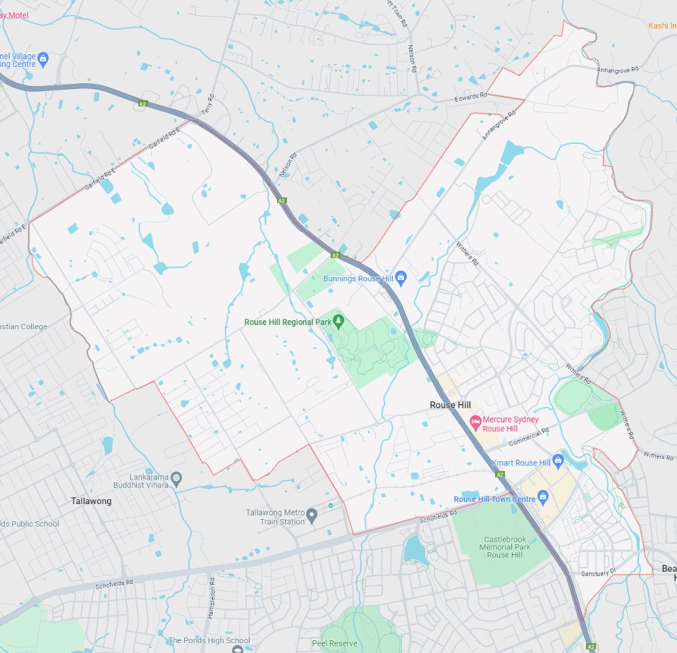
Suburb Planning Review in Rouse Hill NSW 2155
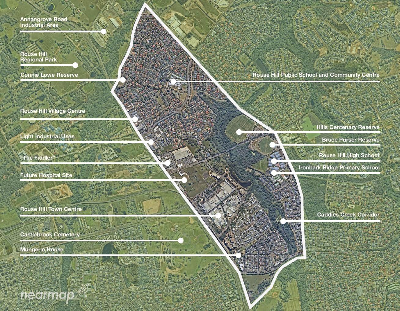
Rouse Hill is a town of approximately 13 square kilometres within the Hills Shire and Blacktown City Council, forming part of the Greater Western Sydney region in New South Wales, located 43 kilometres north-west of the Sydney CBD.
Rouse Hill is named after Richard Rouse, a settler who received land in the area in 1816. Despite attempts to change it due to its connection to a convict insurrection, Governor Macquarie renamed the area from Vinegar Hill to Rouse Hill. The old name persisted until at least the 1860s.
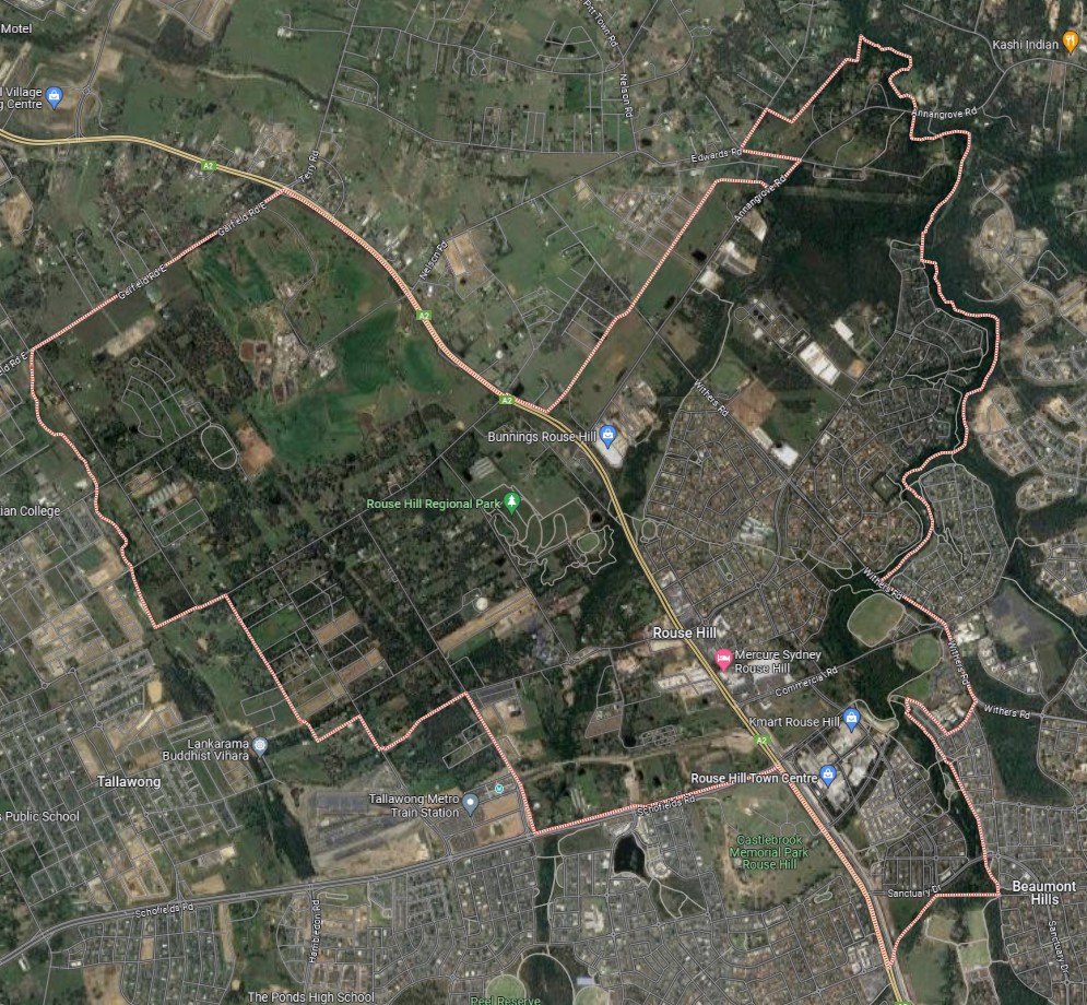
The suburb boundary is located along property boundaries, Windsor Road, Tallawong Road and Schofields Road to the south. Property boundaries, Nirmal Street and First Ponds Creek form the western boundary. Caddies Creek and Withers Road form the boundary to the east. Caddies Creek, Garfield Road East, Windsor Road, Outback Street, Annagrove Road, Edward Road, Hession Rd and Property boundaries make up the entire northern boundary.
The Windsor Road pathway stretches across the centre of the suburb (north-south), creating a division between its two sides. Rouse Road, Schofields Road, and Rouse Hill Road facilitate local traffic flow, linking and interconnecting the various road networks present throughout Rouse Hill.
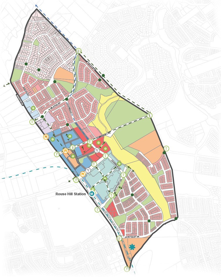
Guntawong Road, Mile End Road, Commercial Road and Rouse Road provide access to the surrounding suburbs and the local network of roads. The headquarters of the Sydney Metro Rail is situated southeast of the suburb, running through its southern section via a rail flyover bridge.
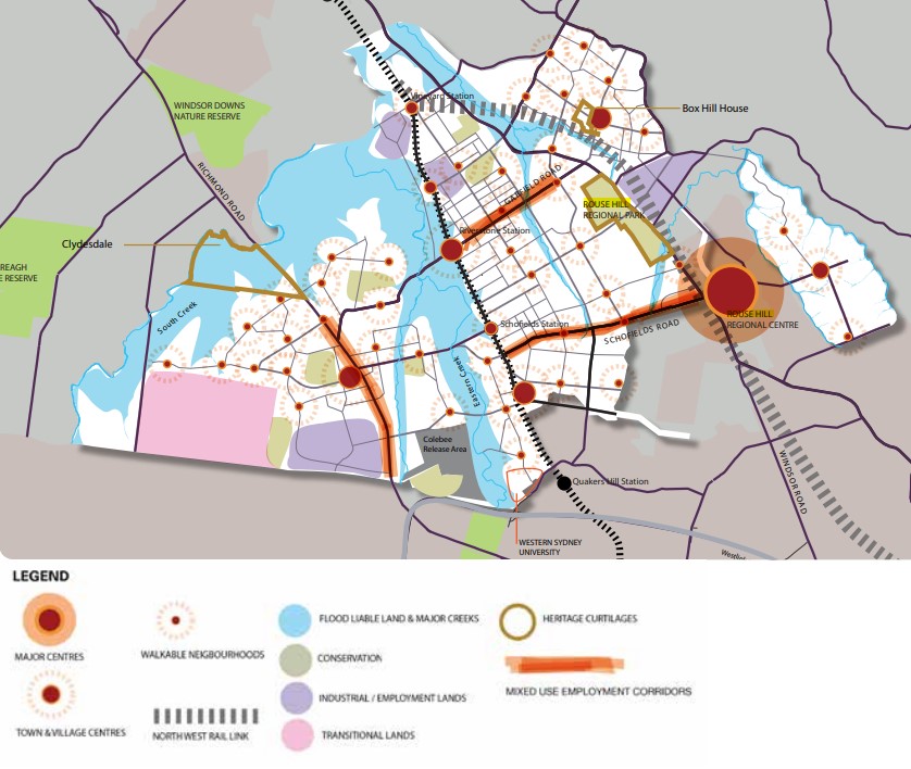
The western portion (Blacktown City Council) of the suburb is primarily rural land holdings and vegetated rural residential properties found throughout. The eastern portion (Hills Shire Council) contains an increased density in proximity to the Rouse Hill Town Centre, which also provides for the urban area of Beaumont Hills adjoining the suburb.
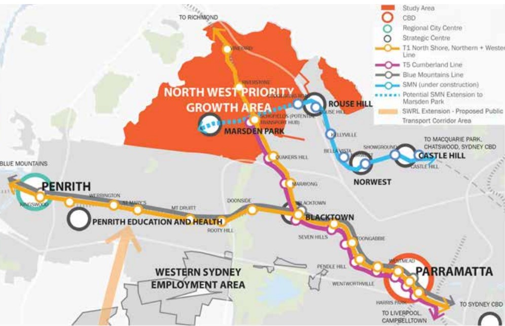
North West Priority Growth Area(Rouse Hill)
Sydney’s North West will form part of the new approach to planning in NSW, following a review by the Department of Planning Industry and Environment in partnership with the Greater Sydney Commission and Government Architect. The decision was made to deliver 51 growth precincts, with the state government able to target areas and local councils empowered to get the correct planning for their community. The precinct planning will occur in four different pathways, being:
- State-led strategic planning
- Collaborative planning between the State and councils
- State-led rezoning
- Council-led rezoning
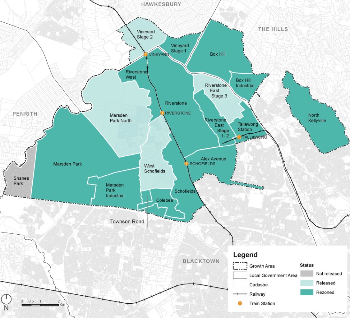
Rouse Hill forms part of the growth area, with the western section forming part of the Tallawong Station area. Even though the urbanised eastern portion isn't included in the rezoning area, the growth area specifically highlights Rouse Hill Town Centre as an established employment area. Additionally, the West Central District Plan recognizes Rouse Hill as a district centre and will allow the Hills Shire Council to provide further planning for this area.
The western growth area will proceed under the Strategic Planning method, with early work by the Department, councils, State agencies and communities in the development of places and the planning frameworks that support them.
The Hills Shire Council prepared an amended Development Control Plan (DCP) that was adopted by in a Council meeting on 11 October 2022, this excludes North Kellyville and Box Hill. This DCP only covers the eastern portion of Rouse Hill. The Western portion of Rouse Hill is covered under the Blacktown Development Control Plan and Development Control Plans (DCPs) created by the Growth Centres SEPP requirements of the NSW state government.
Transportation of Rouse Hill
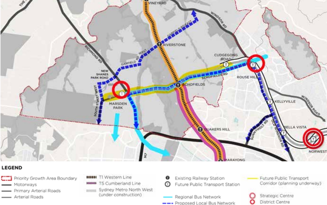
The North West Growth Area prioritises public transport enhancement and connectivity. This includes assessing current infrastructure and forecasting the potential impact of population growth on service demands.
Rail Infrastructure Enhancement:
The forthcoming development of a public transport route stretching from Cudgegong Road Station to Marsden Park presents a promising prospect for establishing a transport interchange hub at Schofields Station. This strategic location intersects with the rail line, offering a significant opportunity for enhanced connectivity and transportation facilitation.
Enhancement of Bus Connectivity:
Sydney's Bus Future initiative designates distinct rapid routes connecting Rouse Hill to Parramatta and Castle Hill to Blacktown via the T-way. These identified corridors play a pivotal role in fostering a comprehensive and accessible bus network, allowing seamless integration with district and suburban bus routes. This interconnectedness aims to bolster efficient public transportation throughout the region.
North West Growth Centre Vision(Rouse Hill)
“The Implementation Plan identifies the infrastructure needs to support growth and prioritises the forward funding or delivery of infrastructure to meet higher capacity growth projections. Communities will be supported by infrastructure that is planned and delivered to meet the needs of new residents.
Identify and enhance key biodiversity areas, open spaces, riparian corridors and culturally sensitive areas The Implementation Plan identifies additional open space requirements needed to support new communities, based on a high growth housing capacity scenario. It also identifies the opportunity to establish a new green space corridor along Eastern Creek to provide new open space and better green connections to where people will live.
Bushland will be protected and connected through a Green Grid across the North West Priority Growth Area and beyond, linking growing suburbs, rehabilitating waterways, and providing places for recreation and community events. Areas of sensitive heritage significance in precincts yet to be rezoned will be considered as part of detailed planning for those areas.
Explore new land uses along major infrastructure corridors to maximise public investment in infrastructure The Implementation Plan incorporates infrastructure commitments across the North West Priority Growth Area and recommends that further investigation be undertaken to leverage the opportunities along key corridors, such as significant road upgrades - Schofields Road, Richmond Road and Bandon Road - and public transport - Sydney Metro Northwest and its transport corridor extension. The Western Sydney Rail Needs Scoping Study will help to identify future transit corridors in the North West.
Corridor preservation projects such as the Outer Sydney Orbital and Bells Line of Road will influence the land uses in the area and are incorporated into the Implementation Plan and will be considered as planning progresses in the North West Priority Growth Area”.
The Hills Future 2036: Local Strategic Planning Statement (LSPS) was ratified on March 6, 2020, after approval by the Greater Sydney Commission. This statement outlines the Council's envisioned growth path until 2036 and outlines various actions slated for implementation from 2020 to 2023 in alignment with the Council's vision.
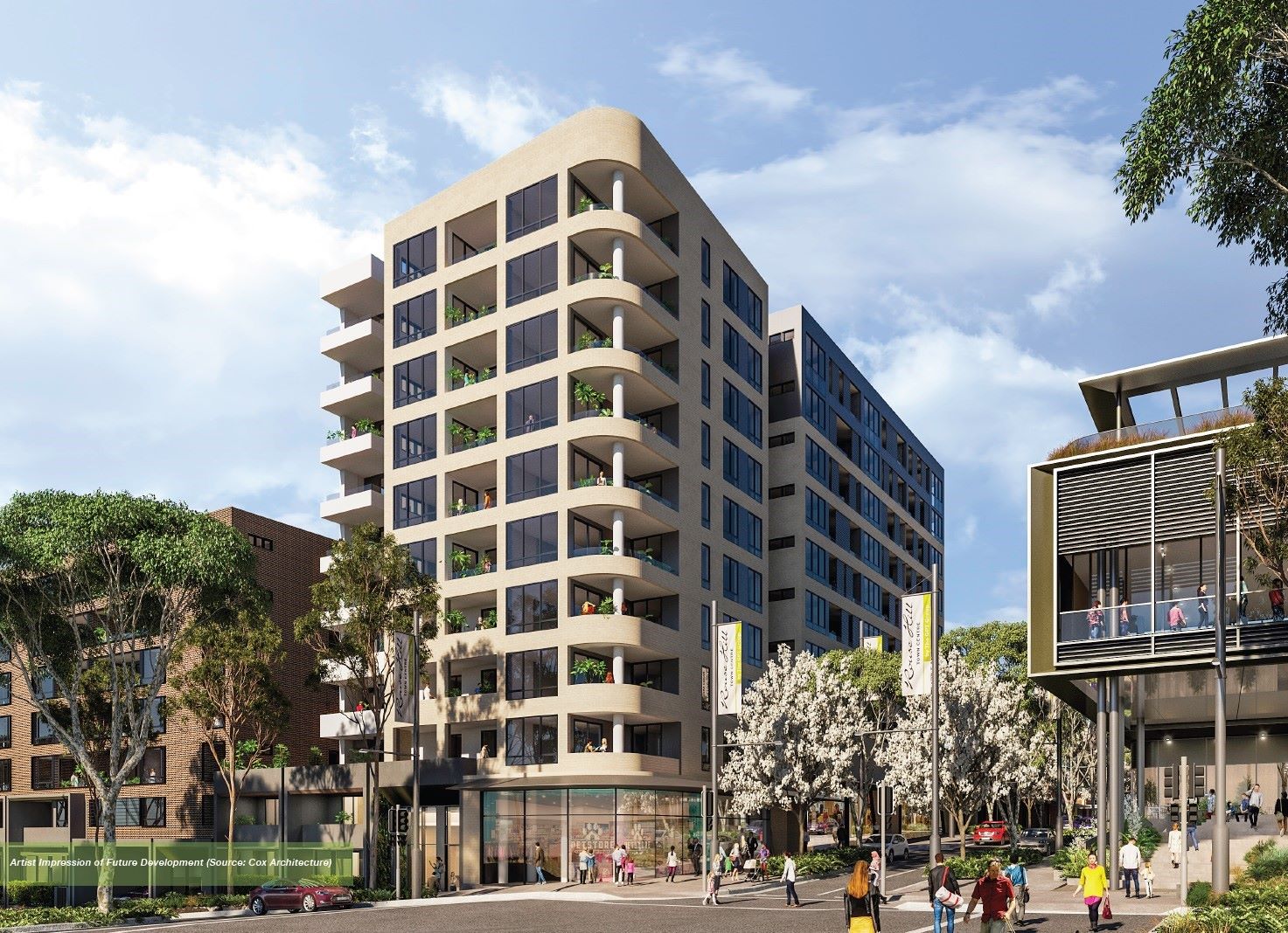
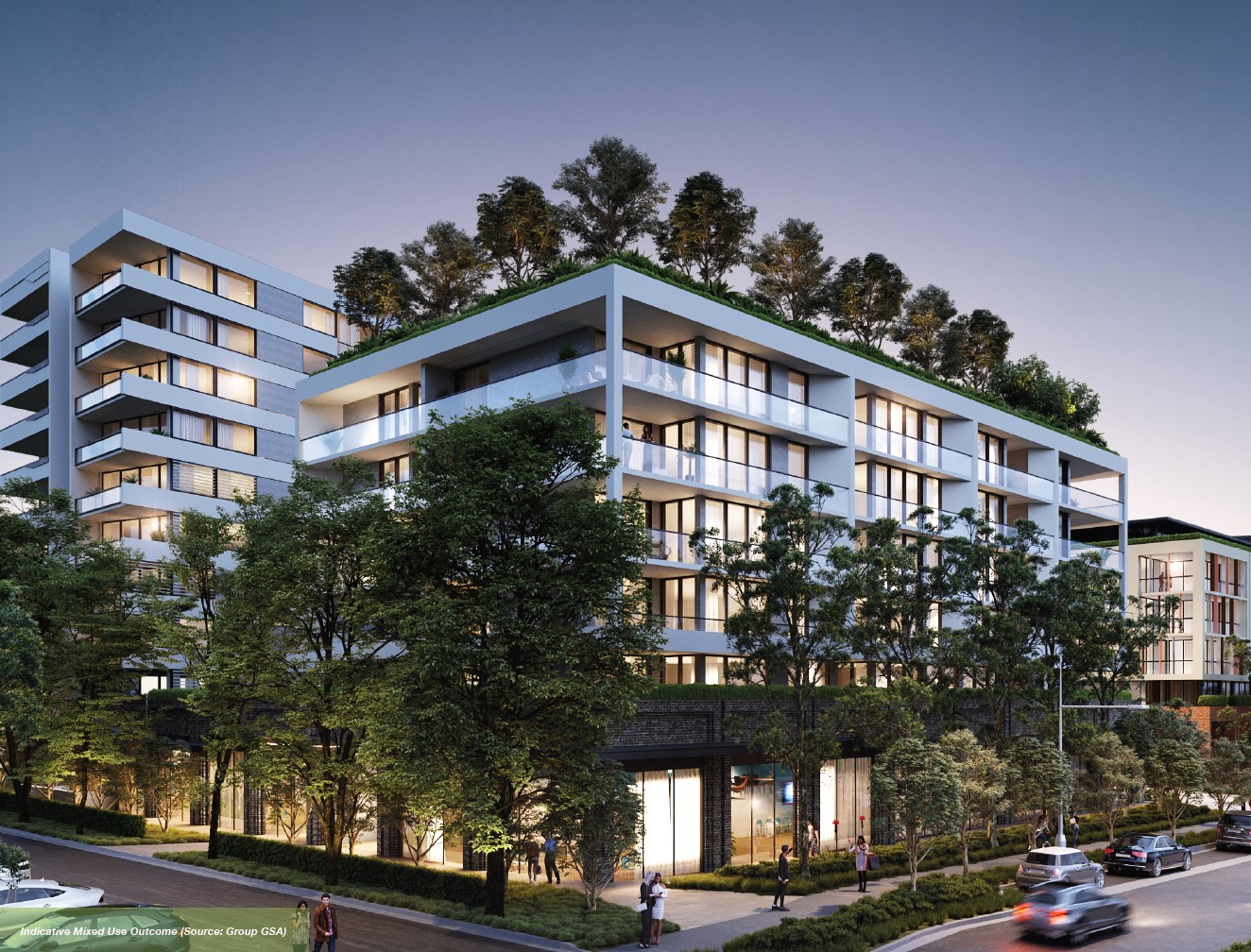
The Hills Shire Council set about focusing on the eastern (central) portion of Rouse Hill in a strategy designed to establish Rouse Hill as a thriving mixed-use hub, providing diverse residential, employment, and lifestyle options for the swiftly expanding North West Region.
The Draft Rouse Hill Precinct Plan aims to transform Rouse Hill into a dynamic regional centre, providing job opportunities suited to residents. By 2041, it envisions Rouse Hill as a hub for knowledge-based industries like health, education, technology, and finance. This plan emphasizes better connectivity to nearby centres and aims to attract skilled workers to support economic growth in The Hills Shire and the expanding North West Growth Area.
The result will provide a blueprint for actions necessary for the Council to implement to see the vision for the area transform over three phases, led by the council and the overall housing market.
Vision of Rouse Hill
“The Rouse Hill Study Area will play an important role in the NWRL corridor, as a mixed use destination. The introduction of the NWRL will enable the Study Area to become a major transport and retail/commercial hub for the surrounding suburbs centred on a new train station and a hub for the North West Growth Centre. The introduction of the NWRL has the potential to transform the Study Area into a Major Centre enabling significant residential and commercial uptake in the surrounding areas. An integrated bus and cycle network feeding the NWRL station will allow Rouse Hill to serve as a major transport hub and gateway to Sydney CBD. The Study Area will provide opportunities for increased employment and housing capacities within walking/cycling distance of the station, while ensuring the local heritage, open space network and natural environment are protected. The NWRL will also provide opportunities to increase residential densities within walking distance of the station, involving a variety of housing types to ensure there is affordable and appropriate housing for all members of the community”.
Rouse Hill Suburb Summary
References
Eastern Rouse Hill (Hills Shire) – Development Control Plan
Western Rouse Hill (Blacktown City Council) Development Control Plan
North West Rail Link Rouse Hill Station Structure Plan
Rouse Hill Strategic Centre – Draft Precinct Plan
The Hills Future 2036: Local Strategic Planning Statement
North West Priority Growth Area – Land Use and Infrastructure Implementation Plan
Reviews & Comments on The Oxford Estate - Rouse Hill
Estate Brochure, Masterplan, Engineering Plan, Plan of Subdivision (POS), Design Guidelines
FAQs about The Oxford Estate - Rouse Hill
- Rouse Hill Anglican College - 1.1km east
- The Ponds School - 1.7km south-east
- The Ponds High School - 1.8km south
- Riverbank Public School - 1.9km south
- Rouse Hill Public School - 2.1km east
- St John Paul II Catholic College - 2.1km south
Popular Estates near The Oxford Estate - Rouse Hill
Latest New Home Articles for You

16/Mar/2026 | OpenLot.com.au
New South Wales: Top 30 Most Searched Housing Developments (February 2026)
If you’ve been considering a move in New South Wales, February 2026 provi...

09/Mar/2026 | OpenLot.com.au
Victoria: Top 30 Most Searched Housing Developments (February 2026)
If you’ve been exploring housing opportunities in Victoria, February 2026...

20/Feb/2026 | OpenLot.com.au
Display Homes at Drouin Fields Estate: A Thriving Community in Drouin
Welcome to Drouin Fields, a place where beauty, space, and modern luxury ...

19/Feb/2026 | OpenLot.com.au
Display Homes at Manor Lakes Esate: A Thriving Waterside Community in Manor Lakes
A place where you can settle in, rather than just settle down. Named for ...

13/Feb/2026 | OpenLot.com.au
🏠 Victoria: Top 30 Most Searched Townhouse Developments – January 2026

11/Feb/2026 | OpenLot.com.au
🏡 Top 30 Most Searched Estates by State - January 2026

10/Feb/2026 | OpenLot.com.au
Victoria: Top 30 Most Searched Housing Developments (January 2026)
If you’ve been considering making a move in Victoria, January 2026 offere...

10/Feb/2026 | OpenLot.com.au
Queensland: Top 30 Most Searched Housing Developments (January 2026)
If you’ve been considering making a move in Queensland, January 2026 offe...

09/Feb/2026 | OpenLot.com.au
Western Australia: Top 30 Most Searched Housing Developments (January 2026)
If you’ve been considering making a move in Western Australia, January 20...