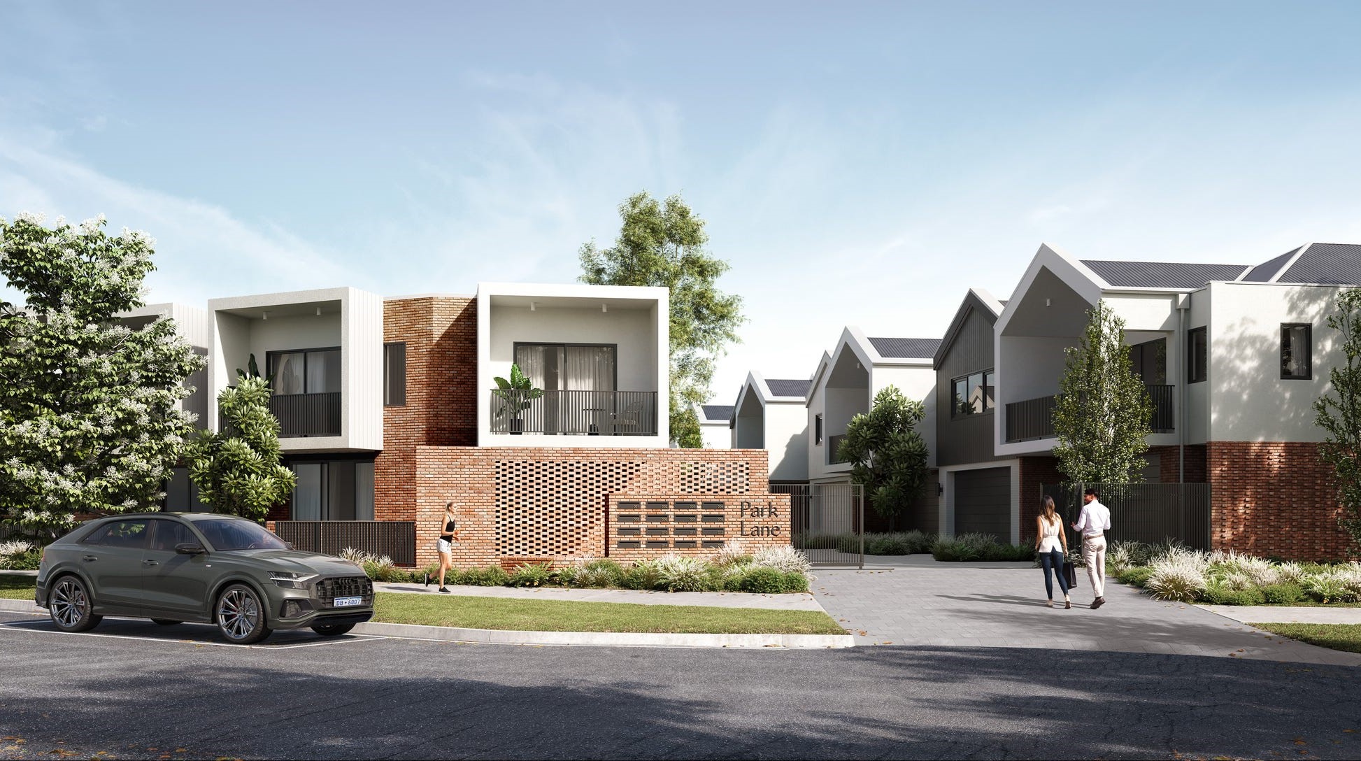
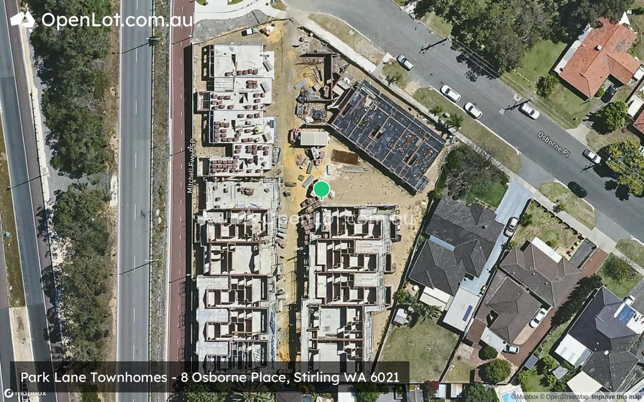
Park Lane Townhomes - Stirling
This information is estimated by the OpenLot research team. Let us know here to provide up-to-date information about this development.
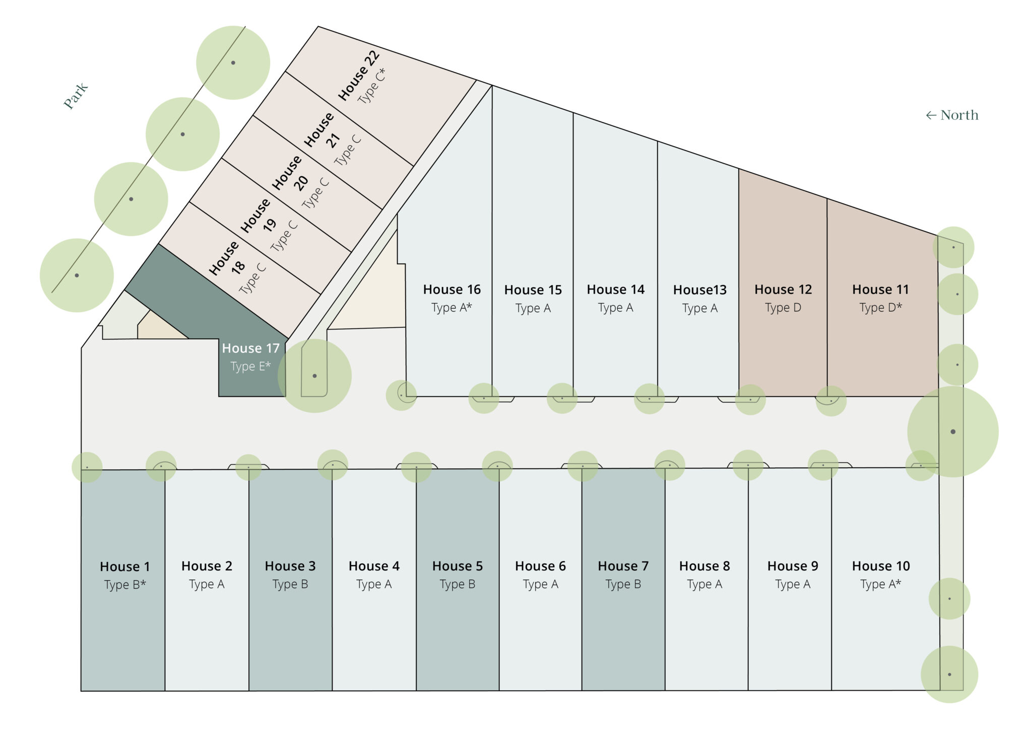
| Total new homes | 22 |
| Area size | 0.37 hectares |
| Growth Region | Perth North West Growth Areas |
| City council | City of Stirling |
| Developer | Locus Development Group |
| Project marketer | Hive Residential |
| Creative agency | Brandform |
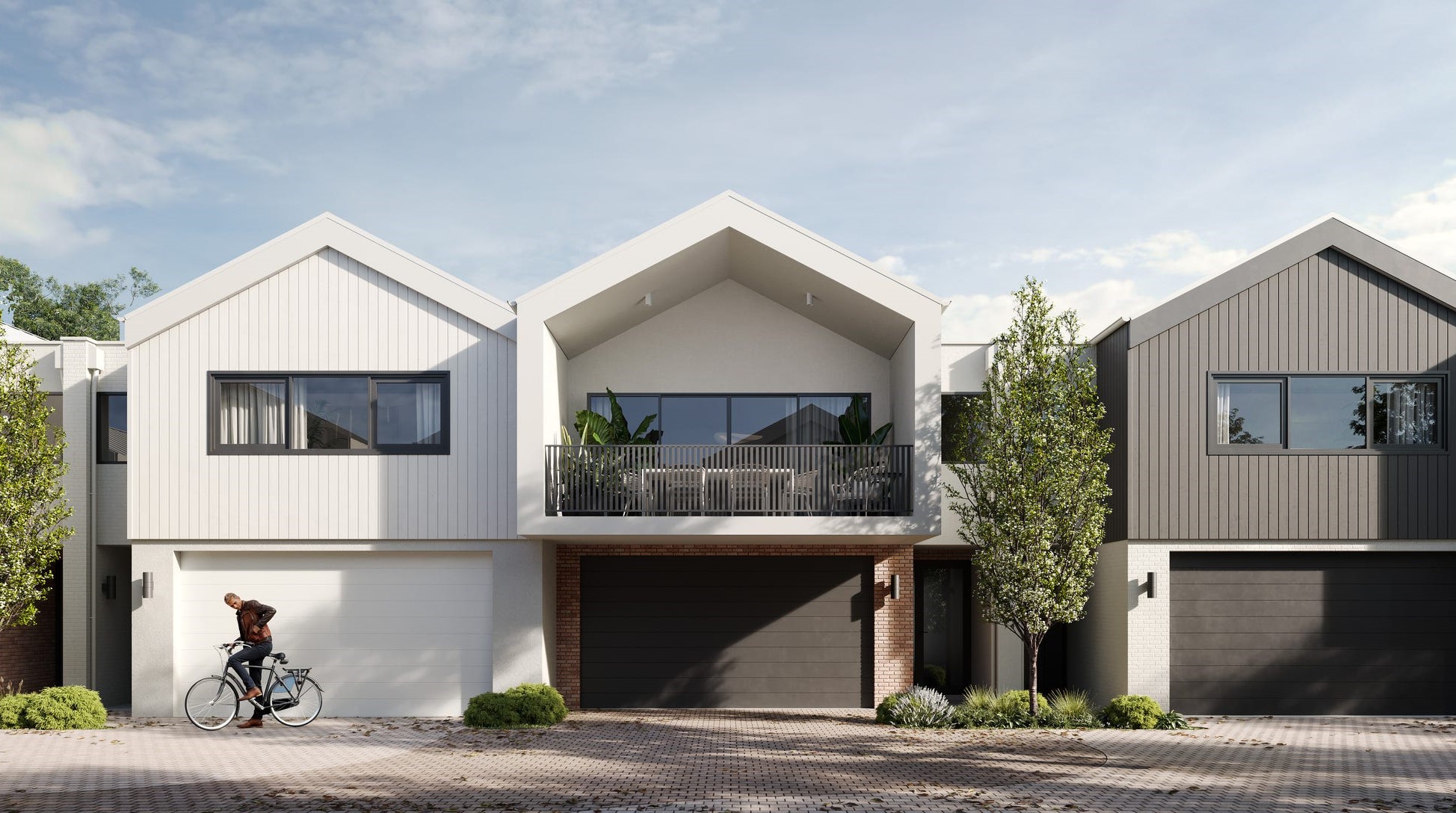
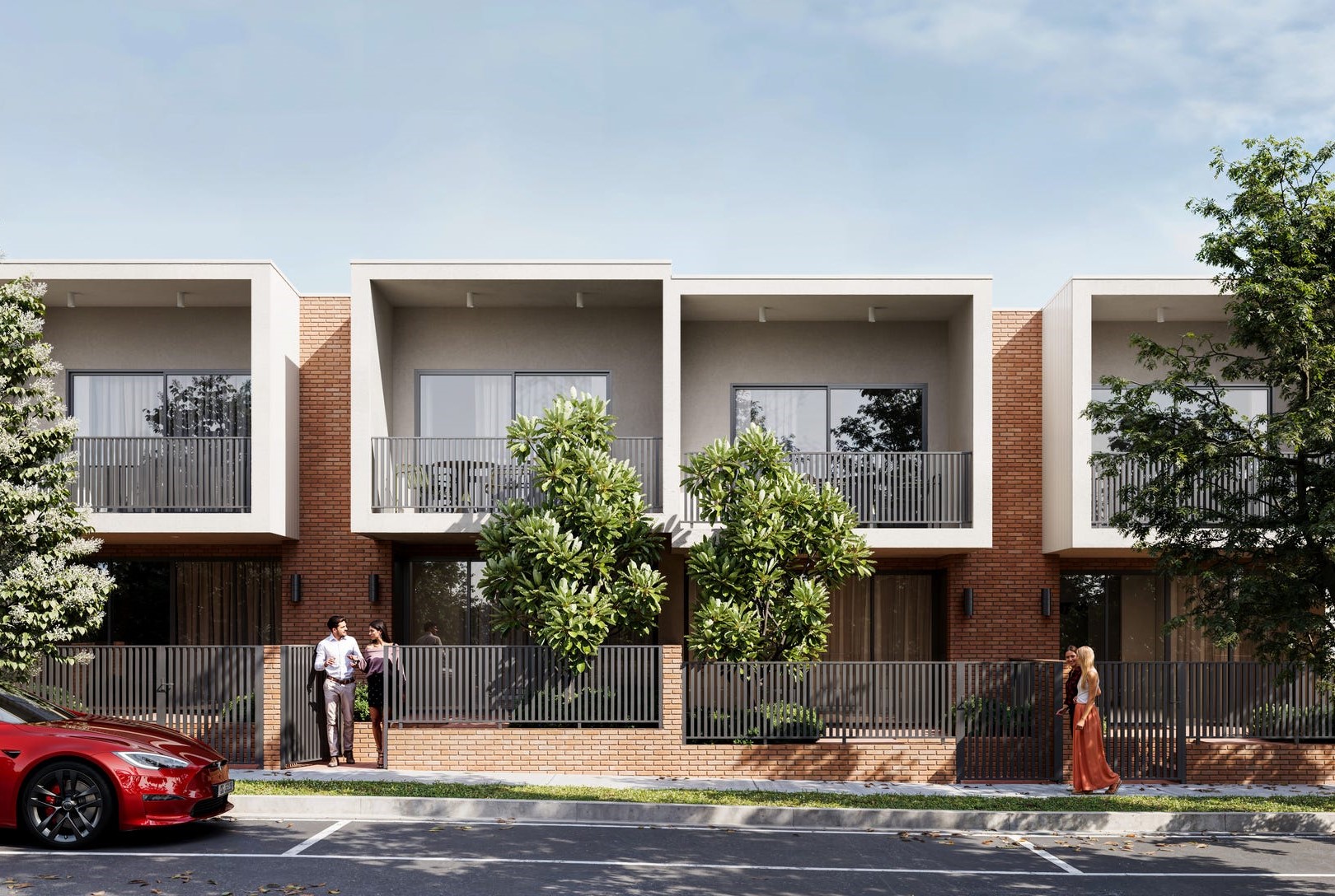
Townhomes:
Popular Estates near Park Lane Townhomes - Stirling

Updates for Park Lane Townhomes - Stirling
Facebook updates:
Submit the Facebook page for Park Lane Townhomes - Stirling.
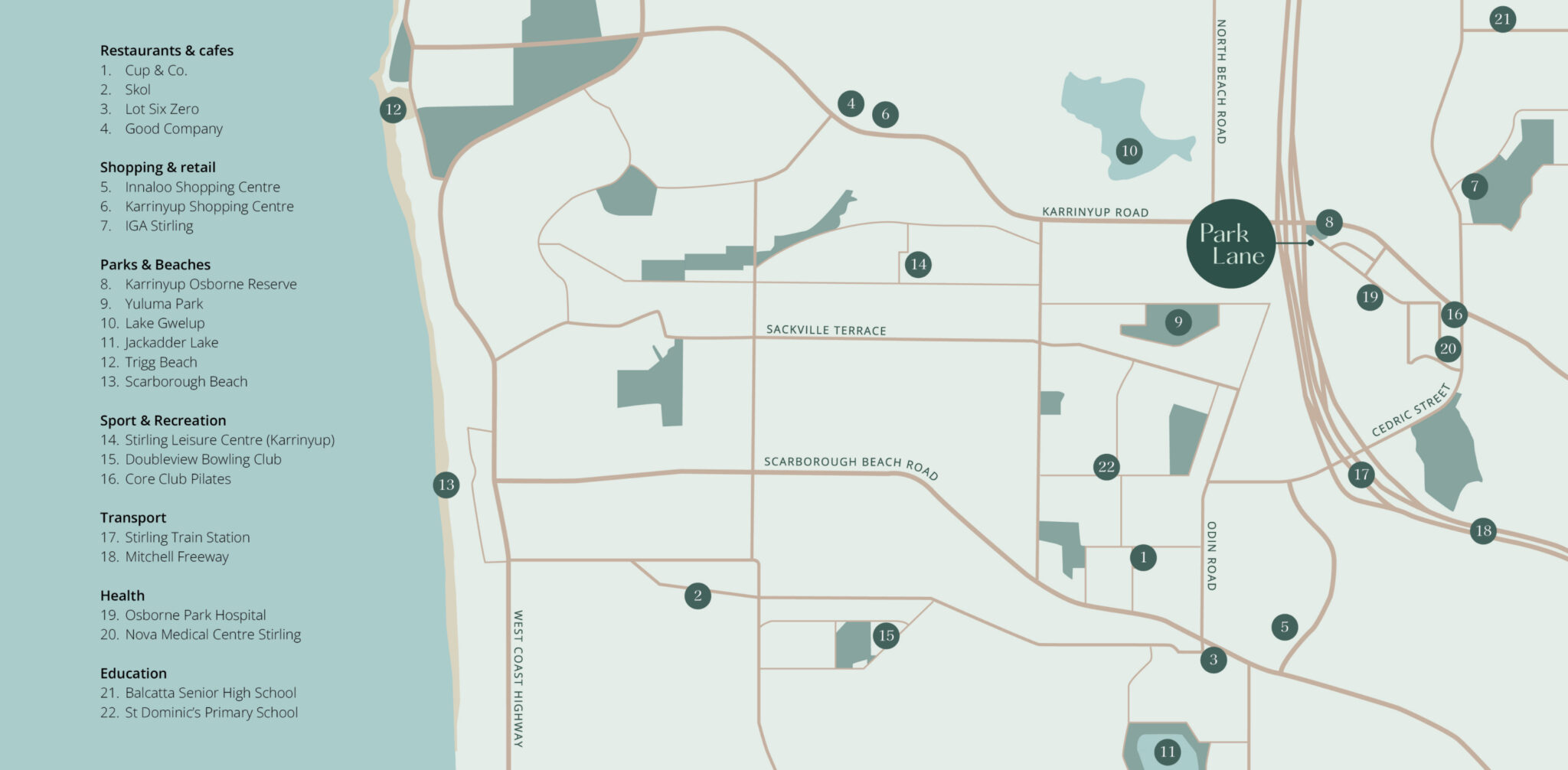
Location & Map for Park Lane Townhomes - Stirling
Visit Display Homes near Park Lane Townhomes - Stirling


Vacancy Rate in Stirling WA 6021
View full vacancy rate history in Stirling WA 6021 via SQM Research.
Schools near Park Lane Townhomes - Stirling
Here are 6 schools near Park Lane Townhomes - Stirling:
7-12 Government Secondary School
K-6 Government Primary School
K-6 Government Primary School
K-6 Government Primary School
PP-6 Catholic Primary School
K-6 Government Primary School
Reviews & Comments on Park Lane Townhomes - Stirling
Estate Brochure, Masterplan, Engineering Plan, Plan of Subdivision (POS), Design Guidelines
FAQs about Park Lane Townhomes - Stirling
View all estates from Locus Development Group
View all estates marketed by Hive Residential
- Balcatta Senior High School - 1.3km north-east
- West Balcatta Primary School - 1.4km north-east
- Lake Gwelup Primary School - 1.4km north
- Yuluma Primary School - 1.5km south-west
- St Dominic's School - 1.6km south-west
- Newborough Primary School - 2.0km west
Popular Estates near Park Lane Townhomes - Stirling
Latest New Home Articles for You

09/Mar/2026 | OpenLot.com.au
Victoria: Top 30 Most Searched Housing Developments (February 2026)
If you’ve been exploring housing opportunities in Victoria, February 2026...

20/Feb/2026 | OpenLot.com.au
Display Homes at Drouin Fields Estate: A Thriving Community in Drouin
Welcome to Drouin Fields, a place where beauty, space, and modern luxury ...

19/Feb/2026 | OpenLot.com.au
Display Homes at Manor Lakes Esate: A Thriving Waterside Community in Manor Lakes
A place where you can settle in, rather than just settle down. Named for ...

13/Feb/2026 | OpenLot.com.au
🏠 Victoria: Top 30 Most Searched Townhouse Developments – January 2026

11/Feb/2026 | OpenLot.com.au
🏡 Top 30 Most Searched Estates by State - January 2026

10/Feb/2026 | OpenLot.com.au
Victoria: Top 30 Most Searched Housing Developments (January 2026)
If you’ve been considering making a move in Victoria, January 2026 offere...

10/Feb/2026 | OpenLot.com.au
Queensland: Top 30 Most Searched Housing Developments (January 2026)
If you’ve been considering making a move in Queensland, January 2026 offe...

09/Feb/2026 | OpenLot.com.au
Western Australia: Top 30 Most Searched Housing Developments (January 2026)
If you’ve been considering making a move in Western Australia, January 20...

06/Feb/2026 | OpenLot.com.au
South Australia: Top 30 Most Searched Housing Developments (January 2026)
If you’ve been considering making a move in South Australia, January 2026...