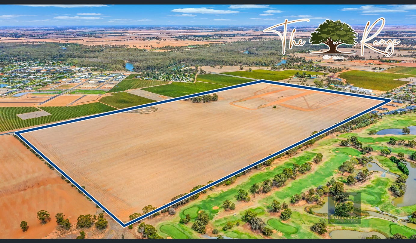
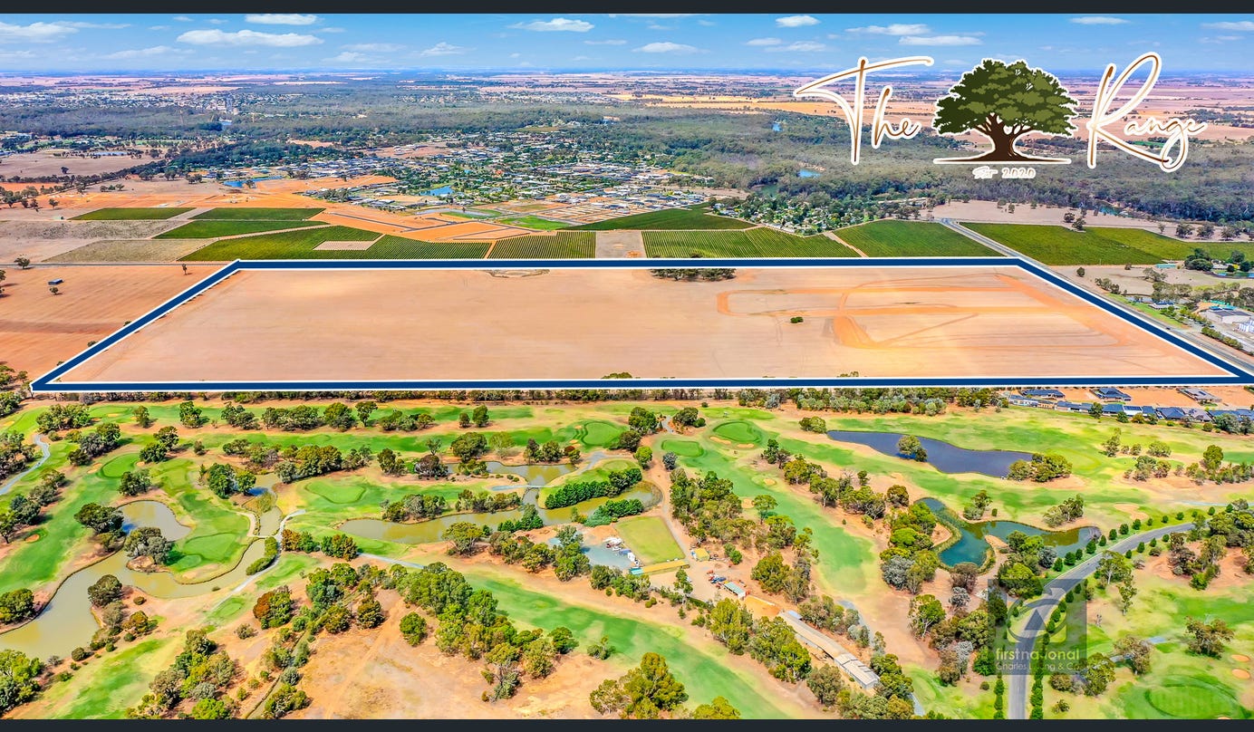


The Range Estate - Moama
This information is estimated by the OpenLot research team. Let us know here to provide up-to-date information about this development.
| Total new homes | N/A |
| Area size | 58.83 hectares |
| City council | Murray River Council |
| Developer | N/A |
| Project marketer | Charles L King & Co First National |
Land for Sale, House and Land Packages:
Popular Estates near The Range Estate - Moama


 4
4
 2
2
 2
2


Updates for The Range Estate - Moama
Facebook updates:
Related news:
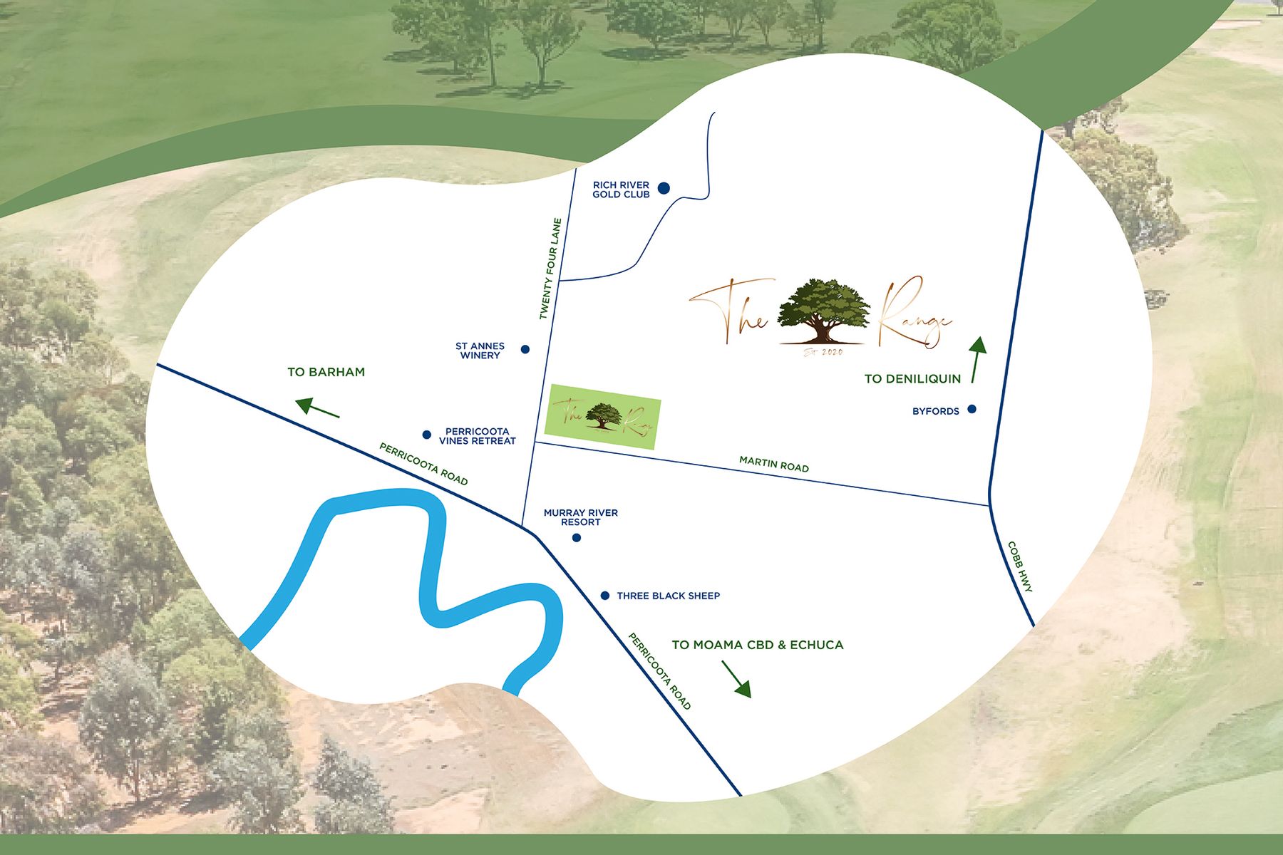
The Range is Moama's newest land estate and is right next door to the Rich River Golf Club with it two championship18 hole golf course, with access to

Prime Land with Stunning Lake Views in Prestigious Moama Estate - 53 Whistler Circuit, Moama NSW 2731 - Vacant Land For Sale by Century 21 Rich River Real Estate

Life on the Range - 45 Currawong Circuit, Moama NSW 2731 - Vacant Land For Sale by Century 21 Rich River Real Estate

Missing articles? Send us a link here.
Location & Map for The Range Estate - Moama
Schools near The Range Estate - Moama
Here are 6 schools near The Range Estate - Moama:
Unknown Catholic Primary School
K-12 Independent Combined School
7-12 Catholic Secondary School - School Head Campus
P-6 Government Primary School
Prep-6 Government Primary School
Reviews & Comments on The Range Estate - Moama
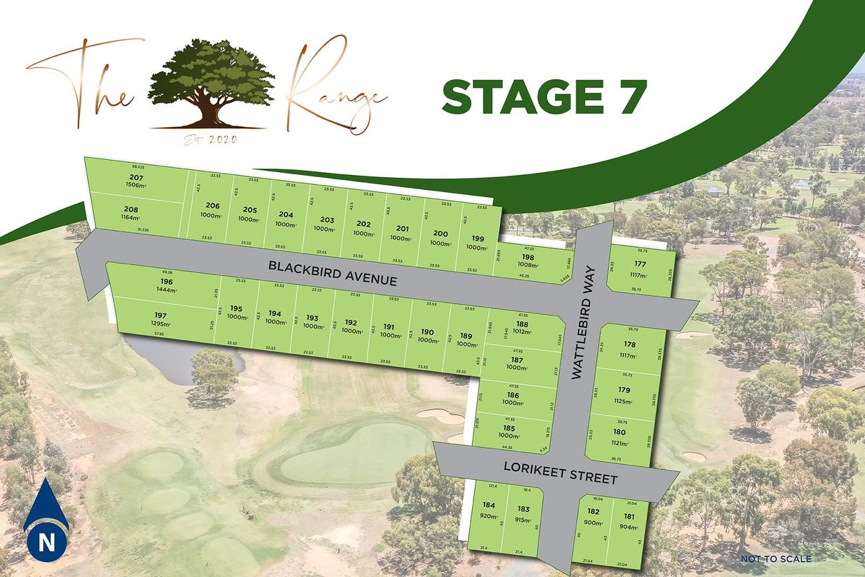
Estate Brochure, Masterplan, Engineering Plan, Plan of Subdivision (POS), Design Guidelines
FAQs about The Range Estate - Moama
View all estates marketed by Charles L King & Co First National
- Carlo Catholic College - 2.3km south
- Moama Anglican Grammar School - 2.7km south-east
- St Joseph's College - Brigidine Campus - 4.2km south
- Moama Public School - 4.7km south-east
- Echuca Primary School - 5.4km south
Popular Estates near The Range Estate - Moama
Latest New Home Articles for You

09/Mar/2026 | OpenLot.com.au
Victoria: Top 30 Most Searched Housing Developments (February 2026)
If you’ve been exploring housing opportunities in Victoria, February 2026...

20/Feb/2026 | OpenLot.com.au
Display Homes at Drouin Fields Estate: A Thriving Community in Drouin
Welcome to Drouin Fields, a place where beauty, space, and modern luxury ...

19/Feb/2026 | OpenLot.com.au
Display Homes at Manor Lakes Esate: A Thriving Waterside Community in Manor Lakes
A place where you can settle in, rather than just settle down. Named for ...

13/Feb/2026 | OpenLot.com.au
🏠 Victoria: Top 30 Most Searched Townhouse Developments – January 2026

11/Feb/2026 | OpenLot.com.au
🏡 Top 30 Most Searched Estates by State - January 2026

10/Feb/2026 | OpenLot.com.au
Victoria: Top 30 Most Searched Housing Developments (January 2026)
If you’ve been considering making a move in Victoria, January 2026 offere...

10/Feb/2026 | OpenLot.com.au
Queensland: Top 30 Most Searched Housing Developments (January 2026)
If you’ve been considering making a move in Queensland, January 2026 offe...

09/Feb/2026 | OpenLot.com.au
Western Australia: Top 30 Most Searched Housing Developments (January 2026)
If you’ve been considering making a move in Western Australia, January 20...

06/Feb/2026 | OpenLot.com.au
South Australia: Top 30 Most Searched Housing Developments (January 2026)
If you’ve been considering making a move in South Australia, January 2026...