Roebuck Estate - Djugun
This information is estimated by the OpenLot research team. Let us know here to provide up-to-date information about this development.
| Total new homes | N/A |
| Area size | N/A |
| City council | Shire of Broome |
| Developer | N/A |
| Project marketer | PRD Broome |
Land for Sale, House and Land Packages:
Popular Estates near Roebuck Estate - Djugun


Updates for Roebuck Estate - Djugun
Facebook updates:
Related news:
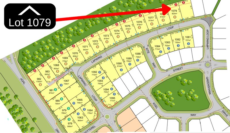
Lot 1079 Lapwing Loop, DJUGUN. NEW BLOCKS - Available Now! Residential for Sale. $307,000 Listed by PRD.
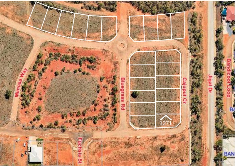
Lot 1271 33 Cajuput Crescent, DJUGUN. NEW RELEASED BLOCK! Residential for Sale. SOLD Listed by PRD.
Missing articles? Send us a link here.
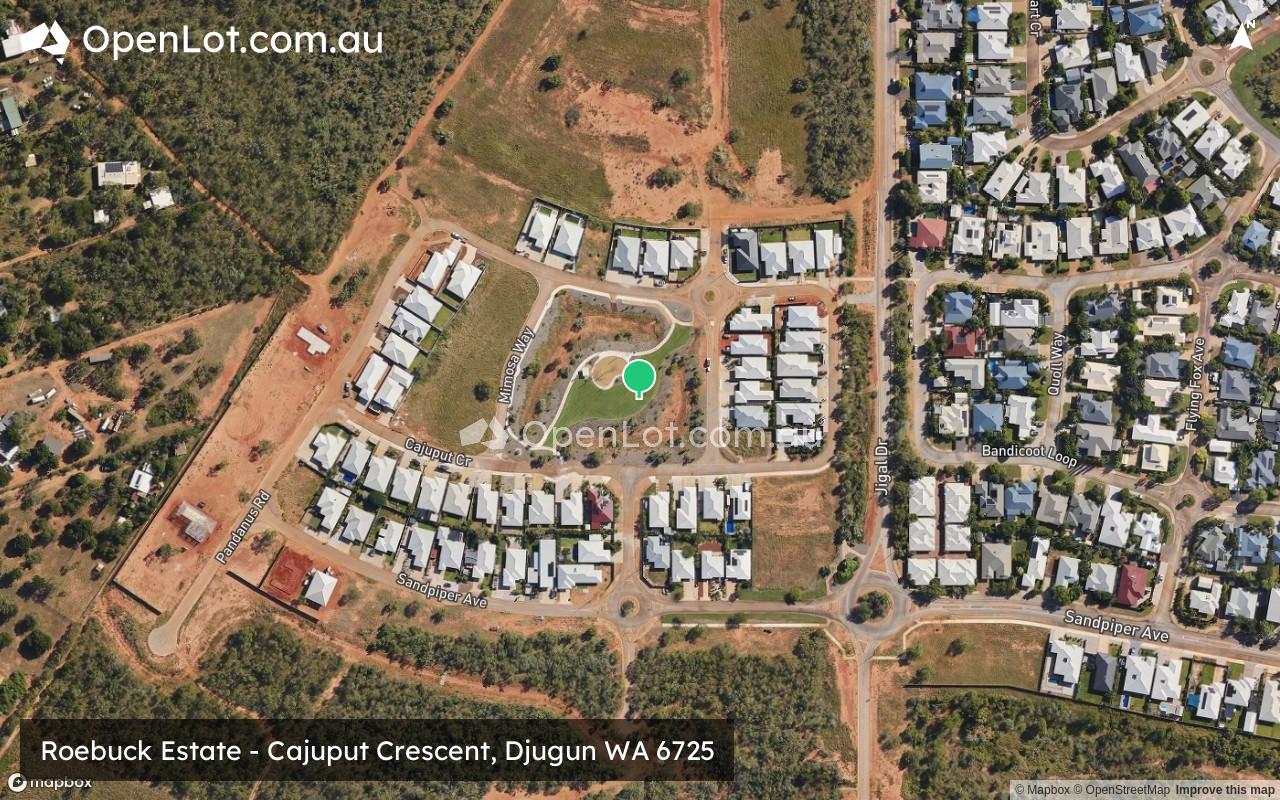
Location & Map for Roebuck Estate - Djugun
Schools near Roebuck Estate - Djugun
Here are 6 schools near Roebuck Estate - Djugun:
K-6 Government Primary School
7-12 Government Secondary School
7-12 Catholic Special School
K-6 Government Primary School
PP-12 Catholic Combined School - School Head Campus
K-6 Government Primary School
Reviews & Comments on Roebuck Estate - Djugun
Estate Brochure, Masterplan, Engineering Plan, Plan of Subdivision (POS), Design Guidelines
FAQs about Roebuck Estate - Djugun
View all estates marketed by PRD Broome
- Roebuck Primary School - 595m north-east
- Broome Senior High School - 1.3km south
- St Martin de Porres School - 1.8km south-west
- Broome North Primary School - 2.0km north
- St Mary's College - 2.0km south
- Cable Beach Primary School - 2.0km south-west
Popular Estates near Roebuck Estate - Djugun
Latest New Home Articles for You

18/Mar/2026 | OpenLot.com.au
Queensland: Top 30 Most Searched Housing Developments (February 2026)
If you’ve been exploring housing opportunities across Queensland, Februar...

16/Mar/2026 | OpenLot.com.au
New South Wales: Top 30 Most Searched Housing Developments (February 2026)
If you’ve been considering a move in New South Wales, February 2026 provi...

09/Mar/2026 | OpenLot.com.au
Victoria: Top 30 Most Searched Housing Developments (February 2026)
If you’ve been exploring housing opportunities in Victoria, February 2026...

20/Feb/2026 | OpenLot.com.au
Display Homes at Drouin Fields Estate: A Thriving Community in Drouin
Welcome to Drouin Fields, a place where beauty, space, and modern luxury ...

19/Feb/2026 | OpenLot.com.au
Display Homes at Manor Lakes Esate: A Thriving Waterside Community in Manor Lakes
A place where you can settle in, rather than just settle down. Named for ...

13/Feb/2026 | OpenLot.com.au
🏠 Victoria: Top 30 Most Searched Townhouse Developments – January 2026

11/Feb/2026 | OpenLot.com.au
🏡 Top 30 Most Searched Estates by State - January 2026

10/Feb/2026 | OpenLot.com.au
Victoria: Top 30 Most Searched Housing Developments (January 2026)
If you’ve been considering making a move in Victoria, January 2026 offere...

10/Feb/2026 | OpenLot.com.au
Queensland: Top 30 Most Searched Housing Developments (January 2026)
If you’ve been considering making a move in Queensland, January 2026 offe...