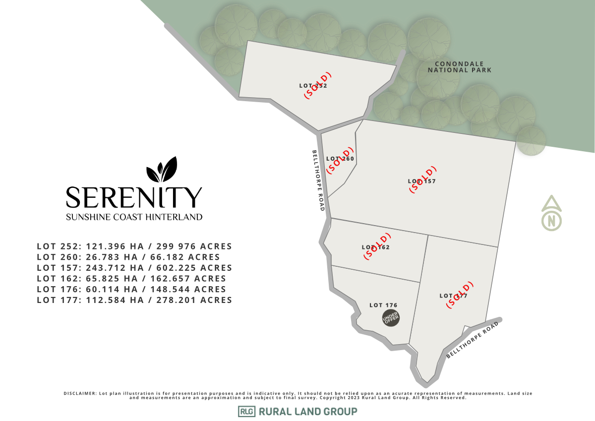

Serenity Estate - Conondale SOLD OUT
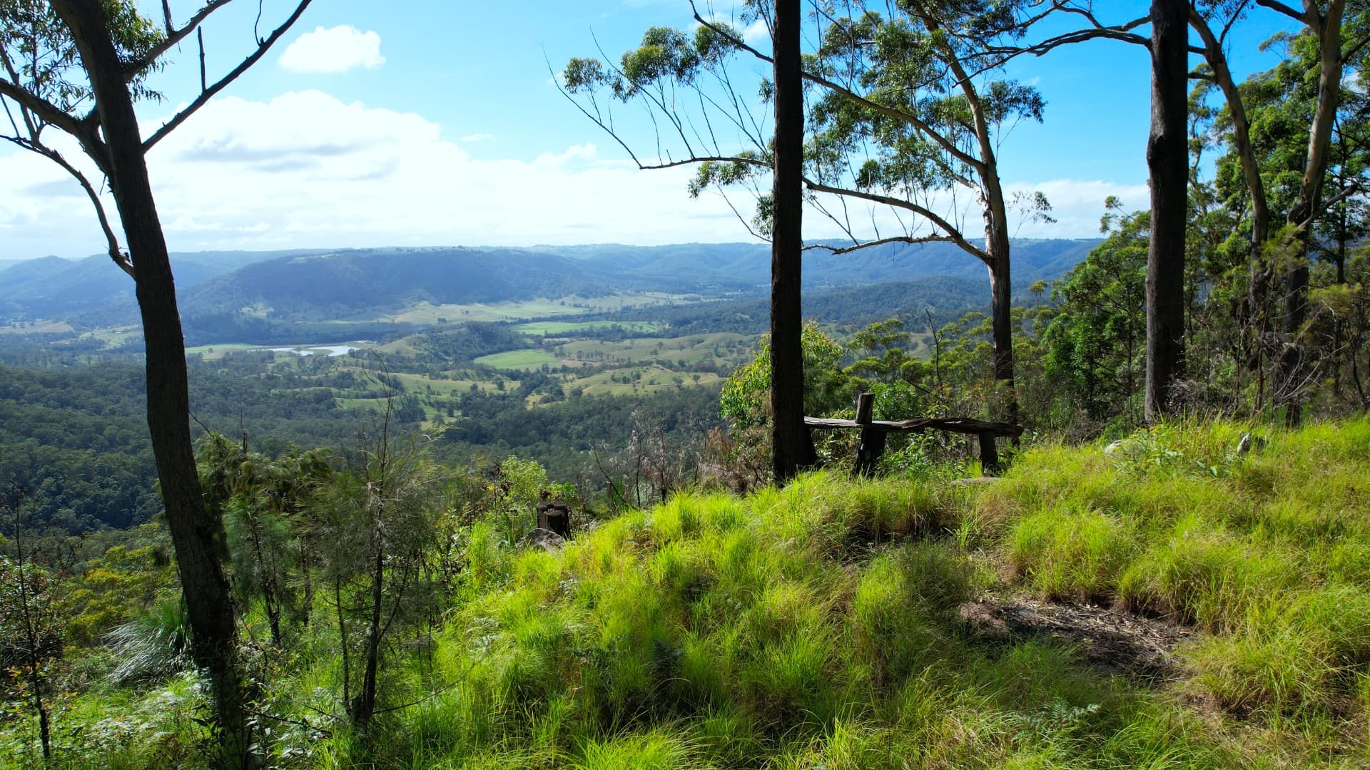
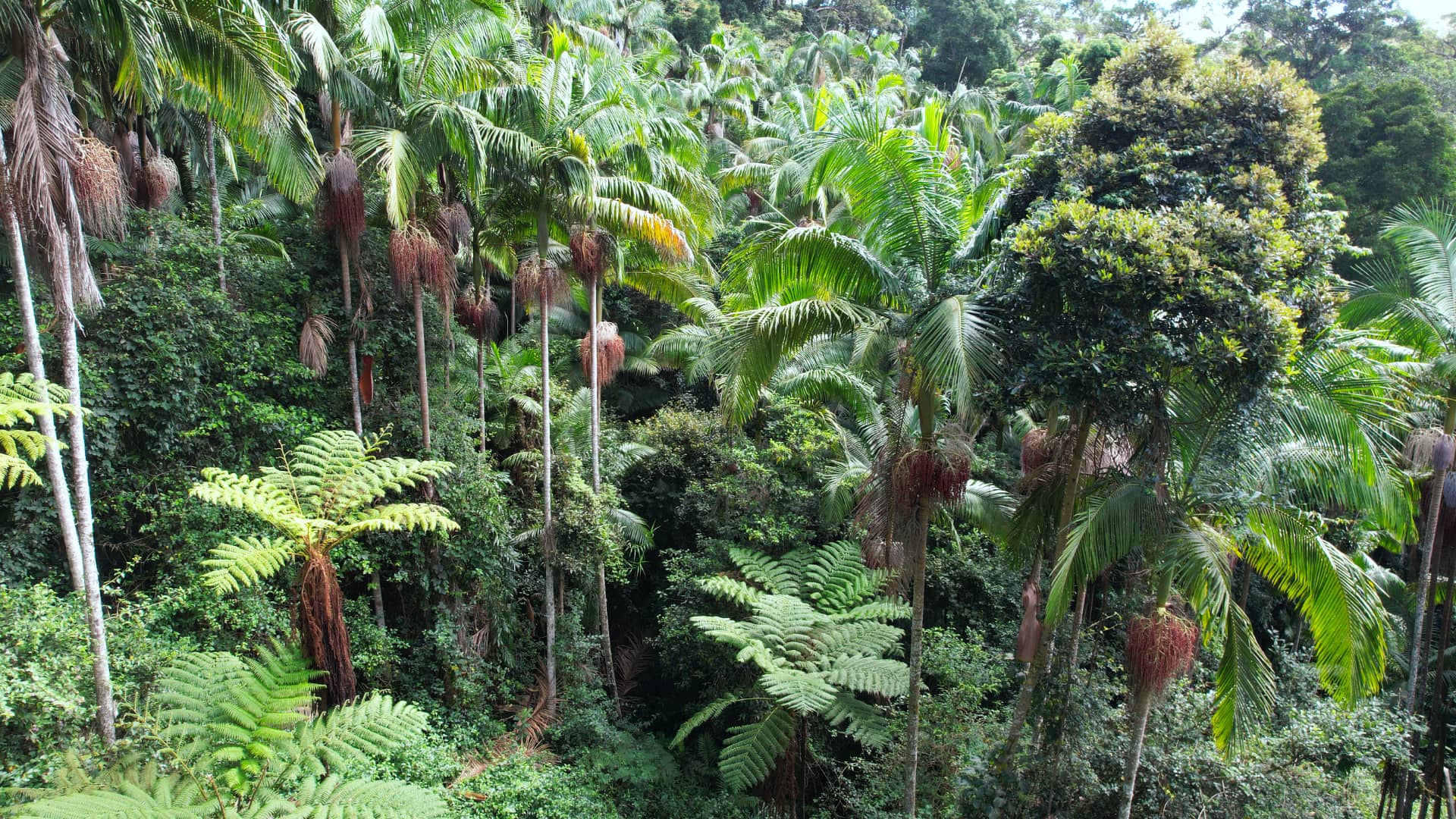
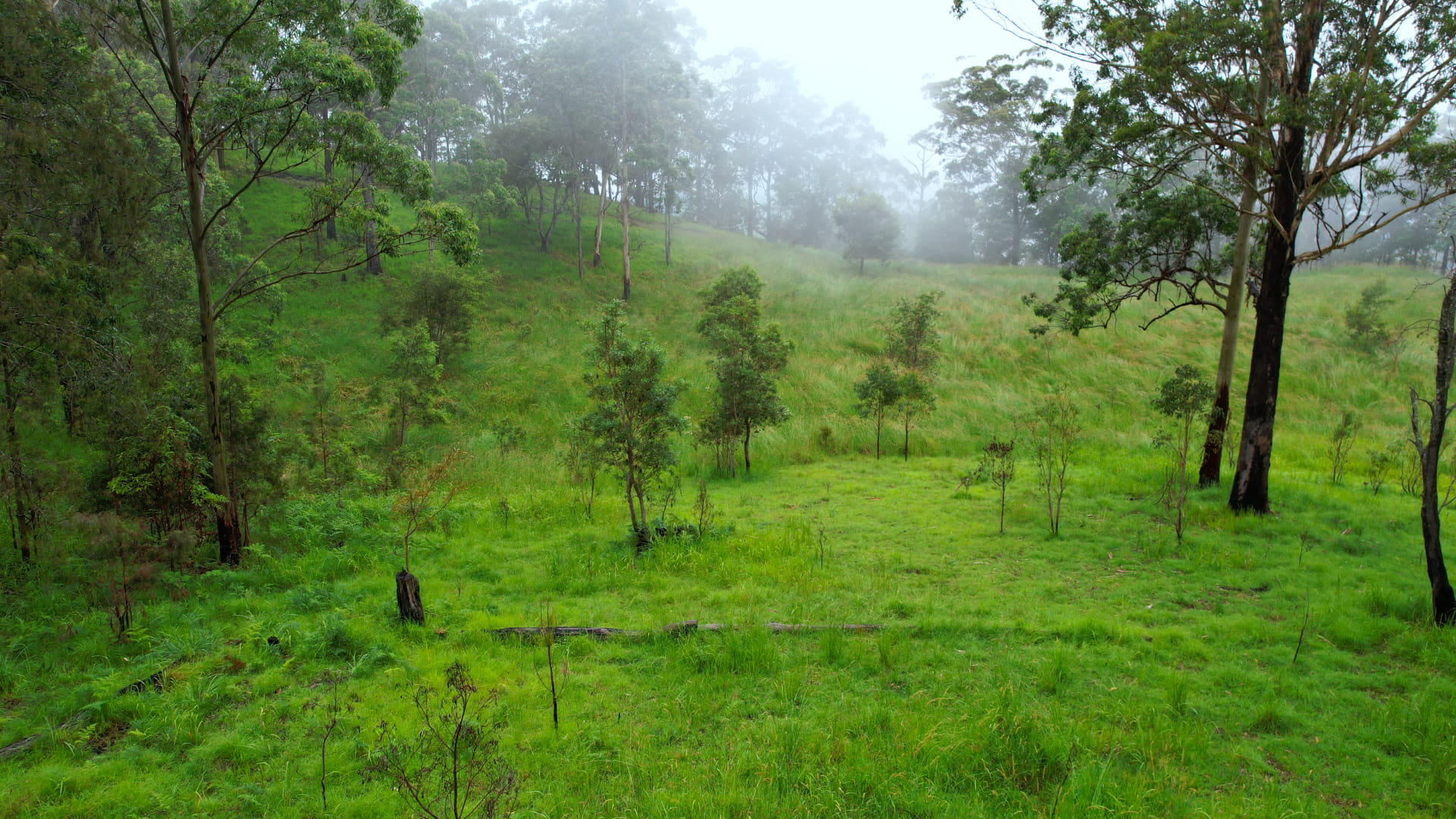
[LIMITED OFFER] A WORLD OF ITS OWN
- Panoramic Views
- Rainforest Pockets
- Rockpools & Waterfalls
- Off-grid Living
This information is estimated by the OpenLot research team. Let us know here to provide up-to-date information about this development.
| Total new homes | 6 |
| Area size | 630.40 hectares |
| Growth Region | Sunshine Coast Growth Areas |
| City council | Sunshine Coast Council |
| Developer | Rural Land Group |
| Distance to | Brisbane CBD - 85 km north-west |
Land for Sale, House and Land Packages:
Popular Estates near Serenity Estate - Conondale


 4
4
 2
2
 2
2


Updates for Serenity Estate - Conondale
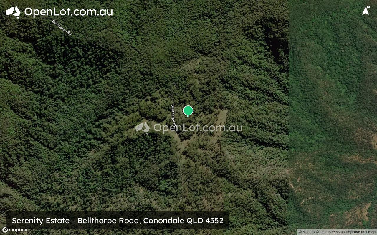
Location & Map for Serenity Estate - Conondale
Vacancy Rate in Conondale QLD 4552
View full vacancy rate history in Conondale QLD 4552 via SQM Research.
Schools near Serenity Estate - Conondale
Here are 6 schools near Serenity Estate - Conondale:
Prep-6 Government Primary School
Prep-6 Government Primary School
7-11 Independent Secondary School
Prep-6 Independent Primary School
Prep-6 Government Primary School
7-12 Government Secondary School
Reviews & Comments on Serenity Estate - Conondale
Estate Brochure, Masterplan, Engineering Plan, Plan of Subdivision (POS), Design Guidelines
FAQs about Serenity Estate - Conondale
View all estates from Rural Land Group
- Conondale State School - 7.2km north-east
- Mount Kilcoy State School - 13.6km south-west
- My Independent School - 16.2km north-east
- The River School - 17.9km east
- Maleny State School - 18.6km east
- Maleny State High School - 18.7km east
Popular Estates near Serenity Estate - Conondale
Latest New Home Articles for You

09/Mar/2026 | OpenLot.com.au
Victoria: Top 30 Most Searched Housing Developments (February 2026)
If you’ve been exploring housing opportunities in Victoria, February 2026...

20/Feb/2026 | OpenLot.com.au
Display Homes at Drouin Fields Estate: A Thriving Community in Drouin
Welcome to Drouin Fields, a place where beauty, space, and modern luxury ...

19/Feb/2026 | OpenLot.com.au
Display Homes at Manor Lakes Esate: A Thriving Waterside Community in Manor Lakes
A place where you can settle in, rather than just settle down. Named for ...

13/Feb/2026 | OpenLot.com.au
🏠 Victoria: Top 30 Most Searched Townhouse Developments – January 2026

11/Feb/2026 | OpenLot.com.au
🏡 Top 30 Most Searched Estates by State - January 2026

10/Feb/2026 | OpenLot.com.au
Victoria: Top 30 Most Searched Housing Developments (January 2026)
If you’ve been considering making a move in Victoria, January 2026 offere...

10/Feb/2026 | OpenLot.com.au
Queensland: Top 30 Most Searched Housing Developments (January 2026)
If you’ve been considering making a move in Queensland, January 2026 offe...

09/Feb/2026 | OpenLot.com.au
Western Australia: Top 30 Most Searched Housing Developments (January 2026)
If you’ve been considering making a move in Western Australia, January 20...

06/Feb/2026 | OpenLot.com.au
South Australia: Top 30 Most Searched Housing Developments (January 2026)
If you’ve been considering making a move in South Australia, January 2026...