


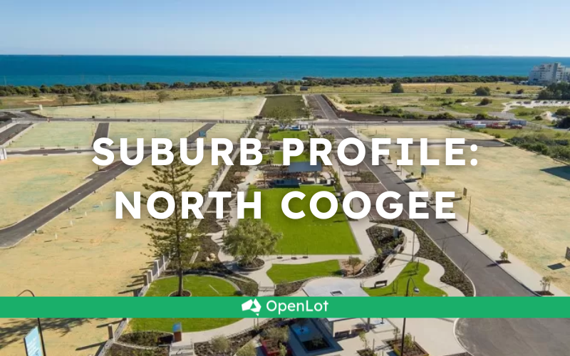
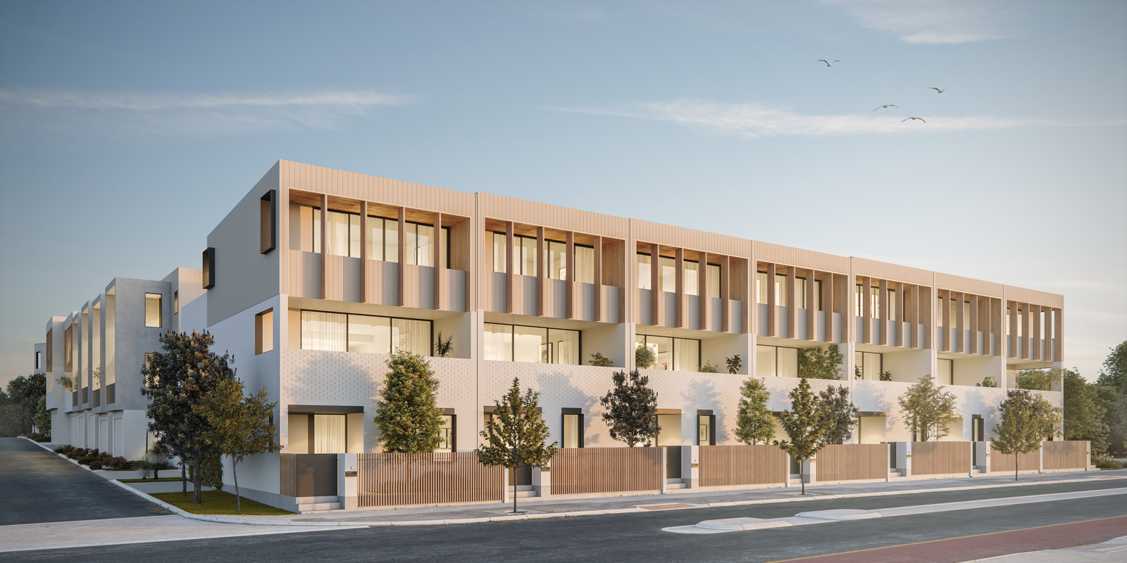
Shoreline Estate - North Coogee COMING SOON
- Located in North Coogee, just 4km south of Fremantle, Shoreline is a stone’s throw from Perth’s world class beaches, with a famous shopping, food and entertainment precinct in its own backyard.
- With Fremantle Train Station 11 minutes away, bus links, and bike paths already established, you could be meeting friends in Fremantle, picking up fresh produce at the markets or enjoying a Sunday session watching boats from the harbour.
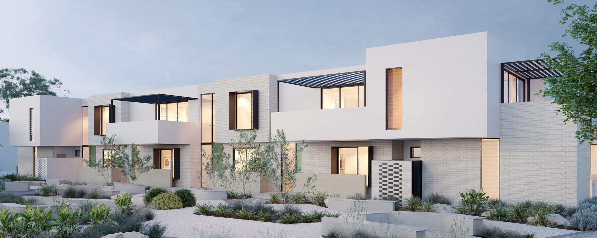
- Drawing on the best design ideas from the world’s most liveable cities, Shoreline sets a new benchmark for medium density living in Western Australia.
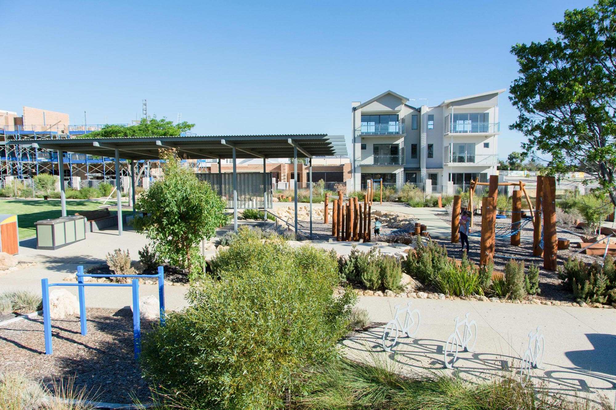
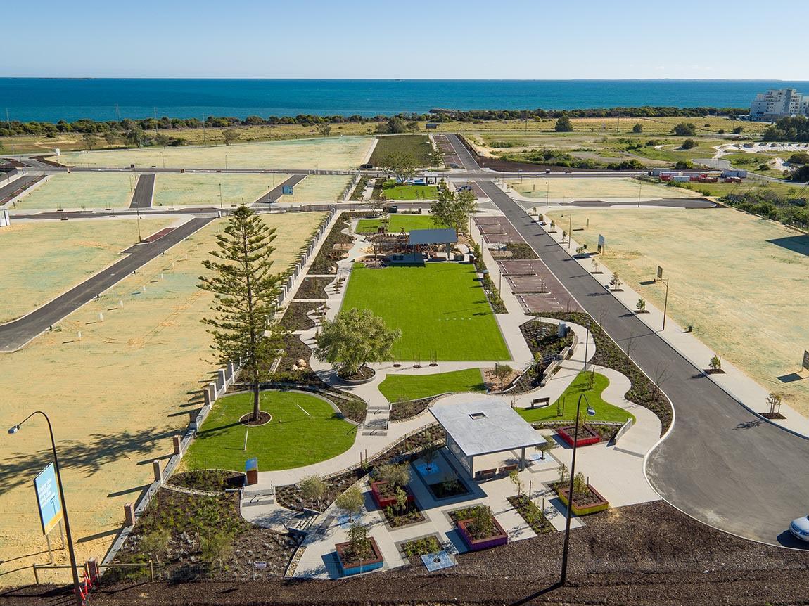
- Once complete, the main street at Shoreline will provide an array of shops, restaurants, cafes, recreation spaces and entertainment facilities.
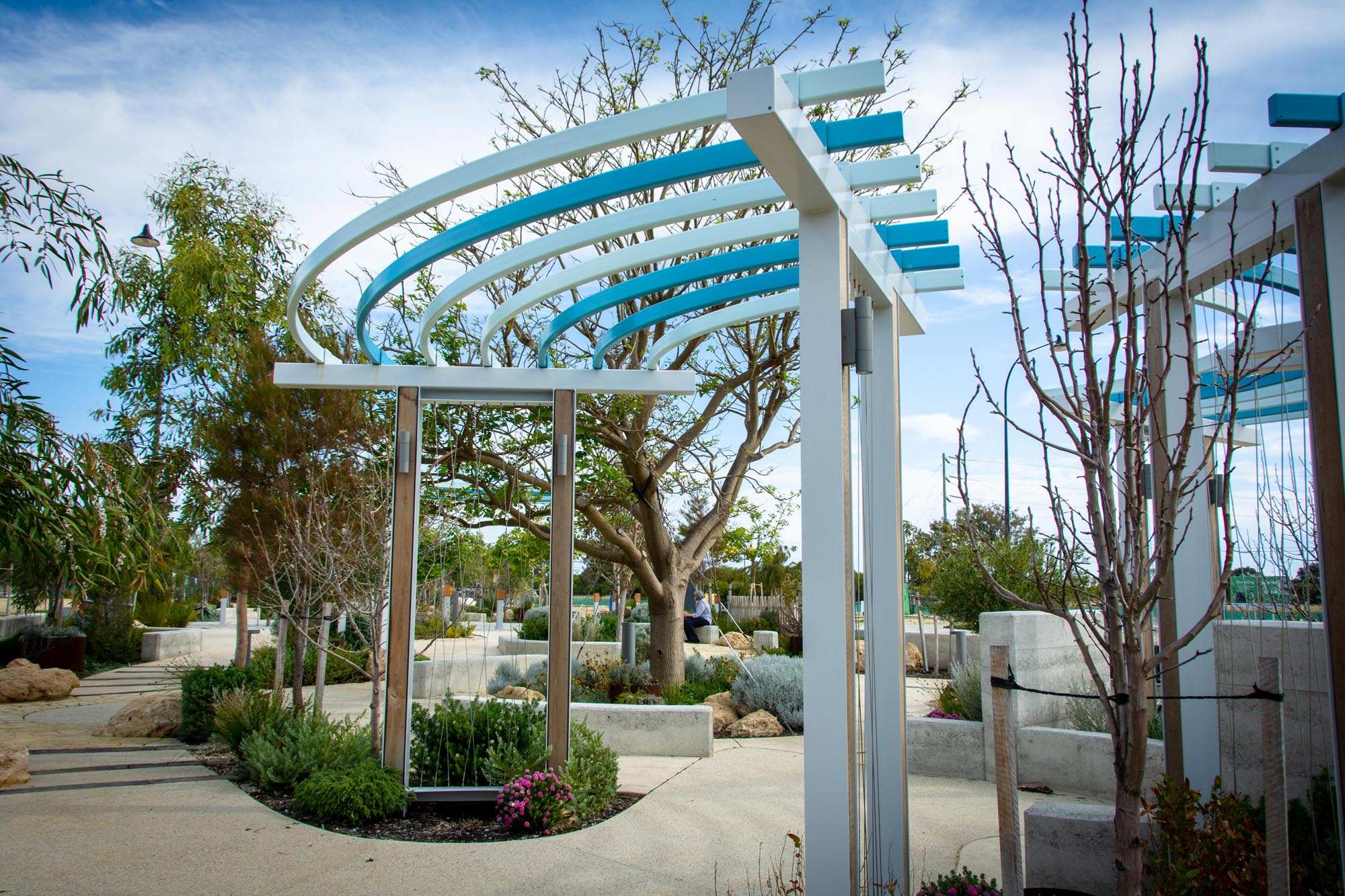
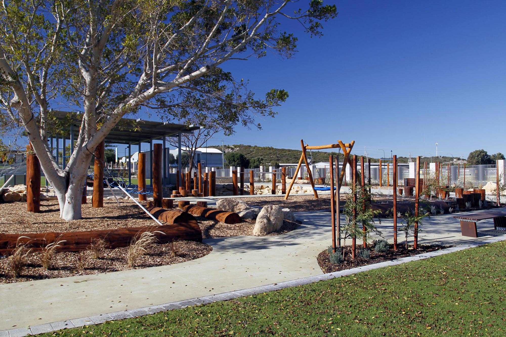
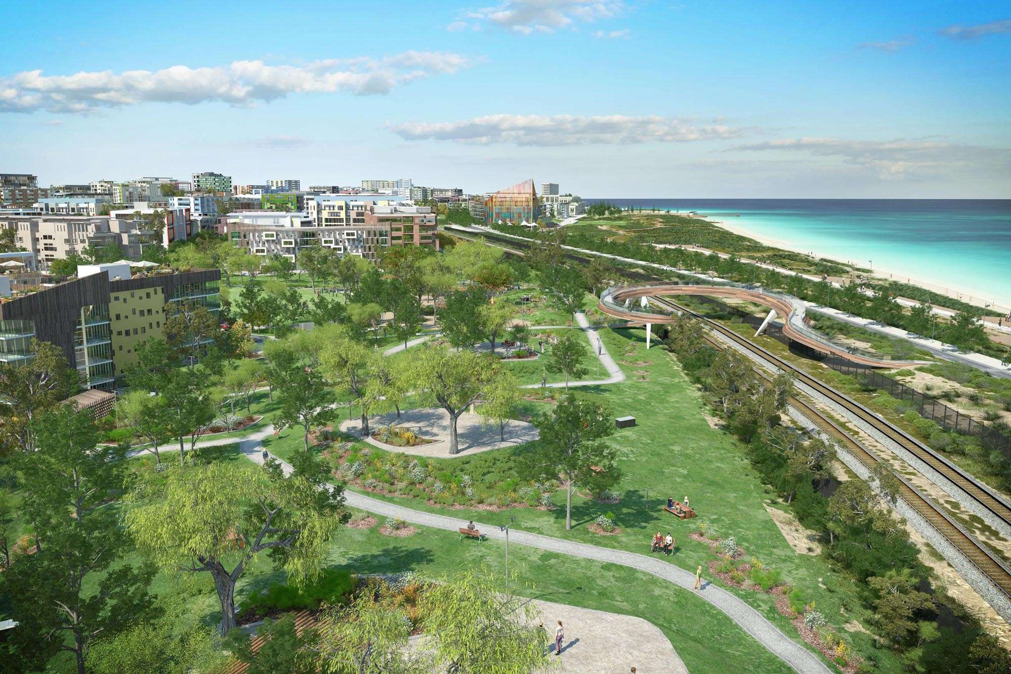
- To connect the community to the coast, new pedestrian and vehicle access will cross over the freight rail line, linking the main street to the beach plaza. More than 3.5 hectares will be dedicated to parks, green spaces and community facilities.
This information is estimated by the OpenLot research team. Let us know here to provide up-to-date information about this development.
| Total new homes | 2,500 |
| Area size | 47.00 hectares |
| Growth Region | Perth South West Growth Areas |
| City council | City of Cockburn |
| Developer | DevelopmentWA |
| Other names | Salt Lane |
Land for Sale, House and Land Packages, Townhomes:
Popular Estates near Shoreline Estate - North Coogee

 3
3
 2.5
2.5
 1
1


Updates for Shoreline Estate - North Coogee
Facebook updates:
Submit the Facebook page for Shoreline Estate - North Coogee.
Related news:
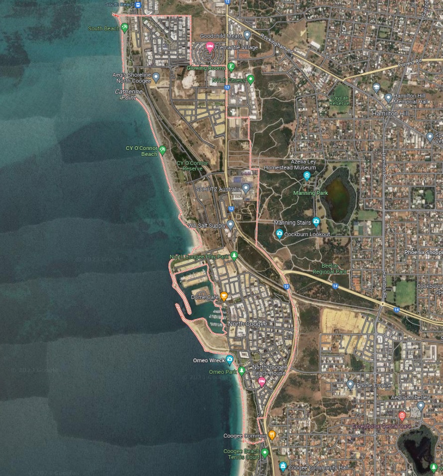
North Coogee is a local town of approximately 2.8 square kilometres in area, forming part of the southern coastal region of Perth that is located 23 kilometres south of the Perth CBD. The township is located 4km south of the City of Fremantle, east of both Beeliar Regional Park and Manning Park and north of Coogee Coastal Township.
Western Australia’s property market continues to show robust growth, with diverse housing estates attracting attention from homebuyers and investors alike. According to the latest data from OpenLot.com.au for January 2025, these estates have emerged as the top five most popular in their respective growth regions:

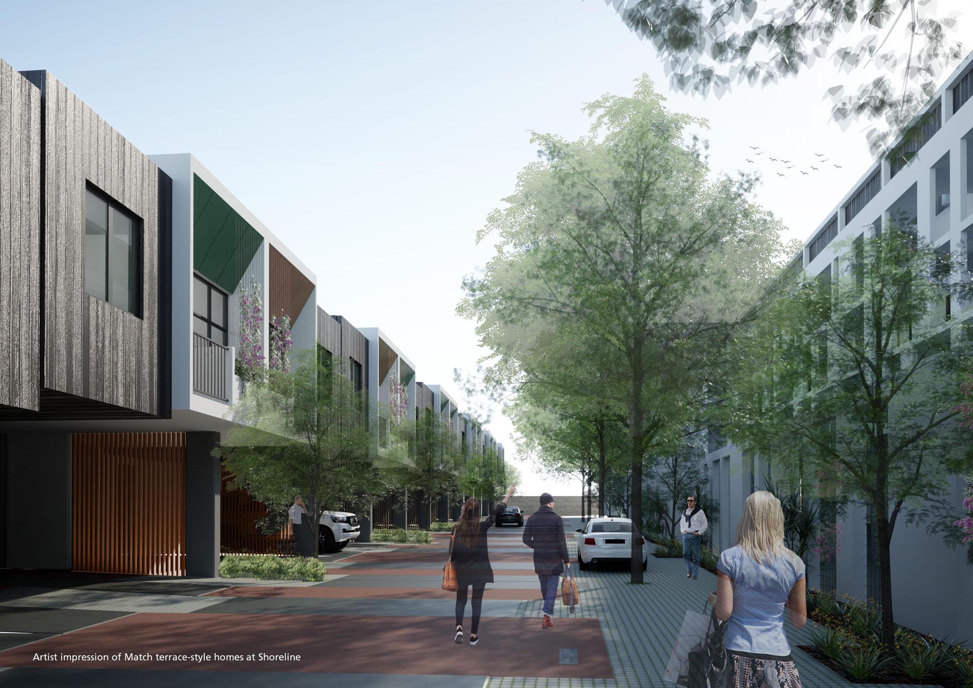
Salt Lane at Shoreline in North Coogee is a pedestrian friendly community featuring quality terrace houses minutes from the beach and Freo life.

With the weather warming up, the timing couldn’t be better for the release of a range of new high-quality homes at Salt Lane – part of the growing Shoreline development on the coast at North Coogee.
North Coogee Terrace Homes for Sale | 16 boutique Terrace Homes for sale in visionary Shoreline precinct. Find yours... 0432 660 066
We Help Our Clients Deliver Successful Town Planning, Urban Design & Development Projects. Read More About This Recent Project At Our Website.

Terrace Homes for Sale | 23 contemporary three-storey homes surrounding a lush landscaped courtyard. Find yours... 0432 660 066
TERRACE Homes offer Salt Lane Shoreline in North Coogee. To know more details on home designs in North Coogee.
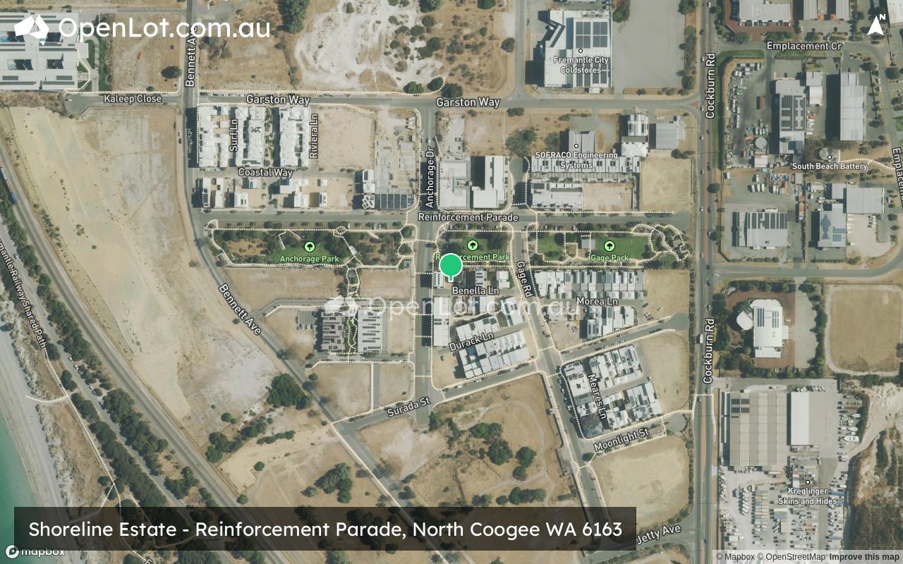
Shoreline Estate is a 47-hectare estate being presently developed by DevelopmentWA to repurpose former industrial land into high quality mixed-use outcomes incorporating numerous shared zones, public open space and heritage elements. The Shoreline Stage 3 Salt Lane Precinct, located between Surada St and Reinforcement Parade in North Coogee, is a $2.9M element of the larger … Continue reading "Shoreline at North Coogee"

Missing articles? Send us a link here.
Location & Map for Shoreline Estate - North Coogee
Visit Display Homes near Shoreline Estate - North Coogee


Vacancy Rate in North Coogee WA 6163
View full vacancy rate history in North Coogee WA 6163 via SQM Research.
Schools near Shoreline Estate - North Coogee
Here are 6 schools near Shoreline Estate - North Coogee:
PP-6 Independent Primary School
PP-12 Independent Combined School
K-6 Government Primary School - School Head Campus
8-12 Independent Special School
K-6 Government Primary School
PP-6 Catholic Primary School
Suburb Planning Review in North Coogee WA 6163
North Coogee is a local town of approximately 2.8 square kilometres in area, forming part of the southern coastal region of Perth that is located 23 kilometres south of the Perth CBD. The township is located 4km south of the City of Fremantle, east of both Beeliar Regional Park and Manning Park and north of Coogee Coastal Township.
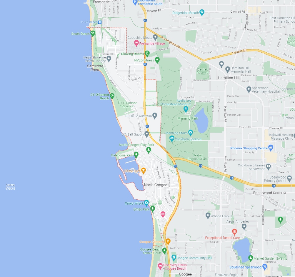
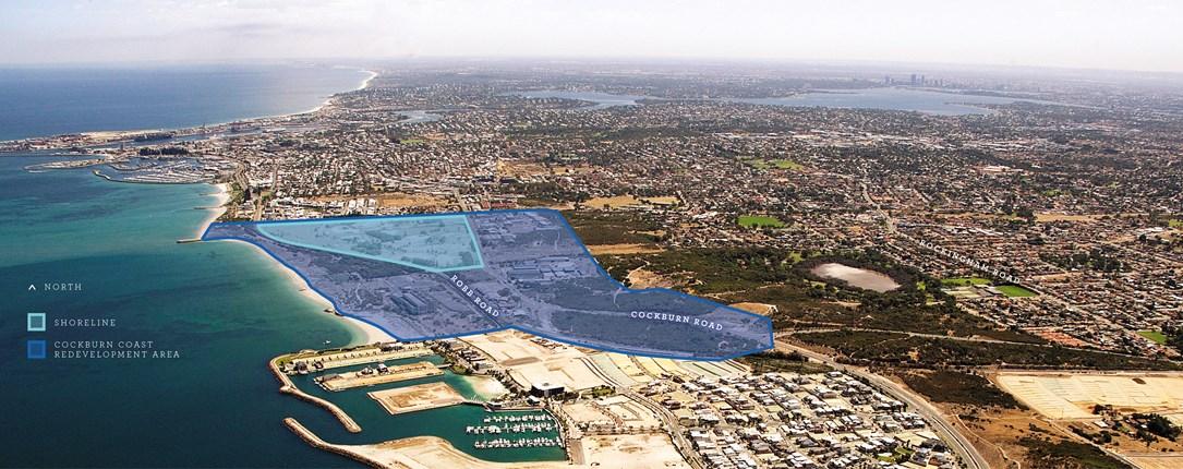
The suburb boundary is located along Powell Road and Coogee Beach Jetty to the south. The property boundaries align with Hollis Park and the South Beach rock breakwater to the north and the Indian Ocean to the west. Cockburn Road and property boundaries make up the entire eastern boundary.
A local road network is found throughout North Coogee, providing access to the surrounding suburbs and the local network of roads. Cockburn Road provides the north-south spine road along the eastern boundary, providing connections to the coastline via Pantheon Venue, McTaggart Cove and Rollinson Road. Robb Road provides a beach esplanade connection to Orsino Boulevard in the south and Ocean Drive in the north.
The elongated suburb was created on 19 December 2005 and incorporated portions of the surrounding suburbs of Hamilton Hill, Spearwood and Coogee. The suburb forms part of the City of Cockburn local government area, containing a northern and southern urbanised area, local centres (commercial and retail), large residential areas, beach and parks.
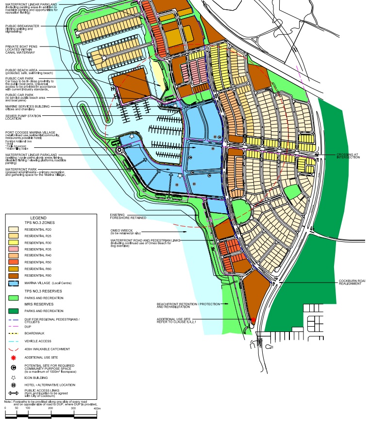
The area was made up of a number of industrial activities, a port, a power station, abattoir and rail yards, until 1990s where small developments were proposed to redevelop the existing industrial land, mainly known as South Beach, Port Coogee and Port Catherine. Further development in 2008 saw approximately 95 hectares of industrial coastline proposed for residential purposes, housing approximately 10,000 people.
In recent years, North Coogee, a once industrial suburb, has experienced rapid expansion, transforming it into one of the most sought-after residential areas south of Perth. Situated within the City of Cockburn, the majority of North Coogee's population resides in its northern and southern regions, with growth now expected between the established areas.
The town centre of North Coogee has been established within the $2 billion Port Coogee Village in the southern area of the township. Port Coogee Village is the new coastal neighbourhood shopping centre at the heart of Port Coogee’s award-winning marina and residential estate. The development was one of Australia’s biggest coastal renewal projects covering more than 85 hectares and provides retail speciality tenancies and a Woolworths supermarket.
The City of Cockburn has been reviewing the planning documents that shape the growth and development that includes the North Coogee area. It is designated as a "growth area" by the Western Australian Planning Commission due to its significant potential for future development and expansion.
Recent Projects in North Coogee
Port Coogee Marina Expansion (Stage 3)
The City of Cockburn, owner and manager of Port Coogee Marina, expanded the marina in multiple stages. Stage 1 and 2, completed in 2012, provided 158 boat berths. Stage 3, part of a $5.84 million project initiated in August 2021 and finalized in October 2022, encompassed:
- Construction of 69 boat pens on the south and western sides of Maraboo Island in Port Coogee, accommodating boats from eight to 25 meters in length. These pens are distributed across three new concrete floating jetties.
- A 90-meter timber boardwalk and concrete loading berth area.
- Two gatehouses to serve the new floating jetties.
- Reconfiguration of Maraboo Island's car parking to create nine new parking bays.
The marina used the 'Bellingham Unifloat' floating concrete jetty, a relatively new design in Western Australia, making Port Coogee one of the state's first marinas to adopt it. The new waterfront boardwalk area is open to the public, enhancing the existing waterside boardwalk and walkways in Port Coogee. Stage 4 will be developed progressively to provide around 250 berths.
Port Coogee Marina Expansion (Stage 4)
Stage 4 involves additional boat pens located south of the current marina jetties. Construction will take place when there is suitable market demand.

Coogee Beach Replenishment
In the fiscal year 2023-24, a budget of $177,000 has been allocated for a beach replenishment project within the coastal and marina domain. This project is aimed at mitigating coastal erosion issues specifically at C Y O'Connor Beach.
Boardwalk Renewal
In the fiscal year 2023-24, a budget of $212,000 has been designated for a boardwalk renewal project within the coastal and marina sector. This project's primary focus is the repainting and maintenance of the marina's boardwalk.
Shoreline Estate (North Coogee)
Shoreline's goal is to create a contemporary, sustainable coastal urban community with 2,500 dwellings. We've been involved in the detailed design since 2013, working closely with stakeholders like the City of Cockburn and the Western Australian Planning Commission. Despite site complexities, we've streamlined processes to secure approvals for subdivision, design guidelines, and local development plans. The outcome will be a unique coastal community with diverse housing options, an activity center, and quality public amenities. We've incorporated innovative design to accommodate different lifestyles and housing needs, including compact terraced homes, small lot housing, and a variety of apartment sizes while enhancing streetscapes and public spaces.

Port Coogee Revised Local Structure Plan (LSP)
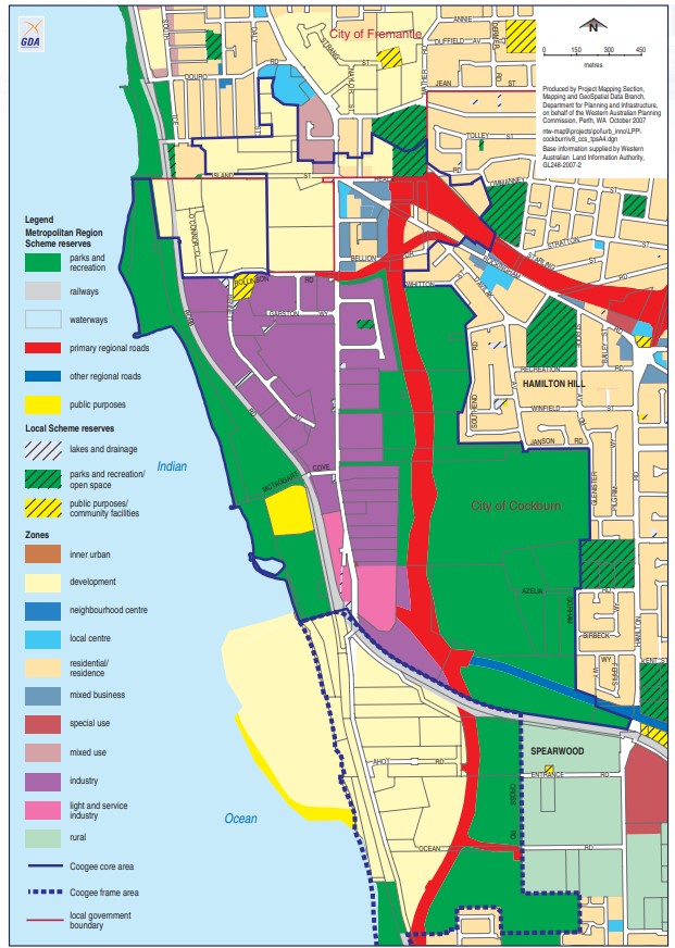
On 26 October 2004 the Metropolitan Region Scheme (MRS) was amended to rezone the land to ‘Urban’, ‘Public Purpose’, ‘Parks & Recreation’ and ‘Primary Regional Road’, and on 28 June 2005 Amendment No. 3 to the City of Cockburn’s Town Planning Scheme No. 3 was gazetted, rezoning the land to ‘Development Zone’. In March 2004 Council adopted a Local Structure Plan (LSP) for Port Coogee.
Design changes to the Marina Village prompted approved revisions to the structure plan in August 2005 and April 2007. Further adjustments to the Local Structure Plan (LSP) were made in 2010 during detailed design reviews of the Marina Village.
In June 2010 and July 2011, the LSP was further amended to enhance the Marina Village and Stage 5. This involved changes such as introducing a Building Heights Plan, increasing public open space, implementing built form codes in the Marina Village Precinct, relocating the southern neighbourhood centre to the Marina Village, and modifying the northern part of Orsino Boulevard. In December 2016 sought higher density and in September 2018 introduced further changes to three urban precincts.
Cockburn Coast – District Structure Plan (DSP)
The Cockburn Coast District Structure Plan envisions diverse housing, employment, and redevelopment, emphasizing the South Fremantle Power Station, transit links, and coastal improvements. It anticipates 10,000 residents and 2,700 jobs, with sustainability and housing variety as key aspects. The plan accommodates various land uses, offering flexibility for existing industries. Collaboration among the State Government, local authorities, landowners, and the community is crucial for successful implementation. This structure plan was signed off by the Minister for Planning in the Western Australian State Government.

Cockburn Strategic Community Plan 2020–2030
The Strategic Community Plan for 2020–2030 serves as the guiding document for the City's development over the next decade, reflecting the community's aspirations and building on historical planning efforts. This report provides an overview of the plan's key components, emphasizing five primary outcomes: economic growth, environmental responsibility, community well-being, urban planning, and organizational excellence. By focusing on these strategic objectives, the City aims to create a thriving, sustainable, and inclusive community that meets residents' needs and builds upon its rich history.
Key Outcomes Summary:
- Local Economy: The City aims to build a sustainable and diverse local economy that attracts investments and generates local job opportunities, emphasizing economic growth and job creation within the community.
- Environment Responsibility: The City commits to leading in environmental management, focusing on enhancing and sustainably managing local natural areas and resources, preserving and responsibly using these assets.
- Community, Lifestyle, and Security: The City's objective is to create a vibrant, healthy, safe, inclusive, and connected community, prioritizing residents' well-being, safety, inclusivity, and connectedness.
- City Growth and Moving Around: The City plans for responsible growth and urban planning to develop a growing City that is easy to navigate and offers an excellent quality of life for its residents.
- Listening and Leading: The City's goal is to be a community-focused, sustainable, accountable, and progressive organization, emphasizing responsiveness, sustainability, forward-thinking, community engagement, and accountability.
Vision of North Coogee
We have a Vision for 2030 Let’s make Cockburn the best place to be How? We’re doing many things… … Like helping to create a city centre As part of out vision to create a living, breathing Place to be for the community We’re supporting local businesses And we urge everyone to shop local As part of our vision to make Cockburn The prosperous place to be AS part of out vision to make Cockburn the natural place to be, We’re preserving the bushland and wetlands For generations to come. We assist young people To gain employment As part of our vision to make Cockburn The place to be for opportunity These are just some of our 2030 vision initiatives Let’s make Cockburn the best place to be.
City of Fremantle Planning Scheme (North Coogee Area)
Within the Cockburn coast area, the City of Fremantle holds jurisdiction over only three areas: the South Fremantle landfill site, the Fremantle Chalet Village, and 5.7 hectares in the Clontarf Hill area. These areas are classified under Local Planning Scheme No. 4, with the landfill site designated as Development Area 2, the Chalet Village as Development Area 3, and Clontarf Hill zoned as Development Area 19 and open space. Any additional development in these areas requires an approved structure plan under the scheme.
City of Cockburn Planning Scheme (North Coogee Area)
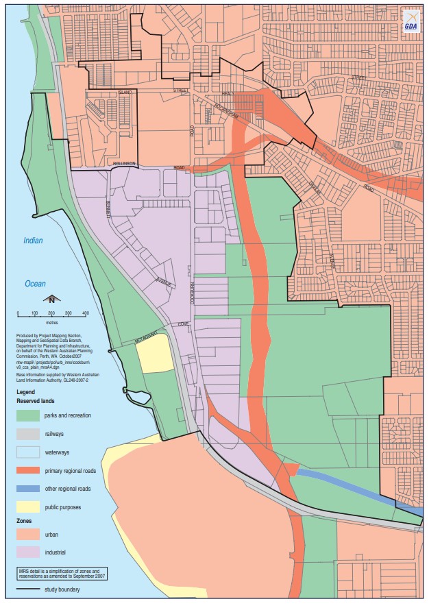
The City of Cockburn's Local Planning Scheme No. 3, enacted in December 2002, encompasses most of the Cockburn coast structure plan area. The land in question is predominantly zoned for Industry and Light Industry, with the remainder designated as MRS reserves, including primary regional road, parks and recreation, and public purpose areas.
Perth and Peel Growth Areas
Growth Areas Perth and Peel (GAPP) represents an alliance of eleven suburban councils in the Perth and Peel regions. These councils have consistently championed the need for increased availability of public open spaces and the development of local sports facilities. They include the City of Cockburn.
GAPP's primary objective is to secure up to $350 million in federal funding for a dedicated account, a fund that would also attract supplementary investments from the State Government, Local Government, and development contribution programs.
With a maximum allocation of $30 million for any single project, these funds would be adequate to develop as many as 12 major sports precincts spanning the 11 suburban local government areas within the next four to eight years. Once these facilities are established, they will be operated and maintained by the respective Local Governments.
What Are the Advantages
- Increased Opportunities for Sports and Healthy Lifestyles:
- Enhanced access to sports facilities promotes physical activity and healthier living.
- Reduction in Obesity Rates:
- The availability of these sports precincts can contribute to lowering obesity rates through increased physical activity.
- Mitigation of Other Lifestyle Issues and Risks:
- These developments can help address various lifestyle-related issues and risks, fostering healthier and safer communities.
- Job Creation:
- The project would stimulate job opportunities, benefiting the local economy.
- Enhanced Livability and Appeal of Perth's Suburban Areas:
- The presence of modern sports facilities enhances the overall quality of life and attractiveness of Perth's suburban regions.
GAPP Framework
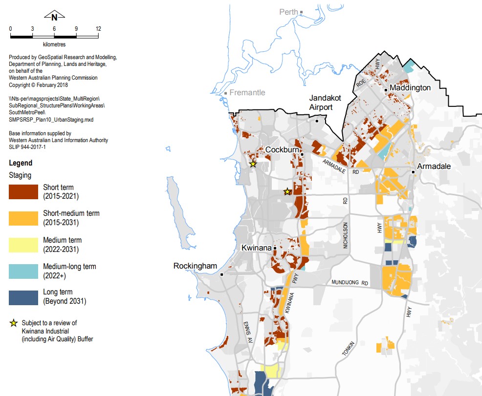
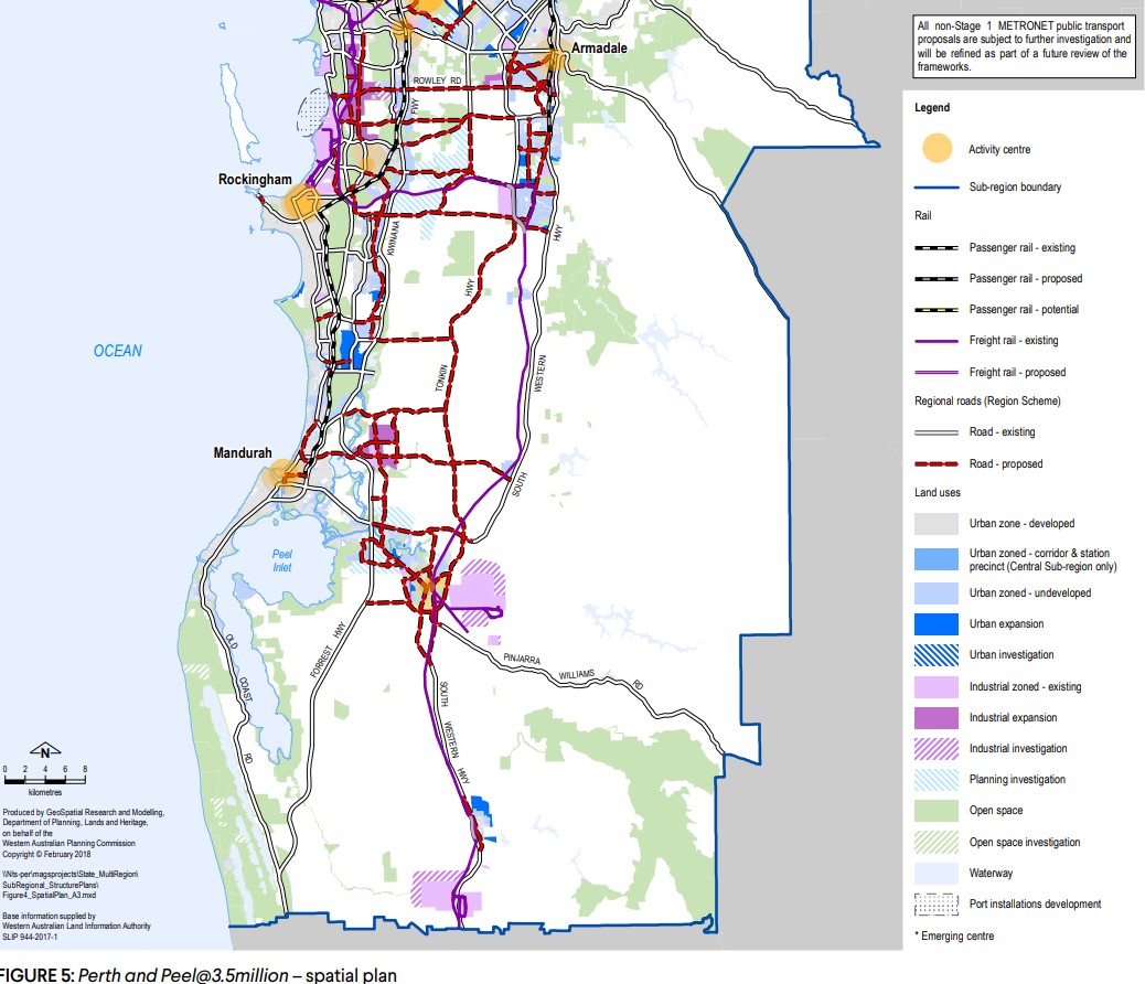
The frameworks aim to accommodate 3.5 million people by 2050 by creating vibrant communities within a compact and connected city; making best use of existing and proposed infrastructure; and protecting important environmental assets.
The framework encourages significantly greater infill development with almost half of the required 800,000 new homes – 380,000 at a minimum - to be built through infill development. The majority of these – around 214,000 – will be built in existing suburbs within the Central sub-region and particularly through alignment with the new METRONET rail project.
The South Metropolitan Peel sub-region report, produced by the Western Australian Planning Commission, indicates that a significant portion of future development will take place on land already designated for urban use. This encompasses ongoing development between Kwinana-Rockingham and Mandurah-Pinjarra, as well as within emerging urban zones throughout the sub-region, including Byford and Mundijong.
In alignment with the planning principle established in the 1999 Coastal and Lakelands Planning Strategy, urban development will not extend south of a demarcation line stretching from Dawesville to Pinjarra. Furthermore, the framework designates specific limited areas in Jandakot/Treeby, Langford, Cardup, Mangles Bay, the Pinjarra-Ravenswood sector, and east of Kwinana for further planning investigation.
A significant focus of future urban development will be situated in the North Coogee area.

North Coogee Suburb Summary
References
- City of Cockburn Planning Scheme (North Coogee Area)
- City of Fremantle Planning Scheme (North Coogee Area)
- Cockburn Coast – District Structure Plan (DSP)
- Port Coogee Revised Local Structure Plan (LSP)
- Shoreline Estate (North Coogee)
- Port Coogee Marina Expansion (Stage 3)
- Cockburn Strategic Community Plan 2020–2030
- North Coogee – Perth and Peel @ 3.5 million - WA Planning Submission
Reviews & Comments on Shoreline Estate - North Coogee
Estate Brochure, Masterplan, Engineering Plan, Plan of Subdivision (POS), Design Guidelines
FAQs about Shoreline Estate - North Coogee
View all estates from DevelopmentWA
- Kerry Street Community School - 1.5km east
- Fremantle Christian College - 1.6km east
- Beaconsfield Primary School - 1.9km north
- Port School - 1.9km east
- Winterfold Primary School - 1.9km north-east
- Christ the King School - 2.0km north-east
Popular Estates near Shoreline Estate - North Coogee
Latest New Home Articles for You

09/Mar/2026 | OpenLot.com.au
Victoria: Top 30 Most Searched Housing Developments (February 2026)
If you’ve been exploring housing opportunities in Victoria, February 2026...

20/Feb/2026 | OpenLot.com.au
Display Homes at Drouin Fields Estate: A Thriving Community in Drouin
Welcome to Drouin Fields, a place where beauty, space, and modern luxury ...

19/Feb/2026 | OpenLot.com.au
Display Homes at Manor Lakes Esate: A Thriving Waterside Community in Manor Lakes
A place where you can settle in, rather than just settle down. Named for ...

13/Feb/2026 | OpenLot.com.au
🏠 Victoria: Top 30 Most Searched Townhouse Developments – January 2026

11/Feb/2026 | OpenLot.com.au
🏡 Top 30 Most Searched Estates by State - January 2026

10/Feb/2026 | OpenLot.com.au
Victoria: Top 30 Most Searched Housing Developments (January 2026)
If you’ve been considering making a move in Victoria, January 2026 offere...

10/Feb/2026 | OpenLot.com.au
Queensland: Top 30 Most Searched Housing Developments (January 2026)
If you’ve been considering making a move in Queensland, January 2026 offe...

09/Feb/2026 | OpenLot.com.au
Western Australia: Top 30 Most Searched Housing Developments (January 2026)
If you’ve been considering making a move in Western Australia, January 20...

06/Feb/2026 | OpenLot.com.au
South Australia: Top 30 Most Searched Housing Developments (January 2026)
If you’ve been considering making a move in South Australia, January 2026...