Stockland Canopy - Glendalough COMING SOON
Townhouses
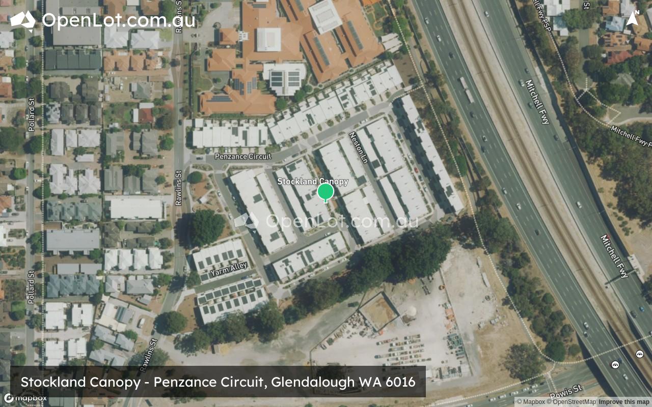
Penzance Circuit, Glendalough WA 6016
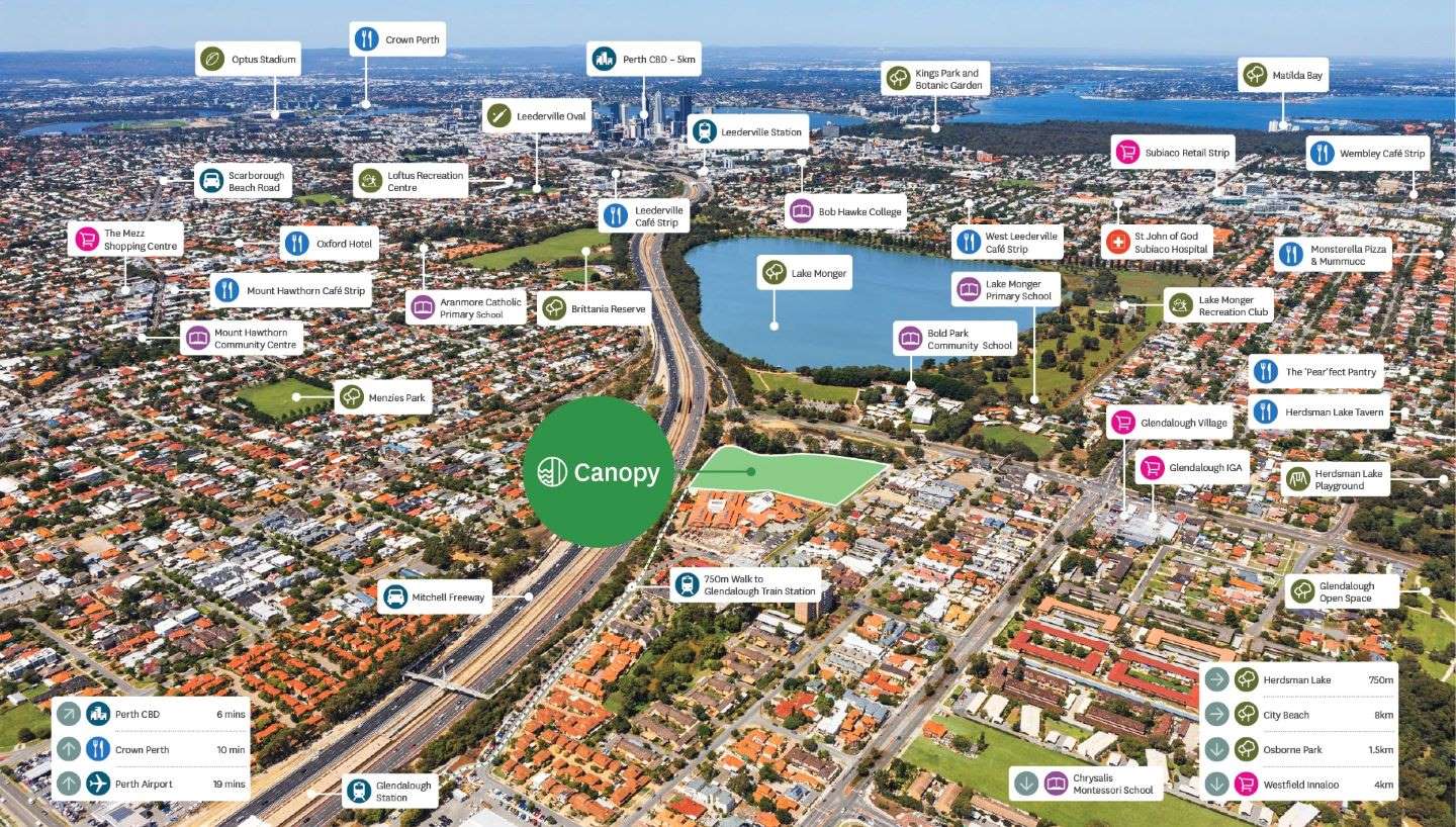
- Discover Canopy, a hidden gem just 5km from Perth's CBD, in the leafy suburb of Glendalough. A collection of green-title designer townhouses, with cafes, shops, schools and transport all nearby.
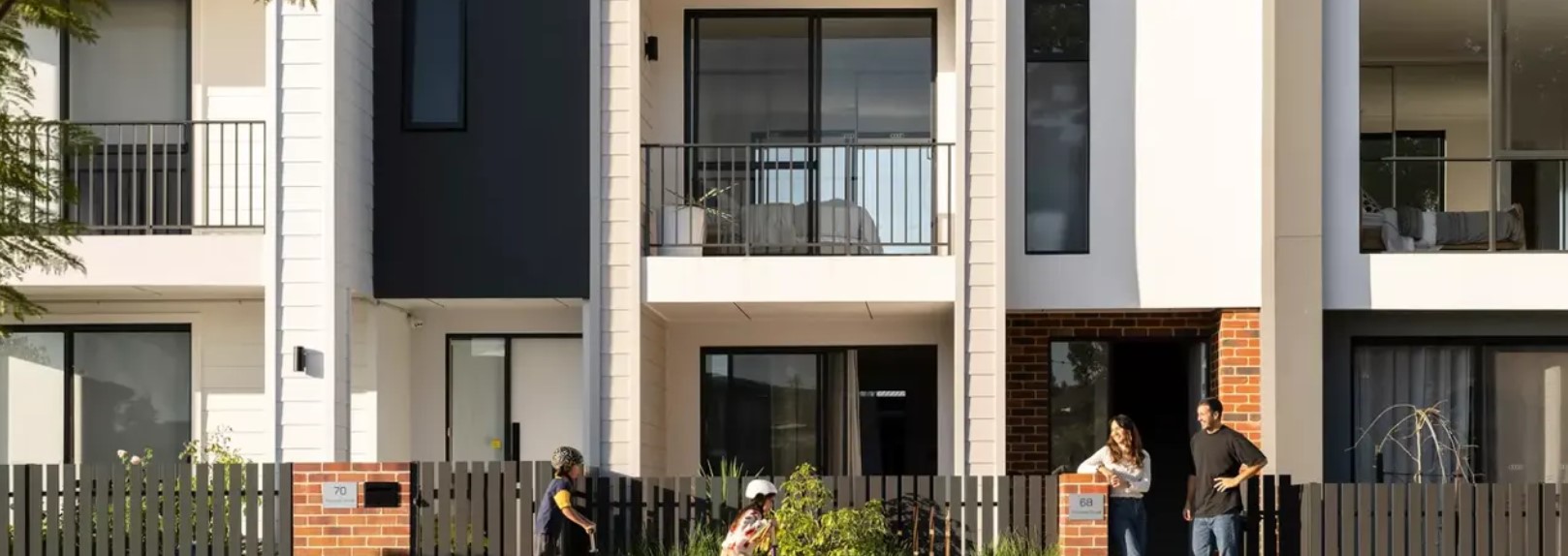
- A selection of designer 2, 3 and 4-bedroom townhomes are on offer, a stone’s throw from the café strips of Leederville, Mount Hawthorn and Wembley.
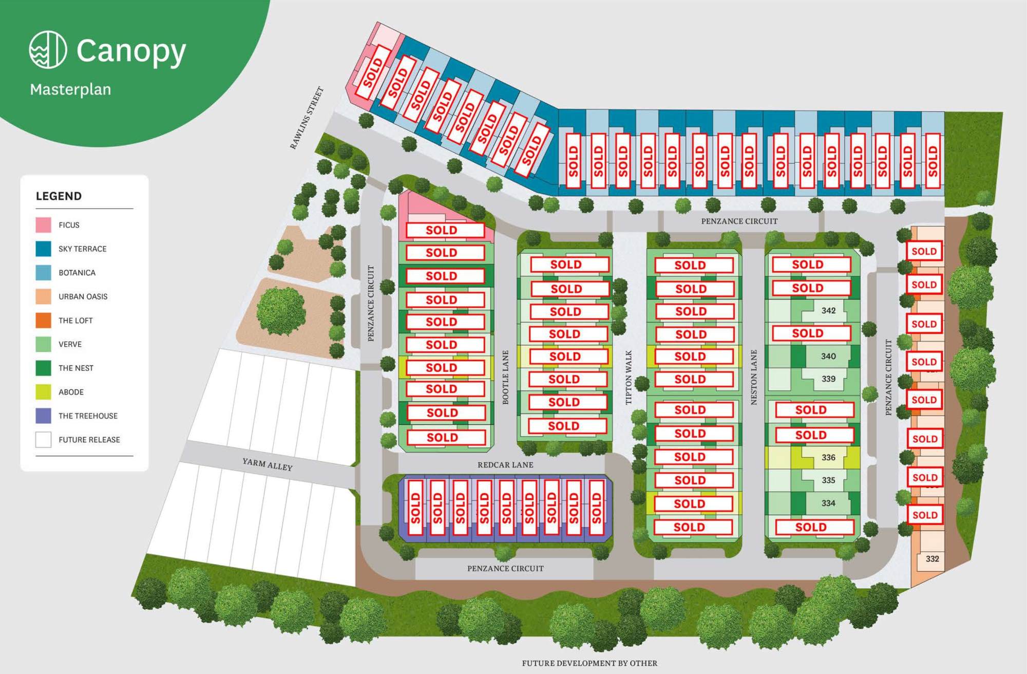
- Discover the wide range of floorplans available at Canopy. Explore the selection to find your perfect fit.
- Smart, stylish homes designed to accommodate a variety of lifestyles and preferences. Reach out to our sales professionals to arrange a time to view our stunning townhomes in person.
- This leafy pocket of Glendalough is just the spot - walking distance from the cafe strips of Leederville, Mount Hawthorn and Wembley. Be part of a community with a bright future and a story that's just beginning.
- Move into a brand-new, turnkey townhome and discover an easier way to live.
The information provided in relation to this development has been obtained from publicly available sources and has not been verified or in any way endorsed by the developer. OpenLot.com.au has not been authorised by the developer to market this land estate on behalf of the developer or the vendors or any other third party.
If you're the developer or authorised agent, contact us now to activate your project.
This information is estimated by the OpenLot research team. Let us know here to provide up-to-date information about this development.
| Total new homes | 96 |
| Area size | 2.80 hectares |
| Growth Region | Perth North West Growth Areas |
| City council | City of Stirling |
| Developer | Stockland |
Townhomes:
Popular Estates near Stockland Canopy - Glendalough


Updates for Stockland Canopy - Glendalough
Location & Map for Stockland Canopy - Glendalough
Visit Display Homes near Stockland Canopy - Glendalough

Vacancy Rate in Glendalough WA 6016
View full vacancy rate history in Glendalough WA 6016 via SQM Research.
Schools near Stockland Canopy - Glendalough
Here are 6 schools near Stockland Canopy - Glendalough:
PP-12 Independent Combined School - School Head Campus
U Independent Special School
K-6 Government Primary School
PP-6 Independent Primary School
K-6 Government Primary School
K-6 Government Special School
Reviews & Comments on Stockland Canopy - Glendalough
Estate Brochure, Masterplan, Engineering Plan, Plan of Subdivision (POS), Design Guidelines
FAQs about Stockland Canopy - Glendalough
View all estates from Stockland
- Bold Park Community School - 231m south
- TSH (Teach, Speak, Hear) - 313m south
- Lake Monger Primary School - 421m south-west
- Chrysalis Montessori School - 727m north-west
- Mount Hawthorn Primary School - 1.1km east
- Mount Hawthorn Education Support Centre - 1.1km east
Popular Estates near Stockland Canopy - Glendalough
Latest New Home Articles for You

09/Mar/2026 | OpenLot.com.au
Victoria: Top 30 Most Searched Housing Developments (February 2026)
If you’ve been exploring housing opportunities in Victoria, February 2026...

20/Feb/2026 | OpenLot.com.au
Display Homes at Drouin Fields Estate: A Thriving Community in Drouin
Welcome to Drouin Fields, a place where beauty, space, and modern luxury ...

19/Feb/2026 | OpenLot.com.au
Display Homes at Manor Lakes Esate: A Thriving Waterside Community in Manor Lakes
A place where you can settle in, rather than just settle down. Named for ...

13/Feb/2026 | OpenLot.com.au
🏠 Victoria: Top 30 Most Searched Townhouse Developments – January 2026

11/Feb/2026 | OpenLot.com.au
🏡 Top 30 Most Searched Estates by State - January 2026

10/Feb/2026 | OpenLot.com.au
Victoria: Top 30 Most Searched Housing Developments (January 2026)
If you’ve been considering making a move in Victoria, January 2026 offere...

10/Feb/2026 | OpenLot.com.au
Queensland: Top 30 Most Searched Housing Developments (January 2026)
If you’ve been considering making a move in Queensland, January 2026 offe...

09/Feb/2026 | OpenLot.com.au
Western Australia: Top 30 Most Searched Housing Developments (January 2026)
If you’ve been considering making a move in Western Australia, January 20...

06/Feb/2026 | OpenLot.com.au
South Australia: Top 30 Most Searched Housing Developments (January 2026)
If you’ve been considering making a move in South Australia, January 2026...