


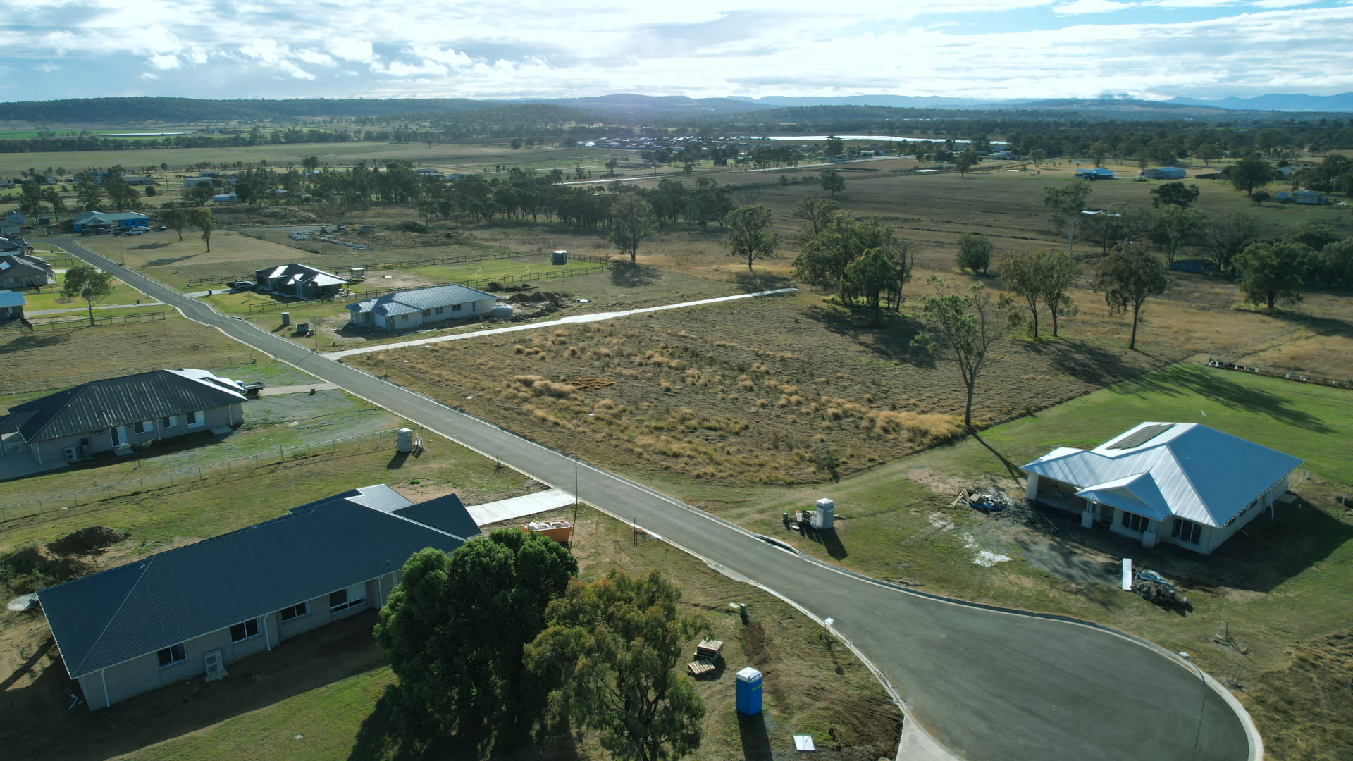
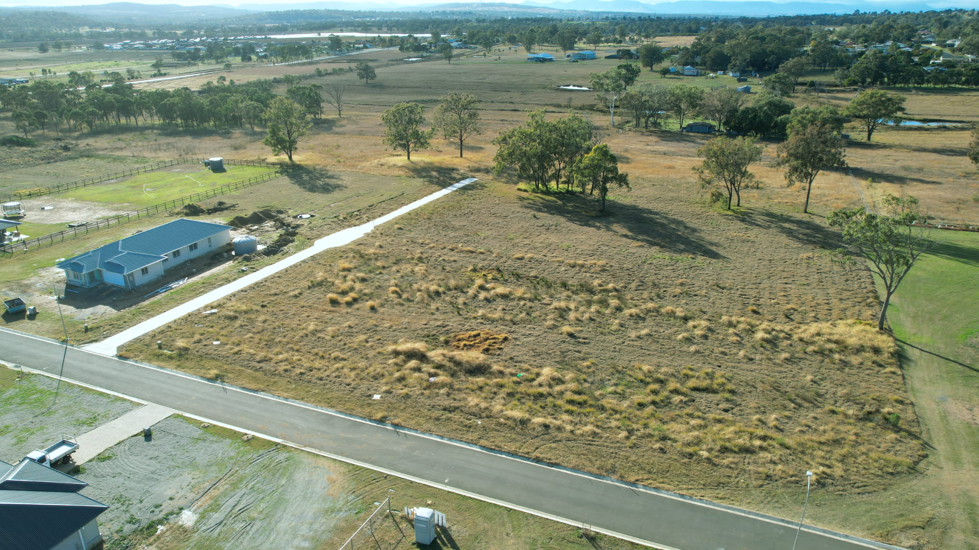

Warner Rise Estate - Rosenthal Heights SOLD OUT
[LIMITED OFFER] REGISTERED PREMIUM LAND - READY TO BUILD
- Town Water
- Underground Electricity
- NBN Ready
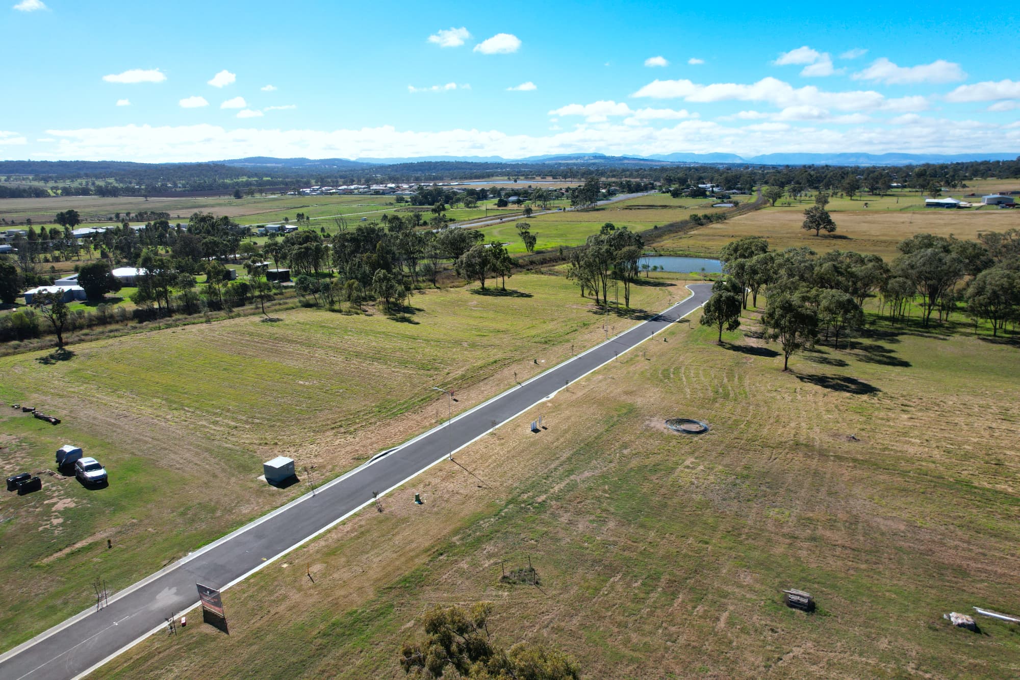
- Elevated Estate
This information is estimated by the OpenLot research team. Let us know here to provide up-to-date information about this development.
| Total new homes | 55 |
| Area size | N/A |
| City council | Southern Downs Regional Council |
| Developer | Rural Land Group |
Land for Sale, House and Land Packages:
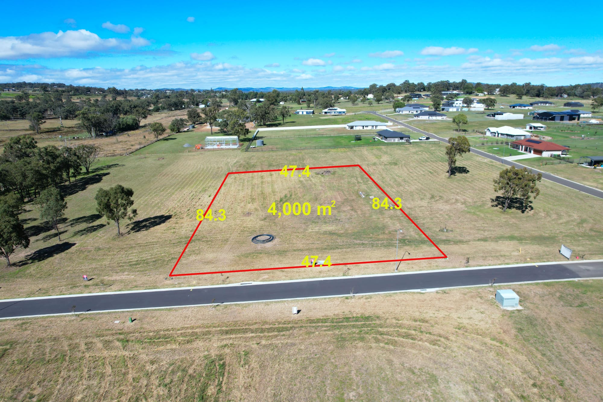
3 Land Lots in Warner Rise Estate - Rosenthal Heights

Popular Estates near Warner Rise Estate - Rosenthal Heights


Updates for Warner Rise Estate - Rosenthal Heights
Facebook updates:
Related news:
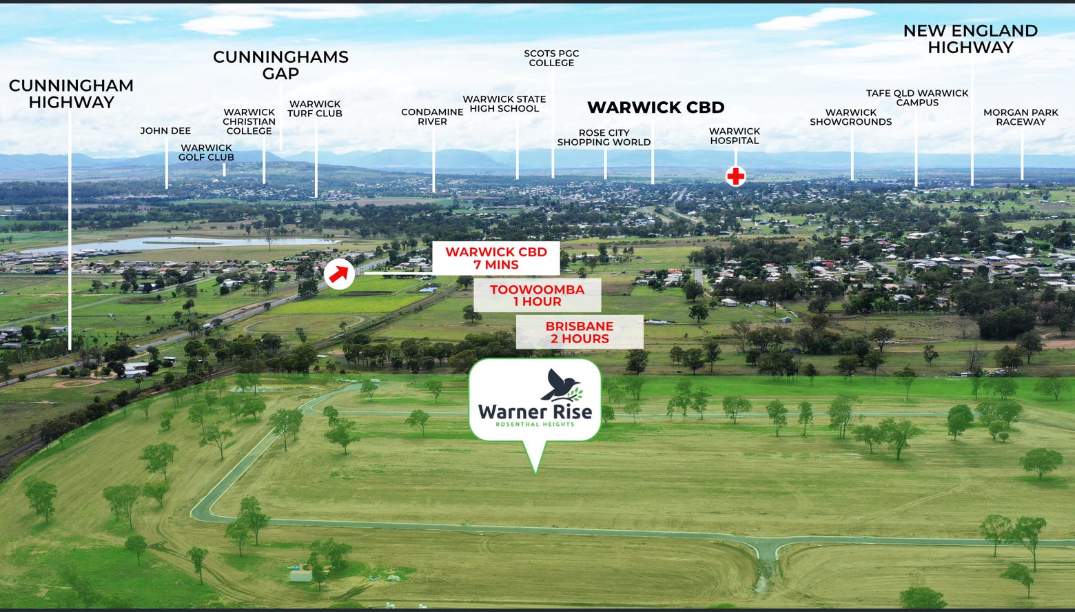
Acreage living at Warner Rise Warwick on 4,000m2 allotments from $149,000. New house & land packages available with no deposit finance available today.

Missing articles? Send us a link here.
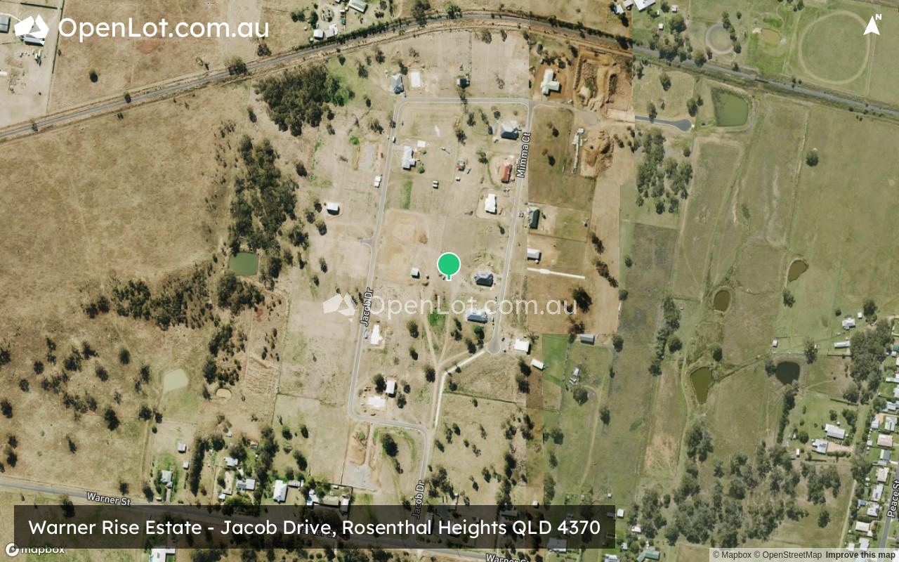
Location & Map for Warner Rise Estate - Rosenthal Heights
Vacancy Rate in Rosenthal Heights QLD 4370
View full vacancy rate history in Rosenthal Heights QLD 4370 via SQM Research.
Schools near Warner Rise Estate - Rosenthal Heights
Here are 6 schools near Warner Rise Estate - Rosenthal Heights:
Prep-6 Government Primary School
7-12 Catholic Secondary School
Prep-6 Government Primary School
Prep-6 Catholic Primary School - School Head Campus
Prep-6 Government Primary School
Reviews & Comments on Warner Rise Estate - Rosenthal Heights
Estate Brochure, Masterplan, Engineering Plan, Plan of Subdivision (POS), Design Guidelines
FAQs about Warner Rise Estate - Rosenthal Heights
View all estates from Rural Land Group
- Warwick West State School - 3.7km east
- Assumption College - 5.1km east
- Warwick Central State School - 5.2km east
- St Mary's School - 5.3km east
- Glennie Heights State School - 5.4km east
Popular Estates near Warner Rise Estate - Rosenthal Heights
Latest New Home Articles for You

09/Mar/2026 | OpenLot.com.au
Victoria: Top 30 Most Searched Housing Developments (February 2026)
If you’ve been exploring housing opportunities in Victoria, February 2026...

20/Feb/2026 | OpenLot.com.au
Display Homes at Drouin Fields Estate: A Thriving Community in Drouin
Welcome to Drouin Fields, a place where beauty, space, and modern luxury ...

19/Feb/2026 | OpenLot.com.au
Display Homes at Manor Lakes Esate: A Thriving Waterside Community in Manor Lakes
A place where you can settle in, rather than just settle down. Named for ...

13/Feb/2026 | OpenLot.com.au
🏠 Victoria: Top 30 Most Searched Townhouse Developments – January 2026

11/Feb/2026 | OpenLot.com.au
🏡 Top 30 Most Searched Estates by State - January 2026

10/Feb/2026 | OpenLot.com.au
Victoria: Top 30 Most Searched Housing Developments (January 2026)
If you’ve been considering making a move in Victoria, January 2026 offere...

10/Feb/2026 | OpenLot.com.au
Queensland: Top 30 Most Searched Housing Developments (January 2026)
If you’ve been considering making a move in Queensland, January 2026 offe...

09/Feb/2026 | OpenLot.com.au
Western Australia: Top 30 Most Searched Housing Developments (January 2026)
If you’ve been considering making a move in Western Australia, January 20...

06/Feb/2026 | OpenLot.com.au
South Australia: Top 30 Most Searched Housing Developments (January 2026)
If you’ve been considering making a move in South Australia, January 2026...