
The Watermark Estate - Karuah 4 AVAILABLE
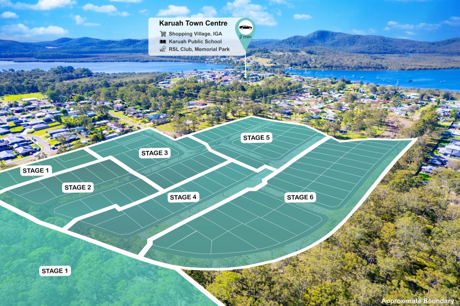
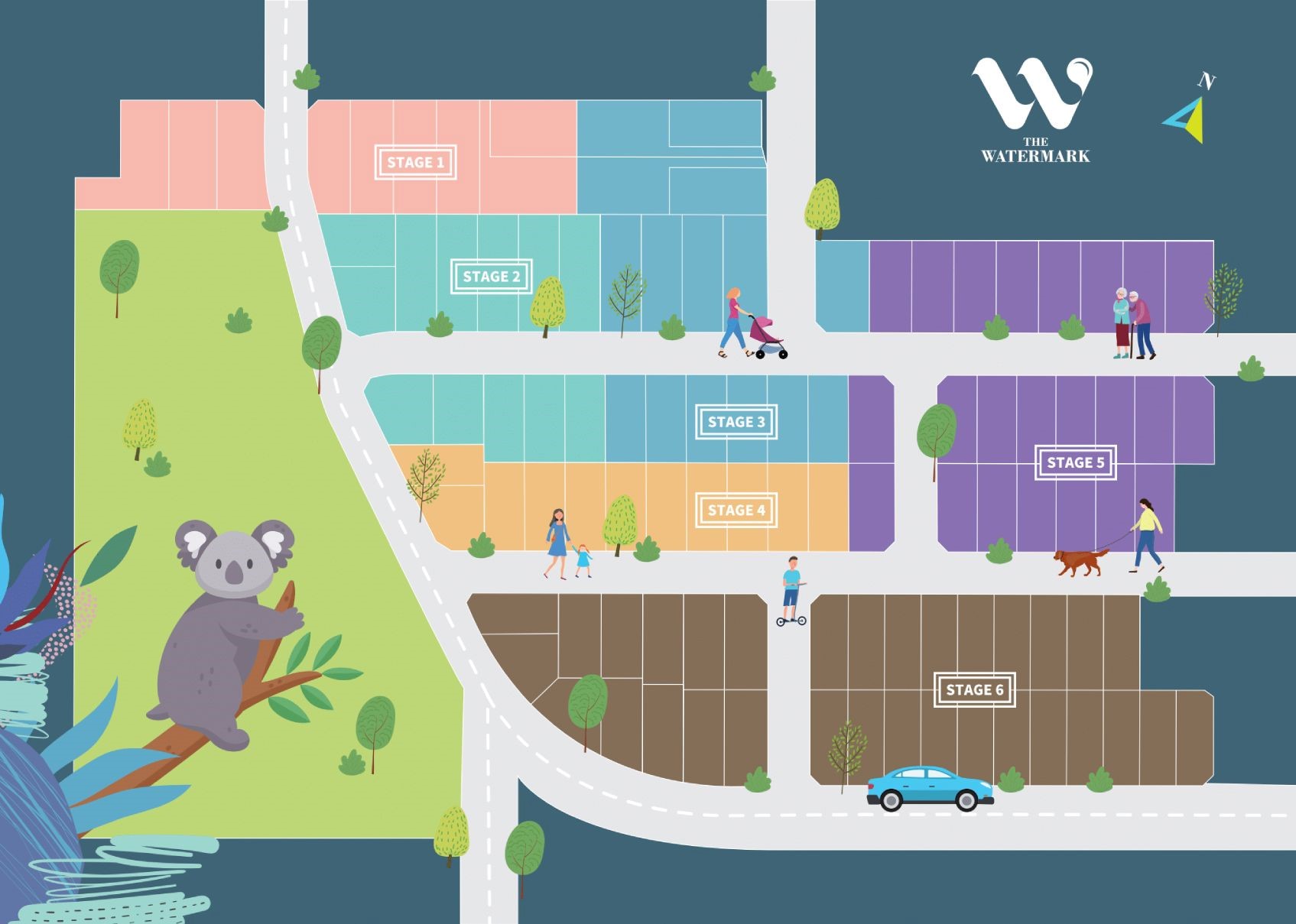
[LIMITED OFFER] Stage4 Release - Welcome the latest house & land release in Karuah
- Great opportunity for people looking for their first home or investment in the Hunter Region. This is the fastest growing corridor in Australia.
The Hunter Region population is expected to increase to around 950,000 people by 2041. The second busiest airport in NSW, Newcastle Airport generates around 1.2 billion in economic activity a year and support around 5600 jobs. It currently serves 12 domestics routes with six domestic airlines, catering for around 1.3 million passengers a year.
Be a part of beautiful New community with waterfront lifestyle, this an amazing opportunity for savvy investors and families looking to build their dream home!
Location Highlights:
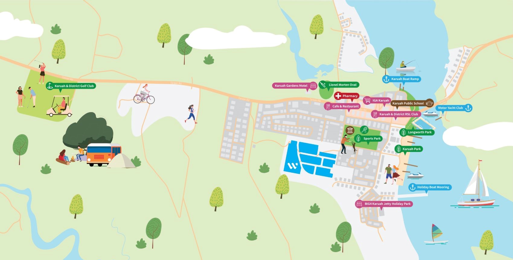
- 15mins walking distance to Karuah Water View
- 15mins drive to Medowie Shops
- 20mins drive to Raymond Terrance Market Place
- 25mins drive to Newcastle International Airport
- 25mins drive to Wanderrabah Beach
- 45mins drive to Famous Tourist Attractions
- 45mins drive to The City of Newcastle
Package Inclusions:
- Fujitsu reverse cycle ducted inverter air conditioner
- Fixed site costs including H1Class slab*
- Tiles to living areas and carpet to all bedrooms
- Designer kitchen with Euromaid Appliances
- 20mm Quantum Quartz Stone Kitchen benchtops
- Alarm System
- Floating vanities to bathrooms
- Remote Control Garage Door
- Choose from 5 external & 5 internal colour schemes
The Six Cities Region will be connected through Country, transport and economic links, a hierarchy of centres and environmental assets.
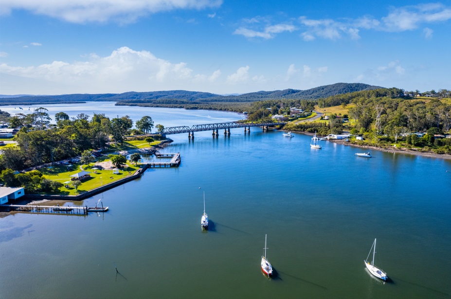
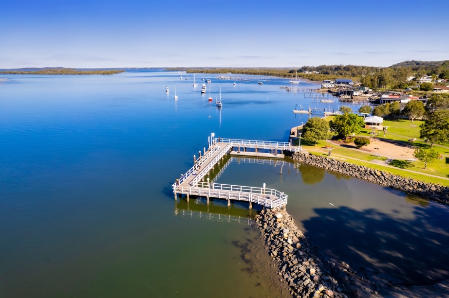
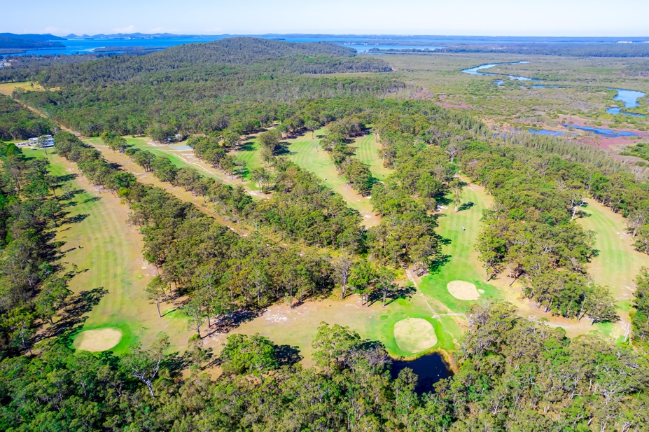
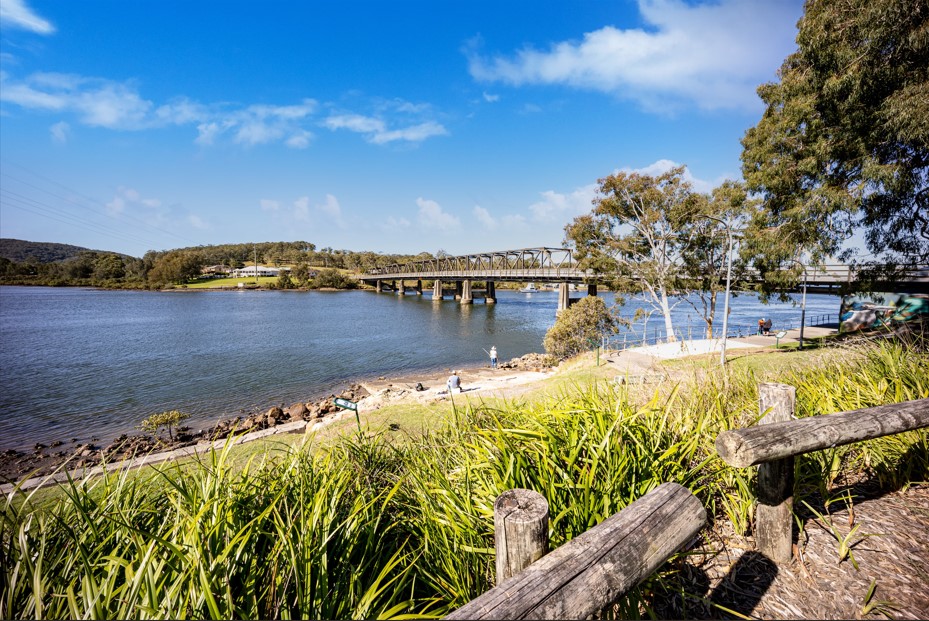
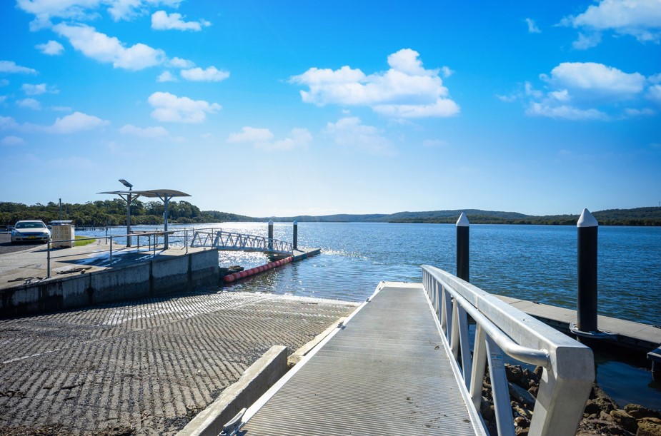
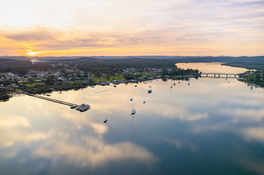
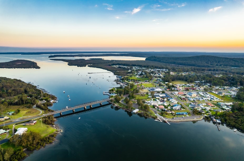
It became a quiet and relaxing holiday destination and the gateway to the northern arm of Port Stephens. Today it is primarily a holiday resort beside the Karuah River offering a boat ramp and picnic spot. It is ideal for swimming in a tidal pool, fishing and boating.
It is known for its scenic beauty, natural attractions, and outdoor recreational opportunities, including fishing, boating, and hiking.
Place Plans - a new way of planning for the growth of the unique towns and villages across Port Stephens.
The Karuah place plan has been designed to support the Karuah Growth Strategy by identifying additional opportunities for residential development, employment lands and public infrastructure. Where there are any inconsistencies between the place plan and the strategy, the Karuah place plan will prevail.
With a growing demand for regional and rural lifestyle opportunities, an increasing ability to work from home, along with favourable conditions for home buyers, housing demand across the Hunter Region continues to growth at a very high rate.
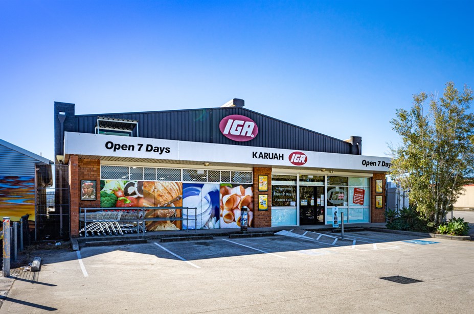
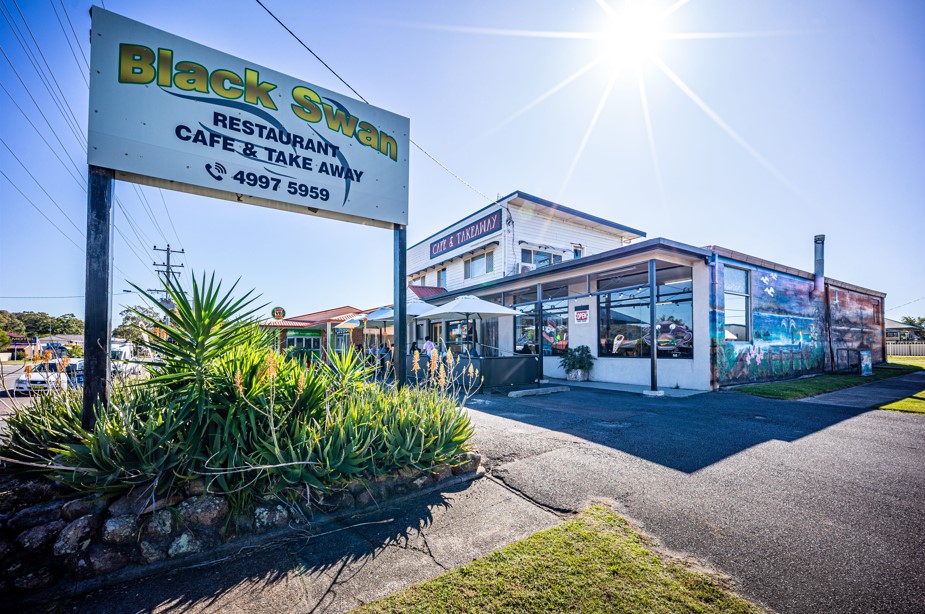
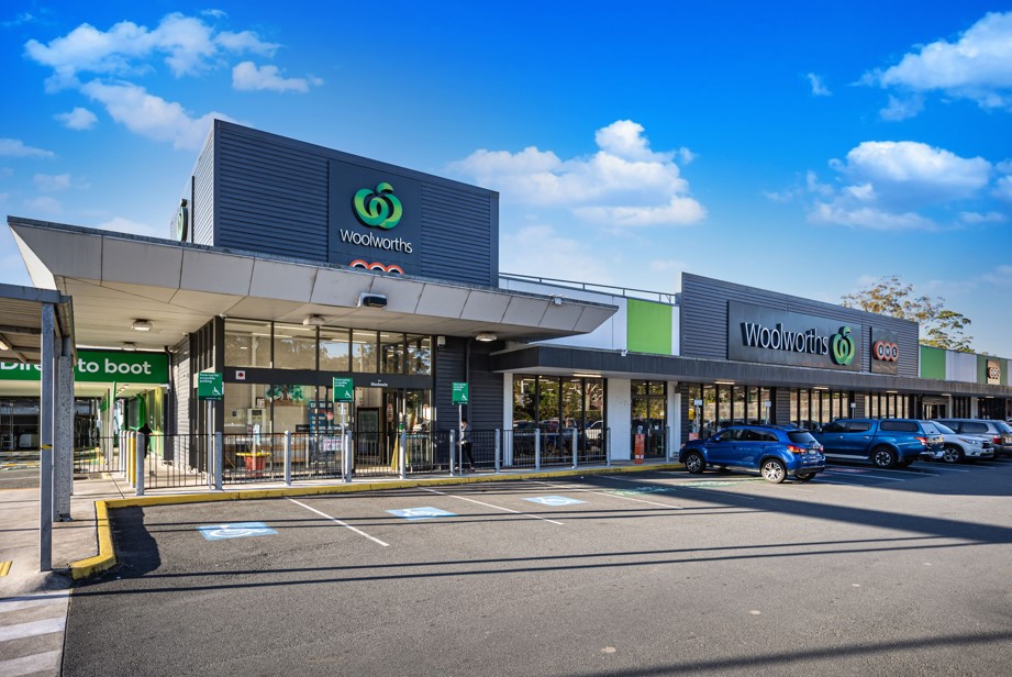
The Karuah township boasts a Public School, IGA, doctors surgery, pharmacy, bakery, RSL, park, boat ramp and a swimming area in the river at Longworth Park. Enjoy the incredible fishing, boating, and quiet lifestyle that Karuah has to offer.
This information is estimated by the OpenLot research team. Let us know here to provide up-to-date information about this development.
| Total new homes | 102 |
| Area size | N/A |
| Growth Region | Greater Newcastle Growth Areas (The Hunter Region) |
| City council | Port Stephens Council |
| Developer | N/A |
| Project marketer | GV Realty |
| Distance to | Newcastle CBD - 34 km north-east |
House and Land Packages:
4 House and Land Packages in The Watermark Estate - Karuah

 4
4
 2
2
 2
2
Popular Estates near The Watermark Estate - Karuah


Updates for The Watermark Estate - Karuah
Facebook updates:
Related news:
Missing articles? Send us a link here.
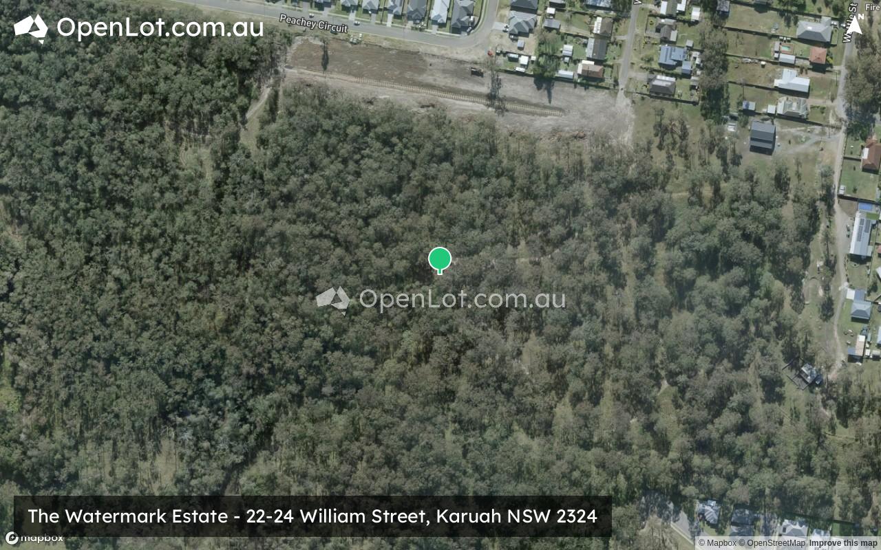
Location & Map for The Watermark Estate - Karuah
Schools near The Watermark Estate - Karuah
Here are 6 schools near The Watermark Estate - Karuah:
K-6 Government Primary School
K-6 Government Primary School
K-6 Government Primary School
K-6 Government Primary School
K-6 Government Primary School
K-6 Government Primary School
Reviews & Comments on The Watermark Estate - Karuah
Estate Brochure, Masterplan, Engineering Plan, Plan of Subdivision (POS), Design Guidelines
FAQs about The Watermark Estate - Karuah
View all estates marketed by GV Realty
- Karuah Public School - 947m north-east
- Tanilba Bay Public School - 9.2km south-east
- Soldiers Point Public School - 11.6km south-east
- Wirreanda Public School - 12.2km south-west
- Bobs Farm Public School - 13.1km south
- Medowie Public School - 13.2km south-west
Popular Estates near The Watermark Estate - Karuah
Latest New Home Articles for You

09/Mar/2026 | OpenLot.com.au
Victoria: Top 30 Most Searched Housing Developments (February 2026)
If you’ve been exploring housing opportunities in Victoria, February 2026...

20/Feb/2026 | OpenLot.com.au
Display Homes at Drouin Fields Estate: A Thriving Community in Drouin
Welcome to Drouin Fields, a place where beauty, space, and modern luxury ...

19/Feb/2026 | OpenLot.com.au
Display Homes at Manor Lakes Esate: A Thriving Waterside Community in Manor Lakes
A place where you can settle in, rather than just settle down. Named for ...

13/Feb/2026 | OpenLot.com.au
🏠 Victoria: Top 30 Most Searched Townhouse Developments – January 2026

11/Feb/2026 | OpenLot.com.au
🏡 Top 30 Most Searched Estates by State - January 2026

10/Feb/2026 | OpenLot.com.au
Victoria: Top 30 Most Searched Housing Developments (January 2026)
If you’ve been considering making a move in Victoria, January 2026 offere...

10/Feb/2026 | OpenLot.com.au
Queensland: Top 30 Most Searched Housing Developments (January 2026)
If you’ve been considering making a move in Queensland, January 2026 offe...

09/Feb/2026 | OpenLot.com.au
Western Australia: Top 30 Most Searched Housing Developments (January 2026)
If you’ve been considering making a move in Western Australia, January 20...

06/Feb/2026 | OpenLot.com.au
South Australia: Top 30 Most Searched Housing Developments (January 2026)
If you’ve been considering making a move in South Australia, January 2026...