


 5
5
 2.5
2.5
 2
2


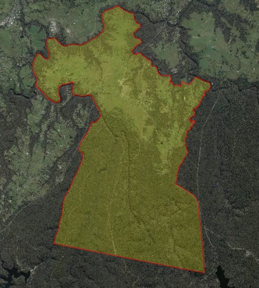
Wilton covers an area of approximately 109 square kilometres within the Wollondilly Shire Council. It is situated as part of the Macarthur Blue Mountains Central Tablelands in the Greater Western Sydney region of New South Wales, located 80 kilometres southwest of Sydney. The suburb is surrounded by national parks (40% of the total area) and waterway corridors surrounding the rural holding to the north.
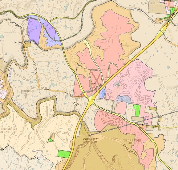
The Wilton township lies at the heart of the rural land holdings and consists of residential development, a school, and no central town centre. Pockets of new dense residential development are emerging towards the Hume Highway, close to the Bingara Gorge Golf Course.
The suburb's boundary extends along Nepean River and Allens Creek to the north, and Nepean River to the west. Picton Road, access tracks, and Cascade Creek define the eastern boundary of the suburb. Property boundaries within the State Conservation Reserve establish the southern property boundary from Nepean River to Lake Cordeaux.
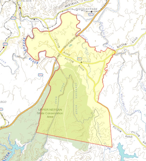
The Hume Highway provides a north-south connection through the northern part of the suburb, intersecting with Picton Road, which offers a northwest-southeast connection. The southern section of the site is accessible only via access tracks, and Picton Road serves as the sole connection through the conservation areas, linking to the neighbouring suburb.
Wilton Road grants access to the northeastern part of the suburb, connecting to Campbelltown. The northern portion of the suburb comprises agricultural and grazing land, including several smaller creek corridors connected to the main waterway corridors. A series of interconnected dams is also situated to the north of the suburb, providing water for agricultural purposes.

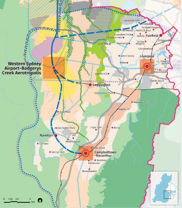
Campbelltown–Macarthur
Wilton constitutes the outer rural area of Campbelltown–Macarthur, a Metropolitan Cluster within the Western Parkland City, which will be part of the regional plan for Greater Sydney. The vision for the next 20 years is to provide jobs, education, health facilities, and services for more residents living within the new Western Parkland City, capitalizing on the new Western Sydney Airport, Badgerys Creek Aerotropolis, and North-South Rail Link.
This growth area will facilitate the creation of a Western Economic Corridor. The planning priorities and actions for enhancing residents' quality of life in this growth area are outlined in the Western City District Plan, "Our Greater Sydney 2056," March 2018.
Western City District Plan
The population growth in the Western City District will be 464,450 by 2036, which is expected to require a housing growth of 184,500 dwellings (25%). The integration of new land use, transport and infrastructure is supported by the Future Transport Strategy 2056 and State Infrastructure Strategy 2018–2038 across the region. The new Western City District Structure Plan illustrates the location for the future urban growth.
Wollondilly 2040
Wollondilly 2040 is Council’s Local Strategic Planning Statement (LSPS). It was made and came into effect on 27 March 2020. Its purpose is to:
- Setting a 20-year land use vision for Wollondilly
- Identifying the distinctive characteristics of Wollondilly
- Acknowledging shared values to be enhanced and preserved
- Managing change and directing growth
- Outlining key actions to support the Western City District Plan
- Supporting the implementation of the Community Strategic Plan, "Create Wollondilly 2033"
- Establishing planning priorities and actions for realizing the land use vision
- Identifying further planning work
South West Growth Area
Wilton is part of the South West Growth Area, and a Development Control Plan (DCP) was developed to incorporate density controls in precinct plans, aligning infrastructure planning with growth. This Plan, known as the Wilton Growth Area Development Control Plan (DCP), was adopted and came into effect on December 4, 2007, with further amendments on August 23, 2021.
The Wollondilly Shire Council, along with the NSW Planning, created The Wilton Growth Area Development Control Plan (the DCP) to establish comprehensive planning controls for urban development in the Wilton Growth Area. The DCP initially applies to the rezoned South East Wilton and North Wilton Precincts, Town Centre, and Bingara Gorge, which will be the initial stages of development for the expanding Wilton community.
Bingara Gorge is currently undergoing development, with the South East Wilton and Wilton North precincts having been rezoned and currently undergoing additional planning stages. The proposed rezoning for the Wilton Town Centre Precinct was publicly displayed in December 2020 and officially enacted on June 30, 2023.
Precincts of Wilton
- South East Wilton Precinct
- North Wilton Precinct
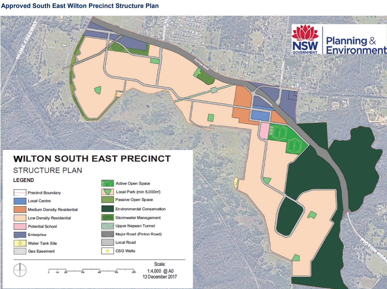
Wilton South East Precinct
The urban areas found in the northern portion of the suburb are being developed under the general low residential zoning, with Medium Density Residential in proximity to a new local centre, which is supported by the Wilton Growth Area Development Control Plan.
The new South East Wilton Precinct will be developed in six stages and is situated south of the current residential area. A new local centre is envisioned to offer various services, including retail and commercial services, along with a proposed community facility to foster community interaction and support emerging residential developments. The Town Centre will be located near a potential new school and active open space.

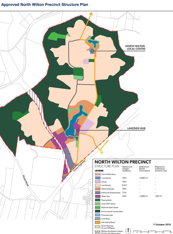
Wilton North Precinct
The proposed precinct is located north of Wilton Airport, the Hume Highway, and Picton Interchange. This rural area is set to be developed under the general low residential zoning, including Medium Density Residential zones near a large new local centre called 'Lakeside Hub,' with a smaller local centre to the north of the precinct. The proposed redevelopment is supported by the Wilton Growth Area Development Control Plan 2021.
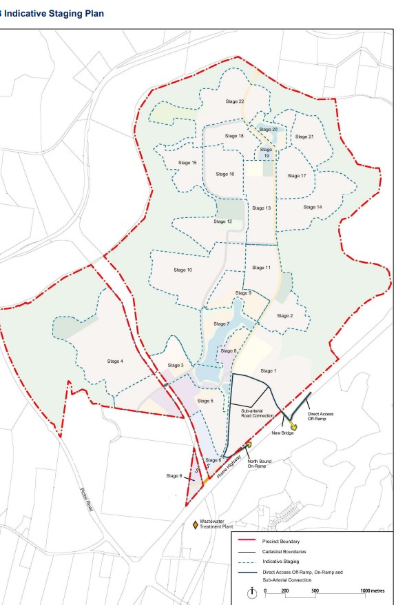
The new North Wilton Precinct creates a corridor for the Maldon–Dombarton Freight Rail Corridor and includes mixed-use zoning in proximity. The precinct will be developed over 22 stages and is situated west of the current residential area.
Wilton Growth – Youtube Video