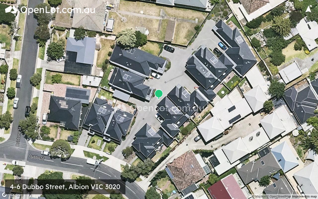
4-6 Dubbo Street, Albion VIC 3020 IN PLANNING
This information is estimated by the OpenLot research team. Let us know here to provide up-to-date information about this development.
| Total new homes | 10 |
| Area size | 0.25 hectares |
| Growth Region | Melbourne West Growth Corridor |
| City council | Brimbank City Council |
| Developer | N/A |
| Distance to | Melbourne Airport - 12 km south Melbourne CBD - 14 km west |
Land for Sale, House and Land Packages:
Popular Estates near 4-6 Dubbo Street, Albion


 4
4
 2
2
 1
1


Updates for 4-6 Dubbo Street, Albion
Facebook updates:
Related news:
4 Dubbo Street, Albion, Vic 3020. View property details and sold price of 4 Dubbo Street & other properties in Albion, Vic 3020.
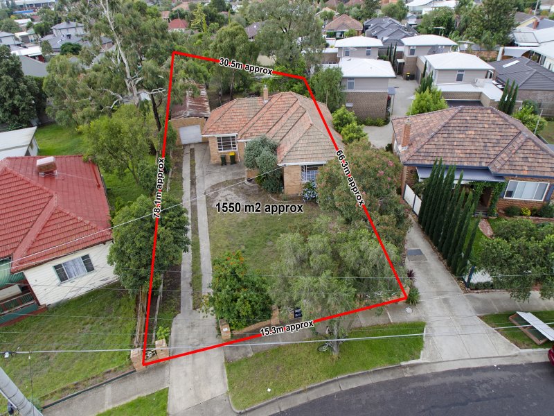
Presenting a rare opportunity to purchase an architecturally designed council approved townhouse site in a sought after location of Albion. Situated i

Missing articles? Send us a link here.
Location & Map for 4-6 Dubbo Street, Albion
Visit Display Homes near 4-6 Dubbo Street, Albion


Schools near 4-6 Dubbo Street, Albion
Here are 6 schools near 4-6 Dubbo Street, Albion:
Prep-6 Government Primary School
Prep-6 Catholic Primary School
Prep-6 Catholic Primary School
7-12 Catholic Secondary School
Prep-6 Catholic Primary School
Prep-6 Government Primary School
Reviews & Comments on 4-6 Dubbo Street, Albion
Estate Brochure, Masterplan, Engineering Plan, Plan of Subdivision (POS), Design Guidelines
FAQs about 4-6 Dubbo Street, Albion
- Albion Primary School - 293m north-east
- St Theresa's School - 467m south-east
- St Paul's School - 1.2km south-west
- Marian College - 1.4km south-west
- Mother of God School - 1.4km west
- Ardeer Primary School - 1.4km west
Popular Estates near 4-6 Dubbo Street, Albion
Latest New Home Articles for You

09/Mar/2026 | OpenLot.com.au
Victoria: Top 30 Most Searched Housing Developments (February 2026)
If you’ve been exploring housing opportunities in Victoria, February 2026...

20/Feb/2026 | OpenLot.com.au
Display Homes at Drouin Fields Estate: A Thriving Community in Drouin
Welcome to Drouin Fields, a place where beauty, space, and modern luxury ...

19/Feb/2026 | OpenLot.com.au
Display Homes at Manor Lakes Esate: A Thriving Waterside Community in Manor Lakes
A place where you can settle in, rather than just settle down. Named for ...

13/Feb/2026 | OpenLot.com.au
🏠 Victoria: Top 30 Most Searched Townhouse Developments – January 2026

11/Feb/2026 | OpenLot.com.au
🏡 Top 30 Most Searched Estates by State - January 2026

10/Feb/2026 | OpenLot.com.au
Victoria: Top 30 Most Searched Housing Developments (January 2026)
If you’ve been considering making a move in Victoria, January 2026 offere...

10/Feb/2026 | OpenLot.com.au
Queensland: Top 30 Most Searched Housing Developments (January 2026)
If you’ve been considering making a move in Queensland, January 2026 offe...

09/Feb/2026 | OpenLot.com.au
Western Australia: Top 30 Most Searched Housing Developments (January 2026)
If you’ve been considering making a move in Western Australia, January 20...

06/Feb/2026 | OpenLot.com.au
South Australia: Top 30 Most Searched Housing Developments (January 2026)
If you’ve been considering making a move in South Australia, January 2026...