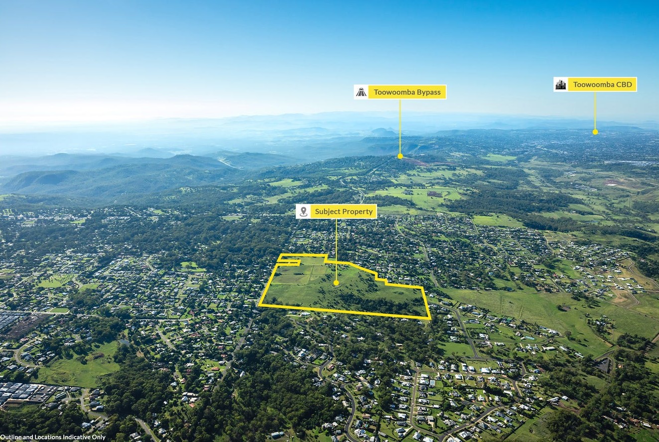

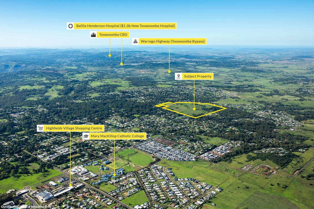
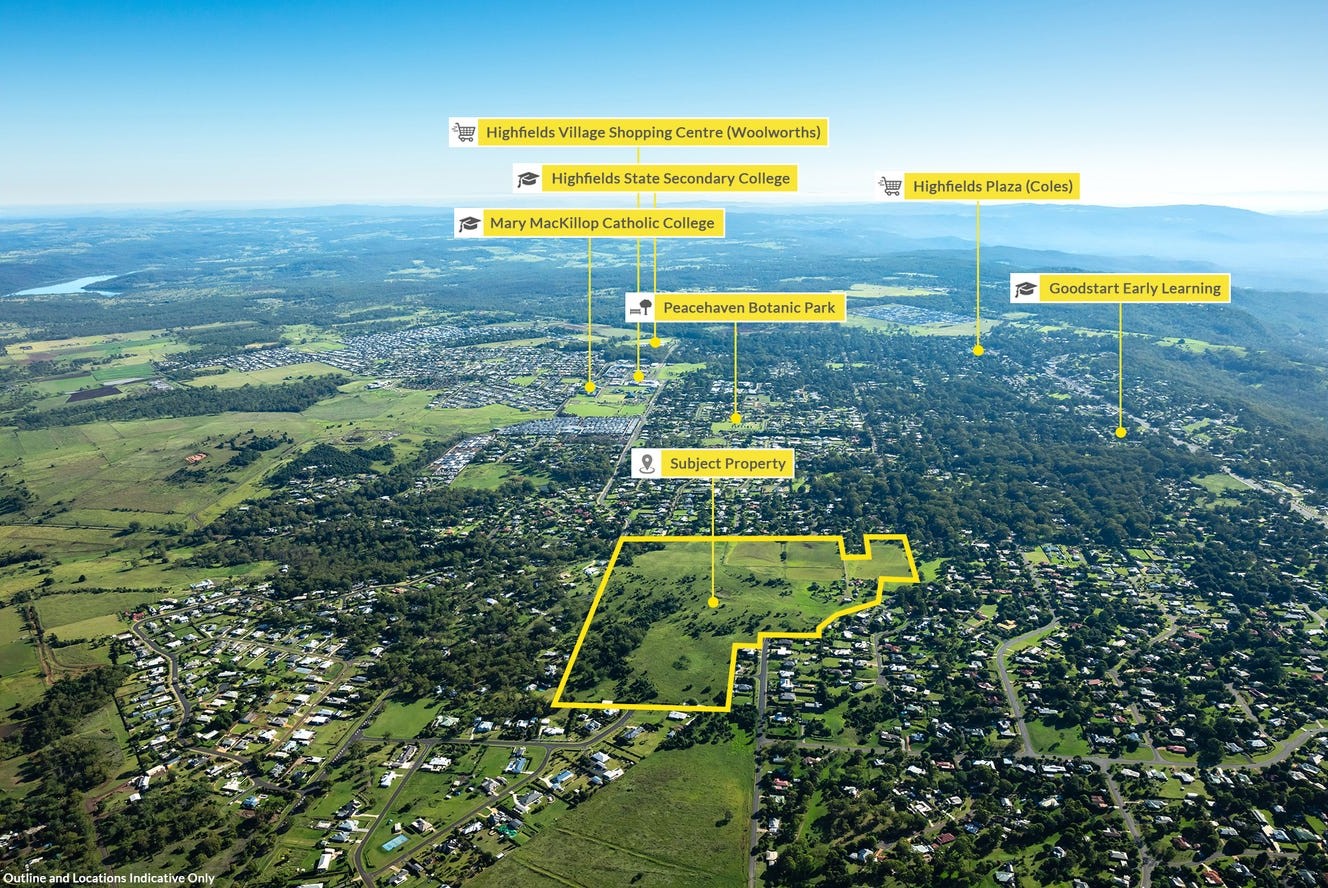


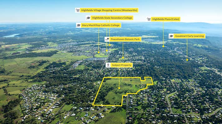
49 Cawdor Road, Highfields QLD 4352 COMING SOON
This information is estimated by the OpenLot research team. Let us know here to provide up-to-date information about this development.
| Total new homes | 93 |
| Area size | 32.76 hectares |
| Growth Region | Toowoomba Growth Areas |
| City council | Toowoomba Regional Council |
| Developer | N/A |
| Distance to | Toowoomba CBD - 14 km north-east |
Land for Sale, House and Land Packages:
Popular Estates near 49 Cawdor Road, Highfields

Wirraglen Estate - Highfields

The Summit at Cranley Estate - Cranley

14 Weale Street, Mount Kynoch QLD 4350

Kilalah Park Estate - Highfields

The Avenues of Highfields - Highfields

10492 New England Highway, Highfields QLD 4352

Steinberg Rise Estate - Highfields

Highcrest Estate, Toowoomba - Highfields

Reis Road, Highfields QLD 4352
Updates for 49 Cawdor Road, Highfields
Facebook updates:
Related news:
'Toowoomba Approved 93 Lot Park Residential Subdivision' - Listed by RW Special Projects Queensland

Development sites & land for sale at 49 Cawdor Road, Highfields, QLD 4352. View more property photos and information about this commercial property for sale on realcommercial.com.au.
Development.i provides you with access to past and current development application details and basic property information for the Toowoomba Regional Council area.
Missing articles? Send us a link here.
Location & Map for 49 Cawdor Road, Highfields
Vacancy Rate in Highfields QLD 4352
View full vacancy rate history in Highfields QLD 4352 via SQM Research.
Schools near 49 Cawdor Road, Highfields
Here are 6 schools near 49 Cawdor Road, Highfields:
Prep-12 Catholic Combined School
Prep-6 Government Primary School
7-12 Government Secondary School
Prep-12 Independent Combined School
Prep-6 Government Primary School
Prep-6 Government Primary School
Land Release Applications for 49 Cawdor Road, Highfields
| Land release | Land report | Number of lots | Plan number | Land surveyor | Lodged date | Intended use | Settlement tracking | |||||||||||||||||||||||||||||||||||||||||||||||||||||||||||||||||||||||||||||||||||||||||||
|---|---|---|---|---|---|---|---|---|---|---|---|---|---|---|---|---|---|---|---|---|---|---|---|---|---|---|---|---|---|---|---|---|---|---|---|---|---|---|---|---|---|---|---|---|---|---|---|---|---|---|---|---|---|---|---|---|---|---|---|---|---|---|---|---|---|---|---|---|---|---|---|---|---|---|---|---|---|---|---|---|---|---|---|---|---|---|---|---|---|---|---|---|---|---|---|---|---|---|
| No updates found |
Reviews & Comments on 49 Cawdor Road, Highfields
Estate Brochure, Masterplan, Engineering Plan, Plan of Subdivision (POS), Design Guidelines
FAQs about 49 Cawdor Road, Highfields
- Mary MacKillop Catholic College - 2.0km north-east
- Highfields State School - 2.5km east
- Highfields State Secondary College - 3.0km north-east
- Toowoomba Christian College - 3.0km south-east
- Meringandan State School - 4.7km north-west
- Gowrie State School - 4.8km south-west
Popular Estates near 49 Cawdor Road, Highfields
Wirraglen Estate - Highfields
The Summit at Cranley Estate - Cranley
14 Weale Street, Mount Kynoch QLD 4350
Kilalah Park Estate - Highfields
The Avenues of Highfields - Highfields
10492 New England Highway, Highfields QLD 4352
Steinberg Rise Estate - Highfields
Highcrest Estate, Toowoomba - Highfields
Reis Road, Highfields QLD 4352
Latest New Home Articles for You

26/Apr/2024
Navigating the Path to Homeownership: Insights from Home Loan Expert
The lates episode of Home Builder Hub sets the stage for an insightful co...

24/Apr/2024
Delving into Design and Structural Changes: Balancing Risk and Reward
In a recent episode of their podcast, hosts Colin Bischof and Darren Bren...

23/Apr/2024
The Property Now Podcast: Using Your Super to Buy Property Like Never Before
In an innovative episode of the esteemed series, hosts Matt Ellul and Bob...

22/Apr/2024
Should Home Buyers Act Before Seven-Star Pricing Kicks In?
In the latest episode of *The Home Building Hub*, hosts Colin Bischof and...

22/Apr/2024
How to Determine Which House Design Will Fit on Your Lot
In the latest episode of the Home Building Hub podcast, hosts Colin Bisch...

15/Apr/2024
Navigating the Intricacies of Nomination Blocks
In a recent episode of the Home Building Hub podcast, hosted by industry ...

10/Apr/2024
How Do Mortgages Work?
What is a mortgage broker? How does a mortgage broker get paid? Licensing...

10/Apr/2024
Victoria: Top 30 Most Searched Housing Developments (March 2024)
We're delighted to present the lineup of the top 30 most searched housing...

10/Apr/2024
Queensland: Top 30 Most Searched Housing Developments (March 2024)
In the radiant expanse of Australia's eastern coast lies Queensland, reno...