

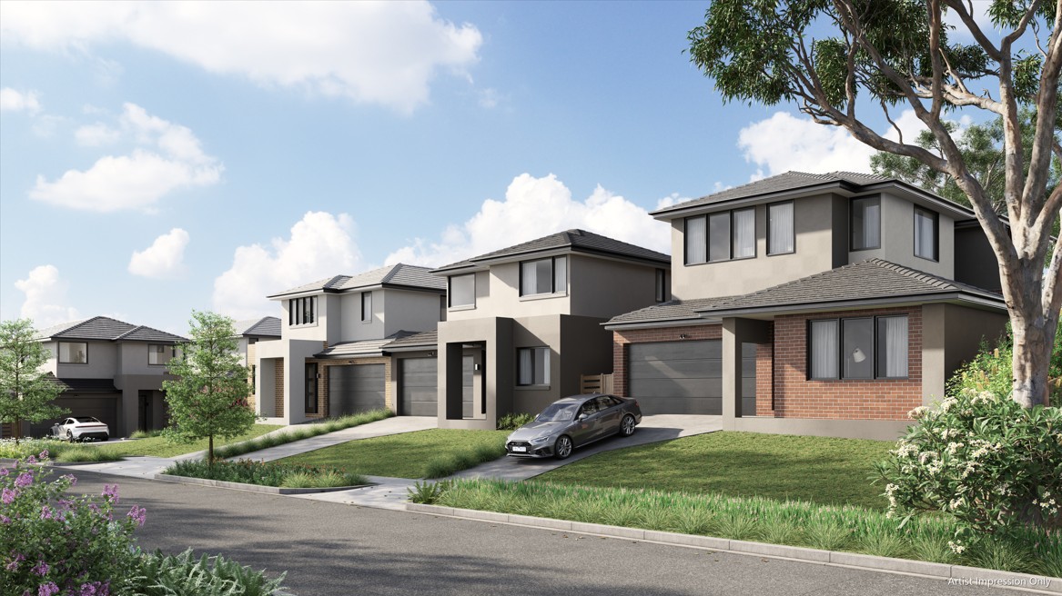
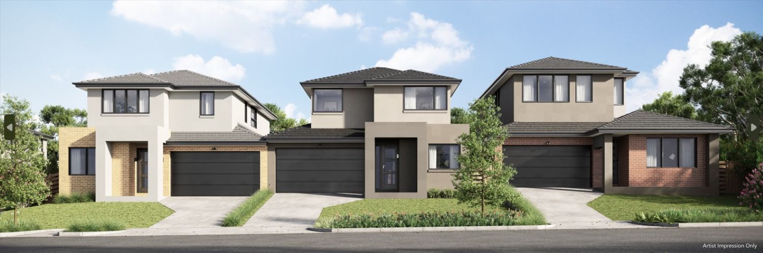
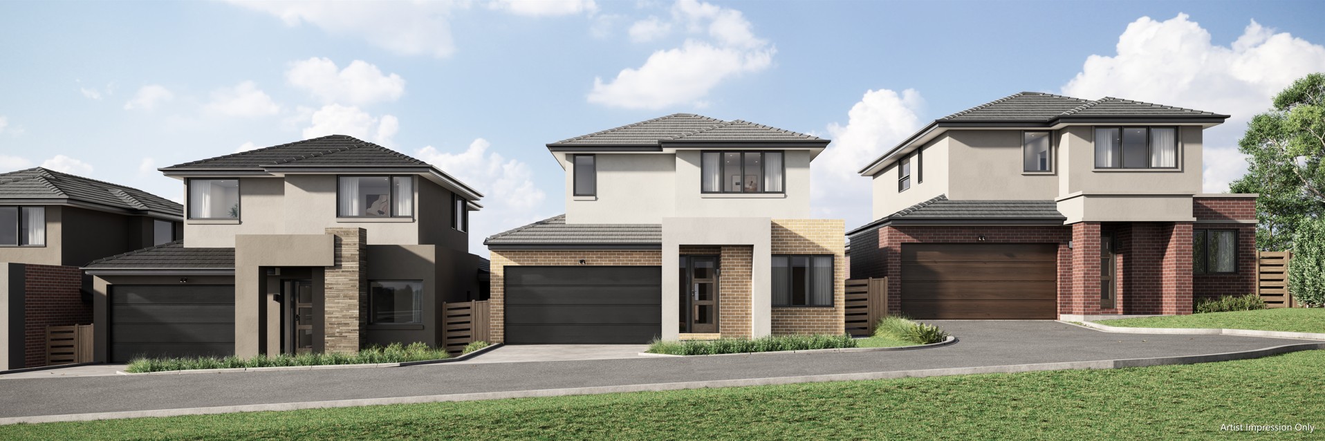
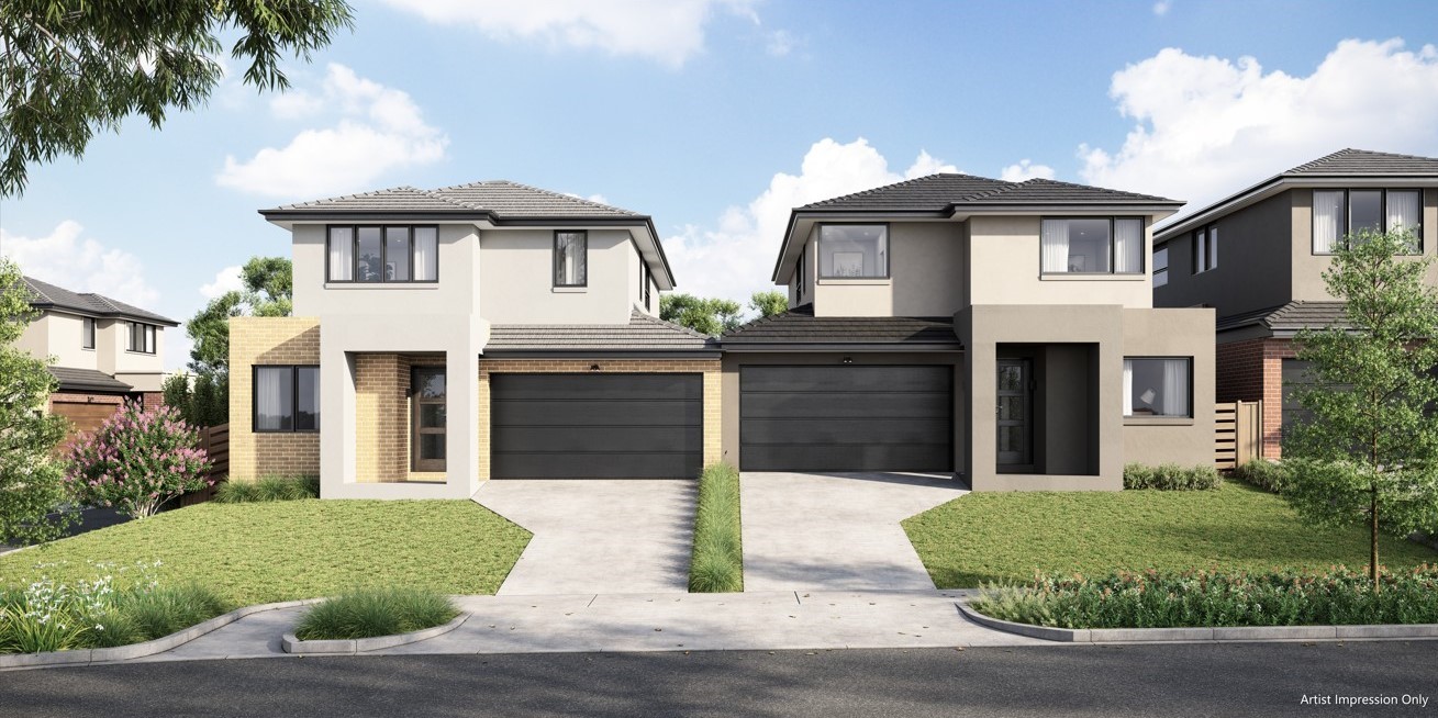
Waverley Woods Estate - Mulgrave 5 AVAILABLE
[NEW RELEASE] Stage 1 Selling Now
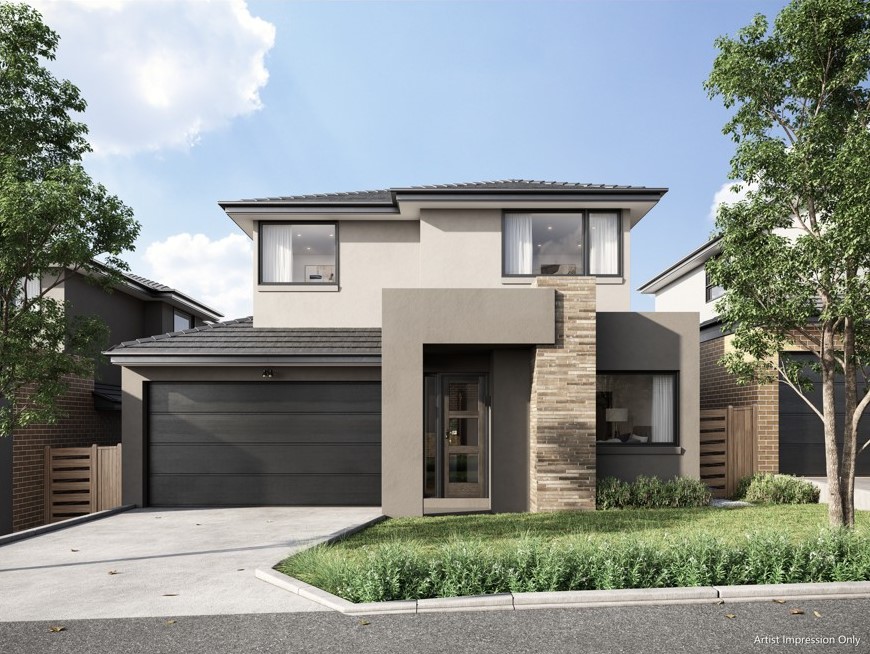
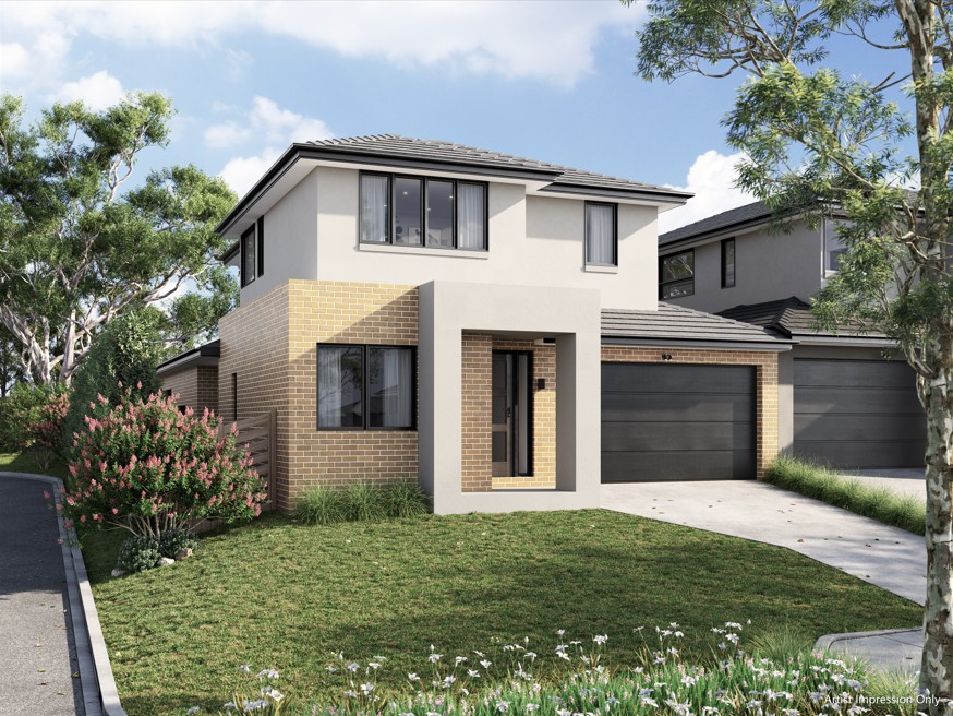
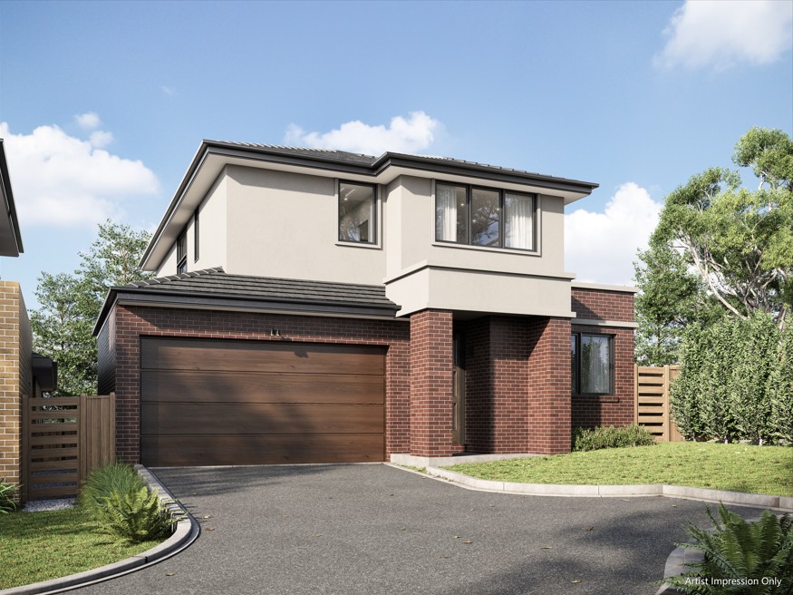
- Positioned in a leafy Mulgrave locale, Waverley Woods offers an exclusive collection of land and house and land packages.
- 27 meticulously designed homes in the sought-after suburb of Mulgrave.
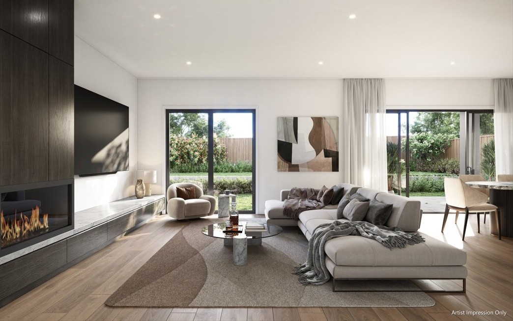
- Spacious interiors, private outdoor sanctuaries, individual entrances, and lush landscaping.
- Floorplans range from three, four, or five bedrooms with a study and double garage as standard.
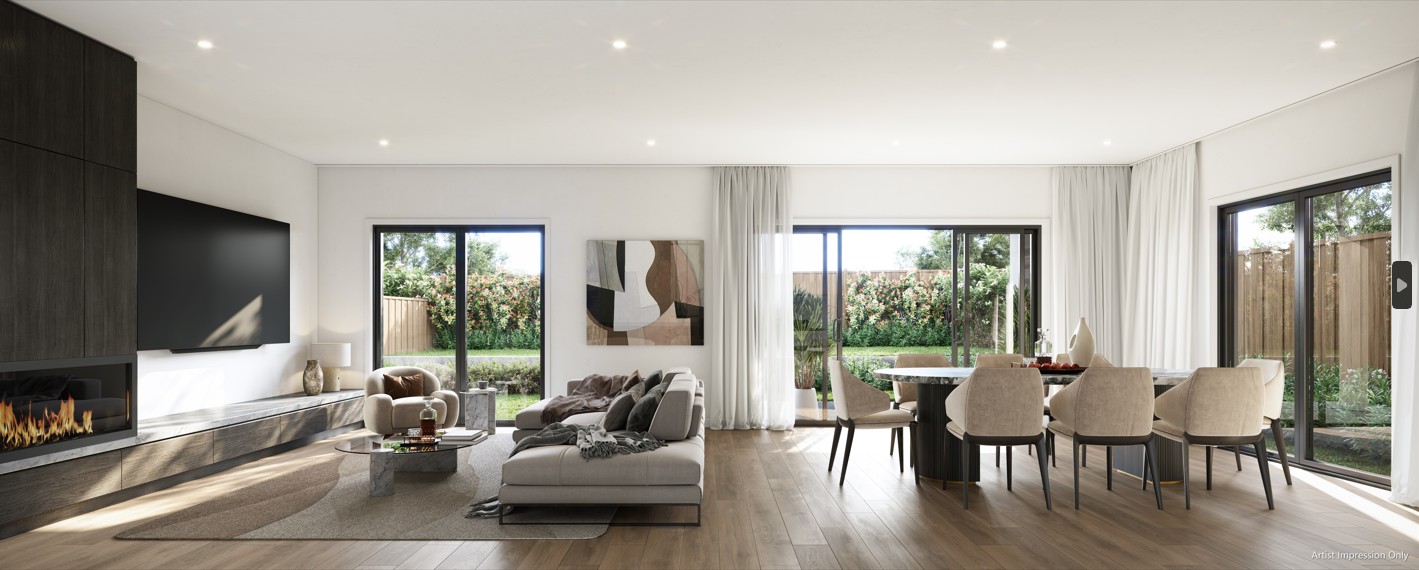
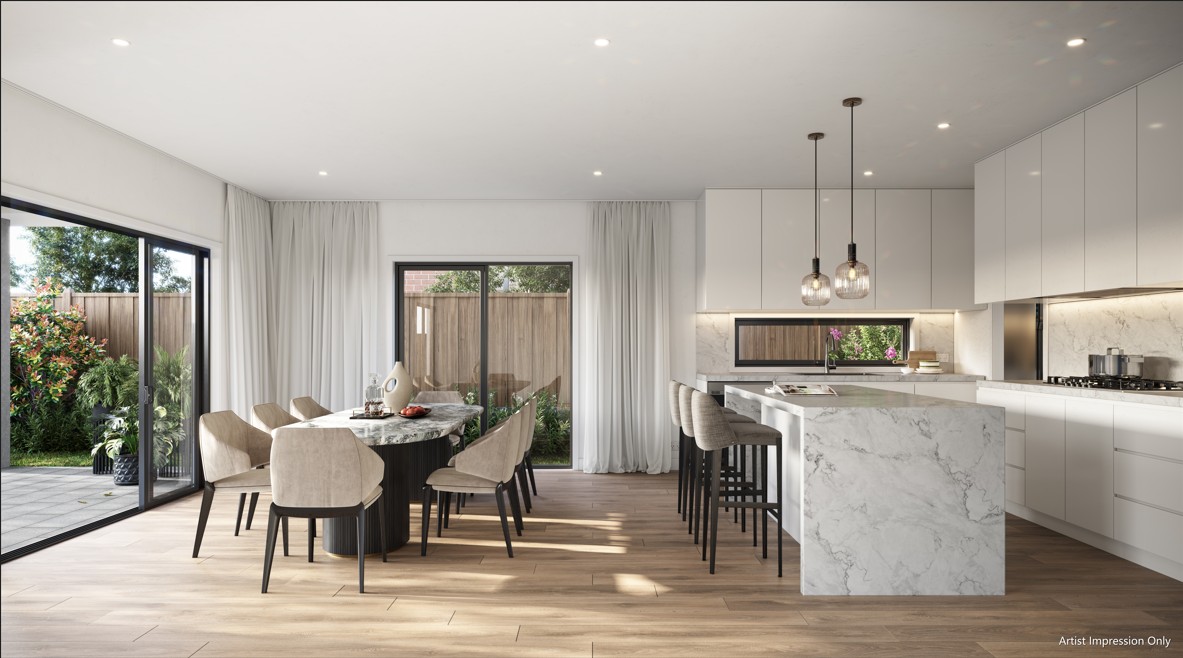
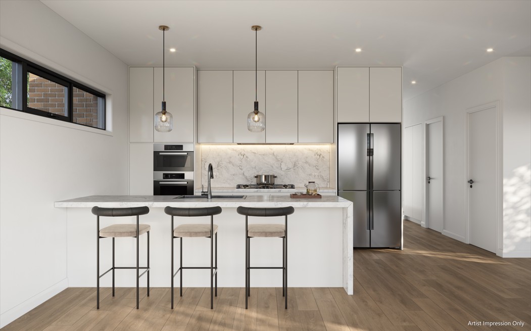
- Interiors blend functionality and beauty, with a focus on creating spaces that are both functional and aesthetically pleasing.
- Kitchens feature concealed storage, integrated appliances, and seamless natural finishes for a timeless, inviting atmosphere.
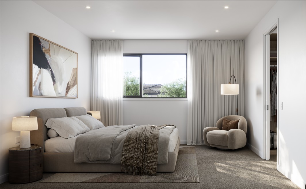
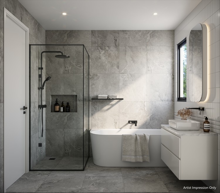
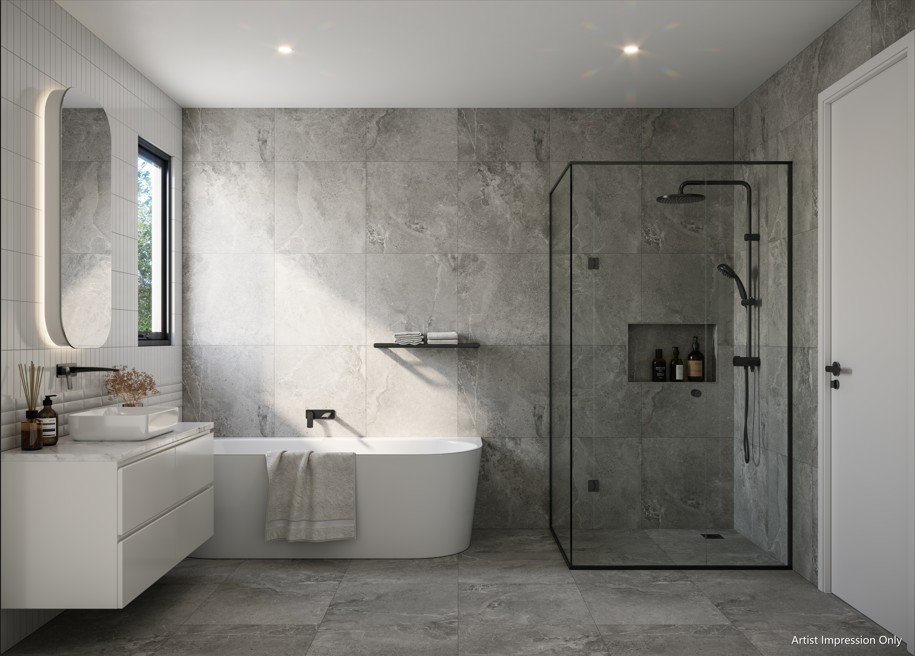
- Master bedrooms are spacious and tranquil, with generous walk-in robes and luxurious ensuites.
- Bathrooms offer relaxation with spacious layouts, deep soak baths, and generous showers.
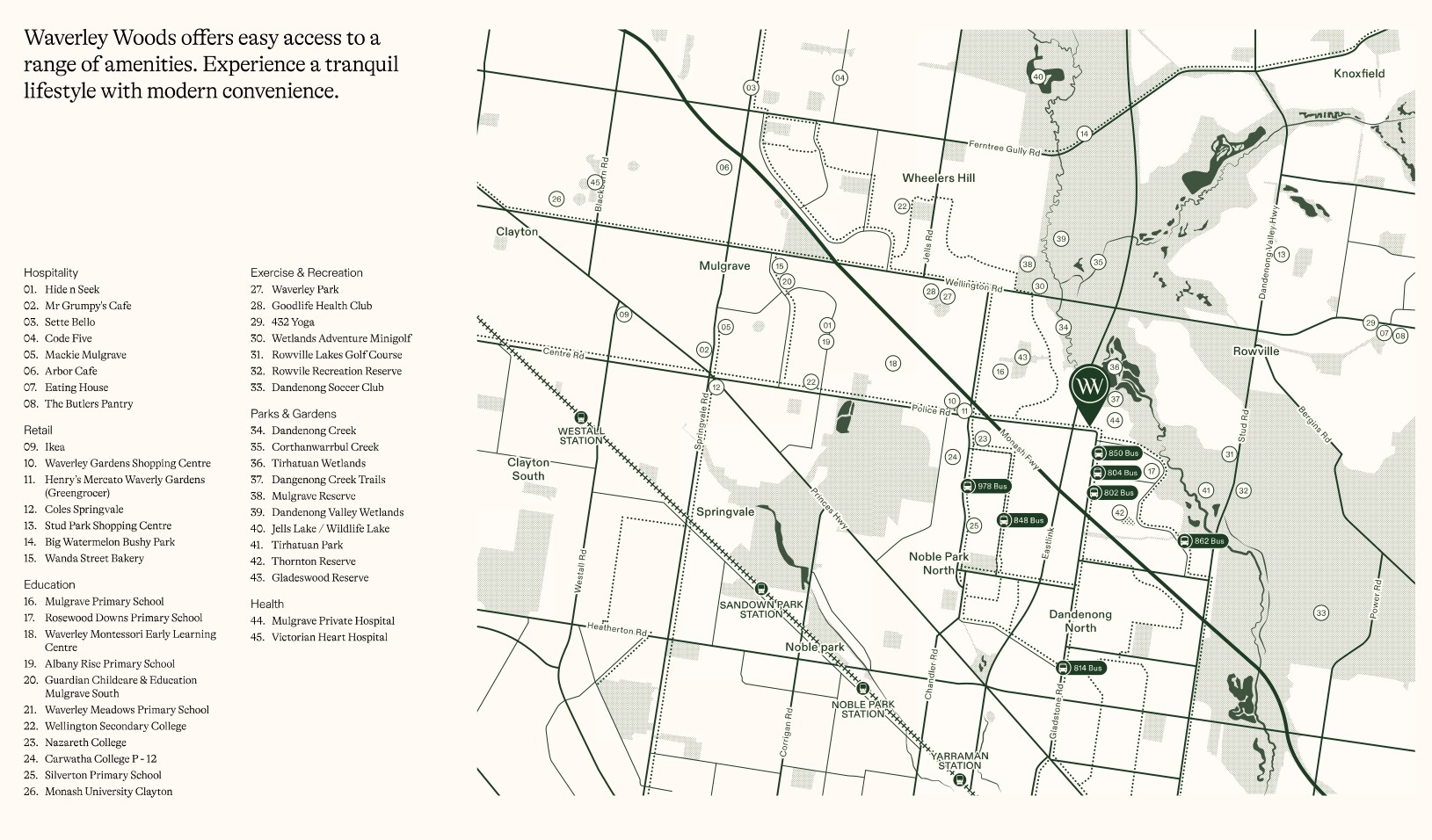
- Waverley Woods offers a peaceful lifestyle while being conveniently located near shops, restaurants, and entertainment.
- Prestigious schools are nearby, ensuring a bright future for the next generation.
- Easy access to public transport and major road networks, commuting and exploring the wider region is effortless.
This information is estimated by the OpenLot research team. Let us know here to provide up-to-date information about this development.
| Total new homes | 27 |
| Area size | 0.95 hectares |
| Growth Region | Melbourne South East Growth Corridor |
| City council | Monash City Council |
| Developer | Tre Towers |
| Project marketer | Areal Projects |
| Distance to | Melbourne CBD - 26 km south-east Melbourne Airport - 44 km south-east |
House and Land Packages:
5 House and Land Packages in Waverley Woods Estate - Mulgrave

 4
4  4
4  3
3Updates for Waverley Woods Estate - Mulgrave
Facebook updates:
Submit the Facebook page for Waverley Woods Estate - Mulgrave.
Related news:
As Victoria's property market continues to evolve, buyers are keen to secure prime real estate in the state's most sought-after growth corridors. According to data from OpenLot.com.au, the following estates have emerged as the top five in each region based on buyer interest in January 2025.

An application for 27 dwellings and associated subdivision for 501-521 Police Road, Mulgrave was approved by Council in July 2023. A previous application, TPA/51849, proposing 41 dwellings on the land was refused by Council at the 27 January 2021 meeting and upheld at VCAT.


Missing articles? Send us a link here.
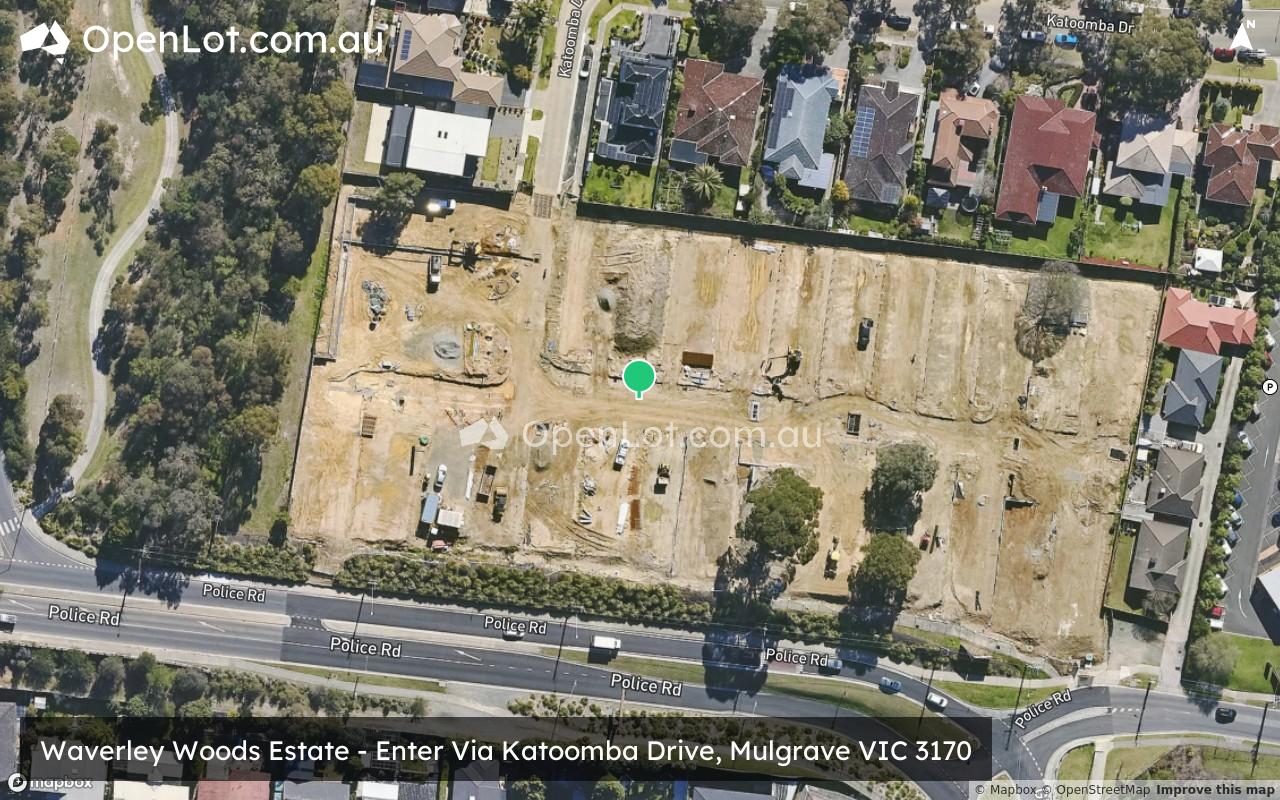
Location & Map for Waverley Woods Estate - Mulgrave
Visit Display Homes near Waverley Woods Estate - Mulgrave

Land Price Trend in Mulgrave VIC 3170
- In Jan - Mar 22, the median price for vacant land in Mulgrave VIC 3170 was $820,000. *
- From Jan - Mar 18 to Jan - Mar 22, the median price for vacant land in Mulgrave VIC 3170 has increased 1.86%. *
- From 2009 to 2022, the median price for vacant land in Mulgrave VIC 3170 has increased 124.19%. *
Vacancy Rate in Mulgrave VIC 3170
View full vacancy rate history in Mulgrave VIC 3170 via SQM Research.
Schools near Waverley Woods Estate - Mulgrave
Here are 6 schools near Waverley Woods Estate - Mulgrave:
Prep-6 Government Primary School
Prep-6 Government Primary School
7-12 Catholic Secondary School
Prep-6 Catholic Primary School
Prep-12 Government Combined School
Prep-6 Government Primary School
Reviews & Comments on Waverley Woods Estate - Mulgrave
Estate Brochure, Masterplan, Engineering Plan, Plan of Subdivision (POS), Design Guidelines
FAQs about Waverley Woods Estate - Mulgrave
View all estates from Tre Towers
View all estates marketed by Areal Projects
- Rosewood Downs Primary School - 748m south-east
- Mulgrave Primary School - 1.3km north-west
- Nazareth College - 1.3km west
- St Elizabeth's School - 1.3km south-west
- Carwatha College P-12 - 1.9km west
- Silverton Primary School - 1.9km south-west
Popular Estates near Waverley Woods Estate - Mulgrave


Latest New Home Articles for You

01/Dec/2025 | OpenLot.com.au
Display Homes at Bushmead: Modern Living in Bushmead
If you love the peace and tranquillity of the Australian bush, you’ll fee...

27/Nov/2025 | OpenLot.com.au
Display Homes at Eden Beach: Premium Coastal Living in Jindalee

26/Nov/2025 | OpenLot.com.au
Display Homes Near Me (VIC): Your Complete Guide to Display Villages Across Victoria
Finding the right display home in Victoria has never been easier, with do...

24/Nov/2025 | OpenLot.com.au
🏡 New Neighbourhoods Season 1 Recap
From the outset, New Neighbourhoods sets out to explore Australia’s dynam...

24/Nov/2025 | OpenLot.com.au
🏡 Suburb Profile: Moss Vale
Moss Vale is a suburb of approximately 79.56 square kilometres within the...

21/Nov/2025 | OpenLot.com.au
Display Homes at Averley: Elevated Living in Nar Nar Goon North
Imagine a place where native bushland complements timeless architecture, ...

18/Nov/2025 | OpenLot.com.au
Display Homes at Exford Waters: True Riverside Living in Weir Views
Discover a lifestyle shaped by nature and connection at Exford Waters, wh...

17/Nov/2025 | OpenLot.com.au
Display Homes at Crownlea: A Lifestyle of Space in Warragul
Embrace the good life and enjoy the very best views in Warragul at Warrag...

13/Nov/2025 | OpenLot.com.au
Display Homes at Bluestone: A Showcase of Style and Innovation in Tarneit
Get ready to immerse yourself in a world of inspiration and design excell...