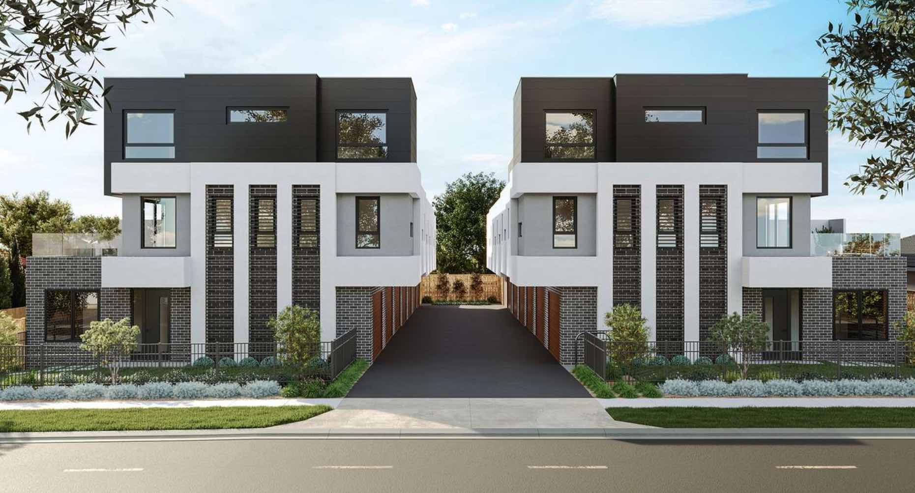
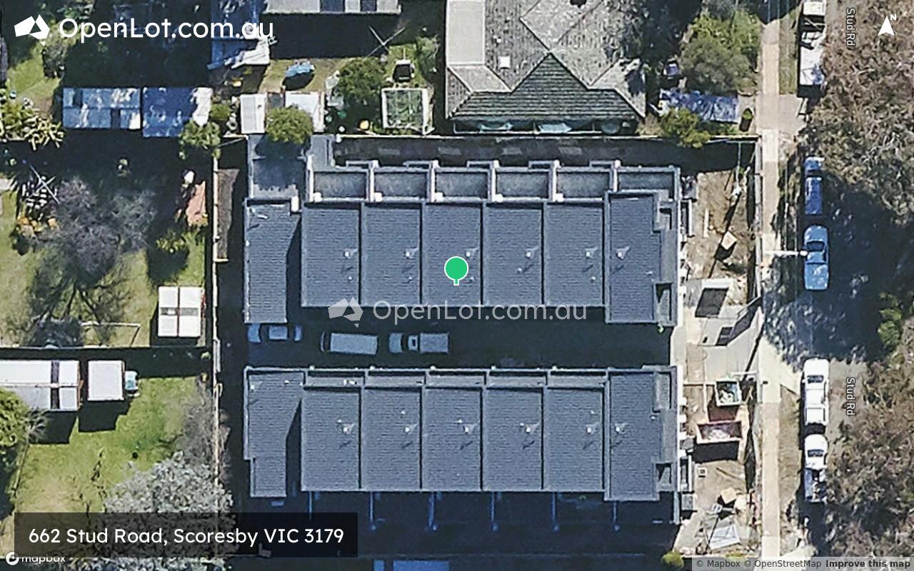
662 Stud Road, Scoresby VIC 3179
This information is estimated by the OpenLot research team. Let us know here to provide up-to-date information about this development.
| Total new homes | 14 |
| Area size | 0.14 hectares |
| Growth Region | Melbourne East |
| City council | Knox City Council |
| Developer | N/A |
| Project marketer | LJ Hooker Boronia |
| Distance to | Melbourne CBD - 25 km east Melbourne Airport - 42 km south-east |
Townhomes:
Popular Estates near 662 Stud Road, Scoresby


 3
3
 2
2
 3
3


Updates for 662 Stud Road, Scoresby
Location & Map for 662 Stud Road, Scoresby
Visit Display Homes near 662 Stud Road, Scoresby

Vacancy Rate in Scoresby VIC 3179
View full vacancy rate history in Scoresby VIC 3179 via SQM Research.
Schools near 662 Stud Road, Scoresby
Here are 6 schools near 662 Stud Road, Scoresby:
7-12 Government Secondary School
Prep-6 Government Primary School
Prep-6 Catholic Primary School
Prep-6 Government Primary School
Prep-6 Government Primary School
U Catholic Special School - School Head Campus
Reviews & Comments on 662 Stud Road, Scoresby
Estate Brochure, Masterplan, Engineering Plan, Plan of Subdivision (POS), Design Guidelines
FAQs about 662 Stud Road, Scoresby
View all estates marketed by LJ Hooker Boronia
- Scoresby Secondary College - 429m north-east
- Scoresby Primary School - 535m south-west
- St Jude the Apostle School - 578m west
- Knox Gardens Primary School - 1.0km north
- Carrington Primary School - 1.3km east
- St Mary's College for the Deaf - 1.7km north-east
Popular Estates near 662 Stud Road, Scoresby
Latest New Home Articles for You

27/Jan/2026 | OpenLot.com.au
Display Homes at Stockland Wildflower Estate: A Smart Community in Piara Waters
Welcome to Wildflower, a vibrant new neighbourhood nestled in the heart o...

16/Jan/2026 | OpenLot.com.au
South Australia Top 30 Most Searched Housing Developments (December 2025)

15/Jan/2026 | OpenLot.com.au
Queensland: Top 30 Most Searched Housing Developments (December 2025)
If you’ve been tracking housing demand across Queensland, December 2025 p...

14/Jan/2026 | OpenLot.com.au
Victoria: Top 30 Most Searched Housing Developments (December 2025)
If you’ve been exploring housing opportunities in Victoria, December 2025...

14/Jan/2026 | OpenLot.com.au
Display Homes at Apsley Estate: A Masterplanned Community in Mandogalup
Apsley is a bold, 1,800-lot masterplanned community just 25 minutes south...

13/Jan/2026 | OpenLot.com.au
Western Australia: Top 30 Most Searched Housing Developments (December 2025)
If you’ve been keeping an eye on housing demand across Western Australia,...

12/Jan/2026 | OpenLot.com.au
New South Wales: Top 30 Most Searched Housing Developments (December 2025)
If you’ve been considering making a move in New South Wales, December 202...

07/Jan/2026 | OpenLot.com.au
🏡 Top 30 Most Searched Estates by State - December

06/Jan/2026 | OpenLot.com.au
Display Homes Near Me (WA): Your Complete Guide to Display Villages Across Western Australia
Finding the right display home in Western Australia has never been easier...