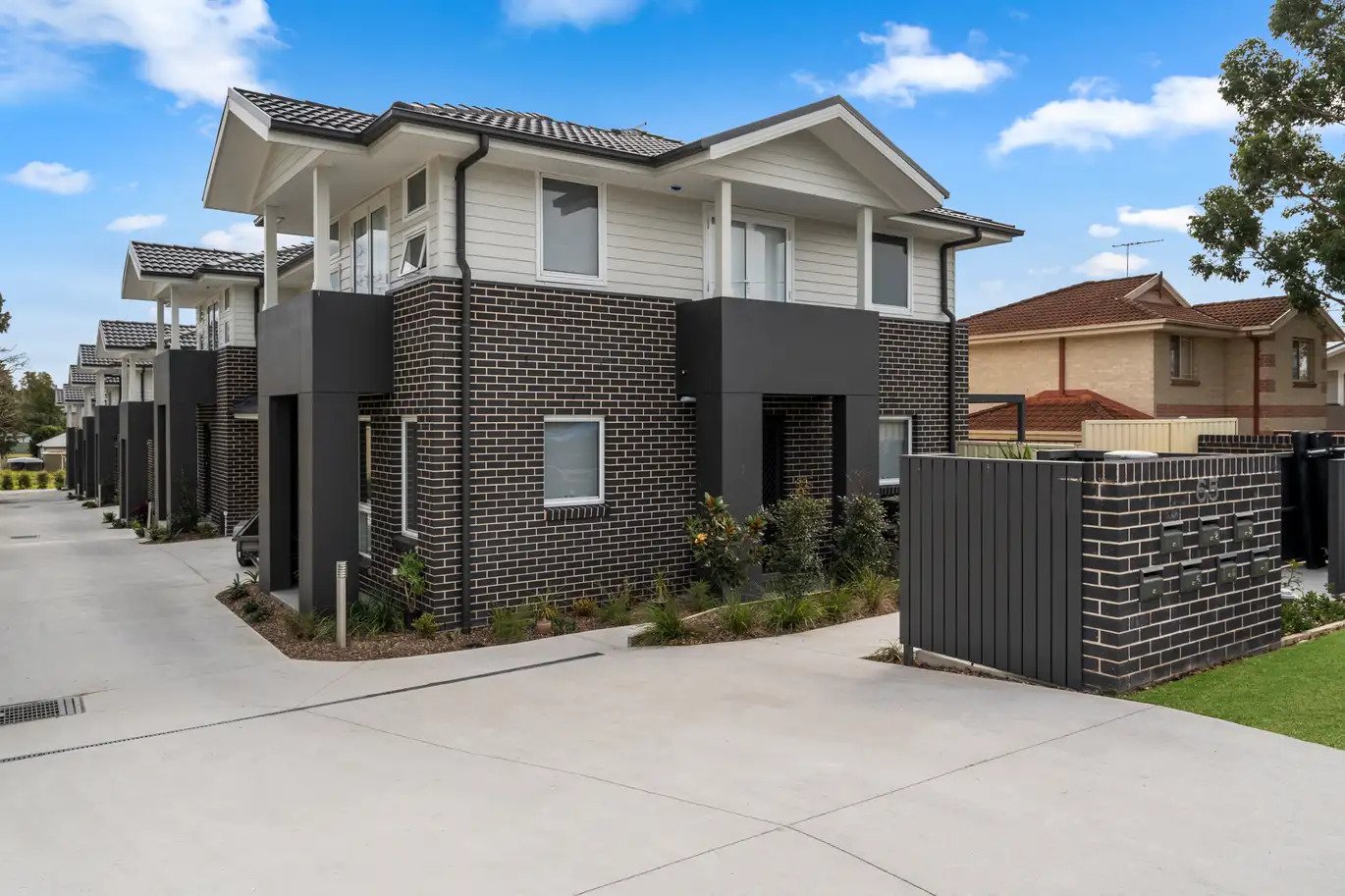
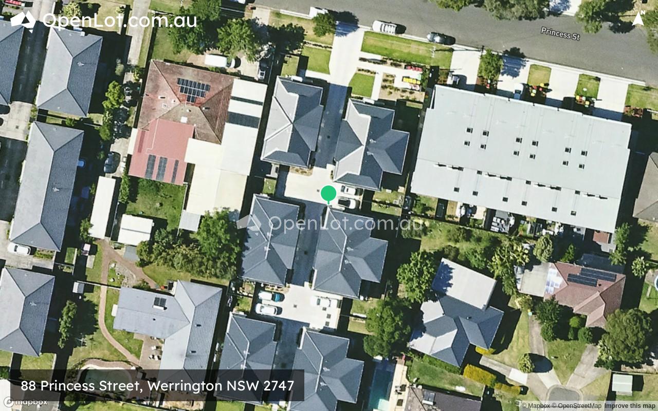
88 Princess Street, Werrington NSW 2747
This information is estimated by the OpenLot research team. Let us know here to provide up-to-date information about this development.
| Total new homes | 12 |
| Area size | 0.23 hectares |
| Growth Region | Sydney North West Growth Areas |
| City council | Penrith City Council |
| Developer | N/A |
| Project marketer | Ray White Diamantidis Group |
| Distance to | Sydney CBD - 42 km west Sydney Airport - 45 km north-west |
Townhomes:
Popular Estates near 88 Princess Street, Werrington


 5
5
 3
3
 2
2


Updates for 88 Princess Street, Werrington
Location & Map for 88 Princess Street, Werrington
Visit Display Homes near 88 Princess Street, Werrington


Vacancy Rate in Werrington NSW 2747
View full vacancy rate history in Werrington NSW 2747 via SQM Research.
Schools near 88 Princess Street, Werrington
Here are 6 schools near 88 Princess Street, Werrington:
K-6 Government Primary School
U Government Special School
2-12 Independent Combined School
K-6 Government Primary School
U Government Special School
U Government Special School
Reviews & Comments on 88 Princess Street, Werrington
Estate Brochure, Masterplan, Engineering Plan, Plan of Subdivision (POS), Design Guidelines
FAQs about 88 Princess Street, Werrington
View all estates marketed by Ray White Diamantidis Group
- Werrington Public School - 738m west
- Putland School - 1.1km south
- Wollemi College - 1.1km south
- Werrington County Public School - 1.2km north-west
- Kurrambee School - 1.4km south
- Penrith Valley School - 1.4km south
Popular Estates near 88 Princess Street, Werrington
Latest New Home Articles for You

09/Mar/2026 | OpenLot.com.au
Victoria: Top 30 Most Searched Housing Developments (February 2026)
If you’ve been exploring housing opportunities in Victoria, February 2026...

20/Feb/2026 | OpenLot.com.au
Display Homes at Drouin Fields Estate: A Thriving Community in Drouin
Welcome to Drouin Fields, a place where beauty, space, and modern luxury ...

19/Feb/2026 | OpenLot.com.au
Display Homes at Manor Lakes Esate: A Thriving Waterside Community in Manor Lakes
A place where you can settle in, rather than just settle down. Named for ...

13/Feb/2026 | OpenLot.com.au
🏠 Victoria: Top 30 Most Searched Townhouse Developments – January 2026

11/Feb/2026 | OpenLot.com.au
🏡 Top 30 Most Searched Estates by State - January 2026

10/Feb/2026 | OpenLot.com.au
Victoria: Top 30 Most Searched Housing Developments (January 2026)
If you’ve been considering making a move in Victoria, January 2026 offere...

10/Feb/2026 | OpenLot.com.au
Queensland: Top 30 Most Searched Housing Developments (January 2026)
If you’ve been considering making a move in Queensland, January 2026 offe...

09/Feb/2026 | OpenLot.com.au
Western Australia: Top 30 Most Searched Housing Developments (January 2026)
If you’ve been considering making a move in Western Australia, January 20...

06/Feb/2026 | OpenLot.com.au
South Australia: Top 30 Most Searched Housing Developments (January 2026)
If you’ve been considering making a move in South Australia, January 2026...