Arcadian Grove Estate - Cobbitty SOLD OUT
This information is estimated by the OpenLot research team. Let us know here to provide up-to-date information about this development.
| Total new homes | 58 |
| Area size | 3.00 hectares |
| Growth Region | Sydney South West Growth Areas |
| City council | Camden Council |
| Developer | AVJennings |
| Distance to | Sydney Airport - 43 km west Sydney CBD - 46 km west |
House and Land Packages, Townhomes:
Popular Estates near Arcadian Grove Estate - Cobbitty
Updates for Arcadian Grove Estate - Cobbitty
Location & Map for Arcadian Grove Estate - Cobbitty
Visit Display Homes near Arcadian Grove Estate - Cobbitty
Vacancy Rate in Cobbitty NSW 2570
View full vacancy rate history in Cobbitty NSW 2570 via SQM Research.
Schools near Arcadian Grove Estate - Cobbitty
Here are 6 schools near Arcadian Grove Estate - Cobbitty:
K-12 Independent Combined School
7-12 Government Secondary School
K-6 Government Primary School
K-6 Government Primary School
K-12 Independent Combined School - School Head Campus
U Independent Special School - School Head Campus
Suburb Planning Review in Cobbitty NSW 2570
Cobbitty is approximately 5,216.4ha within the north ward of Camden Council and the Hume electoral division in New South Wales, located 60 kilometres south-west of Sydney. The regional area is primarily rural land holdings supported by the Cobbitty Town Centre.
The suburb boundary is located along Bringelly Creek to the north and the long winding Nepean River to the west and south. The Macquarie Grove Road and the Northern Road provide part of the boundary to the east, with a series of property boundaries in the northeast. The Camden Airport is also located in the south of Cobbitty, with the University of Sydney establishing research farms in both the north and south of the area.
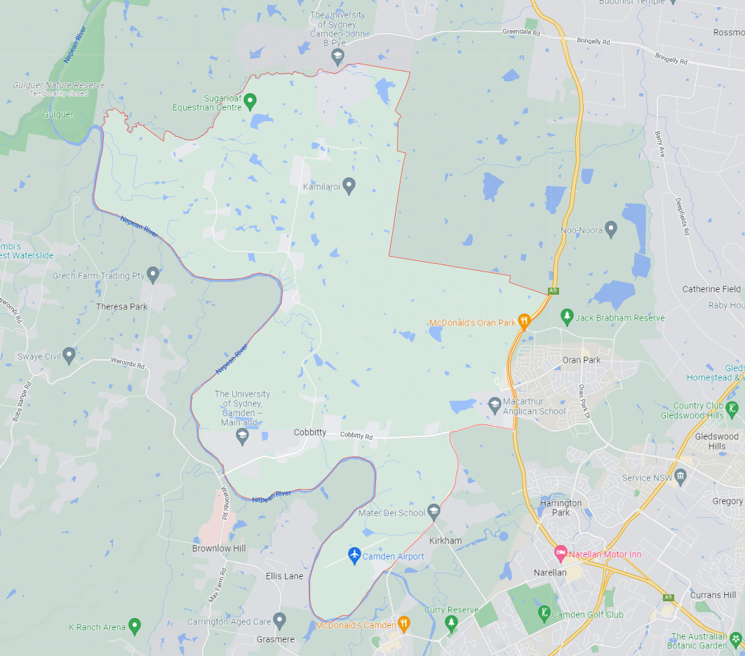
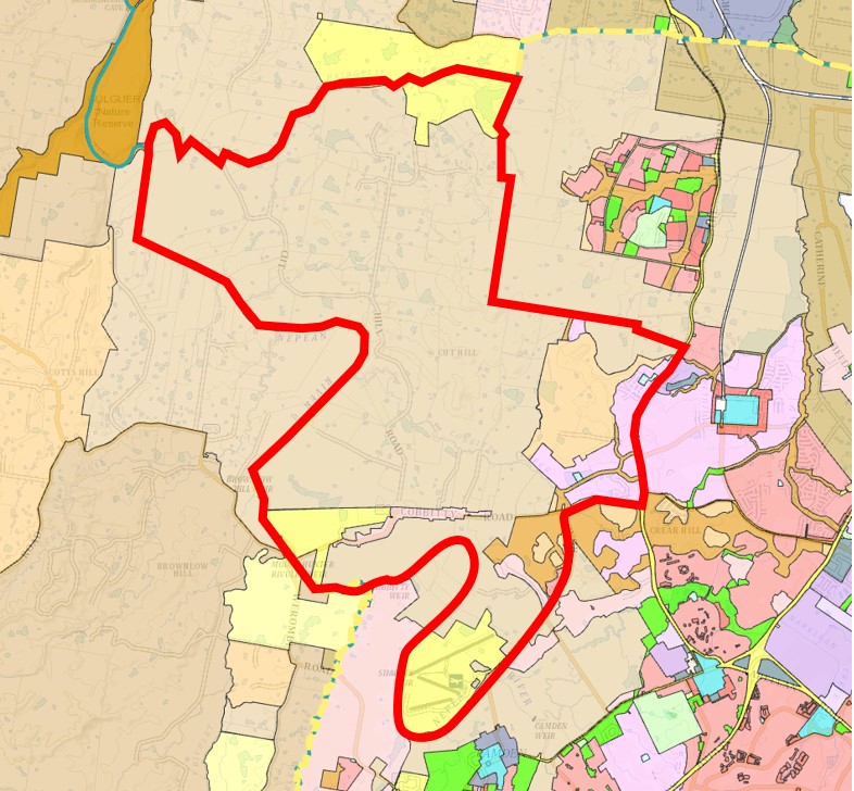
Cobbity Road, Coats Road and Cut Hill Road provide access to the village, the rural properties and surrounding townships. Rural residential zoned areas dominate the northern, southern and western portions of the suburb, however, contains a cluster of low density development to the eastern boundary.
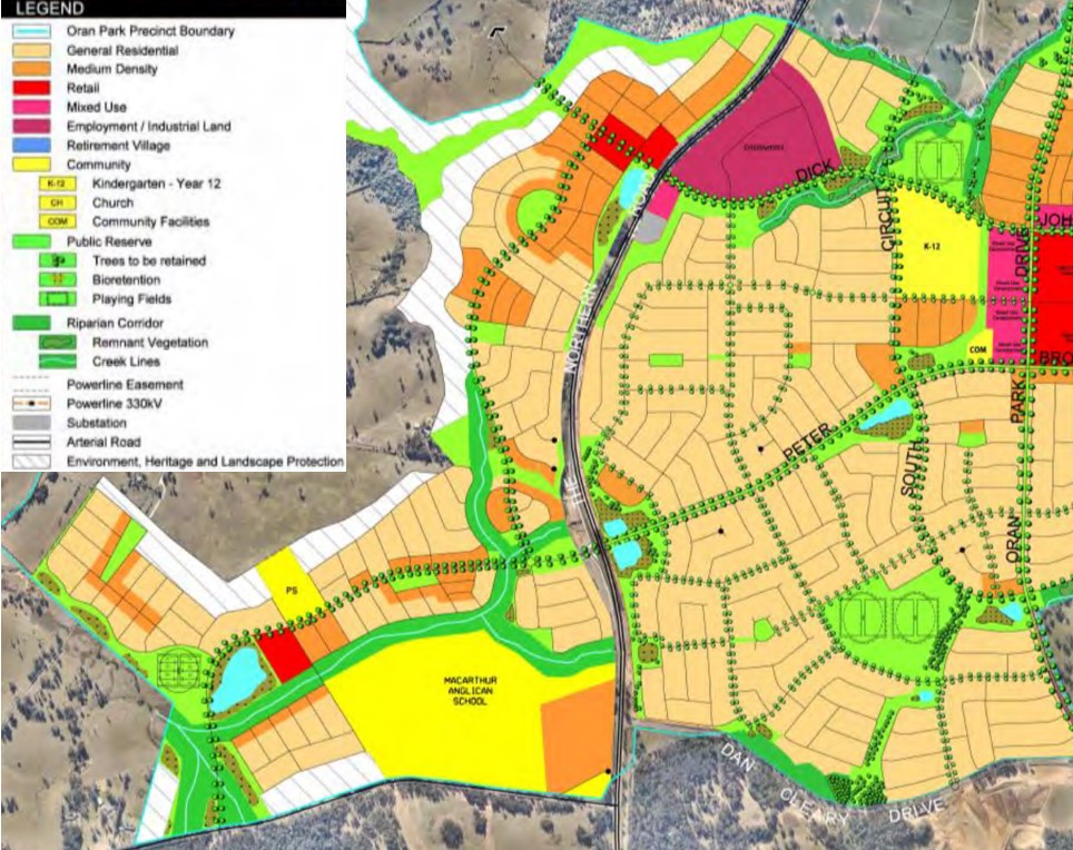
Along both Macquarie Grove Road and the Northern Road, urban areas are being developed under the general residential zoning in an expansion of Oran Park (Local Centre), which is supported by the Oran Park Precinct - Growth Centres Precinct Development Control Plan.
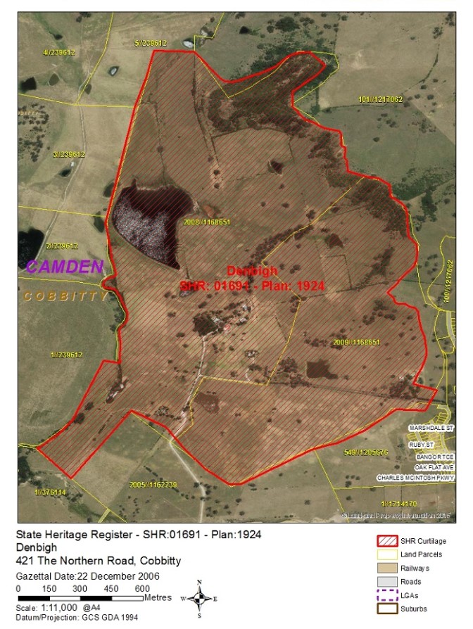
The emerging development wraps around Denbigh, Bangor and Cluny Hill a group of homesteads, buildings and plantations in a large rural setting. The heritage-listed area is of great state significance due to the preservation of the buildings.
Cobbitty: Campbelltown–Macarthur
Cobbitty forms the outer rural area of the Campbelltown–Macarthur a Metropolitan Cluster within the Western Parkland City which will form part of the region plan for Greater Sydney. The vision for the next 20 years is to provide jobs, education, health facilities and services to more residents that live within the new Western Parkland City, drawing on the new Western Sydney Airport and Badgerys Creek Aerotropolis, and North-South Rail Link.
The growth area will create the opportunity for a Western Economic Corridor. The planning priorities and actions for improving the quality of life for residents in this growth area are set down in the Western City District Plan, our greater Sydney 2056, March 2018.
Western City District Plan in Cobbitty
The population growth in the Western City District will be 464,450 by 2036, which is expected to require a housing growth of 184,500 dwellings (25%). The integration of new land use, transport and infrastructure is supported by the Future Transport Strategy 2056 and State Infrastructure Strategy 2018–2038 across the region. The new Western City District Structure Plan illustrates the loction for the future urban growth
Cobbitty Suburb Summary
References
- Camden City Council - Cobbitty DCB
- Cobbitty – Structure Plan for the Western City District
- Cobbitty, NSW - State Heritage Area
- Oran Park – Development Control Plan
- Google Streetview and Aerial
Reviews & Comments on Arcadian Grove Estate - Cobbitty
Estate Brochure, Masterplan, Engineering Plan, Plan of Subdivision (POS), Design Guidelines
FAQs about Arcadian Grove Estate - Cobbitty
View all estates from AVJennings
- Macarthur Anglican School - 312m north-west
- Oran Park High School - 2.0km north-east
- Oran Park Public School - 2.1km north-east
- Harrington Park Public School - 2.2km south-east
- Oran Park Anglican College - 2.3km north-east
- Aspect Macarthur School - 2.6km south-west
Popular Estates near Arcadian Grove Estate - Cobbitty
Latest New Home Articles for You

27/Jan/2026 | OpenLot.com.au
Display Homes at Stockland Wildflower Estate: A Smart Community in Piara Waters
Welcome to Wildflower, a vibrant new neighbourhood nestled in the heart o...

16/Jan/2026 | OpenLot.com.au
South Australia Top 30 Most Searched Housing Developments (December 2025)

15/Jan/2026 | OpenLot.com.au
Queensland: Top 30 Most Searched Housing Developments (December 2025)
If you’ve been tracking housing demand across Queensland, December 2025 p...

14/Jan/2026 | OpenLot.com.au
Victoria: Top 30 Most Searched Housing Developments (December 2025)
If you’ve been exploring housing opportunities in Victoria, December 2025...

14/Jan/2026 | OpenLot.com.au
Display Homes at Apsley Estate: A Masterplanned Community in Mandogalup
Apsley is a bold, 1,800-lot masterplanned community just 25 minutes south...

13/Jan/2026 | OpenLot.com.au
Western Australia: Top 30 Most Searched Housing Developments (December 2025)
If you’ve been keeping an eye on housing demand across Western Australia,...

12/Jan/2026 | OpenLot.com.au
New South Wales: Top 30 Most Searched Housing Developments (December 2025)
If you’ve been considering making a move in New South Wales, December 202...

07/Jan/2026 | OpenLot.com.au
🏡 Top 30 Most Searched Estates by State - December

06/Jan/2026 | OpenLot.com.au
Display Homes Near Me (WA): Your Complete Guide to Display Villages Across Western Australia
Finding the right display home in Western Australia has never been easier...





 4
4
 2
2
 2
2


