


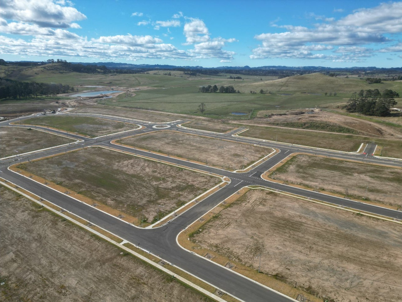

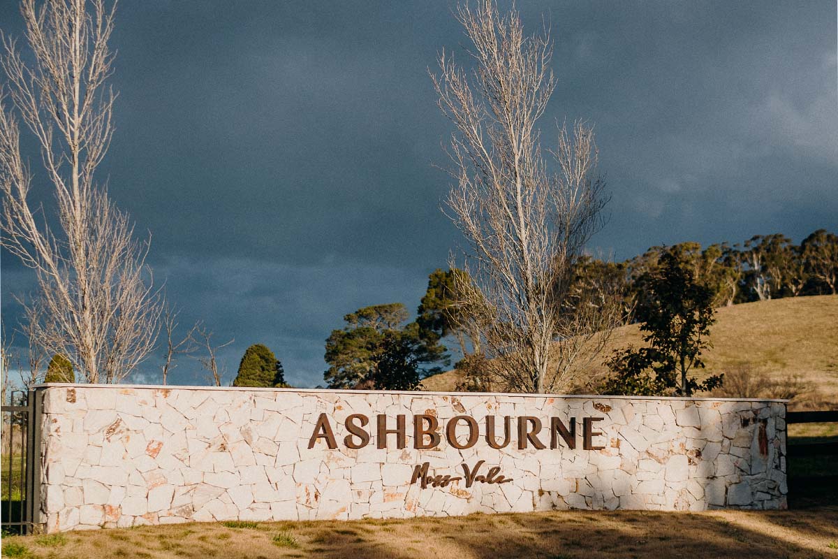
Ashbourne Estate - Moss Vale 15 AVAILABLE
[NEW RELEASE] Welcome to Ashbourne - Smart Design, Prime Location
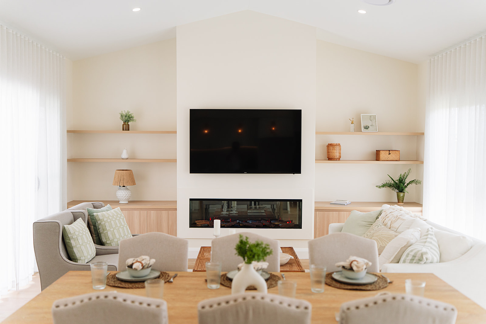
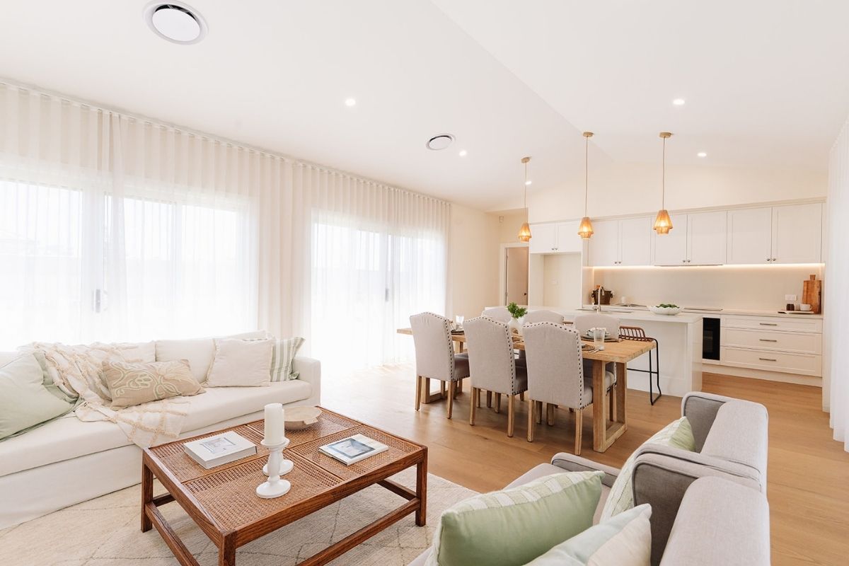
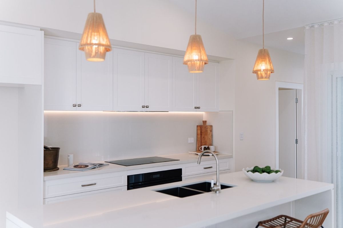
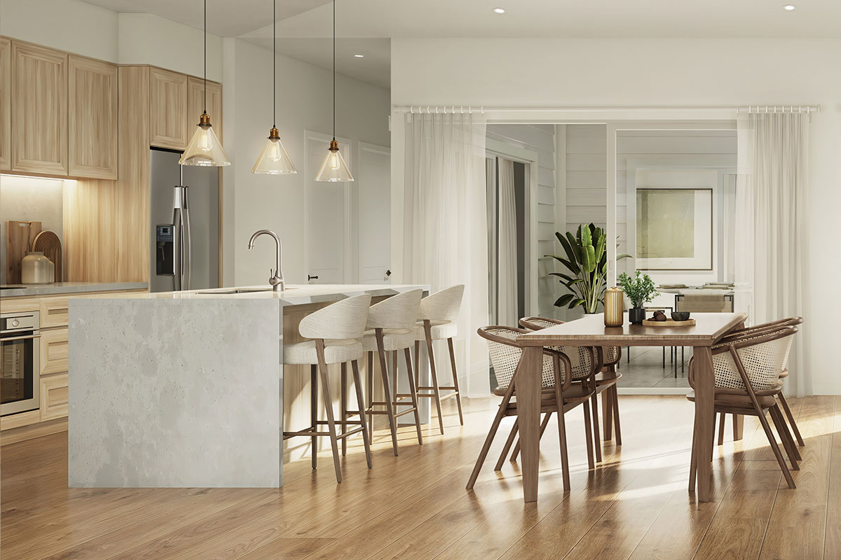
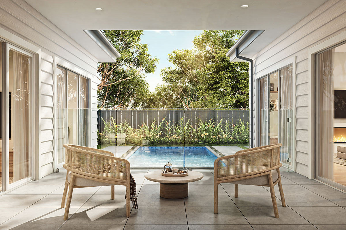
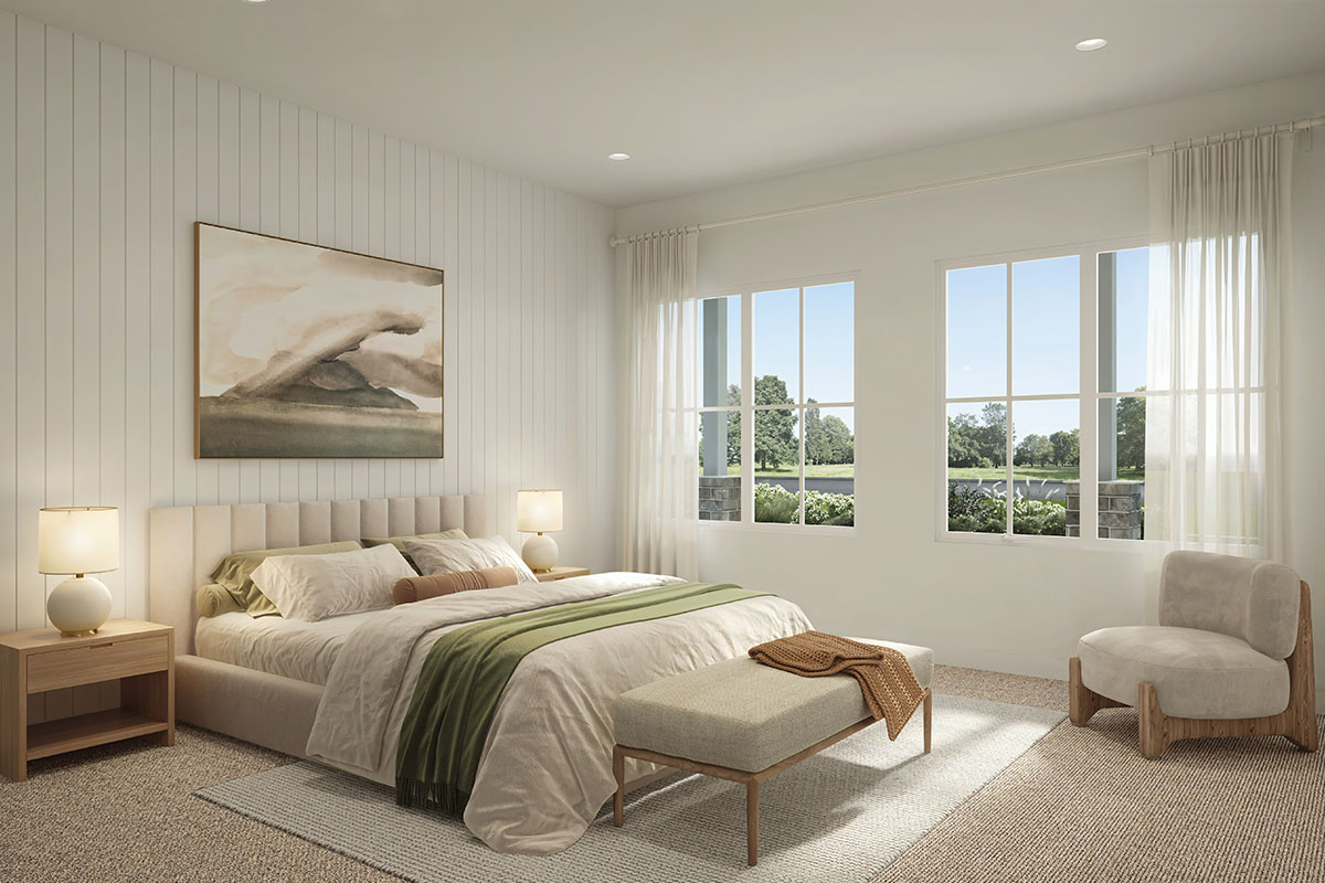
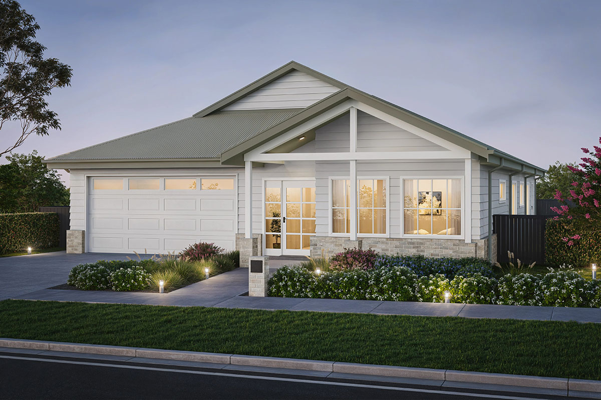
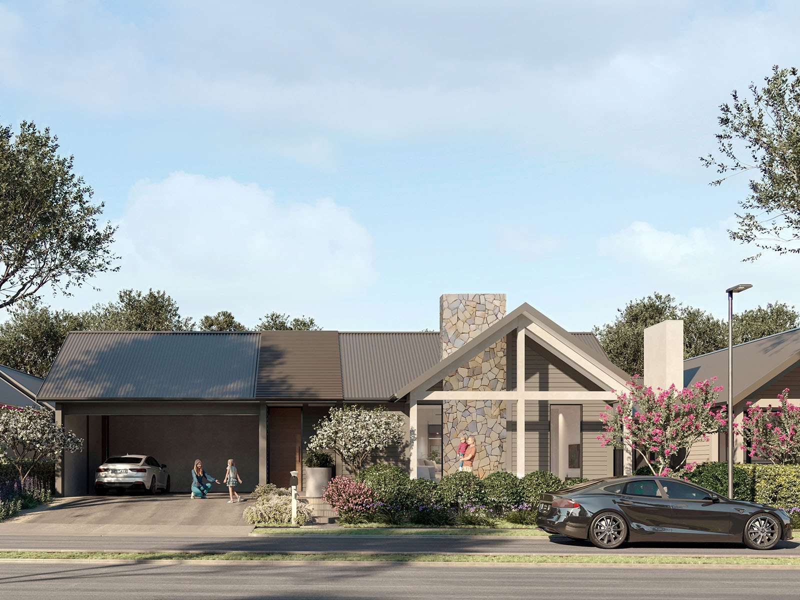
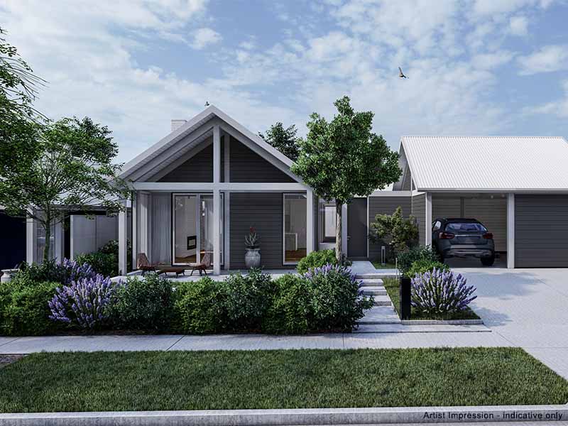
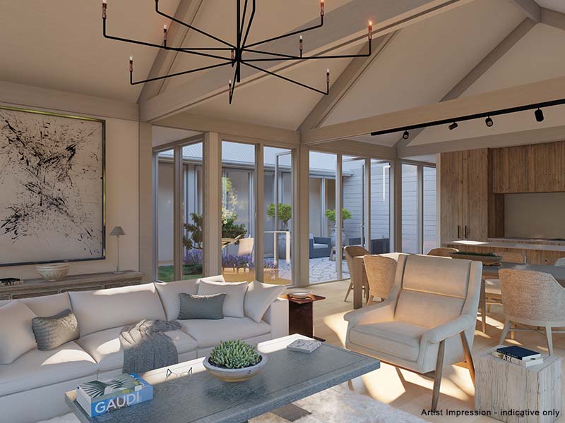
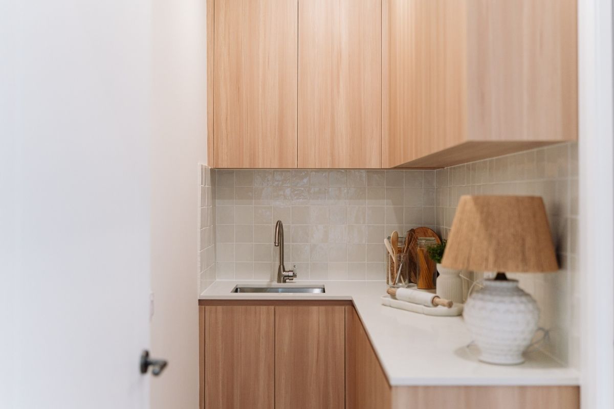
- [New Turnkey Release] We are proud to debut Luminara, our signature turnkey product. Offering a seamless transition into refined luxury, these move-in-ready homes combine the charm of the Southern Highlands with modern, light-filled design—giving you a beautiful, fully-finished home without the wait.
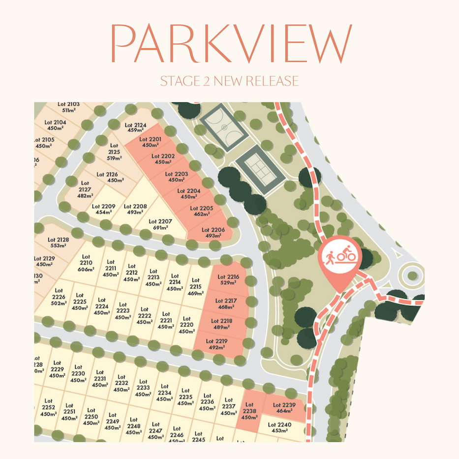
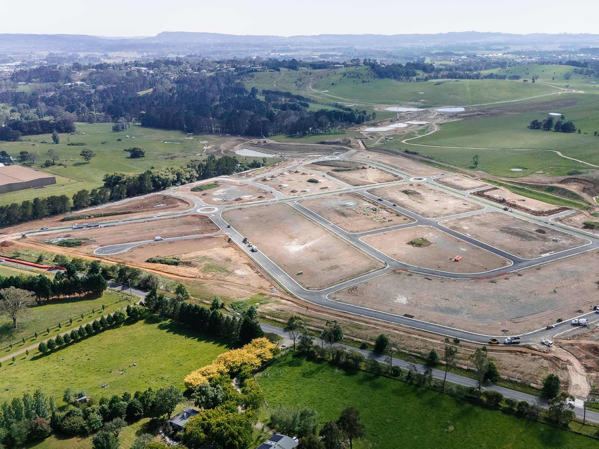
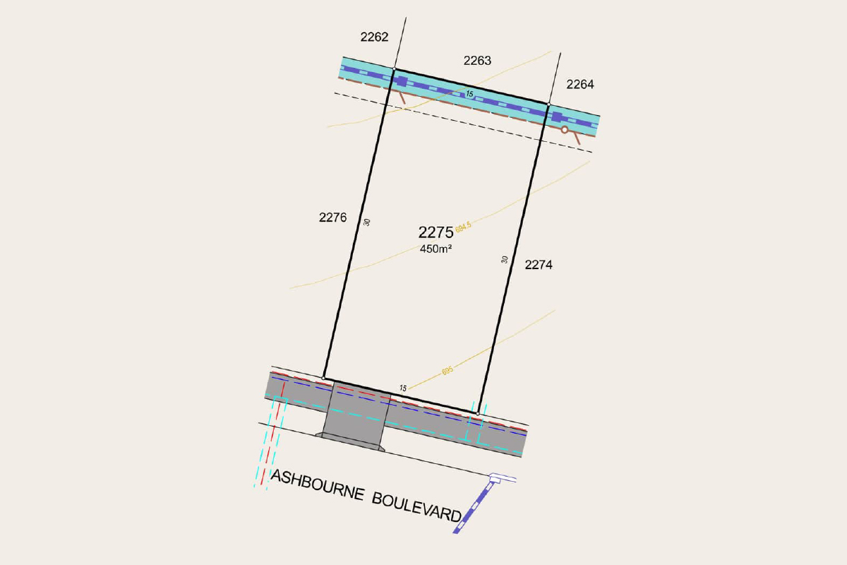
- [Land Lot Release] Discover The Grove – 450sqm Lots in a Prime Lifestyle Pocket
- [House & Land Packages] Stress-free building with House & Land packages from Ashbourne’s trusted local partners.
- Perfectly sized 450sqm lots – offering generous space for comfortable living with minimal upkeep
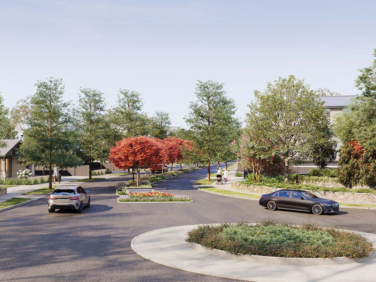
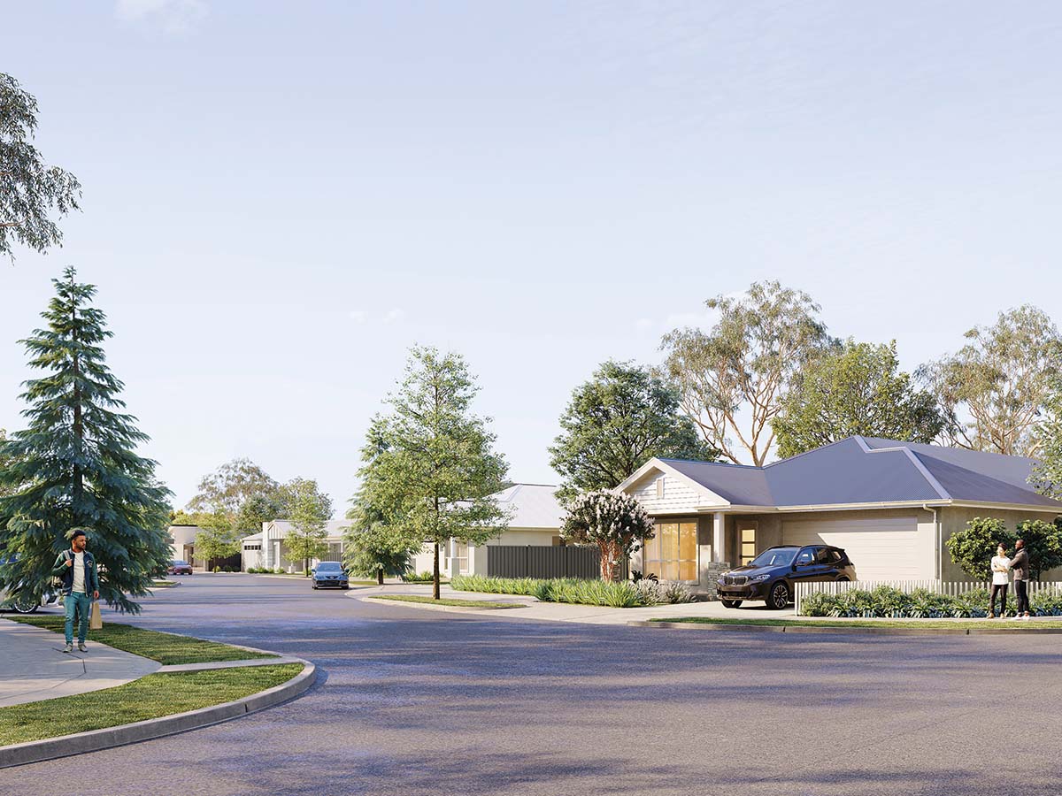
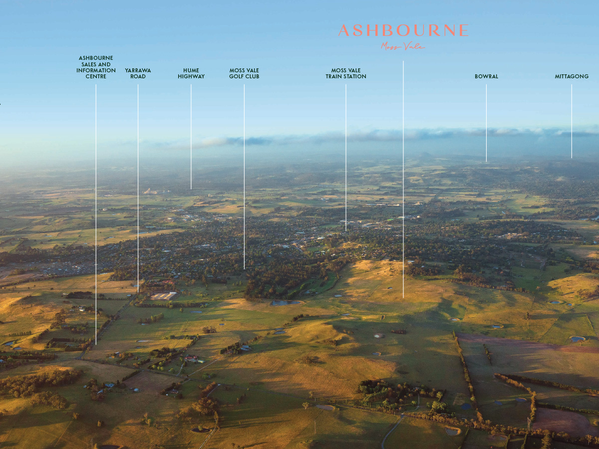
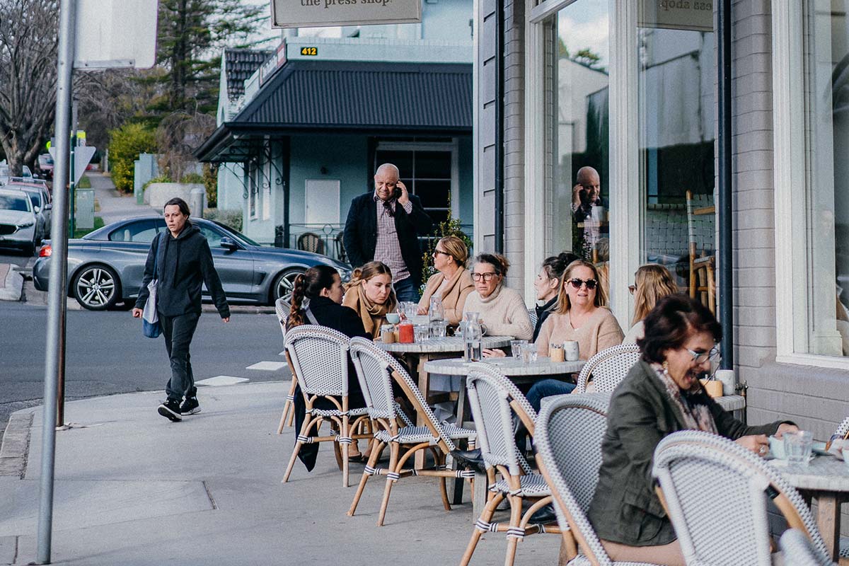
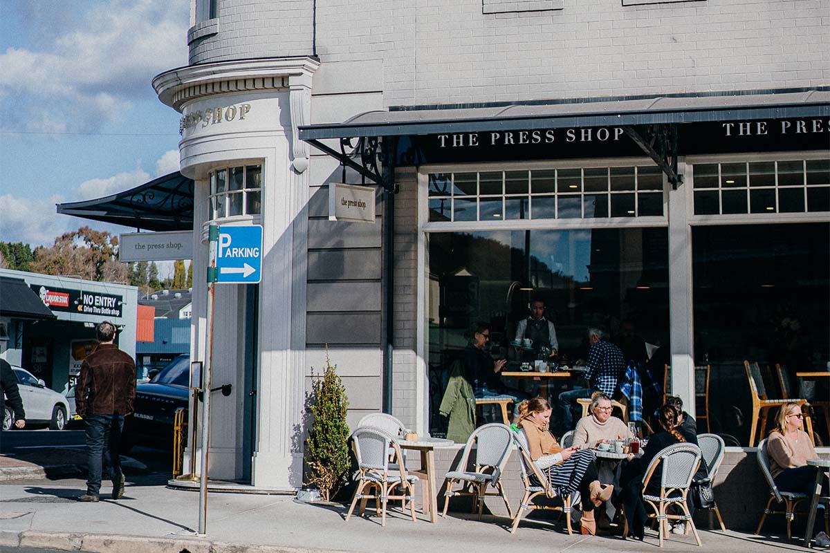
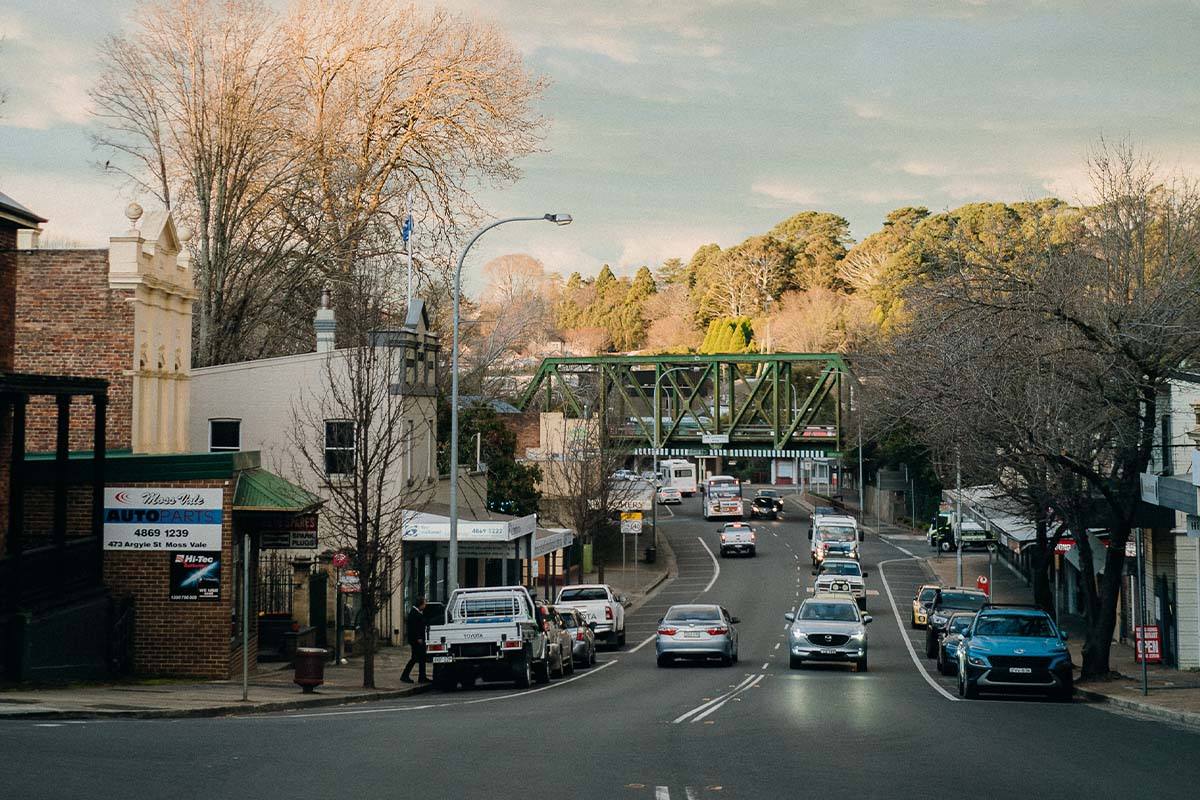
- Ideally located in the heart of the Southern Highlands – just 5 min from Moss Vale Town Centre
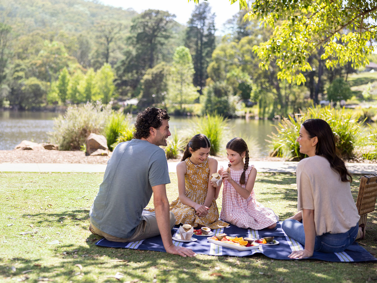
- Ashbourne offers a peaceful village atmosphere with all the comforts of modern living
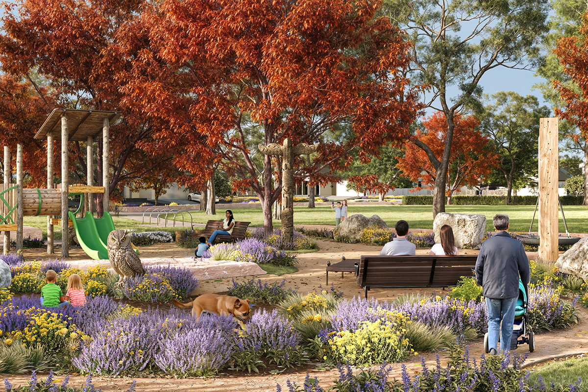
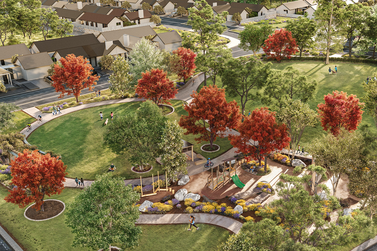
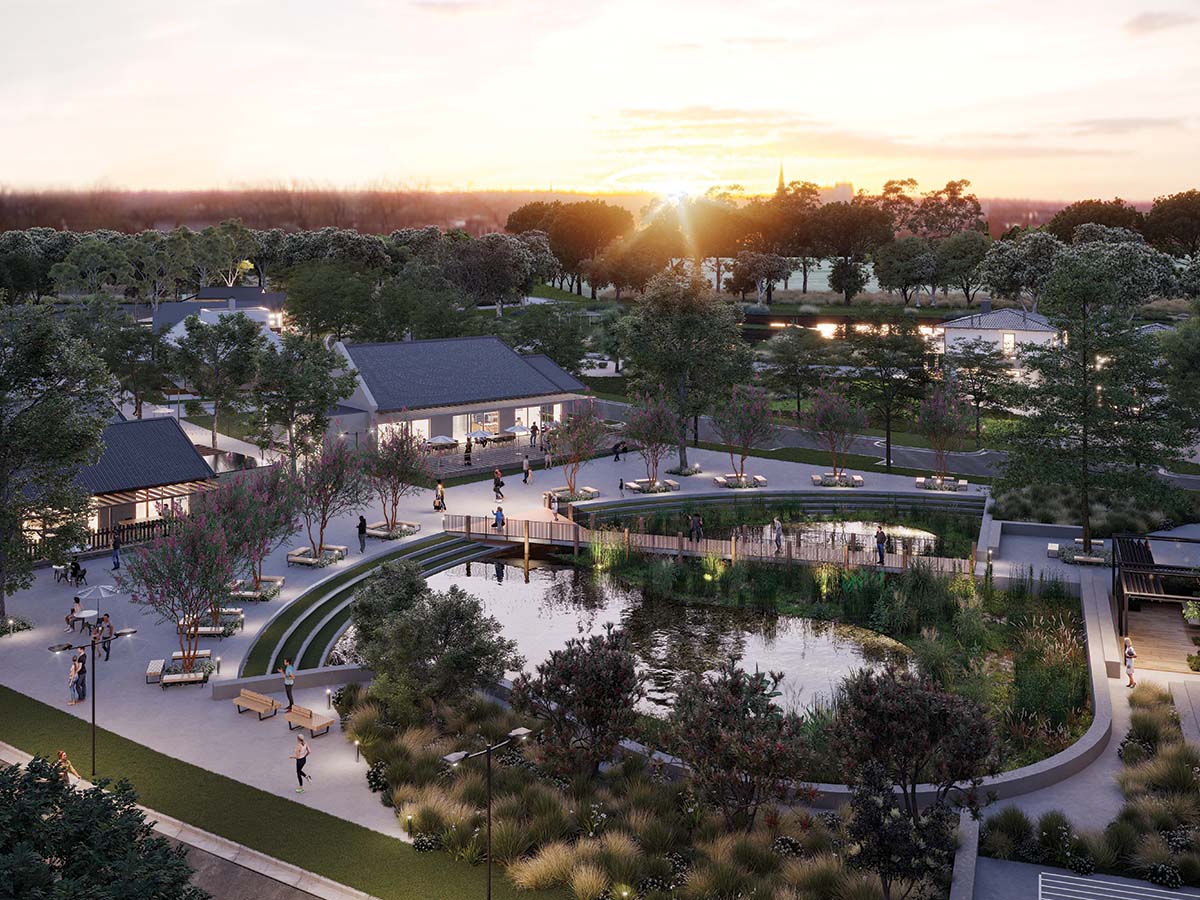
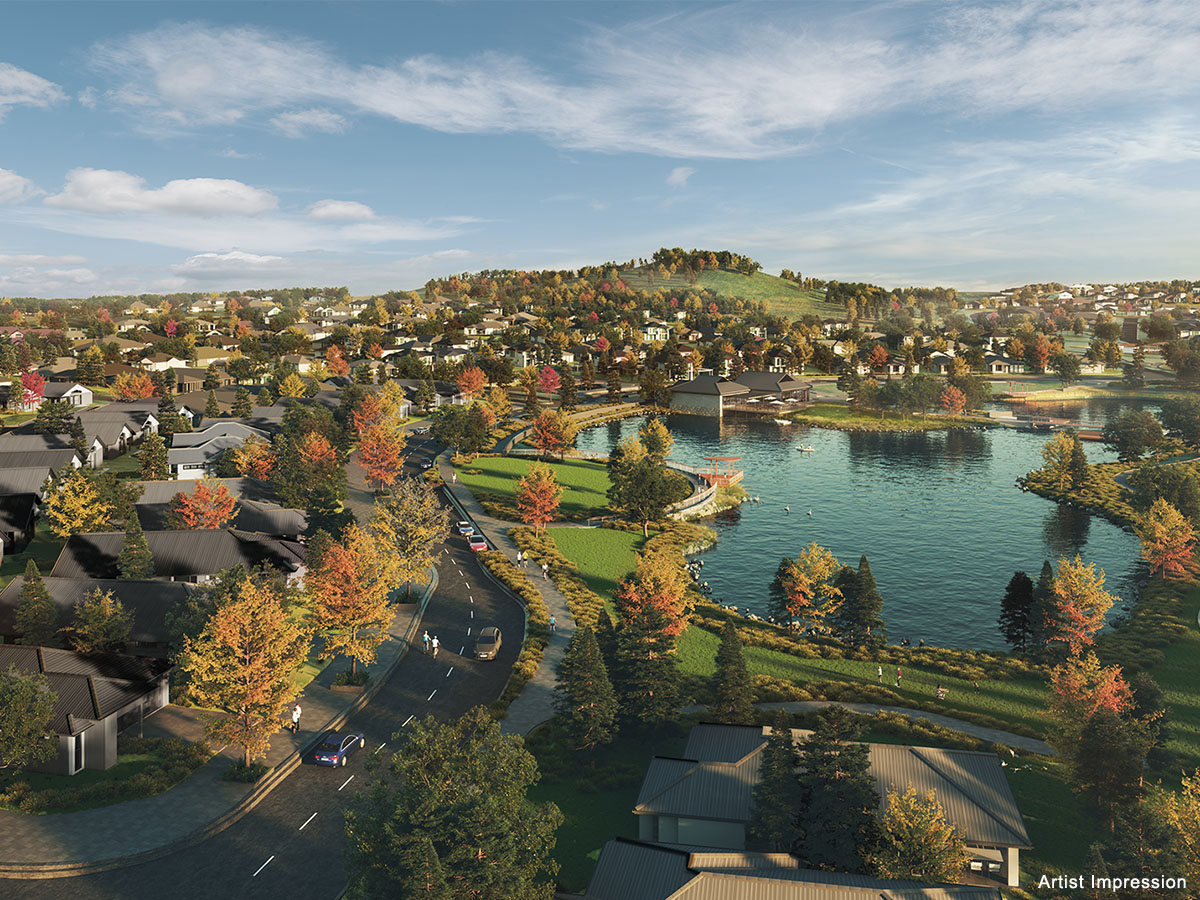
- Stay active with 7.7km of walking and cycling trails connecting you to nature and your neighbourhood.
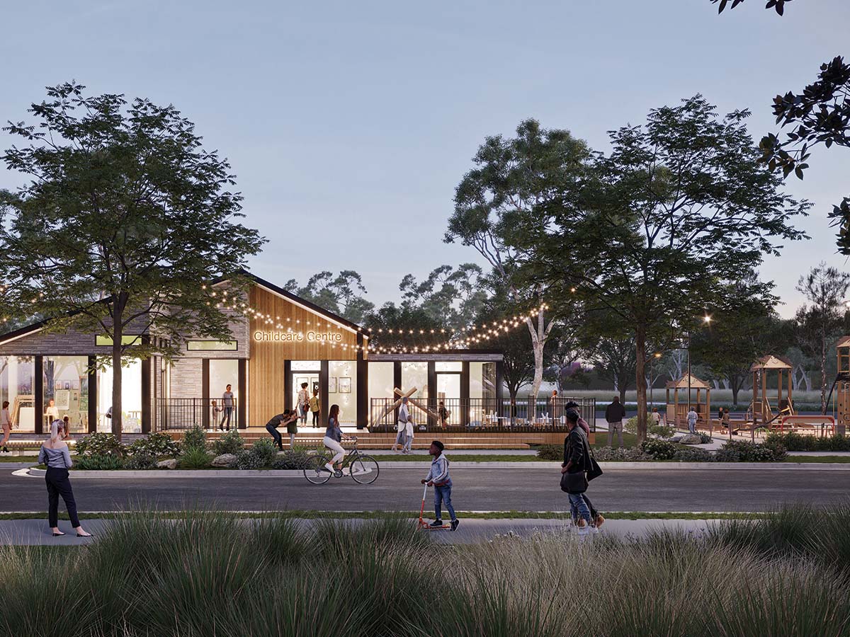
- Ashbourne’s proposed village hub offers shops, dining, childcare, and more – all just a stroll away.
- Live close to education, transit, and direct routes to Sydney and Canberra.
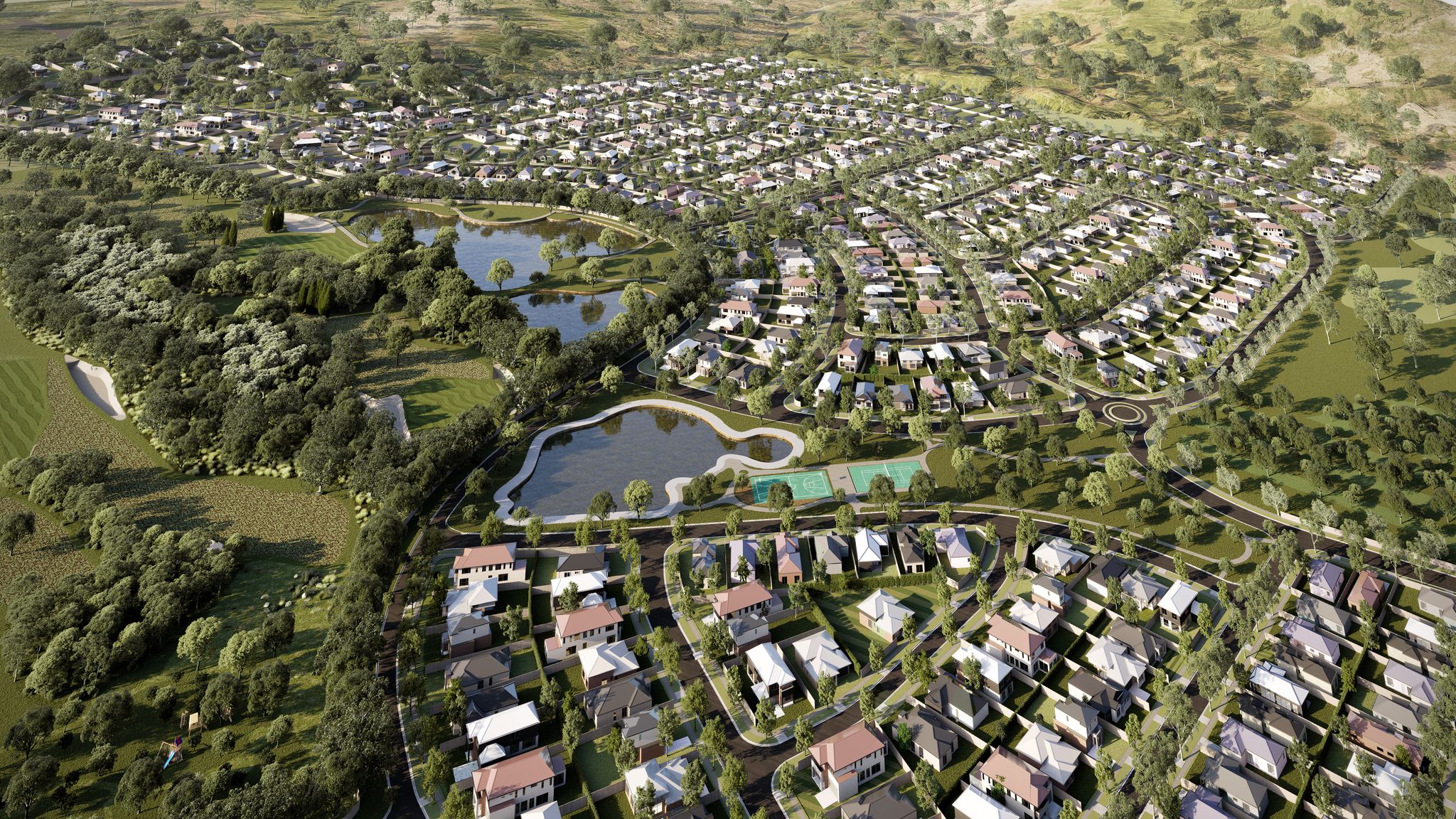
- 32,000sqm Green open spaces that feel like an extension of your backyard
- Long-term growth potential – Invest in a sought-after tree-change region with strong future potential.
- Why Buy Now?
With demand rising in the Southern Highlands and Ashbourne’s masterplanned vision taking shape, property values are set to grow. Buying now means securing your home or investment at today’s prices—before future stages, infrastructure, and amenities drive them higher.
This information is estimated by the OpenLot research team. Let us know here to provide up-to-date information about this development.
| Total new homes | N/A |
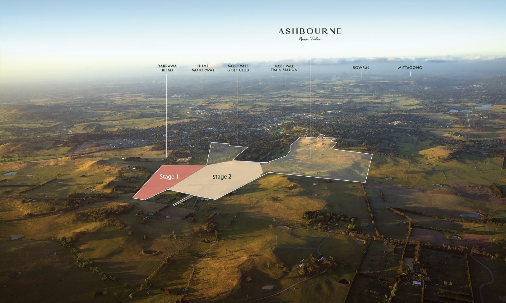
| Area size | 124.00 hectares |
| Growth Region | Wollongong (Illawarra-Shoalhaven Region) |
| City council | Wingecarribee Shire Council |
| Developer | Novm |
| Creative agency | Metropolis |
Land for Sale, House and Land Packages:
9 House and Land Packages in Ashbourne Estate - Moss Vale

 4
4
 2
2
 2
2
6 Land Lots in Ashbourne Estate - Moss Vale
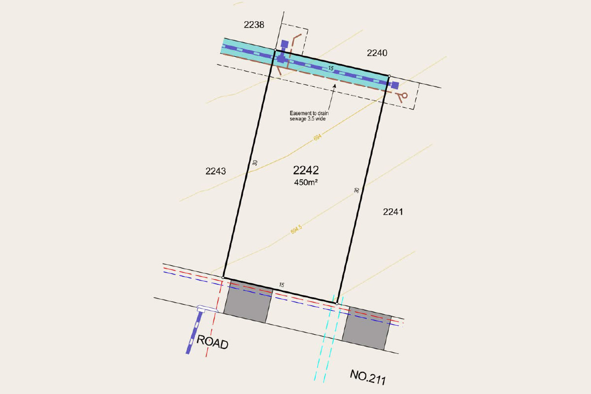
Here, you’ll enjoy the freedom to design a home that reflects your vision, while your north-facing garden becomes a private haven for family gatherings, morning coffees, and golden afternoons in the sun.
This is more than just a lot—it’s your opportunity to embrace the timeless charm of the Southern Highlands, where every day brings your own slice of sunshine.
Enquire Today!
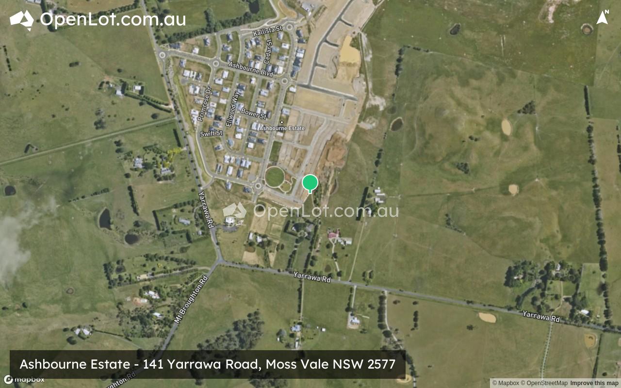
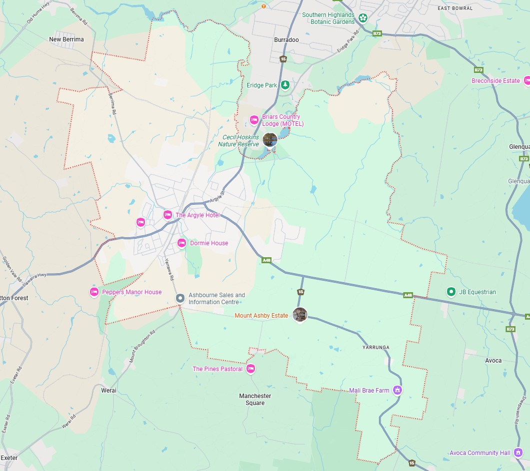
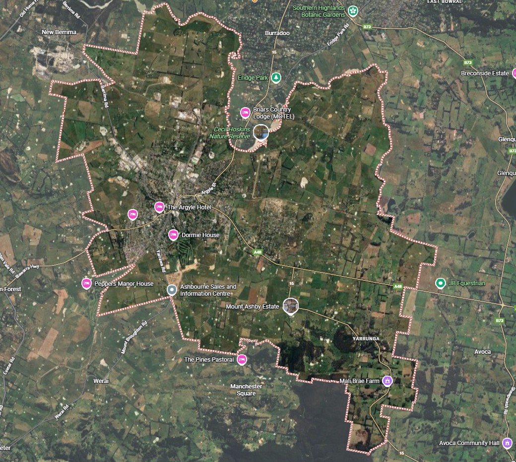
Ashbourne Sales and Information Centre
141 Yarrawa Road, Moss Vale NSW 2577
(Corner of Mt Broughton Rd & Yarrawa Rd)
Opening times:
Monday: 10am – 4pm
Tuesday – Saturday: 9am – 5pm
Sunday: 10am – 4pm
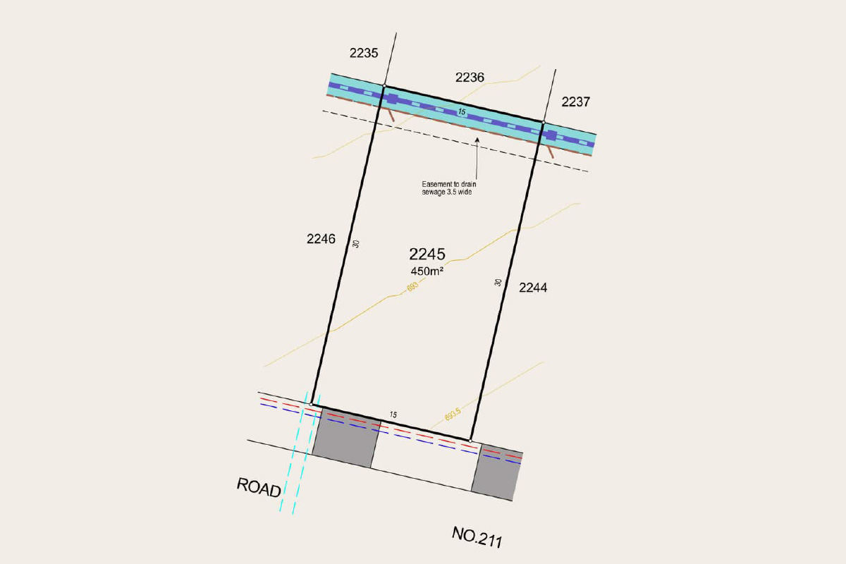
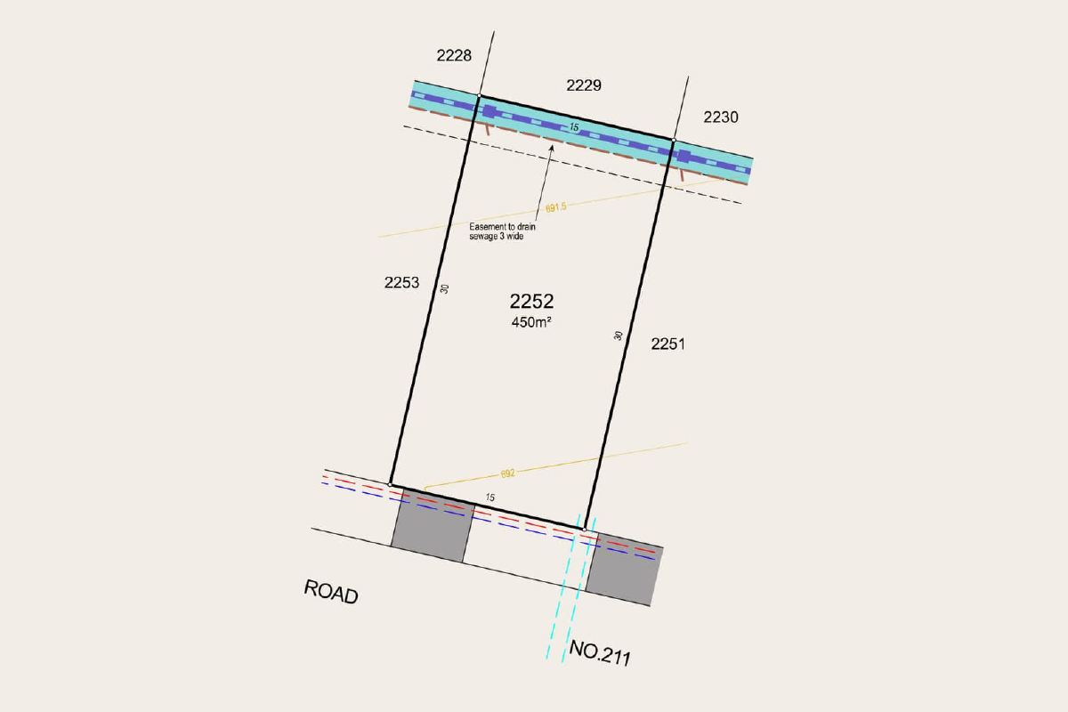
The north-facing backyard invites natural light into your living areas, giving you bright mornings, sun-drenched afternoons, and a garden that feels alive throughout the seasons.
This is more than just land—it’s the foundation for your dream home, set within the beauty of the Southern Highlands, where every day feels open, relaxed, and filled with light.
Ashbourne Sales and Information Centre
141 Yarrawa Road, Moss Vale NSW 2577
(Corner of Mt Broughton Rd & Yarrawa Rd)
Opening times:
Monday: 10am – 4pm
Tuesday – Saturday: 9am – 5pm
Sunday: 10am – 4pm
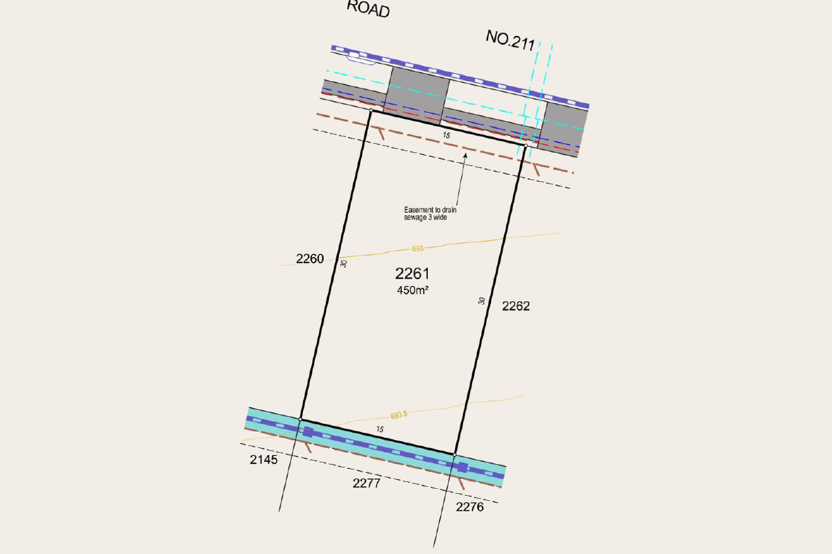
With a north-facing backyard, your living spaces will be naturally bright and welcoming—perfect for morning coffees, weekend barbecues, and long afternoons soaking in the sun.
Set within the charm of the Southern Highlands, this lot is more than land—it’s the beginning of a home and lifestyle that’s truly your own.
Enquire Today!
Ashbourne Sales and Information Centre
141 Yarrawa Road, Moss Vale NSW 2577
(Corner of Mt Broughton Rd & Yarrawa Rd)
Opening times:
Monday: 10am – 4pm
Tuesday – Saturday: 9am – 5pm
Sunday: 10am – 4pm
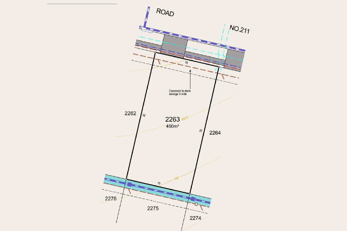
With its north orientation, your living spaces will be naturally bright and welcoming—perfect for morning coffees, weekend barbecues, and long afternoons soaking in the sun.
Set within the charm of the Southern Highlands, this lot is more than land—it’s the beginning of a home and lifestyle that’s truly your own.
Enquire Today!
Ashbourne Sales and Information Centre
141 Yarrawa Road, Moss Vale NSW 2577
(Corner of Mt Broughton Rd & Yarrawa Rd)
Opening times:
Monday: 10am – 4pm
Tuesday – Saturday: 9am – 5pm
Sunday: 10am – 4pm
With a north orientation, the block captures abundant natural light, ensuring interiors feel warm, bright, and inviting throughout the seasons. From family breakfasts to evening gatherings in the garden, every day is enhanced by sunshine and space.
Positioned in the heart of the Southern Highlands, this lot offers more than just land—it offers the foundation for a timeless lifestyle where nature, comfort, and community come together.
Enquire Today!
Ashbourne Sales and Information Centre
141 Yarrawa Road, Moss Vale NSW 2577
(Corner of Mt Broughton Rd & Yarrawa Rd)
Opening times:
Monday: 10am – 4pm
Tuesday – Saturday: 9am – 5pm
Sunday: 10am – 4pm
10am - 4pm
With a north-facing backyard, your living spaces will be naturally bright and welcoming—perfect for morning coffees, weekend barbecues, and long afternoons soaking in the sun.
Set within the charm of the Southern Highlands, this lot is more than land—it’s the beginning of a home and lifestyle that’s truly your own.
Enquire Today!
Ashbourne Sales and Information Centre
141 Yarrawa Road, Moss Vale NSW 2577
(Corner of Mt Broughton Rd & Yarrawa Rd)
Opening times:
Monday: 10am – 4pm
Tuesday – Saturday: 9am – 5pm
Sunday: 10am – 4pm
Updates for Ashbourne Estate - Moss Vale
Facebook updates:
Related news:
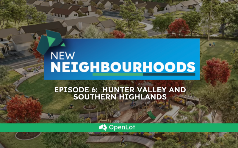
The sixth episode of New Neighbourhoods by OpenLot.com.au takes us on a regional New South Wales road trip, splitting time between the Southern Highlands and the Hunter Valley. Long favoured for cool-climate villages, vineyards and weekend escapes, both regions are now genuine property hotspots. With strong road and rail links to Sydney, Wollongong and Newcastle, buyers are discovering a lifestyle that blends fresh air and space with everyday convenience.
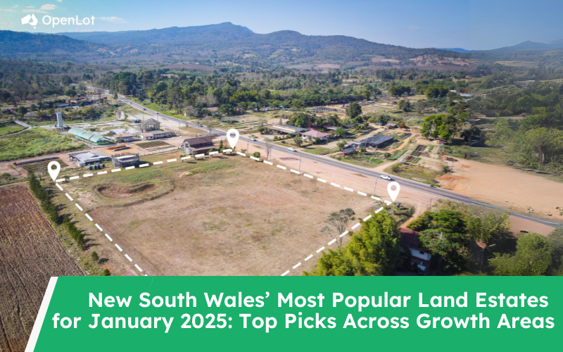
As New South Wales’ property market continues to thrive, several housing estates have emerged as the most sought-after locations for homebuyers and investors alike. Based on data from OpenLot.com.au for January 2025, here are the top five most popular estates in each key region. From Sydney’s bustling growth corridors to the tranquil coastal areas, these estates highlight where buyers are focusing their attention.
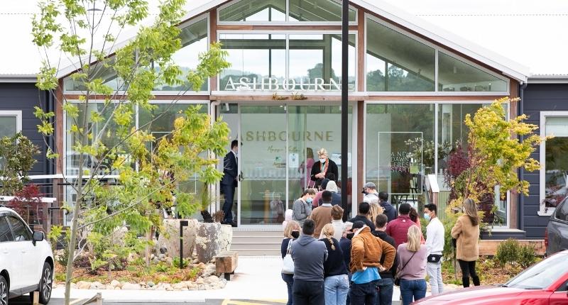
$40M of sales were recorded on Saturday alone
Missing articles? Send us a link here.
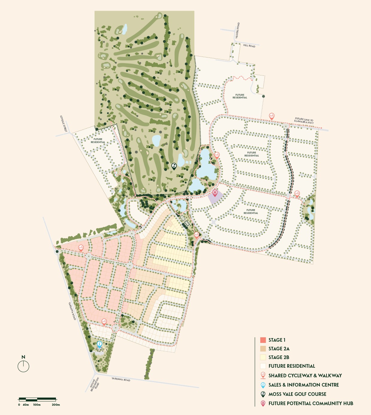
Location & Map for Ashbourne Estate - Moss Vale
Vacancy Rate in Moss Vale NSW 2577
View full vacancy rate history in Moss Vale NSW 2577 via SQM Research.
Schools near Ashbourne Estate - Moss Vale
Here are 6 schools near Ashbourne Estate - Moss Vale:
7-12 Government Secondary School
K-6 Government Primary School
7-12 Independent Secondary School
K-6 Catholic Primary School
K-6 Government Primary School
Suburb Planning Review in Moss Vale NSW 2577
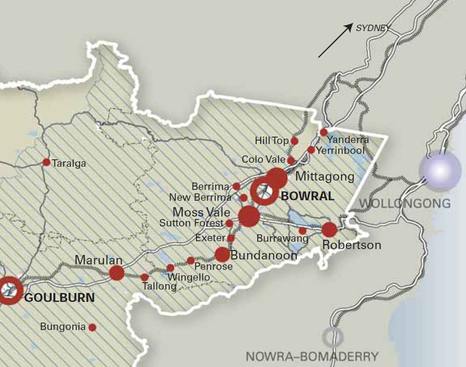
Moss Vale is a suburb of approximately 79.56 square kilometres within the Wingecarribee Shire Council, forming part of the Illawarra region in New South Wales, located 142km south-west of Sydney and 159 kilometres (99 mi) north-east of Canberra.
Moss Vale was first explored by Europeans in the late 1700s. The town's development was spurred by Charles Throsby’s land grant at Bong Bong and the early road network. Moss Vale began to form as a township in 1864 when part of the Throsby Park estate was subdivided in anticipation of the new railway. The local station opened in 1867 as Sutton Forest and was renamed Moss Vale in 1877, with the railway and contemporary land reforms driving the town's early growth.
The suburb is bounded by property lines to the south and east (with Kellys Creek forming part of the eastern boundary), the Illawarra Highway to the west, and the Wingecarribee River and property boundaries to the north.
Argyle Street, Yarrawa Road, and the Illawarra Highway form the primary north-south corridor through the centre of Moss Vale. The Illawarra and Nowra Highways provide connections to the east, while Berrima Road links to the west. The Main Southern railway line runs through the heart of the suburb in a north-south direction.
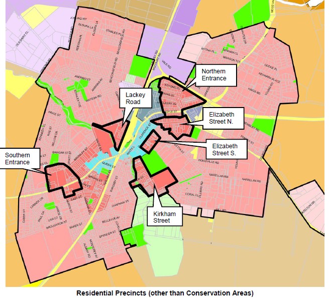
The western and central portions of Moss Vale comprise the urban township, which features schools, a mix of residential densities, retail and commercial areas, parks, and a golf course. The northern part of the urban area is dedicated to industrial uses, while the southeastern and southwestern areas consist of agricultural and rural land.
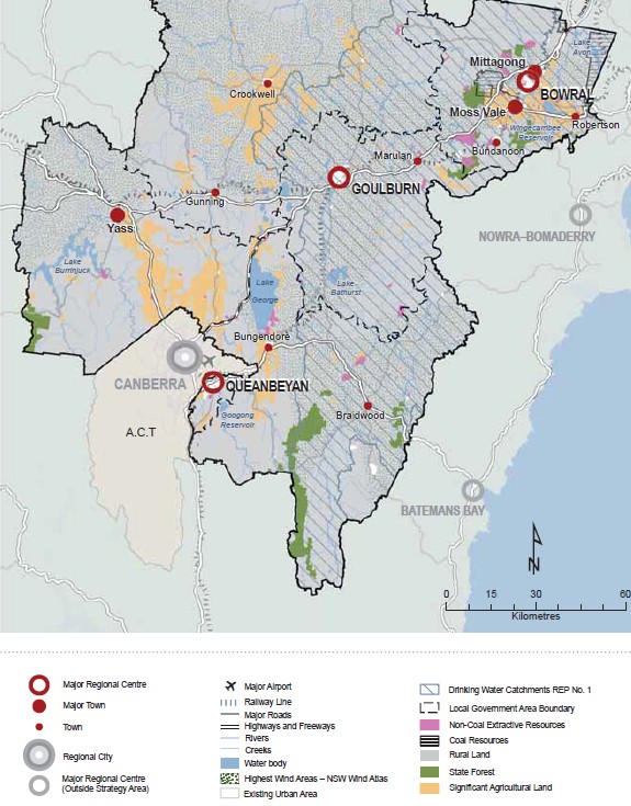
Moss Vale - Sydney–Canberra Corridor Regional Strategy 2008
The Sydney–Canberra Corridor Regional Strategy 2008 was officially endorsed in August 2008 and has since guided key land use planning decisions, including the development of the Wingecarribee Development Control Plans (WDCP) 2010.
Original Strategy Objectives:
- Promote diverse housing (including for an ageing population).
- Concentrate growth in existing towns (Moss Vale to provide 1400 new greenfield lots).
- Protect drinking water catchments (neutral/beneficial effect on quality).
- Plan for employment lands (Moss Vale–Berrima Enterprise Corridor).
- Safeguard biodiversity and environmental corridors.
- Limit rural residential development to protect agricultural land.
- Preserve heritage and rural character.
- Integrate infrastructure with new development.
- Apply neighbourhood planning principles (access to jobs, transport, services).
Moss Vale - Wingecarribee Local Environmental Plan 2010 (WLEP 2010)
The Wingecarribee Local Environmental Plan 2010 (WLEP 2010) was gazetted on 16 June 2010 (latest amendment gazetted on 19 September 2025) and the planning document developed by the Wingecarribee Shire Council in New South Wales (NSW), Australia. It provides the planning framework for land use and development within the Moss Vale area.
Key Purposes of the WLEP 2010:
- Keep towns and villages surrounded by farmland and bushland (no urban sprawl).
- Protect biodiversity, water quality, scenic landscapes, and heritage (Aboriginal & European).
- Support agriculture and stop splitting up viable rural land.
- Focus new housing and jobs near existing town centres with good services and transport.
- Encourage arts, culture, tourism, and sustainable economic growth.
- Reduce bushfire and flood risk.
Provide a mix of housing types (including affordable) without harming the environment.
Draft DCP for Wingecarribee Shire 2025
The primary goals of this project are to:
- Consolidate and Simplify: Combine 17 separate DCPs (which can be complex and confusing) into one comprehensive document, making the development rules clearer and easier to understand for residents, builders, and developers.
- Streamline Development: Create a more consistent and efficient process for assessing development applications across the Shire.
- Retain and Enhance Character: Keep the existing rules that protect the unique character of the Shire's towns, villages, and rural landscapes, while updating and enhancing them where necessary.
What the New DCP Will Cover
The new DCP will provide objectives and controls for a wide range of developments, including:
- Low Density Housing: Houses, dual occupancies, granny flats, pools, and studios.
- Medium Density Housing: Townhouses and residential flat buildings.
- Heritage: Changes to heritage items and buildings in conservation areas.
- Town Centres: New buildings, land uses, and public spaces to create vibrant and safe streets.
- Seniors Housing: Ensuring compatibility with surroundings and high amenity.
- Rural Development: Protecting agricultural land and maintaining visual quality.
- Natural Environments: Protecting water quality, biodiversity, and vegetation.
- Industrial Development: Supporting employment while ensuring positive streetscape contributions.
- Subdivisions: Guidance for residential, industrial, and large-scale new living areas.
Current Status (As of the Provided Information)
The project is currently in an active development phase.
Latest Milestone (June 18, 2025): The Wingecarribee Shire Council provided "in principle" support for the Draft DCP Template. This template is the structure and outline of the new DCP, not the final detailed document.
Current Phase: Council is now in the "Preparation of Draft DCP and targeted consultation" phase. This means they are writing the detailed content for the DCP based on the approved template and consulting with specific stakeholder groups.
Future Steps: The draft DCP will later be endorsed for a formal public exhibition period, where the entire community will have the opportunity to review the full document and provide formal feedback before it is finally adopted.
Moss Vale - Wingecarribee Development Control Plans
The Wingecarribee Development Control Plans provide the planning and design framework for the development the use of land within the Shire, providing guidelines for evaluating development proposals, specifying requirements for different land uses, and aims to ensure that new developments consider environmental, community, and economic factors while fitting the local context.
Key Features
Based on the Moss Vale Master Plan, developed by Queanbeyan City Council using CIC Australia's plan.
Prepared in line with Clause 6.3 of the Queanbeyan Local Environmental Plan 2012 (QLEP 2012), which requires a DCP before development consent can be granted in Moss Vale.
Sets out urban design guidelines, land use controls, and objectives to shape future growth.
Moss Vale Township Development Control Plan
The Moss Vale Master Plan, developed by Wingecarribee Shire Council in 2010 and updated several times with the latest 1 January 2021. The Moss Vale Township Development Control Plan outlines the planning controls and guidelines for development within the township.
It includes provisions for various land uses, such as residential, business, and industrial, and addresses issues like Ecologically Sustainable Development, flood management, vegetation management, subdivision, siting, design within a heritage context, and safety. The plan also specifies controls for business-zoned land, residential-zoned land, and public domain areas, ensuring that development aligns with the township's vision and character.
Key Features:
The main features focus on:
Environmental Sustainability: Promoting ecologically sustainable development and preserving native vegetation.
Risk Management: Providing guidelines for building on flood-prone land and ensuring safety in design and signage.
Community and Heritage: Regulating subdivisions and ensuring new developments respect the existing heritage landscape.
Objectives:
Ecologically Sustainable Development: Promoting the use of environmentally friendly practices in development.
Flood Liable Land Management: Ensuring that development does not occur on flood-prone areas.
Vegetation Management: Preserving native vegetation and preventing its destruction.
Subdivision and Siting Matters: Controlling the design and placement of subdivisions to maintain the town's character.
Design within a Heritage Context: Incorporating the town's historical and cultural heritage into development plans.
Design for Safety: Ensuring that developments are safe for occupants and the community.
Signage: Providing clear and effective signage to guide the public and enhance the town's image.
Moss Vale Township Development Control Plan
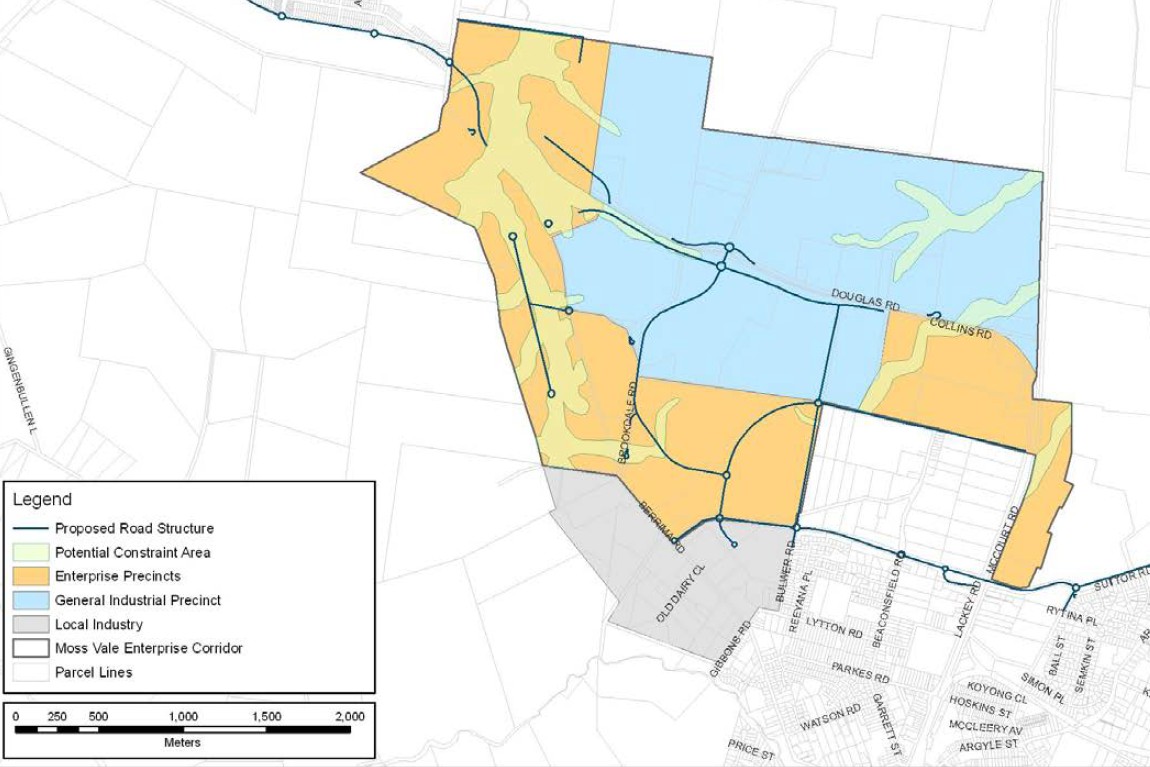
Moss Vale Enterprise Corridor DCP
This document is a detailed planning rulebook created by Wingecarribee Shire Council to guide the transformation of a specific area in the north-east of the Moss Vale township into a major employment and industrial hub. Its primary goal is to facilitate industrial and business development in an orderly and sustainable way, while protecting the area's environmental and scenic values.
Key Points
Minimum lot sizes: 5,000m² (Enterprise), 1 hectare (General Industrial)
Building height limits: 15m near Berrima Road, 20m elsewhere
Building setbacks: 15m from arterial roads, 10m from other roads
Maximum site coverage: 65%
Direct access to arterial roads prohibited
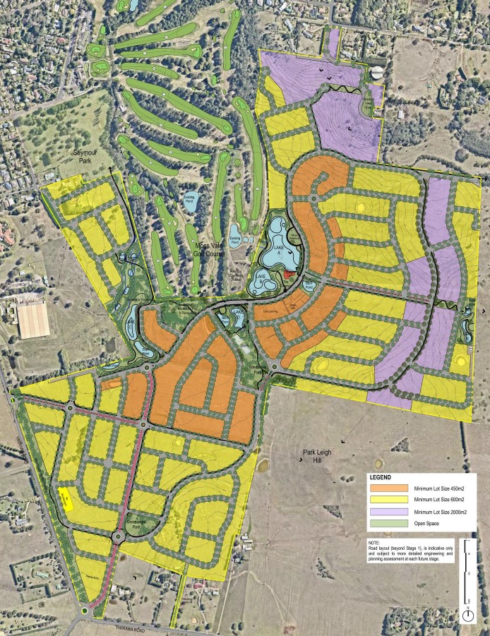
Moss Vale - Chelsea Gardens Coomungie Precinct DCP
This document provides the detailed rules and vision for a new, master-planned residential community south of the existing golf course in Moss Vale. It guides how the land will be subdivided, how streets and parks will be built, and the design of houses and a local village hub.
Key Points:
Vision: To create an authentic Southern Highlands community that is in harmony with nature, offers diverse housing, and promotes a healthy, connected, and walkable lifestyle
Key Features:
- Staged Development: The project will be built in phases over several years.
- Diverse Housing: A mix of lot sizes, from smaller "Courtyard" lots to larger "Parkland" and "Special Character" lots.
- Strong Landscape Character: Tree-lined streets, extensive parks, and a protected creek corridor are central to the design.
- Integrated Village Hub: A small, low-scale neighbourhood centre with shops and services, designed to be pedestrian-friendly.
- Sustainable Design: Focus on managing stormwater with ponds and wetlands, protecting ecology, and ensuring solar access for homes.
- Detailed Residential Controls: Strict rules on building design, materials, fencing, and garages to ensure a consistent, high-quality streetscape that reflects the local character.
Moss Vale Summary
References
- https://www.planning.nsw.gov.au/-/media/files/plep/regional-strategies/sydney-canberra-corridor-regional-strategy-2008.pdf
- https://legislation.nsw.gov.au/view/whole/html/inforce/current/epi-2010-0685
- https://www.wsc.nsw.gov.au/Development-Control-Plans
- https://participate.wsc.nsw.gov.au/comprehensive-dcp
- https://www.wsc.nsw.gov.au/Planning-and-Building
- https://www.wsc.nsw.gov.au/Local-Strategic-Planning-Statement
- https://www.mossvaletownship.com.au/masterplan
Reviews & Comments on Ashbourne Estate - Moss Vale
Estate Brochure, Masterplan, Engineering Plan, Plan of Subdivision (POS), Design Guidelines
FAQs about Ashbourne Estate - Moss Vale
View all estates from Novm
- Moss Vale High School - 2.4km north-east
- Moss Vale Public School - 2.5km north
- St Paul's International College - 2.6km north
- St Paul's Catholic Primary School - 2.9km north
- Exeter Public School - 7.0km south-west
Popular Estates near Ashbourne Estate - Moss Vale


Latest New Home Articles for You

16/Mar/2026 | OpenLot.com.au
New South Wales: Top 30 Most Searched Housing Developments (February 2026)
If you’ve been considering a move in New South Wales, February 2026 provi...

09/Mar/2026 | OpenLot.com.au
Victoria: Top 30 Most Searched Housing Developments (February 2026)
If you’ve been exploring housing opportunities in Victoria, February 2026...

20/Feb/2026 | OpenLot.com.au
Display Homes at Drouin Fields Estate: A Thriving Community in Drouin
Welcome to Drouin Fields, a place where beauty, space, and modern luxury ...

19/Feb/2026 | OpenLot.com.au
Display Homes at Manor Lakes Esate: A Thriving Waterside Community in Manor Lakes
A place where you can settle in, rather than just settle down. Named for ...

13/Feb/2026 | OpenLot.com.au
🏠 Victoria: Top 30 Most Searched Townhouse Developments – January 2026

11/Feb/2026 | OpenLot.com.au
🏡 Top 30 Most Searched Estates by State - January 2026

10/Feb/2026 | OpenLot.com.au
Victoria: Top 30 Most Searched Housing Developments (January 2026)
If you’ve been considering making a move in Victoria, January 2026 offere...

10/Feb/2026 | OpenLot.com.au
Queensland: Top 30 Most Searched Housing Developments (January 2026)
If you’ve been considering making a move in Queensland, January 2026 offe...

09/Feb/2026 | OpenLot.com.au
Western Australia: Top 30 Most Searched Housing Developments (January 2026)
If you’ve been considering making a move in Western Australia, January 20...