


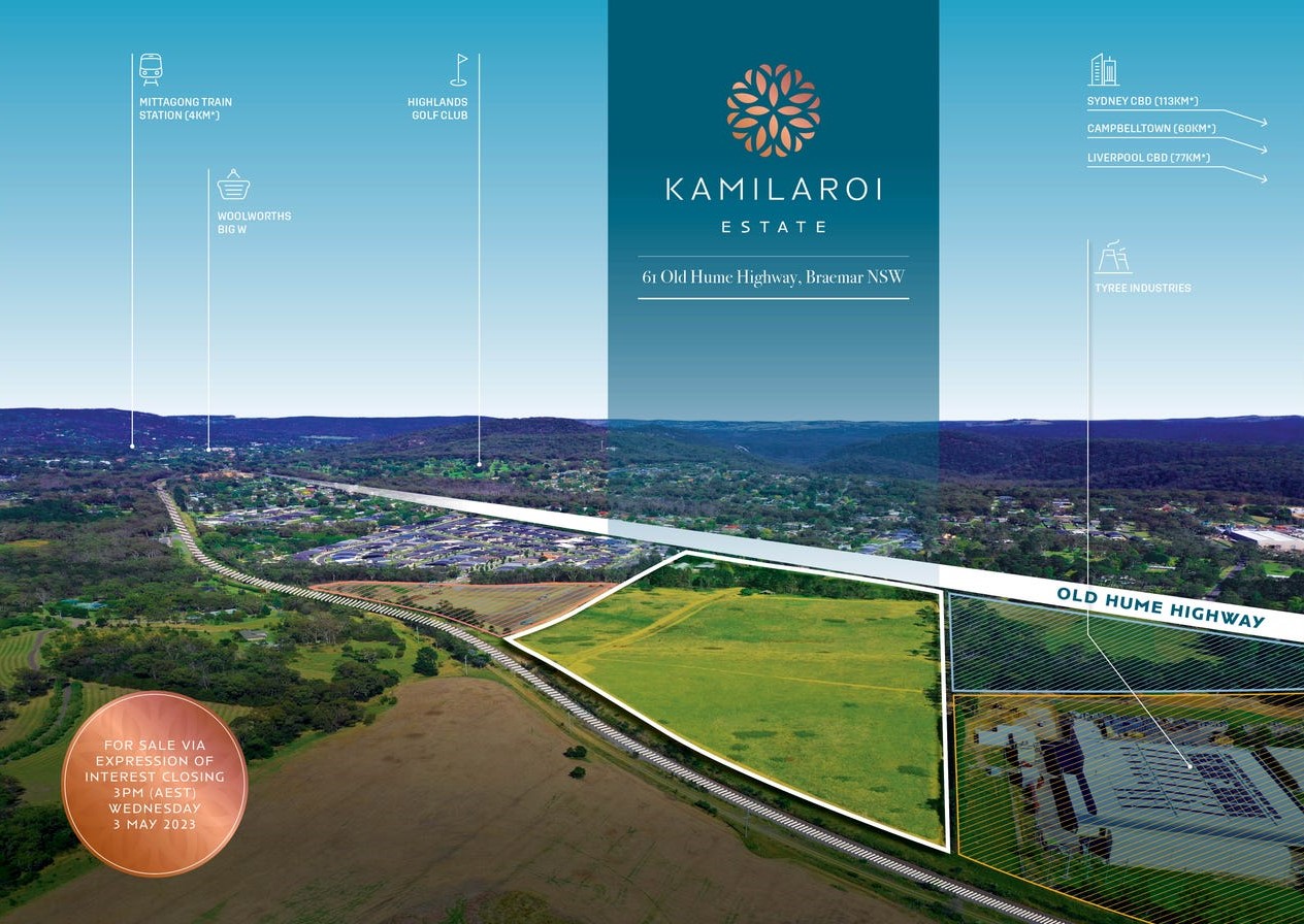
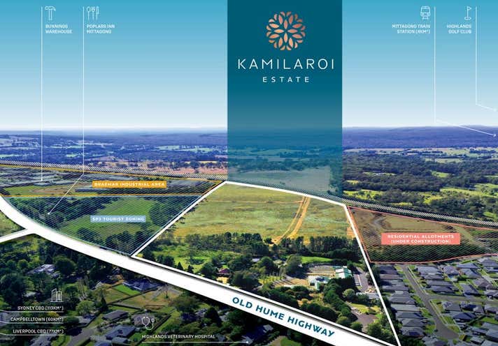
Kamilaroi Estate - Braemar IN PLANNING
This information is estimated by the OpenLot research team. Let us know here to provide up-to-date information about this development.
| Total new homes | 129 |
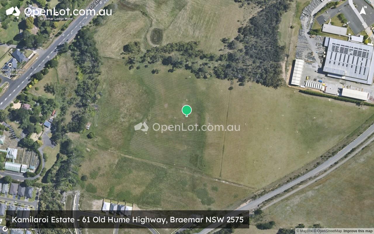
| Area size | 17.31 hectares |
| Growth Region | Wollongong (Illawarra-Shoalhaven Region) |
| City council | Wingecarribee Shire Council |
| Developer | N/A |
| Distance to | Sydney CBD - 90 km south-west |
Land for Sale, House and Land Packages:
Popular Estates near Kamilaroi Estate - Braemar


 4
4
 2
2
 2
2


Updates for Kamilaroi Estate - Braemar
Facebook updates:
Related news:
Sold development sites & land at Kamilaroi Estate, 61 Old Hume Highway, Braemar, NSW 2575. Find more about the sold price, property information, and photos on realcommercial.com.au.
Missing articles? Send us a link here.
Location & Map for Kamilaroi Estate - Braemar
Vacancy Rate in Braemar NSW 2575
View full vacancy rate history in Braemar NSW 2575 via SQM Research.
Schools near Kamilaroi Estate - Braemar
Here are 6 schools near Kamilaroi Estate - Braemar:
U Government Special School
U Government Special School
K-6 Catholic Primary School
K-6 Government Primary School
7-12 Independent Secondary School
K-6 Government Primary School
Reviews & Comments on Kamilaroi Estate - Braemar
Estate Brochure, Masterplan, Engineering Plan, Plan of Subdivision (POS), Design Guidelines
FAQs about Kamilaroi Estate - Braemar
- Highlands School - 2.4km south
- Tangara School - 2.5km south-west
- St Michael's Catholic Primary School - 3.5km south-west
- Colo Vale Public School - 3.6km north
- Frensham School - 3.8km south-west
- Mittagong Public School - 4.0km south-west
Popular Estates near Kamilaroi Estate - Braemar
Latest New Home Articles for You

09/Mar/2026 | OpenLot.com.au
Victoria: Top 30 Most Searched Housing Developments (February 2026)
If you’ve been exploring housing opportunities in Victoria, February 2026...

20/Feb/2026 | OpenLot.com.au
Display Homes at Drouin Fields Estate: A Thriving Community in Drouin
Welcome to Drouin Fields, a place where beauty, space, and modern luxury ...

19/Feb/2026 | OpenLot.com.au
Display Homes at Manor Lakes Esate: A Thriving Waterside Community in Manor Lakes
A place where you can settle in, rather than just settle down. Named for ...

13/Feb/2026 | OpenLot.com.au
🏠 Victoria: Top 30 Most Searched Townhouse Developments – January 2026

11/Feb/2026 | OpenLot.com.au
🏡 Top 30 Most Searched Estates by State - January 2026

10/Feb/2026 | OpenLot.com.au
Victoria: Top 30 Most Searched Housing Developments (January 2026)
If you’ve been considering making a move in Victoria, January 2026 offere...

10/Feb/2026 | OpenLot.com.au
Queensland: Top 30 Most Searched Housing Developments (January 2026)
If you’ve been considering making a move in Queensland, January 2026 offe...

09/Feb/2026 | OpenLot.com.au
Western Australia: Top 30 Most Searched Housing Developments (January 2026)
If you’ve been considering making a move in Western Australia, January 20...

06/Feb/2026 | OpenLot.com.au
South Australia: Top 30 Most Searched Housing Developments (January 2026)
If you’ve been considering making a move in South Australia, January 2026...