Chantelle Circuit, Coral Cove QLD 4670 SOLD OUT
This information is estimated by the OpenLot research team. Let us know here to provide up-to-date information about this development.
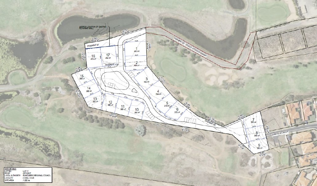
| Total new homes | 17 |
| Area size | 1.28 hectares |
| Growth Region | Hervey Bay (Wide Bay–Burnett Region) |
| City council | Bundaberg Regional Council |
| Developer | Deluxe Property Group |
Land for Sale, House and Land Packages:
Popular Estates near Chantelle Circuit, Coral Cove


Updates for Chantelle Circuit, Coral Cove
Facebook updates:
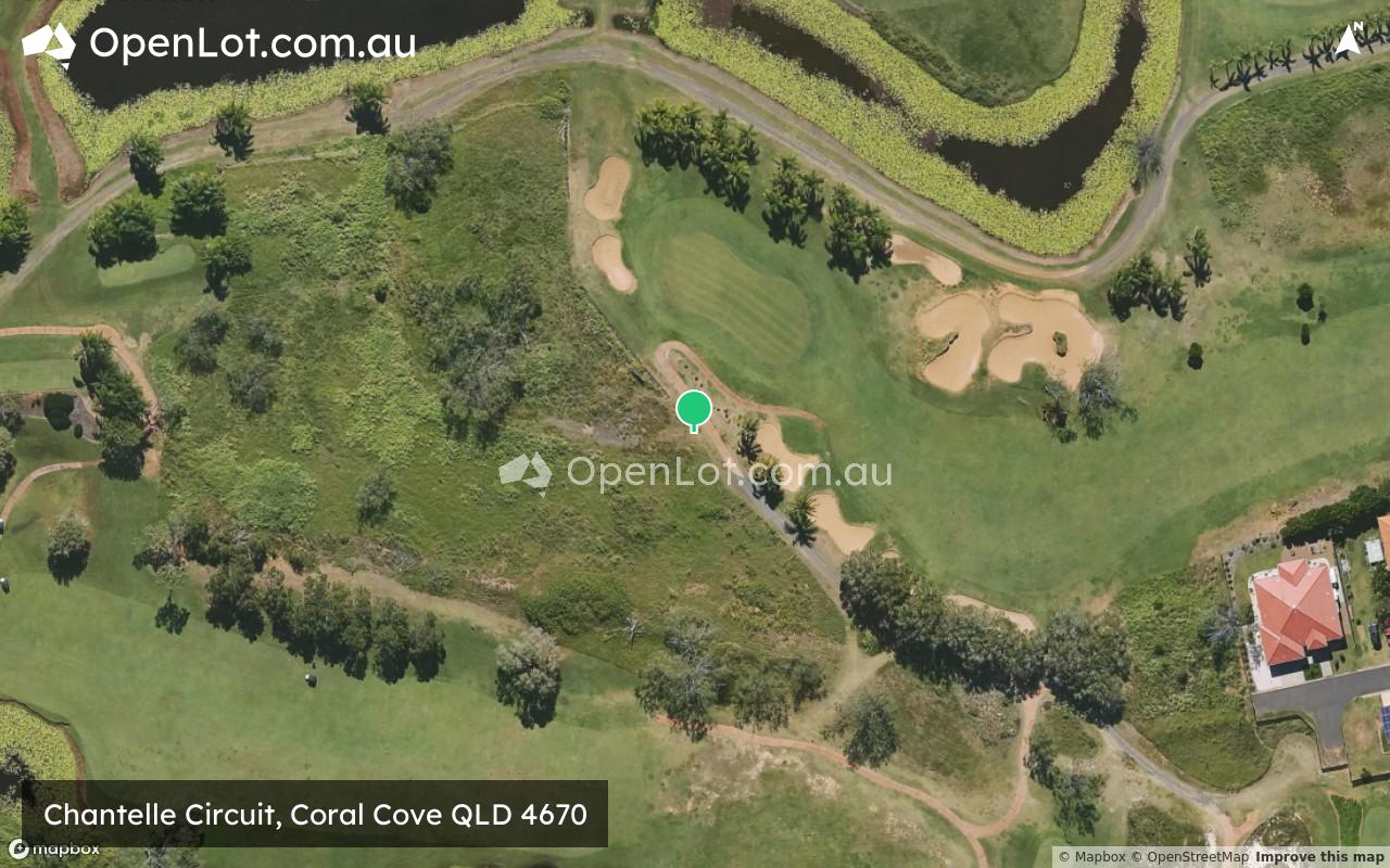
Location & Map for Chantelle Circuit, Coral Cove
Vacancy Rate in Coral Cove QLD 4670
View full vacancy rate history in Coral Cove QLD 4670 via SQM Research.
Schools near Chantelle Circuit, Coral Cove
Here are 6 schools near Chantelle Circuit, Coral Cove:
Prep-6 Government Primary School
Prep-6 Government Primary School
Prep-12 Independent Combined School
Prep-6 Government Primary School
Prep-6 Government Primary School
Prep-12 Independent Combined School
Reviews & Comments on Chantelle Circuit, Coral Cove
Estate Brochure, Masterplan, Engineering Plan, Plan of Subdivision (POS), Design Guidelines
FAQs about Chantelle Circuit, Coral Cove
View all estates from Deluxe Property Group
- Elliott Heads State School - 2.2km south
- Woongarra State School - 7.9km west
- Bundaberg Christian College - 8.0km west
- Bargara State School - 8.7km north-west
- Kalkie State School - 10.0km north-west
- St Luke's Anglican School - 10.4km west
Popular Estates near Chantelle Circuit, Coral Cove
Latest New Home Articles for You

27/Jan/2026 | OpenLot.com.au
Display Homes at Stockland Wildflower Estate: A Smart Community in Piara Waters
Welcome to Wildflower, a vibrant new neighbourhood nestled in the heart o...

16/Jan/2026 | OpenLot.com.au
South Australia Top 30 Most Searched Housing Developments (December 2025)

15/Jan/2026 | OpenLot.com.au
Queensland: Top 30 Most Searched Housing Developments (December 2025)
If you’ve been tracking housing demand across Queensland, December 2025 p...

14/Jan/2026 | OpenLot.com.au
Victoria: Top 30 Most Searched Housing Developments (December 2025)
If you’ve been exploring housing opportunities in Victoria, December 2025...

14/Jan/2026 | OpenLot.com.au
Display Homes at Apsley Estate: A Masterplanned Community in Mandogalup
Apsley is a bold, 1,800-lot masterplanned community just 25 minutes south...

13/Jan/2026 | OpenLot.com.au
Western Australia: Top 30 Most Searched Housing Developments (December 2025)
If you’ve been keeping an eye on housing demand across Western Australia,...

12/Jan/2026 | OpenLot.com.au
New South Wales: Top 30 Most Searched Housing Developments (December 2025)
If you’ve been considering making a move in New South Wales, December 202...

07/Jan/2026 | OpenLot.com.au
🏡 Top 30 Most Searched Estates by State - December

06/Jan/2026 | OpenLot.com.au
Display Homes Near Me (WA): Your Complete Guide to Display Villages Across Western Australia
Finding the right display home in Western Australia has never been easier...