

Harvest Estate - Runcorn
[NEW RELEASE] Harvest Signature Runcorn. 24 New Luxury Residences
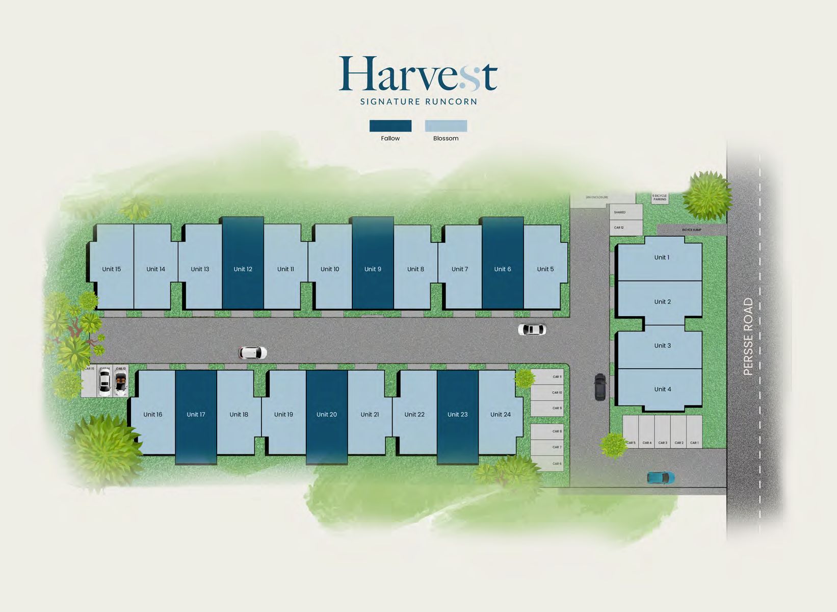
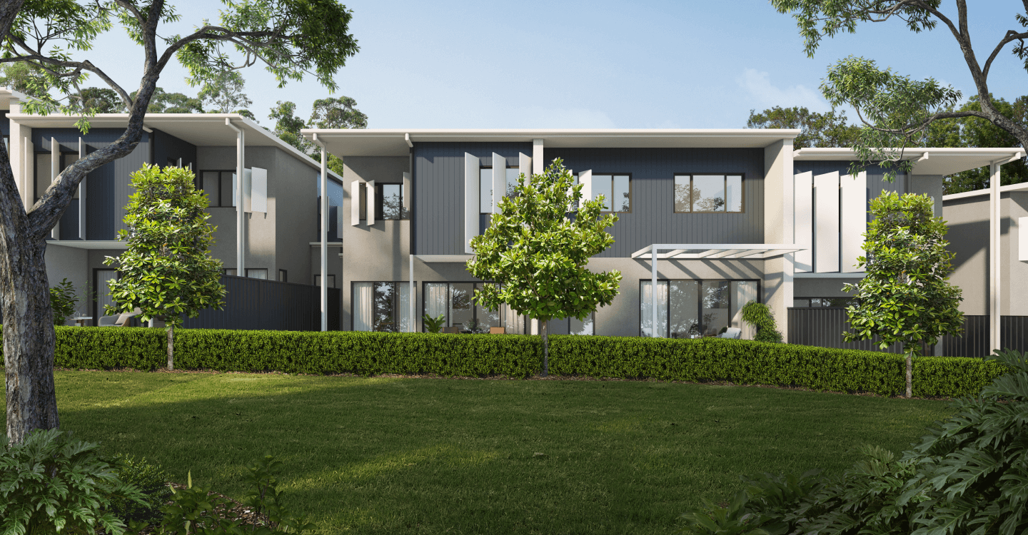
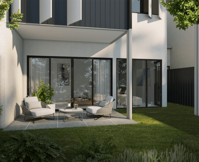
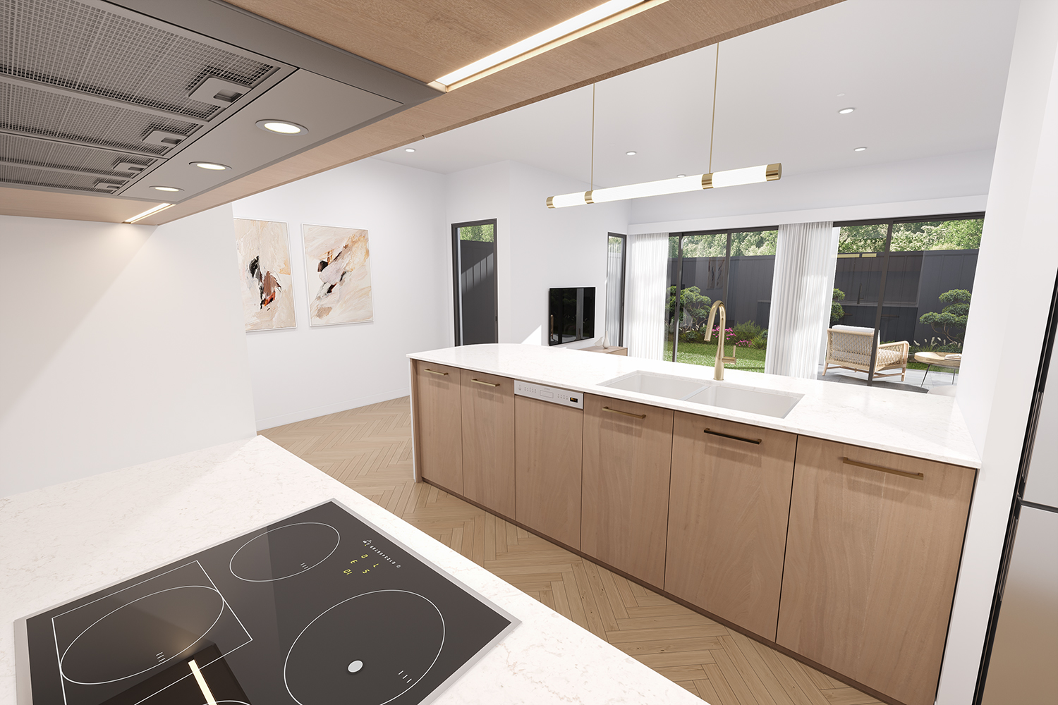
- Welcome to ‘Harvest’ developed by Signature Holdings. An exciting new development in the heart of Runcorn consisting of 24 ultra-high-end townhomes with large open floor plans and completed with high end fittings and finishes throughout.
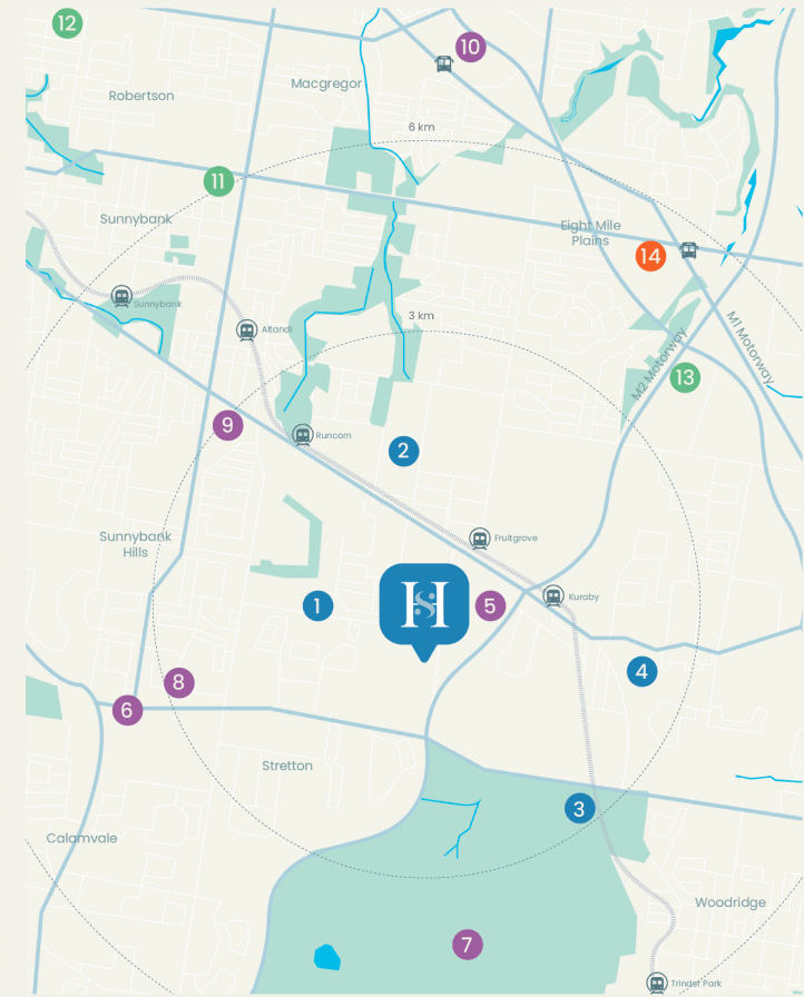
- Well positioned in a booming suburb of Runcorn where you will enjoy the peaceful and yet convenient lifestyle living! You are minutes to all the local amenities including the elite schools, Runcorn train station and city buses, Sunnybank Plaza and Garden City Shopping Centre. You can also easily access to the Pacific Motorway and the Gateway Motorway direct you to the Brisbane CBD, Gold Coast and the Airport.
- A mixture of 3 beds + 2 living areas and 4 bedrooms
- Enjoy the peaceful and yet very convenient lifestyle living
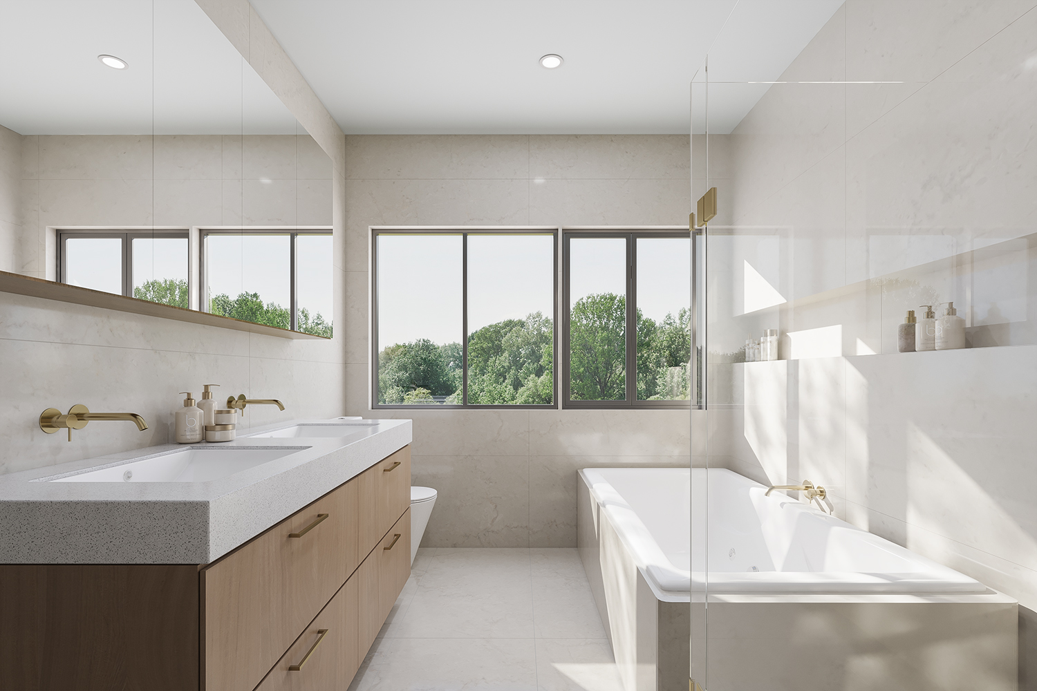
- Beautifully designed with an abundant space and superior finishes
- 2.7m high ceilings on both levels, herringbone flooring and quality carpets
- Reputation builder and developer with a track record
- Low body corporate fee
- Well under construction and due to complete in 2026
This information is estimated by the OpenLot research team. Let us know here to provide up-to-date information about this development.
| Total new homes | 24 |
| Area size | 1.02 hectares |
| Growth Region | Greater Brisbane Growth Areas |
| City council | Brisbane City Council |
| Developer | Signature Holdings |
| Project marketer | Ray White Sunnybank Hills |
| Creative agency | Desketing |
| Distance to | Brisbane CBD - 16 km south Brisbane Airport - 24 km south |
Townhomes:
Popular Estates near Harvest Estate - Runcorn


Updates for Harvest Estate - Runcorn
Facebook updates:
Related news:

Missing articles? Send us a link here.
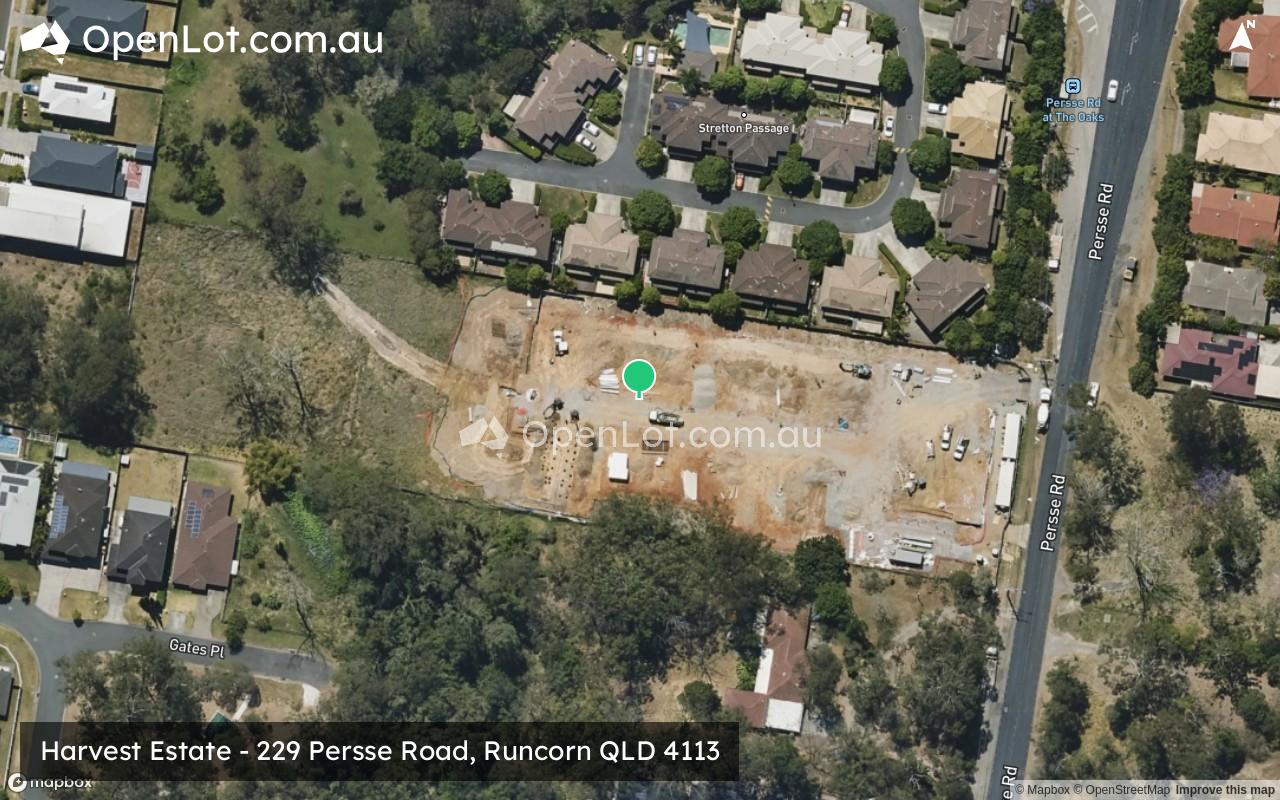
Location & Map for Harvest Estate - Runcorn
Visit Display Homes near Harvest Estate - Runcorn


Vacancy Rate in Runcorn QLD 4113
View full vacancy rate history in Runcorn QLD 4113 via SQM Research.
Schools near Harvest Estate - Runcorn
Here are 6 schools near Harvest Estate - Runcorn:
Prep-6 Government Primary School
Prep-12 Government Special School
7-12 Government Secondary School
Prep-6 Government Primary School
Prep-12 Independent Combined School
Prep-6 Government Primary School
Reviews & Comments on Harvest Estate - Runcorn
Estate Brochure, Masterplan, Engineering Plan, Plan of Subdivision (POS), Design Guidelines
FAQs about Harvest Estate - Runcorn
View all estates from Signature Holdings
View all estates marketed by Ray White Sunnybank Hills
- Runcorn Heights State School - 928m west
- Kuraby Special School - 1.3km east
- Runcorn State High School - 1.6km north
- Kuraby State School - 1.7km east
- Islamic College of Brisbane - 1.8km south-east
- Warrigal Road State School - 2.4km north
Popular Estates near Harvest Estate - Runcorn
Latest New Home Articles for You

09/Mar/2026 | OpenLot.com.au
Victoria: Top 30 Most Searched Housing Developments (February 2026)
If you’ve been exploring housing opportunities in Victoria, February 2026...

20/Feb/2026 | OpenLot.com.au
Display Homes at Drouin Fields Estate: A Thriving Community in Drouin
Welcome to Drouin Fields, a place where beauty, space, and modern luxury ...

19/Feb/2026 | OpenLot.com.au
Display Homes at Manor Lakes Esate: A Thriving Waterside Community in Manor Lakes
A place where you can settle in, rather than just settle down. Named for ...

13/Feb/2026 | OpenLot.com.au
🏠 Victoria: Top 30 Most Searched Townhouse Developments – January 2026

11/Feb/2026 | OpenLot.com.au
🏡 Top 30 Most Searched Estates by State - January 2026

10/Feb/2026 | OpenLot.com.au
Victoria: Top 30 Most Searched Housing Developments (January 2026)
If you’ve been considering making a move in Victoria, January 2026 offere...

10/Feb/2026 | OpenLot.com.au
Queensland: Top 30 Most Searched Housing Developments (January 2026)
If you’ve been considering making a move in Queensland, January 2026 offe...

09/Feb/2026 | OpenLot.com.au
Western Australia: Top 30 Most Searched Housing Developments (January 2026)
If you’ve been considering making a move in Western Australia, January 20...

06/Feb/2026 | OpenLot.com.au
South Australia: Top 30 Most Searched Housing Developments (January 2026)
If you’ve been considering making a move in South Australia, January 2026...