Hinton Loop Estate - Oran Park SOLD OUT
This information is estimated by the OpenLot research team. Let us know here to provide up-to-date information about this development.
| Total new homes | 60 |
| Area size | 2.10 hectares |
| Growth Region | Sydney South West Growth Areas |
| City council | Camden Council |
| Developer | AVID Property Group, Villaworld Homes |
| Distance to | Sydney Airport - 40 km west Sydney CBD - 43 km west |
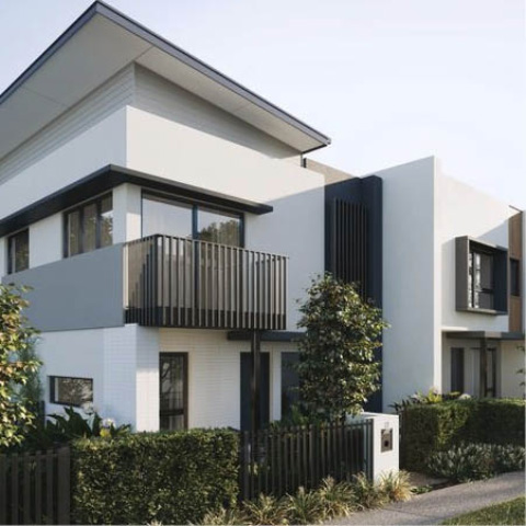
Townhomes:
Popular Estates near Hinton Loop Estate - Oran Park


 5
5
 3
3
 2
2


Updates for Hinton Loop Estate - Oran Park
Facebook updates:
Submit the Facebook page for Hinton Loop Estate - Oran Park.
Related news:
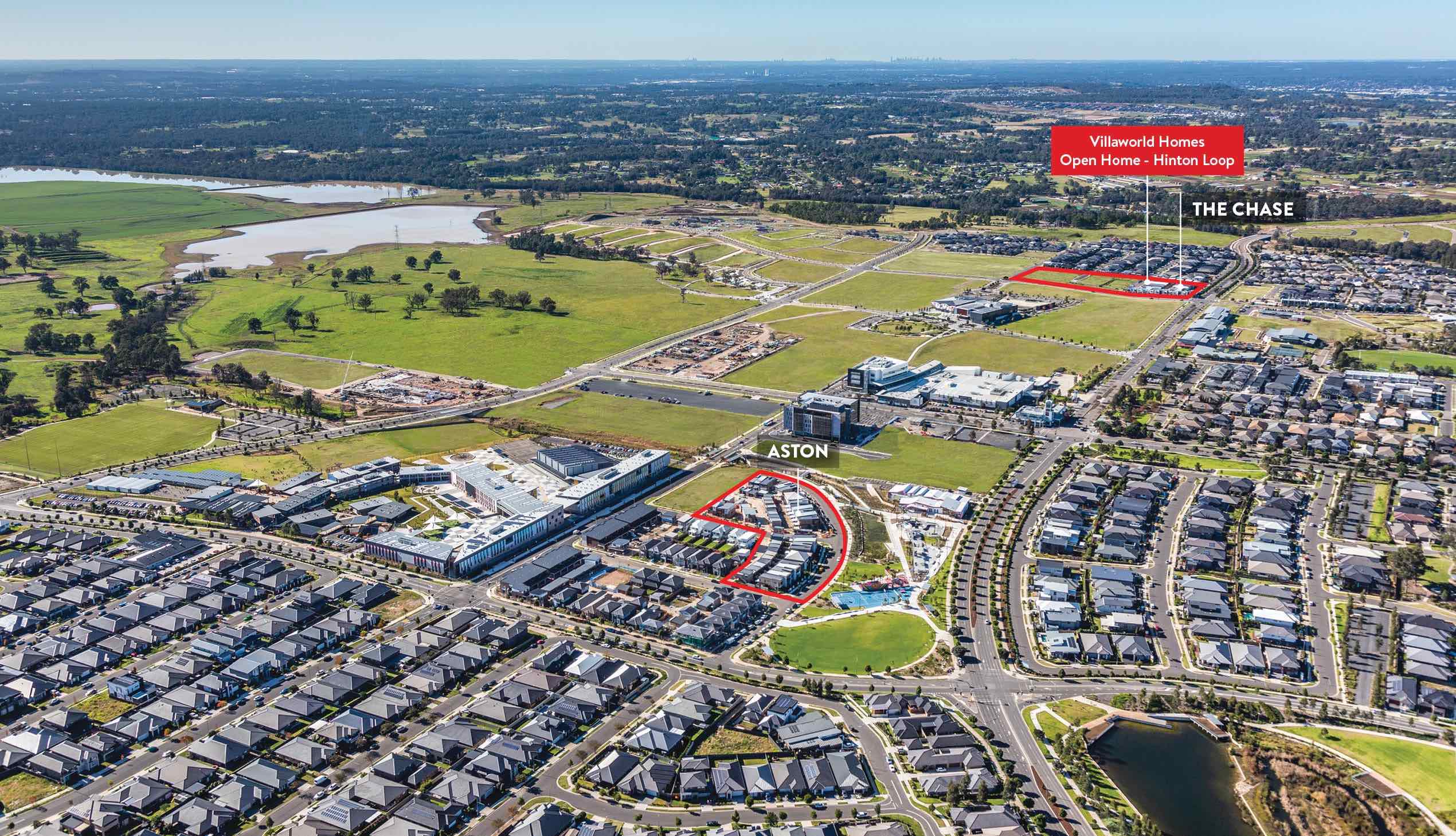
The Chase at Oran Park consists of 27, two storey townhomes across 2 stages. DC8 Studio was engaged by Villa World to design develope the approved designs and prepare documentation for construction.

Missing articles? Send us a link here.
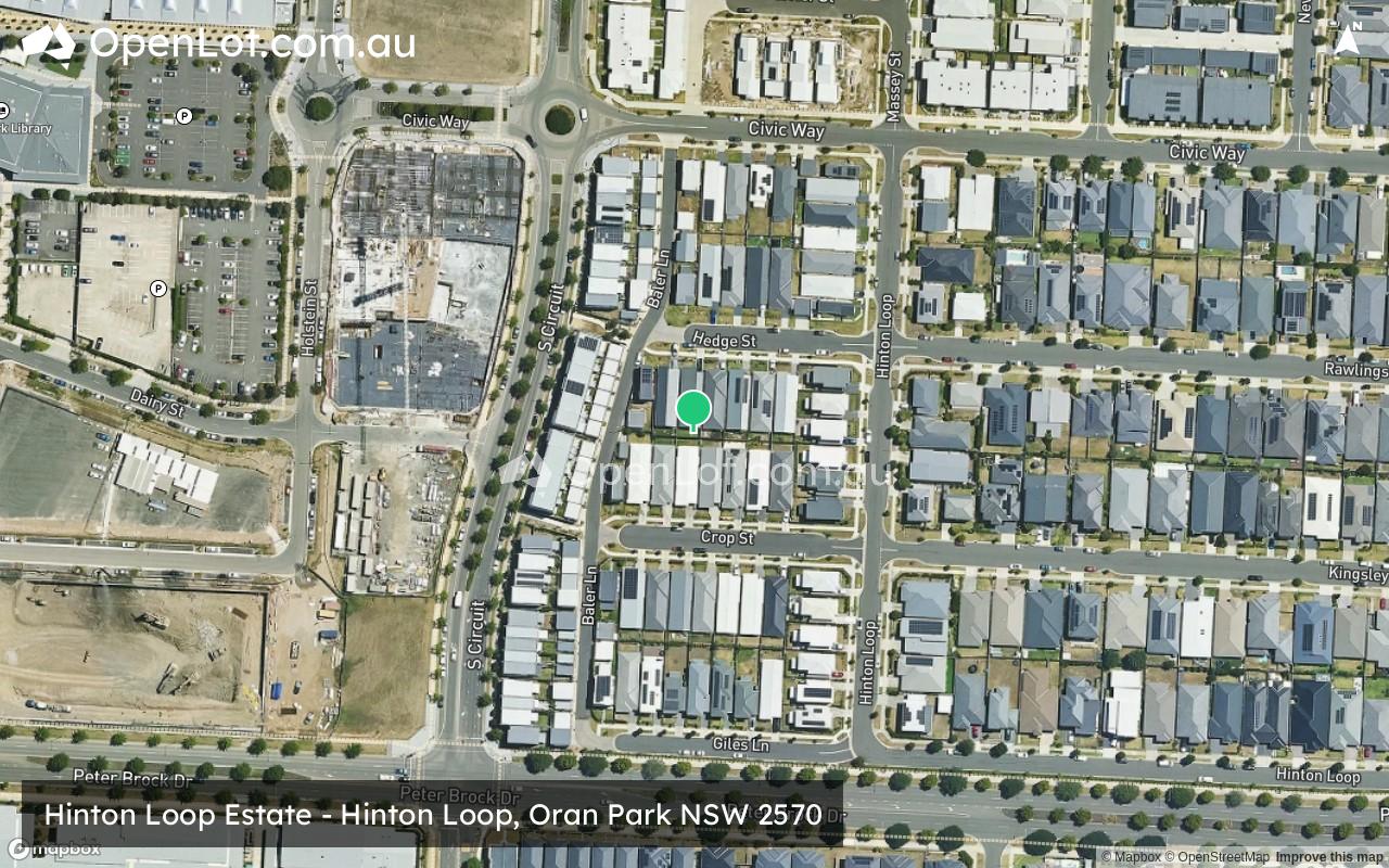
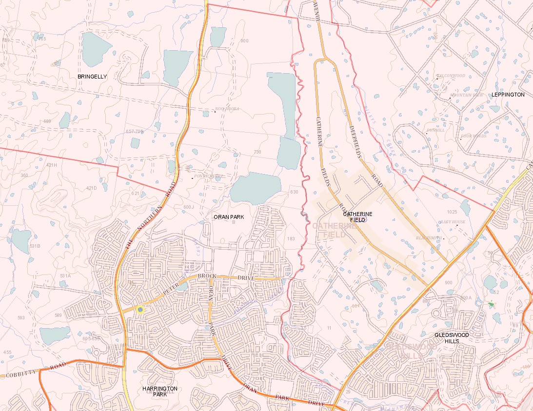
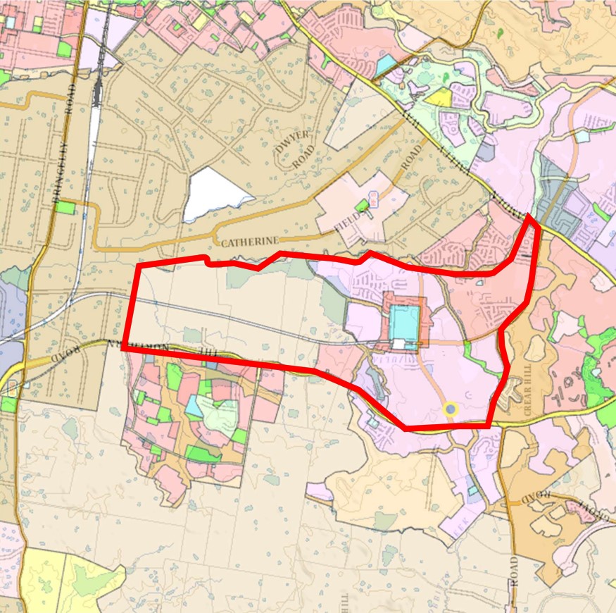
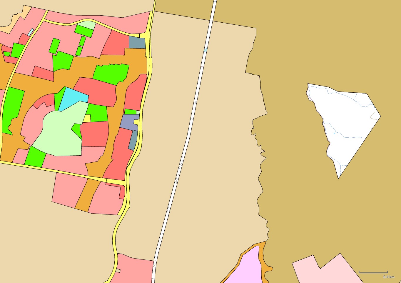
Location & Map for Hinton Loop Estate - Oran Park
Visit Display Homes near Hinton Loop Estate - Oran Park


Vacancy Rate in Oran Park NSW 2570
View full vacancy rate history in Oran Park NSW 2570 via SQM Research.
Schools near Hinton Loop Estate - Oran Park
Here are 6 schools near Hinton Loop Estate - Oran Park:
K-12 Independent Combined School
7-12 Government Secondary School
K-6 Government Primary School
K-6 Government Primary School
K-6 Catholic Primary School
7-12 Catholic Secondary School
Suburb Planning Review in Oran Park NSW 2570
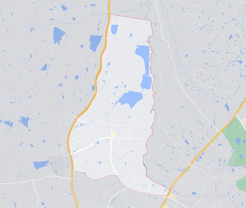
Oran Park is approximately 13.744 square kilometres within the Camden Council forming part of the Greater Western Sydney region in New South Wales, located 45 kilometres south-west of Sydney. The suburb is primarily large rural land holdings found in the north and new residential development with an increased density along the southern suburb area. The suburb did not have a business district, however, a new town centre with a new train station is envisaged as part of the future redevelopment.
The suburb boundary is located along The Northern Road to the west and South Creek to the east. Property boundaries provide for the northern boundary and Dick Johnson Drive provides the property boundary to the south.
A series of local roads are provided throughout Oran Park, providing access to the surrounding suburbs and the local network of roads. Peter Brock Drive and Dick Johnson Drive provide west and east connections through the lower portion of the suburb to the adjoining suburb of Catherine Field and Cobbitty. The Camden Valley Way to the east provides vehicle access connection to major arterial roads in proximity.
The northern part of the suburb is agricultural and grazing land, which contains several smaller creek corridors connected to the eastern South Creek corridor. A series of large interconnected dams are also located to the north of the suburb that provides water for agricultural purposes.
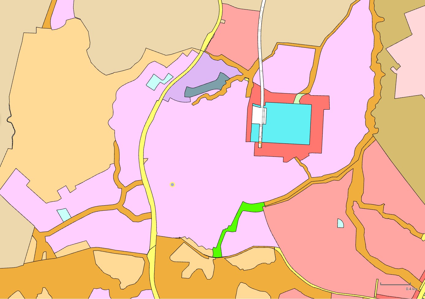
The urban areas found in the southern portion of the suburb are being developed under the general residential zoning, surrounding a Medium Density Residential and local centre zoning, which is supported by the Oran Park Precinct - Growth Centres Precinct Development Control Plan.
The local centres provide a range of services including retail, business, community and entertainment functions that service the emerging residential developments. The Town centre will be the location of a new train station that forms part of the North South Rail Line and South West Rail Link Extension, which is planned south of Western Sydney International (Nancy-Bird Walton) Airport.
Key benefits of Oran Park
Provide for the future major transport link between the surrounding growth areas.
Provide transport options to support population, jobs and economic growth
Support future town centres to be designed and planned infrastructure
Campbelltown–Macarthur
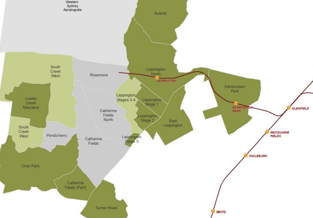
Oran Park forms the outer rural area of Campbelltown–Macarthur a Metropolitan Cluster within the Western Parkland City which will form part of the region plan for Greater Sydney. The vision for the next 20 years is to provide jobs, education, health facilities and services to more residents that live within the new Western Parkland City, drawing on the new Western Sydney Airport and Badgerys Creek Aerotropolis, and North-South Rail Link.
The growth area will create the opportunity for a Western Economic Corridor. The planning priorities and actions for improving the quality of life for residents in this growth area are set down in the Western City District Plan, our greater Sydney 2056, March 2018.
Western City District Plan
The population growth in the Western City District will be 464,450 by 2036, which is expected to require a housing growth of 184,500 dwellings (25%). The integration of new land use, transport and infrastructure is supported by the Future Transport Strategy 2056 and State Infrastructure Strategy 2018–2038 across the region. The new Western City District Structure Plan illustrates the location for the future urban growth.
South West Growth Area
Oran Park forms part of the South West Growth Area and a Development Control Plan (DCP) was prepared to embed density controls in precinct plans to ensure that infrastructure planning aligns with growth. This Plan known as the Oran Park Precinct Development Control Plan (DCP) was adopted and came into force on 4 December 2007 and was further amended on 13 September 2016.
The Camden Council together with NSW Planning prepared the public domain manual for Oran Park Town in May 2011 that provides the vision, urban design guidelines and further information to assist developers and Camden Council in constructing public domain works within Oran Park Town Centre (OPTC).
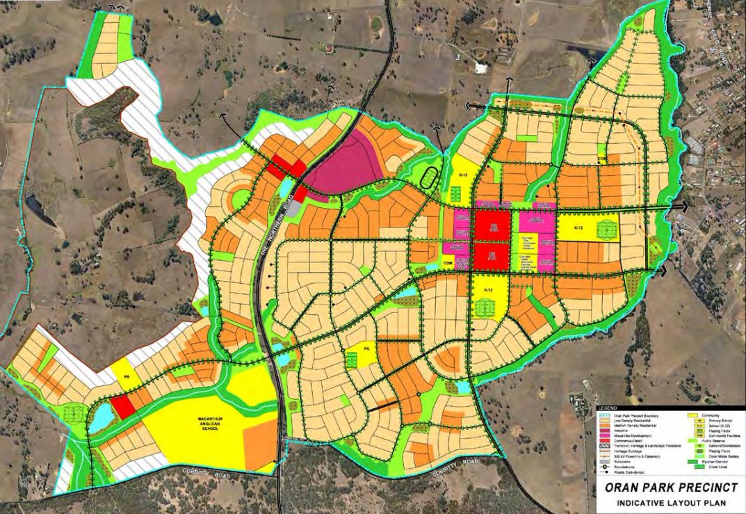
The DCP was prepared to provide additional guidance to developers, simplify the planning and ensure the orderly, efficient and environmentally sensitive development within the Precinct. The Oran Park Growth Centre Precinct was envisaged by the South West Sector Structure Plan and refined by the Oran Park Precinct Indicative Layout Plan.
Oran Park Precinct
The Oran Park Precinct provides the planning so new development provides residential and employment areas that respond to the Precincts’ natural environment. A mix of recreation, employment and residential will be designed to address public transport use, walking and cycling. The New South Wales State Government aimed to provide new precincts, as an attractive and well-connected community, in proximity to public transport, community facilities, open space and retail.
Boundary realignment of the suburb took on additional land west of The Northern Road to form part of the new precinct, however, the balance of the suburb formed two additional precincts, being:
- Lowes Creek Maryland
- South Creek West
Vision of Oran Park
Vision The Oran Park Precinct will establish itself as a high quality urban environment founded on the principles of community pride, well-being, healthy living and educational excellence.
The precinct will encompass a complete community incorporating live, work and play options. Housing densities will be higher than those traditionally delivered in Camden with a broad range of dwelling types provided across the precinct with a particular focus on attractive residential streetscapes structured around well connected, walkable neighbourhoods.
The Oran Park Town Centre and the Neighbourhood Centres west of The Northern Road will become the focal points for community interaction, civic and community facilities and retailing. Local work options will be provided through employment areas, local centres and home based activities.
West of The Northern Road will be a distinctive urban and semi-rural precinct that capitalises on the presence of the heritage listed Denbigh Homestead and areas with recognised scenic and landscape value. It will offer housing opportunities for new residents, who seek a lifestyle that is linked with the distinctive and memorable character of the area.
Oran Park Suburb Summary
References
Reviews & Comments on Hinton Loop Estate - Oran Park
Estate Brochure, Masterplan, Engineering Plan, Plan of Subdivision (POS), Design Guidelines
FAQs about Hinton Loop Estate - Oran Park
View all estates from AVID Property Group
View all estates from Villaworld Homes
- Oran Park Anglican College - 415m west
- Oran Park High School - 1.0km west
- Oran Park Public School - 1.1km west
- Barramurra Public School - 1.5km south
- St Justin's Catholic Primary School - 1.9km south
- St Benedict's Catholic College - 2.1km south
Popular Estates near Hinton Loop Estate - Oran Park
Latest New Home Articles for You

09/Mar/2026 | OpenLot.com.au
Victoria: Top 30 Most Searched Housing Developments (February 2026)
If you’ve been exploring housing opportunities in Victoria, February 2026...

20/Feb/2026 | OpenLot.com.au
Display Homes at Drouin Fields Estate: A Thriving Community in Drouin
Welcome to Drouin Fields, a place where beauty, space, and modern luxury ...

19/Feb/2026 | OpenLot.com.au
Display Homes at Manor Lakes Esate: A Thriving Waterside Community in Manor Lakes
A place where you can settle in, rather than just settle down. Named for ...

13/Feb/2026 | OpenLot.com.au
🏠 Victoria: Top 30 Most Searched Townhouse Developments – January 2026

11/Feb/2026 | OpenLot.com.au
🏡 Top 30 Most Searched Estates by State - January 2026

10/Feb/2026 | OpenLot.com.au
Victoria: Top 30 Most Searched Housing Developments (January 2026)
If you’ve been considering making a move in Victoria, January 2026 offere...

10/Feb/2026 | OpenLot.com.au
Queensland: Top 30 Most Searched Housing Developments (January 2026)
If you’ve been considering making a move in Queensland, January 2026 offe...

09/Feb/2026 | OpenLot.com.au
Western Australia: Top 30 Most Searched Housing Developments (January 2026)
If you’ve been considering making a move in Western Australia, January 20...

06/Feb/2026 | OpenLot.com.au
South Australia: Top 30 Most Searched Housing Developments (January 2026)
If you’ve been considering making a move in South Australia, January 2026...