
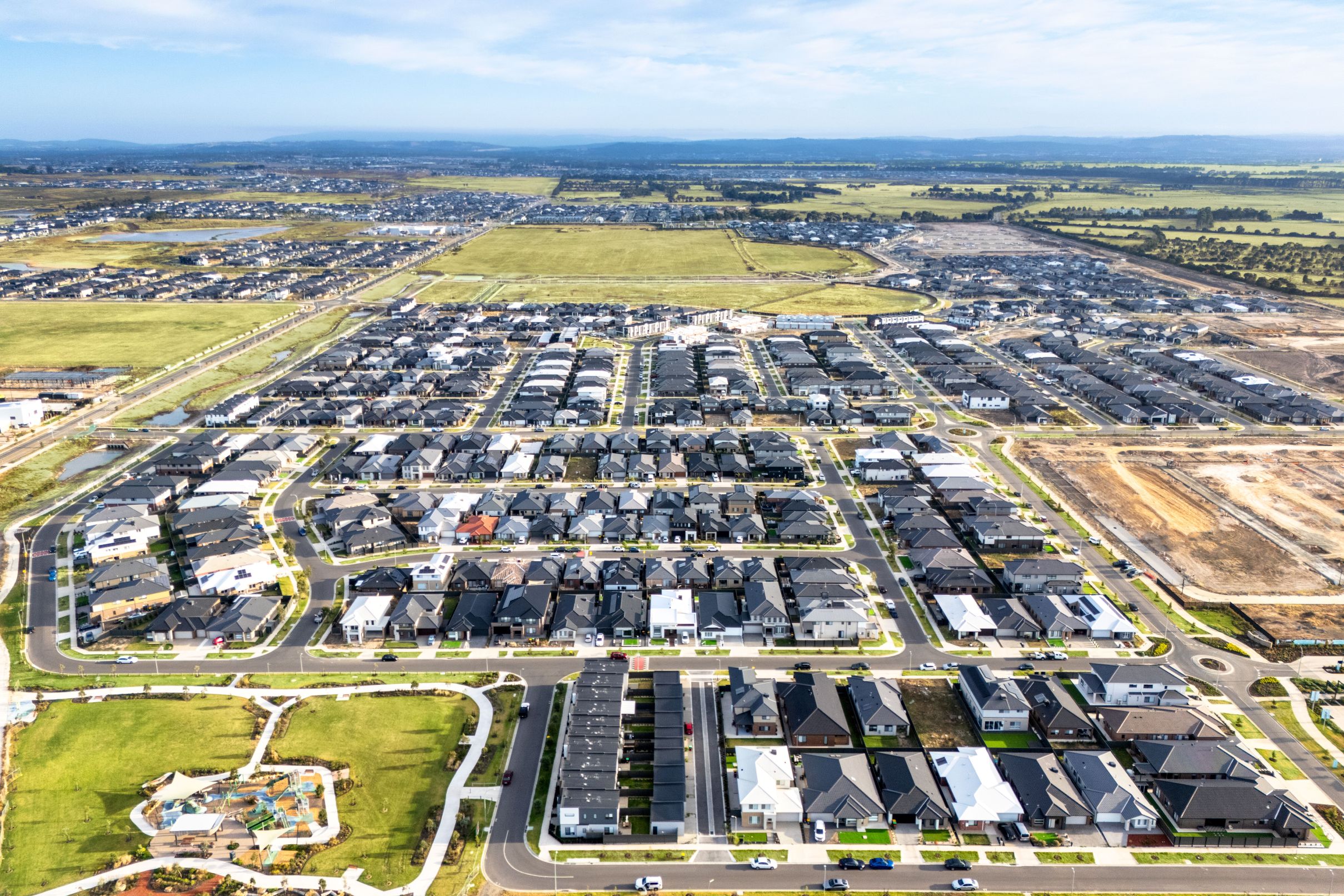

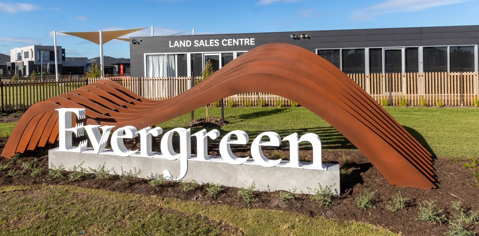
Stockland Evergreen - Clyde 14 AVAILABLE
[NEW RELEASE] You can have it all at Evergreen
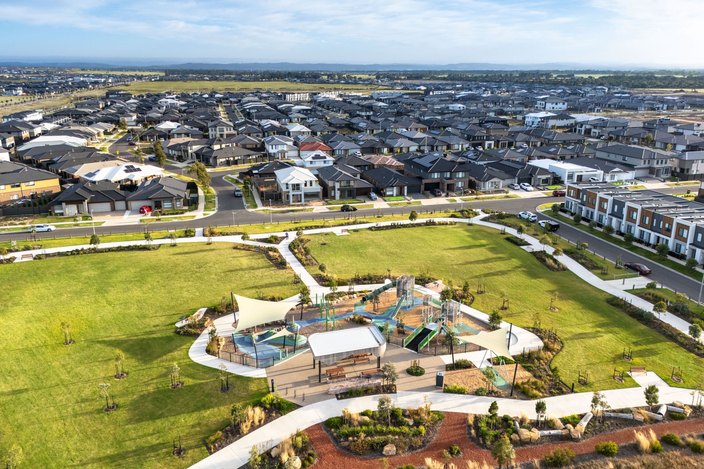
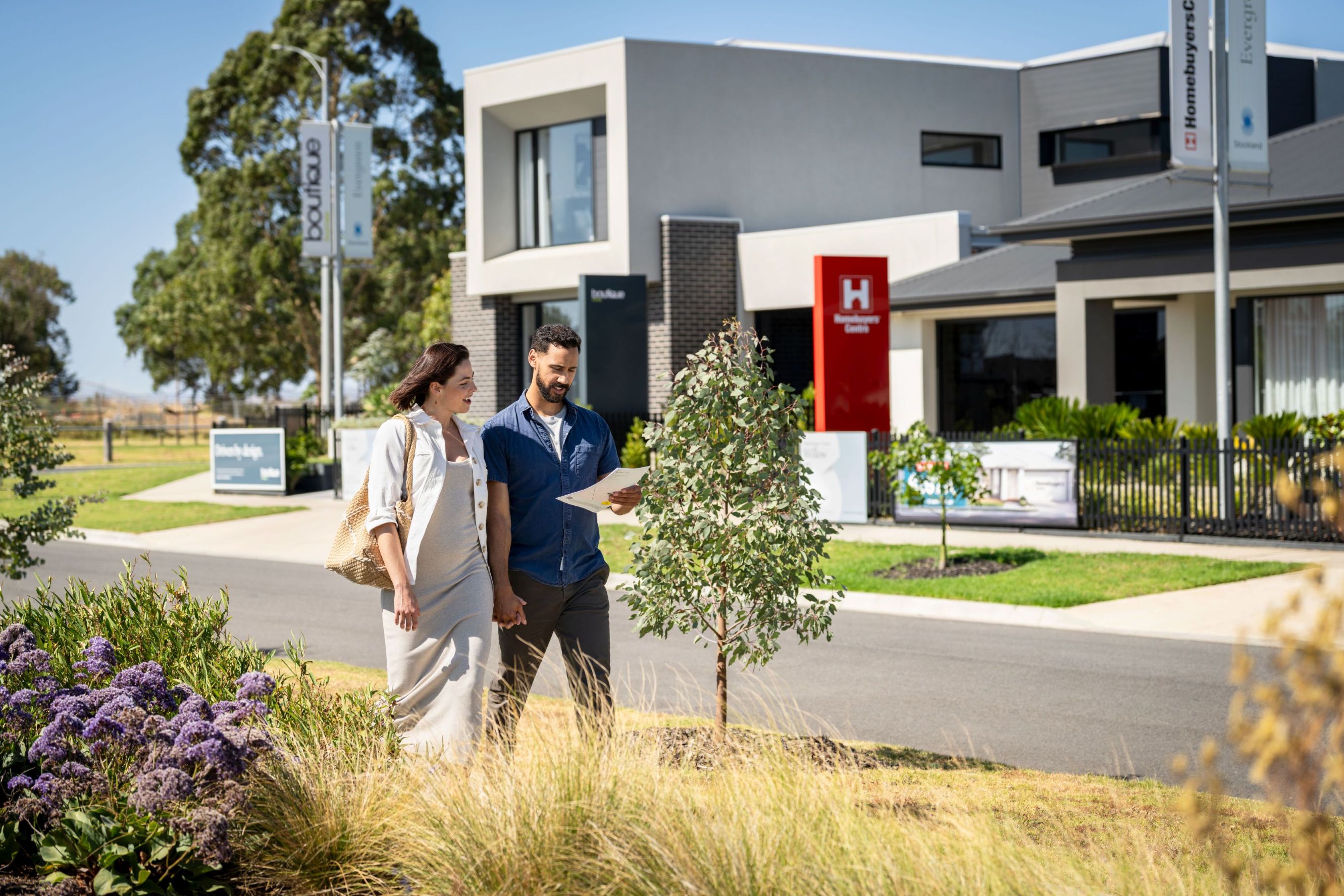
- 17 display homes now open on Karula Circuit, Clyde.
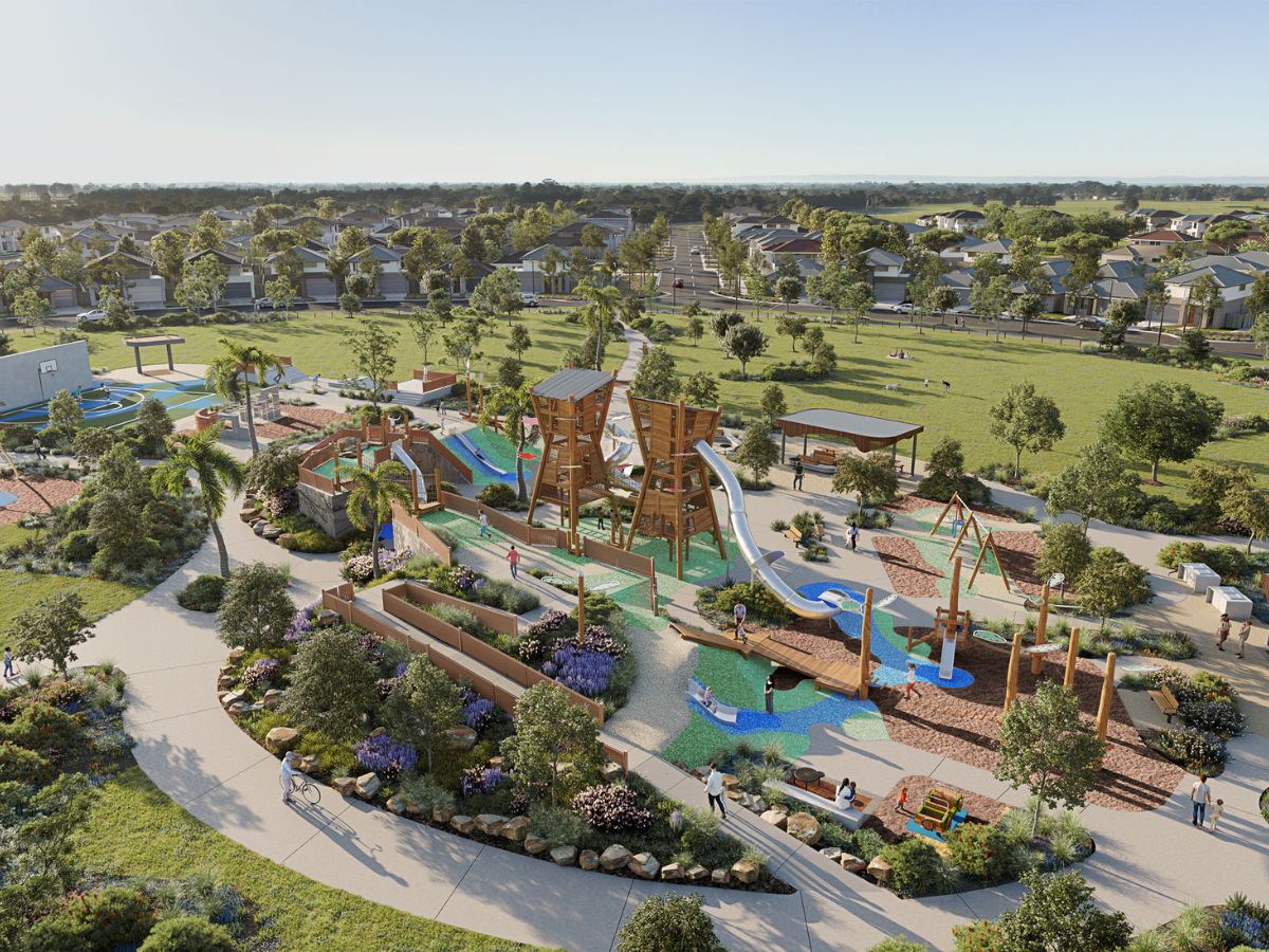
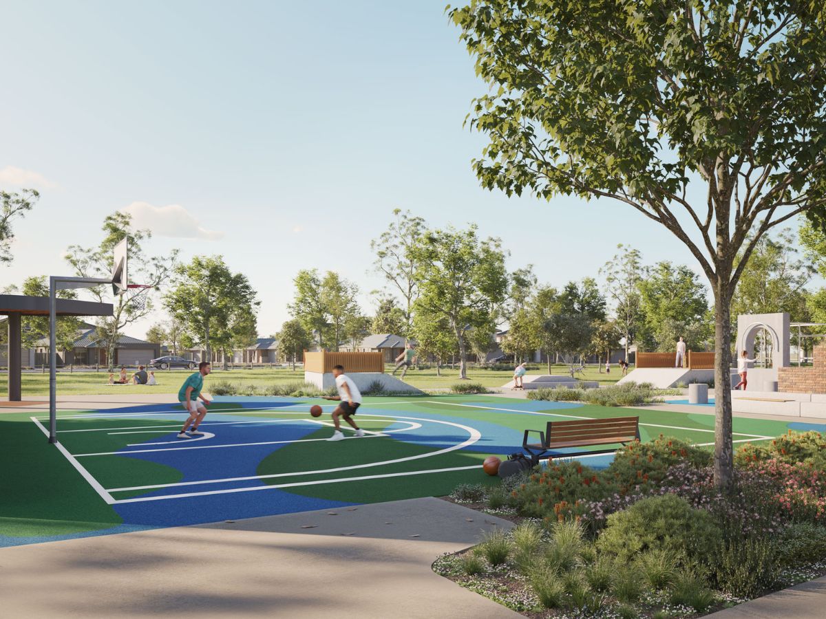
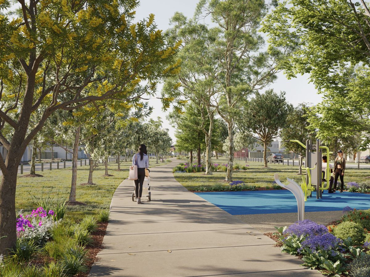
- Our first park is now open! Find it on Zion Parade, Clyde.
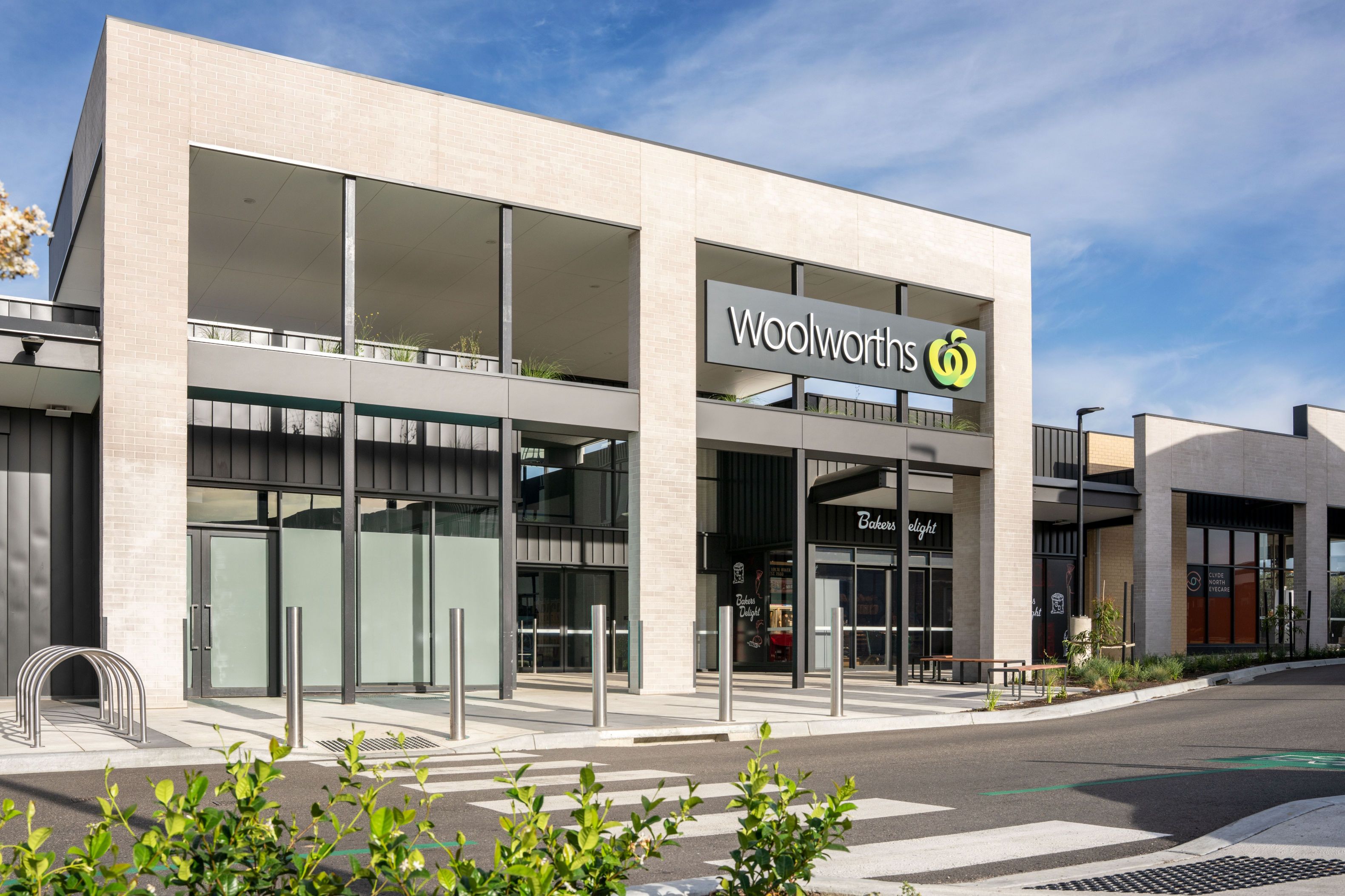
- Full-line Coles opening next door to Stockland Evergreen late 2026^
- Central Park commencing construction early 2026^
- Across the road from the Future Clyde Regional Park and Sports Precinct
- Proposed Local Town Centre on site
- Proposed Private Primary School and Government Secondary School on site
- Proposed Local Sports Reserve and Indoor Recreation Centre
- Close to the proposed Clyde Train Station
- Visit us and speak with our friendly sales team at our sales office at 470S Pattersons Road, Clyde.
- *Price correct as at 12/03/2026. Subject to change and availability.
- *Renders are an artist's impression only, subject to change. Landscaping is indicative only and may show mature planting which may not be mature at settlement.
- ^All details (including any prices), images and statements are based on the intention of, and information available to, Stockland as at the date of this email and may change due to future circumstances. This email is not legally binding on Stockland. Stockland does not give any warranty in relation to any information contained in this email. Stockland does not accept any liability for loss or damage arising as a result of any reliance on this email or its contents. Images are subject to change. Stockland is only responsible for the sale of the land. Price does not include stamp duty, registration fees or any incidental fees.
- This listing is supplied for the purpose of providing an impression of Stockland Averley and the approximate location of existing and proposed third party infrastructure, facilities, amenities, services and destinations, and is not intended to be used for any other purpose. All details, images and statements are based on the intention of, and information available to, Stockland as at the time of publication (May 2025) and may change due to future circumstances. Renders are an artist's impression only, subject to change. Information and images relating to landscaping are indicative only and may show mature plantings which may not be mature at settlement. All distance and travel timeframe references are estimates only, refer to distance by car or driving time (unless specified otherwise), and are based on information obtained from Google Maps at the time of publication.
This information is estimated by the OpenLot research team. Let us know here to provide up-to-date information about this development.
| Total new homes | 1,400 |
| Area size | 130.70 hectares |
| Growth Region | Melbourne South East Growth Corridor |
| City council | Casey City Council |
| Developer | Stockland |
| Distance to | Melbourne CBD - 50 km south-east |
Land for Sale, House and Land Packages, Townhomes:
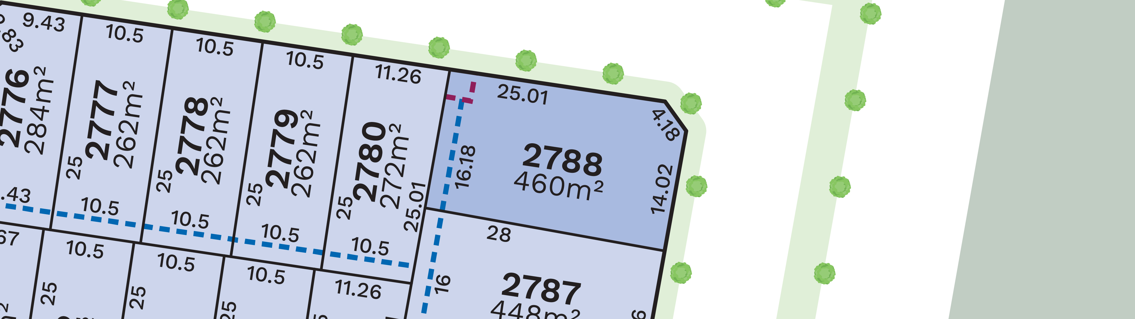
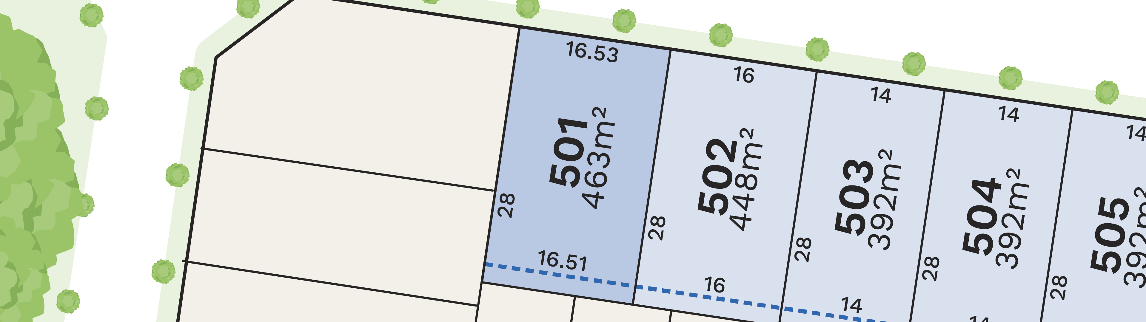
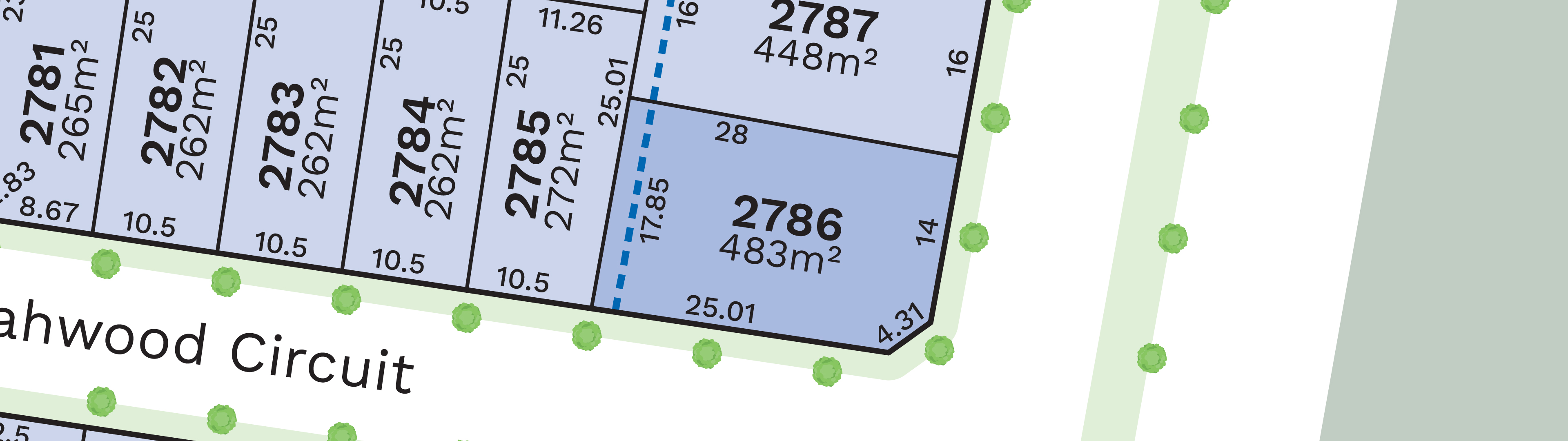
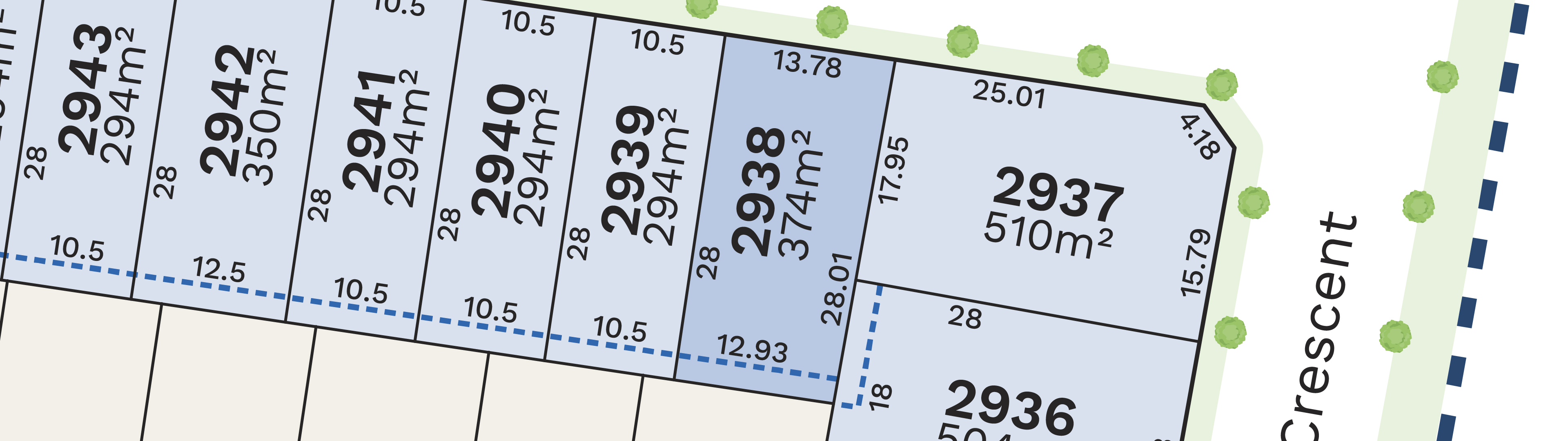
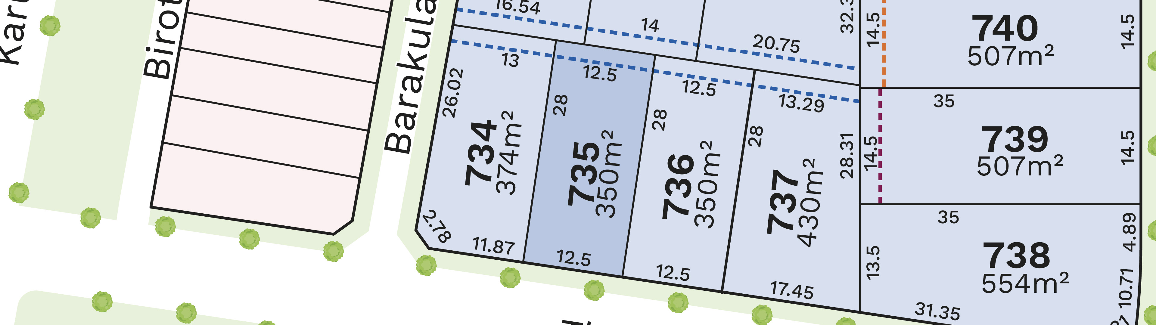
7 Land Lots in Stockland Evergreen - Clyde

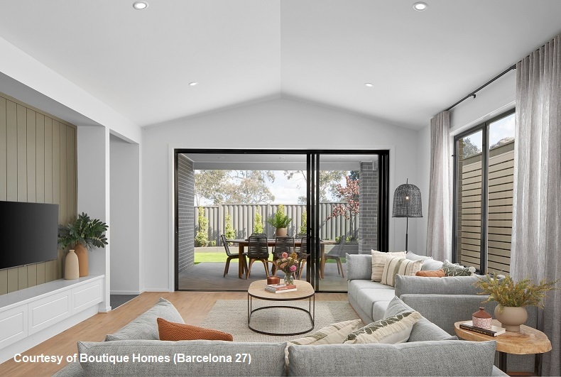
House and Land Packages in Stockland Evergreen - Clyde
5 Townhouses in Stockland Evergreen - Clyde
17 Display Homes in Stockland Evergreen Display Village - Clyde

 4
4
 4
4
 2
4
2
2
4
2
 1
2
4
2
1
2
4
2
2
2
4
2
1
2
4
2
2
2
4
2
2
2
4
2
1
2
4
2
2
2
4
2
2
2
4
2
2
2
4
2
2
2
4
2
2
2
4
2
2
2
1
2
4
2
1
2
4
2
2
2
4
2
1
2
4
2
2
2
4
2
2
2
4
2
1
2
4
2
2
2
4
2
2
2
4
2
2
2
4
2
2
2
4
2
2
2
4
2
2
2
Updates for Stockland Evergreen - Clyde
Facebook updates:
Related news:
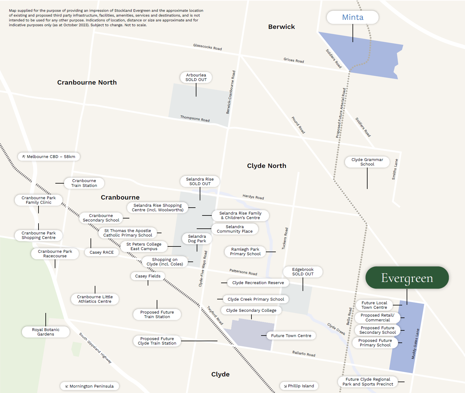
Clyde is with the City of Casey located 48 kilometres South-East of Melbourne, which contains a rural-residential township that forms part of the Urban Growth Boundary. The Clyde growth area is approximately 1,154 ha, which is located on either side of the Pattersons Road.
The Clyde site Stockland is circling has the potential to accommodate almost 1500 dwellings within an approved new suburb.
Missing articles? Send us a link here.
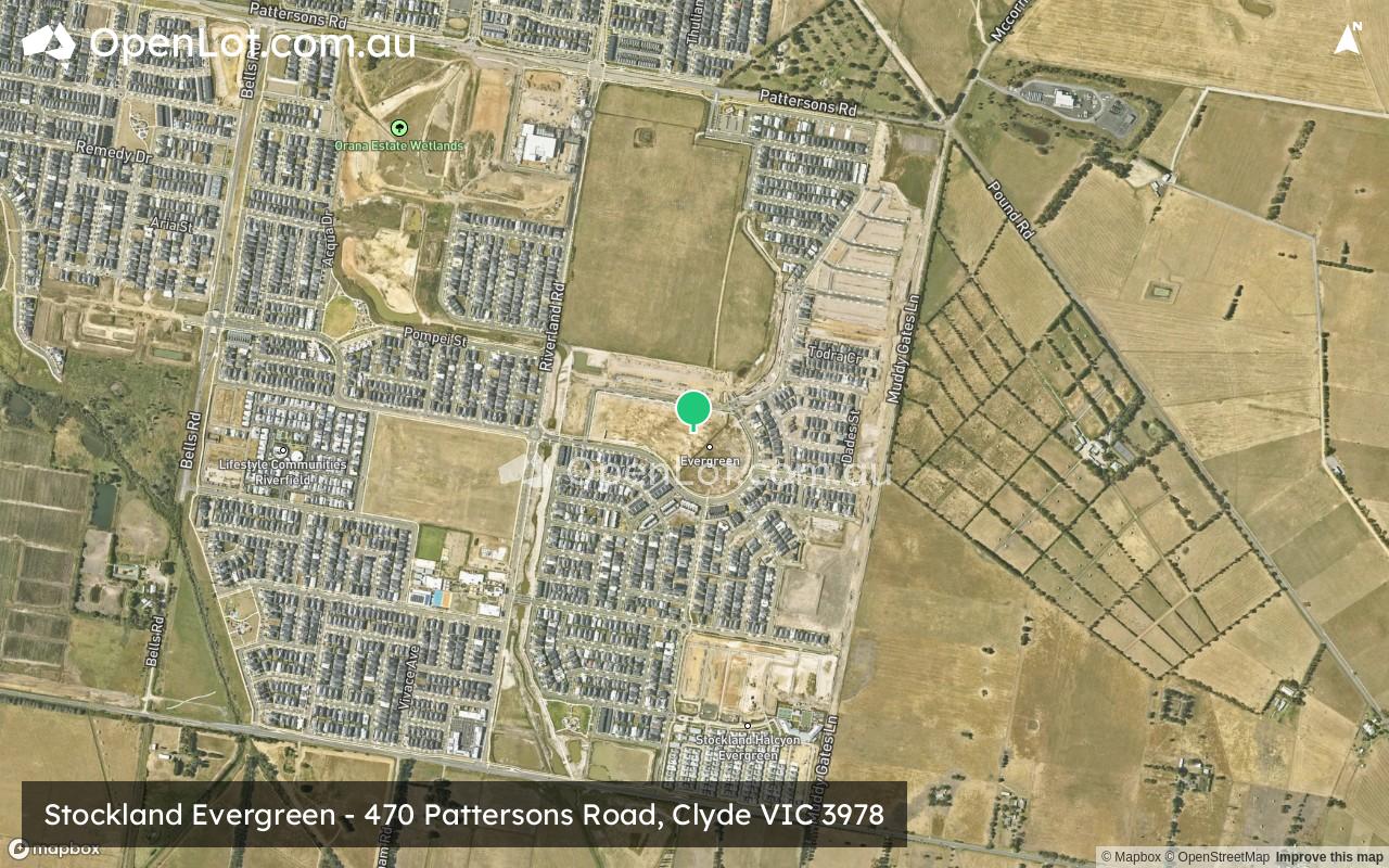
Location & Map for Stockland Evergreen - Clyde
Land Price Trend in Clyde VIC 3978
- In Oct - Dec 24, the median price for vacant land in Clyde VIC 3978 was $365,500. *
- From Oct - Dec 17 to Oct - Dec 24, the median price for vacant land in Clyde VIC 3978 has increased 17.9%. *
- From 2010 to 2024, the median price for vacant land in Clyde VIC 3978 has increased 66.98%. *
Schools near Stockland Evergreen - Clyde
Here are 6 schools near Stockland Evergreen - Clyde:
Prep-5 Independent Primary School
7-10 Government Secondary School
Prep-6 Government Primary School
U, Prep-6 Government Primary School - School Head Campus
Prep-6 Government Primary School
Prep-6 Government Primary School
Suburb Planning Review in Clyde VIC 3978
Clyde is with the City of Casey located 48 kilometres South-East of Melbourne, which contains a rural-residential township that forms part of the Urban Growth Boundary. The Clyde growth area is approximately 1,154 ha, which is located on either side of the Pattersons Road.
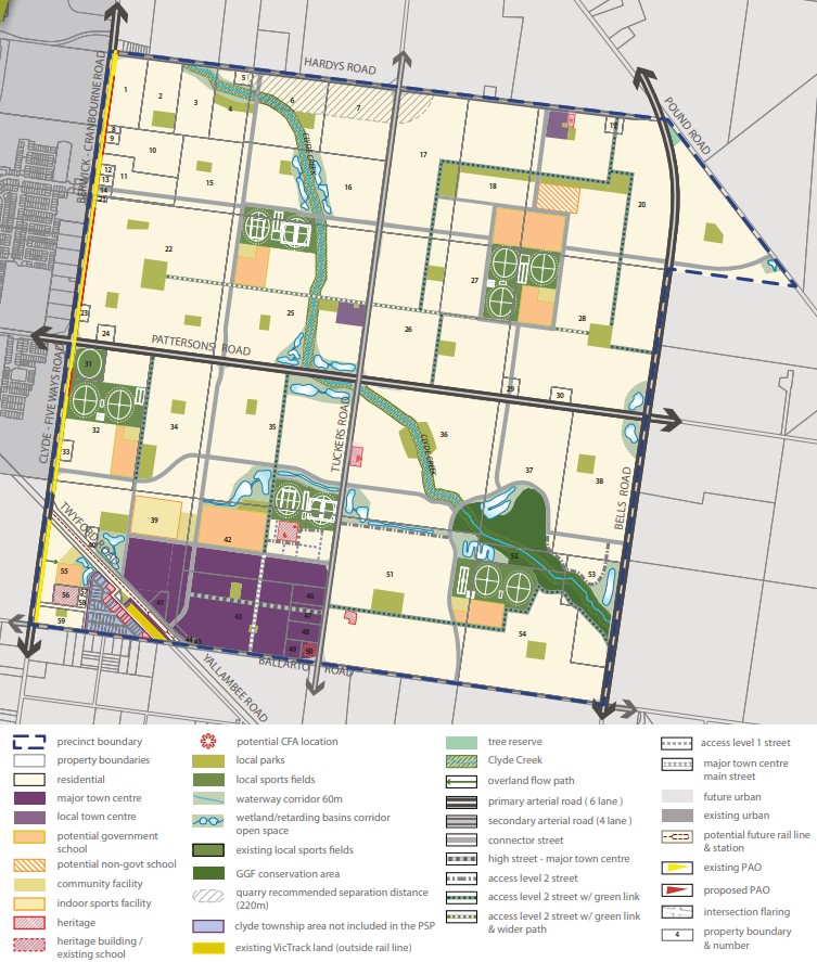
The new suburb is bounded by Clyde-Five Ways Road to the west, Pound Road and Bells Road extension to the east, Hardys Road to the north and Ballarto Road to the south.
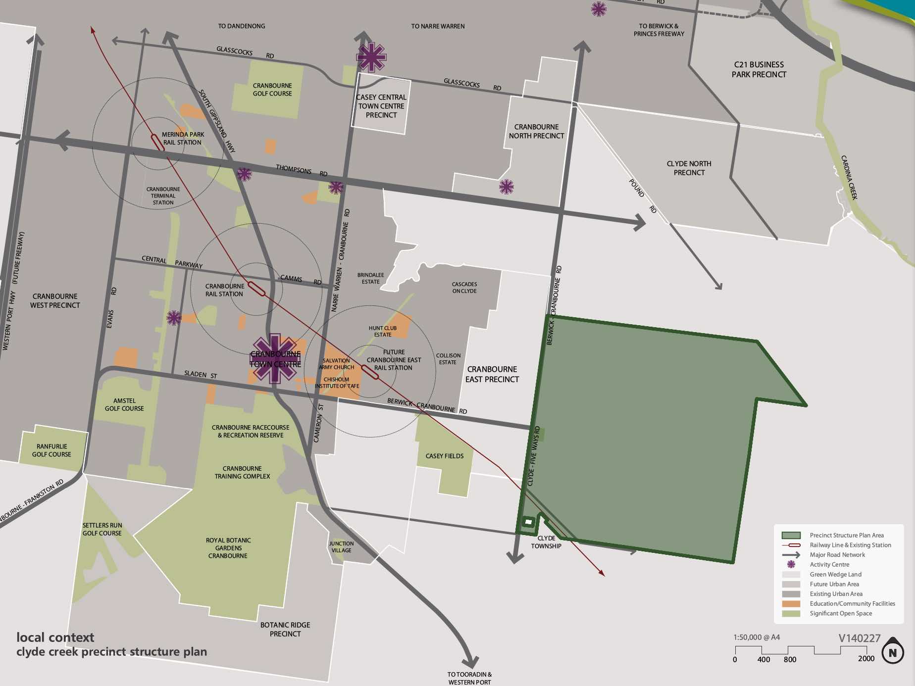
The Clyde Creek Precinct Structure Plan (PSP) was prepared to guide the future community, visitors and workers within the area. The PSP seeks to provide access to services, recreation, employment, shopping and transport infrastructure necessary to support quality of lifestyle and a mix of affordable housing.
The conservation and enhancement of the significant biodiversity area of the Clyde Creek corridor have been recognised, which integrates the stormwater design and open space. A protected species of the Growling Grass Frog has been provided ponds and foraging areas along the Clyde Creek corridor and cultural heritage sites.
Clyde also has other Precinct Structure Plan areas to the north of the existing township. The Victorian Planning Authority (VPA) has prepared a Clyde North PSP that was approved by Minister for Planning in November 2011 through Amendment C186 to the Casey Planning Scheme.

The Clyde Creek Precinct Structure Plan PSP was prepared by Victorian Planning Authority (VPA) in consultation with the Casey City Council and was approved by the Minister for Planning in November 2014. The decision was officially gazetted in October 2014 under Amendment C186 to the Casey Planning Scheme, then further amended in October 2015.
The Vision of Clyde Creek
“Clyde Creek is planned to be a community where a distinct urban form, characterised by a grid of high quality streets, is complemented by an extensive natural creek environment and park network. The Clyde Major Town Centre, planned immediate to the north of the potential future Clyde railway station, will deliver extensive services and facilities to the surrounding residential area.”
“Clyde Creek will be a place that residents and businesses are proud to call home, a place of significant housing choice, catering for a diversity of people, and a connected community through public transport, road-trail networks and integrated community hubs.”
“Significant biodiversity within the Clyde Creek corridor has been recognised through the conservation and enhancement of the Growing Grass Frog Category 1 habitat area. The prominent landform of the precinct, Clyde Creek, will form the key environmental, recreational and community spine of the future suburb. The topography of the precinct provides for attractive views and vistas.”
“Heritage values - both aboriginal and cultural heritage and post-contact heritage sites - have been identified and incorporated into the future urban structure of Clyde Creek Precinct.”
Benefits of Clyde Creek
The existing zoning will be amended to provide for Urban Growth Zones, that will provide for a future urban structure and future development. The Clyde Creek Precinct Structure Plan provides for a diversity of streetscape, open space, local character and protection of the Clyde Creek Conservation Area that traverses the precinct.
Existing and proposed sports fields and parks are strategically located within the new residential areas. The major and minor town centre areas provide for social, retail and community infrastructure, with the largest located to the south west corner of the Precinct Structure Plan.
The Precinct Structure Plan provides the planning framework to facilitate the new mixed use community, new schools, sports and recreation areas and protect Clyde Creek.
Transportation in Clyde Creek
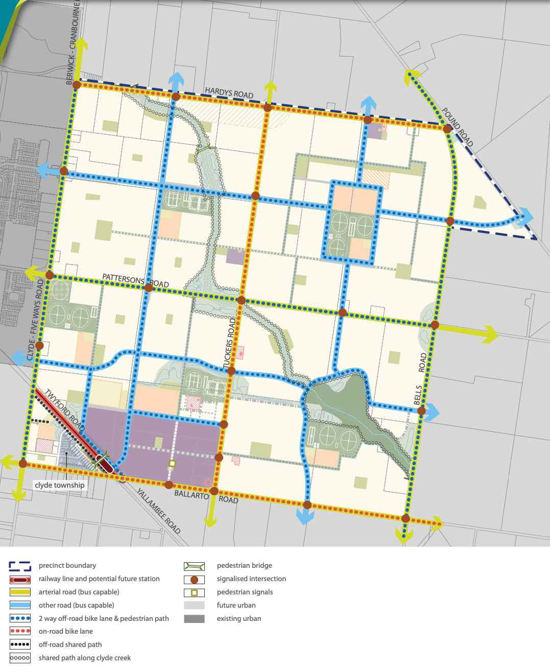
Clyde Creek will be connected to public passenger transport, with a future train station to be built in proximity to the south west of the Clyde Township and the passenger train service will connect to Melbourne CBD.
The suburb will include a network of shared paths, linking the local parks and a new road network. A road network including a 6 lane (primary arterial) road along Pattersons Road and 4 lane (second arterial) road along Tuckers Road to facilitate vehicle access to the surrounding growth areas and Clyde North. Access to Berwick – Cranbourne Road to the west will provide a direct connection to the Princes Freeway, access to Melbourne CBD or eastern Victoria.
Clyde Creek Suburb Summary
References
Victoria Planning Authority – Planning Schemes
Victoria Planning Authority – Clyde Creek PSP
Reviews & Comments on Stockland Evergreen - Clyde
Estate Brochure, Masterplan, Engineering Plan, Plan of Subdivision (POS), Design Guidelines
FAQs about Stockland Evergreen - Clyde
View all estates from Stockland
- Clyde Grammar - 3.0km north
- Clyde Secondary College - 3.3km west
- Ramlegh Park Primary School - 3.8km north-west
- Clyde Creek Primary School - 4.0km west
- Clyde Primary School - 4.4km west
- Cardinia Primary School - 4.4km east
Popular Estates near Stockland Evergreen - Clyde


Latest New Home Articles for You

16/Mar/2026 | OpenLot.com.au
New South Wales: Top 30 Most Searched Housing Developments (February 2026)
If you’ve been considering a move in New South Wales, February 2026 provi...

09/Mar/2026 | OpenLot.com.au
Victoria: Top 30 Most Searched Housing Developments (February 2026)
If you’ve been exploring housing opportunities in Victoria, February 2026...

20/Feb/2026 | OpenLot.com.au
Display Homes at Drouin Fields Estate: A Thriving Community in Drouin
Welcome to Drouin Fields, a place where beauty, space, and modern luxury ...

19/Feb/2026 | OpenLot.com.au
Display Homes at Manor Lakes Esate: A Thriving Waterside Community in Manor Lakes
A place where you can settle in, rather than just settle down. Named for ...

13/Feb/2026 | OpenLot.com.au
🏠 Victoria: Top 30 Most Searched Townhouse Developments – January 2026

11/Feb/2026 | OpenLot.com.au
🏡 Top 30 Most Searched Estates by State - January 2026

10/Feb/2026 | OpenLot.com.au
Victoria: Top 30 Most Searched Housing Developments (January 2026)
If you’ve been considering making a move in Victoria, January 2026 offere...

10/Feb/2026 | OpenLot.com.au
Queensland: Top 30 Most Searched Housing Developments (January 2026)
If you’ve been considering making a move in Queensland, January 2026 offe...

09/Feb/2026 | OpenLot.com.au
Western Australia: Top 30 Most Searched Housing Developments (January 2026)
If you’ve been considering making a move in Western Australia, January 20...