
Tate Estate - Kew
This information is estimated by the OpenLot research team. Let us know here to provide up-to-date information about this development.
| Total new homes | 8 |
| Area size | 0.10 hectares |
| Growth Region | Melbourne East |
| City council | Boroondara City Council |
| Developer | ANGLE |
| Creative agency | Earl.St |
| Distance to | Melbourne CBD - 7 km east Melbourne Airport - 24 km south-east |
Townhomes:
Popular Estates near Tate Estate - Kew


 4
4
 4
4
 4
4


Updates for Tate Estate - Kew
Facebook updates:
Related news:
Property development extends beyond constructing four walls. It’s about creating spaces for people to live in. That’s our ANGLE.
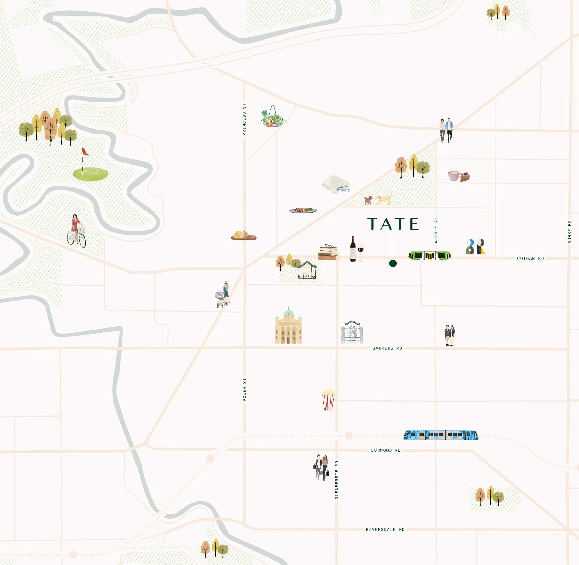
Located in the prestigious Sackville Ward precinct on the doorstep of a significant number of these prestigious schools, Tate has been designed to respond to the demands of modern families: spacious, flexible and with...
Missing articles? Send us a link here.
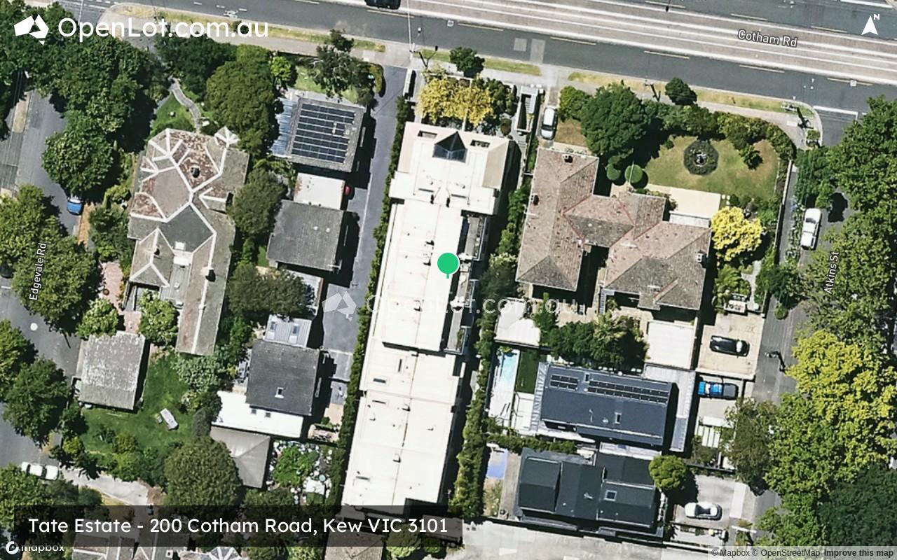
Location & Map for Tate Estate - Kew
Schools near Tate Estate - Kew
Here are 6 schools near Tate Estate - Kew:
Prep-12 Independent Combined School
Prep-6 Catholic Primary School
Prep-12 Independent Combined School
U Independent Special School
Prep-12 Independent Combined School - School Head Campus
Prep-12 Independent Combined School - School Head Campus
Reviews & Comments on Tate Estate - Kew
Estate Brochure, Masterplan, Engineering Plan, Plan of Subdivision (POS), Design Guidelines
FAQs about Tate Estate - Kew
View all estates from ANGLE
- Ruyton Girls' School - 554m south-west
- Sacred Heart School - 610m west
- Trinity Grammar School Kew - 794m west
- Andale School - 813m north-west
- Carey Baptist Grammar School - 847m south
- Methodist Ladies' College - 848m south-west
Popular Estates near Tate Estate - Kew
Latest New Home Articles for You

09/Mar/2026 | OpenLot.com.au
Victoria: Top 30 Most Searched Housing Developments (February 2026)
If you’ve been exploring housing opportunities in Victoria, February 2026...

20/Feb/2026 | OpenLot.com.au
Display Homes at Drouin Fields Estate: A Thriving Community in Drouin
Welcome to Drouin Fields, a place where beauty, space, and modern luxury ...

19/Feb/2026 | OpenLot.com.au
Display Homes at Manor Lakes Esate: A Thriving Waterside Community in Manor Lakes
A place where you can settle in, rather than just settle down. Named for ...

13/Feb/2026 | OpenLot.com.au
🏠 Victoria: Top 30 Most Searched Townhouse Developments – January 2026

11/Feb/2026 | OpenLot.com.au
🏡 Top 30 Most Searched Estates by State - January 2026

10/Feb/2026 | OpenLot.com.au
Victoria: Top 30 Most Searched Housing Developments (January 2026)
If you’ve been considering making a move in Victoria, January 2026 offere...

10/Feb/2026 | OpenLot.com.au
Queensland: Top 30 Most Searched Housing Developments (January 2026)
If you’ve been considering making a move in Queensland, January 2026 offe...

09/Feb/2026 | OpenLot.com.au
Western Australia: Top 30 Most Searched Housing Developments (January 2026)
If you’ve been considering making a move in Western Australia, January 20...

06/Feb/2026 | OpenLot.com.au
South Australia: Top 30 Most Searched Housing Developments (January 2026)
If you’ve been considering making a move in South Australia, January 2026...